| Previous :: Next Topic |
| Author |
Message |
Paul M
Member


Joined: 15 Jul 2008
Posts: 371 | TRs | Pics
|
|
Paul M
Member
|
 Mon Jun 25, 2018 11:31 am |
|
|
Silas W, Don B, Carla S, and I teamed up to climb Hozomeen Mountain during a narrow weather window this past weekend. The conditions on summit day were as good as could be. But make no mistake. This is a serious mountain! Not because the climbing is overly difficult. But because of the nature of the rock it is impossible to protect. Prior reports mention 30-100 feet for the steepest class 4 section where you first gain the NW ridge
. It sure felt like at least 100 feet. After that the angle of the route does lessen but the exposure is still immense.
I also cant say enough by how accurate the MM5 forecast was this weekend. It called for light rain Friday night (which we had at our car camp); solid overcast on Saturday with clearing starting about 3pm (which it did just as we neared camp on the ~6,400 ft summit just before the boarder). Sunday morning dawned completely clear with perfect temps and stunning views into the pickets and beyond. By the time we started our drive back home the clouds were thick and by 11pm it was raining hard, accompanied by thunder and lightning just for good measure.
All in all this was a great trip and a great summit shared. Way to go Silas  Postscript. The window for this climb seems to be pretty narrow but we were still a bit surprised to see another party of three people arrive at our camp sometime after we had set up. They graciously granted us a head start in the morning so we could minimize any potential congestion on the route.
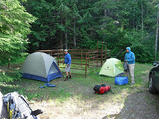 Horse camp near Trail Head 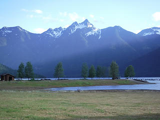 Raeburn from upper Ross lake at dusk 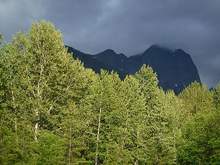 Hozomeen looming like Mordor 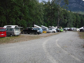 Westy camping convention 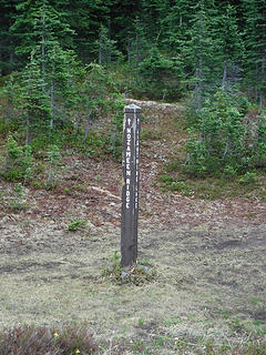 Trail junction 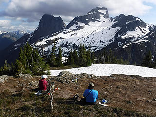 Afternoon clearing views from camp 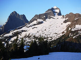 Perfect morning dawning on Hozomeen 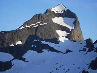 Our route in full view and great condition 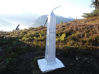 Monument 74 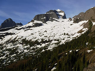 Getting closer to our objective 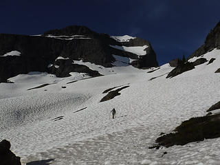 Silas leading the way 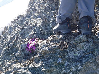 Typical rock quality in route 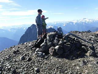 Happy to be on the summit 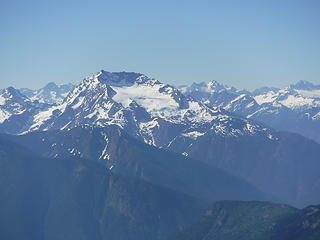 Jack Mountain from Hozomeen 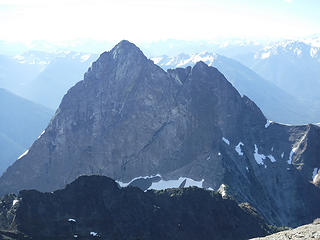 Looming South Hozomeen from summit 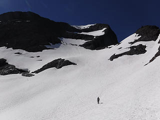 All safely down form the peak 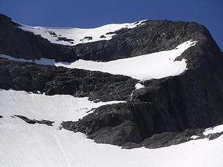 Another climber starting to descend the middle snowfleld 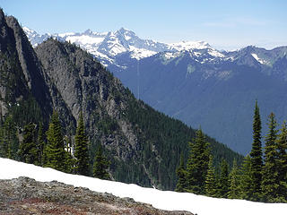 Boarder swath looking west 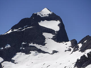 Our tracks in the snow visible from camp 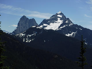 One last view of Hozomeen from the long deproach trail
|
| Back to top |
  
|
|
Brushbuffalo
Member

Joined: 17 Sep 2015
Posts: 1887 | TRs | Pics
Location: there earlier, here now, somewhere later... Bellingham in between |
Well done, lady and gents!
| Paul M wrote: | | This is a serious mountain! |
No lie. Looks too sporting now for me, being in MAS2 (middle age stage 2). 
Passing rocks and trees like they were standing still
Passing rocks and trees like they were standing still
|
| Back to top |
|
|
nordique
Member

Joined: 04 May 2008
Posts: 1086 | TRs | Pics
|
|
nordique
Member
|
Mon Jun 25, 2018 1:40 pm |
|
|
Silas probably is a bit older than you!
|
| Back to top |
|
|
canadug
Member

Joined: 25 May 2007
Posts: 110 | TRs | Pics
Location: Canada |
|
canadug
Member
|
Mon Jun 25, 2018 1:47 pm |
|
|
Nice.
Did you start from Hozomeen campground?
We did it starting from Manning Park and all in a very long day.
Here is a link to our TR:
Hozomeen
|
| Back to top |
|
|
Brushbuffalo
Member
Joined: 17 Sep 2015
Posts: 1887 | TRs | Pics
Location: there earlier, here now, somewhere later... Bellingham in between |
| nordique wrote: | | Silas probably is a bit older than you! |
That could be true, possibly, but in any case Silas is an accomplished alpinist.
I'm just a hillwalker/ trailrunner/ brushbuffalo with low fear threshold. 
Passing rocks and trees like they were standing still
Passing rocks and trees like they were standing still
|
| Back to top |
|
|
Paul M
Member
Joined: 15 Jul 2008
Posts: 371 | TRs | Pics
|
|
Paul M
Member
|
Mon Jun 25, 2018 6:54 pm |
|
|
| canadug wrote: | | Did you start from Hozomeen campground?
We did it starting from Manning Park and all in a very long day. |
We came up the Skyline II trail to the ridge.
Man and I thought we had a long approach.... you guys really had a long day!
|
| Back to top |
|
|
Mike Collins
Member
Joined: 18 Dec 2001
Posts: 3096 | TRs | Pics
|
Driving in from the north on Silver Creek road is an oddity. You are in Canada on a road and then you are in the United States without going through any official border crossing with immigration. I wonder how long that is going to last.
|
| Back to top |
|
|
canadug
Member
Joined: 25 May 2007
Posts: 110 | TRs | Pics
Location: Canada |
|
canadug
Member
|
Mon Jun 25, 2018 7:34 pm |
|
|
That crossing is a strange one.....The Border Dudes are flying drones and helicopters all along the 49th parallel and busting people at the old PCT crossing at Manning.
Weird times 
|
| Back to top |
|
|
canadug
Member
Joined: 25 May 2007
Posts: 110 | TRs | Pics
Location: Canada |
|
canadug
Member
|
Mon Jun 25, 2018 7:37 pm |
|
|
What do you think the total distance of your journey was via Skyline II?
|
| Back to top |
|
|
Paul M
Member
Joined: 15 Jul 2008
Posts: 371 | TRs | Pics
|
|
Paul M
Member
|
Mon Jun 25, 2018 7:51 pm |
|
|
| canadug wrote: | | What do you think the total distance of your journey was via Skyline II? |
Something like ~23 to 26 miles.... depending on which trail marking app you believe and something like 9,600+ ft total elevation gain.
|
| Back to top |
|
|
cartman
Member
Joined: 20 Feb 2007
Posts: 2800 | TRs | Pics
Location: Fremont |
|
cartman
Member
|
Mon Jun 25, 2018 9:57 pm |
|
|
Nice one, Paul. That's a serious but fun mountain in a fantastic setting. Looks like you had very similar conditions as on our trip five years ago.
Seems like most people do it end of June. We ran into other climbers too. Fortunately Dave and Crispin had camped at the border swath so were a bit ahead of us on the route and we only ran into them as they were descending the highest snowfield.
| Paul M wrote: | Our tracks in the snow visible from camp |
| Paul M wrote: | Another climber starting to descend the middle snowfleld |
Amazing how much--thankfully--that route lays back as you approach it. And yet it's still steep in places.
Canadug, my notes have the stats as 23 miles and 9600' of gain.
| Brushbuffalo wrote: | | I'm just a hillwalker/ trailrunner/ brushbuffalo with low fear threshold. |
Oh, stop. Anyone who was keeping up with Rowland Tabor in his prime is just a tad more than a "hillwalker". 
|
| Back to top |
|
|
canadug
Member
Joined: 25 May 2007
Posts: 110 | TRs | Pics
Location: Canada |
|
canadug
Member
|
Mon Jun 25, 2018 10:44 pm |
|
|
Our route on Skyline I then Skyline II was about 24 miles (40Km's) return and ~10,000 ft elevation......Seems like both routes are quite similiar. Super long day either way.
|
| Back to top |
|
|
mountainflamingo
Member

Joined: 15 Nov 2008
Posts: 82 | TRs | Pics
Location: Tralfamadore |
It was great to chat with you along the way and I'm glad we managed to mostly stay out of each others way on a difficult route. I got a few photos of your crew while we were out there. It was also great to meet you again Carla!
I did a little write up of our experience on Hozomeen, but probably not worth a new post.
https://mountainflamingo.com/2018/06/26/2018-06-23-24-hozomeen-mountain/
|
| Back to top |
|
|
Matt Lemke
High on the Outdoors

Joined: 15 Jul 2010
Posts: 2052 | TRs | Pics
Location: Grand Junction |
|
Matt Lemke
High on the Outdoors
|
Wed Jun 27, 2018 10:20 am |
|
|
Oh wow! Now I'm jealous!!
|
| Back to top |
|
|
|
|


