| Previous :: Next Topic |
| Author |
Message |
freddyfredpants
saucy


Joined: 08 Jul 2018
Posts: 40 | TRs | Pics
Location: Seattle |
Despite a less than encouraging weather forecast for the next couple of days, on July 1 G-Dogg and I set out on the Ptarmigan Traverse starting at the Eldorado TH. Our logistical preparations did not include a second car parked at the preferred Downey Creek exit, so we planned on an in and out trip instead. That is an easy call to make when in the comfort of your living room.
We arrived at the Eldo parking area in light rain which continued during our final packing, departure, and walk along the first mile of the road. The west wind blowing clouds across the N Face of J-Berg made for some stellar scenery. The wind was an ever present companion over Cascade Pass, Cache Col, and on to Kool-Aid Lake. We arrived at camp to find one melted out bivy spot.
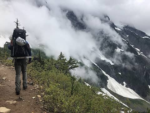 A menacing G-Dogg and a menacing J-Burg 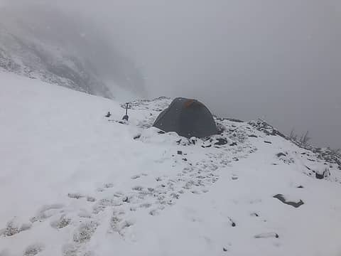 Camp at Kool Aid Lake 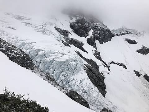 Middle Cascade Glacier 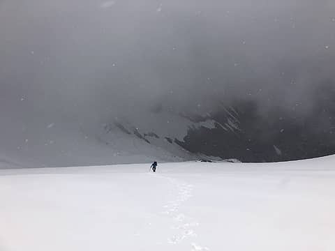 G-Dogg on the way up MCG 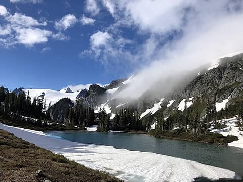 Snow still in Yang-Yang Lakes 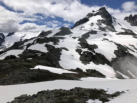 Le Conte from just above Yang-Yang Lakes 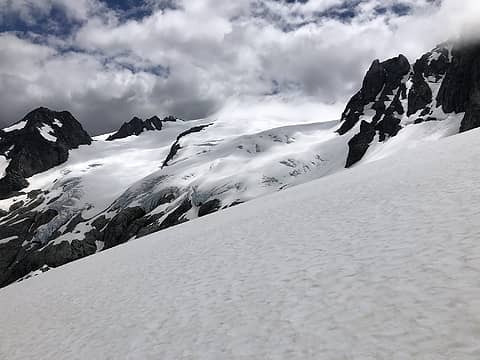 Heading south, east of Le Conte 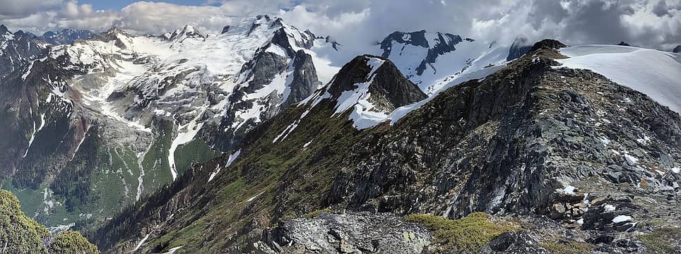 The view south from Lizard 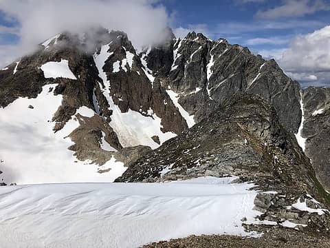 Sentinel and Old Guard from Lizard 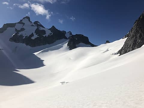 Heading up to Dana Col 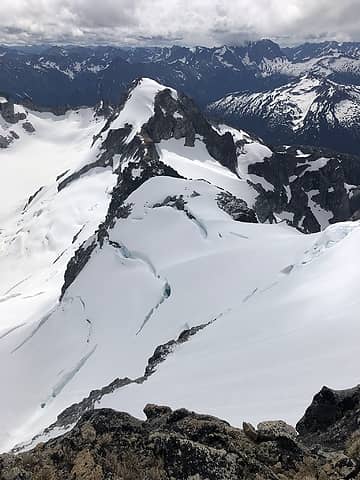 Sinister from Dome 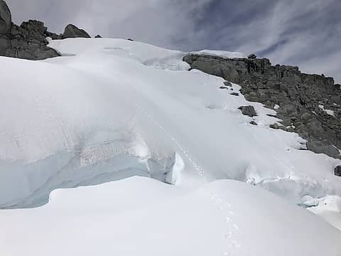 Snowbridge on the upper Chikamin 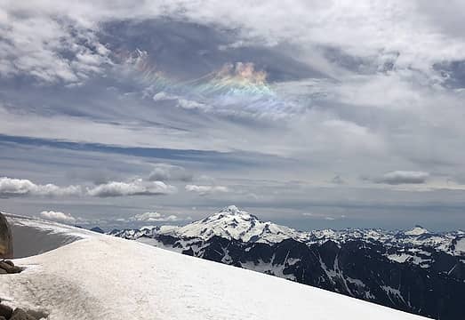 Glacier from S of Sinister 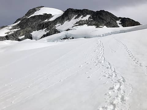 Some bergschrund endrunning required to reach W ridge of Sinister 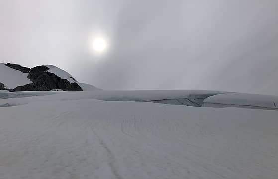 Clouds settling in on the way back over Dome 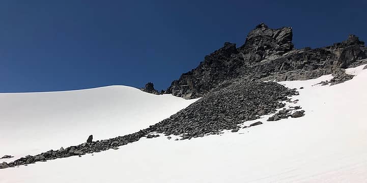 Talus below Spire Point 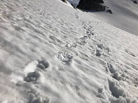 Footprints of local resident on South Cascade Glacier 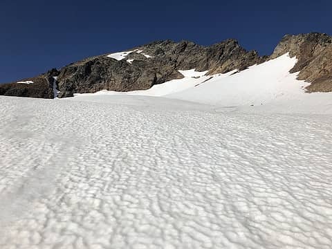 Approaching upper snowfield to access Sentinel W Face 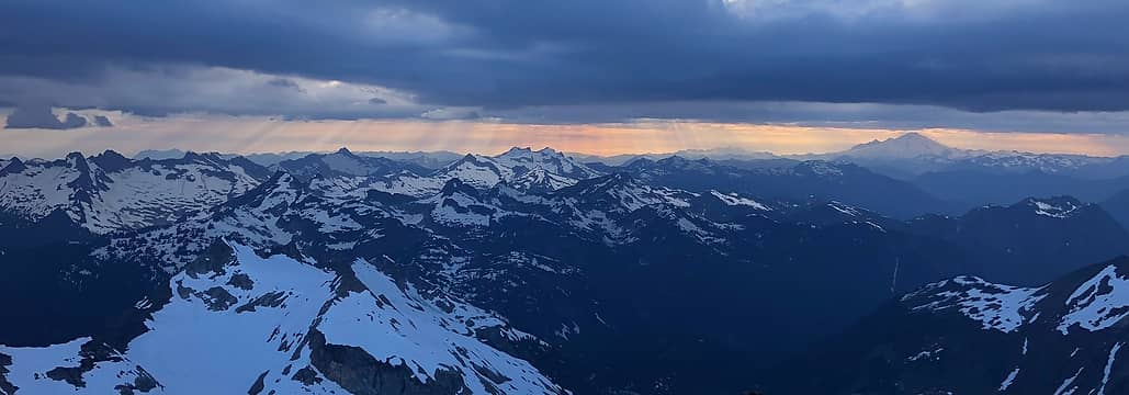 Sunset from Sentinel 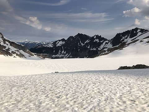 View downhill from upper South Cascade Glacier 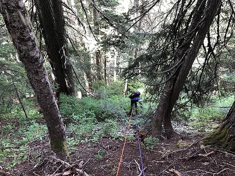 Rapping trees 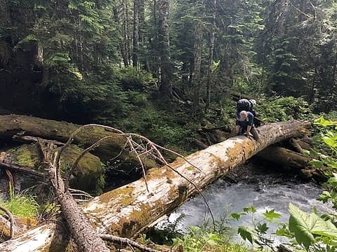 Humping logs
|
| Back to top |
  
|
|
neek
Member

Joined: 12 Sep 2011
Posts: 2337 | TRs | Pics
Location: Seattle, WA |
|
neek
Member
|
 Sun Jul 08, 2018 8:37 pm |
|
|
Heck of a first TR! I can't see your full sized photos, perhaps sharing perms?
|
| Back to top |
|
|
shane w
Member

Joined: 14 Apr 2012
Posts: 69 | TRs | Pics
|
|
shane w
Member
|
Sun Jul 08, 2018 8:47 pm |
|
|
Best report of SFCR in a long time. Maybe ever. Thanks!
|
| Back to top |
|
|
MtnGoat
Member

Joined: 17 Dec 2001
Posts: 11992 | TRs | Pics
Location: Lyle, WA |
|
MtnGoat
Member
|
Sun Jul 08, 2018 8:58 pm |
|
|
SFC is *brutal*. Empathize with the 1/4 mile per hour in the brush, and the cliff sections hidden in forest after leaving the lake. We didn't make it out on time either.
Diplomacy is the art of saying 'Nice doggie' until you can find a rock. - Will Rogers
Diplomacy is the art of saying 'Nice doggie' until you can find a rock. - Will Rogers
|
| Back to top |
|
|
Matt Lemke
High on the Outdoors

Joined: 15 Jul 2010
Posts: 2052 | TRs | Pics
Location: Grand Junction |
|
Matt Lemke
High on the Outdoors
|
Sun Jul 08, 2018 9:16 pm |
|
|
Wow Fred! You descended the SFC?? Wow...thats worse than our descent of Swamp Creek below the Dark Glacier I hear.
It was great to run into you at Dana Col. I wish I would have told you the weather on Thursday was going to be perfect so you could have gotten up earlier for Spire Point! That's why we approached Wednesday and planned just for two days.
Thanks for the tracks on the Chikamin btw! I was wondering why you were wandering all over, now I know haha.
|
| Back to top |
|
|
Tom
Admin
Joined: 15 Dec 2001
Posts: 17853 | TRs | Pics
|
|
Tom
Admin
|
Sun Jul 08, 2018 11:24 pm |
|
|
| neek wrote: | | I can't see your full sized photos, perhaps sharing perms? |
OP needs to use this method to embed permanent links for google photos (other methods such as right click get the image link will result in expiring image links).
|
| Back to top |
|
|
freddyfredpants
saucy
Joined: 08 Jul 2018
Posts: 40 | TRs | Pics
Location: Seattle |
Thanks, I reinserted photos using the correct method!
|
| Back to top |
|
|
RichP
Member

Joined: 13 Jul 2006
Posts: 5634 | TRs | Pics
Location: here |
|
RichP
Member
|
Mon Jul 09, 2018 7:04 am |
|
|
Great read. I've been wondering about the SFC River trail above where the WTA is working on it. It sounds like there is a price to be paid by the traveler that dares wonder up or down there.
|
| Back to top |
|
|
puzzlr
Mid Fork Rocks

Joined: 13 Feb 2007
Posts: 7220 | TRs | Pics
Location: Stuck in the middle |
|
puzzlr
Mid Fork Rocks
|
Mon Jul 09, 2018 5:20 pm |
|
|
What a read! Thanks for taking the time to write this up. When doing the PT the SFC is always mentioned as a possible exit route, but you've put the kabosh on that!
| Quote: | | Overall it was a fantastic trip |
You know it's an epic trip when you can say both of these things. 
|
| Back to top |
|
|
Brian R
Member
Joined: 10 Feb 2018
Posts: 501 | TRs | Pics
|
|
Brian R
Member
|
Mon Jul 09, 2018 9:24 pm |
|
|
Wow, the Chickamin Glacier on Dome has really receded! (I knew about the South Cascade Glacier, but wow!)
|
| Back to top |
|
|
cascadetraverser
Member

Joined: 16 Sep 2007
Posts: 1407 | TRs | Pics
|
Cool trip and epic finish! I will never go down the SFCR because of this TR!! 
|
| Back to top |
|
|
AlpineRose
Member
Joined: 08 May 2012
Posts: 1953 | TRs | Pics
|
You realize this trip made you members of a very exclusive club - survivors of the SCG/SFCR exit. A group far more select than other Ptarmigan Traversers. Perhaps in this day and age, more select even than Bulger list finishers (which, thanks to detailed route descriptions and GPS tracks. seem to be a dime a dozen now.)
On a PT in the early 80's, while being pinned down by severe weather for three days on the Le Conte - Sentinel col, our group gave serious thought to exiting via SCG. So glad the weather finally broke and we were able to exit Downey Ck, grabbing a Dome Peak summit on the way out.
|
| Back to top |
|
|
|
|
You cannot post new topics in this forum
You cannot reply to topics in this forum
You cannot edit your posts in this forum
You cannot delete your posts in this forum
You cannot vote in polls in this forum
|
Disclosure: As an Amazon Associate NWHikers.net earns from qualifying purchases when you use our link(s). |


