| Previous :: Next Topic |
| Author |
Message |
neek
Member


Joined: 12 Sep 2011
Posts: 2337 | TRs | Pics
Location: Seattle, WA |
|
neek
Member
|
 Sat Jul 14, 2018 10:59 am |
|
|
This story really starts with a failed attempt on the Illabot Creek route last year. I don't advise going that way. Or if you do, go above the area of intense blowdown that has completely obliterated the first quarter mile of the old trail. This part took me nearly an hour to clamber through, leaving not enough time to finish the route. The late start and prolific blueberries higher up didn't help either - this was in early September. Also I hadn't researched the route higher up much. I made it to Pt 6597 and called it a day. Here are a few photos from that trip.
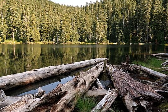 2017-09-03 King Lake 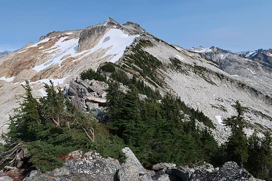 2017-09-03 Snowking from the west 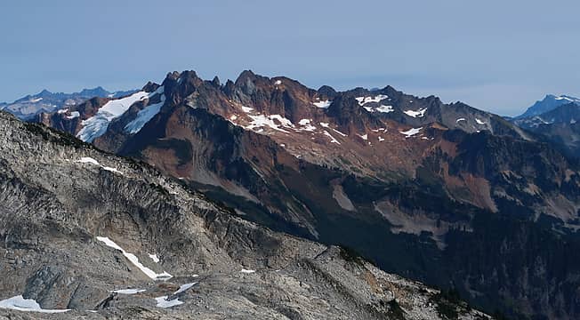 2017-09-03 Buckindy, and yes that's Buck way back there on the right 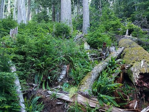 A fairly arduous climb through forest 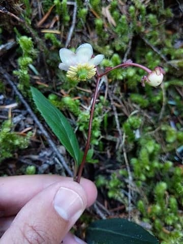 Don't recall seeing this flower before but there were lots of them 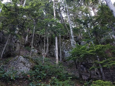 Boulders thrown in to make things even more interesting 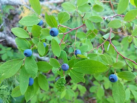 Already?? 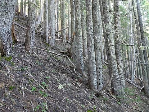 Friendlier terrain 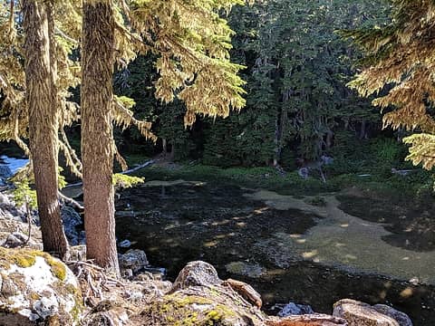 Pond 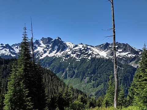 Mount Chaval from above King Lake 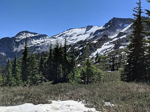 Snow-covered slabs on the north slopes of Snowking 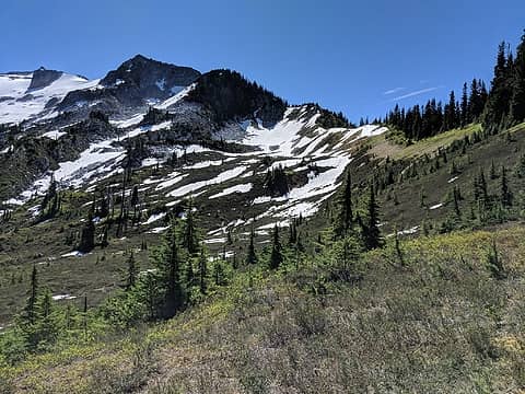 I followed the ridge on the right, then headed across the snow field at center. Probably should have stuck more to the ridge. 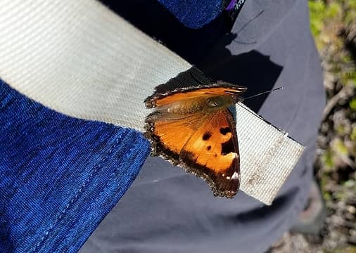 Friendly butterfly 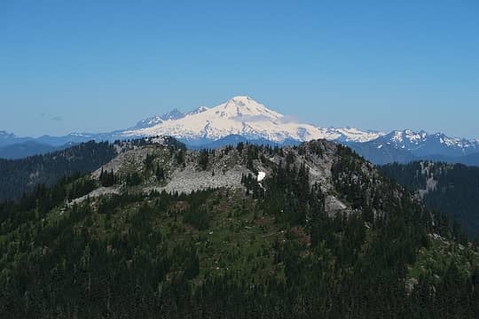 Baker above Ottabot 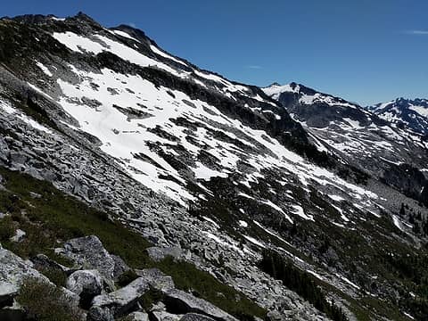 South slopes 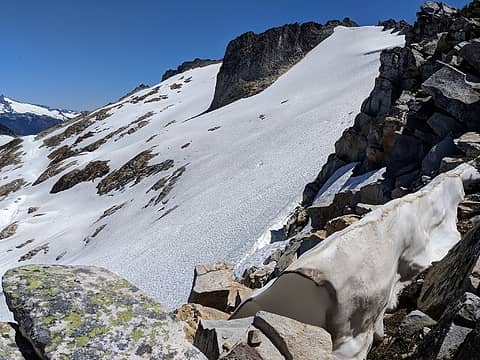 North slopes and a good looking return route 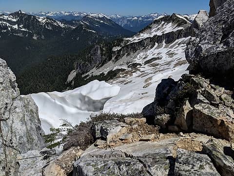 Many North Cascades peaks coming into view 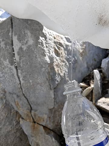 Refill 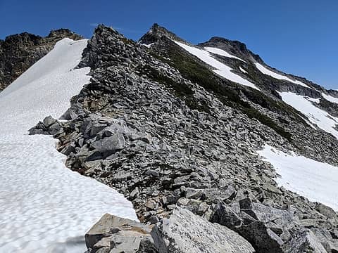 More talus, some shifty 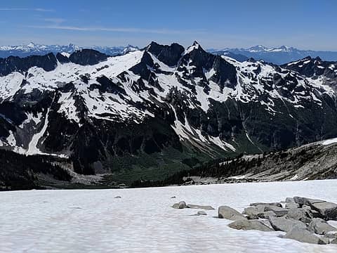 Chaval 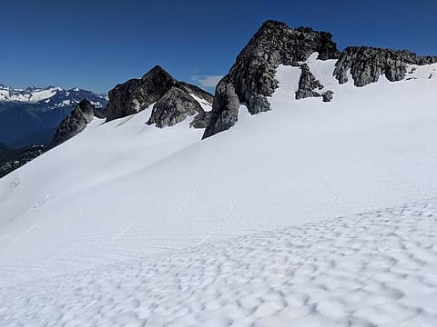 Snowking Glacier 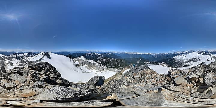 Summit 360 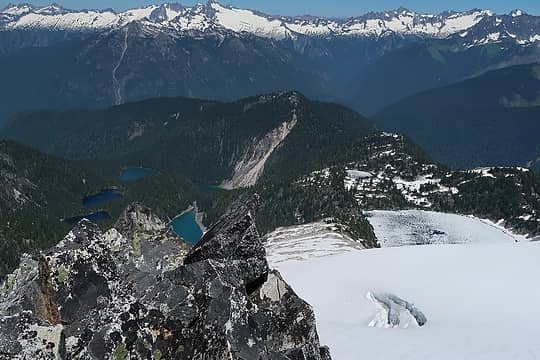 Lakes: Neori, Found, Snowking, Cyclone 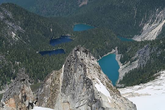 Lake zoom 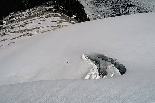 Big crevasse 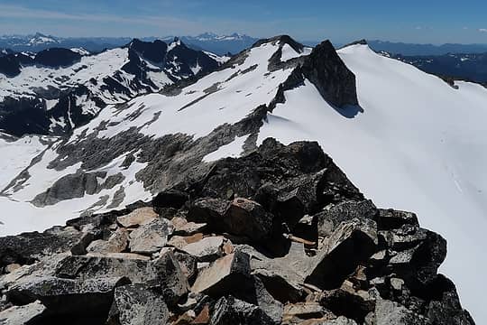 Looking west 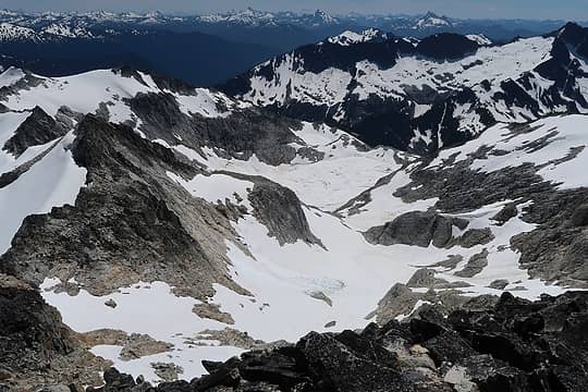 Watched some of that slide (middle center) come down 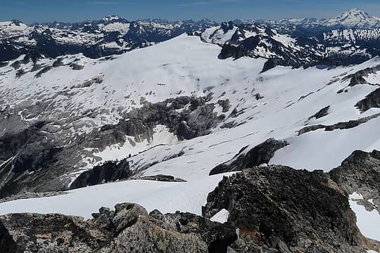 Mutchler 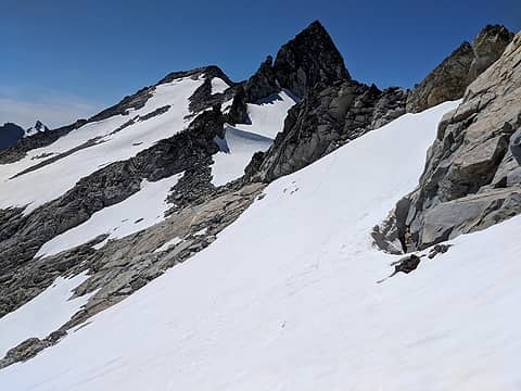 Looking back 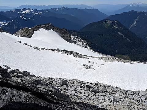 Mostly a straight shot back to the ridge above King Lake 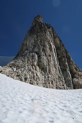 tower 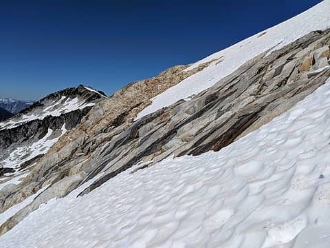 Won't be so easy when the snow melts 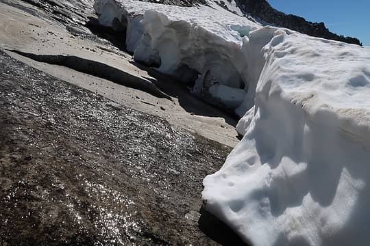 Good water source 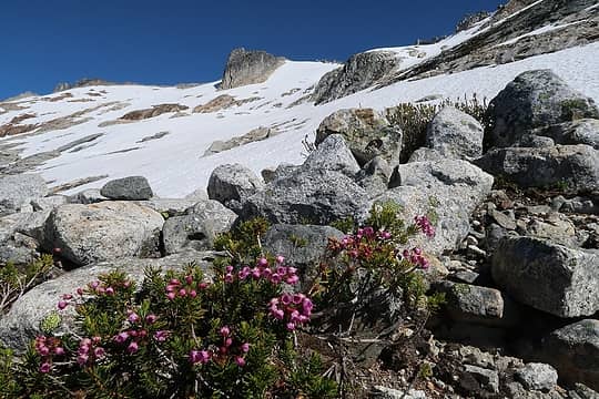 Looking back 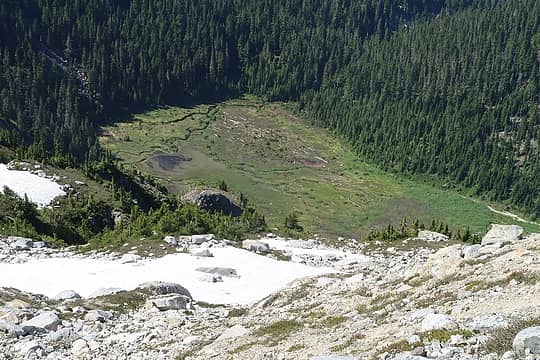 Meadow where the south fork of Otter Creek starts 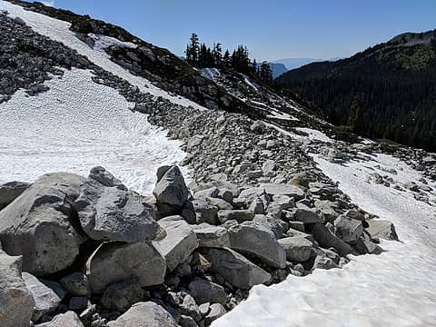 Still going 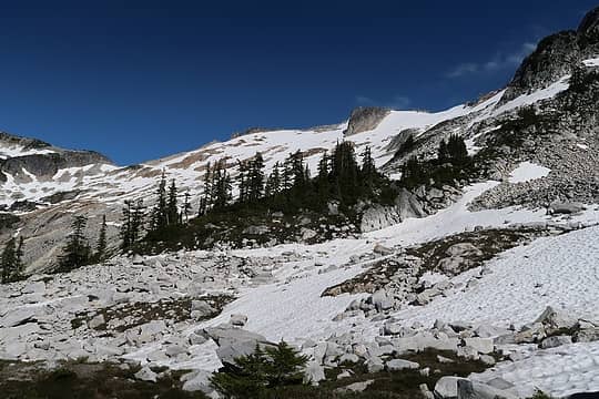 Can't stop looking back 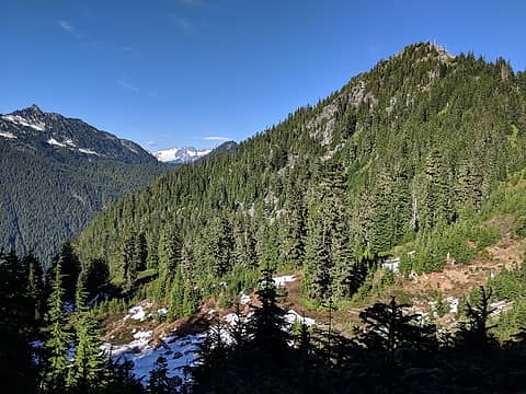 Ottabot 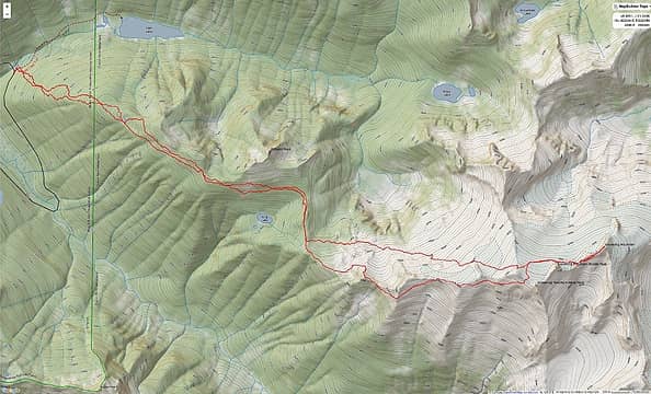 Track
 zimmertr zimmertr
zimmertr |
| Back to top |
  
|
|
RichP
Member

Joined: 13 Jul 2006
Posts: 5634 | TRs | Pics
Location: here |
|
RichP
Member
|
Sat Jul 14, 2018 11:07 am |
|
|
Interesting route. 
|
| Back to top |
|
|
mehitabel
archyologist

Joined: 23 Mar 2009
Posts: 519 | TRs | Pics
Location: the Emerald City |
|
mehitabel
archyologist
|
Sat Jul 14, 2018 12:46 pm |
|
|
is this way shorter than the kindy ridge route?
toujours gai toujours gai
toujours gai toujours gai
|
| Back to top |
|
|
cartman
Member

Joined: 20 Feb 2007
Posts: 2800 | TRs | Pics
Location: Fremont |
|
cartman
Member
|
Sat Jul 14, 2018 1:18 pm |
|
|
Cool you had a great trip and got to finish what you started last year. Those meadows and snow slopes up high look like great alpine terrain.
Mehitabel, my notes say the Kindy Ridge route was 18 miles RT and 9k of gain with all the ups and downs (this includes a descent to camp at Cyclone Lake).
|
| Back to top |
|
|
Schroder
Member

Joined: 26 Oct 2007
Posts: 6722 | TRs | Pics
Location: on the beach |
|
Schroder
Member
|
Sat Jul 14, 2018 1:18 pm |
|
|
I did that route at the end of July once with the slight variation of starting at the Illabot Creek Bridge and staying on the South side the entire distance, staying overnight at 5400 ft. Never touched a foot on snow & finding water was an issue. We decided to head out via that meadow in your photos at the head of Otter Creek and Slide Lake. That was a little easier than the talus and tangle on the lower ridge. It was a memorable climb that I never wanted to repeat.
|
| Back to top |
|
|
Bootpathguy
Member
Joined: 18 Jun 2015
Posts: 1790 | TRs | Pics
Location: United States |
Experience is what'cha get, when you get what'cha don't want
|
| Back to top |
|
|
Kenji
Member
Joined: 18 May 2010
Posts: 320 | TRs | Pics
Location: Seattle |
|
Kenji
Member
|
Sat Jul 14, 2018 9:42 pm |
|
|
Thanks for TR! Ever since I've read a TR on the West ridge high route years ago (maybe >20), I've been interested in this as a ski approach. Of course, I'm not sure how this compares to the infamous "fisherman's path" to King lake. I guess I'd have to find out soon...
|
| Back to top |
|
|
Brushbuffalo
Member

Joined: 17 Sep 2015
Posts: 1887 | TRs | Pics
Location: there earlier, here now, somewhere later... Bellingham in between |
I'd say you picked a fine alternative to the rut normale from the west ( the valley).. Most of us, I'm assuming, prefer a good ridge walk to a valley brushfest.
Passing rocks and trees like they were standing still
Passing rocks and trees like they were standing still
|
| Back to top |
|
|
Justus S.
Member
Joined: 17 Nov 2004
Posts: 1298 | TRs | Pics
Location: WA |
|
| Back to top |
|
|
ozzy
The hard way

Joined: 30 Jul 2015
Posts: 476 | TRs | Pics
Location: University place, wa |
|
ozzy
The hard way
|
Sun Jul 15, 2018 12:23 am |
|
|
I never knew that route was really there! Badass tr man, cheers!  Which route is the better option in your humble opinion!? Which route is the better option in your humble opinion!?
I dont know whats gonna happen, but I wanna have my kicks before the whole shithouse goes up in flames-Mr Mojo Risin
I dont know whats gonna happen, but I wanna have my kicks before the whole shithouse goes up in flames-Mr Mojo Risin
|
| Back to top |
|
|
rbuzby
Attention Surplus
Joined: 24 Feb 2009
Posts: 1011 | TRs | Pics
|
|
rbuzby
Attention Surplus
|
Sun Jul 15, 2018 7:03 am |
|
|
That view from the summit where you can see 7 different lakes, with Eldorado (etc) soaring in the background is un-beatable.
Amazing that people are doing day trips up there, I thought it was a tough over nighter even when you could drive farther.
|
| Back to top |
|
|
cascadetraverser
Member

Joined: 16 Sep 2007
Posts: 1407 | TRs | Pics
|
Haven`t seen that route before. Very cool and well done.
|
| Back to top |
|
|
joker
seeker

Joined: 12 Aug 2006
Posts: 7953 | TRs | Pics
Location: state of confusion |
|
joker
seeker
|
Sun Jul 15, 2018 11:42 am |
|
|
Cool!
Seems like the Kindy Ridge route will be a relative rest day for you ;-)
|
| Back to top |
|
|
Matt Lemke
High on the Outdoors

Joined: 15 Jul 2010
Posts: 2052 | TRs | Pics
Location: Grand Junction |
|
Matt Lemke
High on the Outdoors
|
Sun Jul 15, 2018 2:35 pm |
|
|
You were mentioning this trip when we went out for Azurite. Glad you made it happen! Looks fun 
|
| Back to top |
|
|
OutOfOffice
Member

Joined: 02 Jun 2015
Posts: 91 | TRs | Pics
Location: Seattle |
|
| Back to top |
|
|
|
|


