| Previous :: Next Topic |
| Author |
Message |
raising3hikers
Member


Joined: 21 Sep 2007
Posts: 2344 | TRs | Pics
Location: Edmonds, Wa |
Mad Eagle Pk 8111'
Goliah Pk 7742'
Canuck Pk 7365'
All last week I had been looking at the weather forecast trying to figure out an area to go that would be sunny. This area in/near the Chilliwacks said the smoke should clear out by Friday and have a nice sunny Saturday and part of Sunday. It was wrong, really wrong!
I got a later start than I normally like, so I began hiking the Depot Creek trail after 10:30am. The trail had many blueberries ready to be eaten, so I helped myself and ate a lot of them. At around 3200' is where I would cross Depot Creek and head up slope to the rarely visited area. I found a nice log to cross on and then it was a battle of devils club and steep vegetated slopes for a while. There's a small but decent description of the Lake Fork route in the Beckey guide that helped a little. I traversed away from the creek draining from above and found some big boulder fields that were a welcome sight. They were much easier to travel on than the steep slopes. The worst part of this approach was the first 600', then things mellow out a little when I found the boulders.
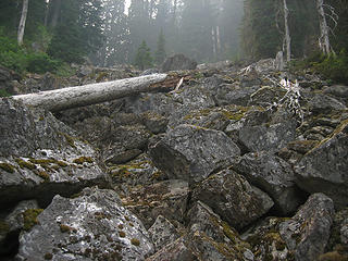 the boulder field approach 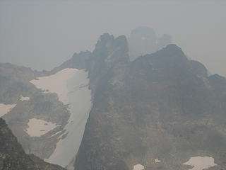 Mad Eagle and Redoubt in the smoke 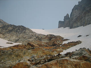 slabs leading to the North ridge 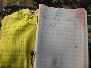 Mad Eagle register, doesn't get a lot of visitors 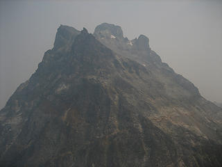 hazy view of Redoubt 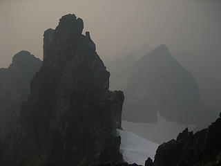 Mad Eagle's 4' lower W Pk and Goliah in the distance 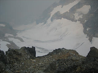 looking down the W Depot Creek glacier 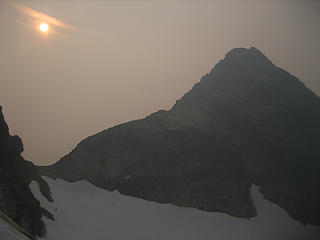 the sun trying to burn through the smoke with Goliah 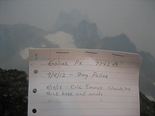 Goliah register 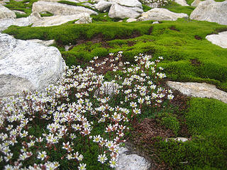 a little life in the barren environment 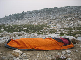 bivy site 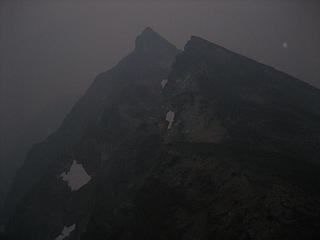 sunrise photo of Goliah? 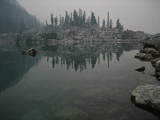 hazy view from the lake 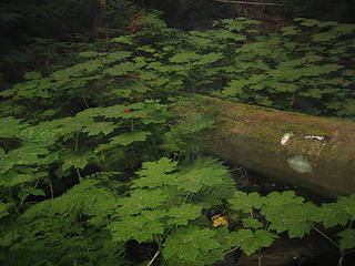 lots of Devils club
|
| Back to top |
  
|
|
Gimpilator
infinity/21M

Joined: 12 Oct 2006
Posts: 1684 | TRs | Pics
Location: Edmonds, WA |
Sorry to hear about the smoke. I have never heard about these peaks! 
|
| Back to top |
|
|
Brushbuffalo
Member

Joined: 17 Sep 2015
Posts: 1887 | TRs | Pics
Location: there earlier, here now, somewhere later... Bellingham in between |
| raising3hikers wrote: | sunrise photo of Goliah? |
Whoa... I thought the orange sun through the pall of smoke was bad today down here in the lowlands, but you couldn't even see an orange blob in this view!
How could you even breathe?
Passing rocks and trees like they were standing still
Passing rocks and trees like they were standing still
|
| Back to top |
|
|
Nancyann
Member
Joined: 28 Jul 2013
Posts: 2319 | TRs | Pics
Location: Sultan Basin |
|
Nancyann
Member
|
 Sun Aug 19, 2018 8:42 pm |
|
|
That smoke looks really awful, Eric. Its so hard to know where to go to get away from it. I took a chance on Friday and went on the PCT south from Stevens. There was just a thin haze that pretty much dissipated by the end of the day.
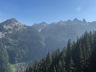 Views from the PCT south of Stevens Pass, Friday 8/17/18 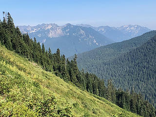 Views from the PCT south of Stevens Pass, Friday 8/17/18
|
| Back to top |
|
|
iron
Member

Joined: 10 Aug 2008
Posts: 6392 | TRs | Pics
Location: southeast kootenays |
|
iron
Member
|
Sun Aug 19, 2018 10:48 pm |
|
|
the rarest of the rare right there. good stuff. bummer on the views. come back for a repeat some day with me...
|
| Back to top |
|
|
geyer
Member

Joined: 23 May 2017
Posts: 463 | TRs | Pics
Location: Seattle |
|
geyer
Member
|
Mon Aug 20, 2018 9:25 am |
|
|
| Eric Willhite wrote: | | (I was up at Hannagan Pass & Copper Ridge Lookout). |
Did you catch a glimpse of the new Little Fork Fire west of the ridge?
Had the same experience this weekend thinking about going up Shuksan. But unlike you, we called it off because the smoke was too thick...
|
| Back to top |
|
|
Stefan
Member

Joined: 17 Dec 2001
Posts: 5093 | TRs | Pics
|
|
Stefan
Member
|
Mon Aug 20, 2018 12:45 pm |
|
|
what? That is a day trip!!!
|
| Back to top |
|
|
cartman
Member
Joined: 20 Feb 2007
Posts: 2800 | TRs | Pics
Location: Fremont |
|
cartman
Member
|
Mon Aug 20, 2018 2:45 pm |
|
|
And to think I was just considering this area for a trip...great minds think alike.
Good thing you got this now, as there is a new fire on the SW flank of No Doubt Pk just north of where you were, though it is still very small.
BTW, I could have given you a good TR for these three peaks if I'd known...
I have never seen smoke this bad. I was just a few miles from Dome with an unobstructed view and all I could see was a wall of white. Not even an outline. Crushing.
|
| Back to top |
|
|
NorthwestWanderer
Member

Joined: 28 May 2016
Posts: 113 | TRs | Pics
Location: Montana |
You guys really shouldn't be physically working in this smoke
|
| Back to top |
|
|
Prosit
Member
Joined: 08 May 2011
Posts: 130 | TRs | Pics
|
|
Prosit
Member
|
Mon Aug 20, 2018 8:22 pm |
|
|
Great effort in nightmarish conditions. The smaller, higher lake in lake-fork basin is one I'd like to visit.
I did the traverse from monument 64, climbing Nodoubt, and then on to these peaks, Bear Lake and beyond in 1995. I climbed Canuck and bivied on Goliah, but didn't attempt Mad Eagle. Nice country, seldom seen, but well worth the effort.
Hopefully you'll return for the views some day.
|
| Back to top |
|
|
iron
Member
Joined: 10 Aug 2008
Posts: 6392 | TRs | Pics
Location: southeast kootenays |
|
iron
Member
|
Mon Aug 20, 2018 8:50 pm |
|
|
| backpacker92out wrote: | | You guys really shouldn't be physically working in this smoke |
and people shouldn't drive cars given the risks.
|
| Back to top |
|
|
cartman
Member
Joined: 20 Feb 2007
Posts: 2800 | TRs | Pics
Location: Fremont |
|
cartman
Member
|
Tue Aug 21, 2018 5:50 am |
|
|
| backpacker92out wrote: | | You guys really shouldn't be physically working in this smoke |
Probably true, as the more one works the more one breathes in this crap. If I'd known it would have been better S of Hwy 2, I would have gone there instead.
However, the body does seem to adapt at least for short periods. Despite the awful haze, I really didn't notice it affecting my breathing for a 2.5 day trip in it. Not likely to repeat the experience though.
I don't drive cars given the risks to my sanity...
|
| Back to top |
|
|
MangyMarmot
Member

Joined: 06 Apr 2012
Posts: 474 | TRs | Pics
|
Cool trip to some rarely visited peaks. I saw that you signed in at the park boundary. The smoke was really bad on the Redoubt glacier as well. The top of the haze was at about 9k. We could see the top of Baker sticking out above it from Redoubt.
|
| Back to top |
|
|
slabbyd
Member
Joined: 21 Jun 2005
Posts: 293 | TRs | Pics
|
|
slabbyd
Member
|
Tue Aug 21, 2018 7:22 pm |
|
|
How does the north buttress of Goliath look? Beautiful contours on the topo map.
|
| Back to top |
|
|
NorthwestWanderer
Member
Joined: 28 May 2016
Posts: 113 | TRs | Pics
Location: Montana |
| iron wrote: | | and people shouldn't drive cars given the risks. |
We shouldn't but do because we got to get to work and make a living so we can pay to drink and eat to support our families. We don't got to hike in this smoggy crap, same thing as smoking cigs. Climbing peaks at air quality index 148 won't feed your kids.
|
| Back to top |
|
|
|
|


