| Previous :: Next Topic |
| Author |
Message |
MojaveGeek
Member


Joined: 16 Aug 2009
Posts: 49 | TRs | Pics
|
I live in Boston but have been hiking in Washington for three decades. I haven't posted a TR here before, but reading some recent ones, I'm motivated to archive my most recent trip here. Hope it's welcome.
My standard hiking travel is day hikes out of some low priced motel where I can cook or nuke my meals, get out pre-dawn and spend the day outside. I call it "motel camping" and although it means my shaky knees don't need to carry full pack weight, I don't get to sleep out in the wild. A compromise.
A few years ago I spent a few days in the eastern edge of Yosemite (the Sierra rise from west to east, so the highest peaks are near the eastern escarpments) and was blown away. Wanted to go back last year, but too much snow. So this year I spent two weeks hiking out of June Lake, CA. The plan had been to go in via a number of access points on the east side, but due to the fires - Ferguson in western Yosemite and Lions just a bit east of Mammoth - I did all my hiking in a small area around Tioga Pass, as it seemed to have the clearest air many days. Of course you don't know what's going to happen, even if you study the smoke convection models online, so I was getting up before 4 to be on the trail with the sun, as the mornings were generally good, with smoke rising and wafting over the Sierra peaks some time between 11 and 2 most days. Most...
I flew into Reno and during the three hour drive south saw almost nothing, the air was brown and the sun sickly. So my "big peak" plans for the first day sort of faltered. First I went and hiked around Panum Crater near Mono Lake. It's a volcanic crater which has a huge obsidian plug, and I like obsidian. At that point I mistakenly figured if it was smoky in the Owens Valley, it was smoky on the peaks. Not so.
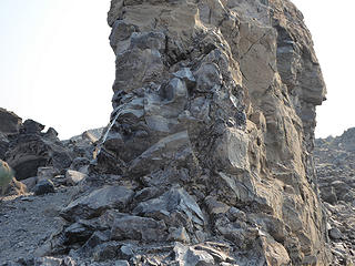 most of that is obsidian 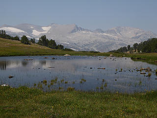 Lake 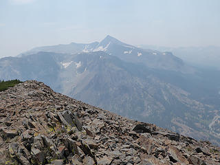 Peak 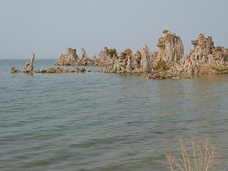 Tufa towers 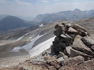 False White 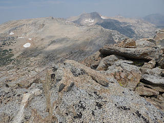 False White 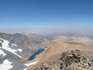 False White 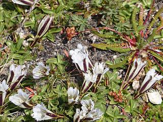 Tioga Gentian 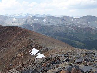 Gibbs view west 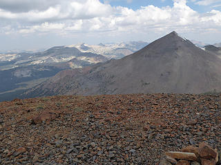 east to Mt. Dana 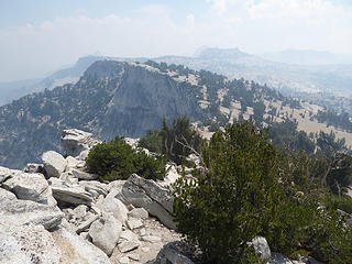 Tenaya Peak 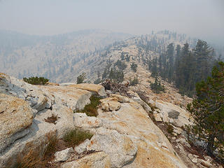 starting to get smoky 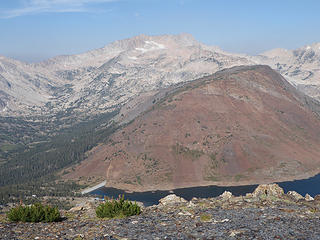 Nice approach with a view to Conness beyond Saddlebag Lake 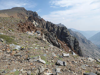 Final push to the peak 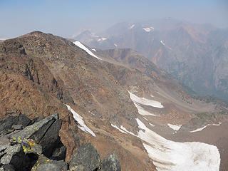 Could be a great view! 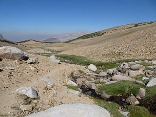 Dana Plateau 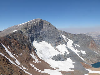 Dana from the other side 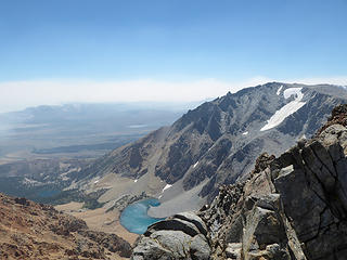 Kidney Lake down there 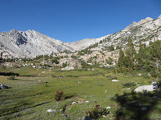 Beautiful morning approach 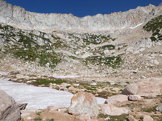 Nice cirque 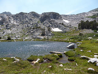 One of the Treble Lakes 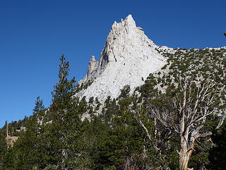 Cathedral Peak 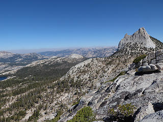 Nice view before the smoke 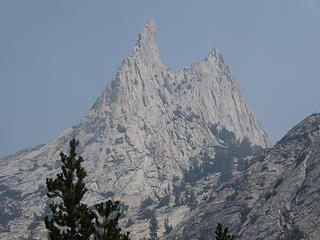 You can see where it gets the name. 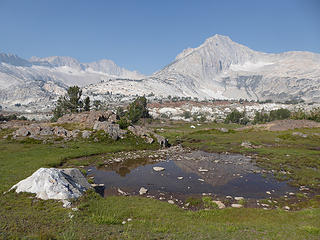 Behind Saddlebag Lake 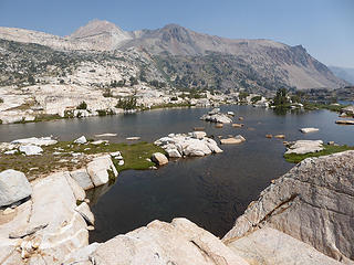 One of the lakes 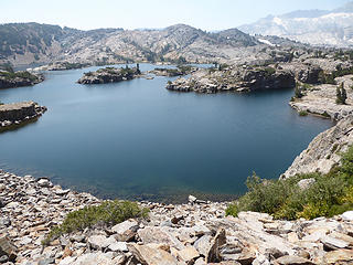 Another one. 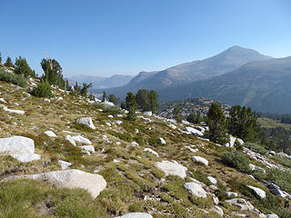 Nice skies on ascent 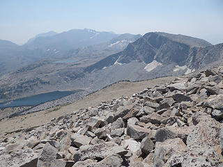 Kuna Crest from the peak 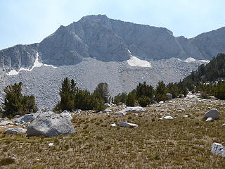 Kuna Crest from the lake. 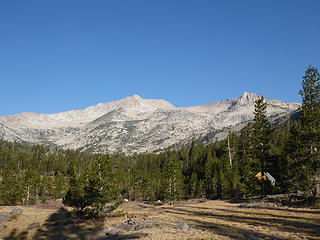 Great morning skies on approach 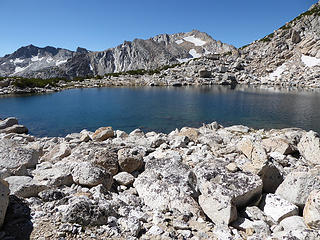 Alpine Lake 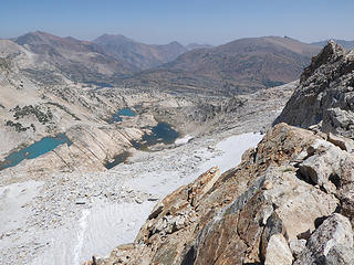 View from the east ridge 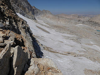 Conness Glacier 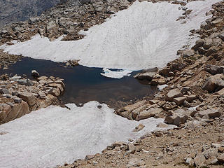 Two snowfields converge near the summit. 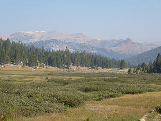 Meadows along Parker Pass Creek 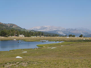 Spillway Lake 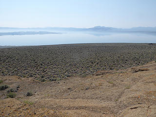 Mono Lake 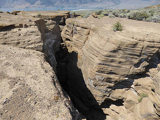 One of the fissures 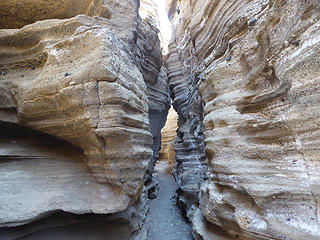 Inside another fissure 
|
| Back to top |
  
|
|
John Morrow
Member

Joined: 03 Apr 2007
Posts: 1526 | TRs | Pics
Location: Roslyn |
So wish I could get there! Thanks for the tease. We may be the only two NWHikers to have been on "False White". Great walk, great lakes, great views, but not exactly known to be a classic!
John
Tell me, what is it you plan to do with your one wild and precious life?-Mary Oliver
A nation that continues year after year to spend more money on military defense than on programs of social uplift is approaching spiritual doom.
― MLK Jr.
Tell me, what is it you plan to do with your one wild and precious life?-Mary Oliver
A nation that continues year after year to spend more money on military defense than on programs of social uplift is approaching spiritual doom.
― MLK Jr.
|
| Back to top |
|
|
olderthanIusedtobe
Member
Joined: 05 Sep 2011
Posts: 7709 | TRs | Pics
Location: Shoreline |
 I love the east side of Yosemite/Tuolumne area. I haven't explored it as thoroughly as you did. Sounds like you were creative and flexible in coming up with hikes to do each day. Thanks for posting your TR.
|
| Back to top |
|
|
|
|
You cannot post new topics in this forum
You cannot reply to topics in this forum
You cannot edit your posts in this forum
You cannot delete your posts in this forum
You cannot vote in polls in this forum
|
Disclosure: As an Amazon Associate NWHikers.net earns from qualifying purchases when you use our link(s). |


