| Previous :: Next Topic |
| Author |
Message |
Ski
><((((°>


Joined: 28 May 2005
Posts: 12832 | TRs | Pics
Location: tacoma |
|
Ski
><((((°>
|
 Mon Aug 27, 2018 11:17 pm |
|
|
60th Anniversary - 08/19 - 08/24
USGS 12040500 08/19/18 @ 05:30 PDT - 507 CFS
Central Park 08/19/18 @ 08:30 PDT 57° F
Amanda Park 08/19/18 @ 09:50 PDT 59° F
Nine vehicles at trailhead at 11:00 AM, one of which belonged to a young man who was packing up and leaving. Spoke briefly with a young couple who staying in the campground and were just beginning a walk around the Sams Loop Trail. They said that most of the people who had been staying in the campground left earlier that morning.
Met a trio about a half a mile in who were coming out from an overnight at Spruce Bottom. One of them had a number of questions like "Why are there no signs here?" I referred him to Park headquarters up at Port Angeles for an answer on that one, and spent a lot of time answering quite a few others.
Met a group of four dayhikers coming out at a dry Coal Creek while I was shaking the sand out of my socks. One of them was carrying a rock the size of a football in his hands.
The weather was nice and sunny, and the sky was relatively clear of smoke when I got to the big maple on the bank at about mile 3.0 and had a little snack.
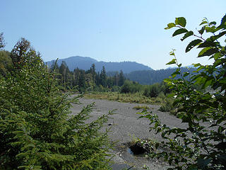 Queets River (mile 3.0) 081918 01 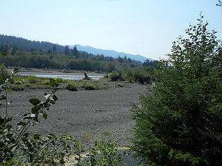 Queets River (mile 3.0) 081918 02 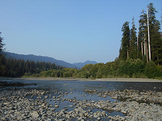 Queets River 081918 01 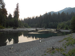 Queets River 081918 02 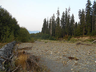 Queets River 081918 03 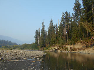 Queets River 082018 02 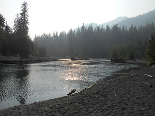 Queets River 082018 01 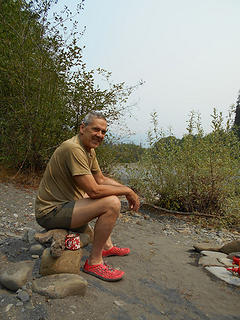 BK Queets 082018 01 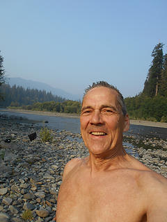 BK Queets 082018 02 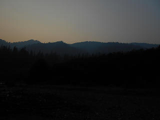 Queets River 082118 01 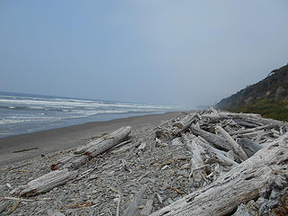 Kalaloch Beach 1 082418 02 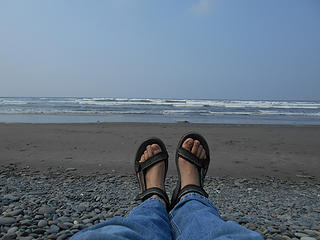 Kalaloch Beach 1 082418 01
"I shall wear white flannel trousers, and walk upon the beach.
I have heard the mermaids singing, each to each."
"I shall wear white flannel trousers, and walk upon the beach.
I have heard the mermaids singing, each to each."
|
| Back to top |
  
|
|
tinman
Member

Joined: 08 Oct 2004
Posts: 355 | TRs | Pics
Location: Where it rains, WA |
|
tinman
Member
|
Tue Aug 28, 2018 5:05 pm |
|
|
Ski, always look forward to your yearly Queets report. And 60 years is just flat amazing!
Wherever you go, there you are.......
Wherever you go, there you are.......
|
| Back to top |
|
|
cascadetraverser
Member

Joined: 16 Sep 2007
Posts: 1407 | TRs | Pics
|
60 years is amazing! By your healthy appearance and that healthy tasty looking food, I look forward to many more....
|
| Back to top |
|
|
Bloated Chipmunk
Cock Rock Searcher

Joined: 29 Jan 2007
Posts: 2993 | TRs | Pics
Location: Margaritaville |
Home is where the hiking is.
"Peaks that have come and gone four times should halt a man in his steps." -- William O. Douglas
A balanced diet is a margarita in each hand.
|
| Back to top |
|
|
Ski
><((((°>
Joined: 28 May 2005
Posts: 12832 | TRs | Pics
Location: tacoma |
|
Ski
><((((°>
|
Tue Aug 28, 2018 10:27 pm |
|
|
"I shall wear white flannel trousers, and walk upon the beach.
I have heard the mermaids singing, each to each."
|
| Back to top |
|
|
meck
Member

Joined: 31 Dec 2010
Posts: 920 | TRs | Pics
|
|
meck
Member
|
Wed Aug 29, 2018 9:14 pm |
|
|
Hi Ski, I was looking forward to your report from the Queets this year, sounds like quite a pleasant adventure and great time to be out there! (I am always envious of your meal selections) Visiting the burned area was a pretty neat adventure last year, though the sticker brush vines were taking over the remnants of the trail that I was able to find; its good to know that the upper end of that trail is getting some TLC.
*Just say NO to Rent-Seeking, don't give up the concept of "ownership"*
*Just say NO to Rent-Seeking, don't give up the concept of "ownership"*
|
| Back to top |
|
|
Ski
><((((°>
Joined: 28 May 2005
Posts: 12832 | TRs | Pics
Location: tacoma |
|
Ski
><((((°>
|
Wed Aug 29, 2018 10:02 pm |
|
|
| meck wrote: | | "...its good to know that the upper end of that trail is getting some TLC." |
To be clear: the current plan calls for clearing out the trail between Harlow Bottom up to Paradise Creek. Logistics, weather, and other factors may impede progress being made up to that point.
Another point which should be mentioned is that there are not too many who actually know where the upper end of the trail is/was located, particularly once one gets up to the vicinity of Bob Creek.
| the aforementioned acquaintance who walked up to Kilkelly last week, in an email wrote: | | Burn zone itself now is a mess of rubus vines, down limbs, etc., and not worth trying to travel through. Took me about 2 hours to get to mouth of Alta creek from above mentioned maple glade above Bob, going in a mix of gravel bars, fording, and un-burnt alder flats. |
It's been some time since I ventured up beyond Bob Creek. I'd have to go pick through my notes, but I'm sure it was before the fire in 2015.
There's a point at which the trail ascends a couple hundred feet up along the side of the ridge (to avoid a marshy area on the north bank) and then zig-zags back down to the river, which was fairly confusing for a lot of people prior to the fire event. I would imagine that it's worse now, although Gary Patton sent me photos a couple years ago showing that he'd managed to negotiate his way up there without too much difficulty. (Bear in mind, of course, that he's been going up there almost as long as I have.)
In a phone conversation a couple years ago, Ernie told me he didn't have any trouble finding the site of the now gone Pelton Creek shelter. But again, as with Gary, he's well-acquainted with the trail.
As the fire ultimately took out a good portion of the trail even below Bob Creek, I would posit erring on the side of caution might be the better choice if one were thinking about venturing up there right now. A more prudent choice might be to wait and see what Ernie and his crew are able to do once they get up there, which is my intention at the moment. I'm waiting for a good weather window and hoping to see if I can coordinate with my old friend mentioned above, who missed me up there by a mere three hours last week.
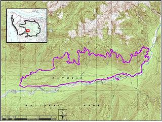 Paradise Fire Burned Area Perimeter - NPS 2017
"I shall wear white flannel trousers, and walk upon the beach.
I have heard the mermaids singing, each to each."
"I shall wear white flannel trousers, and walk upon the beach.
I have heard the mermaids singing, each to each."
|
| Back to top |
|
|
gmphiker
Member
Joined: 10 Sep 2018
Posts: 4 | TRs | Pics
|
|
gmphiker
Member
|
Mon Sep 10, 2018 1:52 pm |
|
|
Looks like you had a great time Ski! I was up with my cousin and his nine year old son (first trip up the Queets) Aug 27th - 31st. Had a fabulous trip. Great weather except for one off and on rainy day, and very minimal smoke. We only went as far a Tshletshy but had a great time taking short hikes up and down the river from there. We even hiked up Tshletshy about a mile, which I hadn't done in years The condition of the trail is better than it's been in many years. Many thanks to Ernie! Thanks for the email link to your post! Gary.
|
| Back to top |
|
|
Kim Brown
Member
Joined: 13 Jul 2009
Posts: 6899 | TRs | Pics
|
Looks like a great time, Ski! Great looking grub, too!
So... What's the anniversary!? I didn't catch that.
"..living on the east side of the Sierra world be ideal - except for harsher winters and the chance of apocalyptic fires burning the whole area."
Bosterson, NWHiker's marketing expert
"..living on the east side of the Sierra world be ideal - except for harsher winters and the chance of apocalyptic fires burning the whole area."
Bosterson, NWHiker's marketing expert
|
| Back to top |
|
|
Ski
><((((°>
Joined: 28 May 2005
Posts: 12832 | TRs | Pics
Location: tacoma |
|
Ski
><((((°>
|
Tue Sep 11, 2018 9:56 pm |
|
|
"I shall wear white flannel trousers, and walk upon the beach.
I have heard the mermaids singing, each to each."
|
| Back to top |
|
|
Kim Brown
Member
Joined: 13 Jul 2009
Posts: 6899 | TRs | Pics
|
I thought so, but wanted to be sure!
And....damn you're old! 
"..living on the east side of the Sierra world be ideal - except for harsher winters and the chance of apocalyptic fires burning the whole area."
Bosterson, NWHiker's marketing expert
"..living on the east side of the Sierra world be ideal - except for harsher winters and the chance of apocalyptic fires burning the whole area."
Bosterson, NWHiker's marketing expert
|
| Back to top |
|
|
|
|
You cannot post new topics in this forum
You cannot reply to topics in this forum
You cannot edit your posts in this forum
You cannot delete your posts in this forum
You cannot vote in polls in this forum
|
Disclosure: As an Amazon Associate NWHikers.net earns from qualifying purchases when you use our link(s). |


