| Previous :: Next Topic |
| Author |
Message |
geyer
Member


Joined: 23 May 2017
Posts: 463 | TRs | Pics
Location: Seattle |
|
geyer
Member
|
 Wed Sep 05, 2018 7:59 pm |
|
|
Dates: September 2-3, 2018
Distance: 39 miles
Accum. Elevation Gain: 14,400'
Total Humans Seen: muchos
For my annual trip to the Olympics, I knew I wanted to make my way to the Carrie Glacier. And for a long time, I thought I wanted to do it as a challenging out-and-back day-trip. But when I was doing my requisite pre-hike research on Google Earth, I discovered the Carrie and Stephen basins. I couldn't find a way into the Carrie basin that wasn't a total pain in the ass (or over the glacier), so I stuck with the Stephen Peak basin with the hope that I could traverse the glacier from Carrie to Stephen. My day trip was now at least an overnighter (preferably 2 nights, but the stars didn't align for this.)
Day 1: Sol Duc to Heart Lake, Mt Carrie, Stephen Peak Basin,
Distance: 18.4 miles
Elevation Gain: 8550'
Elevation Loss: 5300'
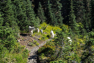
I got out the gates quickly around 6am and made it to Heart Lake in about 3 hours. Most people just seemed to be waking up when I was already halfway done with the 7 lakes loop  There were some goats here walking right down the middle of the path. Goats love human bootpaths. I got in three different goat-jams over the next 36 hours. There were some goats here walking right down the middle of the path. Goats love human bootpaths. I got in three different goat-jams over the next 36 hours.
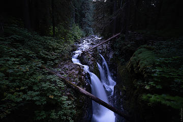 0.8 miles in - Sol Duc Falls 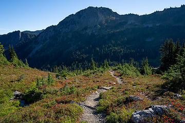 fall, is that you? 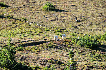 Don't they know they're supposed to yield to uphill hikers!?  . Where is the scrambling?! Suddenly the trail just ended like nothing I had ever seen before. Just one massive cliff in front of me with nowhere to go but up and only minor evidence of other humans. In my brain I thought "Finally some scrambling! this must be the catwalk" For whatever reason, it did not occur to me that maybe, just maybe, I had passed a turn on the trail that went up and to the left before this cliff. Captain Hindsight was not there to save the da! Too late now, as I was already up on some very exposed loose dirt, checking every gully to see if it went up to the actual trail. About 6 gullies and some veggie belay later, I had realized my mistake and found my way through to the trail. This sucked way too much energy out of me, especially so early in my trip. So I stopped and took a nice long break. . Where is the scrambling?! Suddenly the trail just ended like nothing I had ever seen before. Just one massive cliff in front of me with nowhere to go but up and only minor evidence of other humans. In my brain I thought "Finally some scrambling! this must be the catwalk" For whatever reason, it did not occur to me that maybe, just maybe, I had passed a turn on the trail that went up and to the left before this cliff. Captain Hindsight was not there to save the da! Too late now, as I was already up on some very exposed loose dirt, checking every gully to see if it went up to the actual trail. About 6 gullies and some veggie belay later, I had realized my mistake and found my way through to the trail. This sucked way too much energy out of me, especially so early in my trip. So I stopped and took a nice long break. 
 Maybe 30 minutes later... 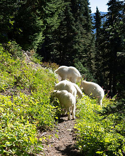 traffic jam 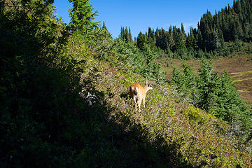 Deer 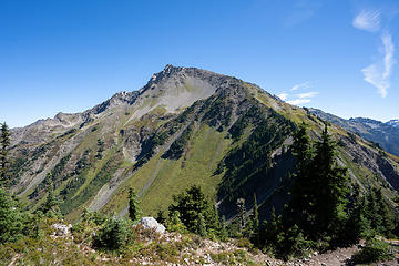 Cat Peak 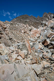 The heaping choss pile that is Mount Carrie 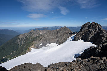 "Unofficial" Carrie Glacier (west) 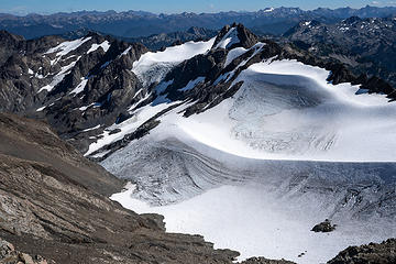 Carrie Glacier (east) 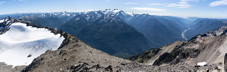 summit pano 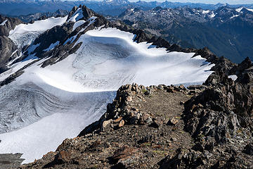 two tremendous bivy sites on the ridge 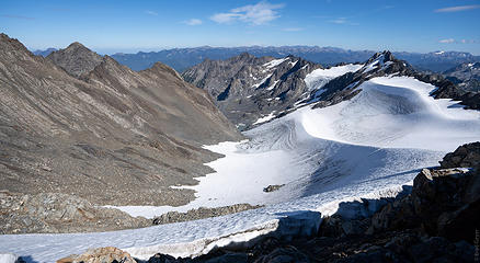 walked along the ridge a bit to get a better vantage 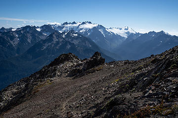 back down 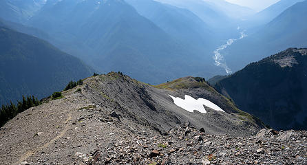 great view into the Hoh  Got my first blister of the year thanks to this.
After coming down Carrie, I continued over towards Stephen when I came across what seemed to be the popular campsite for all the traversers. It was approaching 6 pm and I still had a few miles, plus some uphill to go. I chatted with one of the parties, who was on day 3 of their traverse and asked if I was going to Cream Lake. I had (and still have) no idea where Cream Lake is, but it sounds interesting. I think I piqued their interest with my destination because I saw them again on Monday mulling the decision to go where I had been. Got my first blister of the year thanks to this.
After coming down Carrie, I continued over towards Stephen when I came across what seemed to be the popular campsite for all the traversers. It was approaching 6 pm and I still had a few miles, plus some uphill to go. I chatted with one of the parties, who was on day 3 of their traverse and asked if I was going to Cream Lake. I had (and still have) no idea where Cream Lake is, but it sounds interesting. I think I piqued their interest with my destination because I saw them again on Monday mulling the decision to go where I had been.
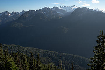 Oly 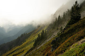 Clouds coming in as I ascend up to Stephen 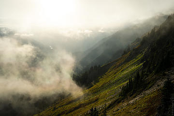 golden hour clouds 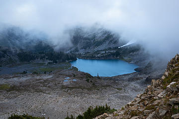 basin views 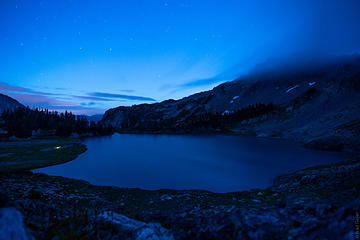 You can see the light on the left is the campsite I was referring to 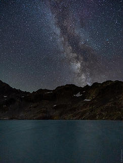 first time attempting MW with the new camera.. not my best effort 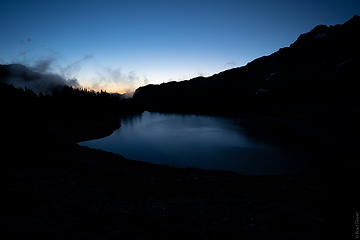 morning twilight views 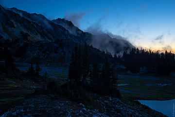 wispy clouds 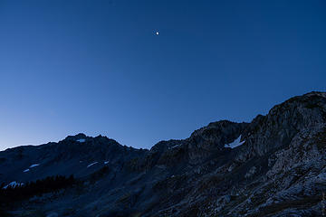 moon 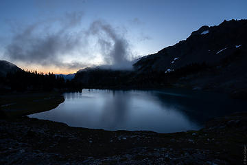 closer to sunrise 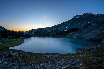 oversaturated 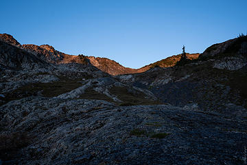 first light 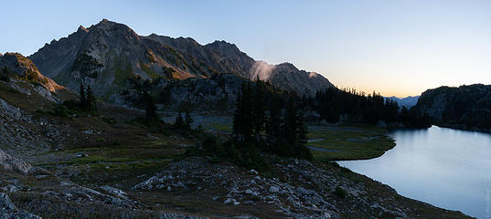 soft morning colors 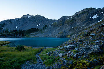 looking at the lake from lower 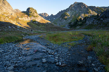 golden hour light further up the braided stream 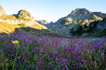 flowers 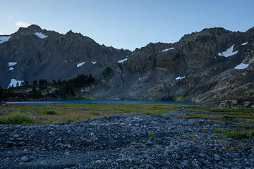 looking back to the lake and that fricken campsite 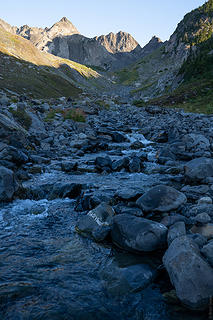 stream views 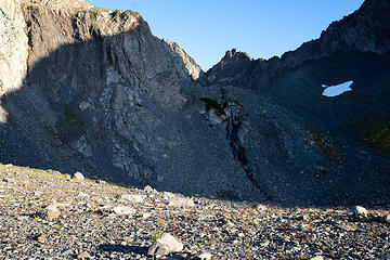 The basin split into two here. going right seemed like the best bet to get to the carrie glacier 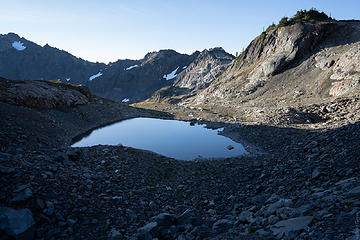 high tarn 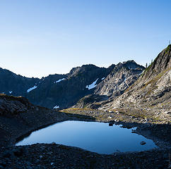 tarn views 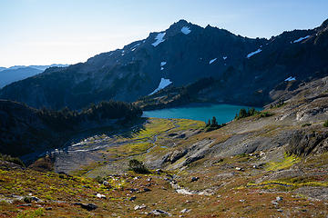 looking down into the basin 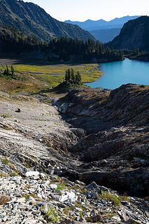 some awesome mini-canyons carved into the rock 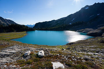 daytime colors 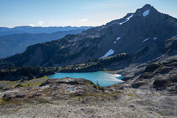 looking back from the ridge 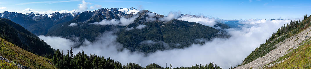 Hoh pano 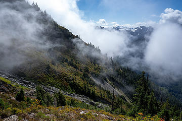 more clouds  Mount Tom and the White Glacier. I want to ski this baby 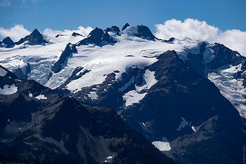 Oly 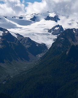 Tom, with his head stuck in the clouds 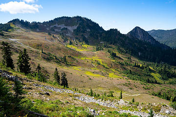 Heart Lake 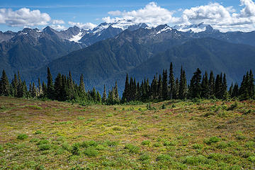 High Divide views 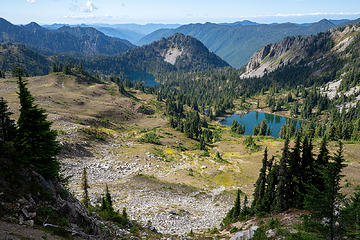 7 lakes basin first views 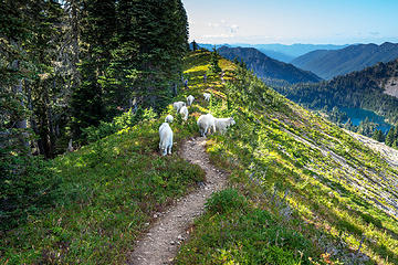 more traffic 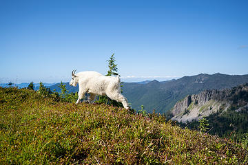 jeez, quit being so dramatic 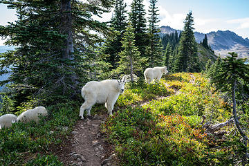 whatchu lookin at? 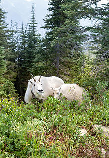 Future "my face when... " meme 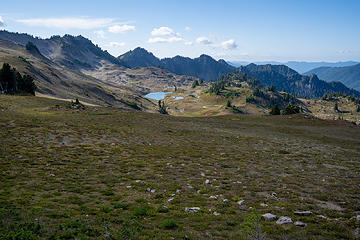 basin 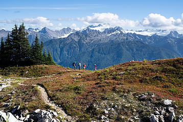 some people I didn't know that I knew 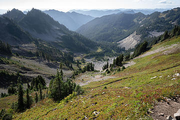 Bogachiel valley 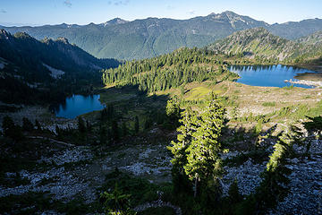 Lunch Lake & friend 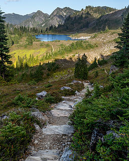 Lunch 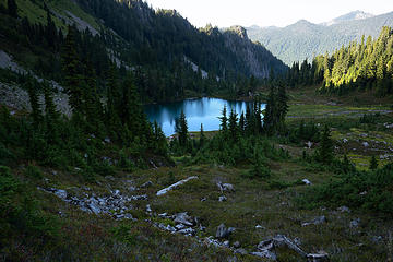 friend 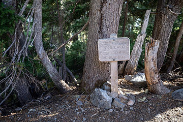 This sign only faces the Lunch Lake trail, and I didn't look at it 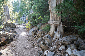 This is the sign you'd see on the High Divide trail. I mistook 7 lakes basin to mean the loop. oops 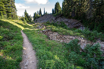 Is there some tectonic activity going on up here? Massive cracks in the ground and trees uprooted 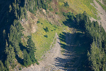 I couldn't tell what those brown dots were, so I got the tele lens out - elk! 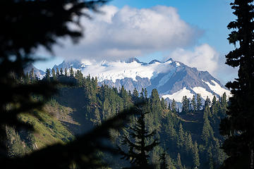 'sup Oly? 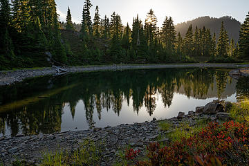 tarn near a buch of campsites
|
| Back to top |
  
|
|
silence
Member

Joined: 25 Apr 2005
Posts: 4420 | TRs | Pics
|
|
silence
Member
|
Thu Sep 06, 2018 7:14 am |
|
|
Awesome trip and photos ... well done! This is a area that of course many of us I've read about and maybe even visited (I wished), but I've never seen such intimate shots of it at this time of year ... usually it's earlier snowy pictures. I guess no place is esp sacred or secret anymore, and I have to be OK with that, whether I like it or not, because no one has special claim on a spot. It's just disappointing to work so hard to get someplace so remote and then have to share it, esp if that neighbor is not being respectful in one way or another. I'm not surprised you met folks up on the Bailey, but yeah it's a little more unusual to see a camp in that out of the way basin. I feel your pain about the bad judgement for their tent site in such a fragile riparian zone, esp with plenty of other low impact sites to choose from. Just the other day I was appalled and disheartened to see a report where they were camping and trampling on delicate alpine zone mountain heather fields ... where some of the communities are known to be up to 10K years old. Being woody plants these are easily breakable no matter where they are, but in this zone they are esp vulnerable because of their short growing season.
BTW ... in both places not only does the ranger explain the most essential LNT principals before issuing a permit, but they are also included with the permit. And, when signing your XC permit you are acknowledging that you will adhere to them. So, it goes without saying, that it is the responsibility of each individual to understand them fully, esp when going off-trail Here's a link to LNT:
https://lnt.org/learn/7-principles
More about the fragile alpine ecosystem and why we should be more vigilant with our steps when traveling in it: https://www.wnps.org/ecosystems/alpine_eco/alpine.htm
PHOTOS
FILMS
Keep a good head and always carry a light bulb. Bob Dylan
PHOTOS
FILMS
Keep a good head and always carry a light bulb. Bob Dylan
|
| Back to top |
|
|
Bootpathguy
Member

Joined: 18 Jun 2015
Posts: 1790 | TRs | Pics
Location: United States |
| geyer wrote: | | Things were going well until a branch stabbed me in the face on the catwalk... |
Yikes!!! Wow!
I always like to keep bad experiences reported by other hikers in my front pocket so that things like this don't happen to me.
Can you please tell me what it stabbed you in the face, with?
Thanks in advance
Experience is what'cha get, when you get what'cha don't want
Experience is what'cha get, when you get what'cha don't want
|
| Back to top |
|
|
awilsondc
Member

Joined: 03 Apr 2016
Posts: 1324 | TRs | Pics
|
|
| Back to top |
|
|
RAW-dad
Member

Joined: 07 Jul 2017
Posts: 119 | TRs | Pics
Location: Oregon |
|
RAW-dad
Member
|
Thu Sep 06, 2018 4:50 pm |
|
|
Nice TR and bummer that Stephen lake was double booked!
|
| Back to top |
|
|
BaNosser
Member

Joined: 04 Dec 2009
Posts: 198 | TRs | Pics
|
|
BaNosser
Member
|
Fri Sep 07, 2018 12:26 am |
|
|
Thanks for taking me back.. Stephen Basin is a special place..
Your photography is exceptional
|
| Back to top |
|
|
geyer
Member
Joined: 23 May 2017
Posts: 463 | TRs | Pics
Location: Seattle |
|
geyer
Member
|
Fri Sep 07, 2018 4:56 pm |
|
|
Thanks everyone. Agree with Silence about that campsite. a little education can go a long way.
| Bootpathguy wrote: | | Can you please tell me what it stabbed you in the face, with? |
It has been sharpening the blunt end of a spoon for the better part of the last 70 years to get its revenge on humanity for setting a route that crosses its territory
| awilsondc wrote: | | You gotta post those goat traffic jam videos! |
Haha I haven't looked into posting videos before. Seems like it could be interesting.
|
| Back to top |
|
|
Monkey Del Mar
Class 2 my ass!
Joined: 04 Sep 2007
Posts: 24 | TRs | Pics
Location: On the wrong gully |
A little late in posting this, but I was one of the parties that you met right before you reached the summit. (I spent roughly an hour at the summit, 1-2pm).
Mine was a 3-day adventure, with a camp at "Swimming Bear Lake", where I had not one but two bears as weekend companions! That site made for a shorter exit on Monday, though I also found that the return via the upper part of the loop was never ending.
Here are a couple of shots that I took on my descent; I think this might be you:
Great trip, though I am in no hurry to walk across that choss pile anytime soon.
|
| Back to top |
|
|
BC knip
Member
Joined: 07 Feb 2019
Posts: 7 | TRs | Pics
Location: Victoria, BC, Canada |
|
BC knip
Member
|
Mon Jul 22, 2019 10:06 pm |
|
|
Monkey. we're heading over there from Victoria on Sunday for our first trip into ONP. We're heading out BR for 5 days out and back, just exploring around. I've been reading about Carrie and that last run to the summit, is that what I'm seeing in the picture on the right? I had read folks normally take the snow, but sometimes take the scree, but it looks to me that staying high on the side of the rock might go quite well, or at least less sucky than that scree?
|
| Back to top |
|
|
cascadetraverser
Member

Joined: 16 Sep 2007
Posts: 1407 | TRs | Pics
|
Ferry basin is soo cool; nice photos!
|
| Back to top |
|
|
Monkey Del Mar
Class 2 my ass!
Joined: 04 Sep 2007
Posts: 24 | TRs | Pics
Location: On the wrong gully |
Hello BC. Yes, that photo shows the last bit to the summit once you cross the bowl. I also read that some folks travel on snow, but it was almost all gone when I went last September; the path I followed is generally outlined in the photo below:
It was mostly tedious loose scree with a few solid spots. The actual ridge looks too broken to be easily doable.
Of course you may have different conditions next week.
Best of luck! It is a very nice summit and of course lovely area in general.
|
| Back to top |
|
|
geyer
Member
Joined: 23 May 2017
Posts: 463 | TRs | Pics
Location: Seattle |
|
geyer
Member
|
Tue Jul 23, 2019 7:40 pm |
|
|
| Monkey Del Mar wrote: | | Here are a couple of shots that I took on my descent; I think this might be you |
wow, yeah that's me! (I can tell because that's the only shirt I wore hiking last year ) I completely forgot about this, thanks for chiming in!
|
| Back to top |
|
|
BC knip
Member
Joined: 07 Feb 2019
Posts: 7 | TRs | Pics
Location: Victoria, BC, Canada |
|
BC knip
Member
|
Tue Jul 23, 2019 9:31 pm |
|
|
awesome, thanks very much
|
| Back to top |
|
|
|
|
You cannot post new topics in this forum
You cannot reply to topics in this forum
You cannot edit your posts in this forum
You cannot delete your posts in this forum
You cannot vote in polls in this forum
|
Disclosure: As an Amazon Associate NWHikers.net earns from qualifying purchases when you use our link(s). |


