| Previous :: Next Topic |
| Author |
Message |
Jake Robinson
Member


Joined: 02 Aug 2016
Posts: 521 | TRs | Pics
|
Trace, Damon, and I climbed these three peaks in one trip this week. I've wanted to do this trip for a long time and I knew this was the right group to make it happen.
We dropped a car at Thunder Creek and started hiking from the Bridge Creek Trailhead at 10:30 AM on Monday. It was hot and smoky. Before we knew it, we'd hiked 15 miles to the Bridge Creek ford directly below the NE Buttress of Goode. After a knee-deep crossing, we proceeded up some talus towards the waterfall on the left, then climbed slabs to its right. I stupidly climbed some weird slab moves unroped through here and set a hand line for Trace and Damon. Once past the slabs, we climbed through alder tunnels and with only a little bushwhacking, reaching open terrain and a great tent site at ~5400.'
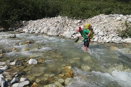 Damon fording Bridge Creek 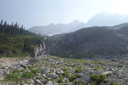 Up to this waterfall, then climb slabs on the right 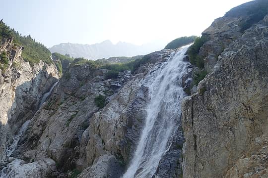 Waterfall from the slabs 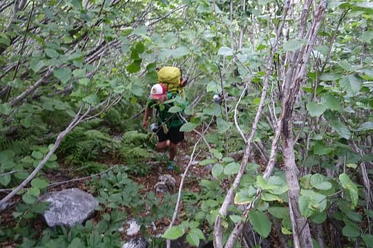 Alder tunnel 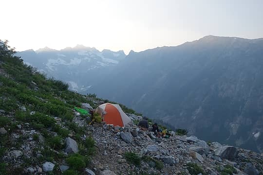 Camp 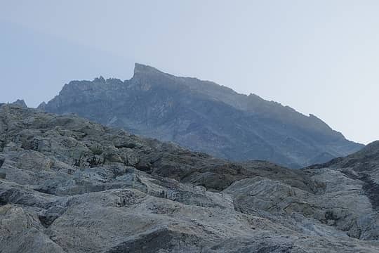 NE Buttress comes down and right directly off the summit 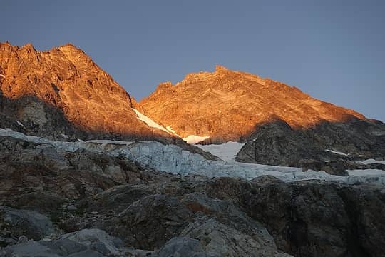 Goode alpenglow 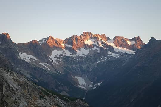 Logan 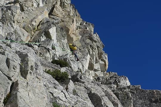 Damon leading up to the crest 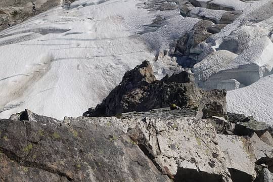 Damon low on the NEB 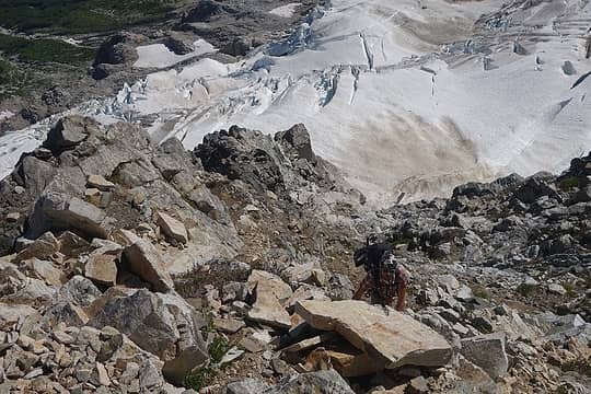 Trace scrambling down low 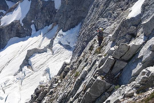 Damon near where we started the roped pitches 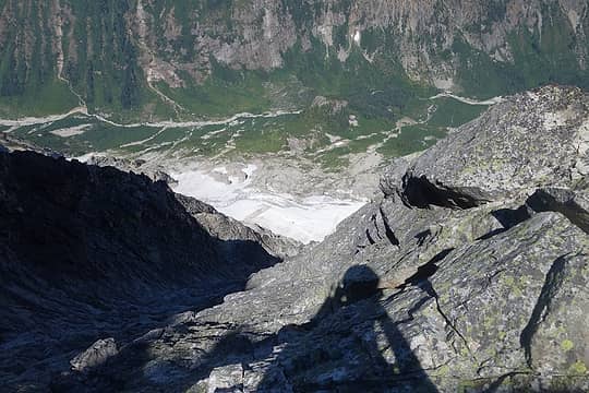 Looking down from near the giant ledge 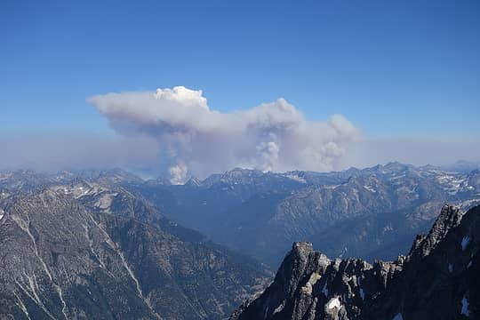 Crescent Mountain Fire 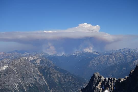 Fire blowing up 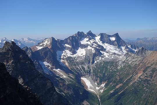 Logan 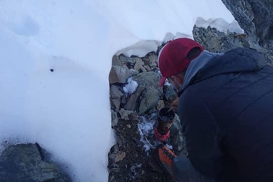 So glad to find this snow, we carried 3 liters each and it wasn't nearly enough in the baking heat 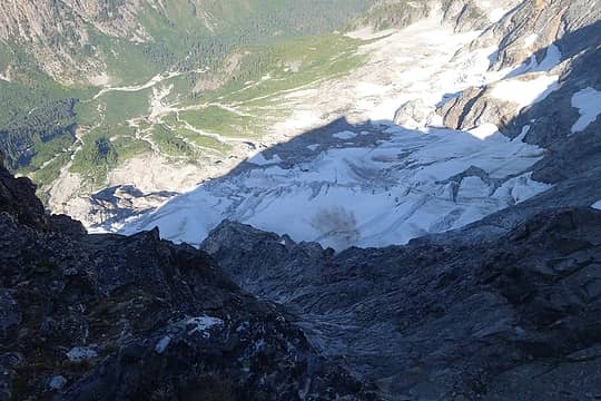 Looking down the route at Goode's shadow 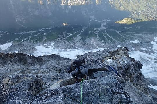 Trace high on the NEB 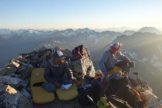 Buds on Goode 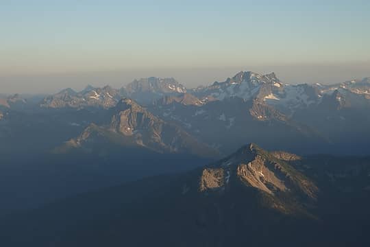 Fernow group and Bonanza  Glacier, Dome, Spire Point 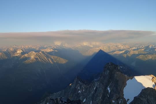 Fire and Goode's shadow 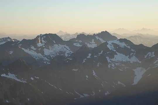 Spider and Formidable 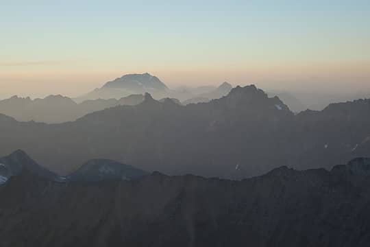 Jack and Ragged Ridge 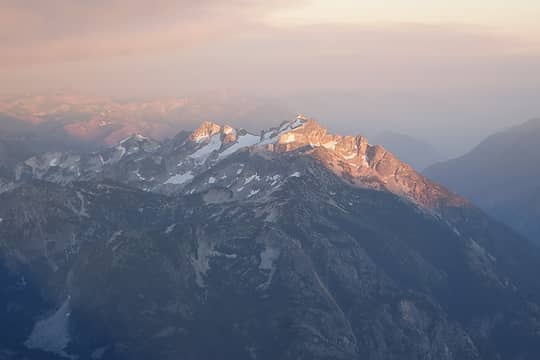 McGregor 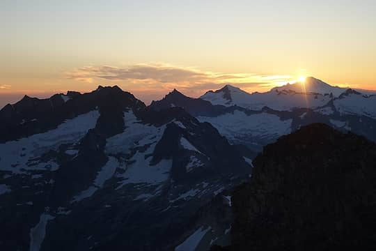 Sunset behind Baker 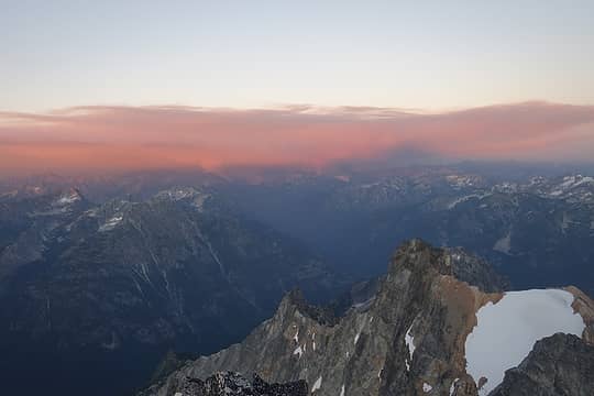 Alpenglow on smoke 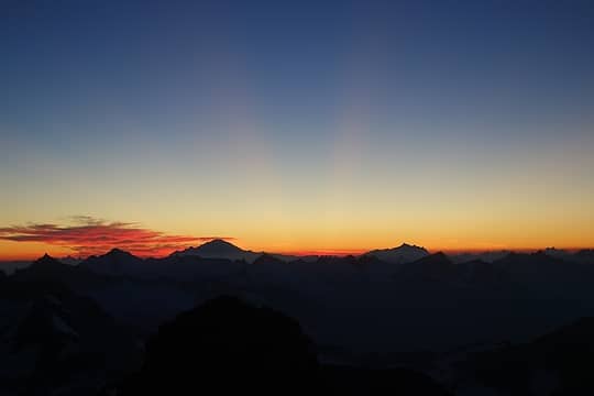 Baker and Shuksan 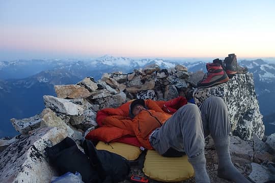 It doesn't get much better than this 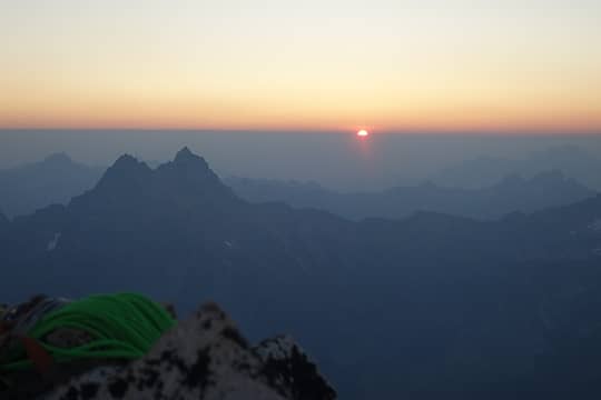 Sunrise over smoke layer 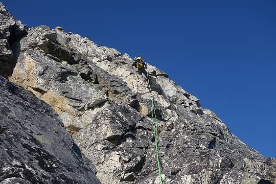 Rappels for breakfast 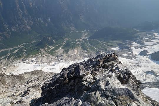 View from rappel 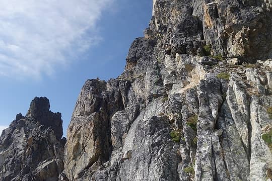 Traverse to Black Tooth Notch 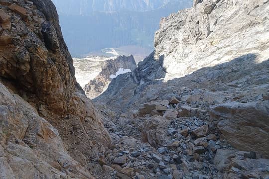 Gully descent 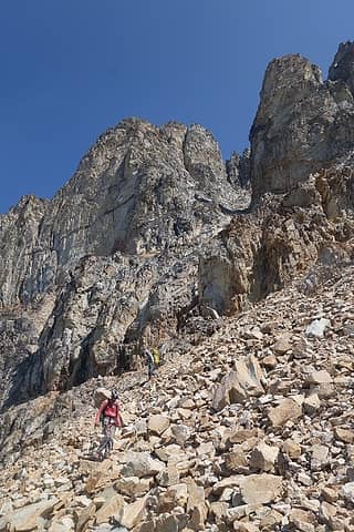 Chossy descent, the usual 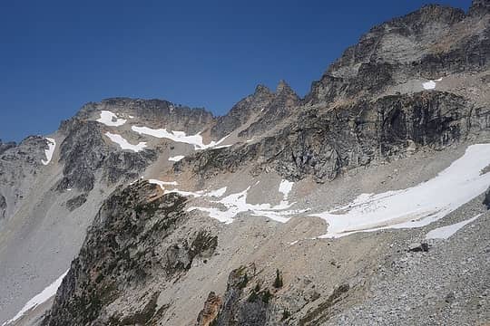 Traverse to Storm King 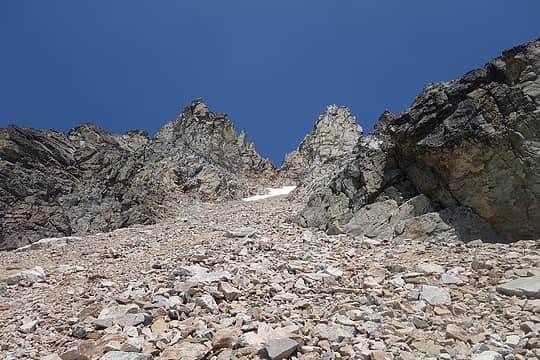 Storm King 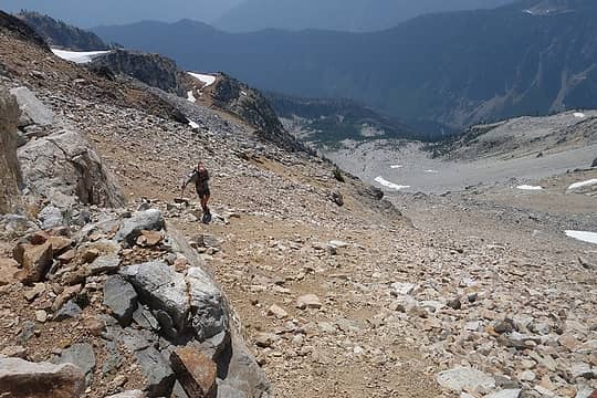 Fun 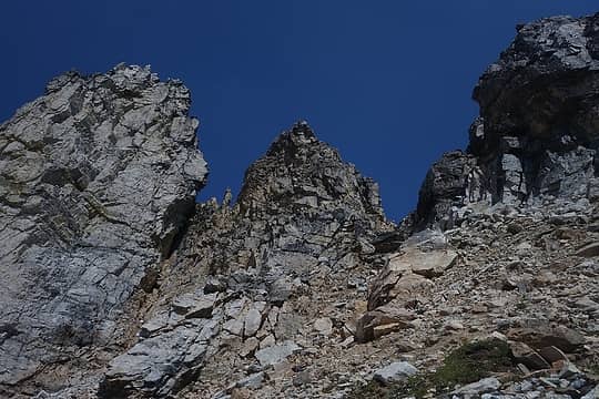 Incorrect gully on the left, correct gully on the right 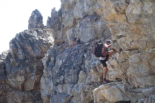 Damon and Trace working the ledge traverse 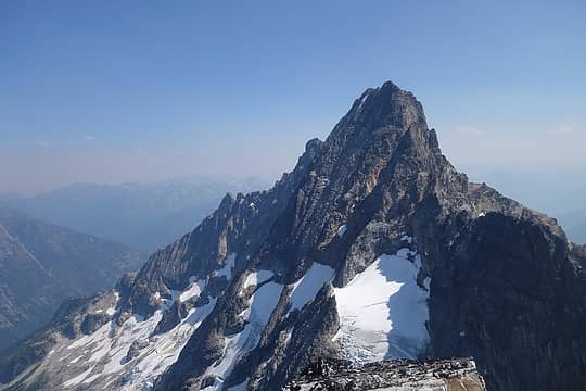 Goode from Storm King - NE Buttress runs continuously from the summit all the way down to the bottom of the photo 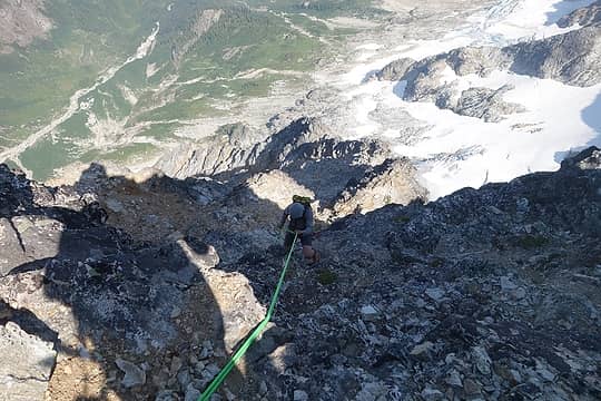 Damon rappelling off Storm King - we probably should have come up this way 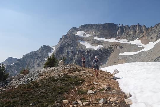 Traversing back from Storm King 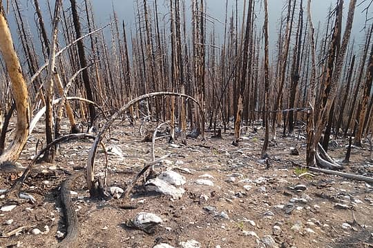 Descending through burn 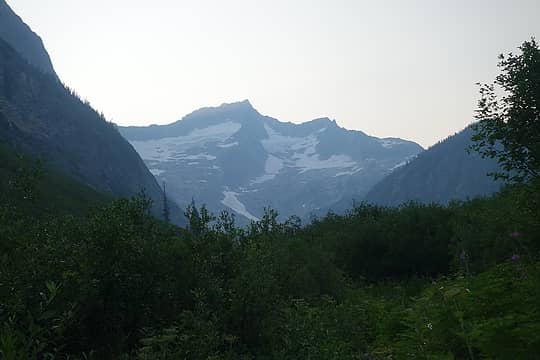 Buckner from the Park Creek Trail 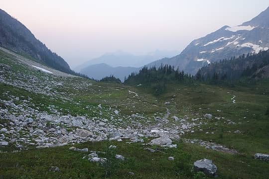 We camped somewhere in here and it was buggy as hell  Climbing to Park Creek Pass in the morning 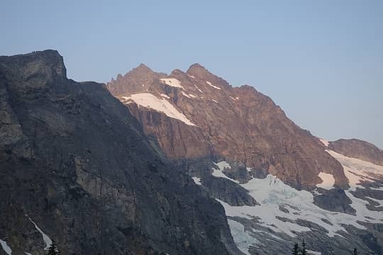 Buckner alpenglow 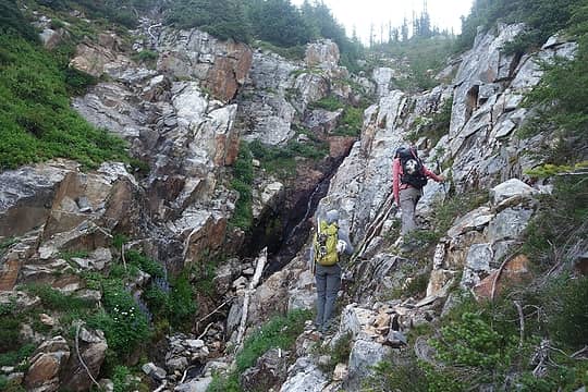 Looking for a gully crossing 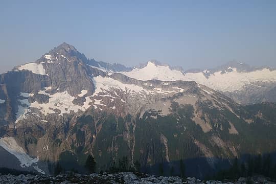 Buckner to Forbidden 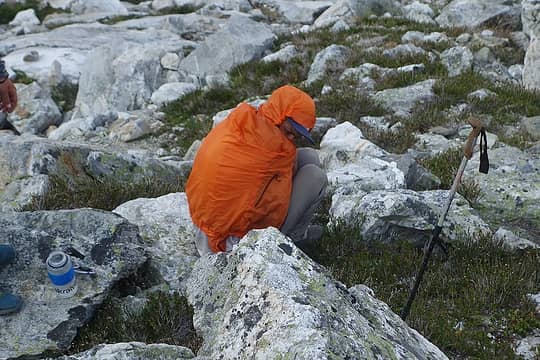 Hiding from the bugs 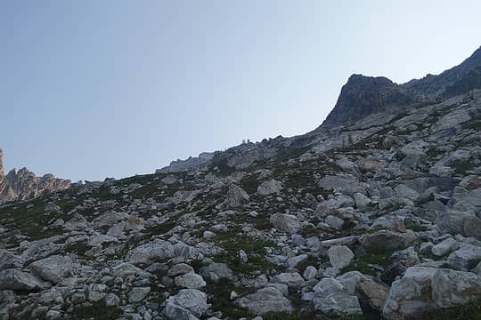 Pleasant terrain to the Fremont 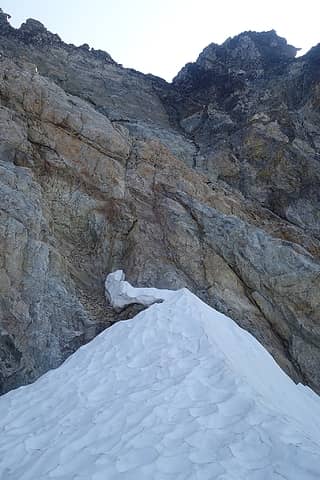 Current condition of the hogsback, we didn't think it was safe 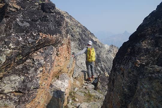 Beginning the traverse on Logan 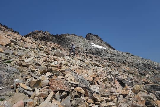 Talus to the false summit 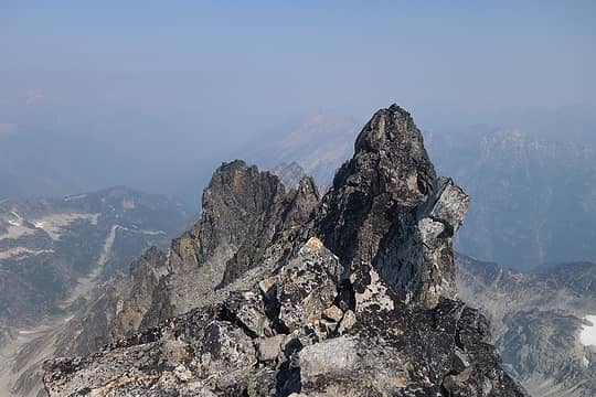 Another false summit from the true summit 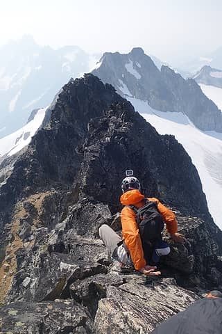 Trace descending Logan 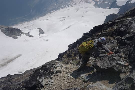 Exposure is present 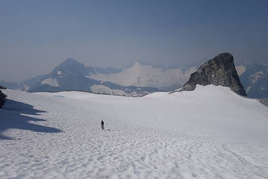 Descending the Fremont 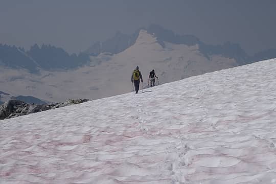 Descending with Sahale and Boston in the smoke 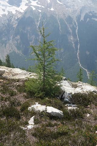 Logan larch 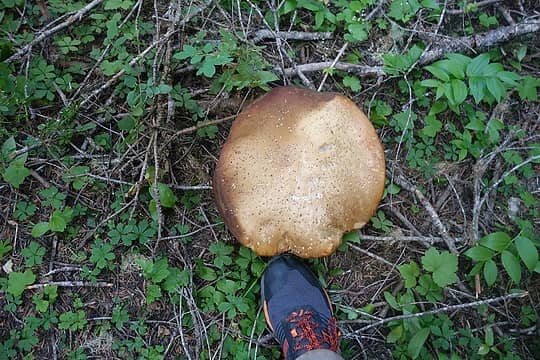 Thunder Creek shrooms 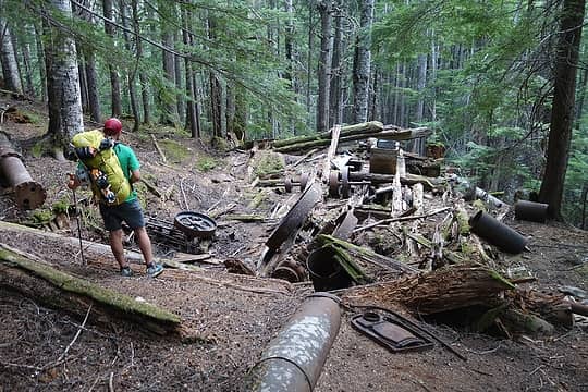 Skagit Queen mine ruins  Goode route 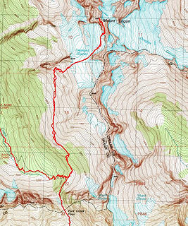 Logan route
|
| Back to top |
  
|
|
awilsondc
Member

Joined: 03 Apr 2016
Posts: 1324 | TRs | Pics
|
|
| Back to top |
|
|
neek
Member

Joined: 12 Sep 2011
Posts: 2337 | TRs | Pics
Location: Seattle, WA |
|
neek
Member
|
 Sat Aug 11, 2018 11:41 am |
|
|
Looks great, if somewhat terrifying!
|
| Back to top |
|
|
rstoddard24
BBQWingz
Joined: 30 Dec 2016
Posts: 74 | TRs | Pics
|
Awesome work u 3. Looks like an incredible trip. We also got very hot descending Logan; must have relaxed in the exact same larch grove.
|
| Back to top |
|
|
raising3hikers
Member
Joined: 21 Sep 2007
Posts: 2344 | TRs | Pics
Location: Edmonds, Wa |
nice work connecting those 3 peaks  keep on getting after it! keep on getting after it!
|
| Back to top |
|
|
Damonexplores
Damonexplores
Joined: 12 Aug 2018
Posts: 1 | TRs | Pics
Location: Seattle |
It was a Black Diamond pole that had been taken apart into two separate pieces and girth hitched a piece of blue tat around. It looked to be a few years old.
|
| Back to top |
|
|
puzzlr
Mid Fork Rocks

Joined: 13 Feb 2007
Posts: 7220 | TRs | Pics
Location: Stuck in the middle |
|
puzzlr
Mid Fork Rocks
|
Mon Aug 13, 2018 6:19 pm |
|
|
This is a very impressive trip. Congrats on all the summits.
|
| Back to top |
|
|
Midnight Slogger
'Schwack Job

Joined: 04 Aug 2017
Posts: 96 | TRs | Pics
Location: Greater Cascadia |
Bodacious work gents, and very inspiring. No denying anymore your full-blown Bulger addiction, Jake...
|
| Back to top |
|
|
Jake Robinson
Member
Joined: 02 Aug 2016
Posts: 521 | TRs | Pics
|
Thanks Reed! And also thanks for expanding my vocabulary with every post.
What's a Bulger?
|
| Back to top |
|
|
Gimpilator
infinity/21M

Joined: 12 Oct 2006
Posts: 1684 | TRs | Pics
Location: Edmonds, WA |
That's a very full itinerary. Cool trip!
|
| Back to top |
|
|
Matt Lemke
High on the Outdoors

Joined: 15 Jul 2010
Posts: 2052 | TRs | Pics
Location: Grand Junction |
|
Matt Lemke
High on the Outdoors
|
Sun Aug 19, 2018 7:40 pm |
|
|
Awesome photos! That one of logan from Goode high camp looks exactly like the one I took. Such a perfect place
|
| Back to top |
|
|
chandlerhaberlack
chandler haberlack

Joined: 29 May 2018
Posts: 26 | TRs | Pics
Location: Monroe |
Lol damn that's gotta be the first bulger meme I've ever seen. What an impressive trip - nice work guys! Super jealous.
|
| Back to top |
|
|
Stuke Sowle
Member

Joined: 23 Sep 2016
Posts: 21 | TRs | Pics
Location: Issaquah, WA |
Figured you must have done a TR for this trip so thought I would stop by and fuel a bit of stoke for tomorrow despite my rather "mundane" route compared to this one. Excellent stuff Jake!
|
| Back to top |
|
|
Jake Robinson
Member
Joined: 02 Aug 2016
Posts: 521 | TRs | Pics
|
Thanks for the kind words Stuke. I would hardly call a 100 mile day hike "mundane", good luck out there!
|
| Back to top |
|
|
|
|


 ) I'm surprised it wasn't more smoky up there. That heat sounds miserable!