| Previous :: Next Topic |
| Author |
Message |
cartman
Member


Joined: 20 Feb 2007
Posts: 2800 | TRs | Pics
Location: Fremont |
|
cartman
Member
|
 Mon Oct 01, 2018 9:04 pm |
|
|
I had no idea I was going to do this trip.
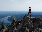
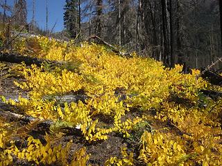 Blazing 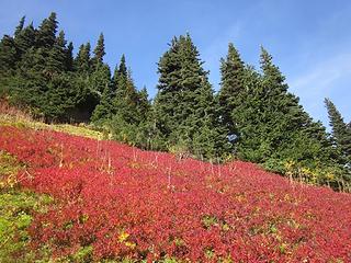 Blueberries 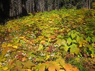 Thimbleberry & ferns 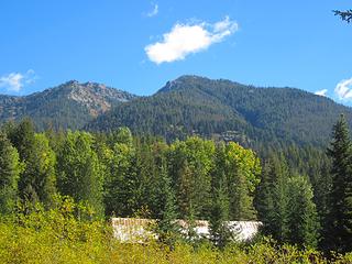 Trinity 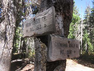 Junction 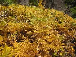 Ferrrnnnsss... 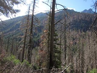 Somewhere up there is a neek 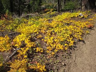 Gold 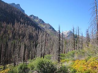 Entering the burn 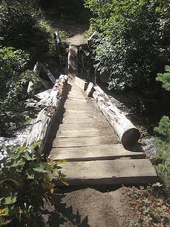 Someone broke da bridge 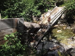 That wuz a big bear 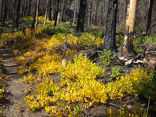 More gold 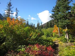 Colorful trail 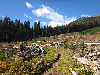 First avy swath 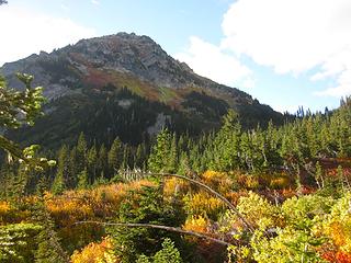 Approaching Helmet Butte 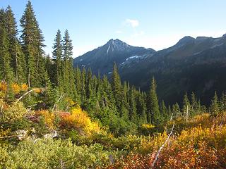 Color and Cleator 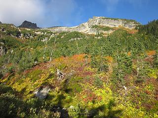 Fortress cliffs  After setting up camp, I had time to watch the shadows and clouds play on the ridges above.
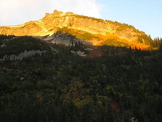 Alpenglow 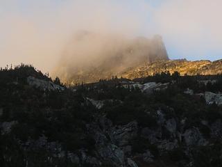 Misty 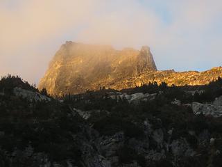 Mists clearing 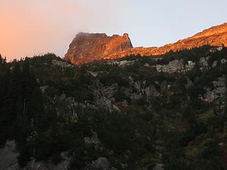 Dusk 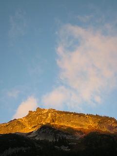 Alpenglow and clouds 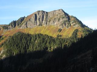 Morning on Liberty Cap 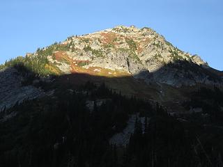 Morning sun on Helmet Butte 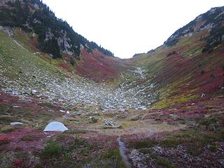 Basin below Pass No Pass 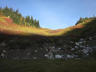 Started up from below the pass 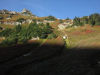 The route up 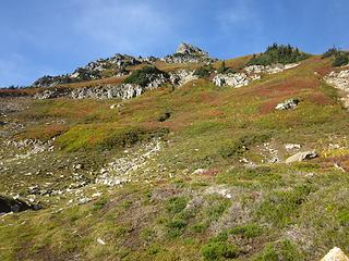 Ascending 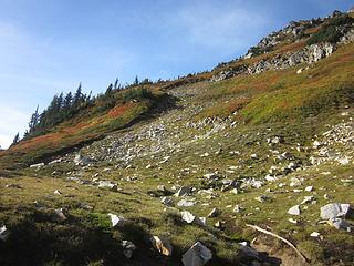 Traverse to left 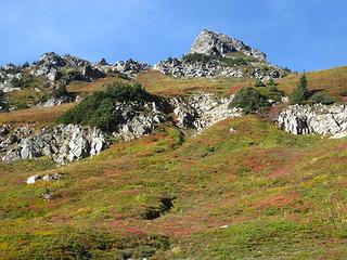 Ravens circling 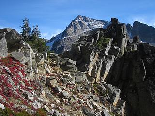 Looking back at notch and Fortress 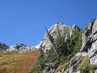 Ravens 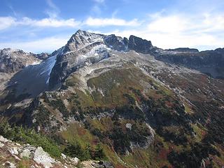 Brilliant day on Fortress 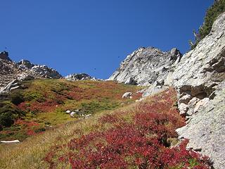 Continuing the ascent 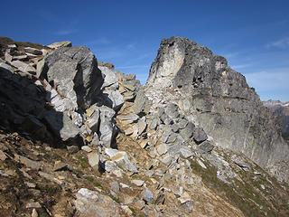 On the South Ridge 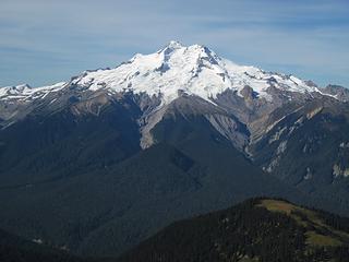 Glacier Peak 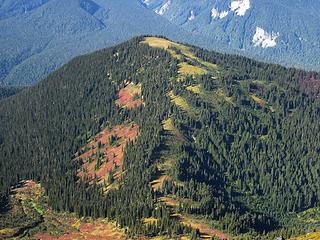 Flower Dome 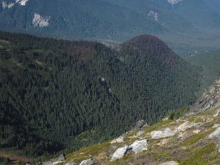 Only slightly singed 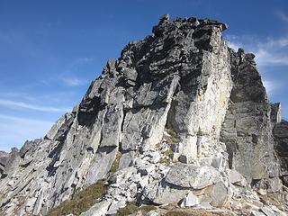 Summit block 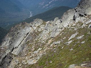 Don't drop 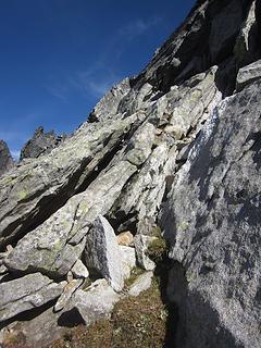 Start of scramble route 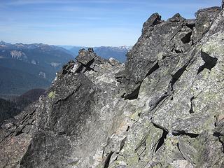 A little higher 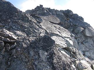 Looking up 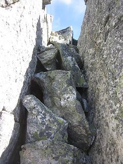 Summit gully 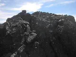 And to the top 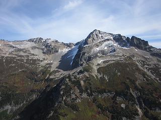 Expansive Fortress 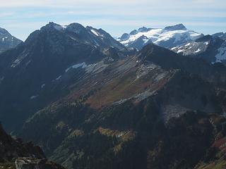 Cleator, Berge, Clark and Luahna; Rally Cap in front 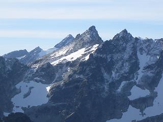 Fresh snow on Napeequa 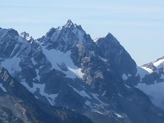 Tenpeak and West Peak 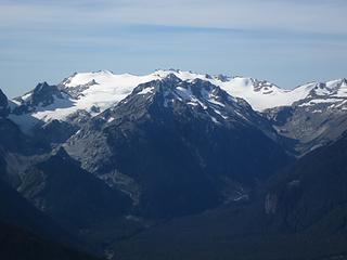 Kololo and the Honeycomb Glacier 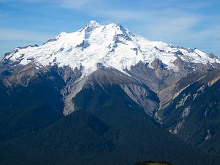 Glacier Peak 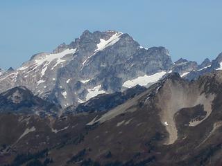 Bonanza 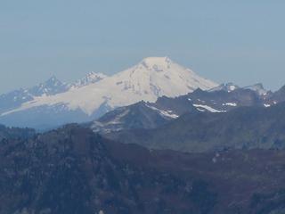 Fuzzy digital zoom on Baker 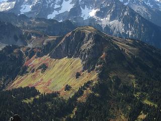 A high view of Liberty Cap 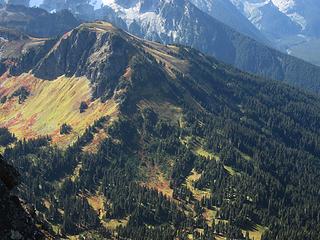 Trails on Liberty Cap 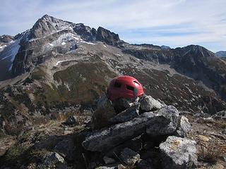 Helmet on Helmet Butte 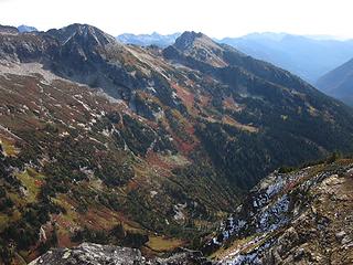 The Massie High Route 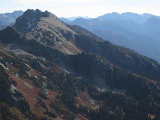 A closer look 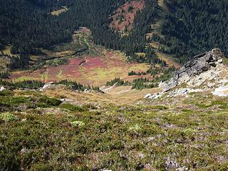 A look down the west side route 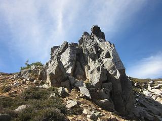 Notch Rock 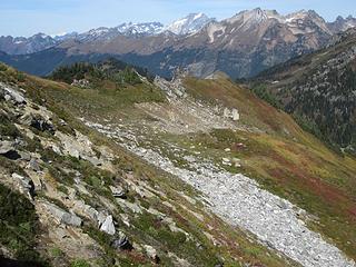 Better to traverse down and left 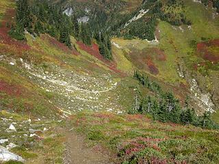 Nice marmot path, Pass No Pass below 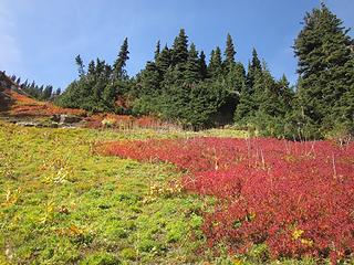 Blueberries Blueberries 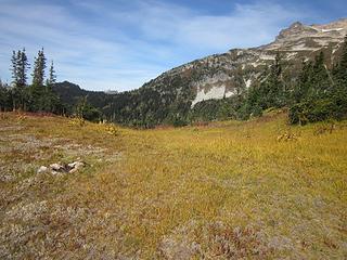 Pass No Pass 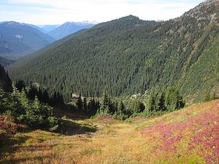 At the pass, looking to Middle Ridge 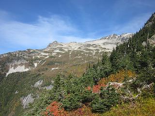 North Ridge of Fortress 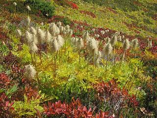 Western anemone 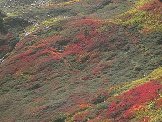 Marmot runs on Helmet Butte 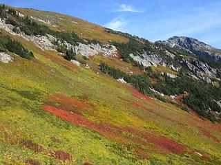 The easy lower slopes of Fortress 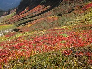 Purple 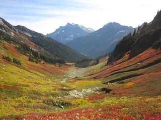 Basin and Buck 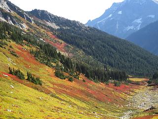 A look toward the Massie High Route 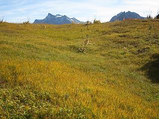 The back side of Pass No Pass 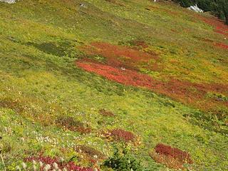 Color fields 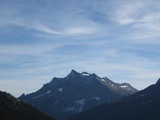 Wisps and Buck 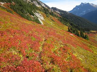 Marmot track 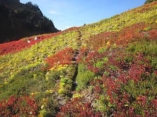 Track looking back to Pass No Pass 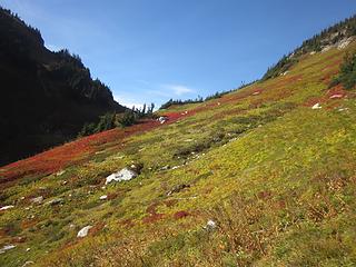 Another look back 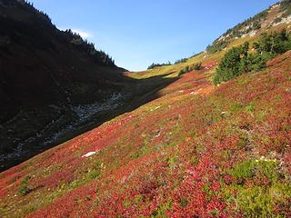 Descending shadows 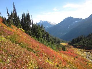 Layers of purple 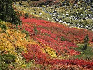 Many blueberries 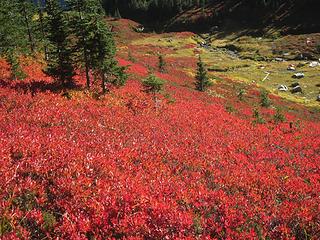 A riot of violet 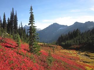 Descending to the basin 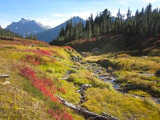 Basin brook 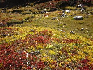 Color in the basin 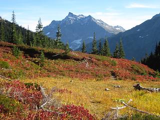 Buck 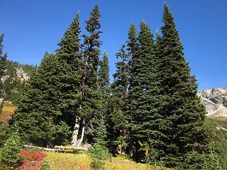 The "hidden" camp 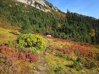 The beginning of the Massie High Route 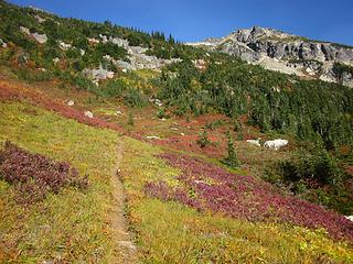 Good trail 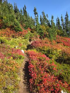 The trail continues 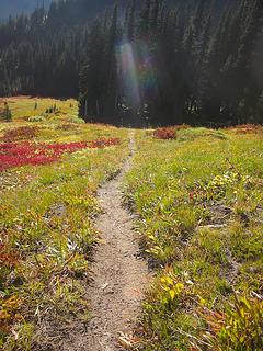 Blessed camp 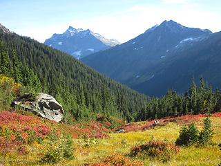 Boulder, Buck and Cleator 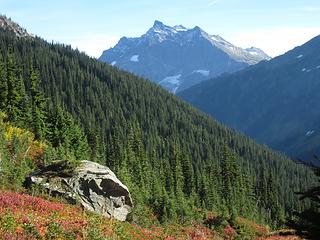 Boulder and Buck 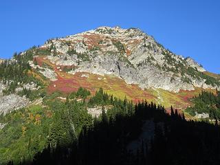 Morning on Helmet Butte 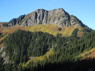 Liberty Cap 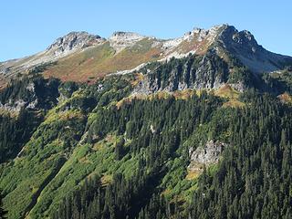 Rally Cap 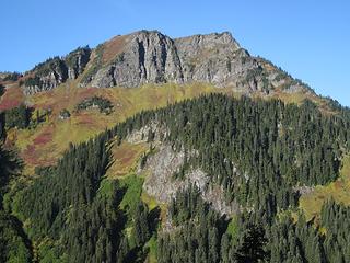 Liberty Cap, another angle 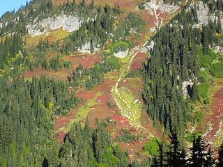 The Buck Creek Trail crossing Helmet Butte  Chair Rock 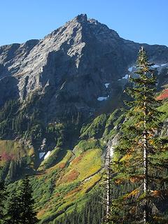 Cleator 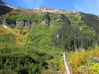 Verdant fields 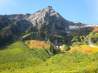 Sunlit 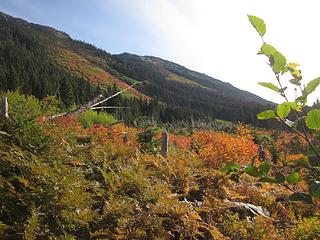 Ferns and swath 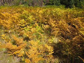 Golden ferns 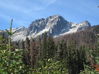 Barren Berge 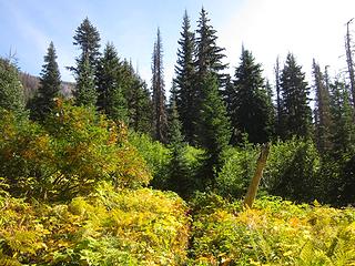 Contrast 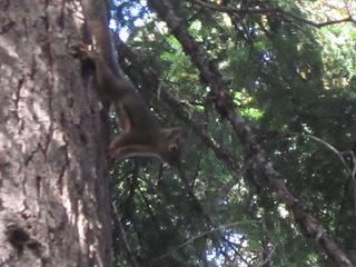 Douglas squirrel 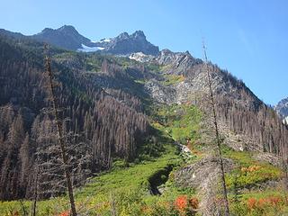 A view in the burn 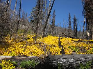 Brilliant Blazing 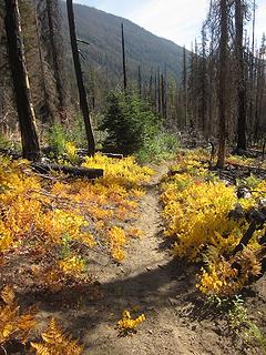 Follow the Yellow...  Thimbleberries 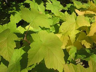 Thimbleberry Thimbleberry & ferns 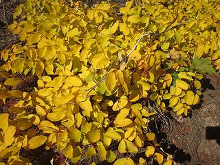 Pot o' gold  Goodbye GPW 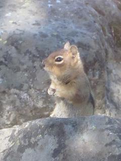 Ground squirrel 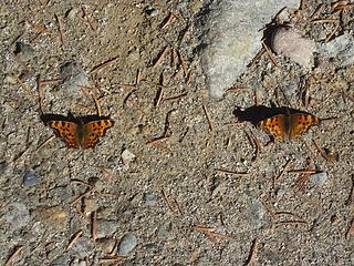 Green comma butterflies  Closeup of green comma
|
| Back to top |
  
|
|
Bernardo
Member

Joined: 08 Feb 2010
Posts: 2174 | TRs | Pics
Location: out and about in the world |
|
Bernardo
Member
|
Mon Oct 01, 2018 10:15 pm |
|
|
Nice picture of the elusive Douglas squirrel! One of my favorite foredt animals.
|
| Back to top |
|
|
Matt
Tea, Earl Grey, Hot

Joined: 30 Jan 2007
Posts: 4307 | TRs | Pics
Location: Shoreline |
|
Matt
Tea, Earl Grey, Hot
|
Mon Oct 01, 2018 11:58 pm |
|
|
Looks great, Eric. I like your helmet on Helmet, plus your chair rock.
As beacons mountains burned at evening. J.R.R. Tolkien
As beacons mountains burned at evening. J.R.R. Tolkien
|
| Back to top |
|
|
wildernessed
viewbagger

Joined: 31 Oct 2004
Posts: 9275 | TRs | Pics
Location: Wenatchee |
 Great colors ! Great colors !
Living in the Anthropocene
Living in the Anthropocene
|
| Back to top |
|
|
wolffie
Member

Joined: 14 Jul 2008
Posts: 2693 | TRs | Pics
Location: Seattle |
|
wolffie
Member
|
Tue Oct 02, 2018 12:06 pm |
|
|
Another nice way to get in there is Middle Ridge direct from PCT near Suiattle R. From the Middle RIdge sheep camp, you can easily scramble and bivvy way up high on the NW buttress of Fortress, higher than Helmet Butte. And go on south to High Pass area.
I think it's a shorter drive from Seattle. Approach might be longer, but flat and fast for the first 9 miles.
Some people have better things to do with their lives than walking the dog. Some don't.
Some people have better things to do with their lives than walking the dog. Some don't.
|
| Back to top |
|
|
Nancyann
Member
Joined: 28 Jul 2013
Posts: 2318 | TRs | Pics
Location: Sultan Basin |
|
Nancyann
Member
|
Tue Oct 02, 2018 1:06 pm |
|
|
What a wonderful trip report! I like the way you weave your pictures in amongst the narrative. I looked at your gorgeous fall color photos before I fell asleep last night and actually dreamed about them all night!
|
| Back to top |
|
|
Matt Lemke
High on the Outdoors

Joined: 15 Jul 2010
Posts: 2052 | TRs | Pics
Location: Grand Junction |
|
Matt Lemke
High on the Outdoors
|
Wed Oct 03, 2018 4:52 am |
|
|
Excellent color! That area is gorgeous this time of year. I'm surprised glacier peak lost all the fresh snow it had from a couple weeks ago
|
| Back to top |
|
|
Neet
Member
Joined: 10 Jun 2012
Posts: 50 | TRs | Pics
Location: Tacoma/Puyallup |
|
Neet
Member
|
Mon Oct 08, 2018 5:34 pm |
|
|
Thanks for the lovely photos, and the reminders of my birthday trip to High Pass with my son, Neek! I would love to explore that area more. -- I am wondering about the "maples," though. Neither vine maples nor big leaf maples tend to start out their lives in low, dense patches, and the leaves don't seem like maples to me. Any botanists out there? Are these "maples" actually thimble berries, or something else?
|
| Back to top |
|
|
RichP
Member

Joined: 13 Jul 2006
Posts: 5634 | TRs | Pics
Location: here |
|
RichP
Member
|
Mon Oct 08, 2018 6:28 pm |
|
|
This might go down as the best fall for colors in recent memory. I don't recall a better one in the 20+ years I've been hiking in the area.
|
| Back to top |
|
|
cartman
Member
Joined: 20 Feb 2007
Posts: 2800 | TRs | Pics
Location: Fremont |
|
cartman
Member
|
Tue Oct 09, 2018 5:25 am |
|
|
Neet, I think you're correct. Likely a berry, and thimbleberry seems to be the closest I can find when searching. Corrected above.
|
| Back to top |
|
|
Brushwork
Food truck
Joined: 18 Aug 2018
Posts: 508 | TRs | Pics
Location: Washington |
|
Brushwork
Food truck
|
Sat Oct 13, 2018 11:46 pm |
|
|
Yes, the shrub with maple like leaves is thimble berry.
When I grow up I wanna play.
When I grow up I wanna play.
|
| Back to top |
|
|
|
|
You cannot post new topics in this forum
You cannot reply to topics in this forum
You cannot edit your posts in this forum
You cannot delete your posts in this forum
You cannot vote in polls in this forum
|
Disclosure: As an Amazon Associate NWHikers.net earns from qualifying purchases when you use our link(s). |


