| Previous :: Next Topic |
| Author |
Message |
GaliWalker
Have camera will use


Joined: 10 Dec 2007
Posts: 4929 | TRs | Pics
Location: Pittsburgh |
|
GaliWalker
Have camera will use
|
 Mon Oct 15, 2018 6:42 pm |
|
|
Southwestern Virginia (Oct 10-13, 2018)
Mist, heavy rain and gale force winds courtesy of Hurricane Michael, and finally some sun...I experienced all of these on an action packed hiking trip to southwestern Virginia.
Day I: McAfee Knob and Crabtree Falls
McAfee Knob
McAfee Knob, lying just to the southwest of Shenandoah National Park, in Jefferson National Forest, is reputed to host the most photographed view on the Appalachian Trail, so obviously I picked it as one of my destinations. It's also supposed to be super popular, so I wanted to hit it on a weekday. Out of the three such days available to me, Day-II was forecast to be wall-wall rain Hurricane Michael was supposed to do a flyby and I had another destination in mind for Day-III, so I decided to schedule McAfee Knob as my first destination. I left Pittsburgh at 2:00am, and was at the McAfee Knob parking lot a little under 6hrs later. A light rain was falling and mist hung amongst the mountains, so I dialed down my expectation of getting any views.
I headed up the easily graded, but steadily uphill Appalachian Trail for 4.4mi. It was a lonely hike up in the light rain. I was happy to find the rocky viewpoint of McAfee Knob empty. Unfortunately, there was nothing but white nothingness to see, due to all the mist, which was quite disappointing. Forced to look closer in, I was struck by the cool patterns and potholes that had been sculpted into my rocky perch, presumably by the very weather that I was experiencing. I tried to capture these in my photographs, which was quite tough because of the rain. I used an umbrella to keep most of it off and was even able to take a few selfies by deploying the tripod under the umbrella.
I was just about done when the first other hikers began to appear. Thereafter they came in waves, so I was glad that at least my timing there was perfect.
Stats: 8.8mi, 1750ft elevation gain, 4hrs
Crabtree Falls
I had originally planned to climb up nearby Dragon's Tooth, but with the heavy rain that was falling by the time I returned to my car, I decided to head for a stream/waterfall hike instead. Crabtree Falls, located a couple of hours' drive northwards in George Washington National Forest, fit the bill. There are tall claims made about Crabtree Falls being the tallest waterfall in the northeast, but that is untrue, since the 'waterfall' is more of a series of waterfalls. The Lower Falls was comprised of 3-4 drops, while the Middle and Upper Falls were both double drops.
A steep trail led up beside the waterfalls. There were numerous signs warning people not to venture off-trail (onto the waterfall slabs) and that 30 people had lost their lives doing so. The waterfalls were spectacular, although the steady rain that was falling, sometimes sideways, really limited my photography.
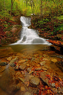 4- Lower Falls: Bottom tier 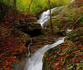 5- Lower Falls: Upper tier 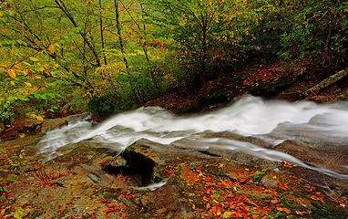 6- Lower Falls: Looking down the upper tier 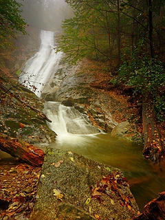 7- Middle Falls 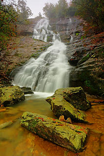 8- Upper Falls 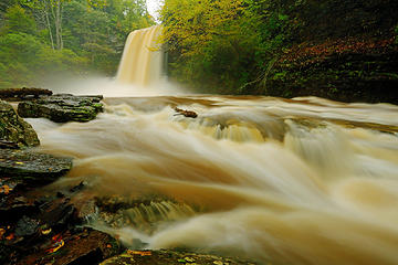 15 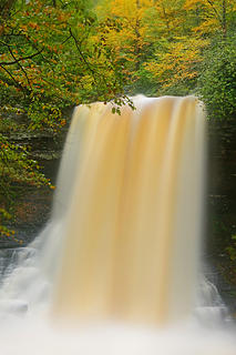 16 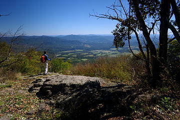 17- Taken on the return 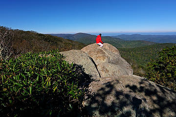 18 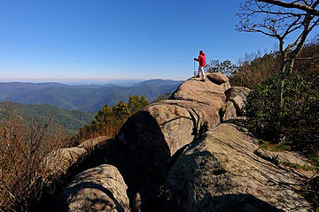 19 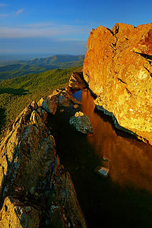 20 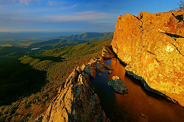 21 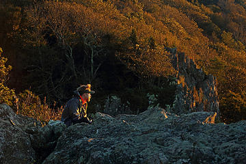 22- AT through hiker, heading south to Georgia 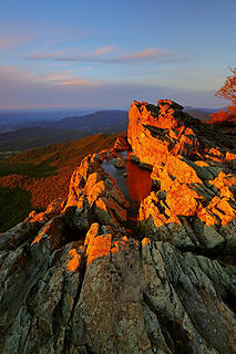 23 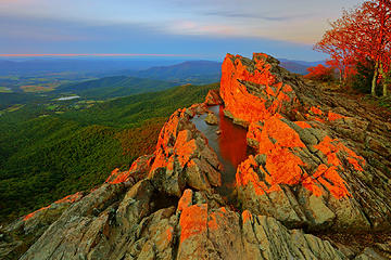 24  25- All by my lonesome 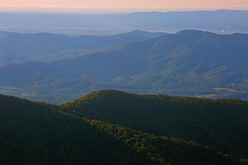 26 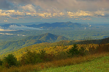 27 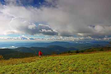 28 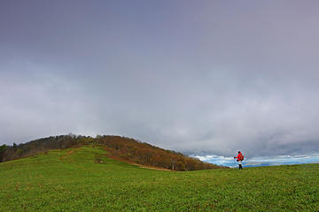 29 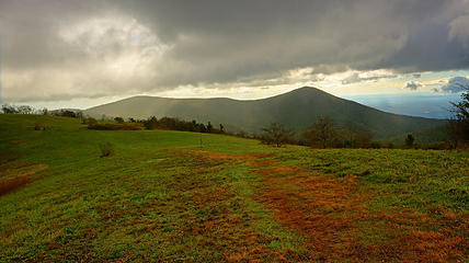 30 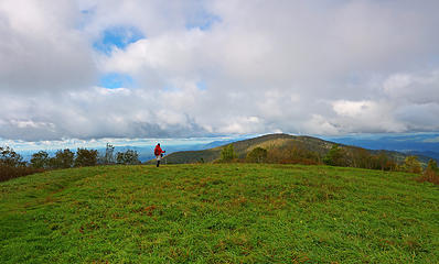 31 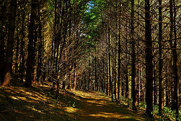 32
|
| Back to top |
  
|
|
Bernardo
Member

Joined: 08 Feb 2010
Posts: 2174 | TRs | Pics
Location: out and about in the world |
|
Bernardo
Member
|
Mon Oct 15, 2018 7:49 pm |
|
|
Nice. Great pictures as always. I love these VA reports.
|
| Back to top |
|
|
GaliWalker
Have camera will use
Joined: 10 Dec 2007
Posts: 4929 | TRs | Pics
Location: Pittsburgh |
|
GaliWalker
Have camera will use
|
Tue Oct 16, 2018 3:25 pm |
|
|
Southwest Virginia was surprisingly more beautiful and hillier than Id expected. It took me about a half day to come up with a plethora of hiking opportunities when I put the trip together.
|
| Back to top |
|
|
williswall
poser

Joined: 30 Sep 2007
Posts: 1967 | TRs | Pics
Location: Redmond |
I always love your waterfall shots. Assuming you are using a filter, which do you use and approx what exposure time?
|
| Back to top |
|
|
GaliWalker
Have camera will use
Joined: 10 Dec 2007
Posts: 4929 | TRs | Pics
Location: Pittsburgh |
|
GaliWalker
Have camera will use
|
Tue Oct 16, 2018 4:12 pm |
|
|
I always have a polarizing filter on, which I rotate as necessary. That cuts the light by about 1.5 times. Other than that, because of the cloudy/rainy conditions, I didnt have to use anything else. My camera does allow me to drop the ISO to 50 though. Exposure times were from 1.6-8sec.
|
| Back to top |
|
|
HermitThrush
Member
Joined: 14 Jan 2016
Posts: 384 | TRs | Pics
Location: Brainerd Lakes Area, MN |
Brings back precious memories of driving up to Sugarloaf Mountain in Maryland as a boy.
|
| Back to top |
|
|
|
|
You cannot post new topics in this forum
You cannot reply to topics in this forum
You cannot edit your posts in this forum
You cannot delete your posts in this forum
You cannot vote in polls in this forum
|
Disclosure: As an Amazon Associate NWHikers.net earns from qualifying purchases when you use our link(s). |


