| Previous :: Next Topic |
| Author |
Message |
Eric Gilbertson
Member


Joined: 04 Jul 2018
Posts: 188 | TRs | Pics
Location: Seattle |
Mount Rahm (8,480 ft) and Mount Custer (8,630 ft)
Feb 17-20, 2024
Feb 17 double carry boat to Ross Lake, paddle to Silver Creek
Feb 18 move camp to Silver Lake, climb Rahm
Feb 19 climb Custer, hike down Silver Creek
Feb 20 finish hike to Ross Lake, paddle back, triple carry gear to trailhead
30 miles hiking, 40 miles paddling
Eric Gilbertson and Josh Celli
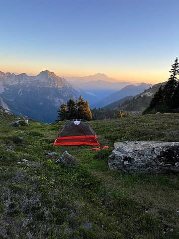
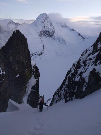 Climbing up the south face of Rahm 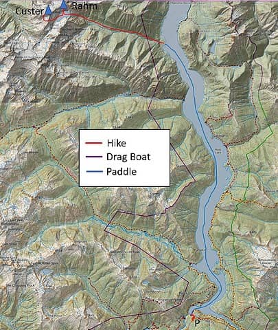 The route 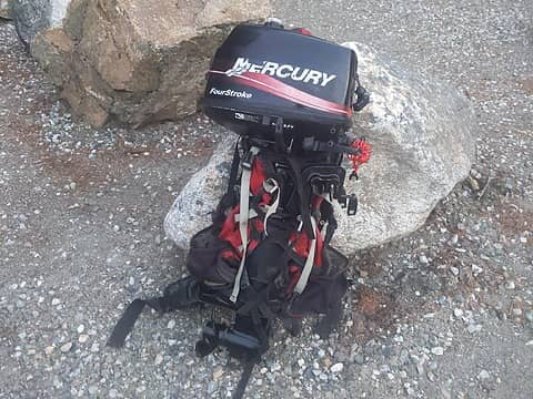 The "new" motor (from 2004) 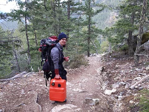 Carrying the motor and fuel down the trail 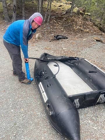 Pumping up the zodiac 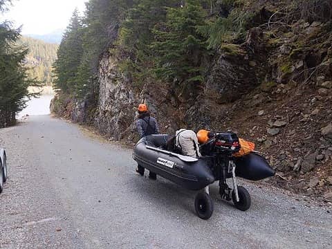 Dragging the boat to Ross Lake 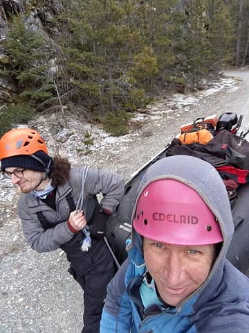 Dragging the boat down the road 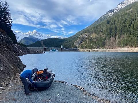 Putting in 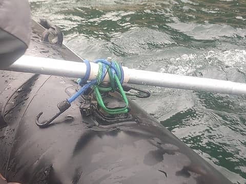 Broken oar lock fixed with bungees 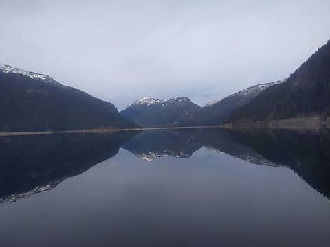 Nice calm water looking up towards Desolation Peak 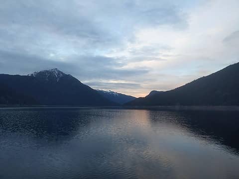 Sunset near Little Beaver 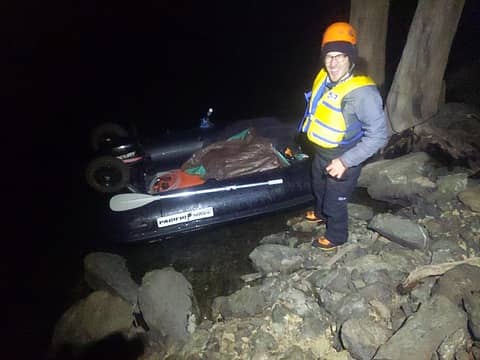 Taking a break near Little Beaver 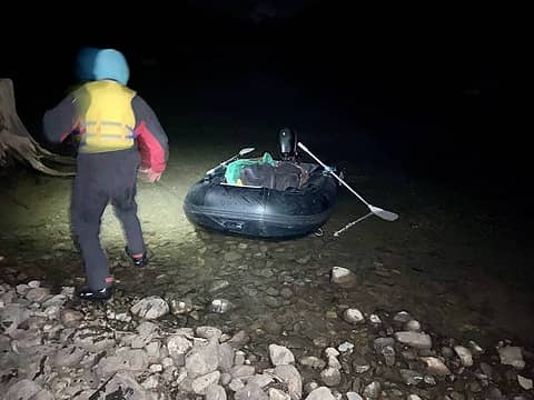 Taking out at Silver Creek 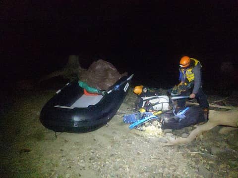 Taking out 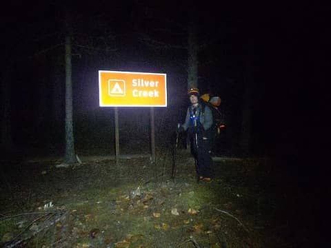 At Silver Creek 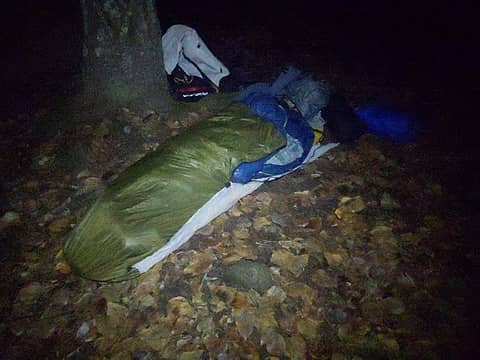 Bivying 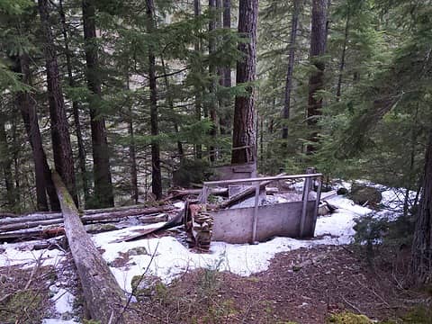 The old cabin 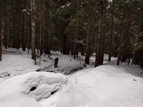 Typical open forest 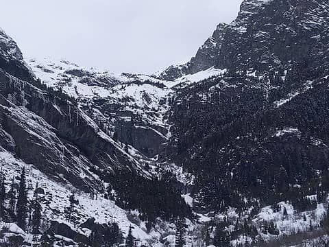 The headwall 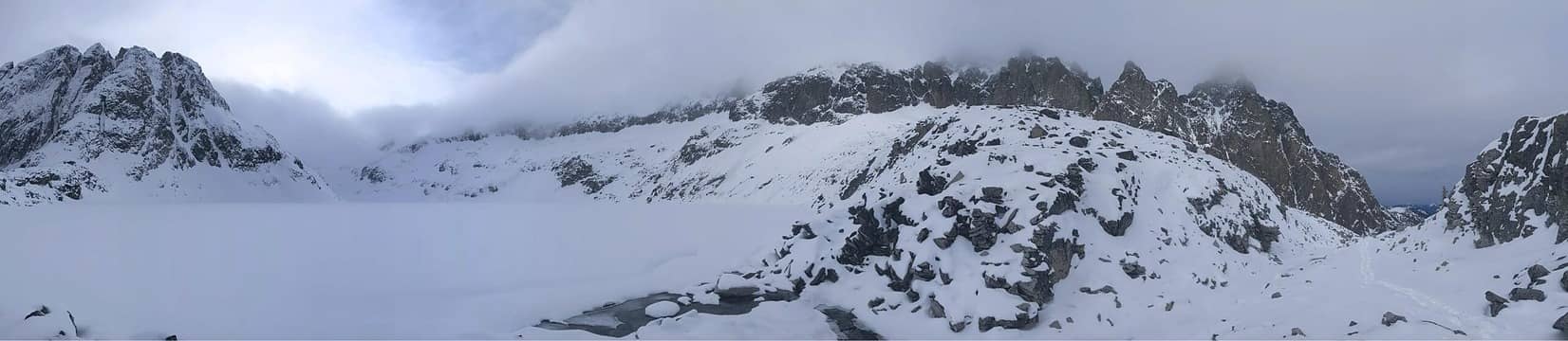 Silver Lake 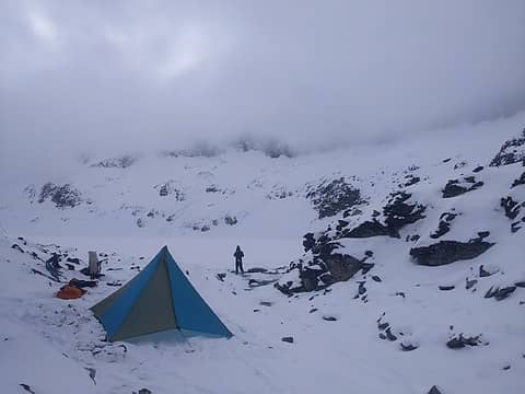 Camp at the outlet 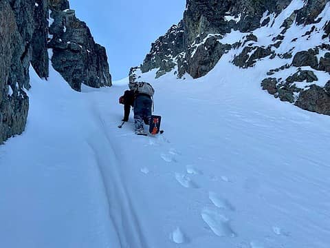 Using ascent plates in the gully 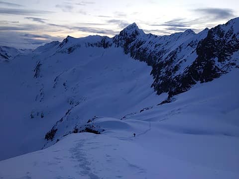 Exiting the gully looking back towards Custer 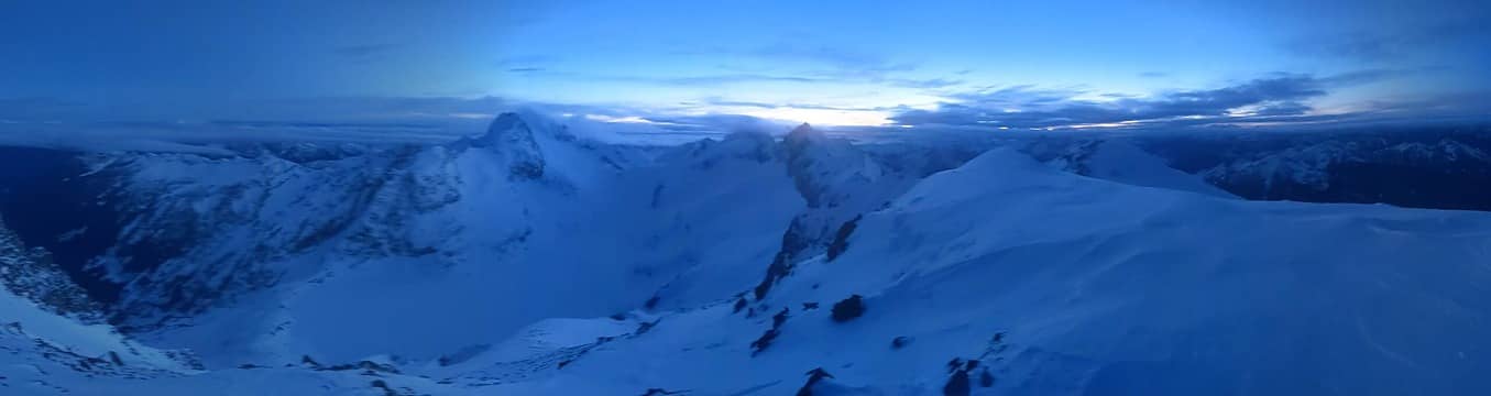 Summit view 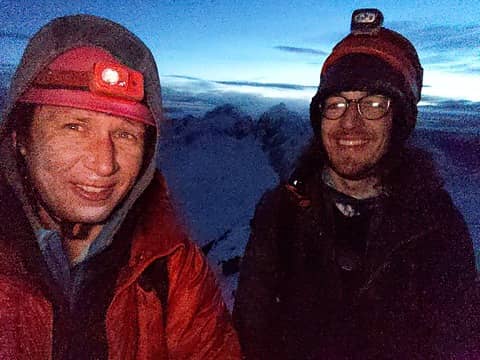 On the summit 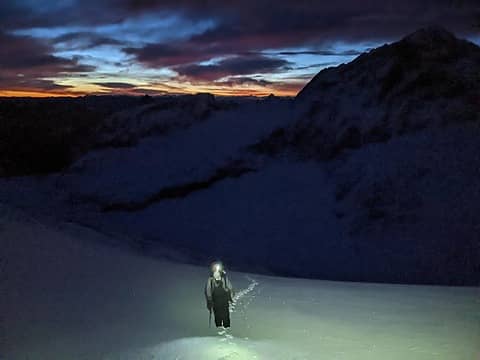 Alpenglow heading up Custer 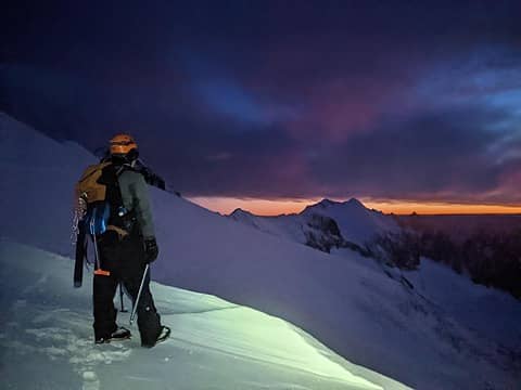 Crossing over the south ridge of Custer 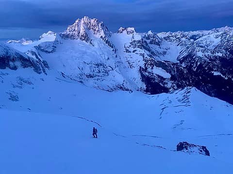 Sunrise on Redoubt 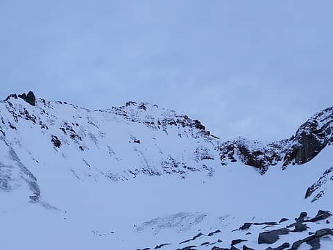 The SW face of Custer 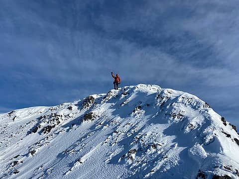 On the summit 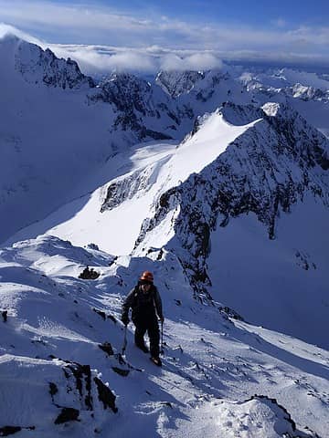 On the south ridge 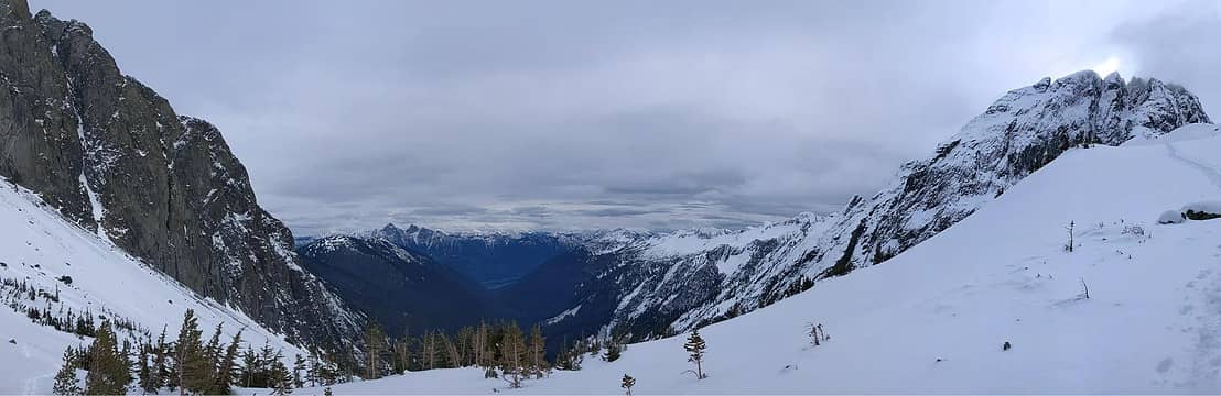 Descending to treeline  Back to the boat 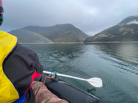 Paddling out 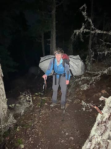 Triple carrying to the trailhead
 Layback, Nancyann, Waterman, JasonK806, sooperfly, BarbE, snowmonkey, Prosit, Pef, Bowregard, neek, tNguyen, ALW Hiker, LukeHelgeson, Route Loser, wallorcrawl, geyer, shane w, Bronco, reststep, NWtrax, SeanSullivan86, fffej50, RAW-dad, flatsqwerl, jsb, raising3hikers, yukon222, John Mac, zimmertr, rubywrangler Layback, Nancyann, Waterman, JasonK806, sooperfly, BarbE, snowmonkey, Prosit, Pef, Bowregard, neek, tNguyen, ALW Hiker, LukeHelgeson, Route Loser, wallorcrawl, geyer, shane w, Bronco, reststep, NWtrax, SeanSullivan86, fffej50, RAW-dad, flatsqwerl, jsb, raising3hikers, yukon222, John Mac, zimmertr, rubywrangler  jaysway, Josh Journey, The Ghost of Bear 380, mbravenboer, awilsondc jaysway, Josh Journey, The Ghost of Bear 380, mbravenboer, awilsondc  KascadeFlat, fourteen410, Now I Fly, RichP, GaliWalker, Tom KascadeFlat, fourteen410, Now I Fly, RichP, GaliWalker, Tom
Layback, Nancyann, Waterman, JasonK806, sooperfly, BarbE, snowmonkey, Prosit, Pef, Bowregard, neek, tNguyen, ALW Hiker, LukeHelgeson, Route Loser, wallorcrawl, geyer, shane w, Bronco, reststep, NWtrax, SeanSullivan86, fffej50, RAW-dad, flatsqwerl, jsb, raising3hikers, yukon222, John Mac, zimmertr, rubywrangler jaysway, Josh Journey, The Ghost of Bear 380, mbravenboer, awilsondc KascadeFlat, fourteen410, Now I Fly, RichP, GaliWalker, Tom |
| Back to top |
  
|
|
GaliWalker
Have camera will use

Joined: 10 Dec 2007
Posts: 4929 | TRs | Pics
Location: Pittsburgh |
|
GaliWalker
Have camera will use
|
 Tue Feb 27, 2024 6:05 am |
|
|
| Eric Gilbertson wrote: | Sunrise on Redoubt |
What a shot! 
|
| Back to top |
|
|
Stefan
Member

Joined: 17 Dec 2001
Posts: 5091 | TRs | Pics
|
|
Stefan
Member
|
Tue Feb 27, 2024 9:58 am |
|
|
Man. You have had so many motor problems! And you persevere!!!
Maybe borrow some ocean kayaks....
Art is an adventure.
Eric Gilbertson
Art is an adventure.
Eric Gilbertson
|
| Back to top |
|
|
TrumOnTop
Scenic Pisser
Joined: 02 Feb 2024
Posts: 4 | TRs | Pics
Location: SLC |
|
TrumOnTop
Scenic Pisser
|
Tue Feb 27, 2024 5:37 pm |
|
|
inspirational!! What an awesome combination of skills
Beep borp
Eric Gilbertson
Beep borp
Eric Gilbertson
|
| Back to top |
|
|
mbravenboer
Member
Joined: 20 Oct 2013
Posts: 1422 | TRs | Pics
Location: Seattle |
Very interesting! This must have been the longest trip report I read end-to-end. So captivating!
I had no idea that motorboat engines are so difficult to work with (I also didn't know that about snowmobiles until your earlier reports). Impressive perseverance.
Eric Gilbertson
Eric Gilbertson |
| Back to top |
|
|
tNguyen
Member
Joined: 04 Oct 2022
Posts: 30 | TRs | Pics
Location: Cougar Mountain, WA |
|
tNguyen
Member
|
Wed Feb 28, 2024 4:37 pm |
|
|
Wow! Congrats!!!
Eric Gilbertson
Eric Gilbertson |
| Back to top |
|
|
The Ghost of Bear 380
~SJ~
Joined: 15 Dec 2022
Posts: 19 | TRs | Pics
Location: In your IG feed |
| mbravenboer wrote: | | This must have been the longest trip report I read end-to-end. |
Same!
This is so amazing! Thank you for showing us the beauty of this area in winter.
Eric Gilbertson
Eric Gilbertson |
| Back to top |
|
|
snowmonkey
Member

Joined: 23 May 2014
Posts: 88 | TRs | Pics
|
Wow- your tenacity is out of this world. Thanks for the report.
Ocian in view! O! The joy!
William Clark
Eric Gilbertson
Ocian in view! O! The joy!
William Clark
Eric Gilbertson
|
| Back to top |
|
|
trent
Suffering fool

Joined: 02 Oct 2006
Posts: 65 | TRs | Pics
Location: Stanwood |
|
trent
Suffering fool
|
Sun Mar 10, 2024 8:45 pm |
|
|
Congrats! Thanks for posting; Your TRs are always motivational.
It's all downhill from here!
Eric Gilbertson
It's all downhill from here!
Eric Gilbertson
|
| Back to top |
|
|
Matt
Tea, Earl Grey, Hot

Joined: 30 Jan 2007
Posts: 4307 | TRs | Pics
Location: Shoreline |
|
Matt
Tea, Earl Grey, Hot
|
Thu Mar 21, 2024 11:59 pm |
|
|
Well, that's one way to mitigate the loose choss on the SW face of Custer.
As beacons mountains burned at evening. J.R.R. Tolkien
As beacons mountains burned at evening. J.R.R. Tolkien
|
| Back to top |
|
|
|
|
You cannot post new topics in this forum
You cannot reply to topics in this forum
You cannot edit your posts in this forum
You cannot delete your posts in this forum
You cannot vote in polls in this forum
|
Disclosure: As an Amazon Associate NWHikers.net earns from qualifying purchases when you use our link(s). |


