| Previous :: Next Topic |
| Author |
Message |
Eric Gilbertson
Member


Joined: 04 Jul 2018
Posts: 188 | TRs | Pics
Location: Seattle |
Eric and Duncan, April 27-28, 2019
Saturday leave Seattle 10am, push bikes up Rankin Creek road, ski/snowshoe to camp 6:30pm
Sunday 4:30am leave camp, 6am start route, 9am summit, 2:30pm back at camp, 5pm back to truck
Link to full trip report and pictures.
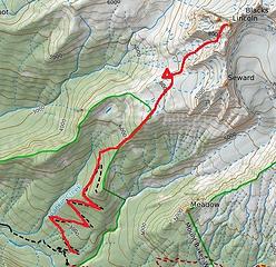 The approach 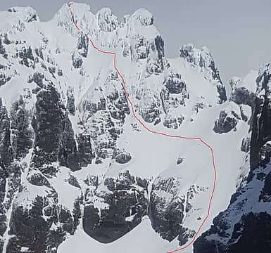 The route 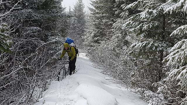 Pushing bikes through the snow 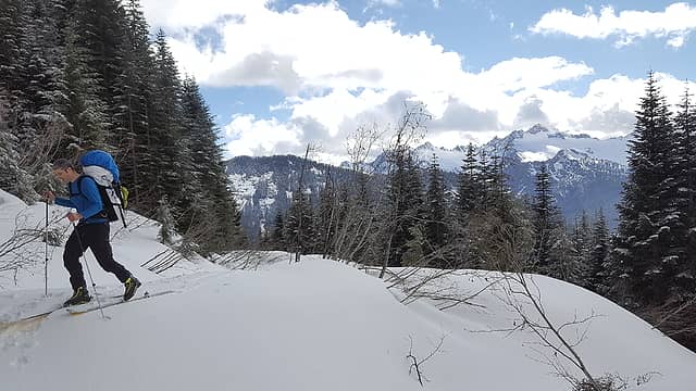 Skiing the upper road 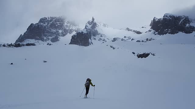 Our first view of Lincoln in the clouds 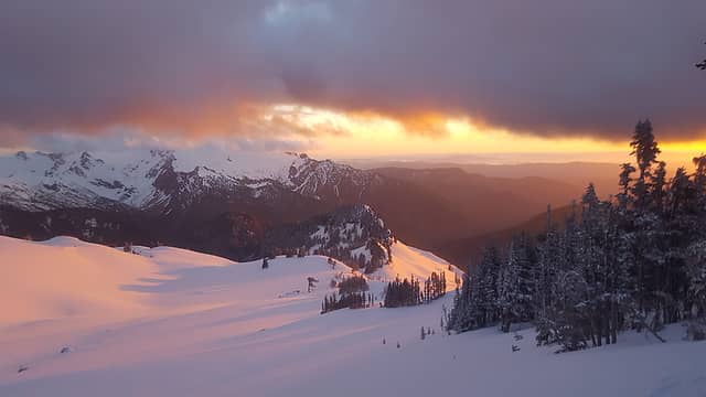 Sunset from camp 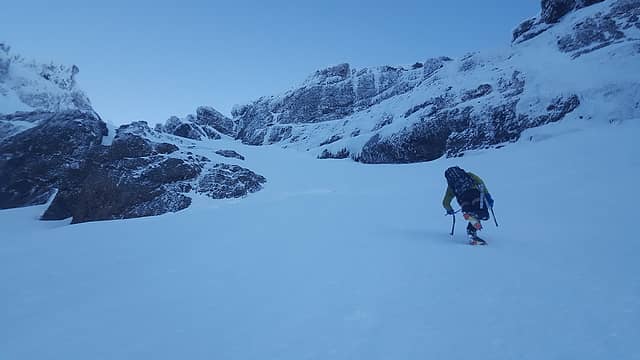 Approaching the schrund 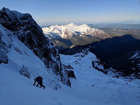 Climbing above the schrund (photo by Duncan) 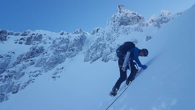 Traversing the lower basin 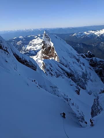 The gully above the lower basin (photo by Duncan) 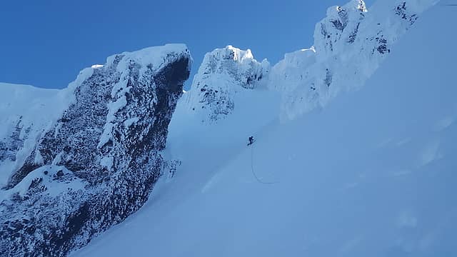 Traversing the upper basin to the leaning tower of Pisa 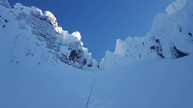 The final gully 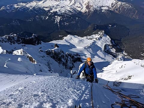 Topping out (photo by Duncan) 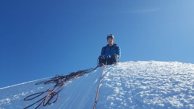 The snowy summit 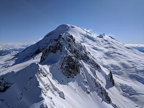 Good views of Baker and Colfax  Descending in a whiteout 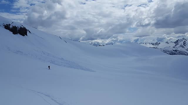 Skiing out 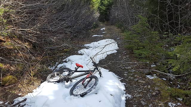 Biking out
|
| Back to top |
  
|
|
xuanxier
Member

Joined: 09 May 2017
Posts: 80 | TRs | Pics
Location: Vancouver, BC |
|
xuanxier
Member
|
 Tue Apr 30, 2019 11:30 am |
|
|
Congratulations Eric. Very happy that you get this one done, and timed it in as perfect as it can ever get. The bergschrund, many giant runnels and icy conditions had made our ascent in May very challenging last year.
|
| Back to top |
|
|
iron
Member

Joined: 10 Aug 2008
Posts: 6392 | TRs | Pics
Location: southeast kootenays |
|
iron
Member
|
Tue Apr 30, 2019 12:21 pm |
|
|
looked like fine bootable snow, especially for lincoln.
|
| Back to top |
|
|
geyer
Member

Joined: 23 May 2017
Posts: 463 | TRs | Pics
Location: Seattle |
|
geyer
Member
|
Tue Apr 30, 2019 12:26 pm |
|
|
Great job on Lincoln and finishing the top 100 list!
|
| Back to top |
|
|
Stefan
Member

Joined: 17 Dec 2001
Posts: 5093 | TRs | Pics
|
|
Stefan
Member
|
Tue Apr 30, 2019 12:35 pm |
|
|
|
| Back to top |
|
|
Jake Robinson
Member
Joined: 02 Aug 2016
Posts: 521 | TRs | Pics
|
Congrats Eric  Can't wait to see what's next for you. Can't wait to see what's next for you.
|
| Back to top |
|
|
raising3hikers
Member
Joined: 21 Sep 2007
Posts: 2344 | TRs | Pics
Location: Edmonds, Wa |
nice work you guys on a serious mountain. but, the airy traverse looks so mellow without multiple 6' deep runnels. you picked a great time with the lowering temps and stable snow. congrats on finishing the t100!
|
| Back to top |
|
|
PeakJunkie
Member
Joined: 14 Feb 2009
Posts: 22 | TRs | Pics
|
|
| Back to top |
|
|
Malachai Constant
Member

Joined: 13 Jan 2002
Posts: 16093 | TRs | Pics
Location: Back Again Like A Bad Penny |
Good work, looks like you hit the catbird seat to do it 
"You do not laugh when you look at the mountains, or when you look at the sea." Lafcadio Hearn
"You do not laugh when you look at the mountains, or when you look at the sea." Lafcadio Hearn
|
| Back to top |
|
|
|
|
You cannot post new topics in this forum
You cannot reply to topics in this forum
You cannot edit your posts in this forum
You cannot delete your posts in this forum
You cannot vote in polls in this forum
|
Disclosure: As an Amazon Associate NWHikers.net earns from qualifying purchases when you use our link(s). |


