| Previous :: Next Topic |
| Author |
Message |
awilsondc
Member


Joined: 03 Apr 2016
Posts: 1324 | TRs | Pics
|
My mood leading up to this trip was much like the weather in Washington through most of May... dark, moody, and generally 'meh'. I was also back into my rut of being unable to pick a trip to do. I had several picked out, and plenty of time to think about it, but it came down to the night before the trip and I still hadn't settled on anything. Paralysis by analysis I guess. I had researched the Snowfield group the most so I downloaded maps and beta for that area, still not even sure if I'd head there in the morning but I did. I arrived to a surprisingly somewhat full parking area and hit the trail a few minutes before 7.
I ground out the first few miles of trail, not particularly feeling great. There were a few water features along Pyramid Creek that I checked out, but was too lazy to get my tripod and really frame up a good shot. Pyramid Lake was kind of cool. I continued on through the forest, taking note of a downed tree that I thought looked like a fallen soldier. Fitting since it was Memorial Day weekend. I thanked him for his service and carried on. Snow started around the flat bench at 4200 ft and it was here that I stopped to swap out my trail runners for mountaineering boots. I also noted the dark overcast skies. It was supposed to be 25% chance of rain around 11am, and clearing up as the day went on but things weren't looking too promising. From the flat area around 4200, the trail really gets after it! That sucker was straight up through cliffs in parts and the going was slow in my heavy boots and overnight pack. Soon snow was continuous and I was grateful for my late start since I had tracks to follow which made route finding easier. Soon I encountered a party of three on descent. They had reached the 5800 ft ridge and turned around due to weather. Not a good sign, but I carried on anyway.
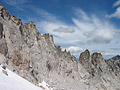
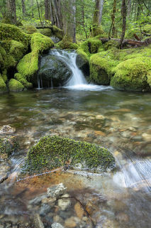 Pyramid Creek 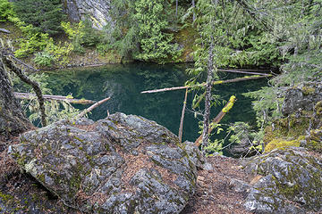 Pyramid Lake 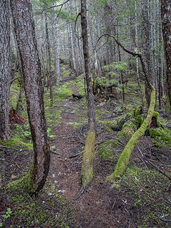 trail 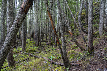 through the trees 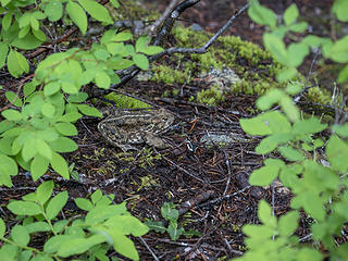 Fattest. Slowest. Frog. Ever. 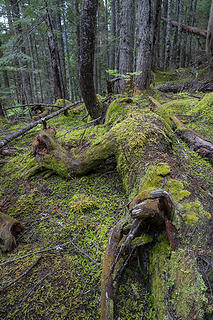 Fallen soldier. Memorial Day 2019 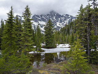 First view of Colonial Peak 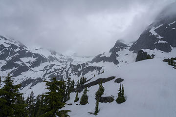 Uhhhh, not looking so good up there 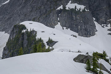 Climbers hiking up to the high point on the ridge east of Pyramid Peak 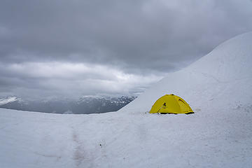 Waiting out the strom 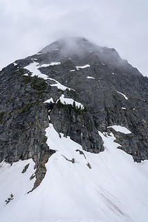 Pyramid Peak 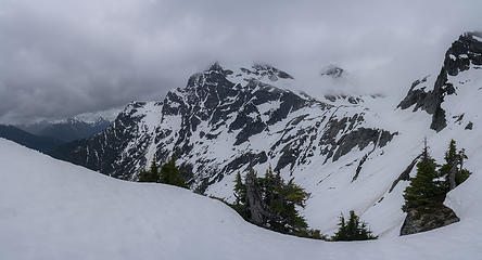 Well, I guess that's it. These are the views I got. 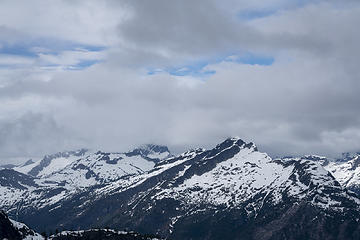 Wait... is that blue sky? 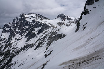 Starting the traverse 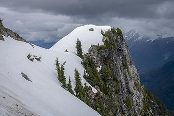 Looking back from the traverse, campers emerge 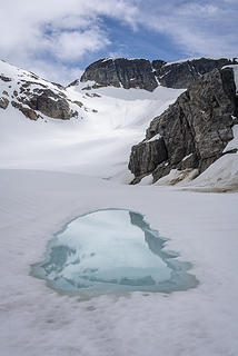 Entering Colonial Glacier Basin 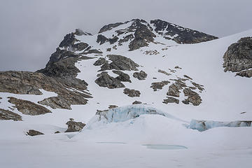 Colonial. This mountain was magnetic this day. 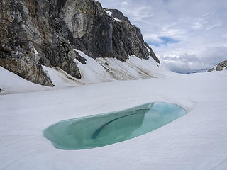 Melt water and waterfall 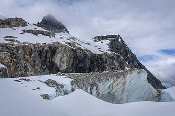 Pinnacle, Pyramid, and Colonial Glacier 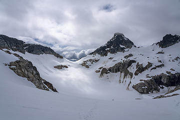 Sun patches at PBS col 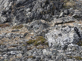 Camouflage level 100 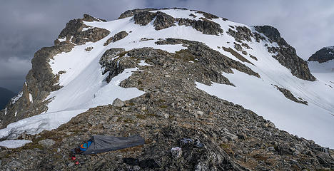 Bivy at 6800 ft below Colonial Peak 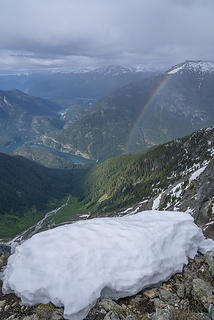 Rainbow 1 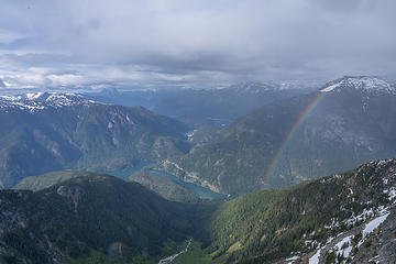 Rainbow 2 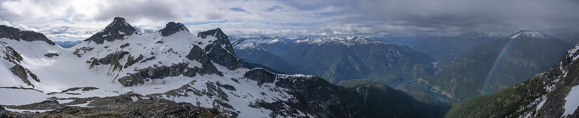 The storm is clearing 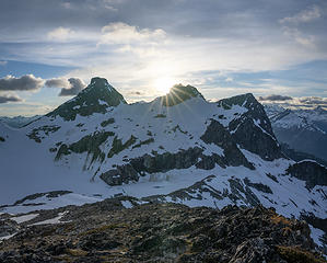 Sunset 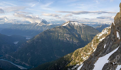 Light over Ruby 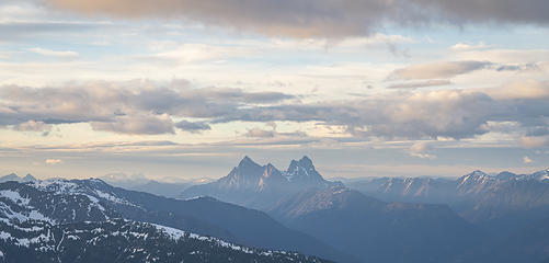 Hozomeen 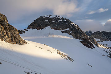 Neve 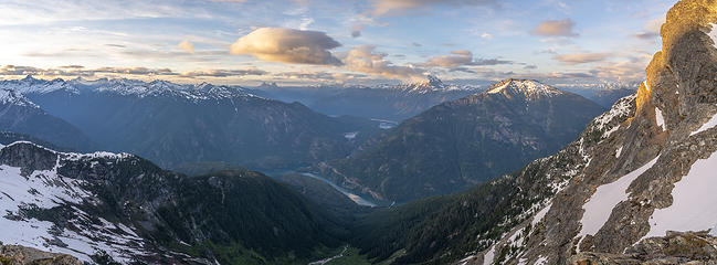 Looking out toward Ross Lake 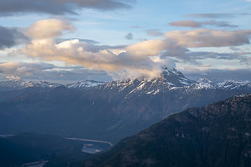 Jack 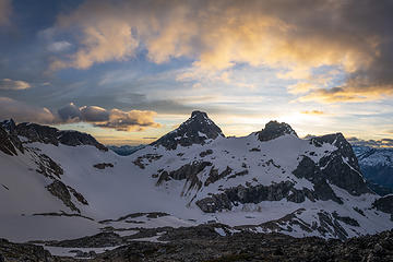 Let the burn begin! 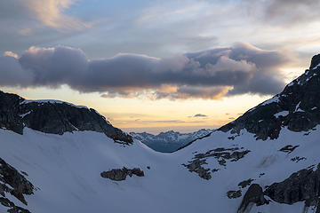 Cool clouds over PBS col 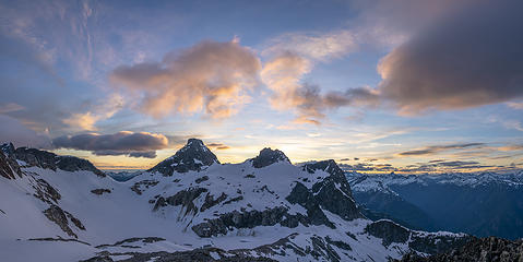 This sunset was absolutely gorgeous  Fading light 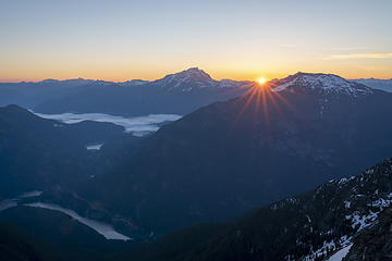 Sunrise over Ruby and Jack 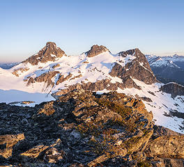 Alpenglow 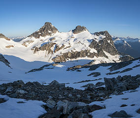 Golden light 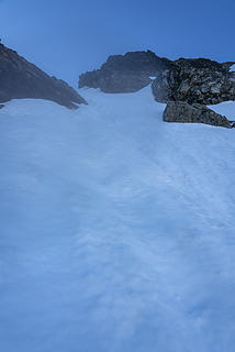 Only photo from the steep snow 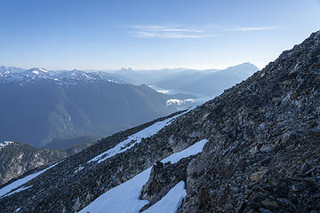 Chossy traverse 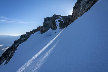 Nearing the summit block 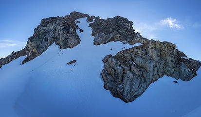 Colonial Peak summit block 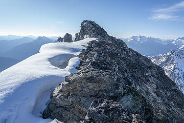 Summit! 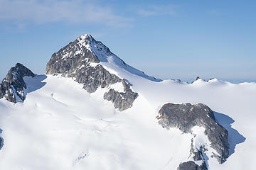 Snowfield 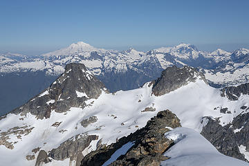 Baker and Shuksan 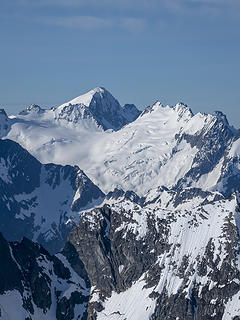 A-03963 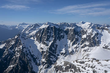 A-03964 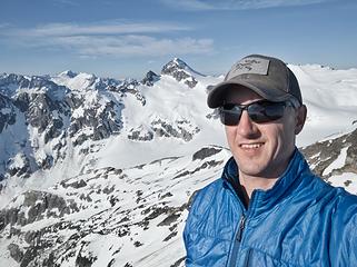 Colonial Peak summit selfie 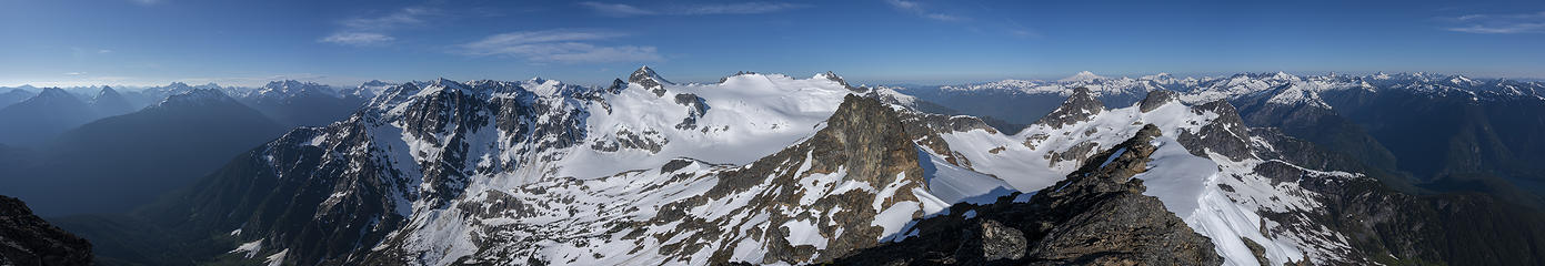 summit panorama 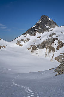 Descending 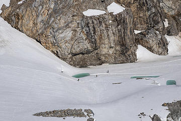 Three skiers in Colonial Glacier Basin 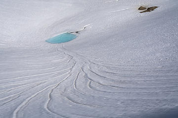 melting 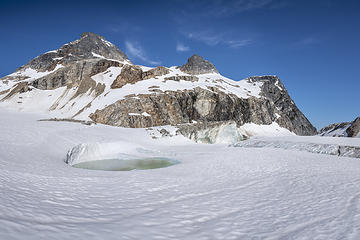 basin 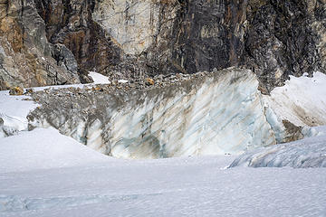 glacier 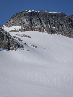 Skiers working up to Neve col 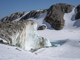 more glacier 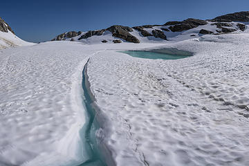 frozen melt water 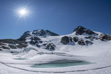 Colonial and Neve 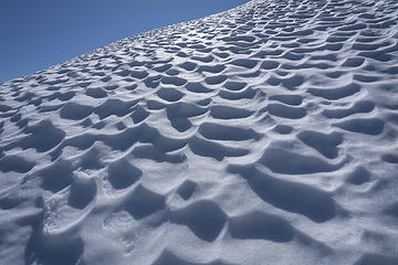 sun cups 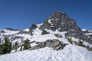 Pyramid 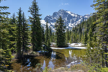 Thanks Colonial, that was fun! 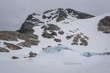 Colonial Peak routes - I took red up and blue down
|
| Back to top |
  
|
|
iron
Member

Joined: 10 Aug 2008
Posts: 6392 | TRs | Pics
Location: southeast kootenays |
|
iron
Member
|
 Sun Jun 02, 2019 10:35 pm |
|
|
colonial is one of my top 5 favorite summits. interesting glacier pics you have. i don't recall seeing anything like that on the route you were on.
|
| Back to top |
|
|
Tom
Admin
Joined: 15 Dec 2001
Posts: 17851 | TRs | Pics
|
|
Tom
Admin
|
Sun Jun 02, 2019 10:41 pm |
|
|
|
| Back to top |
|
|
geyer
Member

Joined: 23 May 2017
Posts: 463 | TRs | Pics
Location: Seattle |
|
geyer
Member
|
Mon Jun 03, 2019 9:47 am |
|
|
| awilsondc wrote: | The storm is clearing |
That pano 
|
| Back to top |
|
|
ozzy
The hard way

Joined: 30 Jul 2015
Posts: 476 | TRs | Pics
Location: University place, wa |
|
ozzy
The hard way
|
Tue Jun 04, 2019 8:57 am |
|
|
Hell yea Aaron way to stick with it! Awesome tr and pics again! I went up there the friday after you and didnt see anyone the whole day!! Thanks again for the intel man. That place is spectacular! 
I dont know whats gonna happen, but I wanna have my kicks before the whole shithouse goes up in flames-Mr Mojo Risin
I dont know whats gonna happen, but I wanna have my kicks before the whole shithouse goes up in flames-Mr Mojo Risin
|
| Back to top |
|
|
neek
Member

Joined: 12 Sep 2011
Posts: 2337 | TRs | Pics
Location: Seattle, WA |
|
neek
Member
|
Tue Jun 04, 2019 9:38 am |
|
|
I've learned by now to view your pics on the big screen and not mess with the silly little cell phone display. Gotta get out to the Colonial basin some day.
|
| Back to top |
|
|
Nancyann
Member

Joined: 28 Jul 2013
Posts: 2318 | TRs | Pics
Location: Sultan Basin |
|
Nancyann
Member
|
Tue Jun 04, 2019 10:29 am |
|
|
Glad you decided not to bail! Wonderful pictures!
|
| Back to top |
|
|
awilsondc
Member
Joined: 03 Apr 2016
Posts: 1324 | TRs | Pics
|
Thanks! Yeah, the glacier was cool. That ice in the middle of what looked like a frozen lake was pretty cool. I watched a couple chunks fall off of it while I was up there, small ones... Nick, I'm surprised you haven't been up there yet! Make it happen! 
|
| Back to top |
|
|
RichP
Member

Joined: 13 Jul 2006
Posts: 5634 | TRs | Pics
Location: here |
|
RichP
Member
|
Tue Jun 04, 2019 9:41 pm |
|
|
You've got a great eye. 
|
| Back to top |
|
|
puzzlr
Mid Fork Rocks

Joined: 13 Feb 2007
Posts: 7220 | TRs | Pics
Location: Stuck in the middle |
|
puzzlr
Mid Fork Rocks
|
Fri Jun 07, 2019 5:32 pm |
|
|
These trips you do are memories you'll never forget, especially with the astounding photos you bring back to remember what it was like.
|
| Back to top |
|
|
Bootpathguy
Member
Joined: 18 Jun 2015
Posts: 1790 | TRs | Pics
Location: United States |
Experience is what'cha get, when you get what'cha don't want
|
| Back to top |
|
|
Jackal
Member

Joined: 21 Jul 2012
Posts: 102 | TRs | Pics
Location: Mazama |
|
Jackal
Member
|
Sat Jun 08, 2019 11:07 am |
|
|
| iron wrote: | | colonial is one of my top 5 favorite summits. interesting glacier pics you have. i don't recall seeing anything like that on the route you were on. |
My thoughts exactly (on both accounts). Was there in August a few years ago and except for the Neve, never saw any side views of glacial ice.
awilsondc, good decision to turn around and go for it! It's really satisfying to look up from the Diablo Lake parking lot with memories of tromping around up there.
|
| Back to top |
|
|
|
|
You cannot post new topics in this forum
You cannot reply to topics in this forum
You cannot edit your posts in this forum
You cannot delete your posts in this forum
You cannot vote in polls in this forum
|
Disclosure: As an Amazon Associate NWHikers.net earns from qualifying purchases when you use our link(s). |


