| Previous :: Next Topic |
| Author |
Message |
Schmidt Altitude
Whippet Entourage


Joined: 28 Mar 2007
Posts: 803 | TRs | Pics
Location: The Quah |
- Date: Wednesday, September 9, 2009 (09/09/09)
- Crew: yukon222, Happy Jack, GeoTom, Jasper, Soapy, Schmidt Altitude (Babe, Row, Kief, Dude)
- Summits (in order that we climbed them):
- Earl Peak, 7039 (#34 Back Court 100, #5 Teanaway 20)
- Bean Peak, 6743 (#53 BC100, #9T20)
- Devils Head, 6666 (#10T20)
- Volcanic Neck, 6660+ (#11T20)
- Marys Peak, 6680+
- Judys Peak, 6560+
- Bills Peak, 6917 (#40BC100, #6T20)
- Teanaway Peak - a.k.a. Genes Peak, 6779 (#47 BC100, #7T20)
- Iron Peak, 6510 (#12 T20)
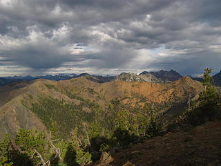
- Location: Teanaway Area of the Wenatchee Mountains
- Stats: ~18 miles, ~9500 gained (GPS had over 10,000 altimeter watch recorded 9,469)
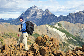
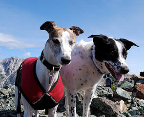
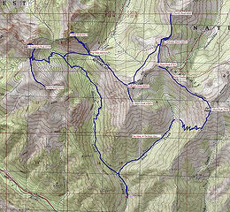 Teanaway Nine map courtesy of yukon222  Babe meets Happy Jack  Earl awaits  Squalls in the distance 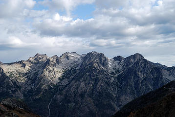 Colchuck, Dragontail, and Little Annapurna 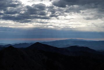 Sun breaking through 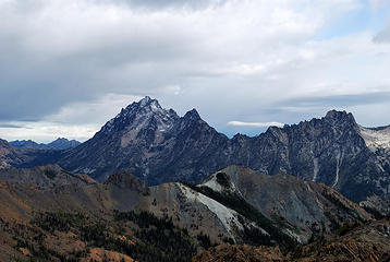 Star of the show 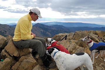 Gather round the treat giver 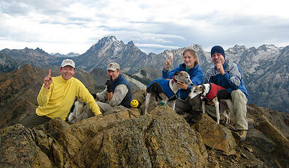 #1: Earl Peak, 7036' 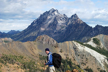 Alti-Dude on Bean Ridge 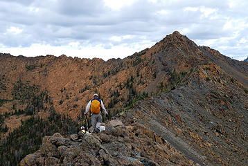 Ridge rambling 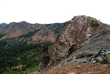 The Burly Phallus 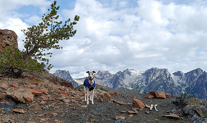 Elusive Kiefer finally takes a decent portrait 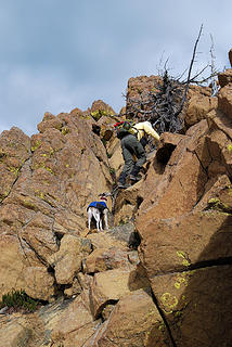 "I think I need a boost, Uncle Yukon." 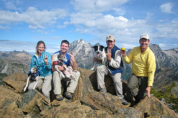 #2: Bean Peak, 6743' 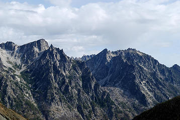 Little Annapurna, Pennant Peak, McClellan and the Nightmare Needles 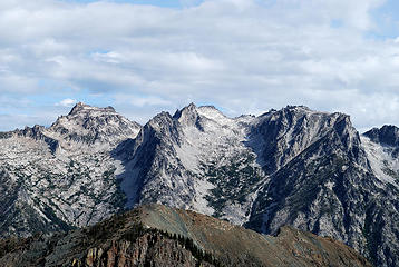 Colchuck and Dragontail rise above Volcanic and Devils Head 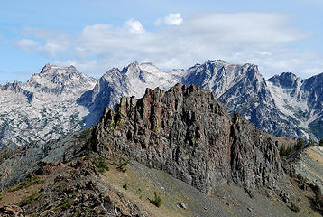 Closing in on Volcanic Neck 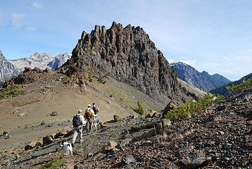 Arrival at the Volcanic Neck saddle 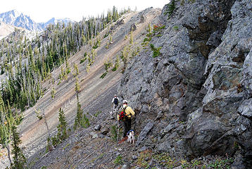 Following the ledge around the Neck 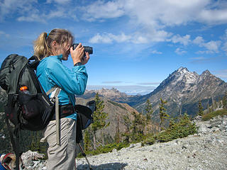 Always trying to capture the moment 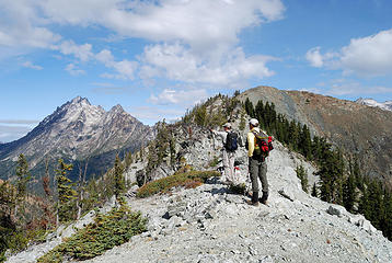 "And that one is Pilchuck." ;-) 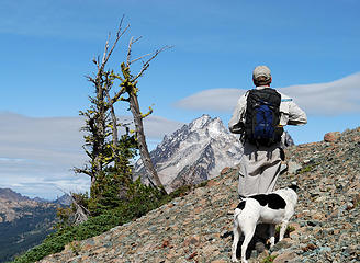 A boy and his obsession 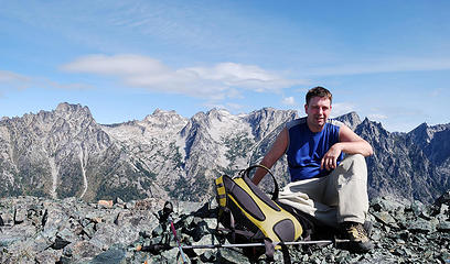 Dude on Devils Head 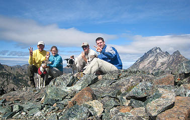 #3: Devils Head, 6666' 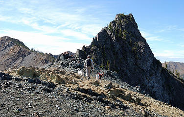 GeoTom is ready for some necking! 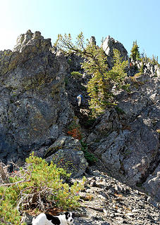 Dude up the gully  Here wait the whiny whippets 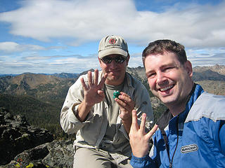 #4: Volcanic Neck, 6600' Team 1 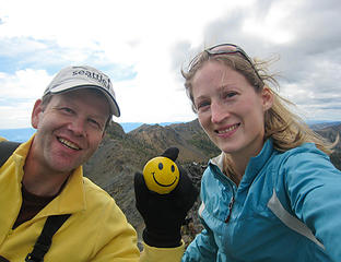 #4: Volcanic Neck, 6600' Team 2 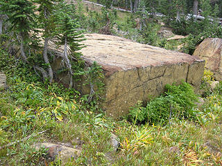 Aslan's Altar? 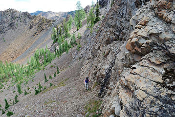 Easier footing by the cliffs 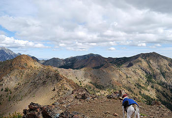 Wild whippet of the Teanaways 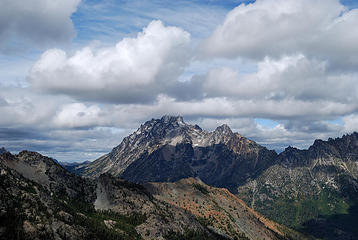 Clouds rolling in over Stuart 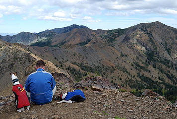 Altitude family takes a break 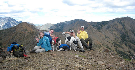 #5: Mary's Peak, 6680'+ 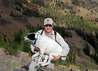 We were in awe that GeoTom could pick up such a stout beast 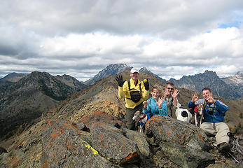 #6: Judy's Peak, 6560'+ 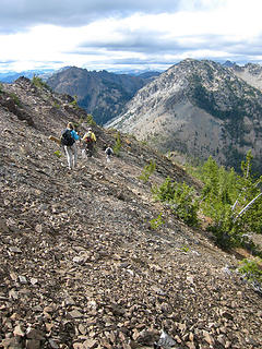 Talus slopes back to Mary's Peak 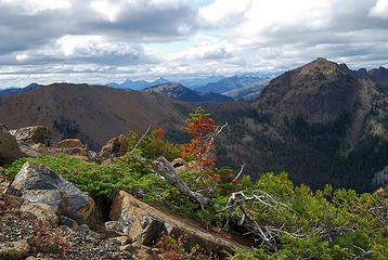 Teanaway color 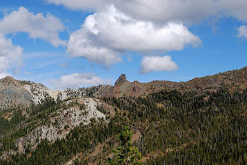 Looking back at Devils and Volcanic 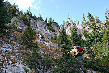 Fueled by GU Chomps! 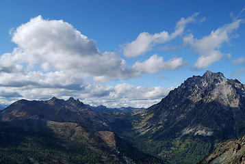 Ingalls and Stuart 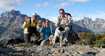 "Is this 7 or 8?" asks Alti-Babe (#7: Bill, 6917') 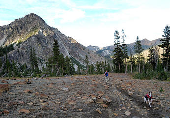 Row and Dude still plugging along, Bill's Peak back left 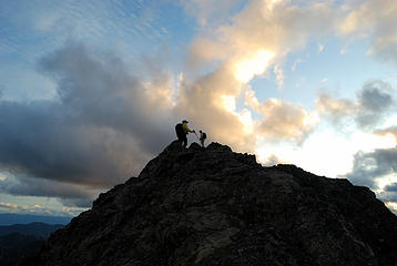 Into the light 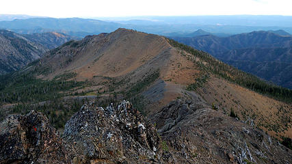 The last peak awaits us 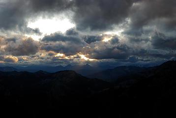 Spotlight on Three Queens 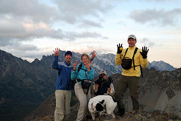 #8: Teanaway/Gene, 6779' 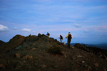 Making our final summit bid 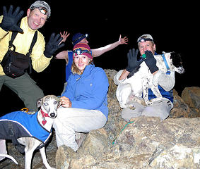 #9: Iron, 6516' Take 1 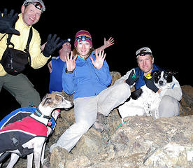 #9 Take 2 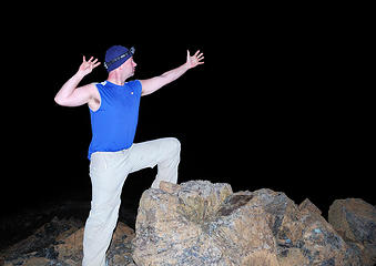 Teanaway Power x 9 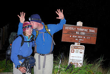 Day of 9, that's a wrap!
"Forest 101: These big wood stick things are called trees. The big rocks are called mountains, and the little rocks are their babies." Elliott from Open Season
"Forest 101: These big wood stick things are called trees. The big rocks are called mountains, and the little rocks are their babies." Elliott from Open Season
|
| Back to top |
  
|
|
yukon222
Member

Joined: 12 Mar 2007
Posts: 1893 | TRs | Pics
|
|
yukon222
Member
|
 Tue Sep 15, 2009 3:20 am |
|
|
What a great day - the poor weather in the forecast never materialized, winds were light enough not to freeze us too badly and the peaks were setup to avoid much backtracking at all. More pics of the adventure:
 DSD_4221 Alti-Dude leaving summit of Earl 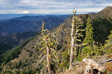 DSD_4225 Another snag photo ;-)  DSD_4250 GeoTom sizing up Volcanic Neck 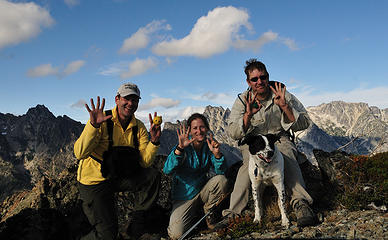 DSD_4281 Teanaway/Gene Peak summit # 8
|
| Back to top |
|
|
Jasper
Cascade Snow Pig

Joined: 13 Apr 2008
Posts: 350 | TRs | Pics
Location: Burrowing in the snow |
|
Jasper
Cascade Snow Pig
|
Tue Sep 15, 2009 7:52 am |
|
|
I liked this one on your flickr page:
 Rowena tolerating Jasper's presence 
|
| Back to top |
|
|
wamtngal
Member

Joined: 13 Jun 2004
Posts: 2382 | TRs | Pics
Location: somewhere |
|
wamtngal
Member
|
Tue Sep 15, 2009 8:10 am |
|
|
This report makes me  (that's supposed to be tired, not bored btw).
Nice job, way to capture some new and old Teanaway peaks! (that's supposed to be tired, not bored btw).
Nice job, way to capture some new and old Teanaway peaks! 
Opinions expressed here are my own.
Opinions expressed here are my own.
|
| Back to top |
|
|
joker
seeker

Joined: 12 Aug 2006
Posts: 7953 | TRs | Pics
Location: state of confusion |
|
joker
seeker
|
Tue Sep 15, 2009 8:52 am |
|
|
Nice report and notion. I've managed a threefer on skis (Iron/Mary/Earl), and that was enough to poop me out. You guys are just hitting your stride, eh!?
That ridge walk between Earl and Bean is a fun one for sure. I'm impressed that the dogs had no issues - you guys all have "climber dogs" for sure. My bigger dogs would all have had some definite physical and/or mental challenges at a few scrambly and exposed points along that route. So the only time I've done that bit of walking was earlier this season while my wife was off at the shore with the dogs...
So what's up for 10/10/10?
|
| Back to top |
|
|
GeoTom
Member
Joined: 19 May 2005
Posts: 3215 | TRs | Pics
Location: Earth |
|
GeoTom
Member
|
Tue Sep 15, 2009 8:57 am |
|
|
| joker wrote: | | So what's up for 10/10/10? |
For me: Throwing 10 frisbees to 10 different dogs while drinking 10 beers. 
| Quote: | | I'm impressed that the dogs had no issues - you guys all have "climber dogs" for sure. |
Jasper and I had been in the area several times over the past few years, previously summitting 8 of the 9 peaks on various trips (not Volcanic Neck) so I was pretty confident he'd be ok. The whippets are light enough to lift a short distance if needed, but they're pretty agile too.
Here's my flickr photo dump. Nothing much different than what has already been posted, but there was an unauthorized* video:
A few photos so this will show up as a TR on my profile:
 A view of where we spent most of our day 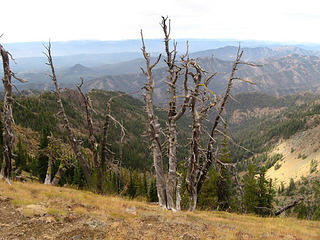 I had a snagasm when I walked past this area 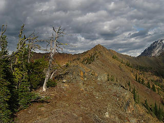 On the ridge to Bean 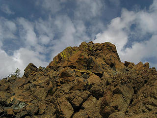 Bean Peak summit 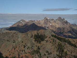 Fortune, South Ingalls and Ingalls with Not Hinkhouse in front (shaded) 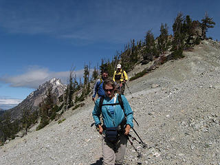 Returning to Volcanic Neck 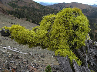 Funky hairdo 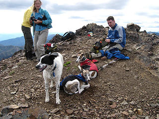 Mary's Peak has gone to the dogs 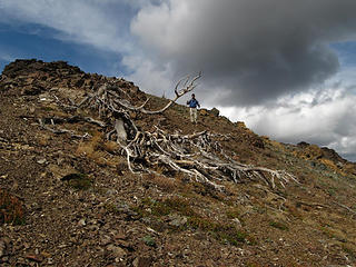 Snag and man 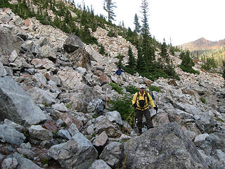 This is the 'fast' way? 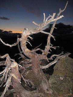 Night snag on Iron 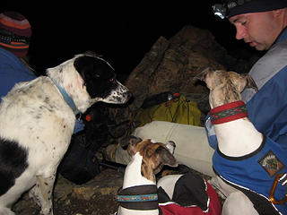 Food interests the K9's
|
| Back to top |
|
|
Randy
Cube Rat

Joined: 18 Dec 2001
Posts: 2910 | TRs | Pics
Location: Near the Siamangs |
|
Randy
Cube Rat
|
Tue Sep 15, 2009 9:12 am |
|
|
Way to clean up out there.
|
| Back to top |
|
|
Malachai Constant
Member

Joined: 13 Jan 2002
Posts: 16092 | TRs | Pics
Location: Back Again Like A Bad Penny |
Next year you have to do 10 peaks on October 10
"You do not laugh when you look at the mountains, or when you look at the sea." Lafcadio Hearn
"You do not laugh when you look at the mountains, or when you look at the sea." Lafcadio Hearn
|
| Back to top |
|
|
DIYSteve
seeking hygge

Joined: 06 Mar 2007
Posts: 12655 | TRs | Pics
Location: here now |
|
DIYSteve
seeking hygge
|
Tue Sep 15, 2009 10:02 am |
|
|
Whoa!
Joker and Randy, this will go as a spring ski tour
|
| Back to top |
|
|
joker
seeker
Joined: 12 Aug 2006
Posts: 7953 | TRs | Pics
Location: state of confusion |
|
joker
seeker
|
Tue Sep 15, 2009 10:20 am |
|
|
I'm in!
but reserve the right to pull what I'll call "the dude option" 
|
| Back to top |
|
|
Go Jo
of the lykkens

Joined: 08 Jun 2003
Posts: 2248 | TRs | Pics
Location: Around The Bend |
|
Go Jo
of the lykkens
|
Tue Sep 15, 2009 10:54 am Re: Climbing Nine Teanaway Summits for 09/09/09
|
|
|
| Schmidt Altitude wrote: | | Next, it was time for Marys southern sister Judy. According to the map, Judys Peak has only 40 feet of clean prominence from the higher Marys Peak. However, both peaks are open contour lines meaning their true summit can be anywhere from 0 to 40 feet more than indicated on the map. Plus, the col between them is also open on the map and can be 0 to 40 feet lower than indicated. Add in the 40 feet already indicated and the true elevation dropped and gained between them can be anywhere from 40 to 160 feet. If everyone has ever traversed between these two peaks they will know it is much closer to 160 difference than the gentler 40 walk up the map indicates. |
Your crazy math skills are almost as impressive as your adventures! I saw there was some bootlegged vid out there, when is the official studio release of The 9 Summit 9 of 9.9.09?
|
| Back to top |
|
|
Slide Alder Slayer
Member

Joined: 14 Jan 2002
Posts: 1960 | TRs | Pics
|
Amazing fun day, my knees ached just reading your report!
|
| Back to top |
|
|
Sennin
Member

Joined: 31 Jul 2008
Posts: 691 | TRs | Pics
Location: West Seattle |
|
Sennin
Member
|
Tue Sep 15, 2009 11:17 am |
|
|
Did you watch the move Nine after?
epic! Great job!
|
| Back to top |
|
|
Ingunn
Hiking Viking
Joined: 01 Feb 2008
Posts: 1751 | TRs | Pics
Location: Redmond |
|
Ingunn
Hiking Viking
|
Tue Sep 15, 2009 12:02 pm |
|
|
You're all crazy.  12/12/12 is going to be awesome!
|
| Back to top |
|
|
dicey
custom title

Joined: 11 May 2004
Posts: 2870 | TRs | Pics
Location: giving cornices a wider berth |
|
dicey
custom title
|
Tue Sep 15, 2009 12:22 pm |
|
|
When Yana and I did Earl/Bean/Mary/Judy in the springtime, we ran into some friends of mine on skis. An idea entered my head....no really!
This would make a great ski tour  Nice job making it to all those summits on foot!
|
| Back to top |
|
|
|
|
You cannot post new topics in this forum
You cannot reply to topics in this forum
You cannot edit your posts in this forum
You cannot delete your posts in this forum
You cannot vote in polls in this forum
|
Disclosure: As an Amazon Associate NWHikers.net earns from qualifying purchases when you use our link(s). |


