| Previous :: Next Topic |
| Author |
Message |
SultanHiker
Member


Joined: 04 Aug 2014
Posts: 78 | TRs | Pics
Location: Washington |
I was up here 2 years ago with a friend (trip report). Often trip reports say: Once you climb Gunn, you really never want to do it again. -- or something similar. But my 15 year old, Mason has become my new hiking partner, and I wanted to share the area with him. I also wanted to explore more of the plane wreckage below wing, and see if I could find and retrieve a complete goat skull from the fresh cougar kill I discovered 2 years ago (hoping it was sun bleached by now). Also there was a photography goal spurred on by another thread.
There was a moderate earthquake (4.6 just west of Monroe) that shook our house in Sultan just before 3am on 7/12/19. Scared my wife and I wide awake. I got up and checked on the kids, and went back to sleep with my alarm previously set for 5:30. Got up, ate, grabbed coffee on the way and headed up the road to Barclay Lake Trailhead. On the way, we chased a deer up the road for 100 yards. He finally found a turn out and just stood there as I passed by. So I hopped out and snapped a few shots.
Left trailhead at 7:23a
There are good reports on the interwebs on how to find the trail. But the first hint I have is about crossing Barclay Creek. Do Not Cross the whole creek on the logs. There is an island where the creek splits. First, you rock hop to get on the logs, but immediately after, you should scramble over the logs and head climbers left onto the little island. You can pick up the trail better using this route. Your natural inclination to use the length of the logs to bear right and cross the whole creek. But this makes it much harder to find the good path.
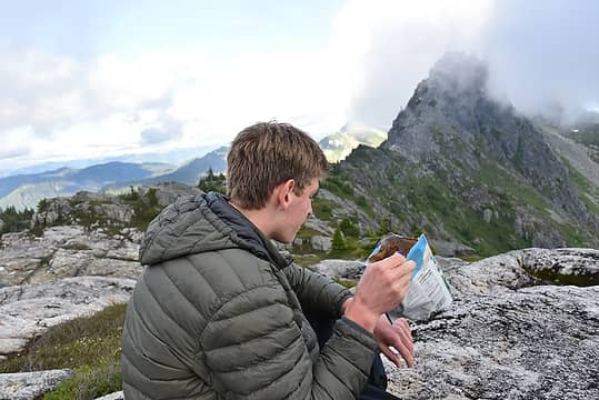
 Don't follow these logs. Turn to the left just off frame. 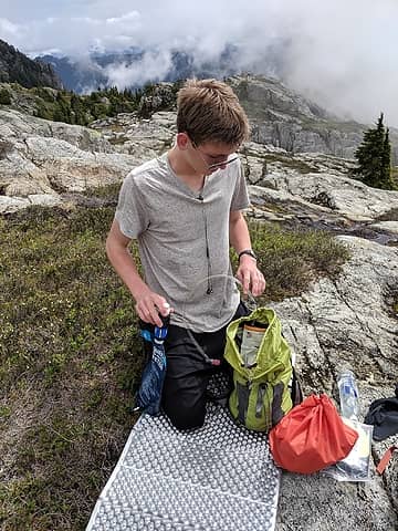 Packing summit bag 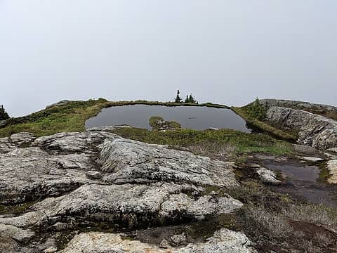 Infinity tarn on Tailgunner shoulder 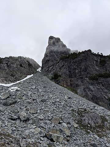 Gunn 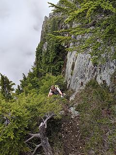 Backside 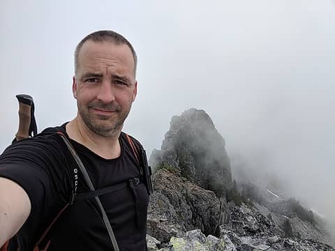 Me on Gunn's summit with the east summit in the background. Only view we had... 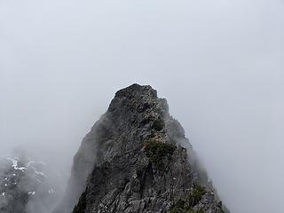 looking over to the true summit 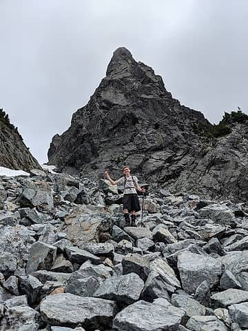 looking back at Gunn 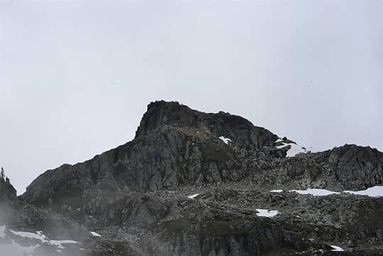 Tailgunner 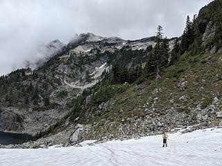 Mason on the snow with Gunnshy peeking out 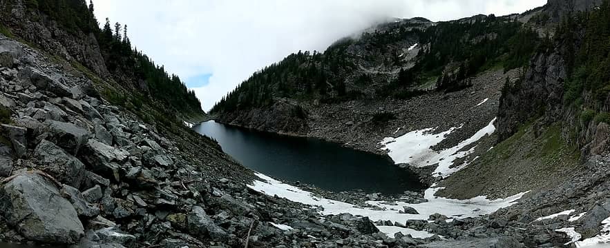 Gunn Lake 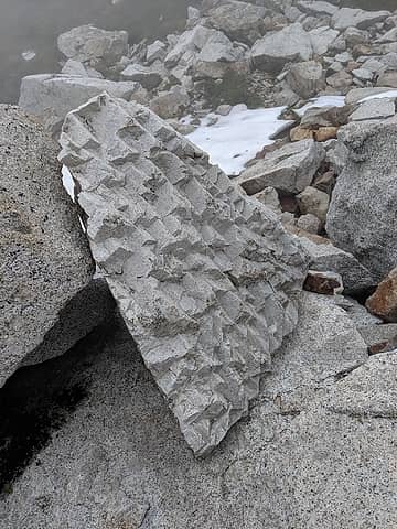 Interesting rock on our way up 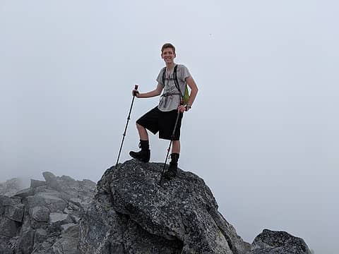 Mason on Gunnshy 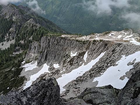 Jumpoff Ridge 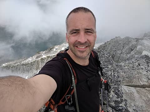 Me on Gunnshy 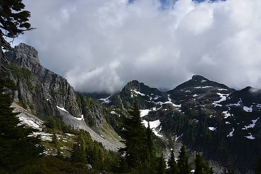 Gunn, Pt5760, Tailgunner 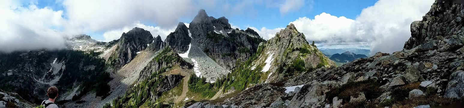 Gunnshy in the clouds, Gunn Peak, and Point 5760 as seen from the final approach to Tailgunner  Back to camp at 6:20p. We ate Phad Thai and watched the 4 goats with babies along the south slopes below Wing. Rainier popped into view. We filtered some more water and settled in to watch most of The Dawn Wall on Netflix (downloaded, and reccomended). But we were too tired to finish it. Weather was still too poor to stargaze.
 Phad Thai 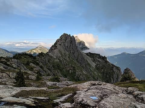 Wing with Merchant just behind 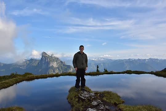 Mason with Baring behind (his favorite mountain so far) 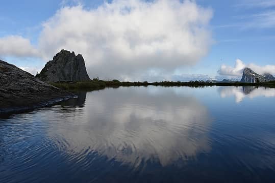 Wing, Infinity Tarn, and Baring 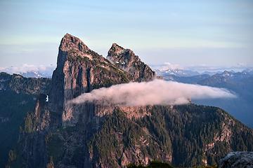 Baring just before sunset 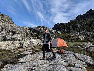 Mason in the morning 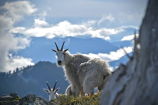 Goats as we came over a rise 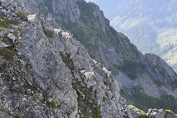 All nine goats 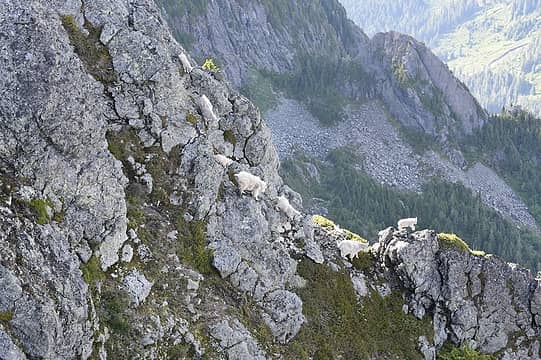 had to include the young goat leaping. 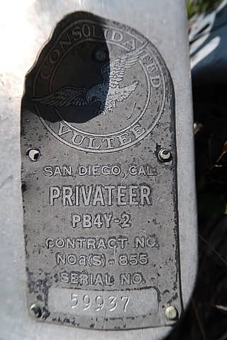 Courtesy of neek from nwhikers.net 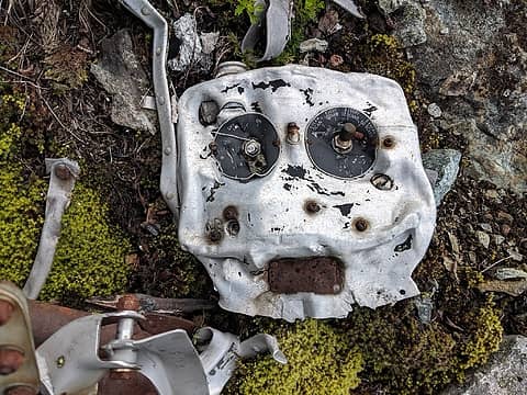 radio box 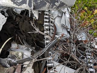 stainless still perfect after 66 years 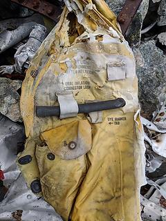 life vest for water landing 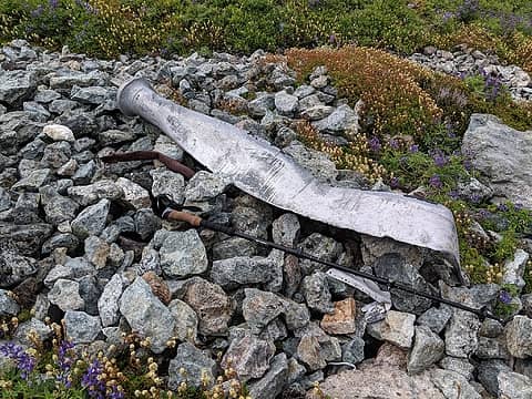 prop 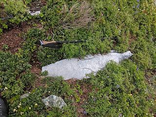 prop 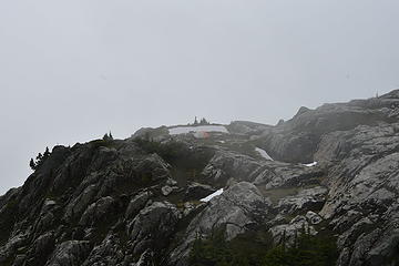 camp from 5760 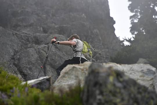 Mason on the way to 5760 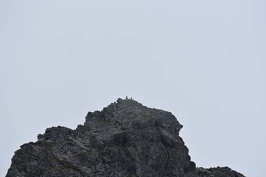 strangers on Gunn 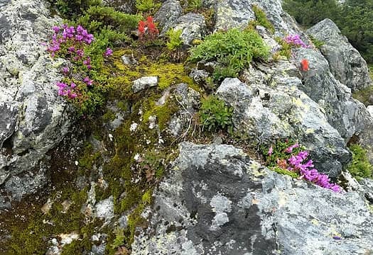 Wildflowers on 5760
|
| Back to top |
  
|
|
RichP
Member

Joined: 13 Jul 2006
Posts: 5634 | TRs | Pics
Location: here |
|
RichP
Member
|
 Tue Jul 23, 2019 8:19 am |
|
|
 Excellent. Excellent.
|
| Back to top |
|
|
Stefan
Member

Joined: 17 Dec 2001
Posts: 5093 | TRs | Pics
|
|
Stefan
Member
|
Tue Jul 23, 2019 9:43 am |
|
|
Congrats on your new hiking partner!!!
|
| Back to top |
|
|
Schroder
Member

Joined: 26 Oct 2007
Posts: 6722 | TRs | Pics
Location: on the beach |
|
Schroder
Member
|
Tue Jul 23, 2019 11:06 am |
|
|
Great adventure and photos!
As a footnote to your last trip report and the questions asked about these crashes, Wing Luke's crash site is at the 5000 ft level on the North side of Wing Pk.
|
| Back to top |
|
|
contour5
Member

Joined: 16 Jul 2003
Posts: 2963 | TRs | Pics
|
|
contour5
Member
|
Tue Jul 23, 2019 12:04 pm |
|
|
Great stuff! Thanks for posting!
|
| Back to top |
|
|
neek
Member

Joined: 12 Sep 2011
Posts: 2338 | TRs | Pics
Location: Seattle, WA |
|
neek
Member
|
Tue Jul 23, 2019 2:15 pm |
|
|
Been looking forward to this one. Hope your ankle isn't too bad.
|
| Back to top |
|
|
SultanHiker
Member
Joined: 04 Aug 2014
Posts: 78 | TRs | Pics
Location: Washington |
| Schroder wrote: | | Great adventure and photos!
As a footnote to your last trip report and the questions asked about these crashes, Wing Luke's crash site is at the 5000 ft level on the North side of Wing Pk. |
Thanks! Now I have to go back there... Grrrr.... 
|
| Back to top |
|
|
Nancyann
Member

Joined: 28 Jul 2013
Posts: 2319 | TRs | Pics
Location: Sultan Basin |
|
Nancyann
Member
|
Tue Jul 23, 2019 3:32 pm |
|
|
So nice to see Masons enthusiasm for climbing with you. What a memorable experience for you both!
|
| Back to top |
|
|
Sky Hiker
Member
Joined: 03 Feb 2007
Posts: 1469 | TRs | Pics
Location: outside |
Nice trip report thanks for posting. Just as an FYI your not allowed to remove goat, deer, elk, etc. skulls unless you harvested it and have appropriate tags & lisc.
|
| Back to top |
|
|
SultanHiker
Member
Joined: 04 Aug 2014
Posts: 78 | TRs | Pics
Location: Washington |
| Schroder wrote: | | Great adventure and photos!
As a footnote to your last trip report and the questions asked about these crashes, Wing Luke's crash site is at the 5000 ft level on the North side of Wing Pk. |
Any hints (links) of reports of this? Often reported as crashing on Merchant. But crashing north on Wing makes some sense as it isn't a "named" peak and is close to Merchant. But finding any beta on the where the smaller plane crashed eludes me.
P. S. Schroder: Love your historical perspective on many posts on this site.
|
| Back to top |
|
|
Schroder
Member
Joined: 26 Oct 2007
Posts: 6722 | TRs | Pics
Location: on the beach |
|
Schroder
Member
|
Fri Jul 26, 2019 9:56 am |
|
|
| SultanHiker wrote: | | Any hints (links) of reports of this? Often reported as crashing on Merchant. But crashing north on Wing makes some sense as it isn't a "named" peak and is close to Merchant. But finding any beta on the where the smaller plane crashed eludes me. |
It's been a long time since I flew over the site but my memory is that it was real cliffy so I think it was below the east shoulder to Merchant proper.
|
| Back to top |
|
|
Anne Elk
BrontosaurusTheorist

Joined: 07 Sep 2018
Posts: 2423 | TRs | Pics
Location: Seattle |
|
Anne Elk
BrontosaurusTheorist
|
Sat Jul 27, 2019 4:57 pm |
|
|
Some of the best goat photos I've ever seen - the group shot (the darker one) could be a serious calendar contender.
"There are yahoos out there. Its why we cant have nice things." - Tom Mahood
"There are yahoos out there. Its why we cant have nice things." - Tom Mahood
|
| Back to top |
|
|
|
|
You cannot post new topics in this forum
You cannot reply to topics in this forum
You cannot edit your posts in this forum
You cannot delete your posts in this forum
You cannot vote in polls in this forum
|
Disclosure: As an Amazon Associate NWHikers.net earns from qualifying purchases when you use our link(s). |


