| Previous :: Next Topic |
| Author |
Message |
ozzy
The hard way


Joined: 30 Jul 2015
Posts: 476 | TRs | Pics
Location: University place, wa |
|
ozzy
The hard way
|
 Thu Sep 17, 2020 10:46 pm |
|
|
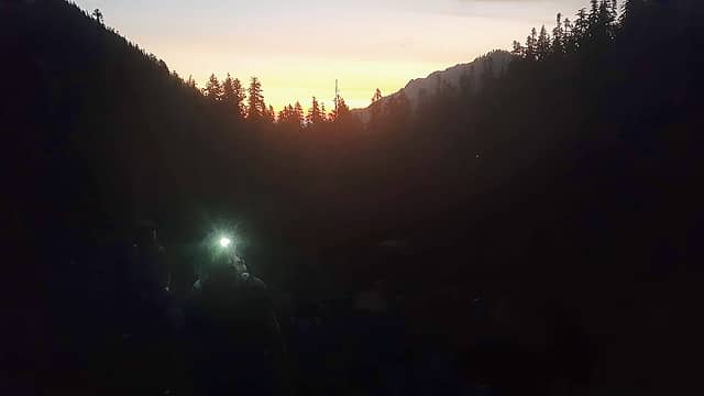
I had been wanting to bag Constance for a few years now and after seeing Aaron's(awilsondc) TR from last year I figured now was a good a time as ever!! I'll spare all the details as he did a phenomenal job already describing the way!  The route was the east route via Cunningham pass. What always shied me away from Constance was the road walk. Than I read Aaron's report and before then I never even knew it was an option. Thank you kind sir we had no route finding issues at all, thank god! The route was the east route via Cunningham pass. What always shied me away from Constance was the road walk. Than I read Aaron's report and before then I never even knew it was an option. Thank you kind sir we had no route finding issues at all, thank god!  My partners in tow would be Bryan and Hans, surprisingly they didnt hesitate to jump on board! My partners in tow would be Bryan and Hans, surprisingly they didnt hesitate to jump on board!  We knew it would be a long day and it seemed fitting, with Jake being gone I wanted to just grind something out for a while. We knew it would be a long day and it seemed fitting, with Jake being gone I wanted to just grind something out for a while.  So I picked up the boys and we made our way to the tunnel creek trail around 4am and began our journey shortly after. Didn't see another soul all day not even in the parking lot. We made quick time up to April basin, I think that's what it is called, and soon after slogged our way up to Cunningham pass. This whole little area is pretty badass, cool little basin down low and the pass up high. Sweet little corner of the olys! So I picked up the boys and we made our way to the tunnel creek trail around 4am and began our journey shortly after. Didn't see another soul all day not even in the parking lot. We made quick time up to April basin, I think that's what it is called, and soon after slogged our way up to Cunningham pass. This whole little area is pretty badass, cool little basin down low and the pass up high. Sweet little corner of the olys!
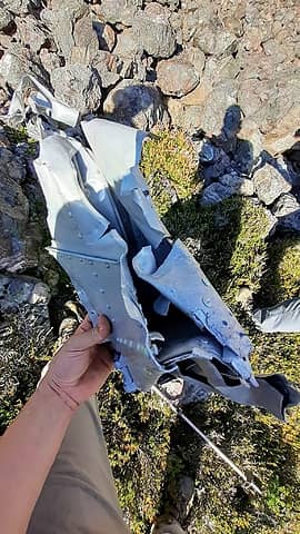
 first light 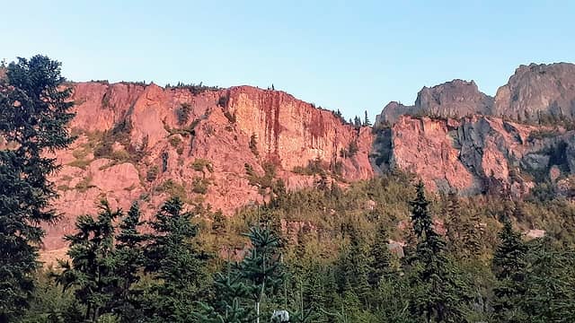 red light on the walls 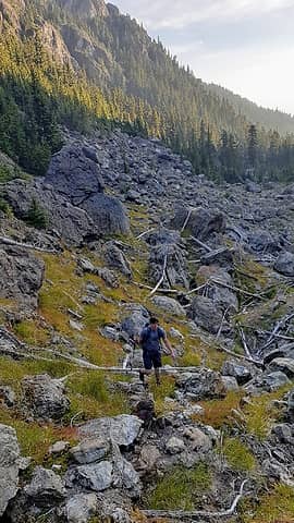 the 2nd boulder field 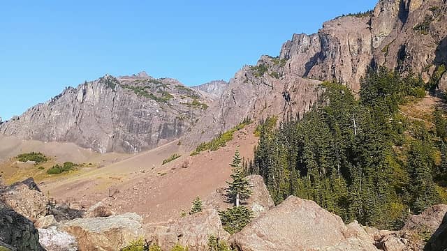 scree slope leading up to Cunningham pass 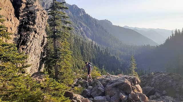 bryan comin up last boulder field 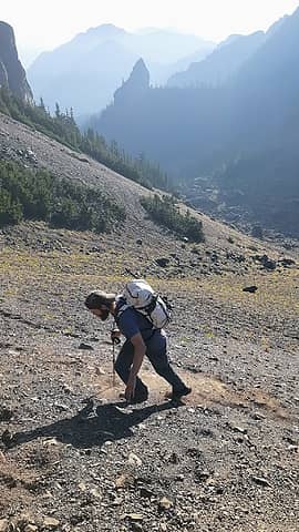 scree, Hans, the Nun 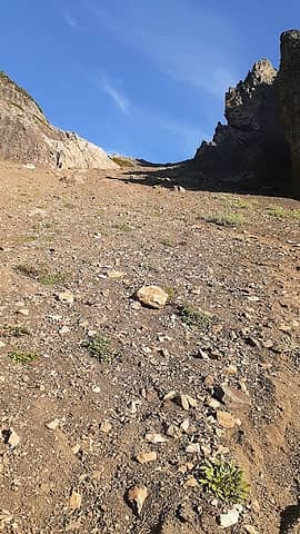 the pass 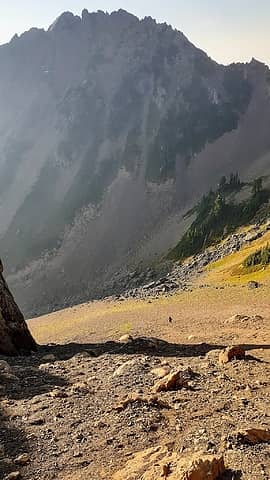 Bryan and April peak 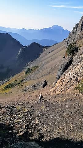 Hans gettin some choss 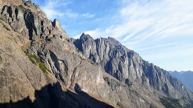 Constance proper from pass 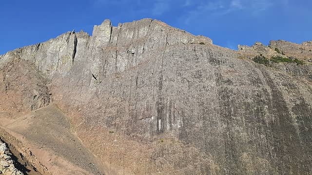 big wall immediately west of pass 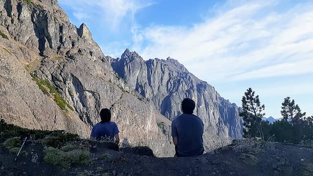 well let's go get this over with  On the other hand we were demoralized because we could see how much further we had to go!! On the other hand we were demoralized because we could see how much further we had to go!!  Well sh## let's get it over with. We dropped N 400ft or so to get over to our scree slope that would lead upwards W about 1000ft to link up with the regular route. On the way we ran across the 1941 B18 plane wreckage, so f### gnarly, RIP soldiers. The climbing became an all out scree slog, luckily the smoke wasn't bad and the temps were alright too. I found that when the scree got nasty I would stick to the rock walls and it would be more solid there. When we joined the standard route we made the first notch and were still astounded at how far away we still were. Well sh## let's get it over with. We dropped N 400ft or so to get over to our scree slope that would lead upwards W about 1000ft to link up with the regular route. On the way we ran across the 1941 B18 plane wreckage, so f### gnarly, RIP soldiers. The climbing became an all out scree slog, luckily the smoke wasn't bad and the temps were alright too. I found that when the scree got nasty I would stick to the rock walls and it would be more solid there. When we joined the standard route we made the first notch and were still astounded at how far away we still were.  The route ahead looked intimidating but we knew that there was a way. I had a lot of fun, there were many ups and downs with plenty of route finding! The climbing was fun too, exposed in places and sick views!! We chose the terrible traverse which had no snow to contend with and from there the key ledge was like a walk in the park!! Actually there is quite a long ledge system that traverses the upper part of the mountain and spits you out right under the summit formation. It's crazy that it's just naturally there! Once off the key ledge we aimed towards the east ridge and ascended that to gain the summit proper! The route ahead looked intimidating but we knew that there was a way. I had a lot of fun, there were many ups and downs with plenty of route finding! The climbing was fun too, exposed in places and sick views!! We chose the terrible traverse which had no snow to contend with and from there the key ledge was like a walk in the park!! Actually there is quite a long ledge system that traverses the upper part of the mountain and spits you out right under the summit formation. It's crazy that it's just naturally there! Once off the key ledge we aimed towards the east ridge and ascended that to gain the summit proper!
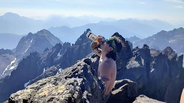
 wreckage 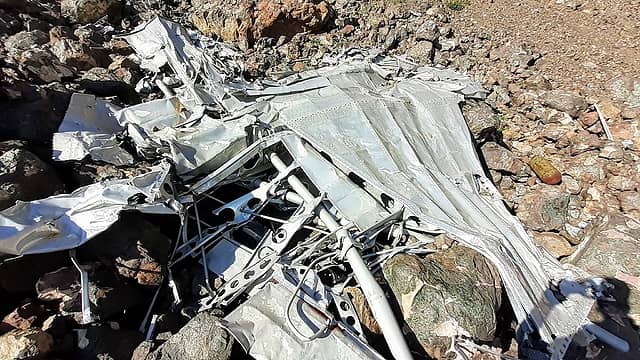 wing section 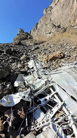 debris field 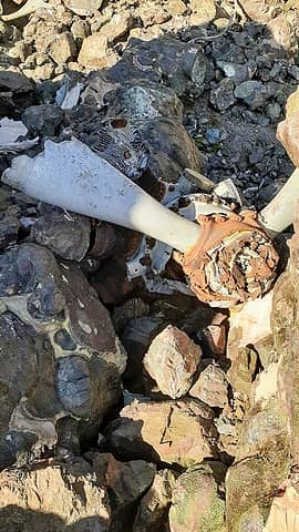 prop 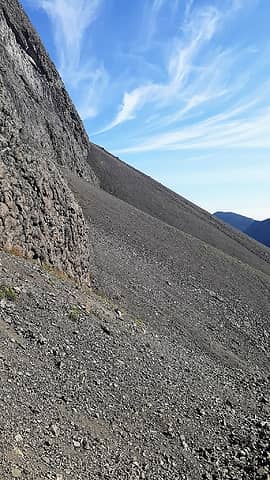 choss slope of hell 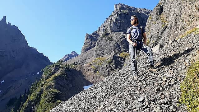 poser lol 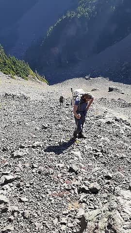 chossy 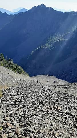 more choss 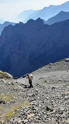 choss again 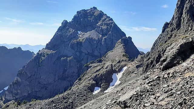 pt harrah 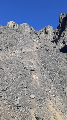 choss up to the first notch 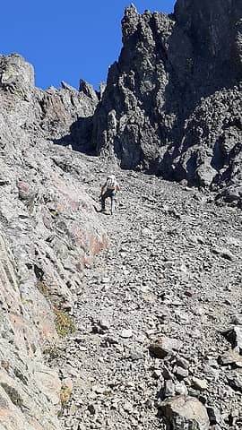 Hans leads towards notch 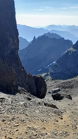 Bryan down low 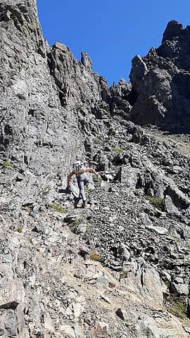 almost to the notch 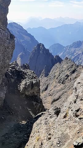 S from notch 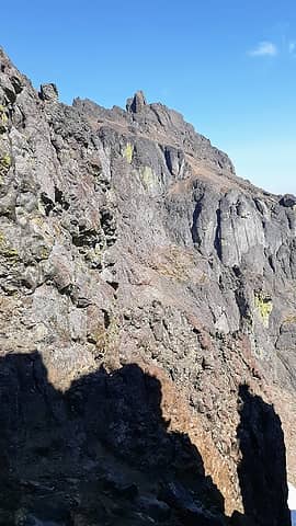 Constance from notch 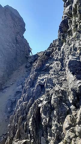 Hans in notch 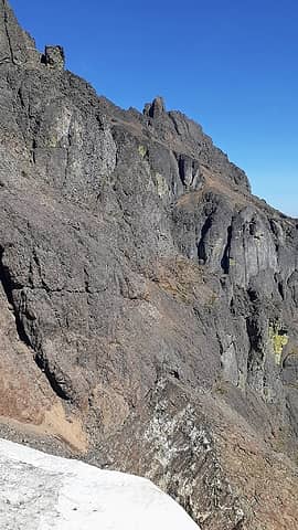 closer 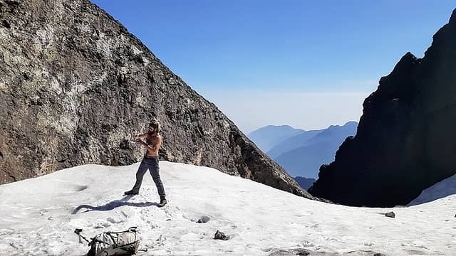 water/snow 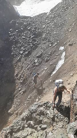 crossing a gully to get to terrible traverse 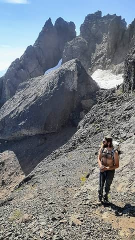 Hans and a goat under the big rock 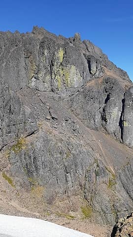 key ledge from top of terrible traverse 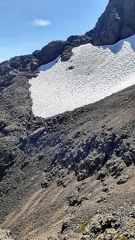 Bryan on TT 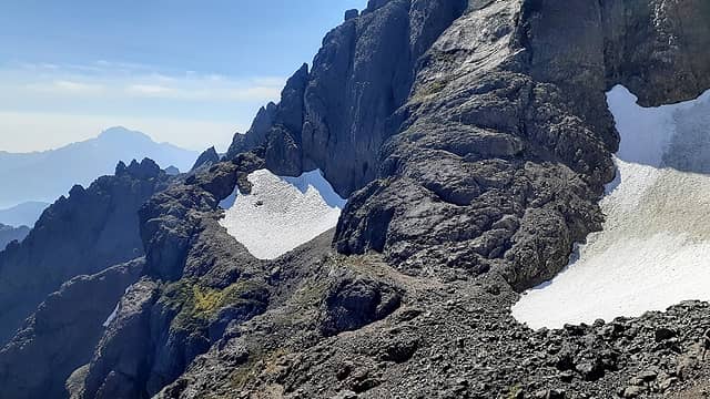 lookin back at the TT 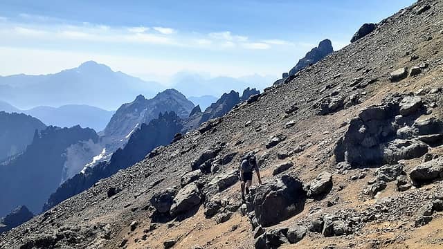 chossy slopes under the summit formation 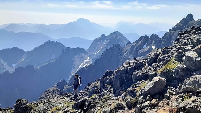 bewilderment 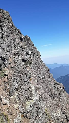 Hans getting to the east ridge 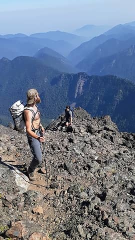 up the east ridge 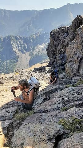 slabs and cracks toward the top 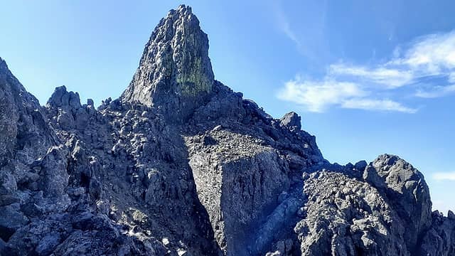 finally there she is! 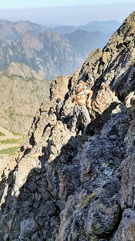 oh damnnnn 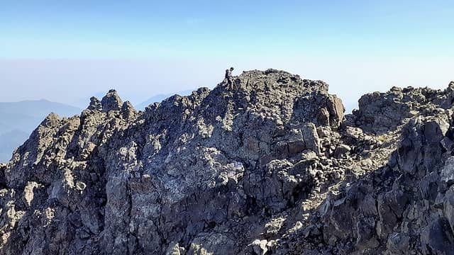 knifey traverse 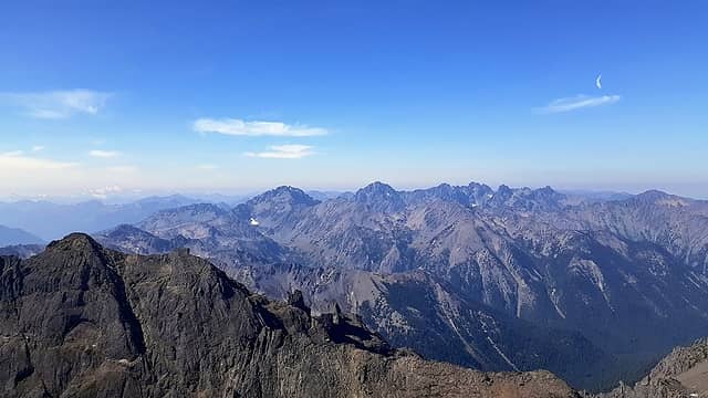 royal basin, Olympus, and others  We were all glad to get this old notch in the belt, this route was a suck fest lol! We departed the summit at 315pm and made our way back across the upper traverse. The scree slopes kicked ass going down and we made decent time. Another note is that there is not much water on route above 4200ft. There are snow patches up high though, that's what we used lol. We made it back to the car at 930pm. Another great day to be alive! I love that I can look at Constance now from across the water and say I've been there! Bout damn time lol! Cheers to all!! We were all glad to get this old notch in the belt, this route was a suck fest lol! We departed the summit at 315pm and made our way back across the upper traverse. The scree slopes kicked ass going down and we made decent time. Another note is that there is not much water on route above 4200ft. There are snow patches up high though, that's what we used lol. We made it back to the car at 930pm. Another great day to be alive! I love that I can look at Constance now from across the water and say I've been there! Bout damn time lol! Cheers to all!!
 cheers Jake!! 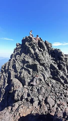 boys in their element 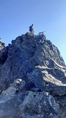 downclimb 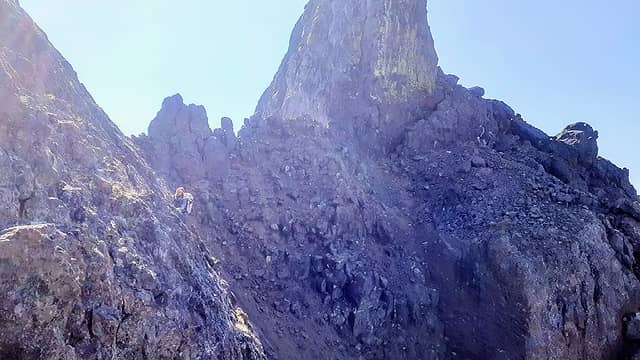 gettin it 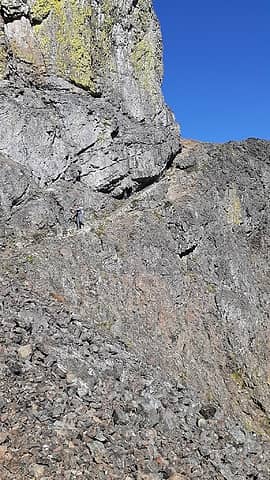 key ledges descent 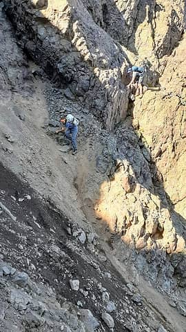 scketch gully crossing 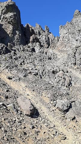 the last bit of the upper reaches 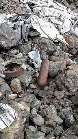 wreckage again 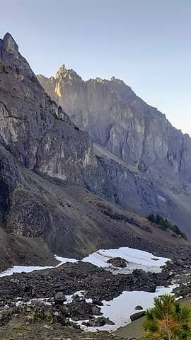 last look 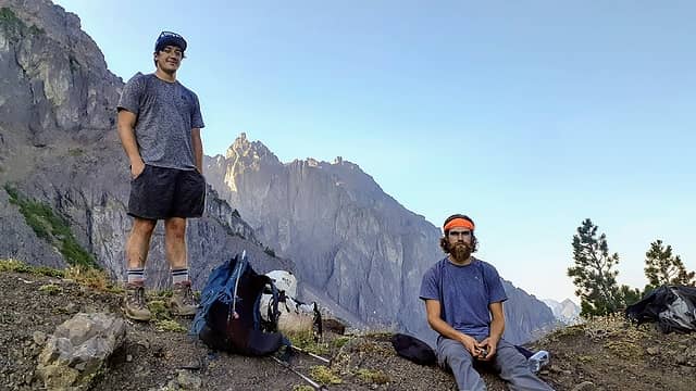 we came, we saw, we got smoked!
I dont know whats gonna happen, but I wanna have my kicks before the whole shithouse goes up in flames-Mr Mojo Risin
I dont know whats gonna happen, but I wanna have my kicks before the whole shithouse goes up in flames-Mr Mojo Risin
|
| Back to top |
  
|
|
IanB
Vegetable Belayer

Joined: 21 Jul 2010
Posts: 1062 | TRs | Pics
Location: gone whuljin' |
|
IanB
Vegetable Belayer
|
Thu Sep 17, 2020 11:39 pm |
|
|
Congrats on getting this one! Brings back memories of being up there in September. I know what you mean - I looked at it for a few years before making it to the top. Great photos!
"Forget gaining a little knowledge about a lot and strive to learn a lot about a little." - Harvey Manning
"Forget gaining a little knowledge about a lot and strive to learn a lot about a little." - Harvey Manning
|
| Back to top |
|
|
Gimpilator
infinity/21M

Joined: 12 Oct 2006
Posts: 1684 | TRs | Pics
Location: Edmonds, WA |
Good work gents! That's one of the best in the range.
|
| Back to top |
|
|
Midnight Slogger
'Schwack Job

Joined: 04 Aug 2017
Posts: 96 | TRs | Pics
Location: Greater Cascadia |
I love the report, Ozzy, thanks for posting. Despite the choss morass I'm intrigued by your and awilsondc's reports. I wonder if anyone has done both this route and the standard from Avalanche Canyon and could weigh-in on their preference.
Cheers!
|
| Back to top |
|
|
Redwic
Unlisted Free Agent

Joined: 23 Feb 2009
Posts: 3292 | TRs | Pics
Location: Going to the Prom(inence) |
|
Redwic
Unlisted Free Agent
|
Sun Sep 20, 2020 1:32 am |
|
|
60 pounds lighter but not 60 points brighter.
|
| Back to top |
|
|
Nancyann
Member

Joined: 28 Jul 2013
Posts: 2322 | TRs | Pics
Location: Sultan Basin |
|
Nancyann
Member
|
Sun Sep 20, 2020 1:54 pm |
|
|
That looks like a good one to get for Jake. Nice work, Ozzy. I always enjoy reading your trip reports!
|
| Back to top |
|
|
raising3hikers
Member
Joined: 21 Sep 2007
Posts: 2344 | TRs | Pics
Location: Edmonds, Wa |
Interesting route choice, thanks for sharing! I had to go back and look at awilson's TR as well.
Both helpful reports, nice to have multiple options for a peak
|
| Back to top |
|
|
NBL
West Seattle Based

Joined: 08 Sep 2020
Posts: 44 | TRs | Pics
Location: 98126 |
|
NBL
West Seattle Based
|
Mon Sep 21, 2020 10:00 am |
|
|
Righteous. Constance is so high on my list and I'm bummed I didn't make it over this year. Didn't even know of this approach route and thought the only way was the long walk and the root climb up to the lake.
Looks like a beautiful crumbly choss pile
I like watching the snow on the TT shrink throughout the summer from West Seattle.
|
| Back to top |
|
|
puzzlr
Mid Fork Rocks

Joined: 13 Feb 2007
Posts: 7220 | TRs | Pics
Location: Stuck in the middle |
|
puzzlr
Mid Fork Rocks
|
Mon Sep 21, 2020 6:10 pm |
|
|
Getting to Constance summit it a big deal no matter the route. Congrats -- you'll never have to do it again
|
| Back to top |
|
|
|
|


