| Previous :: Next Topic |
| Author |
Message |
jdk610
Member


Joined: 21 Aug 2012
Posts: 330 | TRs | Pics
|
|
jdk610
Member
|
 Wed Aug 14, 2019 9:29 am |
|
|
Last week I "thru-hiked" from the Kelley Creek/Martin Creek trailhead up to Johnson Mountain, and then out to the Johnson Ridge trailhead. From there I biked back to my starting point, creating a fun bike/foot loop.
I'm really loving this type of route these days! Traveling across the landscape using multiple forms of human-powered transport. Connecting routes/trails in ways that haven't been done before (at least not recently). Some off-trail travel/navigation (although not quite as much as I'd hoped). Views!! Big trees!! Bike section is at least 50% off-pavement. Long enough that I end the day feeling tired but not shattered. Home in time to tuck in my daughter. And icing on the cake for this route: they even spelled Kelley correctly  The bike section was a known quantity, and basically just a way to shuttle myself back to my starting point while exploring some new-to-me gravel roads and enjoying some nice scenery. It was a great way to end the day!
The foot section was the more "exploratory" part of the route. Trip reports and maps provided mixed information about this section. I knew that there would be a well-established trail from Johnson Mountain west. I also knew there would be a reasonable trail from the Iron Goat/Martin Creek trailhead up the Kelley Creek drainage at least a couple miles. It was the miles in between that were uncertain. The new Kelley Creek trail has not been officially connected to the old Kelley Creek trail. I found a couple of good trip reports, but they were from years ago (2005 and 2015) and did not describe going all the way through from trailhead to trailhead. Just recently, one group did go all the way through, but they bushwhacked down from Johnson Ridge to Kelley Creek, with the key word being "bushwhacked." They hadn't successfully found the trail leading off of Johnson Ridge, and fought a lot of brush and talus until they finally got back on trail below Captain Point. While I admired their tenacity, I had a hunch there was an easier way.
It turns out that if you start at the Kelley Creek trailhead and make your way north to Johnson Ridge, the route is relatively easy indeed. I was surprised to find that as soon as the Kelley Creek trail starts to fade even slightly, flagging begins. There were a few times I had to stop and look for the next flag, but for the most part, the flagging leads you right up the Kelley Creek drainage to the Captain Point ridgeline, on mostly good tread the entire time! It gets a little narrow and brushy in places, and could use some maintenance, but the tread is almost always there, and when the tread disappears the flagging picks up.
On the one hand, I was a little disappointed at how much flagging was up there, and that it no longer felt like an "exploratory mission." On the other hand, the mosquitoes were terrible on the ridge between Captain Point and Johnson Mountain, and it sure was nice to just keep moving from flag to flag, without stopping frequently to check a map!
Kelley Creek trail - current conditions:
The first couple of junctions from the Iron Goat/Martin Creek trailhead are clearly marked - just follow the signs directing you to Kelley Creek. It is a little brushy at first but quickly clears up. You reach a scenic bridged crossing of Martin Creek at 0.5 miles. By this point, the brush is gone and if anything, the trail almost seems to improve as you go along, widening and remaining clear. Large trees line the trail, and you soon enter Wild Sky wilderness.
The bike section was a known quantity, and basically just a way to shuttle myself back to my starting point while exploring some new-to-me gravel roads and enjoying some nice scenery. It was a great way to end the day!
The foot section was the more "exploratory" part of the route. Trip reports and maps provided mixed information about this section. I knew that there would be a well-established trail from Johnson Mountain west. I also knew there would be a reasonable trail from the Iron Goat/Martin Creek trailhead up the Kelley Creek drainage at least a couple miles. It was the miles in between that were uncertain. The new Kelley Creek trail has not been officially connected to the old Kelley Creek trail. I found a couple of good trip reports, but they were from years ago (2005 and 2015) and did not describe going all the way through from trailhead to trailhead. Just recently, one group did go all the way through, but they bushwhacked down from Johnson Ridge to Kelley Creek, with the key word being "bushwhacked." They hadn't successfully found the trail leading off of Johnson Ridge, and fought a lot of brush and talus until they finally got back on trail below Captain Point. While I admired their tenacity, I had a hunch there was an easier way.
It turns out that if you start at the Kelley Creek trailhead and make your way north to Johnson Ridge, the route is relatively easy indeed. I was surprised to find that as soon as the Kelley Creek trail starts to fade even slightly, flagging begins. There were a few times I had to stop and look for the next flag, but for the most part, the flagging leads you right up the Kelley Creek drainage to the Captain Point ridgeline, on mostly good tread the entire time! It gets a little narrow and brushy in places, and could use some maintenance, but the tread is almost always there, and when the tread disappears the flagging picks up.
On the one hand, I was a little disappointed at how much flagging was up there, and that it no longer felt like an "exploratory mission." On the other hand, the mosquitoes were terrible on the ridge between Captain Point and Johnson Mountain, and it sure was nice to just keep moving from flag to flag, without stopping frequently to check a map!
Kelley Creek trail - current conditions:
The first couple of junctions from the Iron Goat/Martin Creek trailhead are clearly marked - just follow the signs directing you to Kelley Creek. It is a little brushy at first but quickly clears up. You reach a scenic bridged crossing of Martin Creek at 0.5 miles. By this point, the brush is gone and if anything, the trail almost seems to improve as you go along, widening and remaining clear. Large trees line the trail, and you soon enter Wild Sky wilderness.
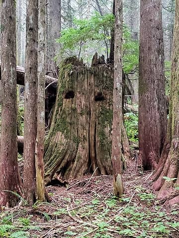 Wink wink 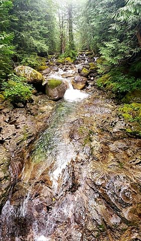 From the bridge across Martin Creek 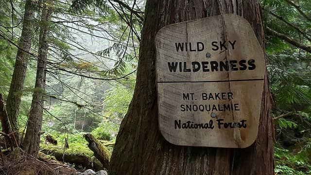 Best-named wilderness 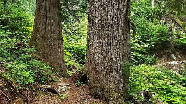 Big trees 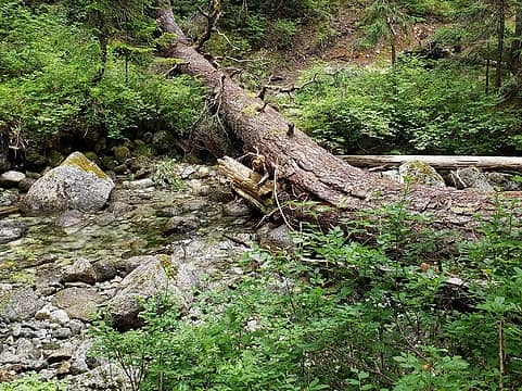 Kelley Creek crossing 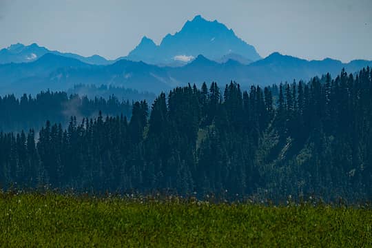 Mt Stuart 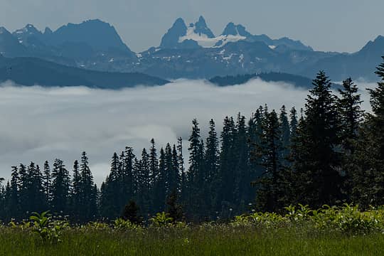 Joan Lake 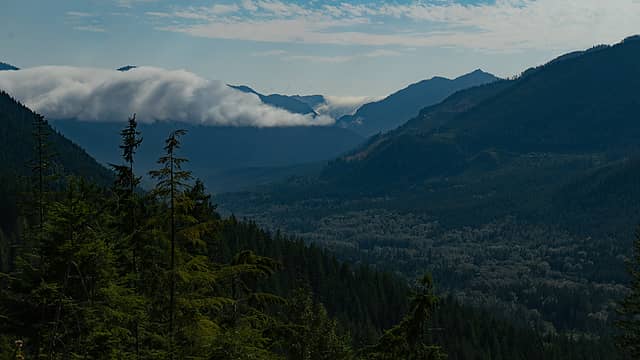 Beckler River Valley (from the bike) 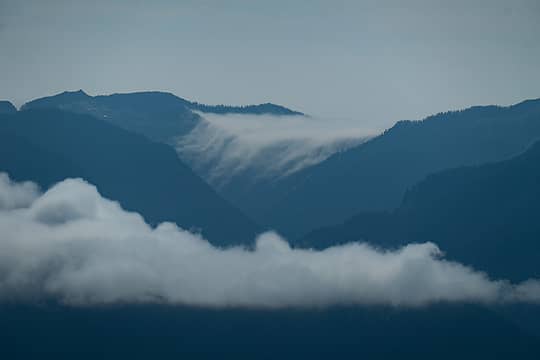 I love cloud pour-overs! 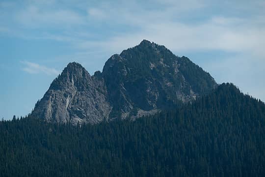 Mt Fernow (from the bike) 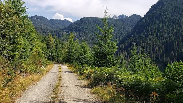 Gravelly goodness 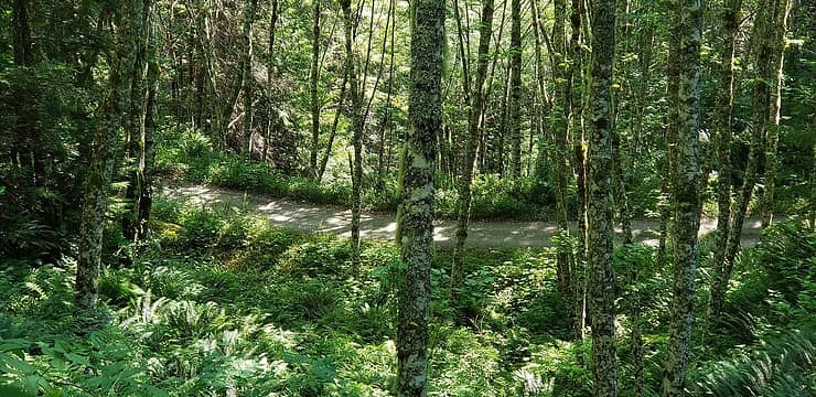 NF-6520 through the trees 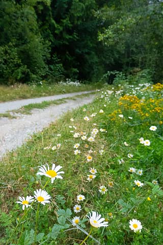 Wildflowers on NF-6520 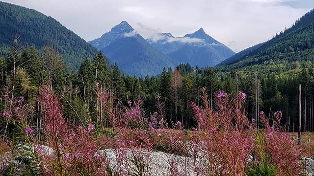 Bald Eagle and Silver Eagle Peaks 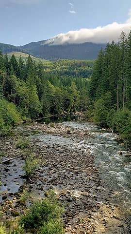 Skykomish River along Hwy 2 - I'm usually zipping by in my car and miss this view entirely 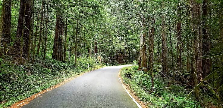 Old Cascade Highway
|
| Back to top |
  
|
|
Waterman
Member

Joined: 21 Mar 2015
Posts: 590 | TRs | Pics
Location: Big Snow Quadrangle |
|
Waterman
Member
|
Wed Aug 14, 2019 9:44 am |
|
|
There was a wind event some years ago that left a tremendous amount of trees blown over the Kelley creek trail in one area. Did that get logged out?
Two roads diverged in a wood, and I,I took the one less traveled by. And that has made all the difference.
Robert Frost
Two roads diverged in a wood, and I,I took the one less traveled by. And that has made all the difference.
Robert Frost
|
| Back to top |
|
|
jdk610
Member
Joined: 21 Aug 2012
Posts: 330 | TRs | Pics
|
|
jdk610
Member
|
Wed Aug 14, 2019 10:47 am |
|
|
I'm guessing you're talking about the area I assumed was an old landslide. Yes, it looked like it got logged out, and perhaps even a couple years ago (not all the cuts looked super fresh)
|
| Back to top |
|
|
Arthur
Member

Joined: 15 Aug 2011
Posts: 76 | TRs | Pics
|
|
Arthur
Member
|
Wed Aug 14, 2019 10:54 am |
|
|
Most of the logs are cut if you stay on the trail. There are a couple of switchbacks and upturned rootballs where we lost the trail temporarily.
A few more details and links to Norms photo stories are available
https://www.nwhikers.net/forums/viewtopic.php?p=1161811#1161811
As the OP said, the route is currently over flagged. Well be removing those after consultation with the SRD.
Arthur
|
| Back to top |
|
|
|
|
You cannot post new topics in this forum
You cannot reply to topics in this forum
You cannot edit your posts in this forum
You cannot delete your posts in this forum
You cannot vote in polls in this forum
|
Disclosure: As an Amazon Associate NWHikers.net earns from qualifying purchases when you use our link(s). |


