| Previous :: Next Topic |
| Author |
Message |
rubywrangler
Member


Joined: 04 Aug 2015
Posts: 511 | TRs | Pics
|
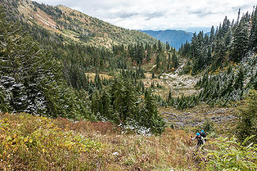
NOAA was predicting partly to mostly sunny weather in the southeastern Olympics last weekend so I recruited Said for a traverse between lakes with plans to climb Mt Stone and Mt Bretherton at either end. The forecast for Saturday was perfect and we were able to climb Stone, but we woke up to clouds and snow on Sunday, so we slept in and bailed on Bretherton.
It was cloudy and drizzly when we left the car on Saturday morning but clearing when we reached Lake of the Angels. We hung out at the lake for awhile, hiding from biting wind and waiting for the sun to fully emerge, then followed the bootpath up to Mt. Stone.
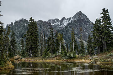
 looking back at swampy meadow below LotA 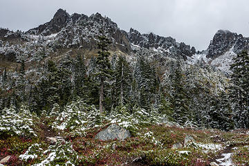 mt stone 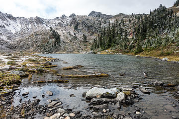 lake of the angels 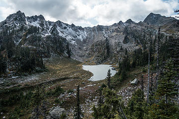 looking back on LotA 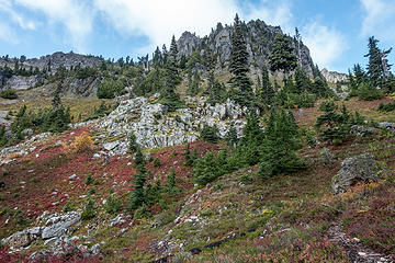 blue sky! 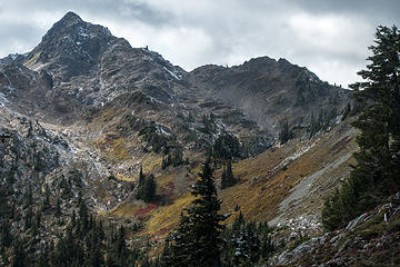 skokomish 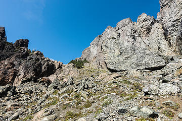 climbing up to the saddle 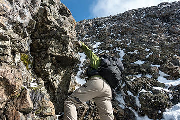 negotiating the snowy gully 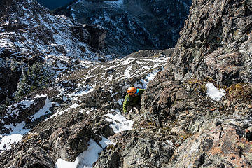 climbing up the 20' class 3 crack 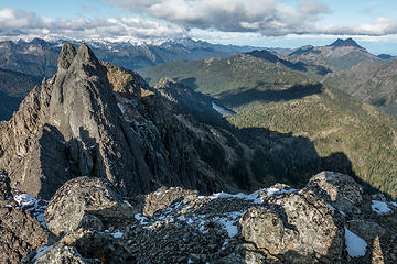 summit view NE to scout lake + the brothers 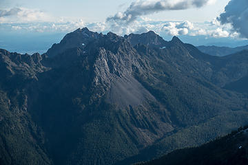 washington pershing ellinor 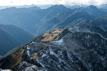 pretty light on pretty slope  stone ponds - we camped near the upper pond 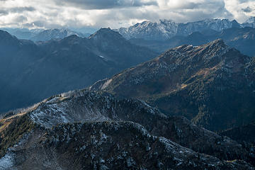 mt. hopper looks like a nice walk 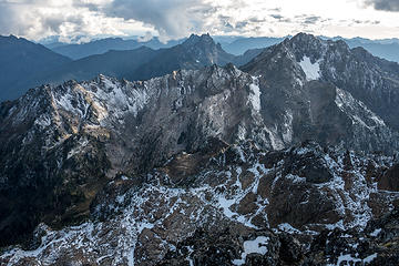 lincoln, cruiser, skokomish  We retraced our steps to pick up our stashed overnight gear at 5600', then climbed up to St. Peter's gate and descended the solid ice "snowfield" to the northeast - was very glad to have crampons. The sun had set by this time so we slowly worked our way down the moraine to the uppermost Stone pond by headlamp to find a campsite. We retraced our steps to pick up our stashed overnight gear at 5600', then climbed up to St. Peter's gate and descended the solid ice "snowfield" to the northeast - was very glad to have crampons. The sun had set by this time so we slowly worked our way down the moraine to the uppermost Stone pond by headlamp to find a campsite.
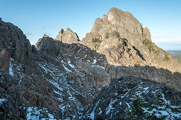 looking back to stone's summit block 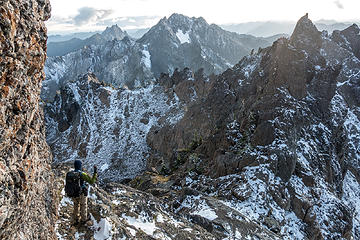 things are getting golden 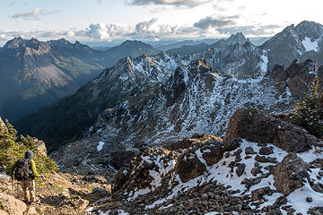 descending 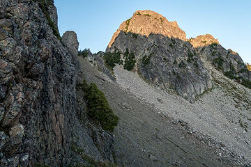 heading up to st peter's gate 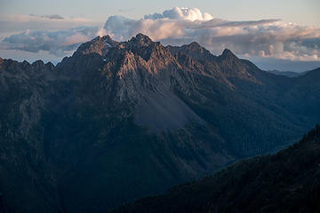 sunset 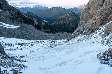 stone icefield 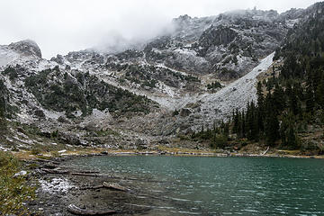 upper stone pond, and our descent route from st. peter's gate 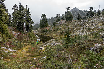 lots of tarns and meadows along the way 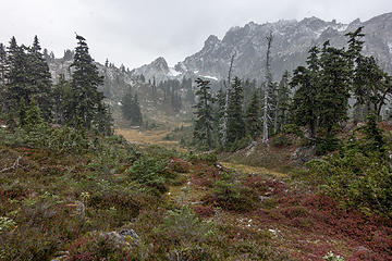 tarns and meadows along the way 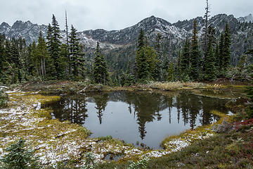 tarns and meadows along the way 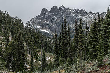 mt. stone 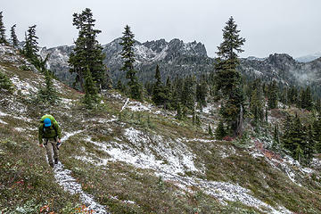 about to crest the ridge  ). On the hike down I entertained myself by taking photos of fungi, and thinking about what I would eat once I got to Three Magnets in Olympia (fried chicken blt sliders, yum). ). On the hike down I entertained myself by taking photos of fungi, and thinking about what I would eat once I got to Three Magnets in Olympia (fried chicken blt sliders, yum).
 the brothers 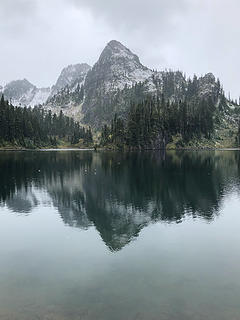 upper lena reflection 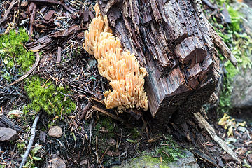 shrooms 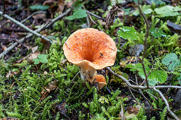 shrooms 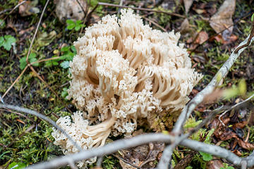 shrooms 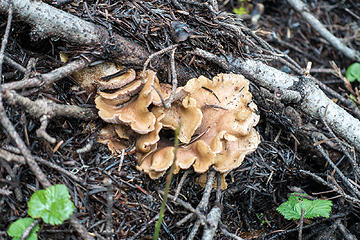 shrooms 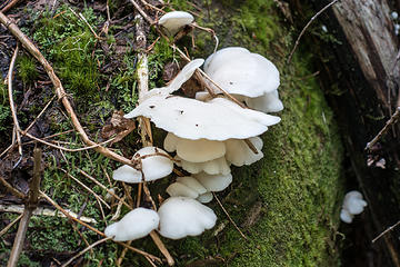 shrooms 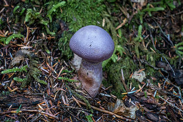 shrooms 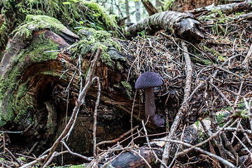 shrooms
|
| Back to top |
  
|
|
IanB
Vegetable Belayer

Joined: 21 Jul 2010
Posts: 1062 | TRs | Pics
Location: gone whuljin' |
|
IanB
Vegetable Belayer
|
 Wed Oct 02, 2019 7:51 pm |
|
|
Exceptional photos! Spectacular this time of year!
"Forget gaining a little knowledge about a lot and strive to learn a lot about a little." - Harvey Manning
"Forget gaining a little knowledge about a lot and strive to learn a lot about a little." - Harvey Manning
|
| Back to top |
|
|
RAW-dad
Member

Joined: 07 Jul 2017
Posts: 119 | TRs | Pics
Location: Oregon |
|
RAW-dad
Member
|
Wed Oct 02, 2019 9:31 pm |
|
|
Nice pics! 
|
| Back to top |
|
|
Brian R
Member

Joined: 10 Feb 2018
Posts: 501 | TRs | Pics
|
|
Brian R
Member
|
Wed Oct 02, 2019 9:36 pm |
|
|
One of my favorite trips. I've done it three times over the years--always as a day trip, stashing a bike at Putvin, then hiking Lena, Upper, Stone Ponds, LOTA, and out. Unfortunately, I've never done it when the ponds were melted out. Seeing your pictures, I'll have to go back!
|
| Back to top |
|
|
cascadetraverser
Member

Joined: 16 Sep 2007
Posts: 1407 | TRs | Pics
|
Way to persevere despite the inclement weather!
|
| Back to top |
|
|
edeezy
Member
Joined: 19 Nov 2014
Posts: 18 | TRs | Pics
|
|
edeezy
Member
|
Thu Oct 03, 2019 12:33 am |
|
|
Gotta add this to the list!
|
| Back to top |
|
|
rubywrangler
Member
Joined: 04 Aug 2015
Posts: 511 | TRs | Pics
|
Thanks, all!
Brian R, that sounds like a long day! I'm going to have to go back too - I'd like to see the Stone ponds when they're all lit up in the sun and visit that beautiful meadowy ridge to Mt. Hopper.
Does anyone know if there is a published map of ONP XC zone boundaries? I've been searching for one for awhile but haven't turned up anything yet.
|
| Back to top |
|
|
Jake Robinson
Member
Joined: 02 Aug 2016
Posts: 521 | TRs | Pics
|
Great trip and pics! And nice job getting up Stone in tricky conditions
|
| Back to top |
|
|
rubywrangler
Member
Joined: 04 Aug 2015
Posts: 511 | TRs | Pics
|
I was thinking of this one for North Cascades NP.
I think they must have something similar for ONP that just isn't public, because they always put a specific zone on the permit (e.g. for this trip my permit was for "lake of the angels to scout lake", for a previous trip to deception basin the permit was for "x-country royal basin", etc.)
It would be nice to know the boundaries of the quota areas. For this trip in particular, I was wondering if Milk lake is within the Upper Lena quota area. I asked a ranger on the phone but didn't get an answer.
|
| Back to top |
|
|
RAW-dad
Member
Joined: 07 Jul 2017
Posts: 119 | TRs | Pics
Location: Oregon |
|
RAW-dad
Member
|
Thu Oct 03, 2019 6:37 pm |
|
|
It's not clear to me that ONP has strict quota zones like NOCA and MORA (if they do, it seems to be a state secret!). I say this based on a long conversation I had with a WIC ranger this summer about some off trail camps I had planned. He seemed mostly uninterested in where I was going as long as it wasn't in Grand Valley...
|
| Back to top |
|
|
rubywrangler
Member
Joined: 04 Aug 2015
Posts: 511 | TRs | Pics
|
Ive seen that map, and its helpful for identifying which camps have quotas, but it doesnt break the backcountry into all the different zones like the one for NCNP. Thanks though!
The NPS should cross-pollinate their good ideas across parks. ONP could get a backcountry zone map and NCNP could get the ability to arrange a permit over the phone!
|
| Back to top |
|
|
|
|


