| Previous :: Next Topic |
| Author |
Message |
Matt
Tea, Earl Grey, Hot


Joined: 30 Jan 2007
Posts: 4307 | TRs | Pics
Location: Shoreline |
|
Matt
Tea, Earl Grey, Hot
|
 Sat Oct 19, 2019 11:37 pm |
|
|
Dates: October 10-11, 2019
Destination: Tatie 7386, North Tatie 7370, Syncline 7580, Cone 7405 (USGS Slate Pass)
Party: me
This was my imperial color trip of the year: azure sky, argent snow, and golden larches.
Short version:
I did a criss-crossing loop over and around peaks on the PCT south from Harts Pass to Grasshopper Pass.
Day 1: Took PCT to south col of Tatie, ascended to summit of Tatie, made side trip to North Tatie, and camped at Tatie summit.
Day 2: Descended to east col of Tatie and dropped pack, traversed over top of Syncline to Grasshopper Pass, returned to pack on PCT and continued to Tatie's south col, then traversed over Cone and back to trailhead.
Highlights: Larches in peak color. Snow bright white underfoot but shallow enough for easy walking. Beautiful calm clear evening and sunset. Very windy morning and pretty sunrise.
Bonus teaser: I later learned that I was following in the tracks of a famous mountaineer for most of the way.
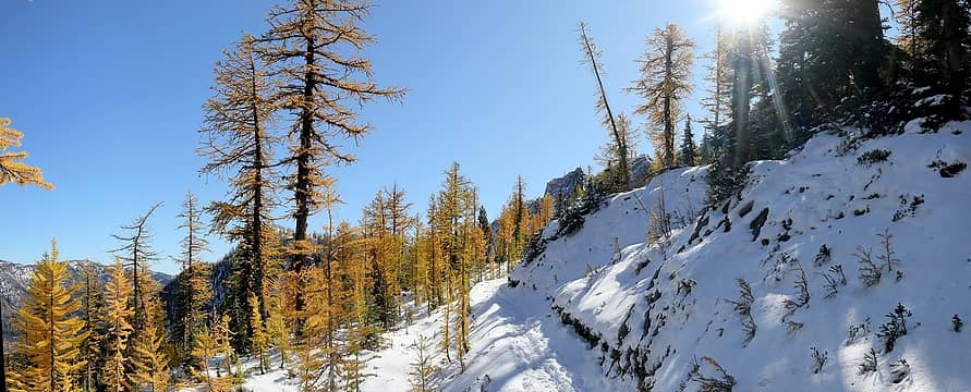 Hiking south from Brown Bear trailhead 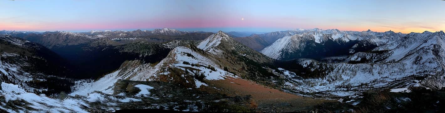 Moonrise from Tatie summit 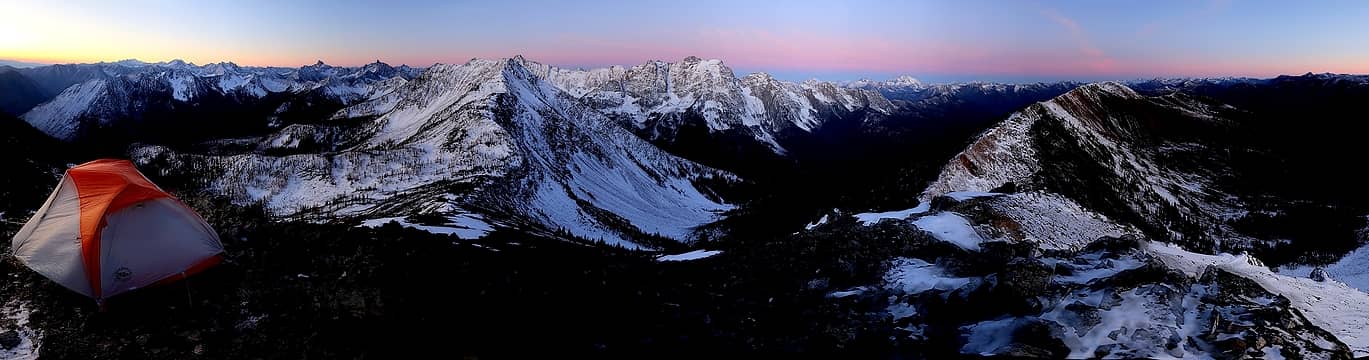 Sunrise from Tatie summit 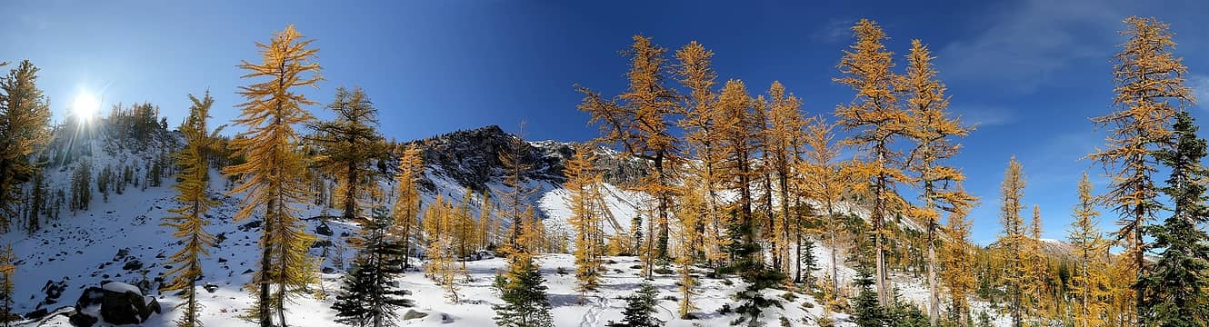 Hiking north from Grasshopper Pass 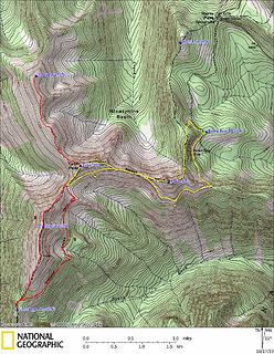 GPS Track 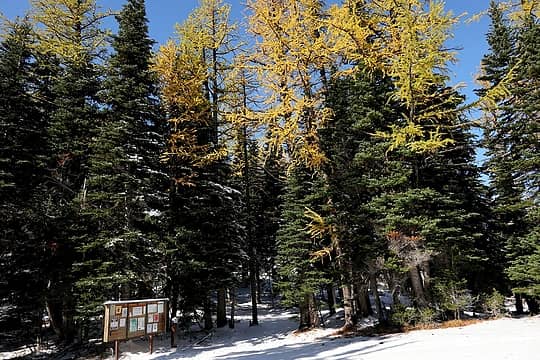 Larches above the trailhead sign 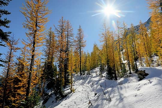 Larches & sunshine 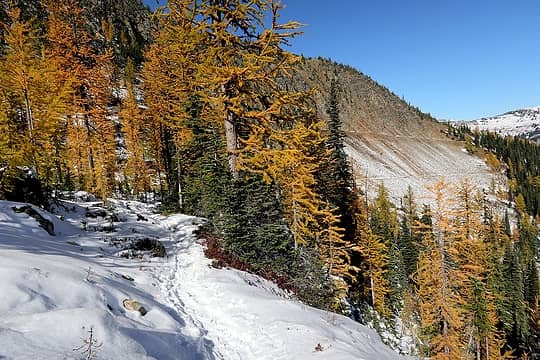 Looking back to the PCT traversing drier slopes 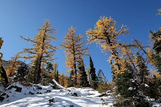 Lots of big larches 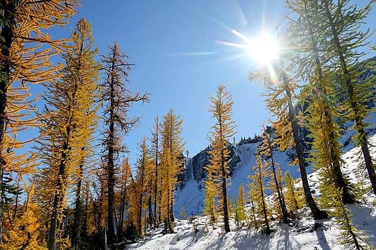 More larches & sunshine 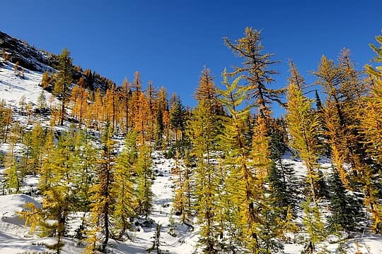 Larches of all sizes and colors 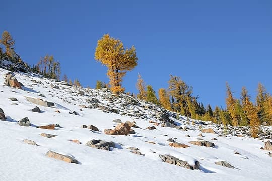 A giant larch blossom on the snow 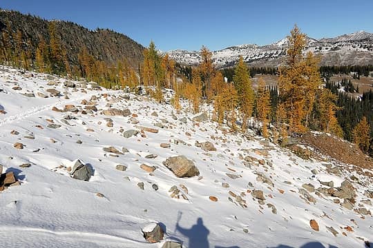 Looking back from the first corner to Harts Pass 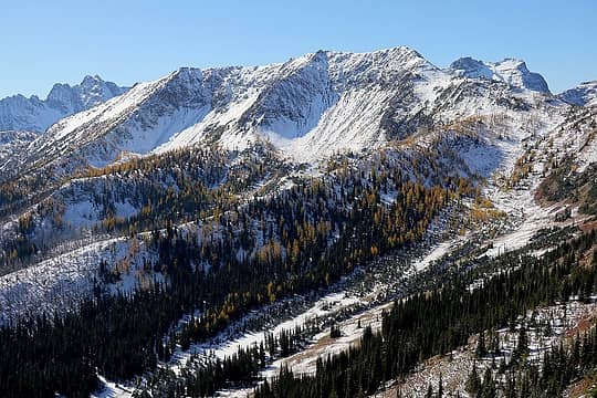 Tomorrow's destination, Syncline Mtn 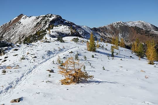 Today's destinations, Tatie and North Tatie, from the Tatie-Cone col 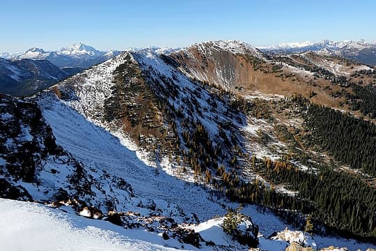 The Ridge running north from Tatie to North Tatie 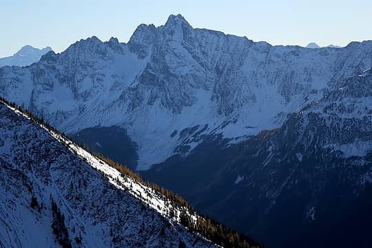 Azurite 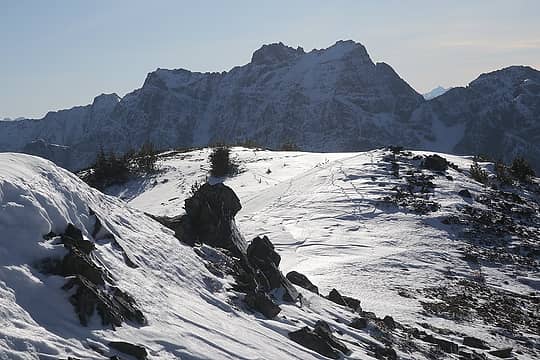 My tracks, animal tracks, and Ballard 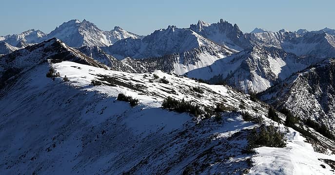 Silver Star and The Needles 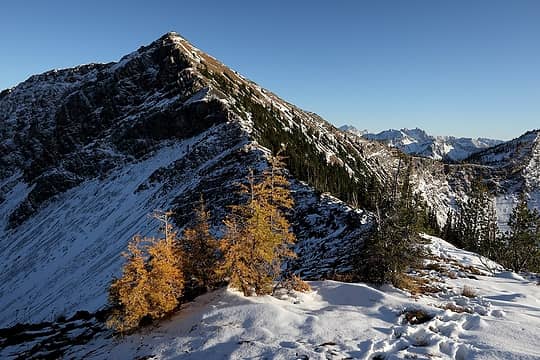 The ridge back up to Tatie 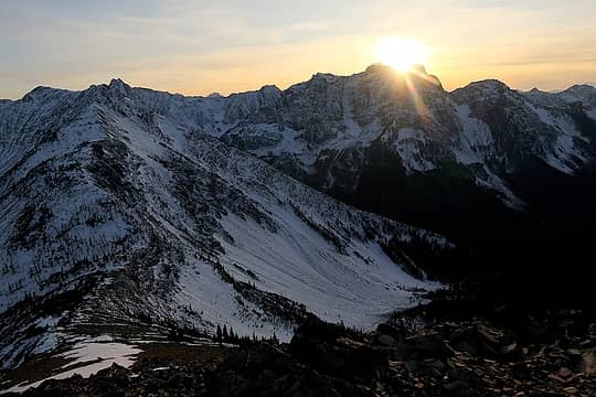 Sun setting behind Ballard 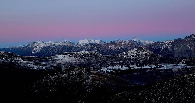 Anti-twilight arc above Osceola, Carru, Lago, Lost 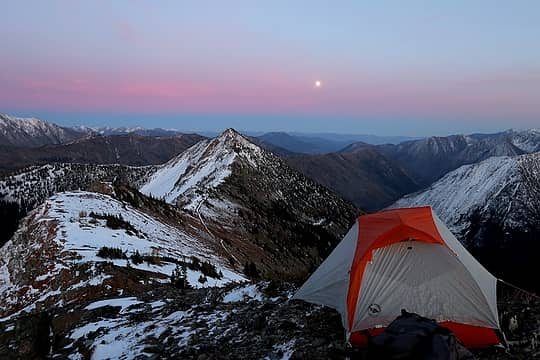 Moon rising 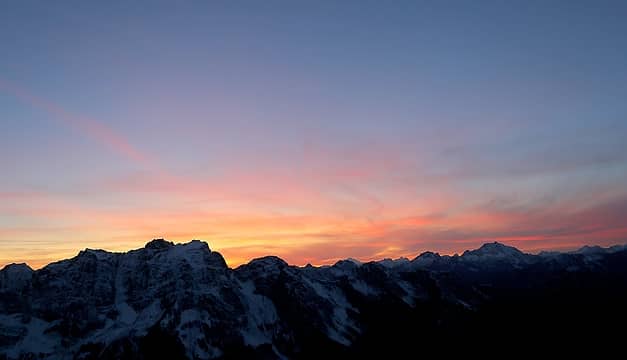 Final colors behind Ballard & Jack, 6:27pm 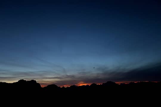 Last light behind Ballard & Jack, 6:42pm 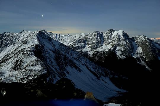 Moonlight on Syncline & Ballard, 7:40pm 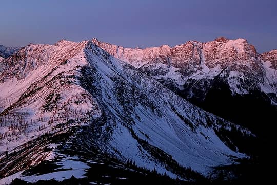 Morning glow on Syncline & Ballard, 6:48am 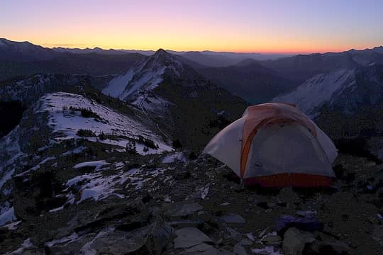 Promise of sunrise 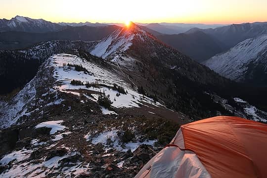 Sun rising behind Cone Mtn 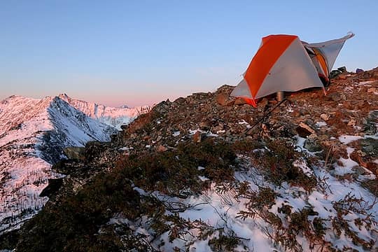 My tent waving a greating to the wind 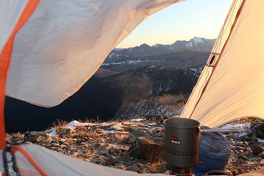 Hot tea and breakfast in the vestibule (Also, the larch-crested ridge in the background will be my exit route) 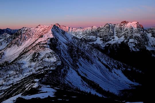 First light on Azurite & Ballard 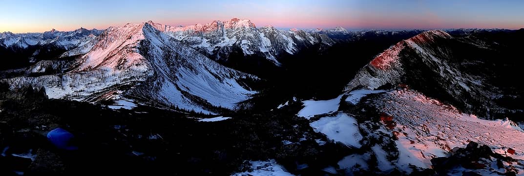 Sunrise highlighting the nearby peaks (Syncline & North Tatie) and the high crest beyond (Needles, Tower, Golden Horn, Azurite, Ballard, Crater, Jack) 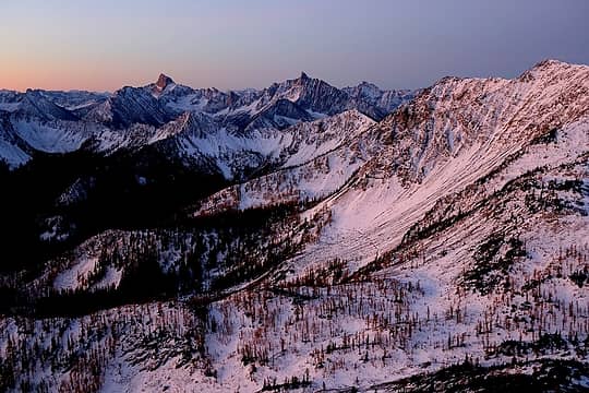 Larch basin with Tower & Golden Horn, pre-dawn, 6:53am 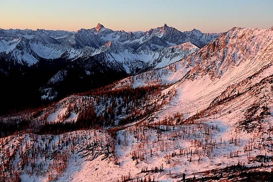 Larch basin with Tower & Golden Horn, sunrise light, 7:15am 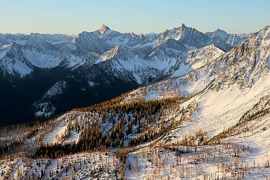 Larch basin with Tower & Golden Horn, golden light, 7:38am 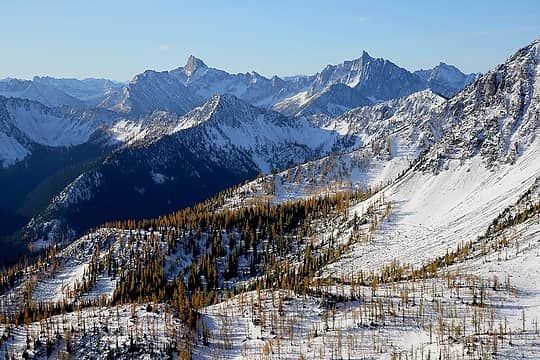 Larch basin with Tower & Golden Horn, daylight, 8:58am 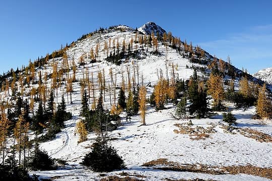 Looking up Syncline from the Tatie-Syncline col 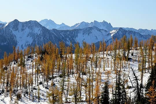 Larches along the way, with Handcock Ridge, Silver Star, and Needles 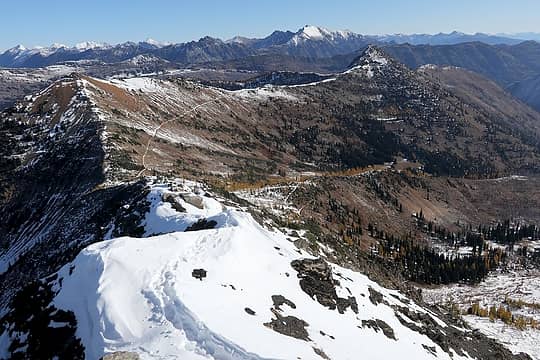 The PCT curving below Taite & Cone, with Robison beyond 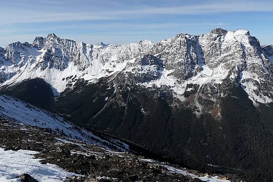 Azurite & Ballard 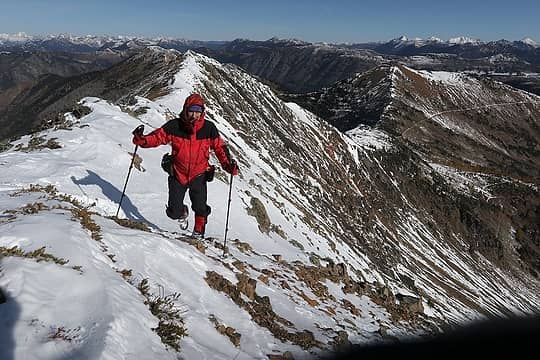 The only photo I remembered to take of myself 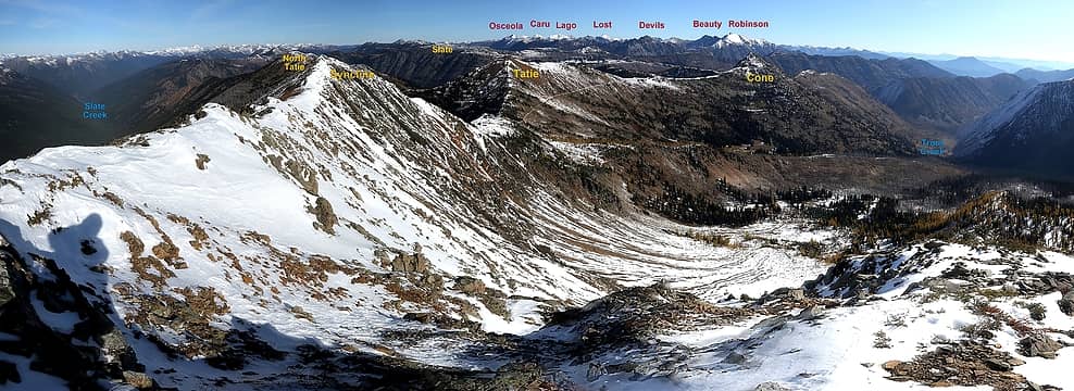 the view north from Syncline 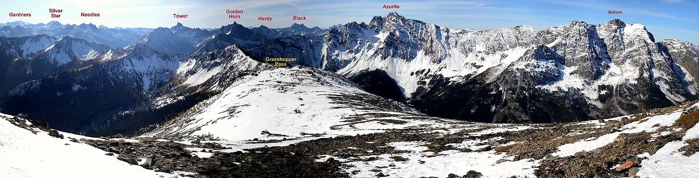 the view south from Syncline 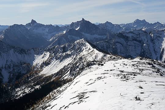 The ridge down to Grasshopper Pass, and looking up to Tower, Golden Horn, Hardy, & Black 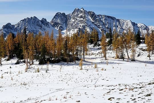 Grasshopper Pass & Azurite 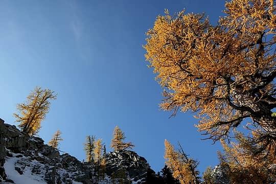 Larches all over the sky 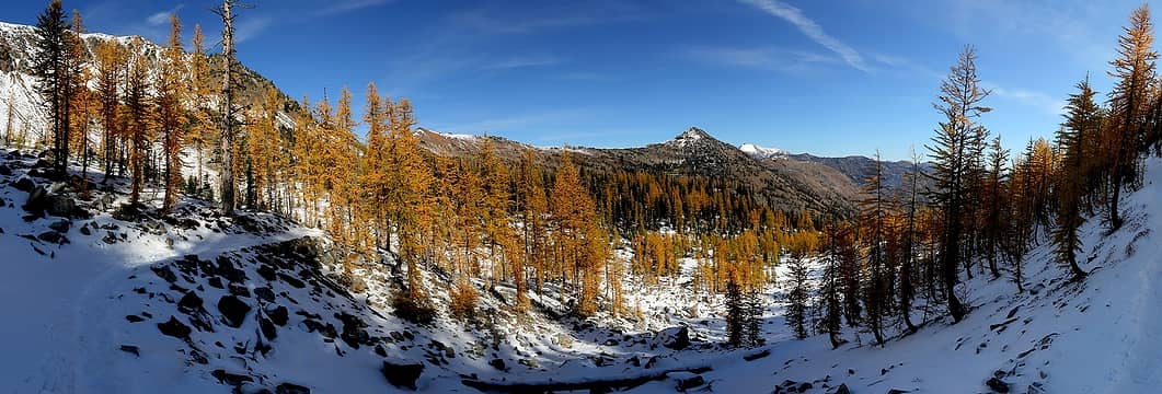 Larches along the trail traversing back toward Tatie & Cone 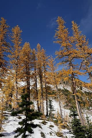 Tall larches along the trail 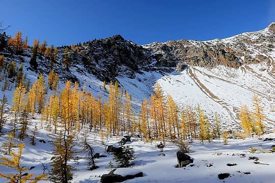 Larchy basin 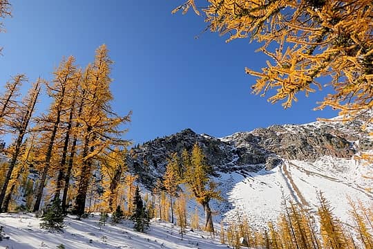 And more larches 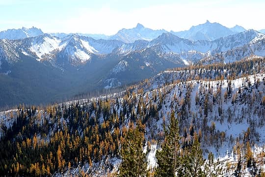 Ridge up on ridge of larches and peaks 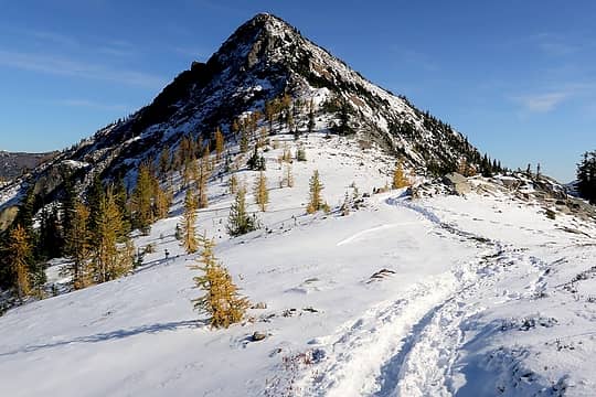 Looking up Cone from the Tatie-Cone col 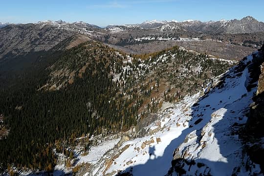 My shadow ascending Cone 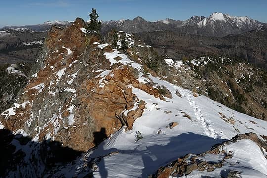 My shadow passing a rock outcrop on the far side of Cone 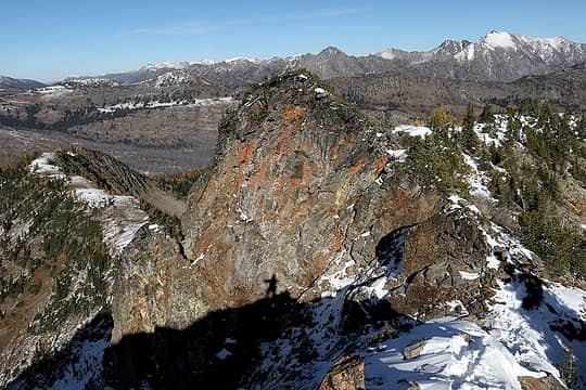 My shadow passing another rocky outcrop 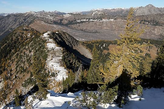 My shadow on a larch, with the inviting exiting pathway a few hundred feet below 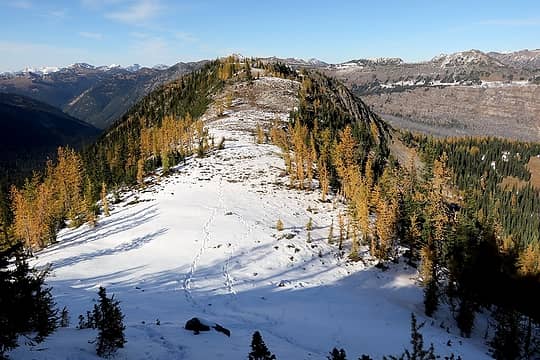 Entering the wide ridge aisle (with Slate Peak lookout centered beyond its high point) 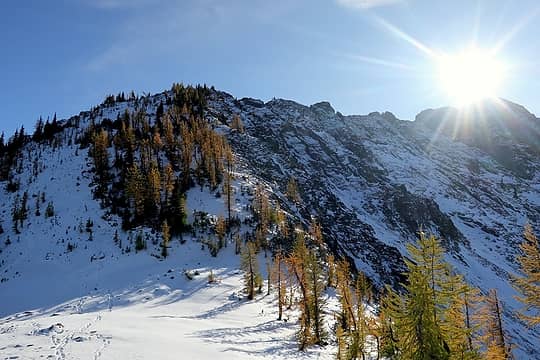 The route down from Cone 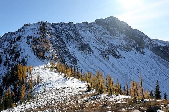 Farther view of the Cone's rocky east ridge and snowy north shoulder 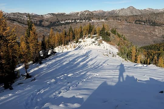 My shadow preparing to descend to the last col and trail 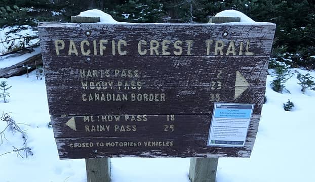 Back at thePCT
As beacons mountains burned at evening. J.R.R. Tolkien
As beacons mountains burned at evening. J.R.R. Tolkien
|
| Back to top |
  
|
|
Backpacker Joe
Blind Hiker

Joined: 16 Dec 2001
Posts: 23956 | TRs | Pics
Location: Cle Elum |
Awesome as usual Matt. Thanks for posting. How far were you able to drive up the road?
"If destruction be our lot we must ourselves be its author and finisher. As a nation of freemen we must live through all time or die by suicide."
Abraham Lincoln
"If destruction be our lot we must ourselves be its author and finisher. As a nation of freemen we must live through all time or die by suicide."
Abraham Lincoln
|
| Back to top |
|
|
Brushbuffalo
Member

Joined: 17 Sep 2015
Posts: 1887 | TRs | Pics
Location: there earlier, here now, somewhere later... Bellingham in between |
Always a thrill to follow Fay to an obscure summit.
As far as the road, quoting Matt:
| Matt wrote: | | The Harts Pass road was mostly dry and bare, with just a bit of snow in the last couple miles. I was happy to find that the road to the Brown Bear trailhead was also driveable. |
It has undoubtedly changed by now considering the elevation and the recent series of storms.
Passing rocks and trees like they were standing still
Passing rocks and trees like they were standing still
|
| Back to top |
|
|
Stefan
Member

Joined: 17 Dec 2001
Posts: 5091 | TRs | Pics
|
|
Stefan
Member
|
Mon Oct 21, 2019 9:42 am |
|
|
I am happy for you imperial Matt!
|
| Back to top |
|
|
|
|
You cannot post new topics in this forum
You cannot reply to topics in this forum
You cannot edit your posts in this forum
You cannot delete your posts in this forum
You cannot vote in polls in this forum
|
Disclosure: As an Amazon Associate NWHikers.net earns from qualifying purchases when you use our link(s). |


