Matt Lemke
High on the Outdoors


Joined: 15 Jul 2010
Posts: 2052 | TRs | Pics
Location: Grand Junction |
|
Matt Lemke
High on the Outdoors
|
 Sat Dec 07, 2019 1:59 am |
|
|
With just one week left in New Zealand, weather in the southern Alps was abysmal. Actually, I got word that Lake Wanaka had flooded this past week and closed the Matukituki River Road shutting off all access to Aspiring merely a few days after I climbed it. Parts of the town are also flooding which was caused by a combination of springtime snow melt and heavy rains. A large landslide also covered the road to Tasman Lake, further extending the already long walk into the Plateau hut if one chooses to walk in for Mount Cook, and another landslide blocked the highway towards the west coast over Haast Pass. Weather this week has been very rainy after my successful climb on Aspiring. You could say I got very very lucky to climb these mountains, as some of my friends trying to climb them now are getting shut down.
Anyway, to escape the bad weather I drove to the northeast part of the south island, and settled in at Kaikoura for a night, enjoying a lovely beachside hostel and had the local catch of the day for dinner. I had my eyes on Manakau, a 2608 meter high ultra-prominent peak in the Seaward Kaikoura Mountains. Gimpilator has a good page about it on SummitPost, however things have changed dramatically since his visit in March 2016, due to the Kaikoura earthquake that hit on November 14th 2016 which caused 100,000 landslides (yes, you read that right) in the Kaikoura region. One such landslide completely reshaped the Hapuku River valley, forever changing the approach for this mountain. In an event of total biblical proportions, during the earthquake a multi-dozen million cubic meter historic landslide came off the eastern flank of Surveyor Spur (the ridge you ascend on the route up Manakau; more on that further down) and cascaded down the Hapuku River Valley for a full two miles burying the entire valley floor in an average of 10 meters of rubble with some areas getting over 50 feet of coverage. In the process, all trees in the valley were stripped clean down to the roots and the steep valley walls showed clear evidence of getting sliced clear of all vegetation, rocks and hope as the landslide would have scoured down the entire valley. When it was all said and done, the valley was widened due to the massive amount of rubble and nothing more than cobbles, boulders and sand filled the new valley floor which was now raised in elevation 30-50 feet the entire way. At the upper end of the landslide where the slide would have first it the valley floor after falling from the steep flanks, the rubble created a wall across the valley over 300 feet tall creating a new lake. Over the past 2-3 years the water outflow from the new lake forced its way through the wall and cut a path, dividing the rubble exposing near vertical moraine-like cliffs above the stream. The scale of this event is truly astounding, and I will do my best to show it in the photos below.
As another aside, many more landslides covered the highway that runs along the east coast north and south of Kaikoura. The town was completely cut off for quite some time, and rebuilding the road took nearly 2 years to get it reopened for any traffic at all, and work is still ongoing to complete the re-building works over 3 years later. Sections of the beachfront highway for miles were covered in landslide debris that was measured in the hundreds of feet deep!
Returning back to my climb, I did not realize any of this until I was midway through the approach up the Hapuku River. I drove to the standard location where people park for hiking up this river valley on Grange Road which it at a measly 100 meters elevation. This would mean the net elevation gain for this climb is 2500 meters plus any ups and downs! I decided to break it into a day and a half, leaving at noon to hike in to Barrats Bivy (which I would find out no longer exists as it was buried in hundreds of feet of debris). Regardless, I started up the wide open lower Hapuku River, crossing to the east side of the stream utilizing large boulders where the road crosses. I was able to easily stay on the streams east side the entire way up to where you start up the bypass trail that heads above and around a section of the valley that narrows into a steep gorge. Since the trail ascends the small ridge on the west side of the valley, I had to ford the stream once immediately before starting up the trail to get back to the west side. A simply knee deep wade was required but this would be the only time I needed to get my feet wet.
Once on the trail, it was easy to follow, however I had to ascend 200 extra feet on a newly built steep trail to bypass another landslide that took out part of the trail that traversed the slope above the gorge. The extra gain added some time but was manageable. I then met up with a large side stream coming in from the west and hiked east down this valley for a few hundred meters before continuing left (northward) up the main Hapuku River. It was when I started this final segment I noticed something very odd. The entire valley floor was devoid of all vegetation and very wide. My suspicions were confirmed when I crossed paths with two local hikers returning from the new lake and they told me about what had happened here, also informing me that Barrats Bivy was destroyed. Not bringing a tent I would have to find a place to bivy, and hope it didn't rain. I continued up the consistent uphill grade constantly boulder hopping, easily crossing the stream on boulders as necessary until the large rightward bend in the valley that Gimpilator mentions in his page at 720 meters of elevation. This bend is where the route up to Stance Saddle (the beginning of Surveyor Spur) starts. I looked around for any kind of natural shelter where I could set up my bivy and in a small patch of trees, found a perfect spot right at the edge of the valley. It took me about 3.5 hours to reach this spot from the car. As I rested and drank some water, I heard small rock and scree slides coming down the steep slopes in the zone the landslide came from. Wind would also whip up rock dust and blow it down valley providing evidence that this whole mountainside was still unstable. I would soon realize that this entire mountain range is falling apart, and the rock comprising it is total garbage!
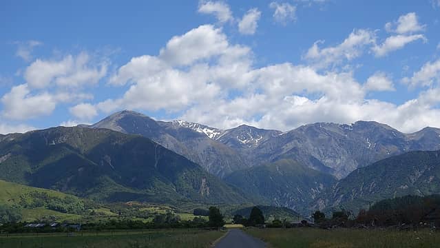 Seaward Kaikoura Range from the highway along the beach 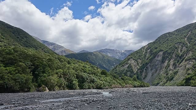 Starting up the Hapuku River from the car park 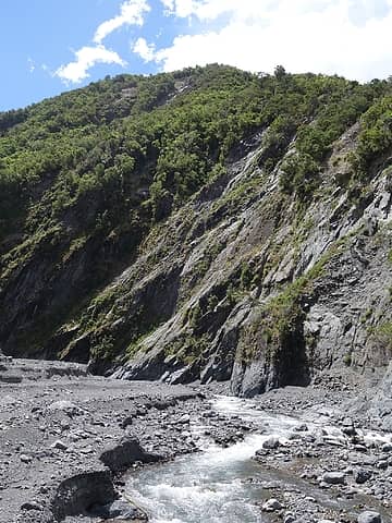 Where I crossed the Hapuku River just before the bypass trail 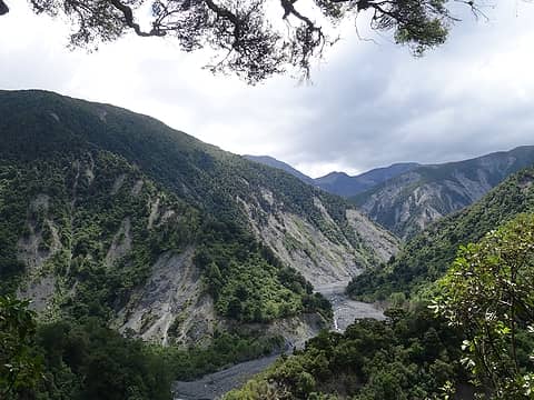 View further up the Hapuku Valley from the bypass trail 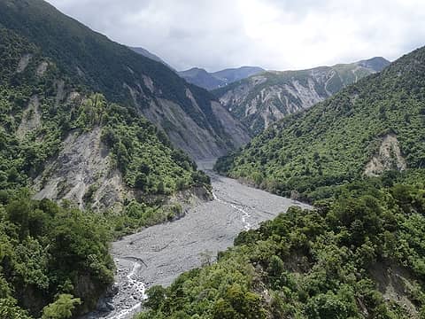 Landslide fill in the upper Hapuku Valley 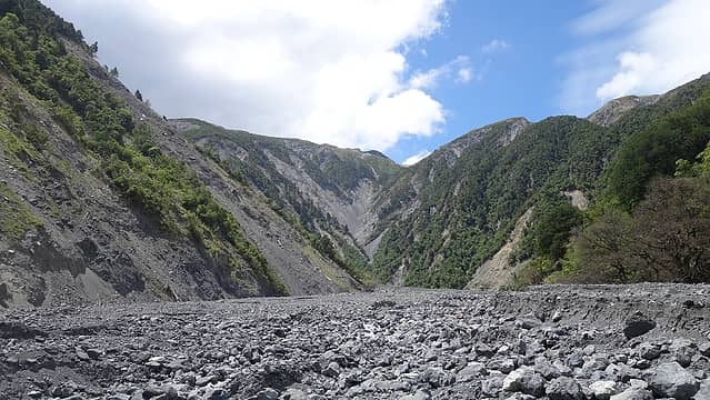 Walking on the landslide debris in the upper Hapuku Valley 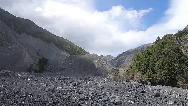 The 300 foot high landslide wall seen in center of the photo 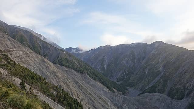 Starting up the slope to Stance Saddle. Notice the landslide scar 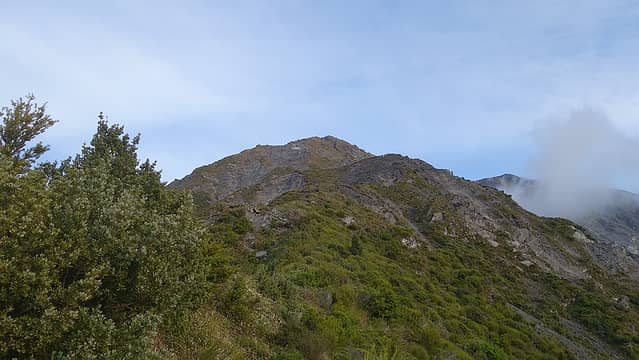 View up Surveyor Spur from Stance Saddle 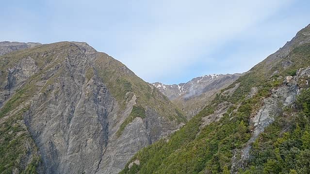 Looking back at Stance Saddle 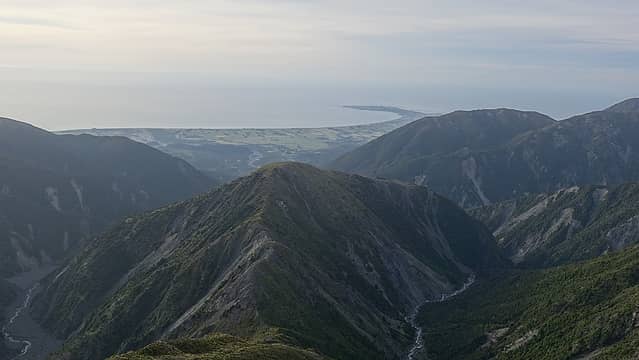 Looking down at the Kaikoura Peninsula with Stance Mountain in center 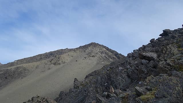 Topping out on the class 4 slabs with the next section of Surveyor Spur coming into view 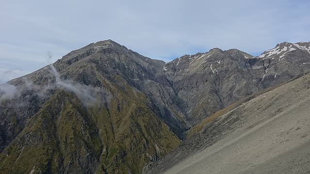 View west from Surveyor Spur 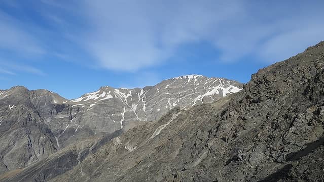 Steep SE face of Manakau 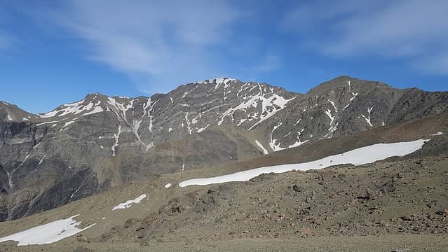 Another view of Manakau with the long east ridge dropping to the right 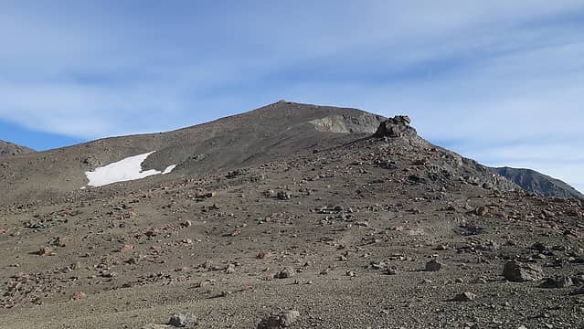 Mellow slopes above 1900 meters on Surveyor Spur 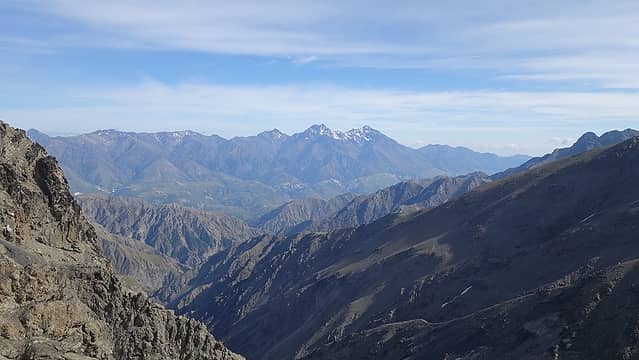 Tapuae-O-Uenuku in the Inland Kaikouras 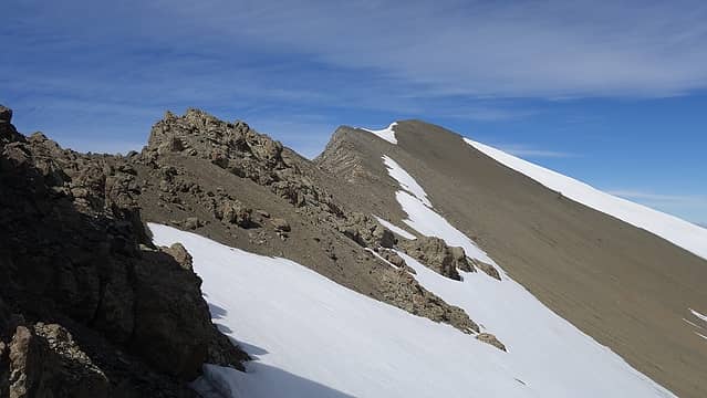 Final bit of the east ridge to the summit 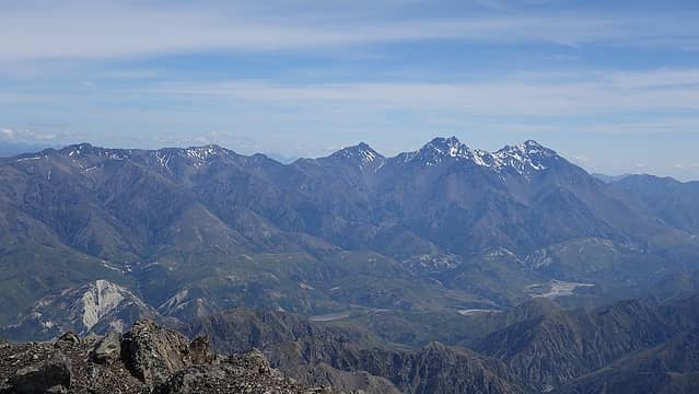 Tapuae-O-Uenuku from the summit of Manakau 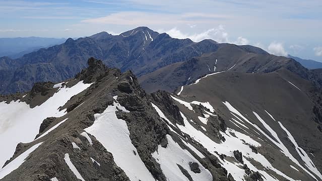 View east from the summit down the spine of the seaward Kaikouras 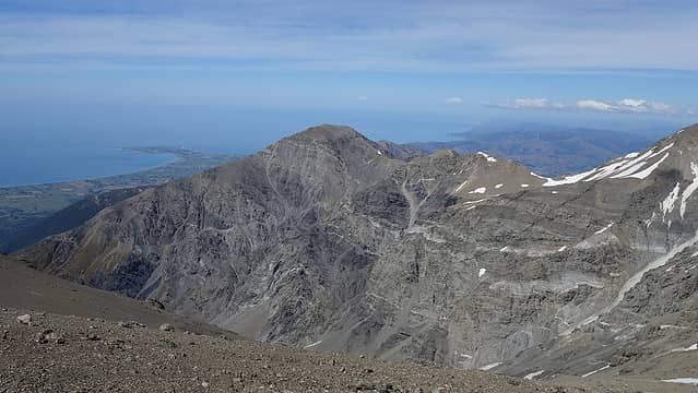 Kaikoura Peninsula viewed from the summit 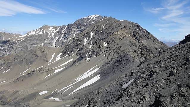 Manakau and east ridge from the return sidehill traverse to Point 2210 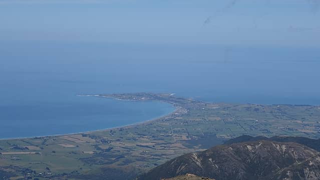 Town of Kaikoura 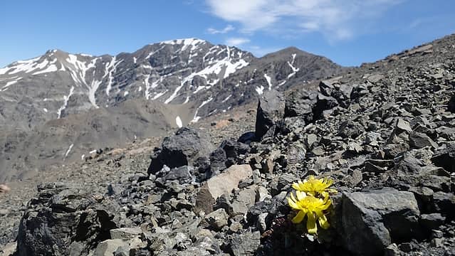 Beautiful flowers growing in the talus 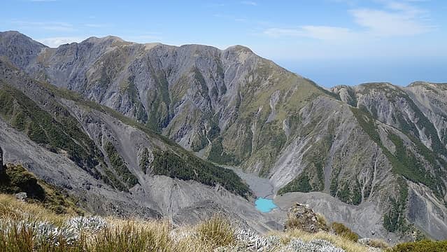 The new lake in the upper Hapuku Valley 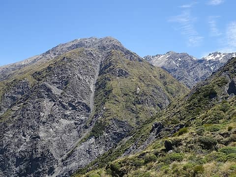 Looking back up towards Manakau from Stance Saddle 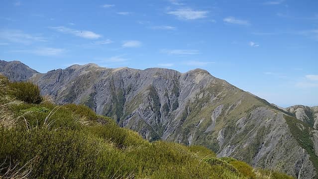 View from Stance Saddle 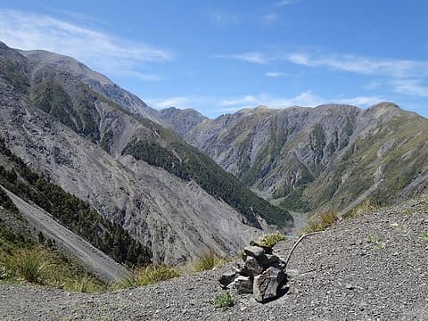 Cairn at Stance Saddle 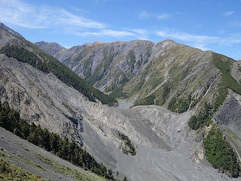 Upper Hapuku Valley with landslide  This was my bivy 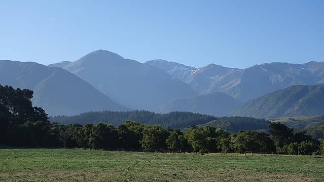 View of Manakau and the whole route seen from Parsons Road on the drive out 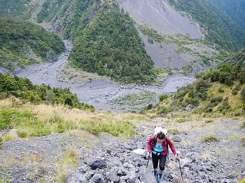 Taken by Gimpilator Taken by myself 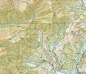 Approach Map; notice the green X marking part of the bypass trail no longer usable. Also note the Hapuku River no longer flows where the maps shows it in the first 3 miles from the car park 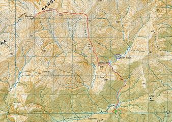 Surveyor Spur route map; note the new lake outlined in blue, the pink dot shows my bivy location
|


