| Previous :: Next Topic |
| Author |
Message |
Jake Robinson
Member


Joined: 02 Aug 2016
Posts: 521 | TRs | Pics
|
A few years ago I read a report from mtn.climber and rocknclimb that described a good snow route up Mountaineer Ridge (just north of Mount Stuart). I thought that given the right conditions, it could make a good winter climb. Given low avalanche danger and clear weather, Masayo and I decided to give it a shot today.
We left the Icicle Creek Road at 6:20 AM. Much of the first mile of the road walk was bare. After that, it was a packed highway all the way to the Stuart/Colchuck Lake trail junction. We donned snowshoes at the junction and followed an old, partially snowed-in skin track to Stuart Lake, arriving 3h30m after leaving the car. The packed trail made for very efficient progress with minimal trailbreaking. There seems to be very little snow below 5000' compared to previous years I've been up here.
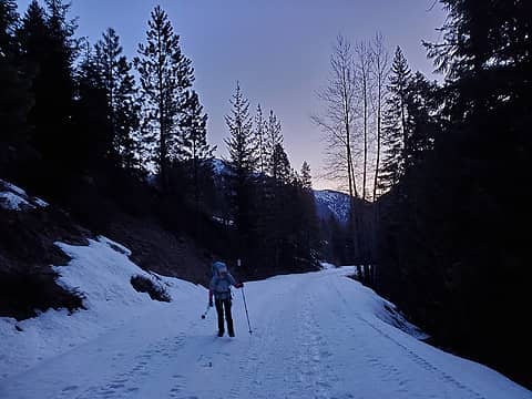 Early morning road walk 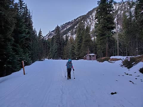 Arriving at the trailhead 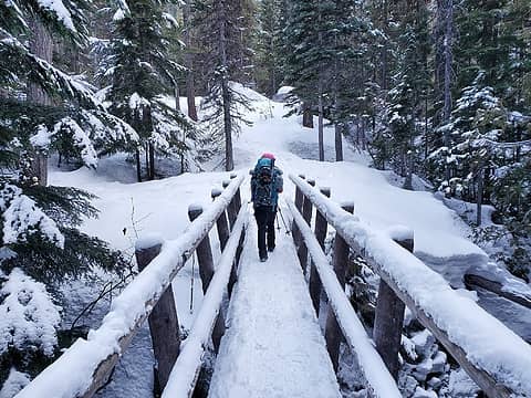 Bridge over Mountaineer Creek 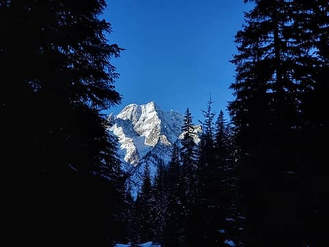 First look at Stuart 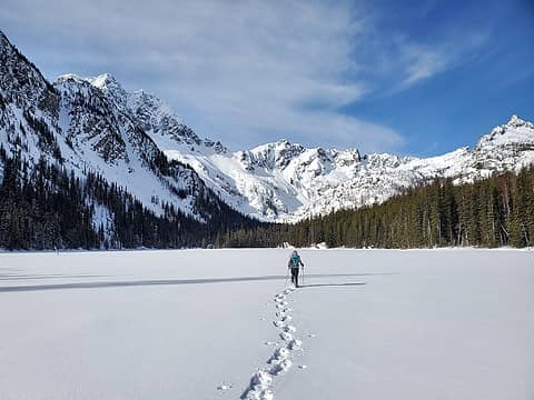 Crossing Stuart Lake 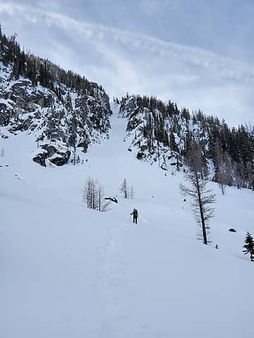 Masayo breaking trail, our couloir ahead 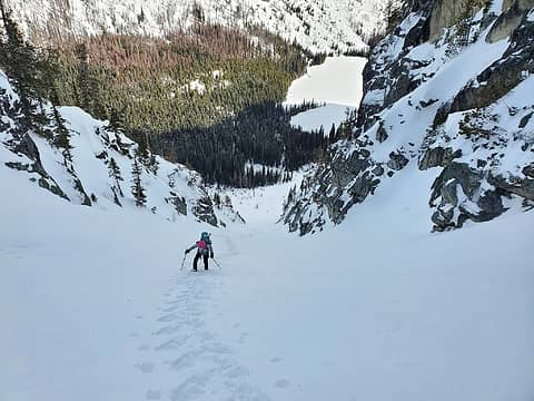 Slow going up the couloir 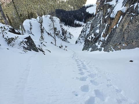 Gets a little steeper towards the top 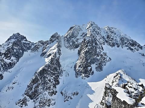 The payoff 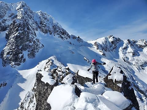 The summit was some precarious snow-covered boulders 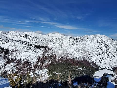 Eightmile, Axis 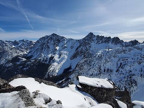 Dragontail, Colchuck, Argonaut 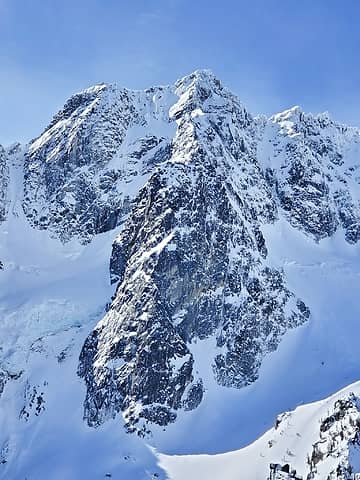 Mount Stuart, Full North Ridge 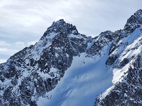 Sherpa 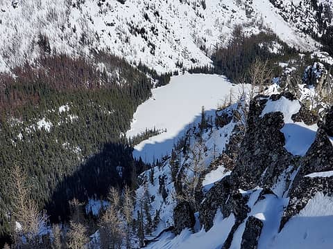 Stuart Lake, our tracks faintly visibl 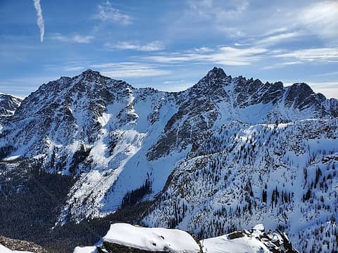 Colchuck, Argonaut 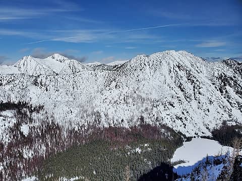 Eightmile, Axis 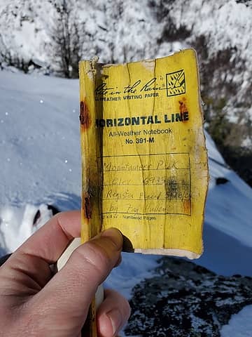 Register 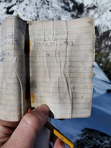 Register entry 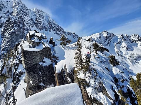 Masayo on a tricky bit getting back to the false summit from the true 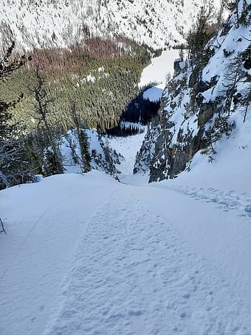 The top of the couloir. I'm sure this has been skied 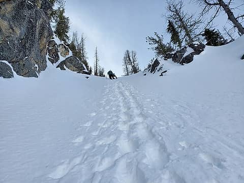 Downclimbing 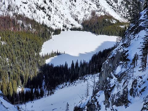 Stuart Lake 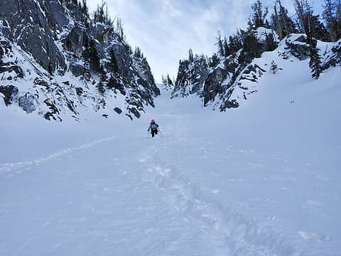 Exiting the couloir 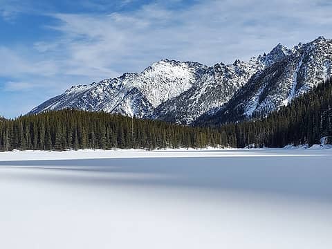 Views from the lake 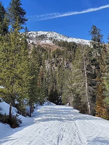 Near the Eightmile TH, maybe not the best time to ski Cashmere right now (at least lower down)
|
| Back to top |
  
|
|
RichP
Member

Joined: 13 Jul 2006
Posts: 5634 | TRs | Pics
Location: here |
|
RichP
Member
|
 Sun Mar 08, 2020 10:03 pm |
|
|
Awesome! Great looking conditions.
|
| Back to top |
|
|
Brushbuffalo
Member

Joined: 17 Sep 2015
Posts: 1887 | TRs | Pics
Location: there earlier, here now, somewhere later... Bellingham in between |
Looks like your route was a fun one!
Rainshadow + southern exposure = Relative paucity of snow on that slope.
Passing rocks and trees like they were standing still
Passing rocks and trees like they were standing still
|
| Back to top |
|
|
gb
Member
Joined: 01 Jul 2010
Posts: 6310 | TRs | Pics
|
|
gb
Member
|
Mon Mar 09, 2020 5:21 am |
|
|
| Brushbuffalo wrote: | | Looks like your route was a fun one!
Rainshadow + southern exposure = Relative paucity of snow on that slope. |
Mission Ridge and Stampede Pass snowpacks are well below normal this winter; so this isn't surprising. But snow depths look really quite shallow well into the subalpine from Jake's images. The desert of Eastern Washington got almost no snow this winter (unlike last). Suspect an early and short wildflower season. I hope somehow they get some spring-summer rains.
|
| Back to top |
|
|
rocknclimb
Member

Joined: 10 Sep 2010
Posts: 474 | TRs | Pics
Location: Wenatchee Valley |
Nice work Jake. The views of Stu up there are outstanding for sure 
When asked "Why do you climb"? Simply respond "Why don't you"?
When asked "Why do you climb"? Simply respond "Why don't you"?
|
| Back to top |
|
|
Backpacker Joe
Blind Hiker

Joined: 16 Dec 2001
Posts: 23956 | TRs | Pics
Location: Cle Elum |
Wonderful report. Thanks for posting. I wonder where these people get their energy? 
"If destruction be our lot we must ourselves be its author and finisher. As a nation of freemen we must live through all time or die by suicide."
Abraham Lincoln
"If destruction be our lot we must ourselves be its author and finisher. As a nation of freemen we must live through all time or die by suicide."
Abraham Lincoln
|
| Back to top |
|
|
|
|


