| Previous :: Next Topic |
| Author |
Message |
rubywrangler
Member


Joined: 04 Aug 2015
Posts: 511 | TRs | Pics
|
I wanted to hike from the northern entrance of Parque Nacional Patagonia, about 1.5 hours from the town of Chile Chico, back to the southern entrance near Cochrane. I had planned to do this later in my trip after returning my rental car, because 1) the car was ridiculously expensive and it seemed stupid to park it for 5 days, and 2) having a car made the logistics of this one-way hike more complicated. But the weather gods provided a window I couldn't resist.
The bus between the two towns only runs on Wednesday and Friday. I couldn't leave Cochrane until Saturday, which meant I had to drive to the northern entrance, hike back to Cochrane, take the bus back to Chile Chico, arrange a ride to my car, and then drive back to Cochrane to continue traveling south on the Carretera Austral. So that was the plan. On the way to Chile Chico, I picked up some hitchhikers. One of them told me that his friend, who worked in the park, had mentioned that the pumas are very active this time of year... but I had nothing to worry about because "they're friendly".  I arrived at the northern park entrance (formerly known as Reserva Jeinimeni) at 8:30am Sunday morning to get my permit and pay the fees ($14000 CLP, $16 USD). The ranger gave me an overview of the route and said the first river crossing was only knee high, but the second one (Rio Jeinimeni) was mid-thigh, and the best place to cross was left of the marked crossing. The route is described here. Basically, walk up Valle Hermoso and down Valle Avilés, then a road walk through Valle Chacabuco to the main park complex, then up and over Mt Tamanguito and down to Cochrane.
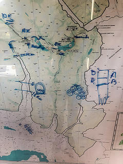 map drawn by the ranger 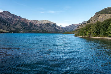 lago jeinimeni 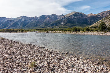 looking back after crossing the river 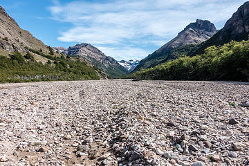 up the riverbed 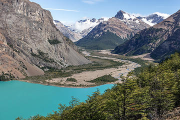 first view of lago verde 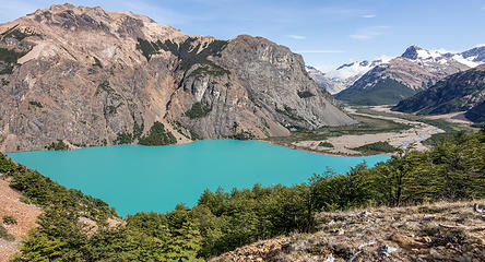 lago verde 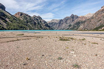 looking back 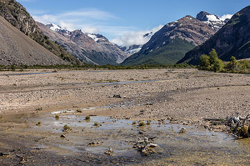 Valle Hermoso 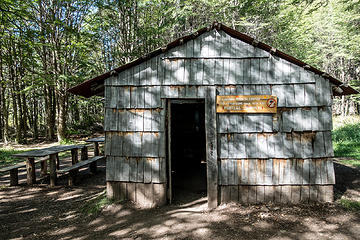 refugio 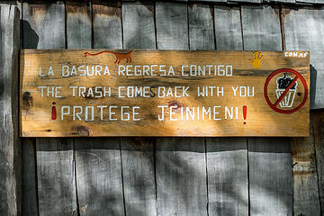 Keep the place clean for the brontasauruses? 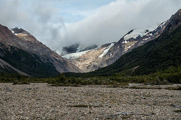 cerro jeinimeni in a cloud 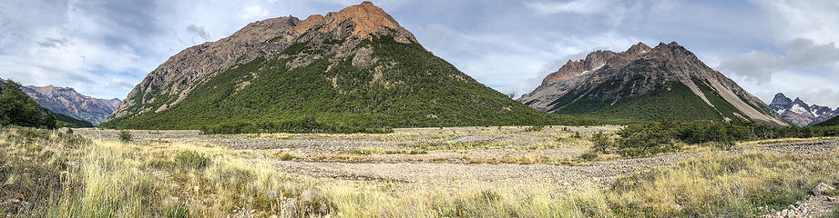 valle aviles 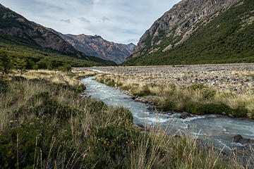 valle aviles 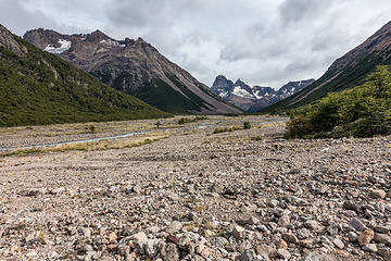 looking back 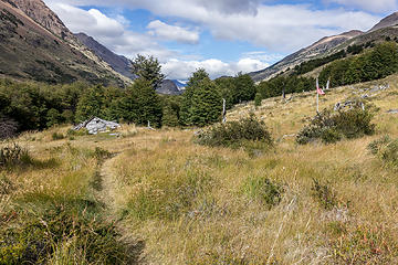 destroyed shepherd's hut 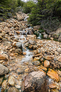 worst water i ever tasted. what is this godforsaken orange rock? 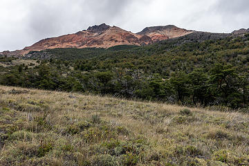 the mountain from whence the terrible water came 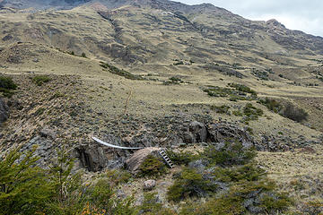 suspension bridge 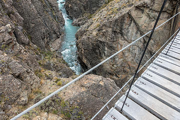 canyon below 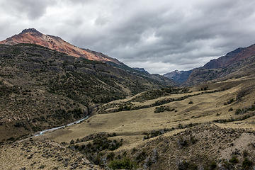 looking back up valle aviles 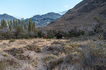 my camp shelter and laundry 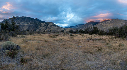 view from camp 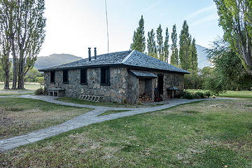 casa piedra 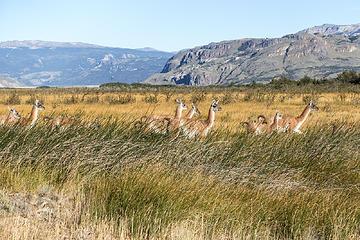 first guanaco encounter of the day 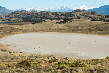 guanacos resting in a dry lake 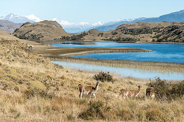 guanacos browsing near a different lake 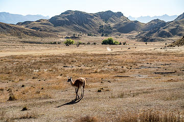 guanaco approaching the car near the main park complex 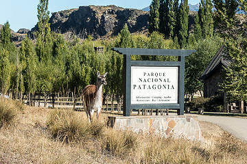 park mascot 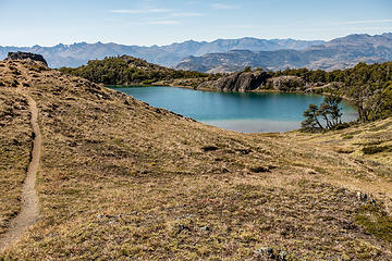 lagunas altas trail 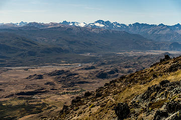 valle chacabuco & beyond 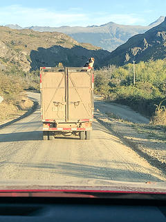 on the road back to cochrane  48 hours and 4 airports later I was back to Seattle. Now I'm in self-imposed total quarantine for 14 days and catching up on Magical Andes (Thanks Brad for mentioning, hadn't heard of it. But wtf, they basically skipped over Chilean Patagonia entirely except for TDP! 48 hours and 4 airports later I was back to Seattle. Now I'm in self-imposed total quarantine for 14 days and catching up on Magical Andes (Thanks Brad for mentioning, hadn't heard of it. But wtf, they basically skipped over Chilean Patagonia entirely except for TDP!  ) )
|
| Back to top |
  
|
|
RichP
Member

Joined: 13 Jul 2006
Posts: 5634 | TRs | Pics
Location: here |
|
RichP
Member
|
 Fri Mar 27, 2020 7:14 am |
|
|
Very nice. It's good to see new national parks being established in this amazing part of the world.
It sounds like you just barley made it out before things shut down tight.
|
| Back to top |
|
|
Brushbuffalo
Member

Joined: 17 Sep 2015
Posts: 1887 | TRs | Pics
Location: there earlier, here now, somewhere later... Bellingham in between |
Fascinating demarkation of sediment-laden water from glacial outflow and clear water ( no glacial contribution). Reminds me of Greenwater and White Rivers north of Mt. Rainier.[quote="rubywrangler"]worst water i ever tasted. what is this
Passing rocks and trees like they were standing still
Passing rocks and trees like they were standing still
|
| Back to top |
|
|
rubywrangler
Member
Joined: 04 Aug 2015
Posts: 511 | TRs | Pics
|
| Brushbuffalo wrote: | | Fascinating demarkation of sediment-laden water from glacial outflow and clear water |
I think what you're actually seeing there is the shadow cast by the ridgeline I just came over. The color of lake is better represented in the previous photos.
| Brushbuffalo wrote: | | including arsenic and |
Sounds like it will mix well with the radioactive water I drank in the Grand Canyon last fall!  Thanks, Doug, iron is what I figured. I only drank a sip and dumped the rest, so not concerned, but appreciate the reassurance!
|
| Back to top |
|
|
Brushbuffalo
Member
Joined: 17 Sep 2015
Posts: 1887 | TRs | Pics
Location: there earlier, here now, somewhere later... Bellingham in between |
| rubywrangler wrote: | | think what you're actually seeing there is the shadow cast by the ridgeline I just came over |
Whoops, shame on me! Wrong conclusion based on hasty interpretation of the evidence. Certainly I should have realized it is Lago Verde, not a stream system.
In a weird way it reminds me of when in 1971 I was mapping various glacial deposits on Chuckanut Mountain and was finding a type called glaciomarine drift at an elevation hundreds of feet higher than it had been known.
Turns out the material was actually making up an old road bed.
Passing rocks and trees like they were standing still
Passing rocks and trees like they were standing still
|
| Back to top |
|
|
iron
Member

Joined: 10 Aug 2008
Posts: 6392 | TRs | Pics
Location: southeast kootenays |
|
iron
Member
|
Wed Apr 01, 2020 11:35 am |
|
|
what a spot.
that's quite a delta on the lake!
|
| Back to top |
|
|
|
|
You cannot post new topics in this forum
You cannot reply to topics in this forum
You cannot edit your posts in this forum
You cannot delete your posts in this forum
You cannot vote in polls in this forum
|
Disclosure: As an Amazon Associate NWHikers.net earns from qualifying purchases when you use our link(s). |


