| Previous :: Next Topic |
| Author |
Message |
Alden Ryno
Member

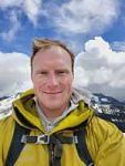
Joined: 04 Jun 2019
Posts: 150 | TRs | Pics
Location: Issaquah, WA |
Allllrighty then!
After plans for an Olympus trip fell through, Mr. Robinson incepted the idea of a shot at the "Stehekin Triangle" peaks from the Bulger/T100 into my head. I hadn't seen any Memorial Day or earlier reports of the peaks, so I was hesitant on that alone... Would there still be too much snow?
Stats: 49 miles, 16,500' cumulative gain.
Overview of route from the Devore Creek Trail junction.
As with all Stehekin-bound trips, logistics is a huge role. I called Lady of The Lake the week before and made a reservation uplake for Friday the 22nd and downlake for Monday the 25th.
Note: The Stehekin Ferry is a new service that began operation this weekend, in collaboration with the Stehekin Valley Ranch, and is a separate and additional option to Lady of The Lake.
Forewarning: the vast majority of the following was either writing in my tent at night in a half-sleep or immediately after the trip while waiting in Stehekin. Hopefully the overall report is coherent.
On Friday morning I called the Stehekin Valley Ranch around 0810 to inquire about shuttle. I was told that I could ask the shuttle upon arrival. I'd prefer a shuttle to riding my bike the 4.5 miles to the Harlequin bridge.
Left Field's Point at 1100 and arrived in Stehekin around 1300 and asked the shuttle about a drop at the Harlequin Bridge. Thankfully it was a bit slow due to COVID and they had a few extra seats and a spot on the bike rack! I thanked Cliff profusely. We set off down the road and stopped at the Bakery. Here, I got my first decent views of what I believed (correctly) to be Tupshin. I stocked up on two cinnamon rolls to make change to tip/pay the shuttle. I was dropped at the bridge at 1500 and so began my adventure in earnest...
I strapped by daypack to my bike rack while my primary pack was on my back (it was too large and unruly to be situated on the rear of my bike.
Soon I was at the airstrip and the brushy started of the Stehekin River Trail. I gratefully crossed the wooden boardwalks across marsh and conjoined an old pit/frontage road.
High-ho silver, AWAY!!!
Not quite. The first mile or so was slowish with rocks and a decent up and down undulation, however, the trail opened up enough to make biking absolutely worthwhile. If you are going to do this and are unsure of shuttle arrangements, a bike is a GREAT addition. There seemed to be more bikeable terrain on the way back?
I reached to Devore Creek Trial junction at 1600 (3.8 miles from Harlequin birdge) and stowed the bike, some food for my last day, and dry clothes/flip-flops in the trees. I set off up the trail.
Reports say that the trail is brushy... And I didn't noticed it much on the way in. On the way out, it seemed like a different trail because of so much brush! I'm still perplexed. The going was slow on the way up with my bigger pack (eef you, tent and snowshoes, neither of which was needed in the end) but nothing bad. I'm glad the elevation gain was relatively consistent. It akin to a Mt. Si from the junction to Bird Creek Camp (~4-4.5 miles and 3,100' gain).
I encountered my first snow debris at 2,800'where a big slide had crossed the trail.. Aww hell. Snow THIS low? Bad juju. I crossed that and another snow filled Creek crossing, but that was it... Until 4,100'.
The snow began out of nowhere. There was NOTHING, then a mere quarter mile before Bird Creek Camp. BOOM. Snow everything. God dammit. I did NOT want to snow camp. Alas, I found a flattish, semi-pine covered (insulation) spot right next to where Bird Creek flows into Devore Creek. I set up camp and was settled in at 1900. Home for a few days. I ate dinner, set-up my day pack for Tupshin and Devore, then went to sleep with an alarm set for 0400.
Saturday, 0530-2145
The alarm went off and it wasn't terribly cold, but temps were still declining. Some new ice here and there, so it must've been just below freezing. Breakfast was had and my paltry day pack was loaded down with snowshoes and an ice tool. I threw the crampons on since I figured it was steep and the snow would be firm.
I left Snow Bird camp at 0530. The snow stopped within 200 vertical feet. My path wandered up the right side of Bird Creek was largely painless; little brush, not much navigation required.
I gained to about 5000-5200 feet when the snow began again.
This was the moment of truth... This snow would dictate (largely) my day and the trip. And it was firm! Not quite bulletproof as I was able to kick steps large enough for the toes of my boots without crampons. Thank the heavens. I was worried that the snow wouldn't be consolidated. Still, there was a lot of snow to contend with and this is usually a hell of a long day without the devil's dandruff.
Once I hit 5,600' in the basin, I practically bee-lined up the right slope to 7,000', almost 7,200', feet; I saw a suspected wolverine den along the way.
From the ridge apex at 7,200', I made a wavering traverse to the basin below Tupshin. I analyzed the face and compared it to images. It appeared the be snowfree for most of the route.
Once at the base of the face (pitch 0), I dropped extra gear (snowshoes, crampons, excess water, some food) and made my way up. I should have kept crampons on for about 75 more vertical feet due to steep snow. I changed out of my boots soon (another too soon...) and into my trusty trail runners. Things eased up once I was fully out of snow and on dry rock...about 7750'.
NOTE: This peak SHOULD be done with ropes, harnessess, and other precautions. Do not follow my lead and I think that it should NOT be done free solo. My comfort level is inordinately high. I am NOT that good of a climber, and my recklessness shouldn't be taken to be seen as such.
I knew the generally established pitches tend to go rightward when things got harder, so I used that rule of thumb when difficulties arose. I'd say that I ascended two (2) 5.2-5.4 moves, however, I don't know crap about scales, so take that with a grain of salt. I do, however, know that the rock was typically loose and I found many small rocks that moved and a few look larger 3-6' long slabs that would falter under stress. But I made it up making no moves that I didn't think I could down climb. If I found a section I could ahve ascended but didnt' feel confident I could downclimb, then I found another way up.
I reached the summit at 1100 (hour after dropping gear) and found a very, very soiled summit register without any recorded ascents in 2019. That poor register is soaked. I snacked and began the downclimb . Going down took me past more rap slings than my ascent, so I must've been more "on route" on the descent. These seemed to be more solid rock (relative terms) and ever-so-slightly more technical climbing. Back to my gear at noon. The hardest, most technical peak of the trip was done!
I crossed the softening snow back to the ridge crest at 7,200' and began a descending traverse to the far upper bird creek basin, about 6,600 feet elevation. I clamored up some steep snow, then rock, back to snow to get to the highest portions of the bird lakes basin. The terrain was gentle with form snow as I descended 300 vertical to the lakes over a half to third mile.
At 1430 I took a break on some melted out rock above the lakes to let my feet dry slightly and to ingest nommies. As I sat, I also ingested my route to come. I found a tick on a rock here of all places as well...
The low point along the northern Devore ridge was practically entirely corniced. However, I saw a potential gap between snow and rock slightly south (right) of the local minimum on the ridge. Worth a shot!
Lo and behold, it worked. I gained the ridge after 45ish degree snow and realized there was still far to go. That upper ridge is hideous (to navigate, a beauty to see) with snow.
I figured earlier that I'd be on the summit around 1700, but that was fast approaching. At 1730 I finally made it to the upper portions of the mountain, after some less than conservative snow and rock shenanigans. While still a ways away, the traverse was dry!
I made haste around gendarmes (outcroppings, let's be fancy though) and made a few 3rd and 4th class moves to get onto the summit block. There was one conspicuous rappel sling at the top of the summit block access though it was smooth sailing after that.
Because of the time, I had dropped my gear lower down the mountain (below the less than conservative stuff) so I some stepped on the top and reversed track. It was nearing 1830. Camp was going to come in the dark.
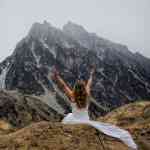
I began my descent and at 1900 I paused. I was at the top of the ridge, feet before dropping down into the bird lakes basin and I just looked. The lighting was amazing. Tupshin was across the way, clouds mingled here and there. It was pure bliss. It dawned on me what a day it had been. I had several impressionable "wow" moment throughout the day, but this was the most profound.
I took the direct route down to bird creek thanks to an Albert track. It seemed like that was the only viable options in or out of the bird lakes basin at this time! Everywhere was so steep that they were interspersed with snow and rock, except this chute. Thank God it worked...
By 2100 I was into the forest and finally out of the snow, and out of light. I reached camp at 2130 and finally used a headlamp to check things out around the tent and to refill my water supply. I ate a bagel and promptly passed out at 2200 while attempting a write up...
Sunday
Wake 0500
Leave 0630
Cross 0815
Pass 1100
Summit 1300
Camp 1800
Packed, 1900
Devore Trail Jct, 2130
Before passing out I had changed my alarm from 0400 to 0500 to get some extra sleep. In all honesty, I wasn't feeling sure about Flora. It was supposed to be another long day and the snow added onto Tupshin and Devore wiped me quite hard. However, I had to give it an honest shot. I woke at 0500 feeling stiff and made breakfast. Because I didn't eat my potatoes for dinner, I added them to my breakfast. The snow was great the day before, so I left the snowshoes...a gamble I was willing to make.
I set off along the snow-covered Devore Creek Trail at 0630 and it was pretty easy to follow. The cut logs along the trail combined with bear tracks made route finding simple. The snow was nice! Firm. I'm not sure that I postholed once other than my dumb ass stepping too close to a covered tree. I crossed the creek at 0815 about 2.5 miles from camp, right about 5,000'. There were several places to cross, none terribly hospitable.
Crap. I realized about 30 minutes after crossing that I left my big bag of Swedish Fish... So much for a grand summit snack, and about 800 calories fewer. That section of forest is a free-for-all; not too dense, all routes work. Be careful of Cascades though, there were a few areas where waterfalls create natural funnels that get steeper than need be. It seemed that the outer fringes of the forest worked better than the middle (eastern and western flanks on topo).
I finally ate and changed into my Echo Hoody for sun coverage in an open meadow (snow covered) at 6,500' at 0940. From there, the route to the pass/col was straightforward with the final 200' on rock instead of snow (good to have a consistency change).
I dropped over into the Castle Creek drainage at 1045 and bee-lined down and across the basin. A track I had circumvented the basin some, however, I went straight across for a steeper descent and the earliest possible (and steeper) ascent to the west of rock bands on the north side of the basin.
I got a full-frontal view of Flora from 7,200 at 1130. I soon paused on some rocks at 7600 to drop my crampons and lay a shirt out to dry. The remainder was easy class 2 rock-hopping, scree-wallowing to the summit, which reached at 1300.
This would be the most likely spot for cell service, so I turned off airplane mode and immediately got three bars and a 4G symbol! Sweet! However... The 4G soon left without any updates and the bars just sat there. I reset the connection (airplane on and off) to no avail, for a few attempts. You tantalizing son of a bitch! Better to have never gotten anything lol.
The view from the Flora summit is spectacular! While each summit is unique, Flora stands out because one can seen Lake Chelan, Domke Lake, the Entiat, Bonanza, the GPW as a whole, the Chelan-Sawtooth, and the Pasayten; it's centralized.
I ate a bagel and some Poptarts and realized my water bottle was missing. Did I leave it down below? Only one was to find out... There was my bottle, next to the shirt. I retraced my steps almost exactly back to the Devore Creek drainage by 1430-1445 and reached the creek crossing not long after. I kept my crampons on from just below Flora to an open meadows [I presume an (old) avalanche washout] where I sat down, snacked, and stowed the 'pons on my day pack. I was SO glad that I didn't bring snowshoes by this point. Camped appeared down the trail at 1800.
A decision was to be made... Pack up now and hike out to Weaver Point or relax with some extra rest with more hiking tomorrow?
I'm a delayed gratification kind of guy, so I packed it all up, and tossed on the trusted combo of snowshoes and trailrunners at 1900. I awkwardly meandered the quarter mile of trail to where the snow ended and stowed the snowshoes before the creek crossing (where I am glad to have placed a tree limb on Friday night).
The hike seemed to drag on, though I had a good and thought-provoking book on (The Alchemist, for the umpteenth time. More like 4th or 5th,but who's counting). At 2100 I crossed the wilderness boundary sign back into the LCNRA and flew down the switchbacks. I made camp at 2145 after a quick jaunt to Devore Creek for a water resupply. Again, I was out at 2200.
Monday
0345, drizzle, setup tent
0530,wake, eat
0640, Stehekin River Trail.
0745,bakery
0845, landing.
I awoke to the pitter-patter of rain on my sleeping bag at 0345. CRAP. Due to being tired, I just threw out my pad and sleeping bag without setting up the tent despite the odds of rain increasing as the weekend progressed. Thankfully the tent is quick to make, so I was inside with the rain fly on within 10 minutes. I never really got back to sleep and was finally up at 0530 and made breakfast. I packed up and was on the bike down the Stehekin River Trail at 0645. The rain stopped quickly after the tent was up and began again slightly as I set off on the bike. It felt quicker on the way out and I reached paved road at the Harlequin bridge...smooth sailing (and a sore taint) from here!
The rain continued until I reached the Bakery around 0745 for coffee and a sandwich. I sat there for about 45 minutes, soaked and happy as a lark. I reached the ferry landing st 0845 and the trip was practically over. Phew.
Edit: replaced explicatives with more subtle verbiage.
 Now I Fly Now I Fly
Now I Fly |
| Back to top |
  
|
|
Jake Robinson
Member

Joined: 02 Aug 2016
Posts: 521 | TRs | Pics
|
Damn, after seeing the photos...that's bold. More snow than I would have expected on those routes. We did 5 rappels on Tupshin and 1 on Devore...in September. You've got some kinda drive! Good call on the bike, and best of all, you barely had to use your snowshoes  Just a few more tough T/100s in the Chilliwacks and you're through the toughest of the list, but I suspect those will be a cakewalk for you.
P.S. I think a trip like this is worthy of a few expletives Just a few more tough T/100s in the Chilliwacks and you're through the toughest of the list, but I suspect those will be a cakewalk for you.
P.S. I think a trip like this is worthy of a few expletives  edit: typo, we rapped on Devore, not Flora...if you find yourself rappelling on Flora then you really messed up
|
| Back to top |
|
|
fourteen410
Member

Joined: 23 May 2008
Posts: 2629 | TRs | Pics
|
Thanks for the info about the Stehekin Ferry! Good to know about options. Looks cheaper, too. We had to cancel our memorial weekend trip to Stehekin due to covid, etc. but we paid $67/ticket, which makes the $39/ticket ferry price enticing.
|
| Back to top |
|
|
Doug_B
Member
Joined: 09 May 2018
Posts: 12 | TRs | Pics
|
|
Doug_B
Member
|
 Tue May 26, 2020 4:42 pm |
|
|
What made you suspect a Wolverine Den? Pictures?
|
| Back to top |
|
|
Alden Ryno
Member
Joined: 04 Jun 2019
Posts: 150 | TRs | Pics
Location: Issaquah, WA |
|
| Back to top |
|
|
rubywrangler
Member

Joined: 04 Aug 2015
Posts: 511 | TRs | Pics
|
|
| Back to top |
|
|
kitya
Fortune Cookie

Joined: 15 Mar 2010
Posts: 842 | TRs | Pics
Location: Duvall, WA |
|
kitya
Fortune Cookie
|
Tue May 26, 2020 6:26 pm |
|
|
Looks like marmot home to me too. i have seen these many times with marmots coming in and out, exactly like this.
|
| Back to top |
|
|
Alden Ryno
Member
Joined: 04 Jun 2019
Posts: 150 | TRs | Pics
Location: Issaquah, WA |
Marmot it is!
Thanks, y'all
|
| Back to top |
|
|
Brushbuffalo
Member

Joined: 17 Sep 2015
Posts: 1887 | TRs | Pics
Location: there earlier, here now, somewhere later... Bellingham in between |
Quite the ambitious trip. Congrats for putting it together and succeeding....you survived.
But...I feel compelled to rain on your parade a bit.
The following is thought provoking.
| RynoA wrote: | | My comfort level is inordinately high. I am NOT that good of a climber, and my recklessness shouldn't be taken to be seen as such. |
At the risk of sounding like an old conservative climber ( too late), there is an old saying:
"There are bold climbers and there are old climbers, but there are very few bold old climbers."
You provide a disclaimer that essentially says 'don't use me as an example'. That's to your credit.
Be very careful in your ambition. Please!
Passing rocks and trees like they were standing still
Passing rocks and trees like they were standing still
|
| Back to top |
|
|
forest gnome
Forest nut...
Joined: 24 Apr 2003
Posts: 3520 | TRs | Pics
Location: north cascades!! |
Holy crap..u must have a nice personal locater beacon!
If not for God's sake someone here send him one...
|
| Back to top |
|
|
Bluebird
suffering optional
Joined: 22 Jan 2014
Posts: 199 | TRs | Pics
Location: United States |
|
Bluebird
suffering optional
|
Mon Jun 01, 2020 8:15 am |
|
|
From my experience seeing a live wolverine, I suspect they'd have bigger dens  Glad your trip went well! You have some beautiful photos.
|
| Back to top |
|
|
Alden Ryno
Member
Joined: 04 Jun 2019
Posts: 150 | TRs | Pics
Location: Issaquah, WA |
I appreciate the concern that some of y'all have respectfully expressed in the comments. I understand the concern and I certainly expected a certain degree of pushback and criticism.
Safety is my priority.
I don't, and won't, climb anything that I cannot downclimb, with certainty.
That is my barometer. I don't surpass it and I use my gut as a guide; it's yet to put me in a postion for failure. That's not to say that it won't. I went on this trip prepared to not summit Tupshin because of the potential for climbing that was "too technical." I also know that the vast majoirty of us, myself included, use hyperbole and exaggeration when describing routes. If nothing else, that hyperbole stokes our egos to think we've done something extreme and beyond what other are capable of (that's not true, others are just as or more capable). Fred Beckey is known to have done this to deter others from his routes. Thus, it's not a new tactic with this generation, millenials, or any age group. I strongly dislike the aggrandizement of things, climbing or otherwise.
I know many climbers who struggle to clamor up rocks only to rely on a tool, with a proven record for failure (even if ultimately human error), to get them down. I believe that is a crutch.
If I remember correctly, then statistics tell that free-soloing isn't what kills people on climbs. It's the use of aids and, in particular, rapelling (as referenced above) that predominantely kills. Alex Honnold, I believe, has claimed similar. Those free-soloers that die generally don't die free-soloing (regardless of the ultimate cause of the event). My conjucture is that this is because there is less focus on the task at hand, because we tend to think that the gear is going to save us or protect us. Not if we don't pay attention and protect ourselves.
Of course, I am young, I am dumb (in many regards), and I am inexperienced. I may be entirely wrong, however, I feel much more competent with my own hands, feet, and body than with the use of an external tool. That is why I don't use geat when climbing low-grade things.
P.S. I am NOT comparing myself to great climbers and explorers such as Honnold and Beckey. I use them because they are ubiquitous figures in the climbing community.
|
| Back to top |
|
|
Alden Ryno
Member
Joined: 04 Jun 2019
Posts: 150 | TRs | Pics
Location: Issaquah, WA |
|
| Back to top |
|
|
Brushbuffalo
Member
Joined: 17 Sep 2015
Posts: 1887 | TRs | Pics
Location: there earlier, here now, somewhere later... Bellingham in between |
That is a clear and reasoned statement of your philosophy and style. Thanks.
Continue to be careful as you enjoy the alpine. Hopefully you will become old and bold like Fred.
Passing rocks and trees like they were standing still
Passing rocks and trees like they were standing still
|
| Back to top |
|
|
rbuzby
Attention Surplus
Joined: 24 Feb 2009
Posts: 1011 | TRs | Pics
|
|
rbuzby
Attention Surplus
|
Mon Jun 01, 2020 9:57 am |
|
|
| RynoA wrote: | | hyperbole stokes our egos to think we've done something extreme and beyond what other are capable of (that's not true, others are just as or more capable). Fred Beckey is known to have done this to deter others from his routes. |
Fred Beckey is famous for doing the opposite of that. Many people think Fred's "class 3" is really class 4. I don't, but that's what I gather from reading reports.
|
| Back to top |
|
|
|
|
You cannot post new topics in this forum
You cannot reply to topics in this forum
You cannot edit your posts in this forum
You cannot delete your posts in this forum
You cannot vote in polls in this forum
|
Disclosure: As an Amazon Associate NWHikers.net earns from qualifying purchases when you use our link(s). |


 Thank you! Although, it's nature that provided the scenes, I was just fortunate enough to be there at the right time(s).