| Previous :: Next Topic |
| Author |
Message |
Trailcat
Member


Joined: 12 Mar 2016
Posts: 28 | TRs | Pics
|
|
Trailcat
Member
|
 Sun Jun 07, 2020 1:33 pm |
|
|
Here is an abbreviated report for a three-day climbing trip to Gunn Basin in the Skykomish Mountains with Eileen and George on June 1-3. We got stymied on our major summit but managed to tuck in four others.
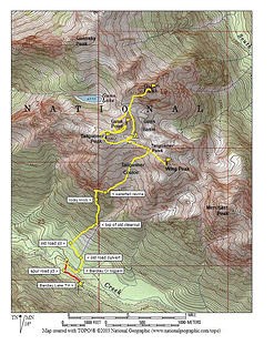 GunnBasinRouteMap 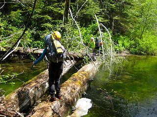 CrossingLogsOverBarclayCreek 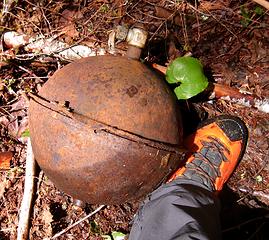 OldPressureVesselNearTailgunnerCreek 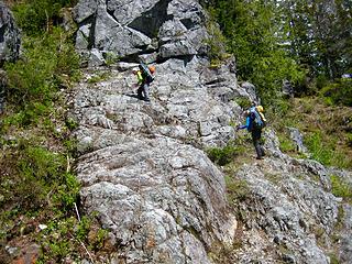 ClimbingOutOfWaterfallRavine 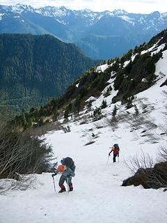 AscendingUpperPartOfTailgunnerCouloir 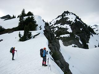 Eileen&GeorgeAtTailgunnerPass 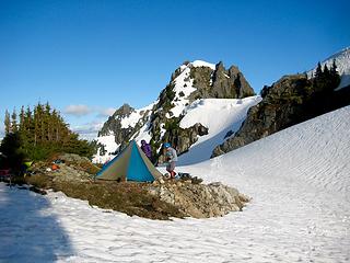 CampInGunnBasin 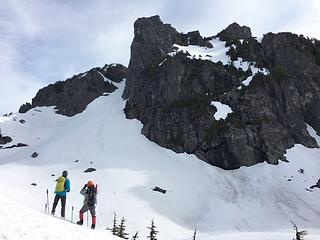 ScopingOutRouteUpGunnPeak 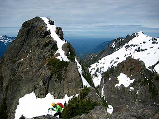 WestGunnPeak&GunnshyPeakFromEastGunnPeak 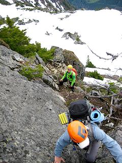 George&EileenClimbingGunnPoint 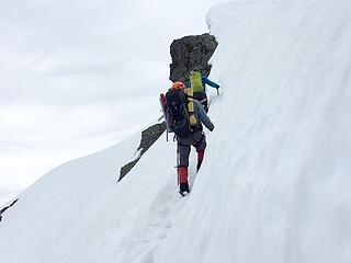 ClimbingSnowHeadwallOnTailgunnerPeak 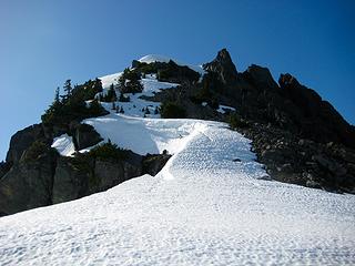 LookingUpNorthwestRidgeOfWingPeak 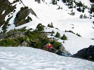 ClimbingNorthwestRidgeOfWingPeak 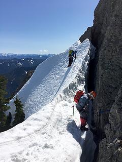 ClimbingWingPeakSnowfinger 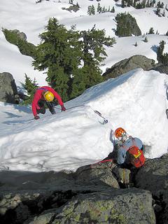 ClimbingWingPeakSnowfinger 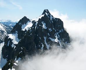 MerchantPeakFromWingPeak
|
| Back to top |
  
|
|
Brushbuffalo
Member

Joined: 17 Sep 2015
Posts: 1887 | TRs | Pics
Location: there earlier, here now, somewhere later... Bellingham in between |
| Trailcat wrote: | ClimbingWingPeakSnowfinger |
Looks quite sporty, Jim. I'm guessing the moat was even more sporty. Tend to hate those things.
Passing rocks and trees like they were standing still
Passing rocks and trees like they were standing still
|
| Back to top |
|
|
timberghost
Member

Joined: 06 Dec 2011
Posts: 1332 | TRs | Pics
|
best done when the snow pack is less and you can see some beautiful scenery
|
| Back to top |
|
|
Nancyann
Member
Joined: 28 Jul 2013
Posts: 2319 | TRs | Pics
Location: Sultan Basin |
|
Nancyann
Member
|
Tue Jun 09, 2020 12:23 pm |
|
|
Living in the area, I always look up at those peaks on a nice day and wonder how challenging it would be to get even part way up there. As Brushbuffalow said Looks quite sporty!
|
| Back to top |
|
|
timberghost
Member
Joined: 06 Dec 2011
Posts: 1332 | TRs | Pics
|
Just follow the climbers trail its not that bad to get into the area
|
| Back to top |
|
|
|
|
You cannot post new topics in this forum
You cannot reply to topics in this forum
You cannot edit your posts in this forum
You cannot delete your posts in this forum
You cannot vote in polls in this forum
|
Disclosure: As an Amazon Associate NWHikers.net earns from qualifying purchases when you use our link(s). |


