| Previous :: Next Topic |
| Author |
Message |
neek
Member


Joined: 12 Sep 2011
Posts: 2337 | TRs | Pics
Location: Seattle, WA |
|
neek
Member
|
 Wed Jun 24, 2020 11:48 pm |
|
|
After a scouting trip last week (not to mention a complete navigational failure into the Thunder Creek basin years ago), I was anxious to finally see the top of Clark. Allocating two days meant we'd have time for Luahna as well, and after not much arm twisting I agreed to try the more scenic Walrus Glacier route. We had a leisurely afternoon stroll down the White River trail and up to Boulder Pass. The Boulder Creek ford at 4100' was pretty much as before, but this time I wore shoes and carried a dog (a friend with two dogs joined us on the first day). Knee deep but moving fast, with big round slippery rocks underneath. There are two or three main branches, and the last is by far the worst. Also beware of nettles right before the crossing. The trail for the next 1000' is in good shape, with a few snow patches remaining. I hoped to run into a fellow nwhiker who I saw from the register was day hiking Clark. Where the Shepard's Trail splits off (still under snow) we looked over and saw a tiny speck coming down from the ridge. We had just downed our Rainiers, however, and were ready to move on. Boulder Pass was still buried, but we found two small dry flat spots on which to pitch tents.
It stayed fairly warm through the night so we knew the snow would be soft. We began hiking the next day at 6:15 AM, by which time it was already bright out and getting hot. We didn't really drop much from Boulder Pass, but stayed high, above the rocky bits. (On the return we went below them, which required slightly less sidehilling.) Rounding the next corner at 7000' brought the Walrus Glacier (called the Clark Glacier on the map) into view. It appeared to be in great shape, with the line to the summit fairly direct and obvious. Like most parties, we ended up making a Z in the middle to get around some broken up bits. Overall it was very mellow, and we were soon on Clark's E ridge, a mix of snow and rock. Obtaining the summit wasn't difficult.
Getting over to Luahna was less of a walk in the park. Simply getting down the SW ridge of Clark was annoying, with steep loose dirt/rock and snow. At 7600', when we appeared to be past the cliffy bits, we turned right, and sidehilled for what seemed like forever, gaining and losing several hundred feet in the process. What at first we thought were several sets of boot tracks were probably goats rather. When directly south of Luahna, we started heading up. The SE ridge looked like the most promising line of attack, and we attained it around 8200'. You wouldn't want to get up there much lower than that. At first the ridge was easy but then it got a little spicy, with some exposed knife edge sections. Fun IMO but perhaps the crux of the whole trip. Relieved to be at the midpoint of the journey, we signed the register full of familiar names, and enjoyed the T-shirt conditions for a few minutes.
For the return, we tried something different. My partner suggested hitting the Walrus early and going around the N side of Clark. I was nervous about switching to an unknown route but from the summit of Luahna we could see the whole thing laid out, and it looked quite mellow. This was indeed the case. We climbed a little above the saddle between Pt 7970 and Clark, then crossed over to the N side. After some gentle ups and downs we met up with our previous tracks and followed them back. This shortcut saved a fair amount of time and misery, and for all I know could be a common way to return, but I don't recall reading about it anywhere.
Back at the pass, we broke down our camp and began the long walk back to the car. Boulder creek was flowing higher than before and like a klutz I lost footing and got soaked up to my belly. I was glad to have my electronics stowed up high. A 4-mile long swarm of determined mosquitoes was waiting for us along the White River trail. I had heard about this menace, but due to their modest appearance the previous day (and complete absence the previous week), wasn't expecting it to nearly so bad. They kept us moving at least, and we made it back off lamp (barely).
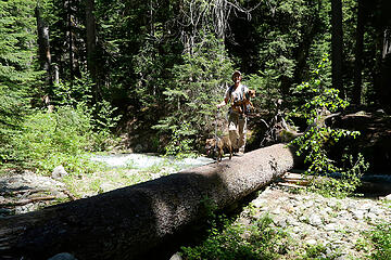 Lower crossing of Boulder Creek. No, the dogs didn't accompany us on the climb.  Saul 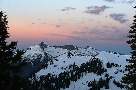 David 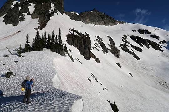 Starting the day from Boulder Pass 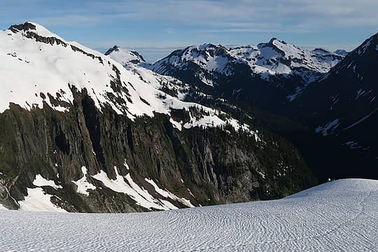 Impressive cliffs below Clark 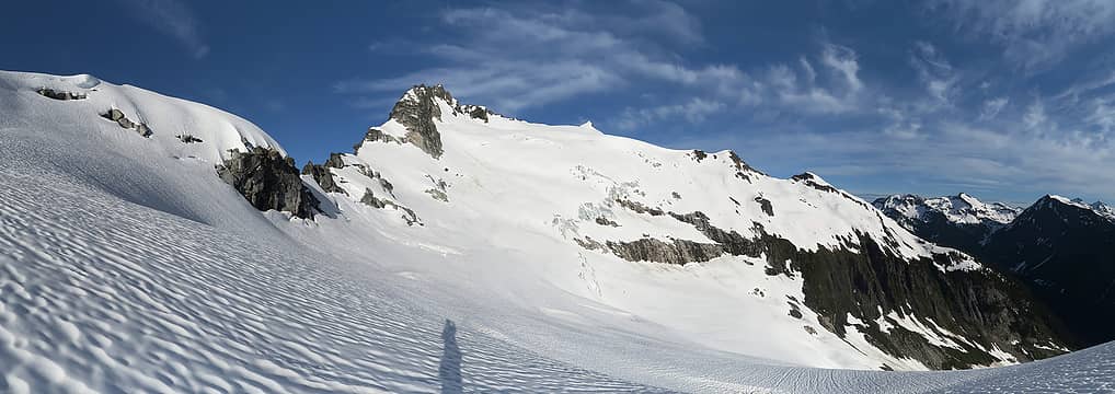 North side of Clark 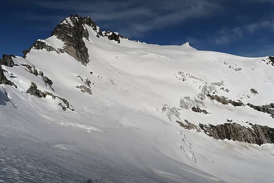 Walrus 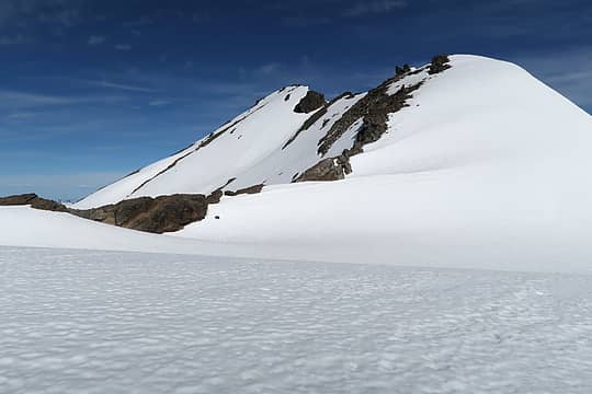 Approaching the summit of Clark 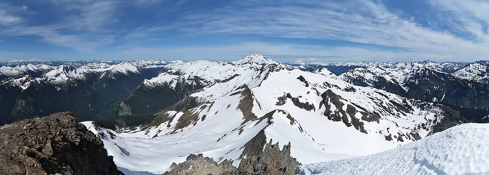 Summit pano from Clark, looking down the DaKobeds to Glacier Peak 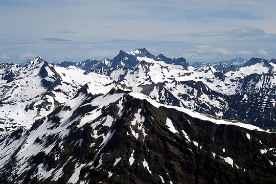 Bonanza 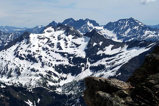 7FJ and Maude 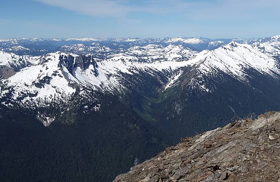 Saul and Indian Head 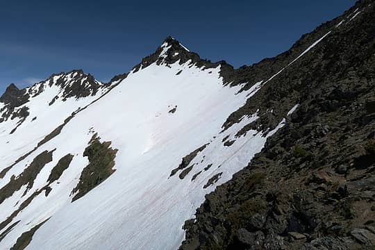 Heading to Luahna 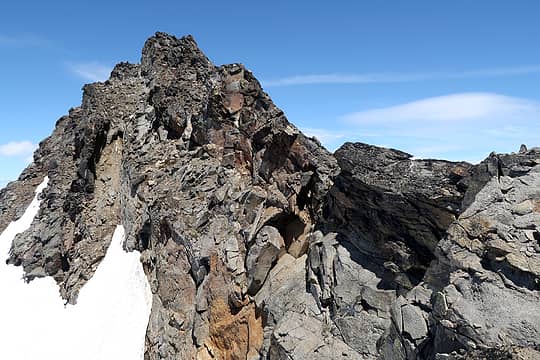 Luahna SE ridge 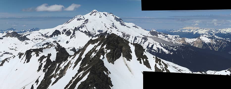 When stitching together a panorama is an afterthought 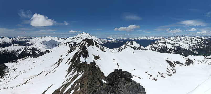 Luahna summit pano 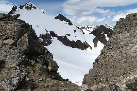 Looking back at Luahna from the saddle between Pt 7970 and Clark 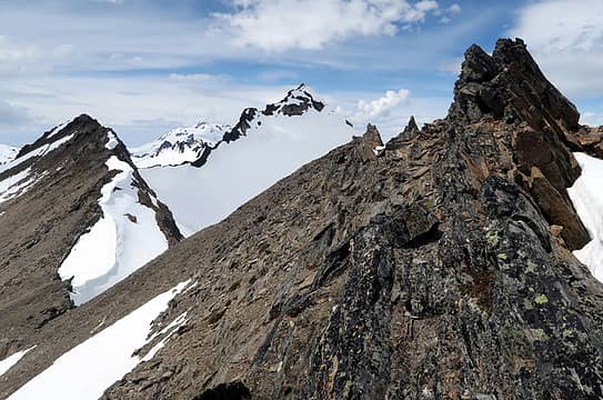 About where we crossed over 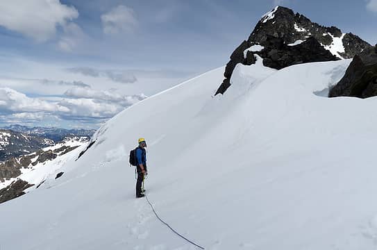 Getting ready to traverse N of Clark 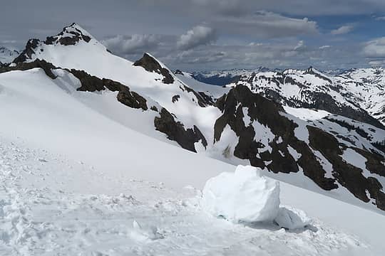 Looking back 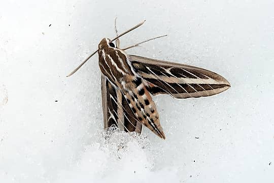 Sphinx moth 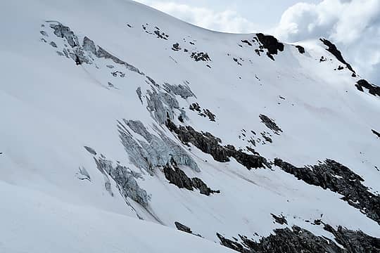 Walrus glacier ice 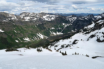 Napeequa valley 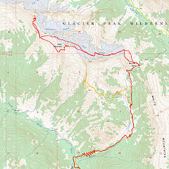 Map
|
| Back to top |
  
|
|
kitya
Fortune Cookie

Joined: 15 Mar 2010
Posts: 842 | TRs | Pics
Location: Duvall, WA |
|
kitya
Fortune Cookie
|
Thu Jun 25, 2020 8:06 am |
|
|
poor moth! i hope you saved her?
|
| Back to top |
|
|
awilsondc
Member

Joined: 03 Apr 2016
Posts: 1324 | TRs | Pics
|
Nice job on the getting back there and summiting this time. I really need to make it up there in the next year or two. Looks like such a beautiful area!
|
| Back to top |
|
|
neek
Member
Joined: 12 Sep 2011
Posts: 2337 | TRs | Pics
Location: Seattle, WA |
|
neek
Member
|
Thu Jun 25, 2020 8:24 pm |
|
|
| kitya wrote: | | poor moth! i hope you saved her? |
We were commenting on the large number of critters in the snow. Bugs, spiders, worms, even a dead bird. I didn't have the impression the moth was still alive, but did wonder who "wanted" to be there and who ended up in the wrong place. Lichens and algae too; it's fascinating how much life thrives on glaciers.
| awilsondc wrote: | | Nice job on the getting back there and summiting this time. I really need to make it up there in the next year or two. Looks like such a beautiful area! |
Yeah, you need to get up there and get some sunrise shots on the glacier 
|
| Back to top |
|
|
OutOfOffice
Member

Joined: 02 Jun 2015
Posts: 91 | TRs | Pics
Location: Seattle |
I'm the guy in blue above and just wanted to add some of my photos. I'll try not to post many duplicate scenes. Great trip! I can finally feel my legs again.
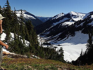 Looking back down the Boulder Creek Valley. 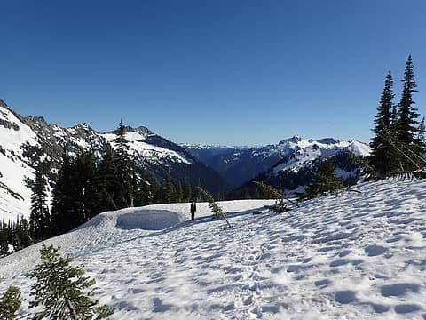 Topping out on Boulder Pass. 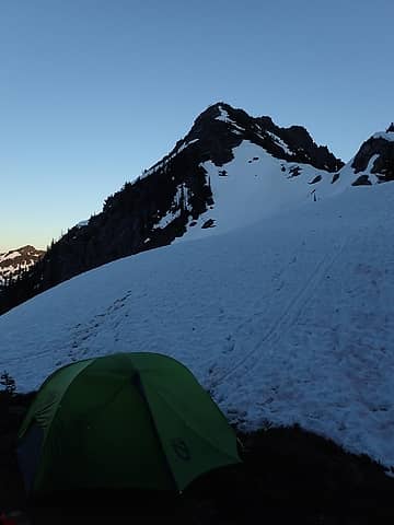 The new tent was a success. 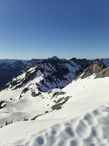 Looking back down on camp at the pass. 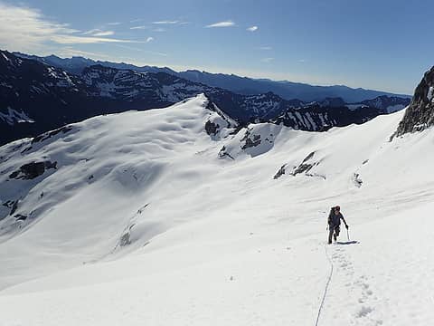 Mounting the Walrus. 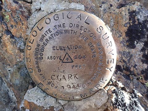 How many feet is it?!?! 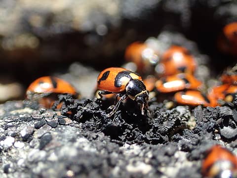 Bob's ordinary suburban life was turned upside down when he discovered that his wife is a regular at their neighbor's summit sex parties. 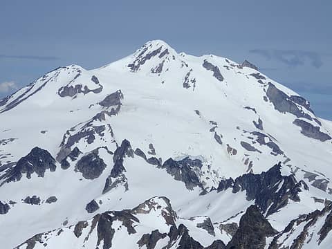 Up close and personal. 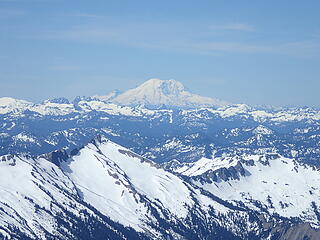 Mt. Si looking good today. 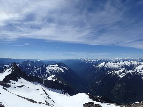 The White River Valley: Mosquito Central 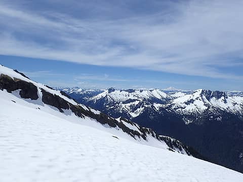 Saul and David on the way to Luahna. 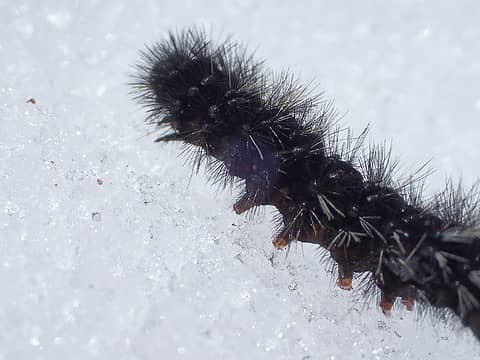 Not sure what these guys are doing up here, but then again, what are we doing up here? Having fun  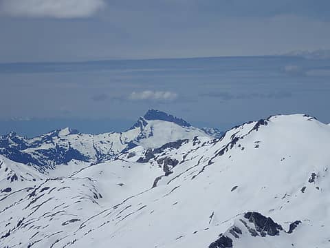 Shark! 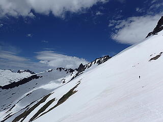 On the way down from Luahna. The clouds began to come in. 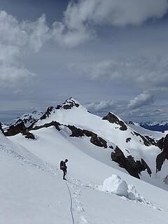 As Neek mentioned above, this is where we got onto the Walrus glacier to avoid that climb back up Clark on our return.
|
| Back to top |
|
|
Gregor
Gregor
Joined: 15 May 2007
Posts: 117 | TRs | Pics
|
|
Gregor
Gregor
|
Sat Jul 04, 2020 7:24 pm |
|
|
Great photos. Its been years since I was up there but i do recall the traverse around Clark being pretty mellow. Nice job getting these done.
|
| Back to top |
|
|
|
|
You cannot post new topics in this forum
You cannot reply to topics in this forum
You cannot edit your posts in this forum
You cannot delete your posts in this forum
You cannot vote in polls in this forum
|
Disclosure: As an Amazon Associate NWHikers.net earns from qualifying purchases when you use our link(s). |


