| Previous :: Next Topic |
| Author |
Message |
Tom
Admin

Joined: 15 Dec 2001
Posts: 17851 | TRs | Pics
|
|
Tom
Admin
|
 Wed Aug 21, 2019 4:05 pm |
|
|
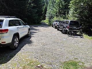
Neek's Chikamin TR piqued my interest in revisiting the Kendall Peak Lakes logging road. In 2003 we climbed Chikamin looping in via Rocky Run and out via the Kendall "back door" (a spur road that came within 400' or so vertical of the PCT). A year later the Kendall Peak Lakes road was barricaded 1/4 mile from Gold Creek. I remember the road being in good shape back in 2003 so was curious what kind of toll 15+ years had taken.
I've never been up to the lakes but they must be getting more popular as I found 2 other cars parked mid-week. The road was bikeable although steep and rocky in spots so I biked in lowest gear most of the way up. Around 3700' I hit a spot where things got brushy. After getting past this section I realized this was where the old spur road used to be. I back tracked and found the spur. It was overgrown so I stashed the bike to investigate. Walking was tedious and brushy and I regretted not putting on long pants. The road washed out at Coal Creek (more likely was decommissioned) and it was a steep but short scramble to get across. I went a little further and scrambled over another washed out creek crossing. Definitely not carrying a bike through either of those sections! The road ahead looked unappealingly steep and hot so I decided to turn around at this point.
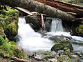
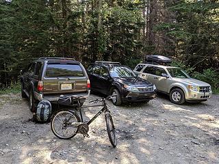 Parking Area 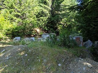 Barricade 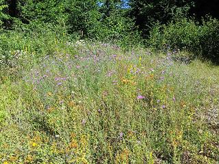 Wildflowers at first switchback 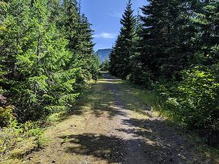 One of the more pleasant sections of road 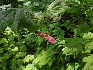 First signs of fall 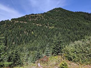 Old PCT back door 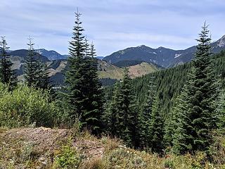 Snoqualmie Pass Ski Area 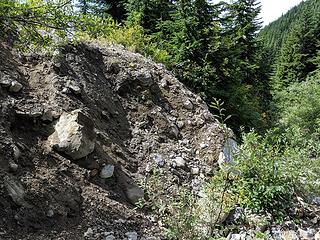 Coal Creek Washout 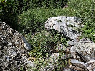 Not very bikeable! 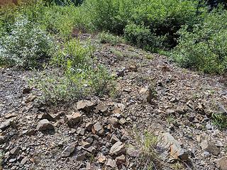 A semi-pleasant section of the decommissioned road 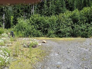 Switchback where I stopped 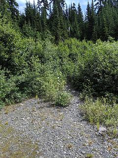 Boopath to vine maple 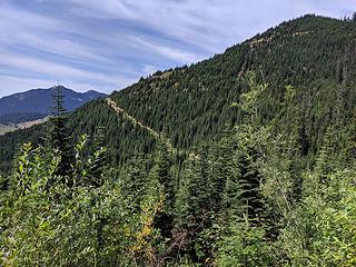 RIP back door  Brushing along road 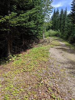 Brushing along road (probably more helpful in winter) 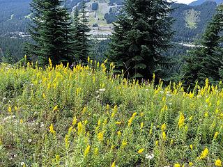 Snoqualmie Pass from Road 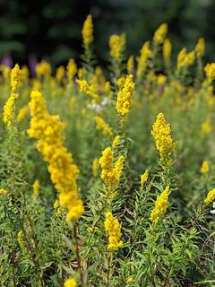 Experimenting with simulated bokeh on my Pixel 3 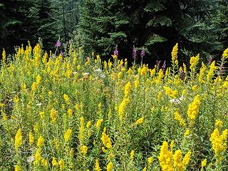 Wildflowers 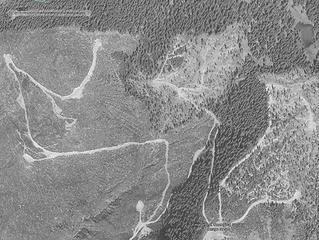 8/1994 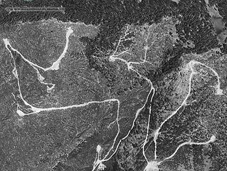 7/1998 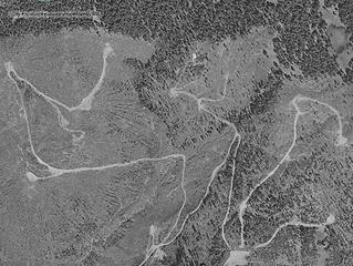 7/2003 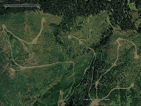 8/2006 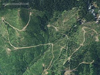 9/2009 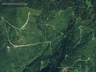 11/2011 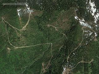 7/2012 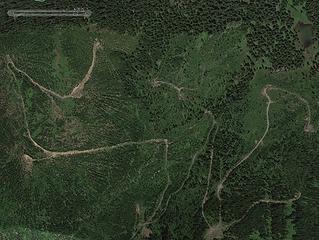 6/2015
|
| Back to top |
  
|
|
Tom
Admin
Joined: 15 Dec 2001
Posts: 17851 | TRs | Pics
|
|
Tom
Admin
|
Mon Aug 26, 2019 12:02 am |
|
|
Decided to explore more on Saturday. Left the parking area around 12:45 PM and made quick work up the road reaching my previous turnaround point within a half hour.
 2 other vehicles 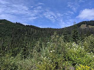 Old PCT shortcut to upper left RIP 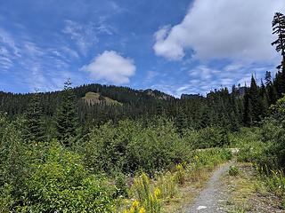 Previous trunaround 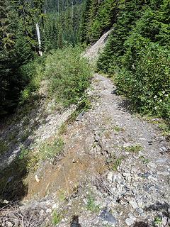 Road washing away 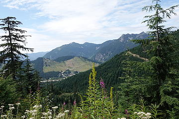 Snoqualmie Pass 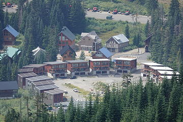 Zooming in 25x to Snoqualmie Pass 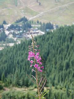 Flower 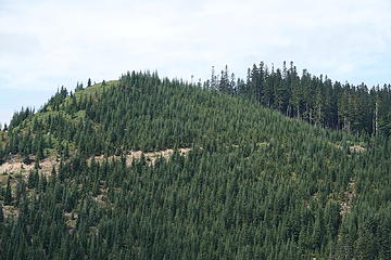 Zooming in to old PCT shortcut RIP 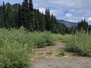 Upper section of road 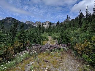 Downed tree 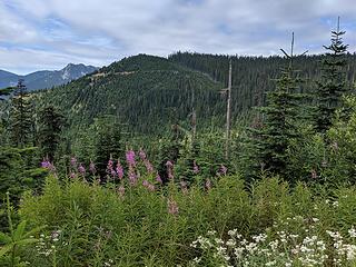 Old PCT shortcut RIP  Bootpath to lakes 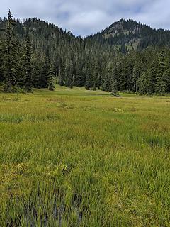 Arriving at lower lake 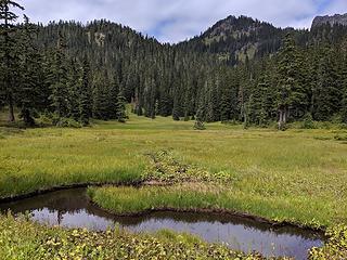 Marshy meadows 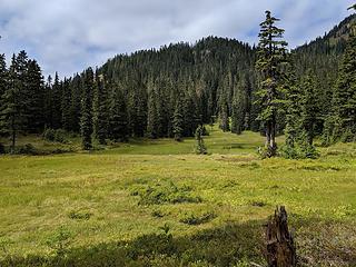 Leaving lower lake 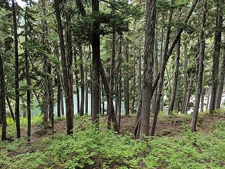 Traversing above middle lake 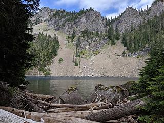 Arriving at upper lake 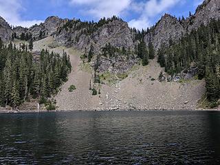 Upper lake 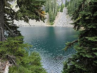 Upper lake from campsite 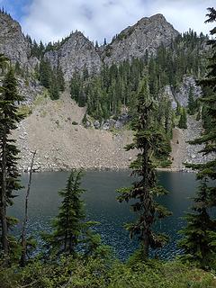 Leaving upper lake 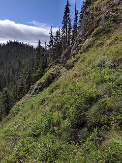 Found this a bit too sketchy to traverse 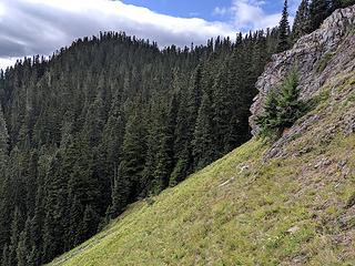 Much easier to traverse 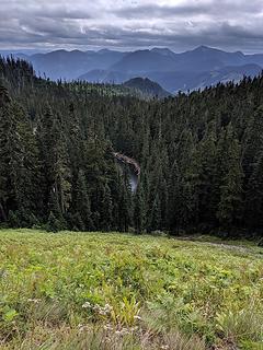 Middle lake peeking out 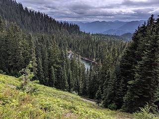 Traversing high above middle lake 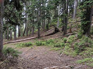 Traversed into open forest 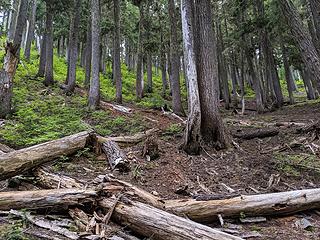 Follow the light 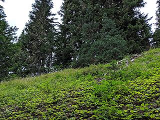 Approaching the ridge 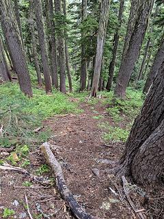 Boot path down to PCT 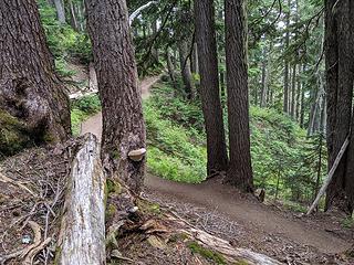 PCT 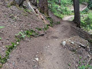 Making mental note of mound for my return 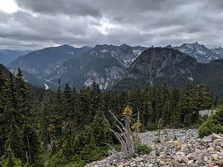 Incoming weather 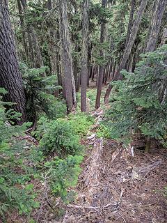 Found it a tad brushier approahcing middle lake 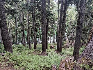 Descending to middle lake 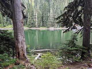 Arriving at middle lake 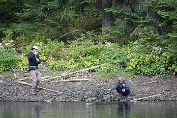 Fishing middle lake 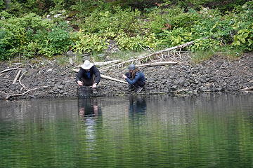 Father and daughter 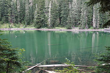 Bathtub ring around middle lake 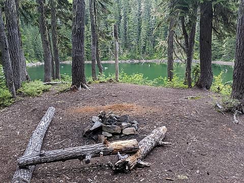 Campsite at middle lake 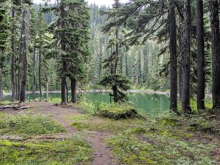 Leaving middle lake 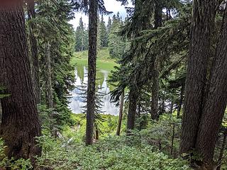 Lower lake  Abstract 25x zoom 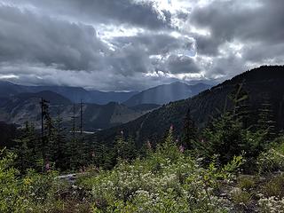 Incoming weather 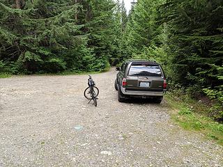 Back to the parking area
|
| Back to top |
|
|
Tom
Admin
Joined: 15 Dec 2001
Posts: 17851 | TRs | Pics
|
|
Tom
Admin
|
Mon Aug 26, 2019 12:54 am |
|
|
Thanks. Feels good to get out again. Body can't take the pounding that it used to. Oh to be a decade younger but with age comes the wisdom to savor each opportunity that much more.
|
| Back to top |
|
|
fourteen410
Member

Joined: 23 May 2008
Posts: 2628 | TRs | Pics
|
Only seen the upper lake in winter. It's much more pleasant looking in the summer than I'd expect. Thanks for sharing.
|
| Back to top |
|
|
Roly Poly
Member

Joined: 02 Jan 2013
Posts: 713 | TRs | Pics
|
How was the noise from I-90? When I went there you could hear I-90 pretty loud for the first three miles. One other hiker I met turned around as the noise was too loud for him. Ive never gone back.
|
| Back to top |
|
|
Gil
Member

Joined: 29 Sep 2004
Posts: 4062 | TRs | Pics
|
|
Gil
Member
|
Mon Aug 26, 2019 7:56 am |
|
|
Nice report, Tom!
Friends help the miles go easier.
Klahini
Friends help the miles go easier.
Klahini
|
| Back to top |
|
|
Tom
Admin
Joined: 15 Dec 2001
Posts: 17851 | TRs | Pics
|
|
Tom
Admin
|
Mon Aug 26, 2019 9:39 am |
|
|
I don't recall much noise along the road but I was biking most of rhe way. When I stopped to take pictures I don't recall freeway noise like say from granite mountain. I think I would probably get bored up there pretty quick though and the lakes do have a bit of a bathtub ring to them.
The few reports I found online indicated the lakea weren't that popular in summer but was surprised to see how many GPS track recordings were posted on alltrails. I encountered more people than the parking area indicated but I think some park further down the road right off the freeway. I wouldn't go up there without a bike in summer.
|
| Back to top |
|
|
Malachai Constant
Member

Joined: 13 Jan 2002
Posts: 16092 | TRs | Pics
Location: Back Again Like A Bad Penny |
We go up there most every winter. Very popular it is about only place you do not need a grooming pass. Smelly from dog leavings when the snow melts. Havent been up in Summer since they blocked it.
"You do not laugh when you look at the mountains, or when you look at the sea." Lafcadio Hearn
"You do not laugh when you look at the mountains, or when you look at the sea." Lafcadio Hearn
|
| Back to top |
|
|
Randito
Snarky Member

Joined: 27 Jul 2008
Posts: 9512 | TRs | Pics
Location: Bellevue at the moment. |
|
Randito
Snarky Member
|
Tue Aug 27, 2019 4:43 am |
|
|
Walking up the road in the summer is way less crowded on a sunny weekend than the PCT or Snow Lake trail or most of other trails along the I-90 corridor. My dog loved romping free along there. An umbrella helps with the sun beating down while traversing the clear cuts. Great views of Mt Rainier and the Alpental valley.
|
| Back to top |
|
|
Backpacker Joe
Blind Hiker

Joined: 16 Dec 2001
Posts: 23956 | TRs | Pics
Location: Cle Elum |
Great report Thomas. How far would you say it is from the PCT to the middle lake? There is supposed to be a well used trail somewhere just before the middle lake that connects to the PCT.
"If destruction be our lot we must ourselves be its author and finisher. As a nation of freemen we must live through all time or die by suicide."
Abraham Lincoln
"If destruction be our lot we must ourselves be its author and finisher. As a nation of freemen we must live through all time or die by suicide."
Abraham Lincoln
|
| Back to top |
|
|
Tom
Admin
Joined: 15 Dec 2001
Posts: 17851 | TRs | Pics
|
|
Tom
Admin
|
Tue Aug 27, 2019 8:49 pm |
|
|
I didn't see anything that looked well used but maybe there is another route or perhaps I lost it on the way down. I crested at the LD in wilderness on the quad.
|
| Back to top |
|
|
Backpacker Joe
Blind Hiker
Joined: 16 Dec 2001
Posts: 23956 | TRs | Pics
Location: Cle Elum |
Thanks. I know Big Steve has talked about using the connector trial in the past. Im heading back in there in September. Ill look for it then. Its way nicer up there in the fall.
"If destruction be our lot we must ourselves be its author and finisher. As a nation of freemen we must live through all time or die by suicide."
Abraham Lincoln
"If destruction be our lot we must ourselves be its author and finisher. As a nation of freemen we must live through all time or die by suicide."
Abraham Lincoln
|
| Back to top |
|
|
Malachai Constant
Member
Joined: 13 Jan 2002
Posts: 16092 | TRs | Pics
Location: Back Again Like A Bad Penny |
Used to go there every summer there never was a well used trail there was a route from the middle lake to the PCT which had flags ever 50 or so until I and others took them down. I was up there on the PCT a couple weeks ago and identified where it used to go but could see no real trace. There was a swale but that could have been a game trail. If you have to walk/ride the road it is not that much shorter than the Commonwealth Basin trail.
"You do not laugh when you look at the mountains, or when you look at the sea." Lafcadio Hearn
"You do not laugh when you look at the mountains, or when you look at the sea." Lafcadio Hearn
|
| Back to top |
|
|
puzzlr
Mid Fork Rocks

Joined: 13 Feb 2007
Posts: 7220 | TRs | Pics
Location: Stuck in the middle |
|
puzzlr
Mid Fork Rocks
|
Sat Aug 31, 2019 9:25 pm |
|
|
I like the sequence of old aerial photos. And I often wondered about that back door route. If they just hadn't made the PCT route so circuitous people wouldn't be constantly trying to find short cuts.
|
| Back to top |
|
|
Randito
Snarky Member
Joined: 27 Jul 2008
Posts: 9512 | TRs | Pics
Location: Bellevue at the moment. |
|
Randito
Snarky Member
|
Sun Sep 01, 2019 4:52 am |
|
|
| puzzlr wrote: | | If they just hadn't made the PCT route so circuitous people wouldn't be constantly trying to find short cuts |
Since the old Commonwealth Basin trail and the PCT intersect, I rarely use the PCT along the lower portion.
The extra length is mostly to skirt private property and additionally to ensure an equestrian grade.
|
| Back to top |
|
|
|
|


