| Previous :: Next Topic |
| Author |
Message |
geyer
Member


Joined: 23 May 2017
Posts: 463 | TRs | Pics
Location: Seattle |
|
geyer
Member
|
 Wed Jul 14, 2021 8:26 am |
|
|
Date: July 10-11, 2021
Distance: 36.7 miles RT
Accum. Elevation Gain: 8800ish ft
Humans Seen: 6, 0 after first two miles of trail
With the amount of bickering you folks do over in trail talk about I-90 hikes, I thought I'd show you how an I-90 hike gets done  The background to this trip actually originated in a chat group with awilsondc when he asked if we knew any cool places for astrophotography. After about 10 minutes of scrolling through Google Earth and Caltopo, I picked out this nice little tarn on a plateau just northwest of the striking ridge of Bears Breast. It seemed like a pain to get to, so we never really discussed it past that. But I kept thinking about it...
Day 1: Dingford to Williams Lake + Bears Breast ridge side trip
Distance: 16.2 miles
Net Elevation Gain: ~5000'
Biking: 8 miles, 1400' gain
Hiking: 8.2 miles, 3600' gain
Summits: 0
I woke up early Saturday morning, entirely un-stoked to go on a solo trip. I'd been building it up in my head for days but the morning came and it just felt kind of pointlessly dangerous. I did a lot more solo off-trail adventuring a few years ago, but after finding some good partners, it no longer felt necessary. That being said, there are some serious perks to going solo: when you're out of shape, you don't have to feel bad about going slow or even changing plans and going with the flow. This is generally when the best exploring happens The background to this trip actually originated in a chat group with awilsondc when he asked if we knew any cool places for astrophotography. After about 10 minutes of scrolling through Google Earth and Caltopo, I picked out this nice little tarn on a plateau just northwest of the striking ridge of Bears Breast. It seemed like a pain to get to, so we never really discussed it past that. But I kept thinking about it...
Day 1: Dingford to Williams Lake + Bears Breast ridge side trip
Distance: 16.2 miles
Net Elevation Gain: ~5000'
Biking: 8 miles, 1400' gain
Hiking: 8.2 miles, 3600' gain
Summits: 0
I woke up early Saturday morning, entirely un-stoked to go on a solo trip. I'd been building it up in my head for days but the morning came and it just felt kind of pointlessly dangerous. I did a lot more solo off-trail adventuring a few years ago, but after finding some good partners, it no longer felt necessary. That being said, there are some serious perks to going solo: when you're out of shape, you don't have to feel bad about going slow or even changing plans and going with the flow. This is generally when the best exploring happens  I had scouted a route to the ridge of Bears Breast and it looked very feasible, but I still felt nervous. A lot of things have happened since I last soloed off trail, such as... 2020 ('nuf said).
For a while Saturday morning, I wasn't even sure if I wanted to go anymore. But I willed myself to load my car with my bike and pack and make the short drive to the end of the middle fork road and the not-so-short road to the Dingford Trailhead. This was my first time on the road and it's honestly not that bad, with the exception of the two creek beds with steep walls you have to drive through. If my 16 year old CR-V can make, I'd venture to say that even a Subaru could make it (shots fired I had scouted a route to the ridge of Bears Breast and it looked very feasible, but I still felt nervous. A lot of things have happened since I last soloed off trail, such as... 2020 ('nuf said).
For a while Saturday morning, I wasn't even sure if I wanted to go anymore. But I willed myself to load my car with my bike and pack and make the short drive to the end of the middle fork road and the not-so-short road to the Dingford Trailhead. This was my first time on the road and it's honestly not that bad, with the exception of the two creek beds with steep walls you have to drive through. If my 16 year old CR-V can make, I'd venture to say that even a Subaru could make it (shots fired  ) When I got to the parking lot, there was a group of probably underaged kids shotgunning beers before heading off to the hot springs. Seemed like a way better time than what I was about to do, to be honest.
I mounted my trusty Salsa Timberjack steed and headed up past the gate. Oooof. 8 miles of constant uphill with a heavy overnight pack is not easy. By the end, I had probably sweat multiple liters out and was already feeling the effects of dehydration. My pace slowed to that of a hiker. That horse camp was such a welcome sight. The ride has some good moments like the views of Snoqualmie Mountain's north side. Oh well, it would all be worth it on the way back.
Almost immediately after stashing my bike and beginning the hike, I ran into a couple who, like me, wanted to know who they had to pay off to get access past the gate at Dingford. There were 8 cars parked on that road! What kind of ...errm, favors ... do I need to do to get my hands on those keys!?! I hiked past the couple and ran into two Forest Service workers who were clearing brush from the trail. It needed it badly in those first couple miles. Kudos to those two for working through the heat. After that, it was a beautifully designed trail with all kinds of boardwalks and bridges.
For most of the way, it was a pretty trail, but not something I'd want to venture out to on its own. That is, until reaching the north flanks of Overcoat, and then Iron Cap, and then the pond with views of the Chief group and Bears Breast. Alright alright alright as Matthew McConaughey would say. To top it all off, Little Big Chief's NW face was just stunning. I wanted to just stop and stare at it all weekend. It was that nice. ) When I got to the parking lot, there was a group of probably underaged kids shotgunning beers before heading off to the hot springs. Seemed like a way better time than what I was about to do, to be honest.
I mounted my trusty Salsa Timberjack steed and headed up past the gate. Oooof. 8 miles of constant uphill with a heavy overnight pack is not easy. By the end, I had probably sweat multiple liters out and was already feeling the effects of dehydration. My pace slowed to that of a hiker. That horse camp was such a welcome sight. The ride has some good moments like the views of Snoqualmie Mountain's north side. Oh well, it would all be worth it on the way back.
Almost immediately after stashing my bike and beginning the hike, I ran into a couple who, like me, wanted to know who they had to pay off to get access past the gate at Dingford. There were 8 cars parked on that road! What kind of ...errm, favors ... do I need to do to get my hands on those keys!?! I hiked past the couple and ran into two Forest Service workers who were clearing brush from the trail. It needed it badly in those first couple miles. Kudos to those two for working through the heat. After that, it was a beautifully designed trail with all kinds of boardwalks and bridges.
For most of the way, it was a pretty trail, but not something I'd want to venture out to on its own. That is, until reaching the north flanks of Overcoat, and then Iron Cap, and then the pond with views of the Chief group and Bears Breast. Alright alright alright as Matthew McConaughey would say. To top it all off, Little Big Chief's NW face was just stunning. I wanted to just stop and stare at it all weekend. It was that nice.
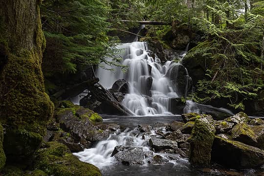
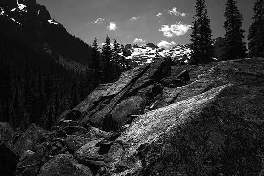 Nice views of Overcoat and some huge boulders 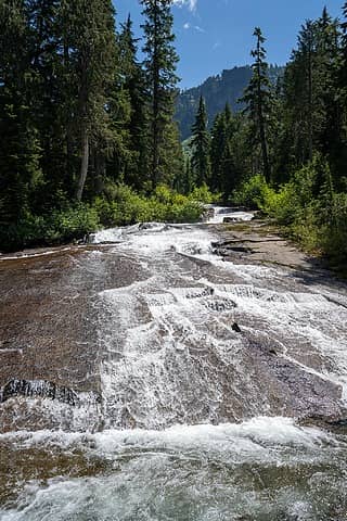 slab waterfall 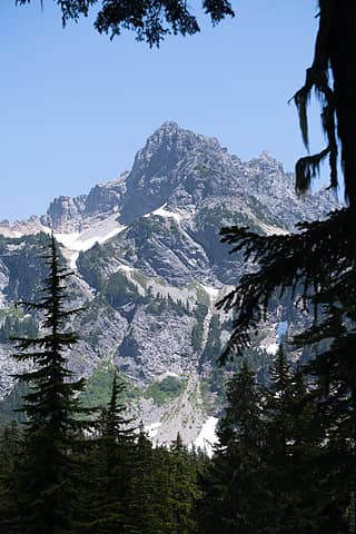 BB 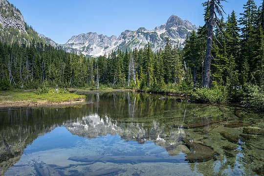 Bears Breast 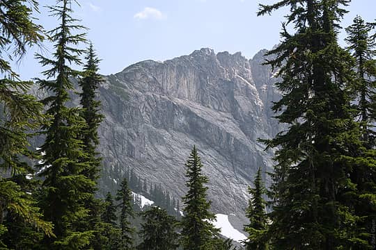 Little big chief 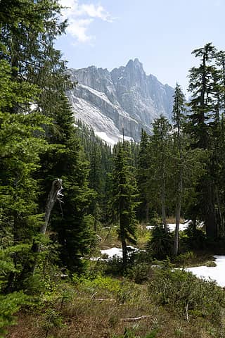 Little big chief 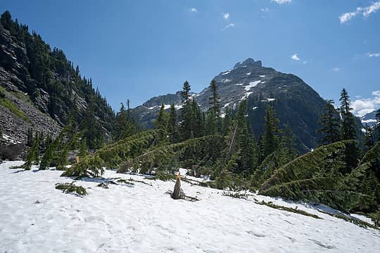 Some serious avalanches this spring 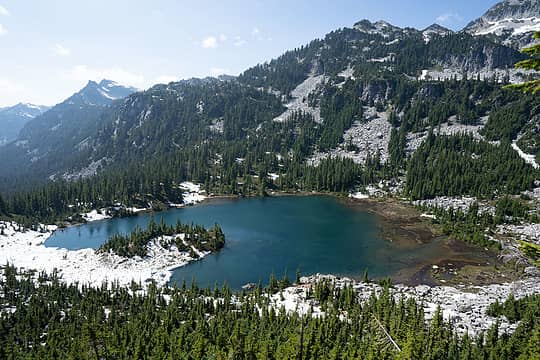 Wiliams Lake 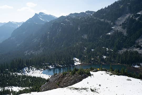 Sup tent 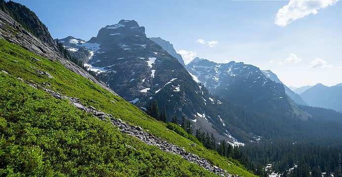 Nice views 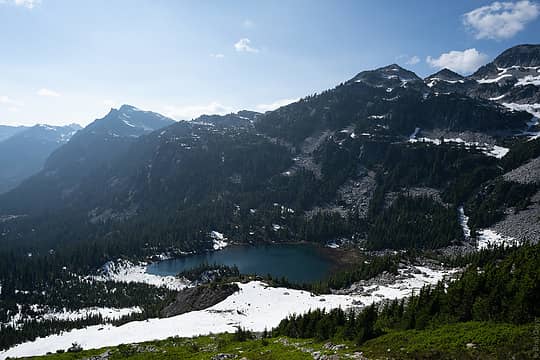 Hi tent 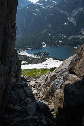 The gully I climbed up + my tent  Bald Eagle  BB  BB  BB 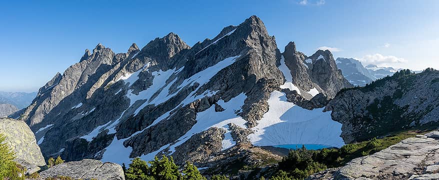 BB 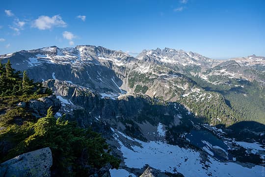 Hinman and Daniel 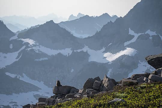 marmot 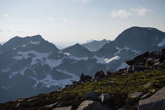 marmot 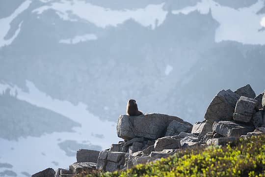 marmot 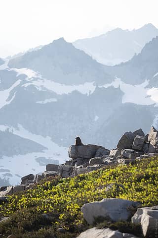 marmot 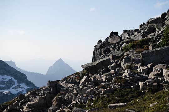 2 marmots 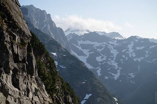 views on the way down 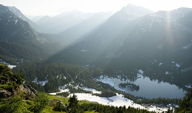 hey tent 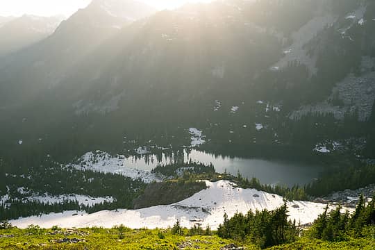 last light 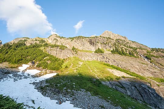 up 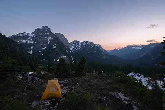 goodnight 
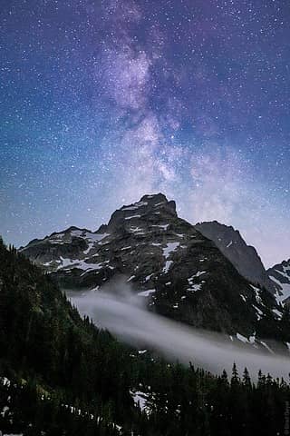 Little big Chief, Little big galaxy 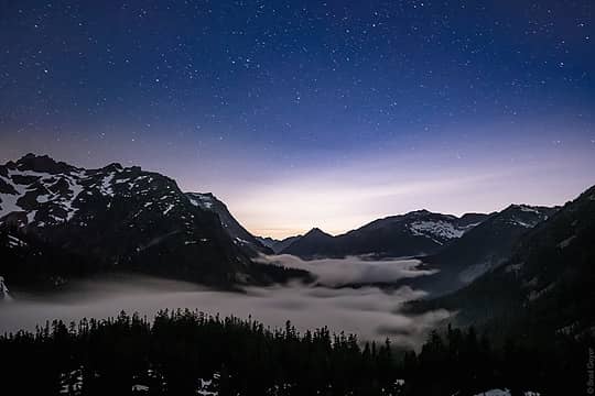 MF Snoqualmie Valley 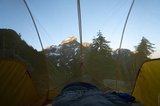 Wake up call 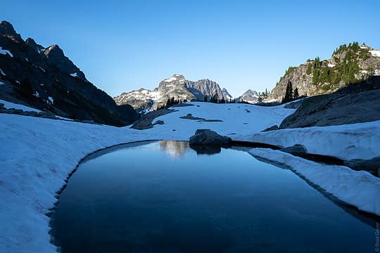 Chain Lakes 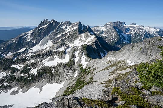 Bears Breast 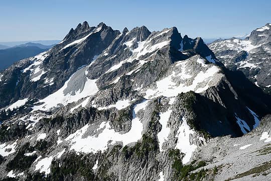 Bears Breast 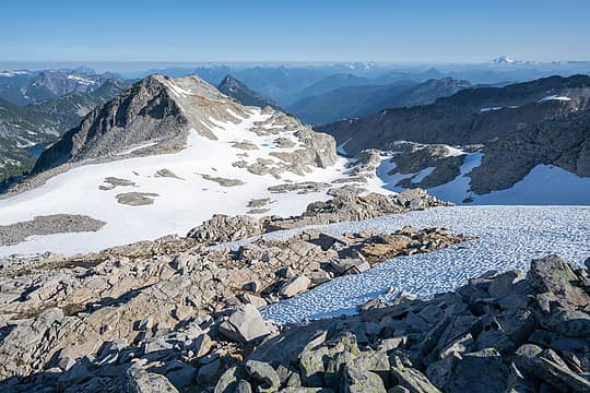 Hinman Glacier 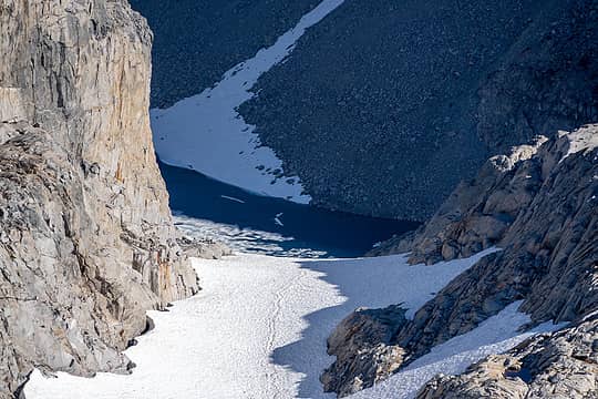 Hinman glacier 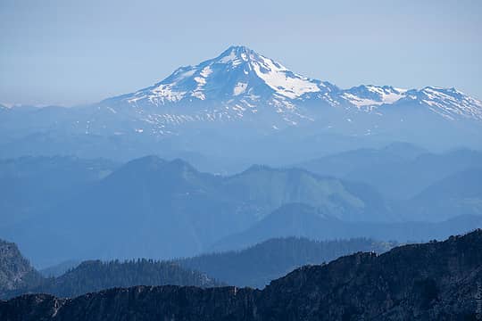 GP 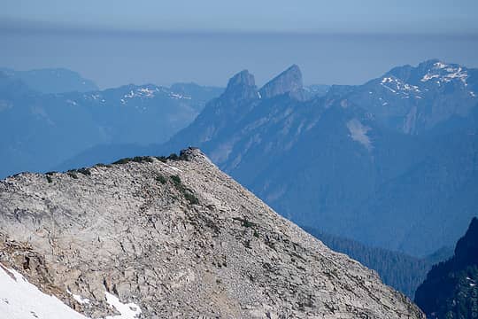 Baring lookin small 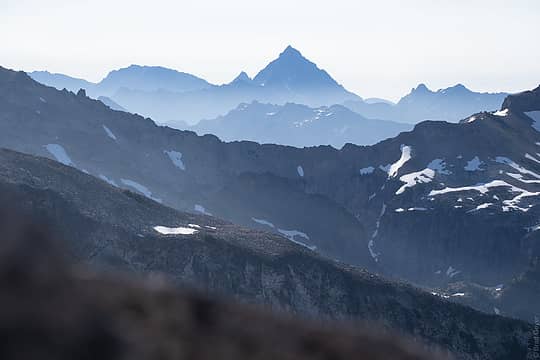 Stu-bear 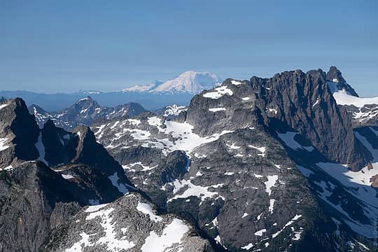 Hey there rain-dog 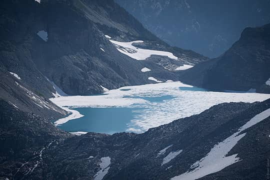 Pea Soup 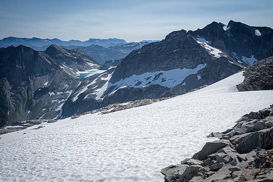 Daniel + Pea Soup 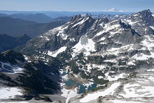 Summit Views 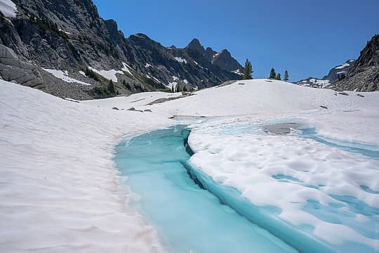 Chain Lakes 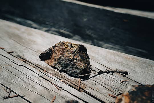 "I LOVE GOLD" - goldmember
 hot.choss, valleyjo, dicey, Foist, mosey, Nancyann, Alden Ryno, Walkin' Fool, hapemask, ChrisSJI, raising3hikers, jstern, drewcoll, GaliWalker, Bramble_Scramble, triad, Gabep, reststep, RichP hot.choss, valleyjo, dicey, Foist, mosey, Nancyann, Alden Ryno, Walkin' Fool, hapemask, ChrisSJI, raising3hikers, jstern, drewcoll, GaliWalker, Bramble_Scramble, triad, Gabep, reststep, RichP
hot.choss, valleyjo, dicey, Foist, mosey, Nancyann, Alden Ryno, Walkin' Fool, hapemask, ChrisSJI, raising3hikers, jstern, drewcoll, GaliWalker, Bramble_Scramble, triad, Gabep, reststep, RichP |
| Back to top |
  
|
|
awilsondc
Member

Joined: 03 Apr 2016
Posts: 1324 | TRs | Pics
|
| geyer wrote: | BB Little big Chief, Little big galaxy |
 I'm super jealous of your photography opportunities this trip! Great stuff man, big thumbs up. I'm super jealous of your photography opportunities this trip! Great stuff man, big thumbs up. 
|
| Back to top |
|
|
Gabep
Member
Joined: 03 Aug 2016
Posts: 31 | TRs | Pics
Location: Kenmore |
|
Gabep
Member
|
Wed Jul 14, 2021 9:27 am |
|
|
Fun looking trip Brad. Great pics!
|
| Back to top |
|
|
Bosterson
Member

Joined: 12 Sep 2019
Posts: 294 | TRs | Pics
Location: Portland |
| geyer wrote: | BB |

Go! Take a gun! And a dog! Without a leash! Chop down a tree! Start a fire! Piss wherever you want! Build a cairn! A HUGE ONE!
BE A REBEL! YOU ONLY LIVE ONCE!
(-bootpathguy)
Go! Take a gun! And a dog! Without a leash! Chop down a tree! Start a fire! Piss wherever you want! Build a cairn! A HUGE ONE!
BE A REBEL! YOU ONLY LIVE ONCE!
(-bootpathguy)
|
| Back to top |
|
|
Bootpathguy
Member

Joined: 18 Jun 2015
Posts: 1790 | TRs | Pics
Location: United States |
Always enjoy your TR's
Experience is what'cha get, when you get what'cha don't want
Experience is what'cha get, when you get what'cha don't want
|
| Back to top |
|
|
chiwakum
not credible

Joined: 29 Jun 2009
Posts: 980 | TRs | Pics
Location: Ballard |
|
chiwakum
not credible
|
Thu Jul 15, 2021 5:39 pm |
|
|
I passed by that way last week on my way over DMG and south on the PCT to Lake Kachees via mineral creek. Great pics.
I skipped Hinman and Williams this time though.
|
| Back to top |
|
|
contour5
Member

Joined: 16 Jul 2003
Posts: 2963 | TRs | Pics
|
|
contour5
Member
|
Fri Jul 16, 2021 6:36 pm |
|
|
Stunner of a tarn. First class trip report, awesome pictures.
I've camped at the exact same spot above Williams Lake and never even noticed that tarn on the map. Nice catch! Thanks for sharing!
geyer
geyer |
| Back to top |
|
|
puzzlr
Mid Fork Rocks

Joined: 13 Feb 2007
Posts: 7220 | TRs | Pics
Location: Stuck in the middle |
|
puzzlr
Mid Fork Rocks
|
Fri Jul 16, 2021 7:56 pm |
|
|
| geyer wrote: | | there was a group of probably underaged kids shotgunning beers before heading off to the hot springs |
I'm sorry to hear that. But I was just up there and did a complete survey of the trailhead for invasive weeds and didn't see any left-over debris from the shooting so at least they cleaned up after themselves. There has been a shooting ban in the valley since 2011.
| geyer wrote: | | Little Big Chief's NW face was just stunning |
So true. It looks ridiculously hard from the west side. I still haven't reconciled in my head the view from the west with the relatively easy (briefly 4th class) route to the summit.
| geyer wrote: | BB |
So beautiful. Had you not just done it, I'd be put off by the steepness of the slopes up to here. I don't think this is in any danger of being overrun :-)
| geyer wrote: | Summit Views |
What's up with all the dirty snow debris in Lake Rowena? This corroborates other reports with evidence that the 2020/2021 winter generated some unusually large avalanches.
Great report. You sure made the most out of your time spent up there.
|
| Back to top |
|
|
Route Loser
Member
Joined: 24 Jul 2012
Posts: 199 | TRs | Pics
Location: Whidbey Island |
Appreciate the honest musings on motivation for solo trips. Those are some seriously beautiful photos.
|
| Back to top |
|
|
Backpacker Joe
Blind Hiker

Joined: 16 Dec 2001
Posts: 23956 | TRs | Pics
Location: Cle Elum |
Ya, Rowena waasnt like that when I was there. Nice work there.
"If destruction be our lot we must ourselves be its author and finisher. As a nation of freemen we must live through all time or die by suicide."
Abraham Lincoln
"If destruction be our lot we must ourselves be its author and finisher. As a nation of freemen we must live through all time or die by suicide."
Abraham Lincoln
|
| Back to top |
|
|
zephyr
aka friendly hiker

Joined: 21 Jun 2009
Posts: 3370 | TRs | Pics
Location: West Seattle |
|
zephyr
aka friendly hiker
|
Sat Jul 17, 2021 12:01 pm |
|
|
| puzzlr wrote: | | geyer wrote: | | there was a group of probably underaged kids shotgunning beers before heading off to the hot springs |
I'm sorry to hear that. But I was just up there and did a complete survey of the trailhead for invasive weeds and didn't see any left-over debris from the shooting so at least they cleaned up after themselves. There has been a shooting ban in the valley since 2011. |
puzzlr, I'm no expert here but I read this as hurriedly drinking the beers. Shotgunning beers I believe means to down them quickly. I interpreted this as the kids were downing them quickly to get buzzed before heading to the springs. There's even a Wiki for it.
So geyer can verify, but I don't think the kids were shooting the cans with actual shotguns. ~z
|
| Back to top |
|
|
puzzlr
Mid Fork Rocks
Joined: 13 Feb 2007
Posts: 7220 | TRs | Pics
Location: Stuck in the middle |
|
puzzlr
Mid Fork Rocks
|
Sun Jul 18, 2021 12:04 pm |
|
|
Thanks, zephyr. That makes a lot more sense re the beers.
|
| Back to top |
|
|
geyer
Member
Joined: 23 May 2017
Posts: 463 | TRs | Pics
Location: Seattle |
|
geyer
Member
|
Mon Jul 19, 2021 5:41 pm |
|
|
| zephyr wrote: | | So geyer can verify, but I don't think the kids were shooting the cans with actual shotguns. ~z |
That's correct z, no guns just 20 year olds doing what 20 year olds do.
Appreciate all the other comments, all.
|
| Back to top |
|
|
|
|
You cannot post new topics in this forum
You cannot reply to topics in this forum
You cannot edit your posts in this forum
You cannot delete your posts in this forum
You cannot vote in polls in this forum
|
Disclosure: As an Amazon Associate NWHikers.net earns from qualifying purchases when you use our link(s). |


