| Previous :: Next Topic |
| Author |
Message |
olympichiker77
Member


Joined: 06 Jun 2018
Posts: 16 | TRs | Pics
Location: Bainbridge Island |
I don't get over to the Cascades nearly as much as I would like, but last weekend I made it over by Baker and was not disappointed. I had a late start but it actually ended up working out quite nicely. I got to Glacier at 18:00, and drove the awful NF-37 up to a packed trailhead (took about 50 minutes). I've been on some bad roads, but the amount of potholes on this one is almost comical. The very first part of the Skyline Divide trail was quite a bit steeper than the rest, which made me question if the elevation gain on wta was accurate. Luckily the grade mellowed out, and the views up on the ridge made up for the steepness between the knolls.
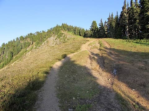 Annoyingly steep section 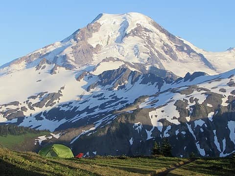 The view I was excited for! 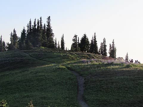 More tent 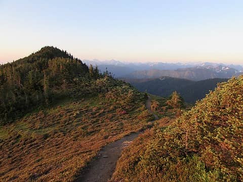 Golden hour 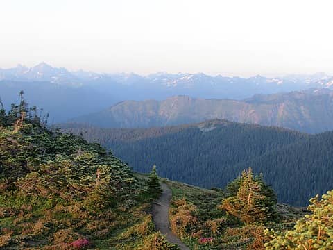 Golden hour looking north 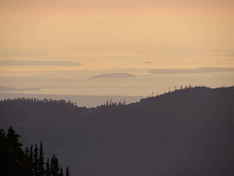 Lummi and other islands I think 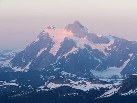 Shuksan starting to glow 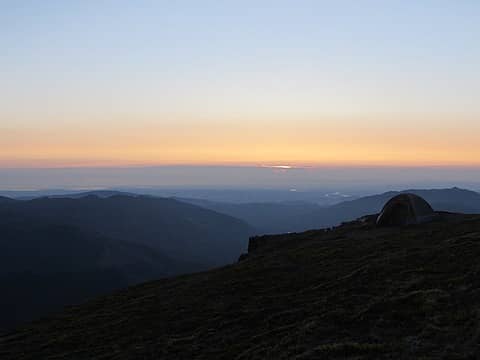 A pretty ideal spot 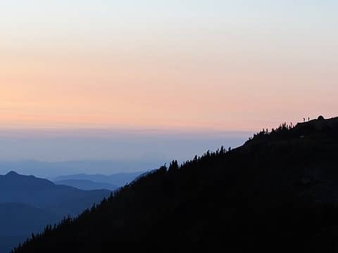 Spot the campers 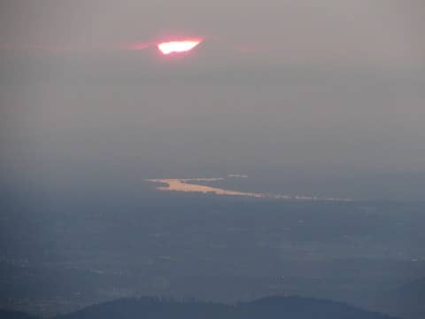 The Fraser possibly? 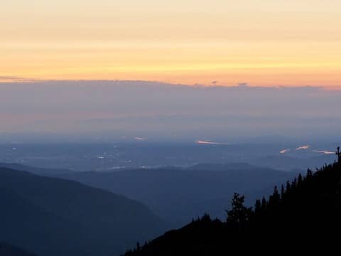 Sunset beauty 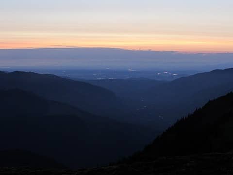 Mt. Baker Highway is somewhere down there 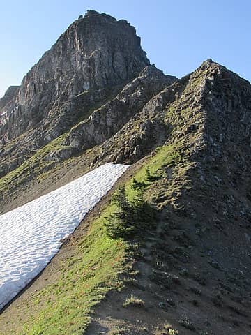 What lies ahead 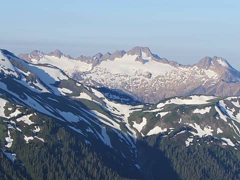 Twin Sisters from camp 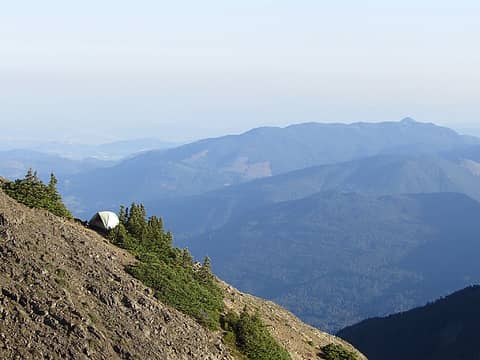 Zooming in on camp 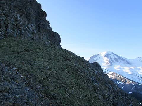 Fun part of Chowder 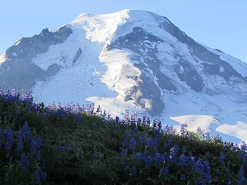 Kulshan rises 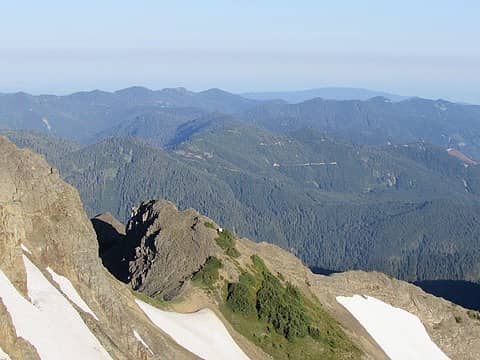 My tent just keeps getting smaller 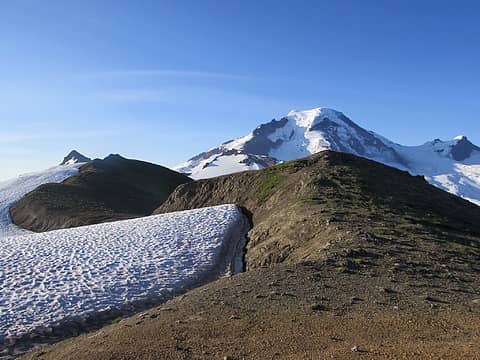 The Chowder Plateau 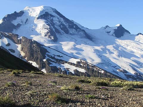 View of Baker from Chowder Plateau 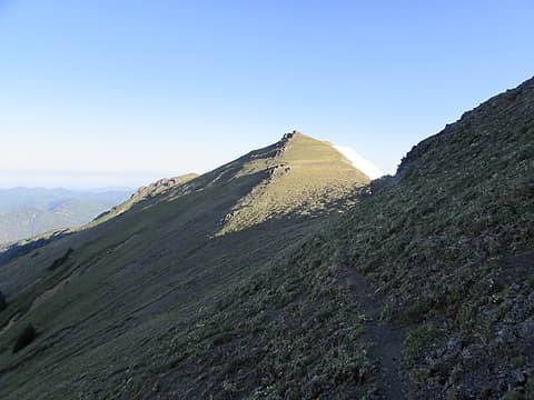 Very faint path 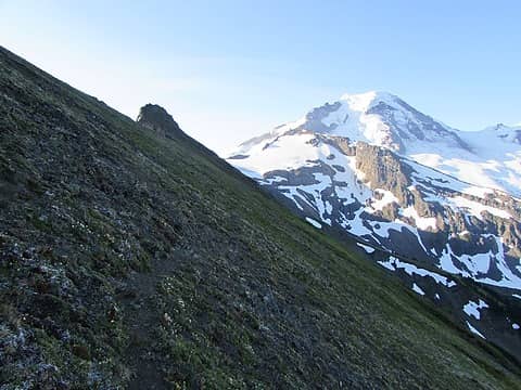 Side-hilling in the shade 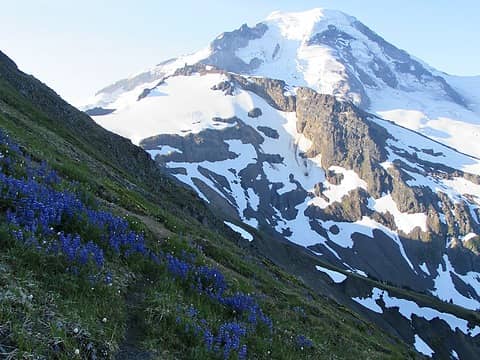 Dense patch of Lupine 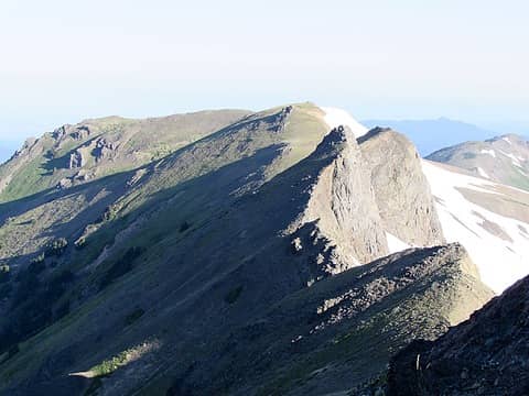 Looking back along Chowder 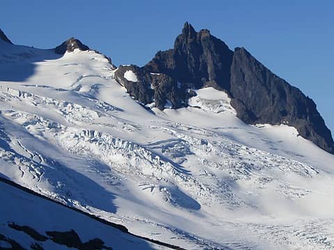 Lincoln Peak? 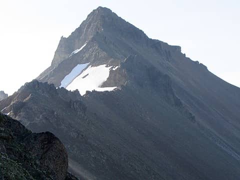 Hadley is finally the next bump in the ridge 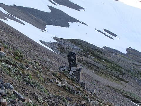 I love these weird out of place rocks 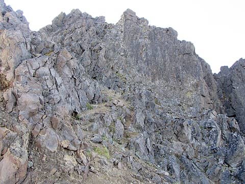 Final push to summit 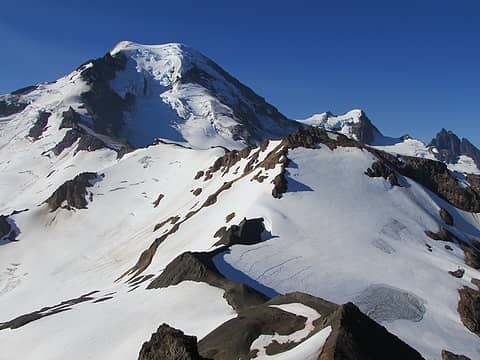 View south from Hadley 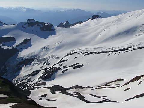 View east from Hadley 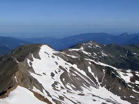 View west from Hadley 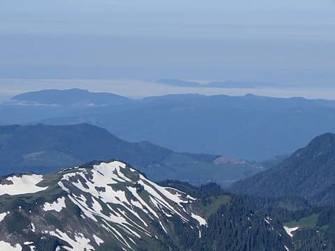 Sea of fog 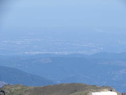 Is this Langley I'm looking at? 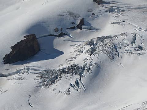 Glacier close-up 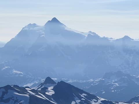 Hazy Shuksan 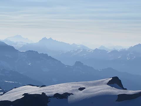 Hazy mountains 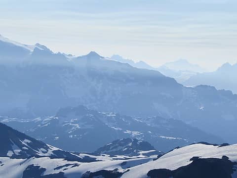 More hazy mountains 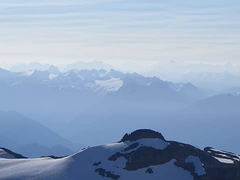 There's so many... 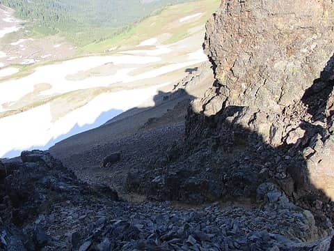 Another fun spot to go down and up 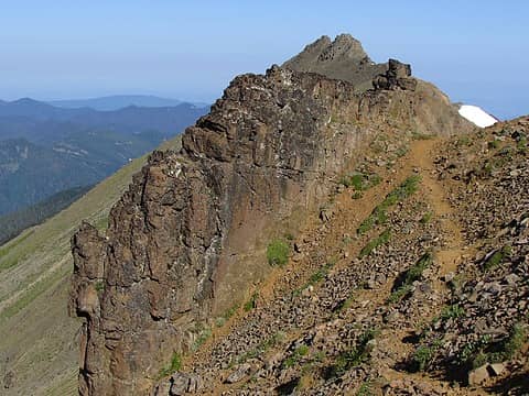 Section with actual trail 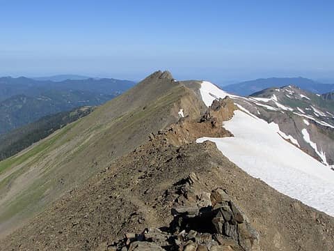 High up on Chowder 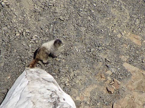 A friend 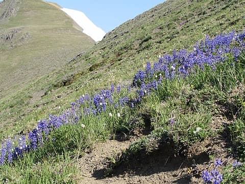 That one really dense patch of Lupine again 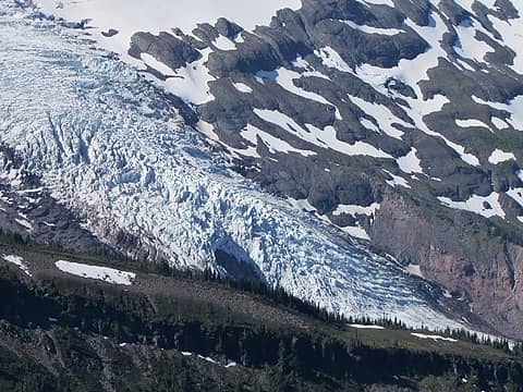 The dramatic Coleman Glacier 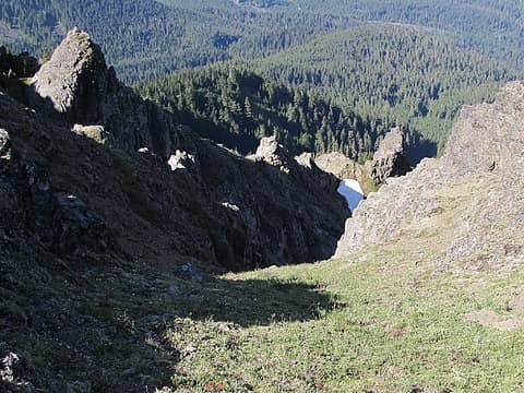 Back down the first gully to camp... 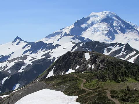 The perfect trail 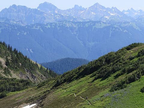 More perfect trail 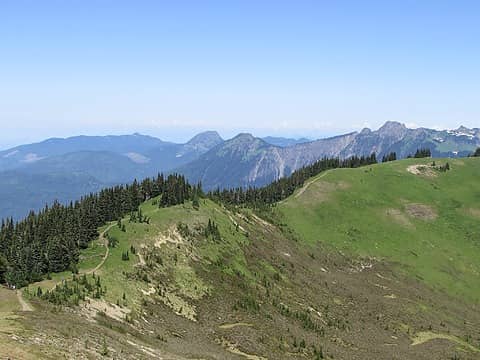 Almost back to the beginning of the ridgeline
 awilsondc, ozzy, reststep, RichP, HikingBex, olderthanIusedtobe, rbuzby, Schroder, Tom, Nancyann, jaysway, GaliWalker, slave524 awilsondc, ozzy, reststep, RichP, HikingBex, olderthanIusedtobe, rbuzby, Schroder, Tom, Nancyann, jaysway, GaliWalker, slave524
awilsondc, ozzy, reststep, RichP, HikingBex, olderthanIusedtobe, rbuzby, Schroder, Tom, Nancyann, jaysway, GaliWalker, slave524 |
| Back to top |
  
|
|
some names
Member

Joined: 08 Jan 2012
Posts: 244 | TRs | Pics
|
Nice trip report and photos!
somesignaturehere and somesignaturethere
somesignaturehere and somesignaturethere
|
| Back to top |
|
|
Kenji
Member
Joined: 18 May 2010
Posts: 320 | TRs | Pics
Location: Seattle |
|
Kenji
Member
|
 Thu Jul 15, 2021 1:47 pm |
|
|
Thanks for the TR  I found it one of the best spot for shooting Milky Way over Baker. It seems FS33 to Cougar Divide is back open! I found it one of the best spot for shooting Milky Way over Baker. It seems FS33 to Cougar Divide is back open!
|
| Back to top |
|
|
ChrisSJI
Member
Joined: 23 Jun 2008
Posts: 361 | TRs | Pics
Location: San Juan Island |
|
ChrisSJI
Member
|
Thu Jul 15, 2021 2:55 pm |
|
|
I biked FS33 last summer. It's open and passable but I wouldn't take a vehicle with less than moderate clearance. It's also quite brushy. Didn't have all the potholes of FS37 though. I'd go while you can. There was flagging at almost every culvert which made me wonder if the FS is considering decommissioning the road past the flow station.
 Mountainpines Mountainpines
Mountainpines |
| Back to top |
|
|
rbuzby
Attention Surplus
Joined: 24 Feb 2009
Posts: 1011 | TRs | Pics
|
|
rbuzby
Attention Surplus
|
Thu Jul 15, 2021 3:04 pm |
|
|
Cool pics.
Did you see any fossils up there? That used to be the sea floor, around 100 million years ago. That must be why it's called chowder ridge, because of bivalve fossils found up there. I found a belemnite fossil up there once, right on the trail.
|
| Back to top |
|
|
olderthanIusedtobe
Member
Joined: 05 Sep 2011
Posts: 7709 | TRs | Pics
Location: Shoreline |
Looks great. I've been right up to the base of Chowder Ridge before from the Divide. Looks like I need to continue going further. Hadley might not be on the agenda but that plateau looks alluring. Thanks for the TR.
|
| Back to top |
|
|
Mountainpines
Member
Joined: 18 May 2021
Posts: 303 | TRs | Pics
Location: Illinois |
|
| Back to top |
|
|
clerr
Professional Yeeter
Joined: 02 Aug 2018
Posts: 3 | TRs | Pics
Location: Maple Ridge |
|
clerr
Professional Yeeter
|
Thu Jul 15, 2021 10:13 pm |
|
|
This is really great photography! I love the vibrant colours
You'll never yeet if you don't make the first step
You'll never yeet if you don't make the first step
|
| Back to top |
|
|
yoko
Member
Joined: 27 Jul 2011
Posts: 18 | TRs | Pics
|
|
yoko
Member
|
Sun Jul 18, 2021 9:38 am |
|
|
Is there any snow left along Skyline divide? Or any water source?
|
| Back to top |
|
|
olympichiker77
Member
Joined: 06 Jun 2018
Posts: 16 | TRs | Pics
Location: Bainbridge Island |
There were definitely larger snowpatches pretty close to the trail, but I don't recall seeing any running water. If you go all the way to the end of the trail there is a little basin with some snowmelt pooled on top of more snow (lake underneath maybe?)
|
| Back to top |
|
|
Eric Hansen
Member
Joined: 23 Mar 2015
Posts: 866 | TRs | Pics
Location: Wisconsin |
Water? As you head south on the Skyline trail there is a split in the trail before Chowder Ridge. A trail runs southeast from there, rounds a shoulder and reaches an east facing basin where a small but steady creek draining large snowfields runs. It was there in August several years ago. Only running water we saw, and a good mile at least from the junction.
Alternatively, if there is a drip running from one of the snowfields setting a wide mouth dromedary, or ziplock baggie propped up by rocks, to catch the drip can do the trick. Ziplock baggies are also handy for scooping shallow, inch deep pools.
|
| Back to top |
|
|
|
|


