| Previous :: Next Topic |
| Author |
Message |
awilsondc
Member


Joined: 03 Apr 2016
Posts: 1324 | TRs | Pics
|
TL;DR version - Brief outline of our trip:
Day 1: Obstruction point high traverse to Moose and Grandview, trail from Grand Pass to Cameron Pass, set up camp in Lost Basin, climbed Lost. 14.3 miles 5,948 gain
Day 2: Lost Pass - Point 6068 - Claywood via a high route (described below) - Fromme - Sentinel - Hayden Pass, trail back to camp. 11.1 miles 4,973 gain
Day 3: packed up, tagged Cameron from Cameron Pass, then back to the car via the trail through Grand Valley. 15.8 miles 6,715 gain
Trip total: 10 peaks - 6530 - 6585 - Moose - Grandview - Lost - 6068 - Claywood - Fromme - Sentinel - Cameron. 41.2 miles 17,636 gain
Long version:
The year was 2006. Trevin and I were in grad school. I had just purchased my first cell phone, a flip phone of course. Facebook opened to the public for the first time and Pluto was kicked out of the solar system. I was really getting into exploring the great outdoors and Summitpost was in its heyday. It had basically become my guidebook to find new places to go. Logging on one day I came across this picture of Lost Peak in the Olympic National Park and fell in love with the idea of going. Sharing the page with Trevin, we both decided that was a place we wanted to visit some day. Only, some day never happened. Years went by but there was always another trip to do and we never got around to Lost Peak. It almost didn't happen this time either. I had another trip planned for my 40th birthday, but a poor forecast made us look for something with better weather and the best weather was on the Olympic Peninsula. You know... sometimes things you really want don't happen until you are ready for them.
With my North Cascades trip looking pretty bleak with a poor forecast, Trevin and I began to shift gears to a 3 day trip deep into the Olympics. Of course Lost Peak is what drew our attention to the area, but it's far from the gem of that region. There are a lot of peaks to climb around Lost Pass and we planned on tagging as many as we could. We decided to start out at Obstruction point so we met up on the morning of the 6th, and after a stop at the Port Angeles WIC to pick up bear cans we made the drive up to the trailhead and were on the trail around 9:15. We checked several forecasts prior to the trip and most said rain around 8-9 and clearing up after that. There was one forecast that showed on and off rain all day. Spoiler alert, the worst case forecast came true.
Starting out it was 40 degrees, socked in, and a bit windy. The trail was pretty easy for the first few miles and we soon came to the turn off that headed to Moose Peak. Rather than descend down into Grand Valley we decided to take the high traverse to Moose Peak and on to Grandview Peak. We headed down the trail and a short bit later we summited our first peak of the day, a mere bump on the ridge but it's got a peakbagger page to sign so it counts. After a bit of a descent and a traverse we found ourselves at the saddle north of Moose Peak. We dropped our packs and tagged Peak 6585 to the north for peak number two. Then it was on to Moose for peak number three. Here we started to get some clearing of the clouds and got some nice views down into Grand Valley. It looked lovely and we looked forward to walking through the valley on the way back in a couple days.
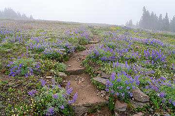 Trail near Obstruction Point 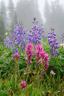 Paintbrush and Lupine 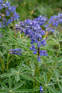 Lupine 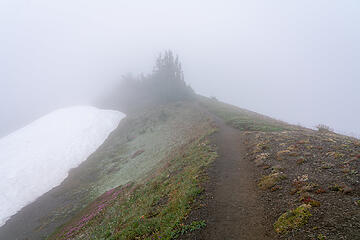 Much of the morning was like this 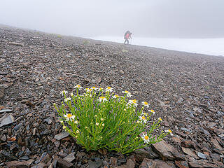 Odd spot, but thriving 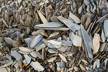 Choss 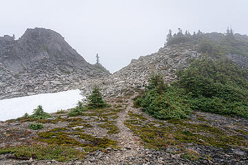 Hiking to Moose 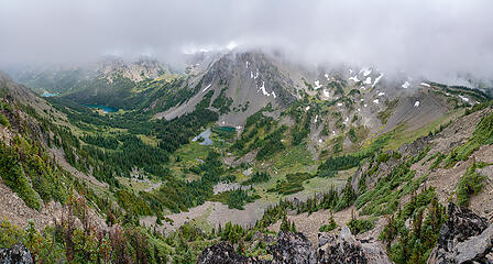 First views of Grand Valley 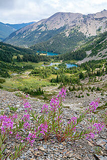 Grand valley 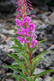 Vibrant and alive 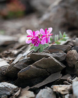 Cozy lil scene 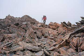 Trevin and boulders 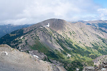 Looking back at Moose 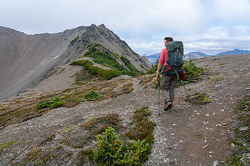 Hiking to Grand Pass 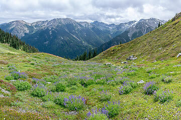 Grand Pass views 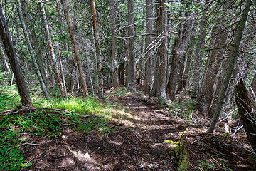 Down into the forest 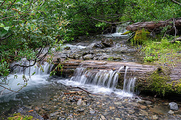 Cameron Creek 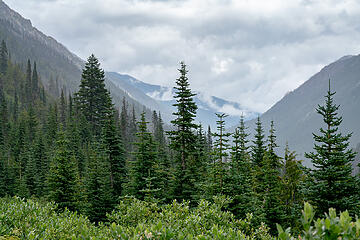 Moody views 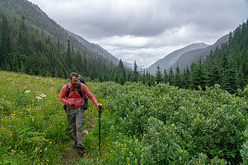 Trevin IDing plants with his app 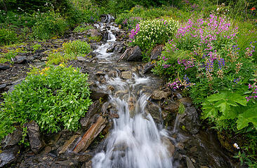 Gentle cascades 1 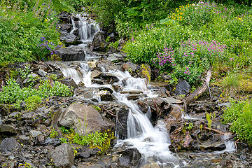 Gentle cascades 2 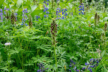 Towering Lousewort 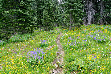 More wildflower meadows 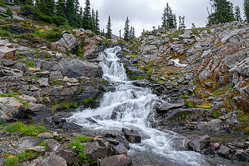 Waterfall 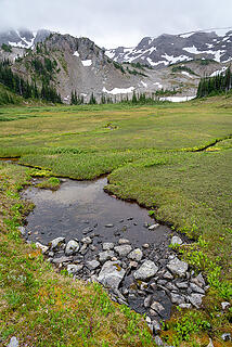 Cameron Basin 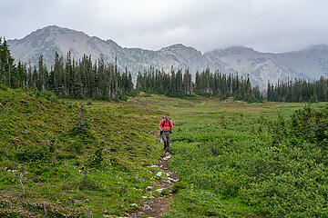 Hiking through Cameron Basin 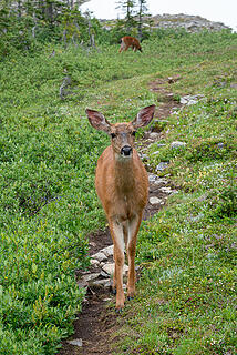 Doe 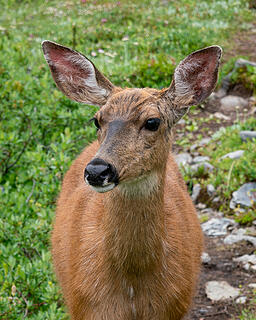 Head shot 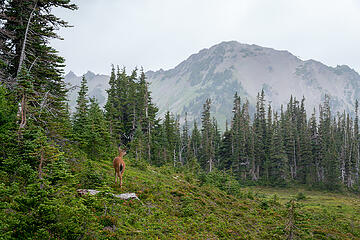 Pure Olympics 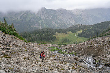 Ascending towards Cameron Pass, basin below 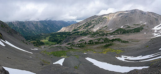 Looking down on Cameron Basin 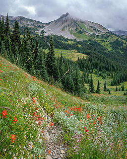 Lost Peak 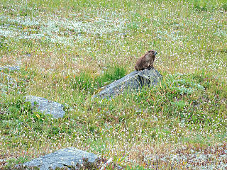 Marmot 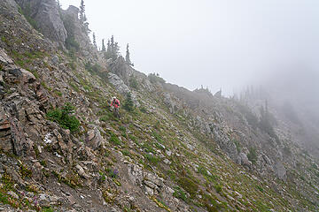 Traversing from the saddle 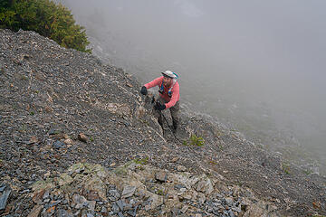 Chossaneering 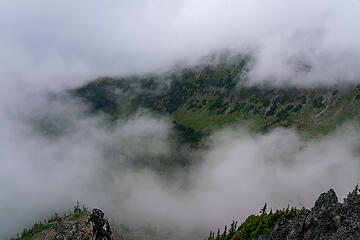 Lost Peak views 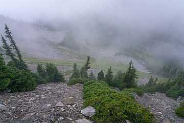 Lost Peak descent route 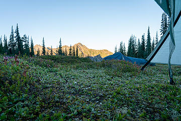 Morning 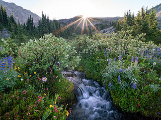 Sunrise 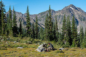 Breakfast 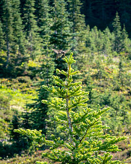 Humming bird 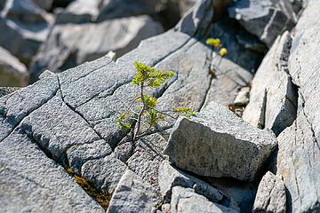 Life finds a way 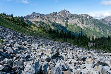 Claywood from Lost Basin boulders 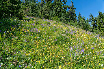 Wildflower meadows coming up from Lost Pass 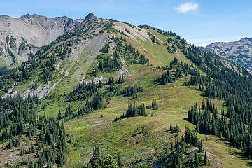 Lost Pass and the family that cheered us on 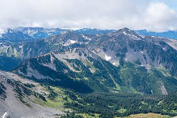 Claywood route 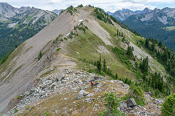 Peak 6068 from the start of the Claywood route 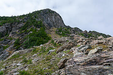 Claywood route 1 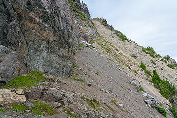 Claywood route 2 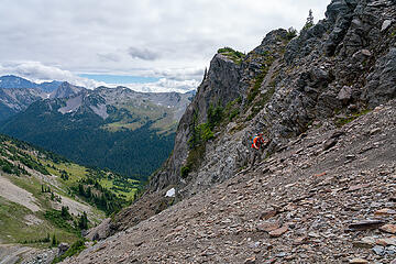 On top of the worst choss from where I traversed 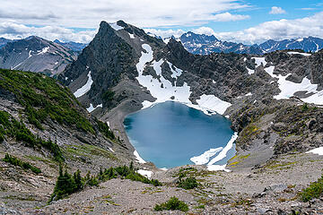 First view of Claywood Lake 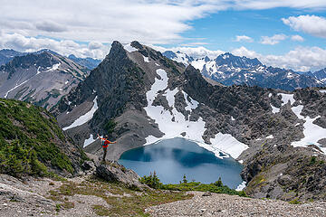 Yeah!!! 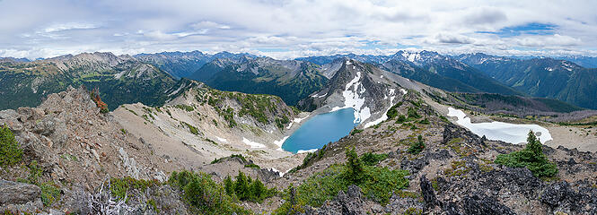 Claywood summit views 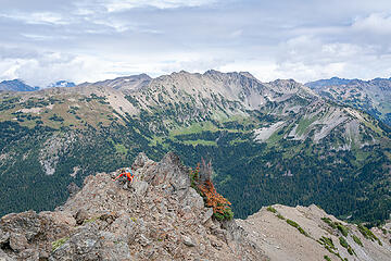 Trevin on the final scramble to Claywood's summit 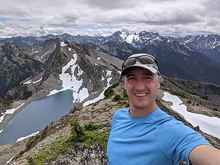 Claywood summit selfie 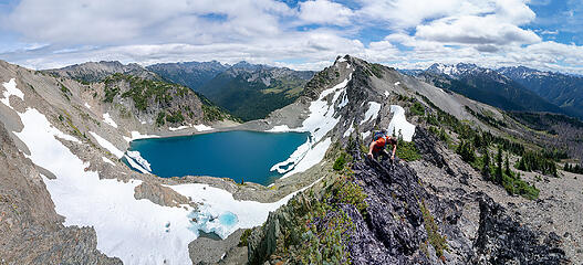 Descending the Claywood - Fromme ridge 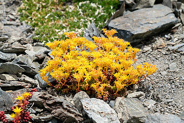 Yellow things 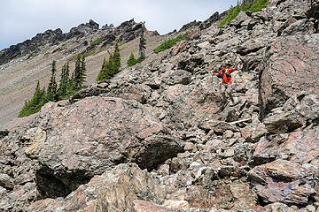 JUMP! 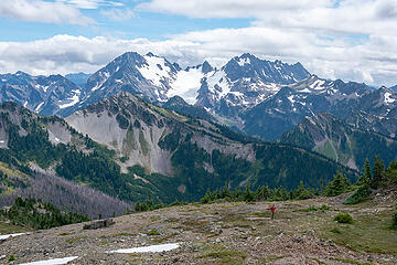 Ascending Fromme, Anderson behind 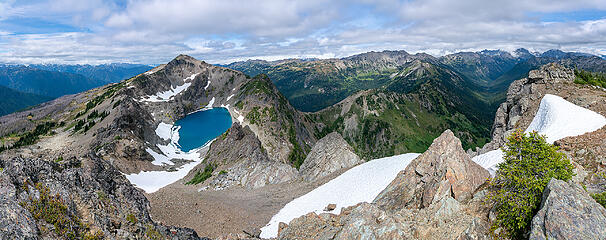 Fromme summit views 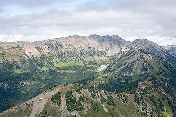 Mount Cameron 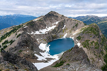 Claywood Lake and Mount Claywood 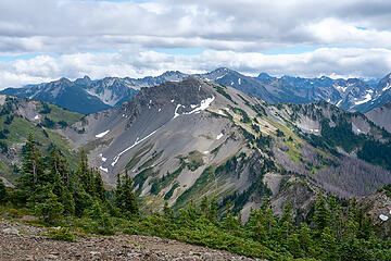 Sentinel from Fromme 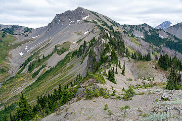 Sentinel as we descend 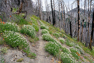 Trail to Hayden Pass 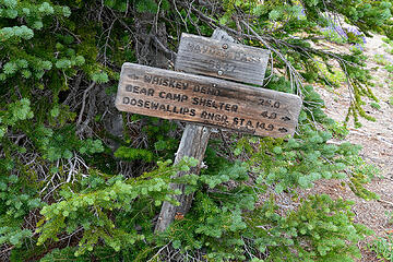 Hayden Pass sign 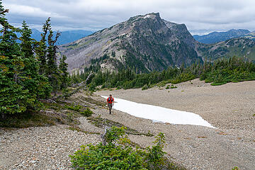 Hiking up Sentinel, Fromme behind 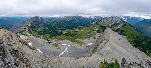 Sentinel views 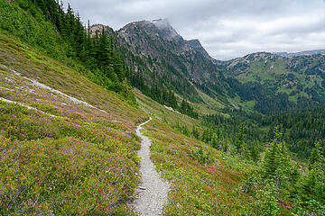 Heading down from Hayden Pass 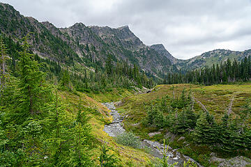 Fromme from the trail down to Dose Meadows 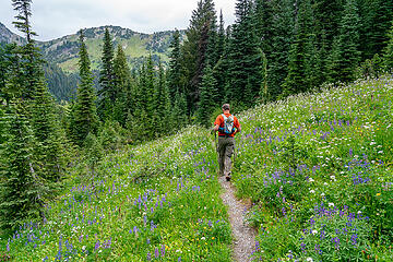 Dose Meadows 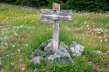 Lost Pass sign 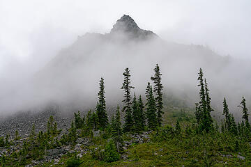 Lost Peak 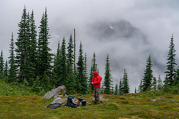 Dinner in the rain 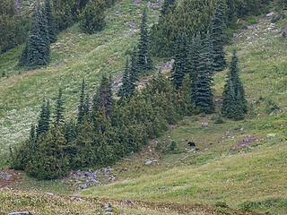 Bear heading to its den 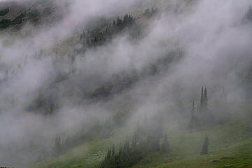 Moody foggy clouds 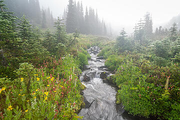 Creek in Lost Basin 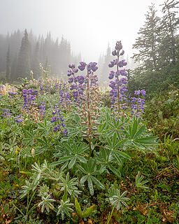 Wet lupine 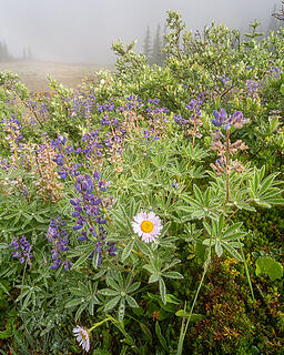 Wet flowers 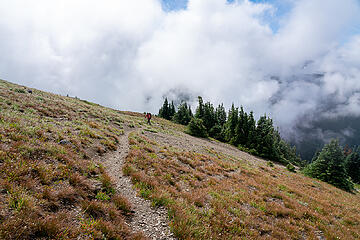 Nearing Cameron Pass 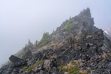 Traversing a gendarme 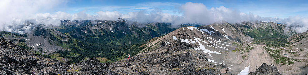 Views from Cameron are expansive 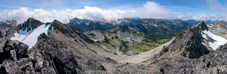 Cameron summit view 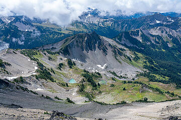 Lost Basin 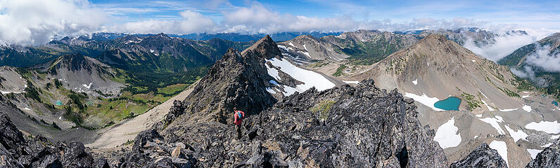 Heading down from the summit 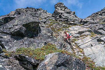 Downclimbing a steep section 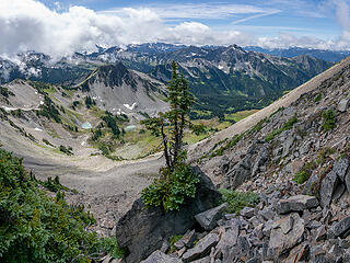 Tree on a rock 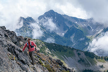 Descending from Cameron, Wellesley behiind 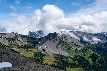 Lost Peak 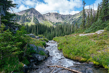 Cameron Creek 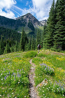 Cameron Creek Valley 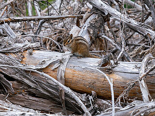 Critter 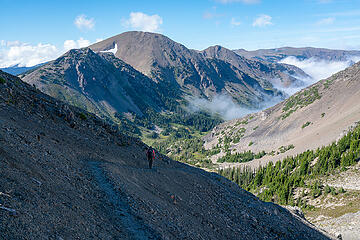 Descending from Grand Pass 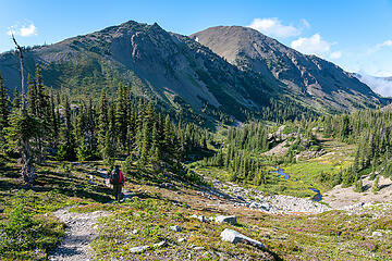 Entering Grand Valley 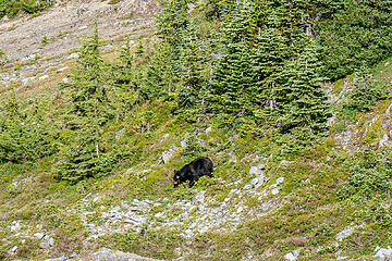 Bear in Grand Valley 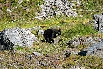 Looking for grubs 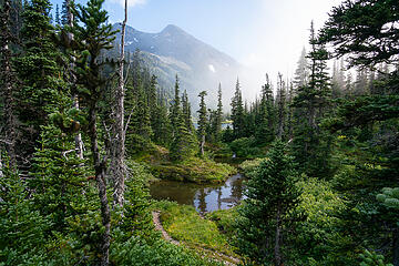 Is this heaven? 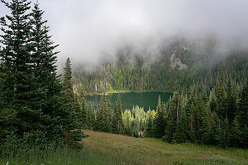 Grand Lake 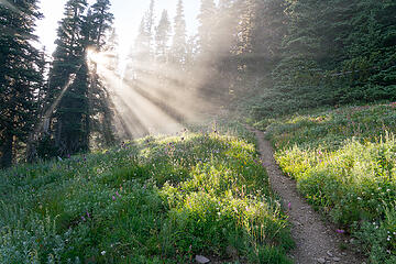 magical 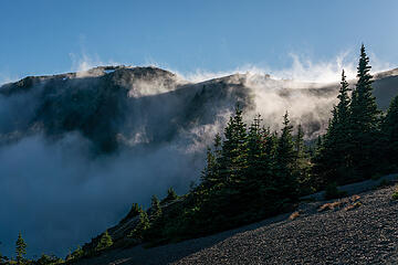 Mountains and clouds 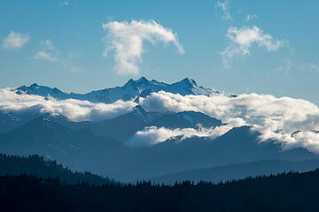 Olympus
|
| Back to top |
  
|
|
benneke
Member

Joined: 15 Sep 2018
Posts: 35 | TRs | Pics
|
|
benneke
Member
|
 Sun Aug 16, 2020 9:15 pm |
|
|
Great trip and report! I really love the photos of Claywood Lake, I've been thru that area several times but never deviated from the trail, I will have to check out Claywood next time I'm back there If you ever end up doing the Lillian - Cameron section, the Olympic Climbers Guide has a pretty good description that saves time.
|
| Back to top |
|
|
Magellan
Brutally Handsome

Joined: 26 Jul 2006
Posts: 13116 | TRs | Pics
Location: Inexorable descent |
|
Magellan
Brutally Handsome
|
Sun Aug 16, 2020 9:54 pm |
|
|
Outstanding! Thanks for writing it up.
|
| Back to top |
|
|
Cyclopath
Faster than light

Joined: 20 Mar 2012
Posts: 7721 | TRs | Pics
Location: Seattle |
|
Cyclopath
Faster than light
|
Sun Aug 16, 2020 11:39 pm |
|
|
|
| Back to top |
|
|
olderthanIusedtobe
Member
Joined: 05 Sep 2011
Posts: 7708 | TRs | Pics
Location: Shoreline |
| awilsondc wrote: | Yellow things |
Weird, cool little things aren't they. It's a kind of stonecrop, Pacific I think.
|
| Back to top |
|
|
olderthanIusedtobe
Member
Joined: 05 Sep 2011
Posts: 7708 | TRs | Pics
Location: Shoreline |
Wow, Claywood L. is gorgeous. I don't think I'd even heard of it before. It has a bit of resemblance to Chickamin L. I'd say. The way it's situated and it's surroundings.
|
| Back to top |
|
|
Gimpilator
infinity/21M

Joined: 12 Oct 2006
Posts: 1684 | TRs | Pics
Location: Edmonds, WA |
This is a great report. Makes me miss the Olympics. I totally remember the online beta you found for Lost, because it's still fresh in my mind many years later. It left that big of an impression. Those photos and report were put up by Byron, right? I actually ran into him on my last Olympics trip. Thanks for posting this.
|
| Back to top |
|
|
RAW-dad
Member

Joined: 07 Jul 2017
Posts: 119 | TRs | Pics
Location: Oregon |
|
RAW-dad
Member
|
Mon Aug 17, 2020 2:35 pm |
|
|
|
| Back to top |
|
|
awilsondc
Member
Joined: 03 Apr 2016
Posts: 1324 | TRs | Pics
|
| Gimpilator wrote: | | I totally remember the online beta you found for Lost, because it's still fresh in my mind many years later. It left that big of an impression. Those photos and report were put up by Byron, right? |
Yep! Byron's page, still in the Orphanage over at SP. If I still cared for the site I'd claim it.
|
| Back to top |
|
|
rubywrangler
Member

Joined: 04 Aug 2015
Posts: 511 | TRs | Pics
|
|
| Back to top |
|
|
silence
Member

Joined: 25 Apr 2005
Posts: 4420 | TRs | Pics
|
|
silence
Member
|
Tue Aug 18, 2020 7:08 am |
|
|
Great trip! Claywood Lake is beautiful.
PHOTOS
FILMS
Keep a good head and always carry a light bulb. Bob Dylan
PHOTOS
FILMS
Keep a good head and always carry a light bulb. Bob Dylan
|
| Back to top |
|
|
ozzy
The hard way

Joined: 30 Jul 2015
Posts: 476 | TRs | Pics
Location: University place, wa |
|
ozzy
The hard way
|
Tue Aug 18, 2020 7:40 pm |
|
|
Wowww boys!! That's one of the prettiest areas of the Olympics I've seen!!  What an arduous adventure yall had!! Way to go get it, cheers and thanks for the awesome tr!! What an arduous adventure yall had!! Way to go get it, cheers and thanks for the awesome tr!!
I dont know whats gonna happen, but I wanna have my kicks before the whole shithouse goes up in flames-Mr Mojo Risin
I dont know whats gonna happen, but I wanna have my kicks before the whole shithouse goes up in flames-Mr Mojo Risin
|
| Back to top |
|
|
neek
Member

Joined: 12 Sep 2011
Posts: 2336 | TRs | Pics
Location: Seattle, WA |
|
neek
Member
|
Wed Aug 19, 2020 2:45 pm |
|
|
spectacular and diverse set of photos, and you used the mist to your advantage. i gotta get out that way more!
|
| Back to top |
|
|
bobbi
stillaGUAMish

Joined: 13 Jul 2006
Posts: 8012 | TRs | Pics
Location: olympics! |
|
bobbi
stillaGUAMish
|
Sat Aug 22, 2020 6:25 pm |
|
|
OMG!
what an adventure! I'm happy you two got 'Lost' 
bobbi ૐ
"Today is your day! Your mountain is waiting. So
get on your way!" - Oh, the Places Youll Go! By Dr. Seuss
bobbi ૐ
"Today is your day! Your mountain is waiting. So
get on your way!" - Oh, the Places Youll Go! By Dr. Seuss
|
| Back to top |
|
|
awilsondc
Member
Joined: 03 Apr 2016
Posts: 1324 | TRs | Pics
|
| bobbi wrote: | | I'm happy you two got 'Lost' |
Hahaha, that's awesome. Although I can't remember the last time anyone has told me to "get lost", now if they do I can say I already did! 
|
| Back to top |
|
|
|
|
You cannot post new topics in this forum
You cannot reply to topics in this forum
You cannot edit your posts in this forum
You cannot delete your posts in this forum
You cannot vote in polls in this forum
|
Disclosure: As an Amazon Associate NWHikers.net earns from qualifying purchases when you use our link(s). |


