pipedream
Member


Joined: 14 Oct 2012
Posts: 228 | TRs | Pics
Location: Formerly Seattle |
Having been to the sites of the former lookouts atop Meadow Mtn & Roaring Ridge already this summer, I figured I should probably resume visiting former fire lookouts and with today's cloudy weather and unexpected early completion of emergency highway construction I pointed myself eastbound and down... to Exit 71. A quick 15 min drive (compared to Monday's 4 hour nightmare for folks unlucky enough to get stuck in it) had me cruising through the outskirts of town, planning to make an attempt at the direct access via Tucker Creek.
As I began the ascent I knew I was in for a rough time, but I had underestimated how rough. Arrived at the first creek crossing and wasn't feeling it, so I turned back to explore the alternate route the recent TRs on WTA describe. I headed out of town on Cabin Creek Road, made the first left after passing the Sno-Park and was having no trouble in my Crosstrek handling the numerous potholes. Somewhere around 2.5 miles in, I reached an undocumented fork and in the interest of not having to back out of the top of Tucker Creek, I hung a slight right and found myself in a clearcut. Well this isn't right... and I don't have the topo map quad for this area so I did the next best thing I could with my extremely limited cell service - loaded Google Maps.
GMaps showed me being less than a tenth of a mile from the trail - I could just traverse a short distance through the woods and I'd hit it, no biggie for an Eagle Scout like me. I geared-up and headed into the brush, having numerous nettle encounters but snacking on small, ripe alpine black- and raspberries. I arrived at a creek crossing which, while dry, had very steep, loose embankments. As I was alone, I really didn't want to slide down only to be unable to get up either side, so I turned around, bushwhacked back the way I came and used my limited cell service to load the satellite imagery for the area (we were long off the end of any sort of road on the regular map view). Ah - I was supposed to continue straight at that last intersection, a mistake which ended-up costing me an hour.
On the road again I made quick time of the short distance and found a place to park very close to where GMaps indicated the trail went up the hill. Only problem was, I couldn't find the dang trail. What looked promising petered-out so I backtracked to the car, walked up the main road some more, found something more promising (with flagging) and headed-up. It was a brutal ascent for the first few hundred feet and I was starting to question my decision-making when I, at last, spied what is apparently the actual trail on a bench above me. My spirit lifted, I began the slog uphill and a dozen switchbacks later found myself... crossing a road?!
Lesson learned - you can just keep going and cut the entire lower half and a thousand feet of gain out. D'oh! This was the shortcut those TRs were talking about! I continued up the steep, loose, rocky & heavily rutted trail for another hour until I reached the former lookout site. It had pretty much no view (as expected), but I found a nice rock outcropping on which to finally eat my sandwich and chug down a cold one. With a stellar view of Lake Kachess and the peaks to the N & NE of it and a great view of the Teanway & Stuart Range to the east I was pleased my effort paid-off. On the way back I took the brief sidetrip to the "Benchmark" where there are some gorgeous basalt rock outcroppings and stellar views into Big Creek & the Cedar River watershed. The Mountain wasn't out, but that's okay because I know I'll be back and that next time I'll save myself quite the effort (and perhaps even push out to the Cole Butte Benchmark which has the same elevation as the top of Alpental's Chair 2). No people, no bugs, and only one surprised black tail doe that almost wiped me out as she was crashing through the woods and ran in front of me by mere feet.
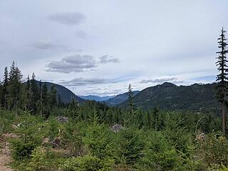 Not the TH 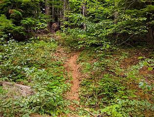 Also not the TH but close enough 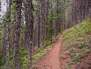 Found the actual trail 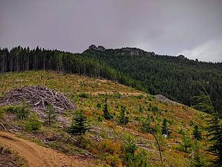 Goat Peak with its upper access in the foreground 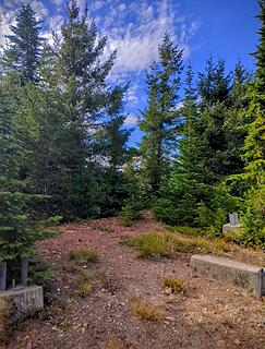 Former LO site 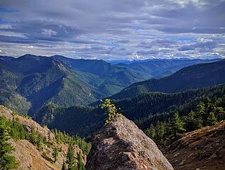 View from the Benchmark 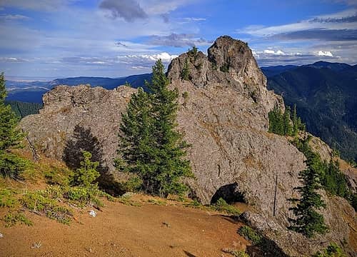 Goat Peak Benchmark 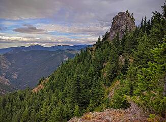 Trolled by nature
|


