| Previous :: Next Topic |
| Author |
Message |
williswall
poser


Joined: 30 Sep 2007
Posts: 1968 | TRs | Pics
Location: Redmond |
9/28: Wahpenayo (6231)/Chutla (6000)/Eagle (5958)
On Sunday, Sep 27, I drove to Mt. Rainier National Park with a peak bagging plan to take advantage of a superb weather forecast. The first part of the plan was to camp at Cougar Rock again for 2 nights, as I had a permit in hand for the Tyee Peak cross country zone on the night of Sep 30th. That trip will involve most of the Northern Loop Trail, but I needed to be in place at Sunrise on the night of the 29th to get a decent start. Last time I checked Highway 410 was still closed, so on this first day of good weather I could do the short drive to Longmire and park at the Eagle Peak trail head..after breakfast and a good nights sleep, I hit the trail at 8:17 AM. The Eagle Peak trail is fine, gaining 3200 without undue stress. However, I broke off the trail at 5000 and proceeded cross country to the Wahpenayo-Chutla saddle. This off trail stuff is slow going but I picked up a faint boot track off and on which deposited me at the saddle. Lots of huffing and puffing on the steep parts. The description of Wahpenayo rates it a moderate scramble with an exposed section but I found it straight forward. The views on the ridge were incredible, with Rainier in your face with a distinct new snow line and the Tatoosh range to the east. Mt Adams and St. Helens were also vying for attention. I spent a short time on the summit, hoping there would be a way to continue from the saddle to Chutla, but it was too cliffy. I descended the way I came and contoured below the cliffs, eventually making my way up a steep meadow. Huff and puff. I was guessing where I could attain the saddle but lucky me, I intercepted the boot path for Chutla and climbed this steepish bit to the saddle. Chutla is an easy walk from the saddle but I was starting to get tired from all the steep work. For shitz and grins I took my phone off airplane mode on the summit and voila
.4 bars! I called my wife, texted some photos and FaceTimed my daughter. Luckily she picked up at work so I was able to show her the 360 views from the summit. This is the 3rd time Ive been able to connect with her on a hike, its getting to be a thing. So again, no direct route to the Eagle/Chutla saddle so I went back down and continued on the way trail to the saddle.
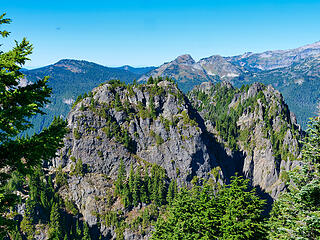 Eagle Peak 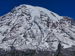 Kautz Glacier center 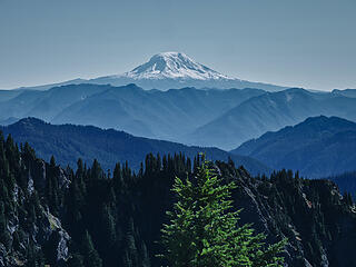 Mt Adams 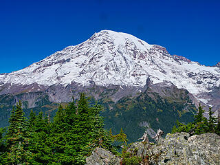 Rainier from Chutla summit2 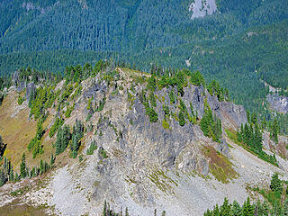 Denman from Plummer 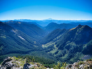 Looking south from Plummer 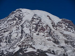 Mountain details from Denman 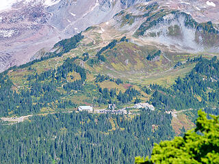 Paradise from Plummer 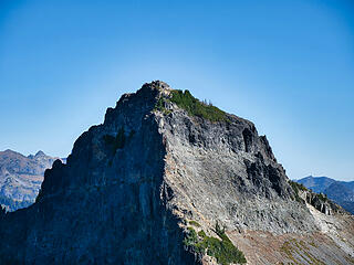 Pinnacle Peak- turned back at the pinnacle 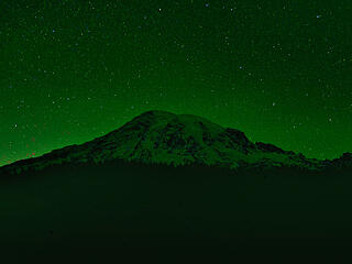 Rainier early morning 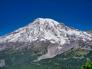 Rainier from Plummer 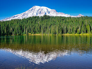 Reflection Lake 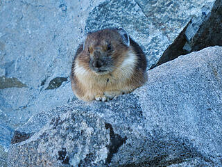 Sleepy Pica 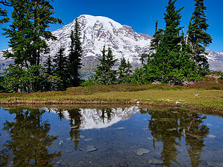 Tarn reflection from the Tatoosh range 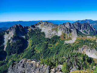 Wahpaneyo, Chutla and Eagle Peaks 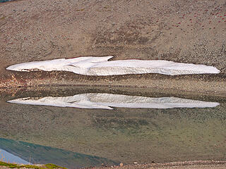 Frozen Lake smooth as glass 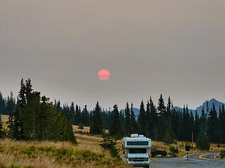 Smoky sunrise at Sunrise 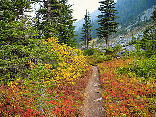 Autumn colors 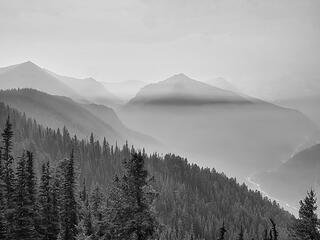 Banded 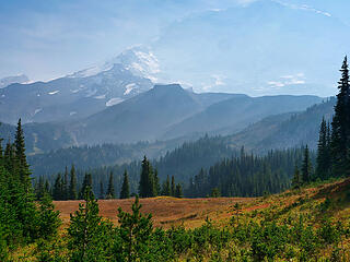 Ghostly view of Willis Wall 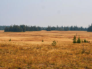 Grand Park2  Green light 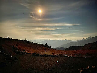 Moonlit landscape 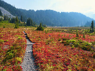 Moraine Park 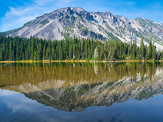 Mystic Lake and Old Desolate 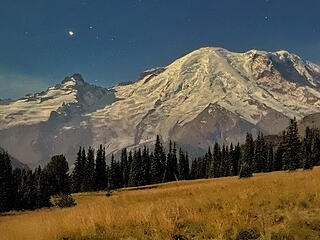 Sunrise at 10 PM enhanced 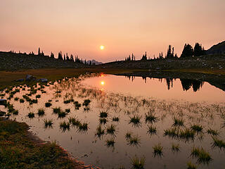 Sunset in the cross country zone 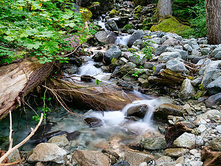 water source 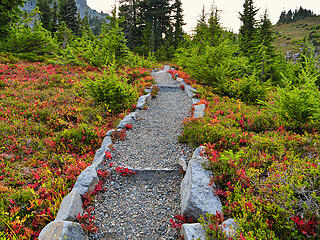 Windy Gap 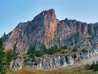 Yellowstone cliffs 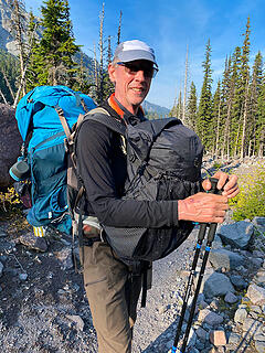 45-50 pounds?
|
| Back to top |
  
|
|
stever
Member

Joined: 25 Jun 2006
Posts: 201 | TRs | Pics
|
|
stever
Member
|
 Fri Oct 02, 2020 8:30 pm |
|
|
Great report. I am going to PM you on something. SR
|
| Back to top |
|
|
hikerman
Member

Joined: 24 May 2011
Posts: 330 | TRs | Pics
Location: Over There |
|
hikerman
Member
|
Sat Oct 03, 2020 2:33 am |
|
|
Always enjoy and appreciate your write ups.
|
| Back to top |
|
|
JimL
Member

Joined: 21 Jul 2002
Posts: 66 | TRs | Pics
Location: Kirkland Wa |
|
JimL
Member
|
Sat Oct 03, 2020 7:44 pm |
|
|
Always enjoy your reports and pictures. Great you were able to help the woman back to Sunrise. Lots of good karma.
|
| Back to top |
|
|
|
|
You cannot post new topics in this forum
You cannot reply to topics in this forum
You cannot edit your posts in this forum
You cannot delete your posts in this forum
You cannot vote in polls in this forum
|
Disclosure: As an Amazon Associate NWHikers.net earns from qualifying purchases when you use our link(s). |


