| Previous :: Next Topic |
| Author |
Message |
Eric Gilbertson
Member


Joined: 04 Jul 2018
Posts: 188 | TRs | Pics
Location: Seattle |
Ptarmigan Peak (8,614ft)
Feb 27-28, 2021
Eric and Alden
40 miles skiing, 32 miles snowmobiling
Ptarmigan peak is perhaps one of the most remote of the Bulger Peaks, nestled deep in the Pasayten Wilderness just a half mile from the most remote point in the Pasayten. I dont think it gets climbed that often. When I first climbed it in June 2018 there hadnt been any sign-ins in the summit register in the past year.
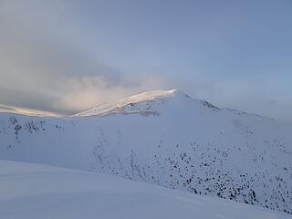 Ptarmigan Peak 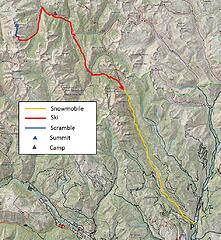 The route 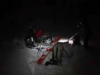 Unloading the snowmobile at Billy Goat trailhead 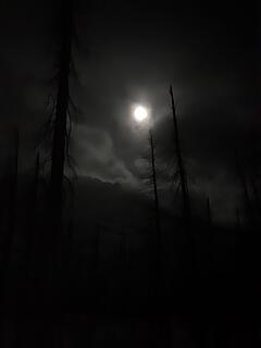 The moon was very bright 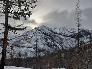 Looking back towards the craggies 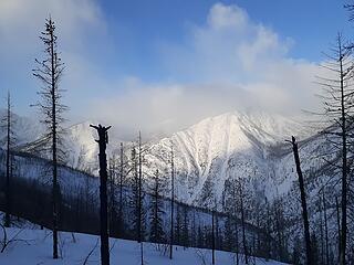 Lost Peak in the clouds 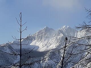 Three Pinnacles 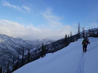 Skiing up the upper lost river drainage 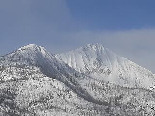 Rampart Peak 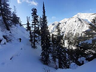 Skiing up 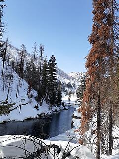 Cougar Lake 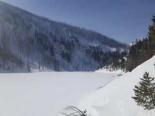 Cougar Lake 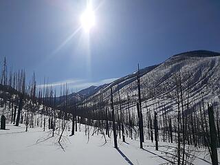 Skiing up Ptarmigan Creek 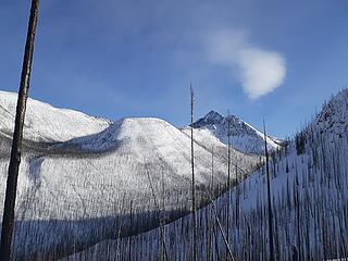 Looking up at Johnny Peak 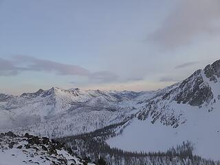 The view from above Dot Lakes looking back towards Lost Peak 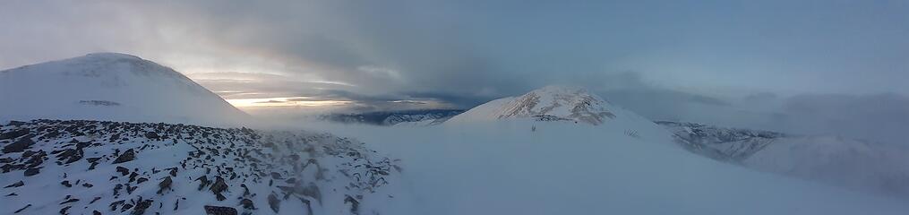 Panorama from below Dot Peak Ptarmigan Peak 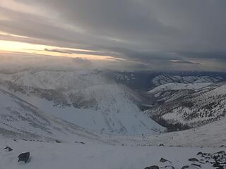 Looking down towards tarn 7045, most remote point in the pasayten 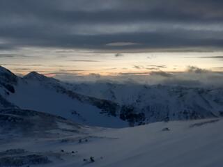 Sunset below the summit 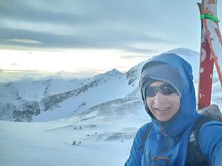 Hiking up to the summit 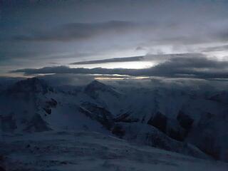 Looking towards Dot, Lago, Carru, Osceola 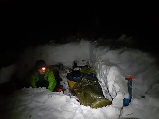 Back at the bivy site at Cougar Lake 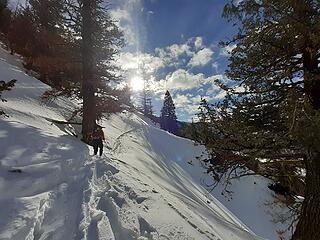 Skiing out 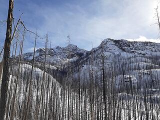 Skiing out, looking up at the Craggies 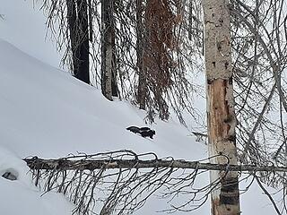 Skunk! 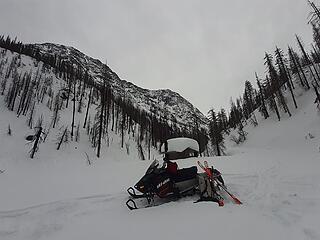 Back at Billy Goat trailhead 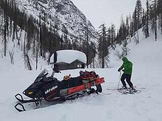 Ready to get towed 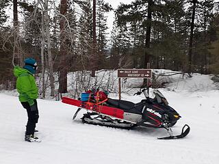 Back to the main road
|
| Back to top |
  
|
|
Gimpilator
infinity/21M

Joined: 12 Oct 2006
Posts: 1684 | TRs | Pics
Location: Edmonds, WA |
Ptarmigan felt like a long way in there, at the height of summer. Hard to fathom doing it in winter. Sounds like a fair amount of suffering. Really enjoying your Bulgers in winter series. Mind boggling. 
|
| Back to top |
|
|
timberghost
Member
Joined: 06 Dec 2011
Posts: 1323 | TRs | Pics
|
Wish there were still Ptarmigan up there
|
| Back to top |
|
|
Alden Ryno
Member
Joined: 04 Jun 2019
Posts: 150 | TRs | Pics
Location: Issaquah, WA |
Thanks again, Eric, for asking me to go! I had a blast despite what my feet were telling me. Ptarmigan does have that reputation of being one of the most feeling Bulgers and to summit it in winter is a huge feat!
Having only lived in a place with winter for three years now and not getting out at all during my first winter here, this trip was a big accomplishment for me as well and you were perhaps the best partner/mentor that I could have had.
Kudos for adding another winter Bulger!
|
| Back to top |
|
|
RichP
Member

Joined: 13 Jul 2006
Posts: 5632 | TRs | Pics
Location: here |
|
RichP
Member
|
 Wed Mar 03, 2021 9:00 am |
|
|
Just getting anywhere near Ptarmigan in winter is an epic feat. It feels remote even in mid summer just like gimpilator said.
|
| Back to top |
|
|
rstoddard24
BBQWingz
Joined: 30 Dec 2016
Posts: 74 | TRs | Pics
|
Awesome trip you two!
| Quote: | | But it was so windy I worried they might blow off the mountain |
hahaha love it. When Damon and I were there in June 2019 it was so windy at the Ptarmigan-Dot saddle area we had to lean into it to avoid falling over
| Quote: | | I accessed the area in the early summer from the Monument Creek trailhead |
There were 2 near misses reported on nwhikers June 2020 - since your TRs are read by many consider adding: (although in early summer a packraft is recommended to make the Eureka creek crossing)
|
| Back to top |
|
|
Stefan
Member

Joined: 17 Dec 2001
Posts: 5090 | TRs | Pics
|
|
Stefan
Member
|
Wed Mar 03, 2021 10:59 am |
|
|
definitely a long way for a winter outing! kudos!
|
| Back to top |
|
|
awilsondc
Member

Joined: 03 Apr 2016
Posts: 1324 | TRs | Pics
|
Nice job you guys! Alden, your blisters are some of the worst I've ever seen, and such an unusual spot. Man, that must have sucked!
|
| Back to top |
|
|
|
|
You cannot post new topics in this forum
You cannot reply to topics in this forum
You cannot edit your posts in this forum
You cannot delete your posts in this forum
You cannot vote in polls in this forum
|
Disclosure: As an Amazon Associate NWHikers.net earns from qualifying purchases when you use our link(s). |


