| Previous :: Next Topic |
| Author |
Message |
Eric Gilbertson
Member


Joined: 04 Jul 2018
Posts: 188 | TRs | Pics
Location: Seattle |
Jack Mountain Circumnavigation by Packraft and Ski
12am April 11 12:30am April 12 (24.5 hours moving)
35 miles (25 hiking/skiing, 10 packrafting)
Last November I did a big hiking and packrafting loop around the Prophet Massif, hiking up to Little Beaver and paddling back down Ross Lake. At the time I wondered if it would somehow be possible to combine skiing and packrafting in the same trip. It seemed like involving Ross Lake was a logical choice since theres plenty of skiable terrain nearby and the lake is great for paddling. I was inspired by reports from Luc Mehl of his big Alaska traverses involving skiing and packrafting, such as his Mt Logan and Mt Fairweather traverses. On glaciers he pulled gear in a packraft like it was a pulk, and on rivers strapped the skis on the side of the packraft.
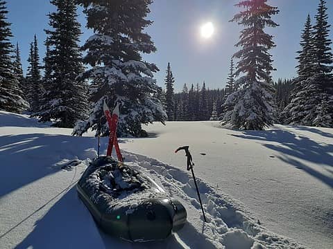 Pulling the packraft across McMillan Park Plateau 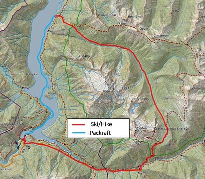 The route 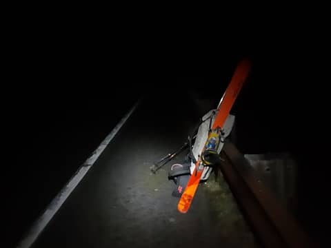 Starting at Ross Dam trailhead  Lots of feline tracks along the trail 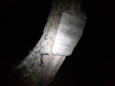 Entering the Pasayten Wilderness 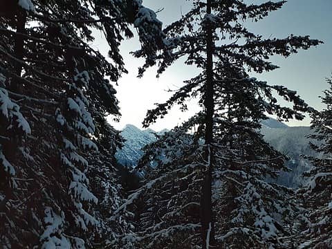 Looking south towards Ruby Mountain 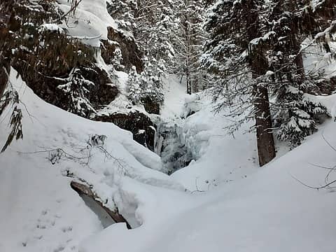 Hiking up Jackita Ridge trail 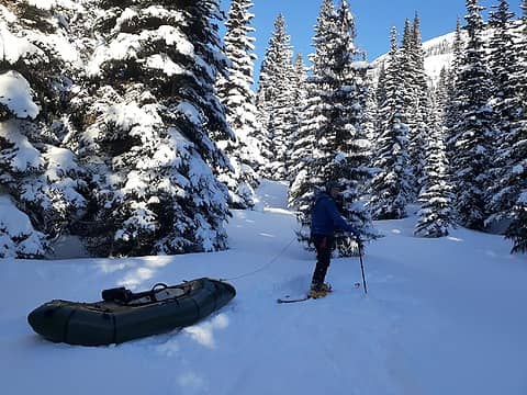 Pulling my gear in the packraft 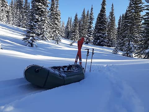 Packraft in the snow 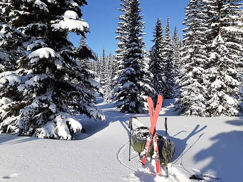 The end of the flat section 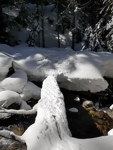 Tricky creek crossings 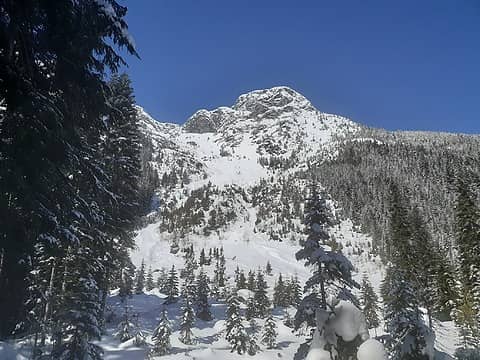 Looking up towards east face of Jack 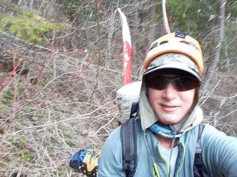 Challenging bushwhacking with skis and boots sticking out 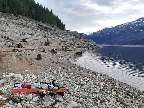 Ross Lake at last 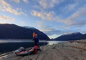 Packed up at Ross Lake, looking north towards Desolation Peak 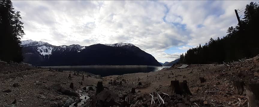 View of Ross Lake 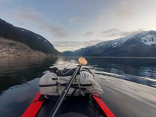 Starting the paddle 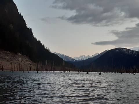 Lots of dead trees sticking out  Back to Ross Dam by midnight
|
| Back to top |
  
|
|
kitya
Fortune Cookie

Joined: 15 Mar 2010
Posts: 842 | TRs | Pics
Location: Duvall, WA |
|
kitya
Fortune Cookie
|
 Tue Apr 13, 2021 7:46 pm |
|
|
Amazing adventure! Just wow.
|
| Back to top |
|
|
BensonM
Member

Joined: 23 Mar 2021
Posts: 22 | TRs | Pics
Location: seattle, wa |
|
BensonM
Member
|
Tue Apr 13, 2021 7:56 pm |
|
|
Amazing to read. Thanks for sharing. Seek help.
Edit: I apologize for being flip. Your trips are astounding. So much movement. Lots of darkness. Frequent storms and miles of bushwhacking. Unique itineraries. And always a lecture to bookend the journey. Solid type 2 therapy.
|
| Back to top |
|
|
KarlK
Member
Joined: 18 Jun 2009
Posts: 584 | TRs | Pics
|
|
KarlK
Member
|
Tue Apr 13, 2021 9:26 pm |
|
|
Hmmm....your comment about a problematic swim to shore if you had gone in without the benifit of the dry suit you left home is, er *problematic*.
Ross Lake's water temperature is ~38 F right now, and would suck heat from you speedy fast, even wearing the clothes you noted were only marginally adequate topside.
As such, immersion would incapacitate you within a handful of minutes, and your soon-to-be corpse would bob colorfully beneath the uncaring sky until the folks with the body bag showed up.
Signed Debbie Downer (but an actual thermoregulatory physiologist who wears his annoying drysuit while paddling on Ross this time of year).
|
| Back to top |
|
|
Eric Gilbertson
Member
Joined: 04 Jul 2018
Posts: 188 | TRs | Pics
Location: Seattle |
| Quote: | | your comment about a problematic swim to shore if you had gone in without the benifit of the dry suit you left home is, er *problematic*. |
Thanks for the concern! Though I believe a packraft sinking is actually a very low-probability event. Sorry I probably gave the wrong impression in that report.
I've had my packraft for six years and have taken it on many expeditions up to three weeks long in Labrador, Quebec, Northwest Territories, Yukon, Nunavut, and Mongolia. I've strapped on ice axes, crampons, rock racks, glacier gear, hiking poles and more on the outside or stuffed it on the inside. I've scraped over all kinds of sharp rocks and submerged debris and never had an issue with leaks. They're actually surprisingly strong!
|
| Back to top |
|
|
KarlK
Member
Joined: 18 Jun 2009
Posts: 584 | TRs | Pics
|
|
KarlK
Member
|
Wed Apr 14, 2021 9:12 am |
|
|
Yup, they are tough -- I've got two Alpackas, each with many nautical miles under its hull, and have only experienced a problem once owning to grit in the blow valve.
Slow deflation ensued, attended by a successful effort to outpaddle the problem.
However, this tack elides the big point: you're a premier exemplar of extreme human endurance performance in mixed circumstances freighted with lethal possibilites. Your long-term survival rides on an expert appraisal of the panoply risk within your scope.
From topside that 38 degree water looks relatively benign. But if one of Ross Lake's many (!) pokey protrusions in the low water of spring does puncture your hull, both your boat and survival prospects will deflate at the speed of "oh sh*t" if you''re not wearing an immersion suit.
Being as I really enjoy your reports, that would piss me off something fierce.
Signed,
Annoying Old Guy with 14 friends that did not stay ahead of the risk.
|
| Back to top |
|
|
Stefan
Member

Joined: 17 Dec 2001
Posts: 5093 | TRs | Pics
|
|
Stefan
Member
|
Wed Apr 14, 2021 9:50 am |
|
|
Wow! I am amazed at even the thought process that goes behind doing this. Very creative. I like how you setup the selfies on your video.
|
| Back to top |
|
|
williswall
poser

Joined: 30 Sep 2007
Posts: 1968 | TRs | Pics
Location: Redmond |
I quite enjoy your reports of suffering and danger. KarlK has a point though...I hope your risk mitigation is successful so you can enjoy sufferfests when you get to be my age (I desire medium danger!).
|
| Back to top |
|
|
iron
Member

Joined: 10 Aug 2008
Posts: 6392 | TRs | Pics
Location: southeast kootenays |
|
iron
Member
|
Wed Apr 14, 2021 7:49 pm |
|
|
| williswall wrote: | | I quite enjoy your reports of suffering and danger. KarlK has a point though...I hope your risk mitigation is successful so you can enjoy sufferfests when you get to be my age (I desire medium danger!). |
concur. on this TR and many preceding other TRs by EG. you're a phenom athlete. don't blow it by taking stupid risks for the sake of a new extreme TR.
|
| Back to top |
|
|
cascadetraverser
Member

Joined: 16 Sep 2007
Posts: 1407 | TRs | Pics
|
Wow is the only proper work for this report (and just about everything else you post for that matter....)!!
|
| Back to top |
|
|
|
|
You cannot post new topics in this forum
You cannot reply to topics in this forum
You cannot edit your posts in this forum
You cannot delete your posts in this forum
You cannot vote in polls in this forum
|
Disclosure: As an Amazon Associate NWHikers.net earns from qualifying purchases when you use our link(s). |


