| Previous :: Next Topic |
| Author |
Message |
Matt Lemke
High on the Outdoors


Joined: 15 Jul 2010
Posts: 2052 | TRs | Pics
Location: Grand Junction |
|
Matt Lemke
High on the Outdoors
|
 Thu Apr 29, 2021 6:17 pm |
|
|
This is a continuation of my last report for Window Blind Peak on the trip Josh and I took through the desert in early March. After a nice night camping along the San Rafael River with ELaine and Josh, we agreed to do a slot canyon, and I found a good option not too far away in Lower Baptist Draw and Upper Chute Canyon. We drive back to the bridge over the river and along the long Temple Mountain Road back to I-70. We passed right under the freeway though, and continued south for 10 miles until we hit the first major junction with FS322 and headed right (west). After another 3.8 miles we hit another major junction with FS 1012 and again headed right where the Tan Seep is located. This whole country is wild and remote!
After another mile we continued left, now heading in a SW direction and went another 4 miles. Note the roads through this entire section are very well maintained and wide dirt roads suitable for just about any vehicle. However, once we turned left onto the unnamed road heading back east towards Baptist Draw, my old stationwagon got tested. Deep ruts in the very narrow road forced me to drive with one side on the middle between the ruts, and the other side slightly off the road on the edge. Luckily the area is not super rocky so the lower clearance of my car wasn't too much of an issue. Continued past a small spur road that branched off to the right after 3 miles on this rougher road and went another half mile or so along the Chute Canyon Overlook Road until we found a nice place to park at the top of the rim, not qite at the end of the road. Kelsey has a good description of this small parking and camping area in his guidebook, and I also have it marked in the map below with a blue dot. After a quick bite to eat, the three of us descended north down the slope into the basin just below, dodging remnant snowfields on the north facing slope as we went. Just off to the east there is an obvious teepee shaped rock peak we aimed for. We caught a nice trail that followed a bench and rounded the south side of this teepee rock before dropping a couple hundred feet into the Lower Baptist Draw drainage. Once in the drainage we turned right (south) and continued with easy walking through some shallow narrows interspersed with wide open areas. This was going to be Elaine's first slot canyon, and she was very excited!
Ryan has a pretty good description of this whole loop we did here, so I won't go into too much detail on the beta, but rather describe our experience as we enjoyed it. It is worth noting that our entire day was completely dry, no wading, no swimming and no water to deal with, which this canyon is sometimes known for holding water so that was a bonus. The Lower Baptist Draw canyon slowly began to get narrower and deeper but never really presented any obstacles. The narrows got very scenic and photogenic with only the occational narrow "walk sideways" sections. We came across the first drop after about 20 minutes or so in the canyon which was well equipped with a long piece of webbing to make a short 15 foot rappel. Beyond that there was nothing super memorable until the final rappel which drops 25 meters down a deep crack into the main Chute Canyon. There were 3 bolts on a slab just off to the right that required a short but exposed walk to get to. The rappel itself was really cool, as you dropped down into the crack with a gigantic chockstone wedged inside above you as you lowered down.
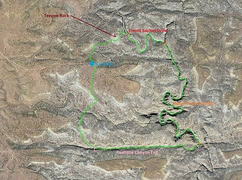 Map of our route 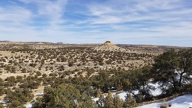 View where we parked with the teepee rock visible 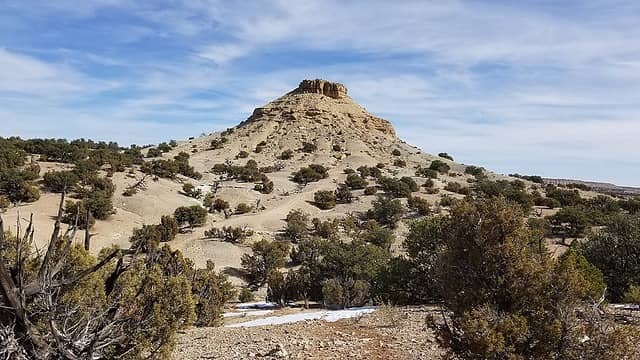 Hiking towards teepee rock 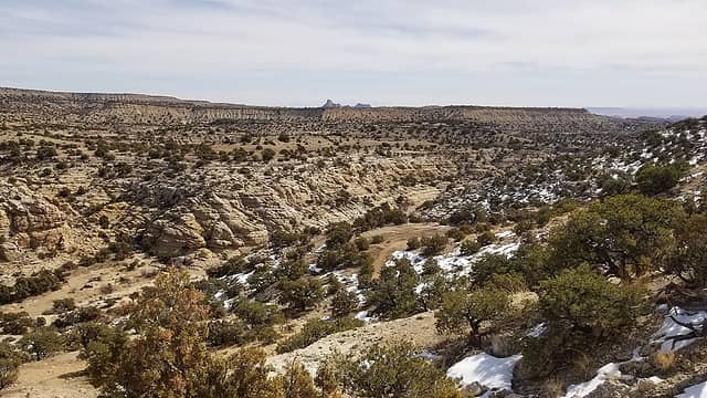 Approaching the descent into Baptist Draw 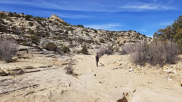 Starting down the wash 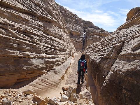 Starting down Lower Baptist 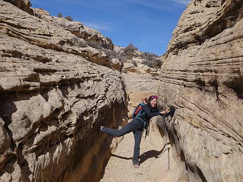 Elaine having fun 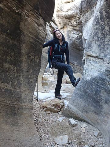 Baptist Draw getting narrower 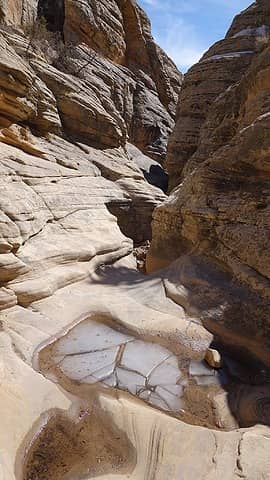 Small pool in Baptist Draw 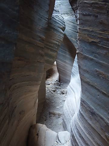 Baptist Draw 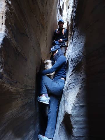 Elaine squeezing through a narrow spot 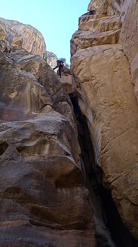 Josh making the final 25m rappel 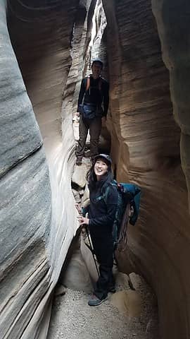 Upper Chute Canyon 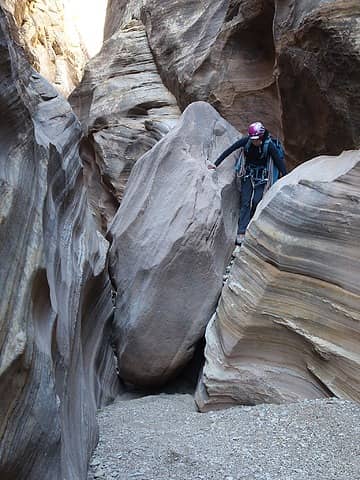 Crawling over large boulders 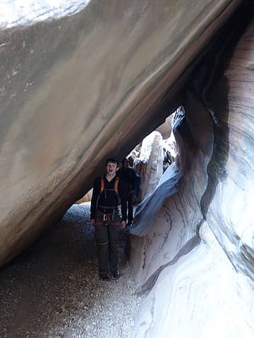 Crawling under large boulders! 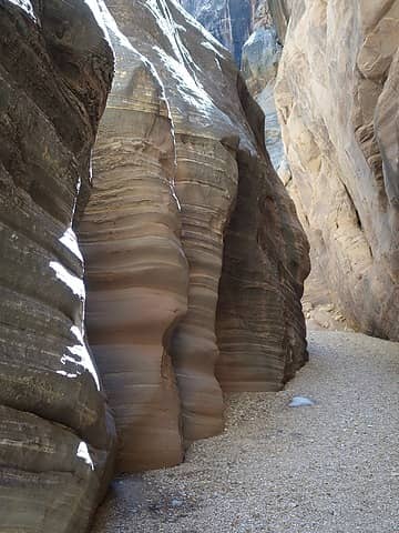 Cool bedding planes 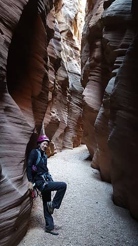 Elaine posing... 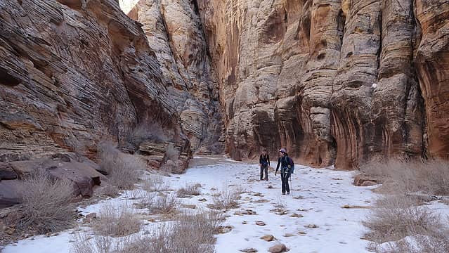 Remnant snow! 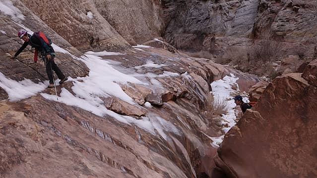 Adding a little spice to the hike 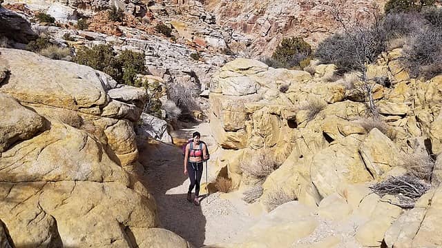 Nearing the junction with Faultline Canyon 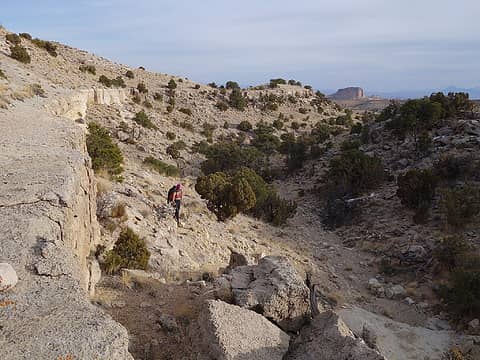 Hiking up Faultline Canyon 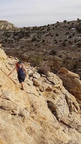 Scrambling out above Faultline Canyon 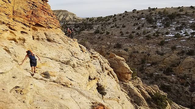 Exposed traverse 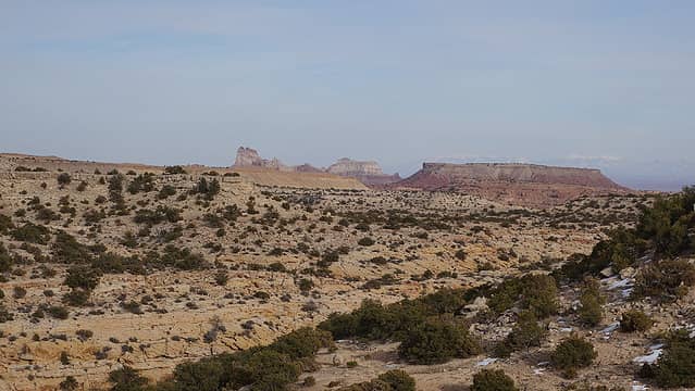 Temple Mountain visible on the reef 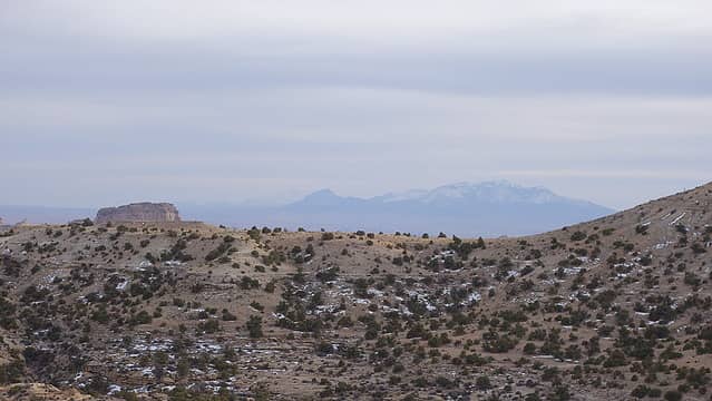 Henry Mountains in distance 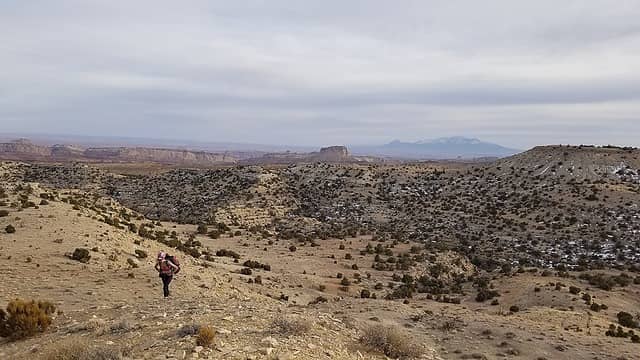 Cross country hiking back to car
|
| Back to top |
  
|
|
John Morrow
Member

Joined: 03 Apr 2007
Posts: 1526 | TRs | Pics
Location: Roslyn |
Love this, thanks for the great beta, Matt. I didn't get a slot canyon fix this spring. I've seen most of the non-technical ones and think I need to begin to try the easiest of the tech canyons
Tell me, what is it you plan to do with your one wild and precious life?-Mary Oliver
A nation that continues year after year to spend more money on military defense than on programs of social uplift is approaching spiritual doom.
― MLK Jr.
Tell me, what is it you plan to do with your one wild and precious life?-Mary Oliver
A nation that continues year after year to spend more money on military defense than on programs of social uplift is approaching spiritual doom.
― MLK Jr.
|
| Back to top |
|
|
Matt Lemke
High on the Outdoors
Joined: 15 Jul 2010
Posts: 2052 | TRs | Pics
Location: Grand Junction |
|
Matt Lemke
High on the Outdoors
|
Fri Apr 30, 2021 6:53 pm |
|
|
You're welcome John! This canyon loop is a good beginner technical canyon.
|
| Back to top |
|
|
|
|
You cannot post new topics in this forum
You cannot reply to topics in this forum
You cannot edit your posts in this forum
You cannot delete your posts in this forum
You cannot vote in polls in this forum
|
Disclosure: As an Amazon Associate NWHikers.net earns from qualifying purchases when you use our link(s). |


