| Previous :: Next Topic |
| Author |
Message |
Eric Gilbertson
Member


Joined: 04 Jul 2018
Posts: 188 | TRs | Pics
Location: Seattle |
Buck Mountain (8,560ft), Mt Berge (7,914ft), and Berge North (7,948ft)
47 miles (23 biking, 24 hiking), 10kft gain
June 6, 2021, 12am 7:30pm
(Summary: Buck Mtn true summit is south summit, and Mt Berge true summit is northeast summit, both incorrect on peakbagger as of June 6, 2021)
Id recently read some trip reports from Fred, Eric E, and others on nwhikers calling into question the true location and elevation of Mt Berge, one of the top 200 peaks in Washington. Nearby, Buck Mountain, a Bulger peak, also had some uncertainty. The peakbagger peak location is at a surveyed point a bit north of the traditional summit cairn, and the elevation is quoted as that of the surveyed point, not that of the traditional summit. As far as I could tell, these discrepancies had never been rigorously resolved.
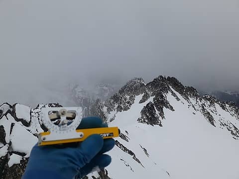 On Mt Berge south summit looking towards true north summit with sight level 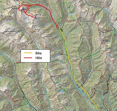 My route 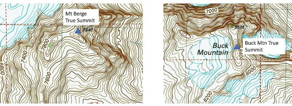 Map showing true summit locations based on my measurements (overlayed on peakbagger map with false summits as green circles) 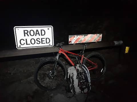 Biking from the gate 11:45pm Saturday night 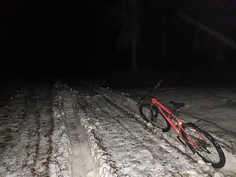 Still snowy farther up the road 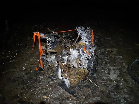 This is what a snowmobile turns into if you ignore the engine overheating light! 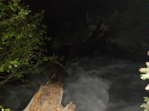 Crossing the Chiwawa River at 3am 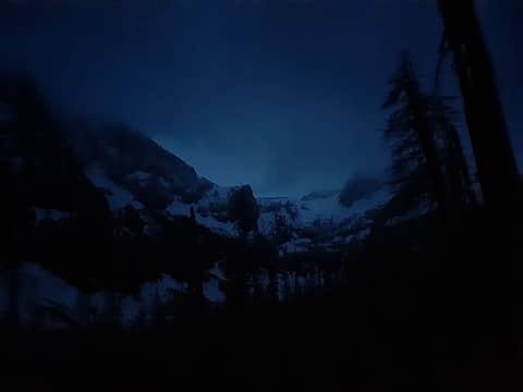 First views up to Buck-Berge col 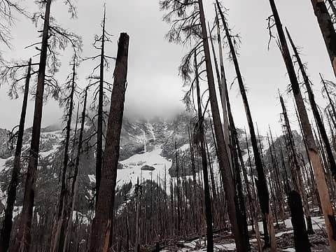 Buck starting to clear out. Wild side ice route might still be climbable 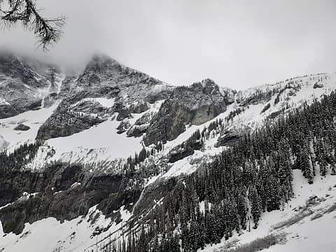 Traversing through cliff bands to the col 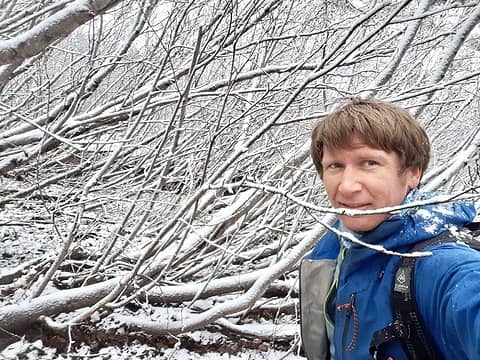 Some delightful alder thrashing 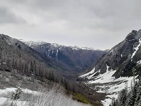 The view back down the valley 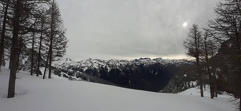 The view across to Maude and Seven Fingered Jack, just starting to clear out before the next storm 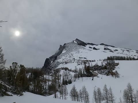 Buck Mountain 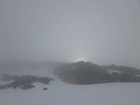 The final scramble up Buck 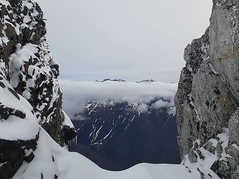 Topping out on the summit ridge 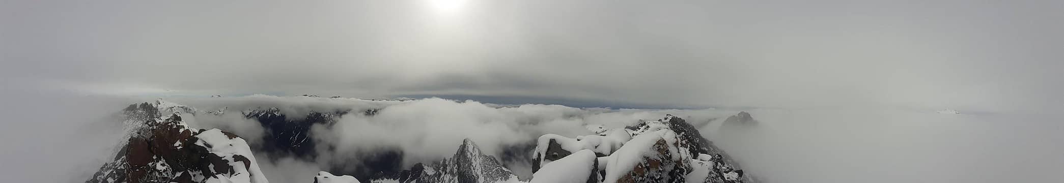 View from the summit 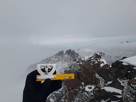 Looking towards the shorter northern summit 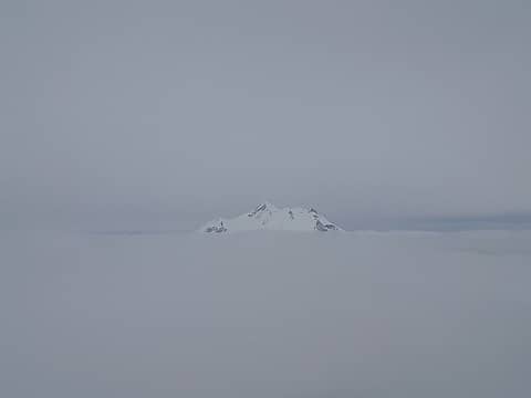 Glacier Peak above the clouds 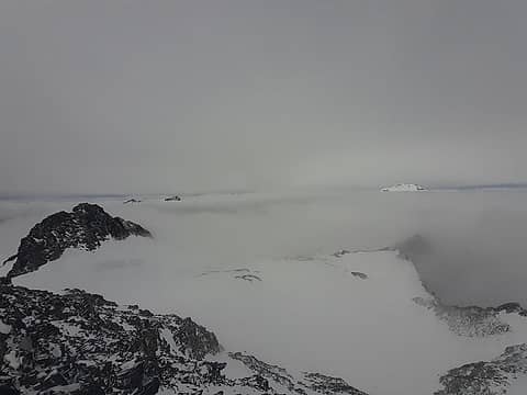 The view opening briefly below me looking towards Glacier Peak 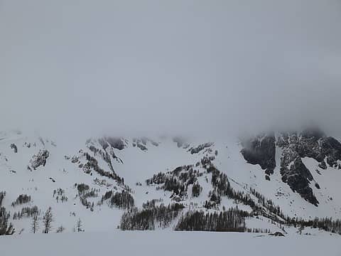 Heading towards Berge (in the clouds) 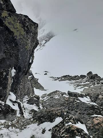 Looking down the 4th class summit block of the north (true) summit 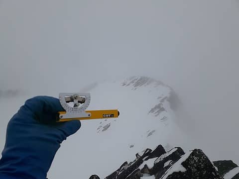 Looking towards the south false summit  On the southern false summit 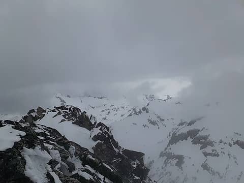 Looking towards Napeequa and Ten Peaks as weather comes in 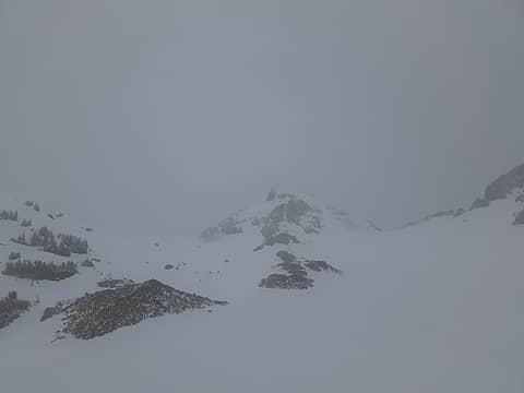 At High Pass, looking towards my exit col right of Cleator 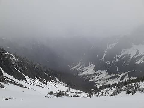 Dropping down the Cleator-Berge col 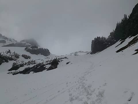 Looking back up to the col 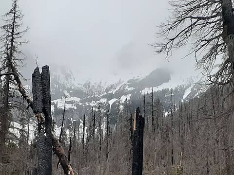 Looking back at Buck-Berge col socked in the snowstorm 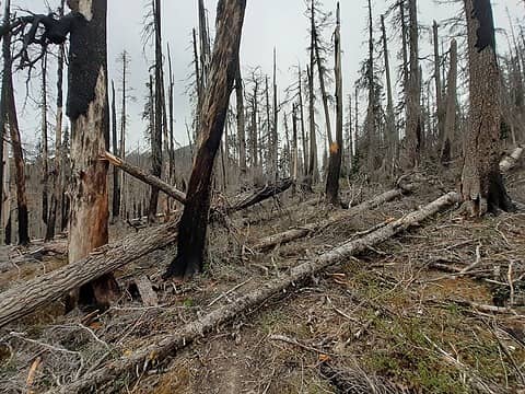 Typical trail conditions up Buck Creek 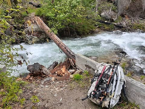 Chiwawa River Crossing. Not as bad in the daylight 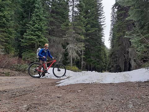 Biking out
|
| Back to top |
  
|
|
neek
Member

Joined: 12 Sep 2011
Posts: 2338 | TRs | Pics
Location: Seattle, WA |
|
neek
Member
|
 Mon Jun 07, 2021 7:18 pm |
|
|
| Eric Gilbertson wrote: | | Buck Mtn true summit is south summit |
Guess I'll have to go back.
| Eric Gilbertson wrote: | | Mt Berge true summit is northeast summit |
Crap.
Randomly ran into Jake a couple years ago between those two peaks.
|
| Back to top |
|
|
geyer
Member

Joined: 23 May 2017
Posts: 463 | TRs | Pics
Location: Seattle |
|
geyer
Member
|
Mon Jun 07, 2021 9:18 pm |
|
|
What's the matter Eric? The total station was too heavy to bike with?  Just kidding. I did some surveying back in college - not my favorite activity - but definitely made more interesting in the mountains. Love the analysis here!
|
| Back to top |
|
|
puzzlr
Mid Fork Rocks

Joined: 13 Feb 2007
Posts: 7220 | TRs | Pics
Location: Stuck in the middle |
|
puzzlr
Mid Fork Rocks
|
Mon Jun 07, 2021 10:52 pm |
|
|
But .... the north summit of Buck is so much more fun!
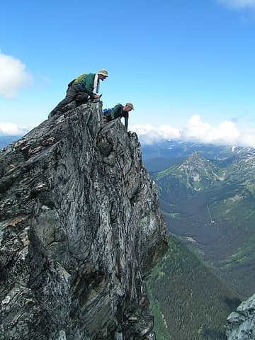 Buck's overhanging N summit - a vertigo-inducing gulf of empty space right over the edge. Hope an earthquake doesn't hit!
|
| Back to top |
|
|
Gimpilator
infinity/21M

Joined: 12 Oct 2006
Posts: 1684 | TRs | Pics
Location: Edmonds, WA |
Eric, this is really great. Thank you for doing the dirty work! And you did it in less than optimal conditions. I've wondered about these specific summits for many years. Now, when I go, there's no guess work. Thanks for saving me that trouble.
|
| Back to top |
|
|
Alden Ryno
Member
Joined: 04 Jun 2019
Posts: 150 | TRs | Pics
Location: Issaquah, WA |
The bridge across the Chiwawa River is MUCH reduced since this past year. As you noted, it was kind of there before, just...unlevel. Awesome report and an intriguing reason for going aside from merely bagging a peak.
Good news for me!
Although, here's a question that I've pondered, and have heard both sides. I'd love to hear the thoughts of others.
If a Bulger summit were found to be shorter than a suspected subsummit of the same peak/mountain, then would future would-be finishers of the list have to go to the new summit to log that peak for the list OR, because it's a historic list, would the traditionally recognized summit be the requirement to log it for the Bulger List?
The true T100(P400) list, I believe, is technically dynamic; I think of the inclusion of Ballard while the Bulger List still omits it (that may be an apples to oranges comparison for subsummits vs entire mountains though).
There may not be resolution and/or perhaps the original Bulger party would have final say.
|
| Back to top |
|
|
Eric Gilbertson
Member
Joined: 04 Jul 2018
Posts: 188 | TRs | Pics
Location: Seattle |
| Quote: | | What's the matter Eric? The total station was too heavy to bike with? |
Do they make portable versions of the more accurate survey equipment? Sounds like you know more about it than I do. Other than the little sight level I used on this trip I've only used a rented Trimble Geo 7x unit for surveying country highpoints. It's actually pretty small (about 8"x3"x6" and maybe two pounds), but kind of expensive. It makes sense when there are multiple highpoint candidates but they are not visible from each other, so a sight level won't be much use.
| Quote: | | But .... the north summit of Buck is so much more fun! |
Wow that's a cool picture! I kind of wish I'd gone over to tag the north summit now.
| Quote: | | If a Bulger summit were found to be shorter than a suspected subsummit of the same peak/mountain, then would future would-be finishers of the list have to go to the new summit to log that peak for the list OR, because it's a historic list, would the traditionally recognized summit be the requirement to log it for the Bulger List? |
I think there is sort of a precedent for this situation for Raven Ridge. My understanding is that Raven Ridge - Libby Peak (peak on west end of ridge) used to be considered the true summit, but it is now known the peak on the east end of the ridge is the true summit after Don Duncan used a surveyors level up there in 2000. A few years ago Jake R and I went up to go for the FWA of Raven Ridge and double checked with John Roper which peak would count as climbing the Bulger (we didn't want to do both), and he confirmed the true (eastern) summit counted.
I assume the original Bulger party would have final say, though. I'm not aware of any other Bulgers in this situation, but happy to go up and survey them if needed.
|
| Back to top |
|
|
Mesahchie Mark
A Lerxst

Joined: 10 May 2005
Posts: 700 | TRs | Pics
Location: In Wonderland |
Eric, I usually enjoy your TRs - not so sure about this one, as I may have to go back now!  Your assessment is in line with Klenke's GPS observations
Interestingly, the bump in elevation doesn't change Buck's position on the Bulger or top 100 lists
Your assessment is in line with Klenke's GPS observations
Interestingly, the bump in elevation doesn't change Buck's position on the Bulger or top 100 lists
|
| Back to top |
|
|
geyer
Member
Joined: 23 May 2017
Posts: 463 | TRs | Pics
Location: Seattle |
|
geyer
Member
|
Tue Jun 08, 2021 5:27 pm |
|
|
| Eric Gilbertson wrote: | | Do they make portable versions of the more accurate survey equipment? Sounds like you know more about it than I do. Other than the little sight level I used on this trip I've only used a rented Trimble Geo 7x unit for surveying country highpoints. It's actually pretty small (about 8"x3"x6" and maybe two pounds), but kind of expensive. It makes sense when there are multiple highpoint candidates but they are not visible from each other, so a sight level won't be much use. |
Nah i was kidding and probably know less than you since it was so long ago. The modern surveying equipment is either pretty heavy or expensive. It would be cool to bring one of those Trimble 3D scanners out somewhere and render everything in extreme detail
I had to go back to my TR to make sure I got the right summit and it looks like I got it right. To be honest, I don't think I ever even realized I hadn't gone where the map shows the high point. Perks of doing a trip without beta I guess Not too surprising given how far off they are with the surveying near King Lake
|
| Back to top |
|
|
ozzy
The hard way

Joined: 30 Jul 2015
Posts: 476 | TRs | Pics
Location: University place, wa |
|
ozzy
The hard way
|
Wed Jun 09, 2021 5:33 am |
|
|
You're truly a beast!!  Another great trip as usual. I'm just hoping you don't find a discrepancy on a peak I've already climbed! Cheers dood! Another great trip as usual. I'm just hoping you don't find a discrepancy on a peak I've already climbed! Cheers dood!
I dont know whats gonna happen, but I wanna have my kicks before the whole shithouse goes up in flames-Mr Mojo Risin
I dont know whats gonna happen, but I wanna have my kicks before the whole shithouse goes up in flames-Mr Mojo Risin
|
| Back to top |
|
|
Eric Gilbertson
Member
Joined: 04 Jul 2018
Posts: 188 | TRs | Pics
Location: Seattle |
Summit locations and elevations are now correct on peakbagger. Thanks Greg!
|
| Back to top |
|
|
Brushbuffalo
Member

Joined: 17 Sep 2015
Posts: 1887 | TRs | Pics
Location: there earlier, here now, somewhere later... Bellingham in between |
Eric, I thoroughly enjoy your engineering mind and math-skill approach to problem solving on this trip. And I really connect to this comment:
| Eric Gilbertson wrote: | | So I hung out on a rock outcrop for another 30 minutes taking in the wind, cold, and snow as the summits got deeper in the clouds |
99% of us would be skiddadling right outta there in the gathering storm!
You linger to savor it.
Passing rocks and trees like they were standing still
Passing rocks and trees like they were standing still
|
| Back to top |
|
|
|
|
You cannot post new topics in this forum
You cannot reply to topics in this forum
You cannot edit your posts in this forum
You cannot delete your posts in this forum
You cannot vote in polls in this forum
|
Disclosure: As an Amazon Associate NWHikers.net earns from qualifying purchases when you use our link(s). |


