| Previous :: Next Topic |
| Author |
Message |
ozzy
The hard way


Joined: 30 Jul 2015
Posts: 476 | TRs | Pics
Location: University place, wa |
|
ozzy
The hard way
|
 Mon Jul 12, 2021 8:48 pm |
|
|
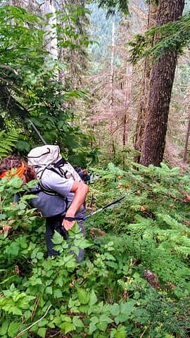
Been saving this one for a while now after seeing Tom S's trip report from 2011. I was instantly intrigued by the direct nature of his route and knew that this would be the way when the time came. The time arrived on Friday!  I was able to convince the usuals, Bryan and Hans, to join in on the fun! Little did we know the suckfest that lie in wait lol! I was able to convince the usuals, Bryan and Hans, to join in on the fun! Little did we know the suckfest that lie in wait lol!  So we drove out to the start of the schwack in the wee hours of the morning. We left the highway onto illabot creek road and drove it for over an hour and finally made it to the hairpin turn that crosses over the creek, pretty close to the slide lake TH. We parked just before the bridge and started battling our way uphill southerly through bushy wooded slopes. So we drove out to the start of the schwack in the wee hours of the morning. We left the highway onto illabot creek road and drove it for over an hour and finally made it to the hairpin turn that crosses over the creek, pretty close to the slide lake TH. We parked just before the bridge and started battling our way uphill southerly through bushy wooded slopes.  Time was 530am. I don't think we took the optimal route up because we were in pretty dense bush for the better part of the first 1500ft of gain lol! That's pretty typical though when you follow me! Time was 530am. I don't think we took the optimal route up because we were in pretty dense bush for the better part of the first 1500ft of gain lol! That's pretty typical though when you follow me!  It was pretty humid out and the bugs were pretty bad! I haven't sweat that much in a great while, nonetheless I was still feeling good! So imma stop right here and say Tom made the summit around 5.5hrs so we knew we would be at least 3hrs behind that time, we are not at that level lol! It was pretty humid out and the bugs were pretty bad! I haven't sweat that much in a great while, nonetheless I was still feeling good! So imma stop right here and say Tom made the summit around 5.5hrs so we knew we would be at least 3hrs behind that time, we are not at that level lol!  We are as casual as peakbaggers come so I knew we were in for a long day just not that long! So anyway we clambered up the hill to 3600ft, pretty steep in places, then made a rising traverse SE to 4100ft. Then we climbed straight up, south, to 4700ft where the forest opened up for good. It had taken us roughly 3hrs to get here(830am) so we took a well deserved break trying to keep the insects at bay. We are as casual as peakbaggers come so I knew we were in for a long day just not that long! So anyway we clambered up the hill to 3600ft, pretty steep in places, then made a rising traverse SE to 4100ft. Then we climbed straight up, south, to 4700ft where the forest opened up for good. It had taken us roughly 3hrs to get here(830am) so we took a well deserved break trying to keep the insects at bay.  If we would have taken a better way up we probably could have shaved 45mins off. If we would have taken a better way up we probably could have shaved 45mins off.
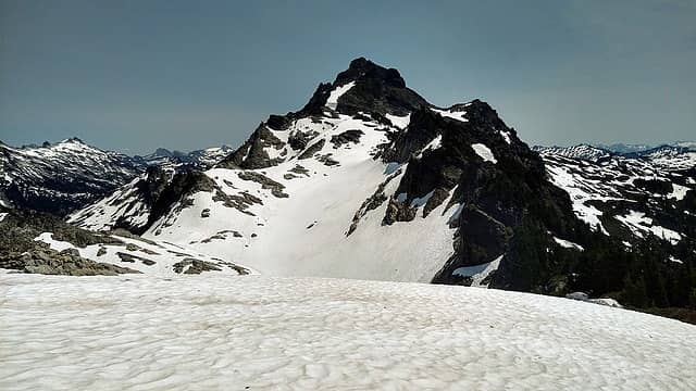
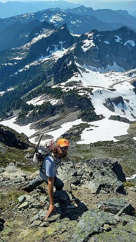
 The bush 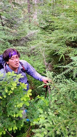 deep 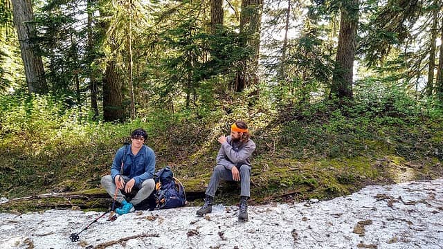 Finally done swimmin  Down to Jug Lk and over to Petite Chaval...what a awesome little paradise! We followed the ridge upward to the east and at 5300ft we ducked on the S side of said ridge to start our traverse to the Petite Chaval col. In hindsight we should have traversed a 100ft higher to avoid some ups and downs on the steeps. We made it just past and underneath the Juggernaut then climbed some class 3 slabs and a little snow to the top of a knoll 500ft above. We had to drop about 200ft here to make our final approach to the col. Man oh man it was a slog up to here and we were all definitely feeling it! Down to Jug Lk and over to Petite Chaval...what a awesome little paradise! We followed the ridge upward to the east and at 5300ft we ducked on the S side of said ridge to start our traverse to the Petite Chaval col. In hindsight we should have traversed a 100ft higher to avoid some ups and downs on the steeps. We made it just past and underneath the Juggernaut then climbed some class 3 slabs and a little snow to the top of a knoll 500ft above. We had to drop about 200ft here to make our final approach to the col. Man oh man it was a slog up to here and we were all definitely feeling it!  We finally arrived at said col which sits at 6100ft, and what a sight to behold! Glacier peak was looking beasty and of course we had our first proper look at the behemoth know as Chaval!! Dayummm...so sweet but still so far away lol! We finally arrived at said col which sits at 6100ft, and what a sight to behold! Glacier peak was looking beasty and of course we had our first proper look at the behemoth know as Chaval!! Dayummm...so sweet but still so far away lol!  At this point it was 1pm so it had taken us 7.5hrs to just get here bahaha! At this point it was 1pm so it had taken us 7.5hrs to just get here bahaha!  The summit was as near as it had been the whole day so I knew we were going for it even though I was rather depleted to say the least lol! Bryan was having minor knee issues so decided to hang back at the col while Hans and I pushed on. The summit was as near as it had been the whole day so I knew we were going for it even though I was rather depleted to say the least lol! Bryan was having minor knee issues so decided to hang back at the col while Hans and I pushed on.
 More open slopes 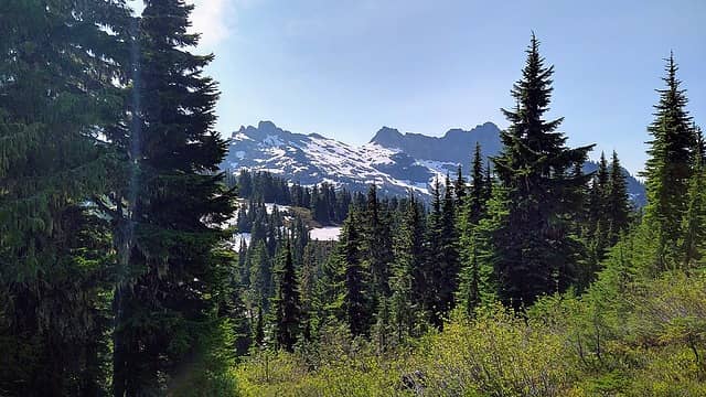 First good views, Petite chaval center 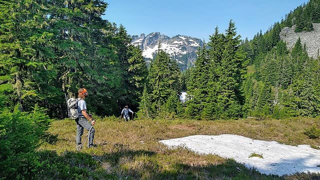 Saddle area above Jug Lk 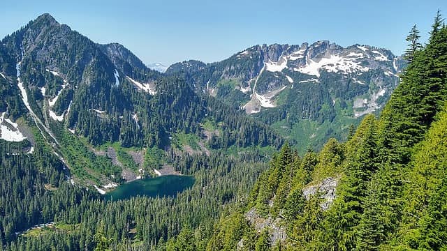 Jug Lk 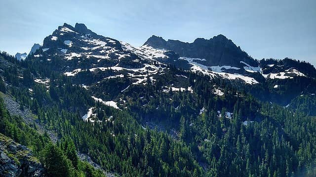 Petite chaval col we are aiming for  Busting moves on the traverse  Just underneath the Juggernaut at this point  Looking back at the Juggernaut  Hans with the traverse behind, pt 5522 is on the left and Baker in back  Coming up the slabs 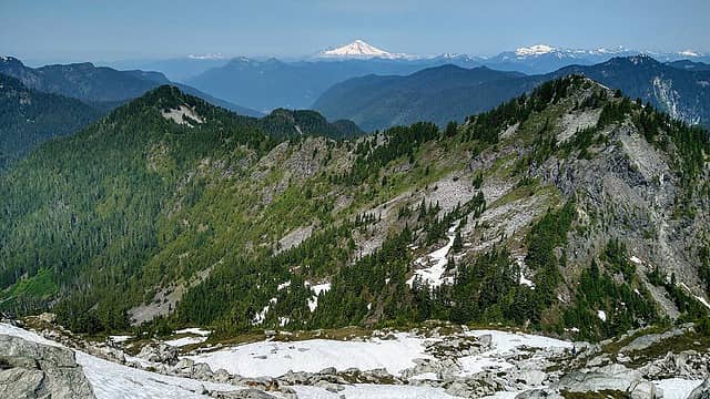 From pt 5522' to the Juggernaut 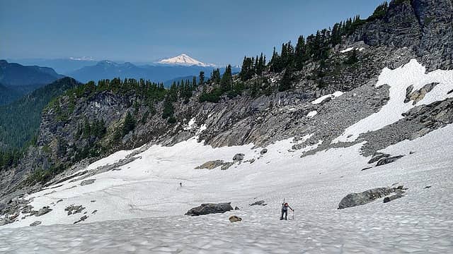 Bringing it up the final snow slopes to the Petite col 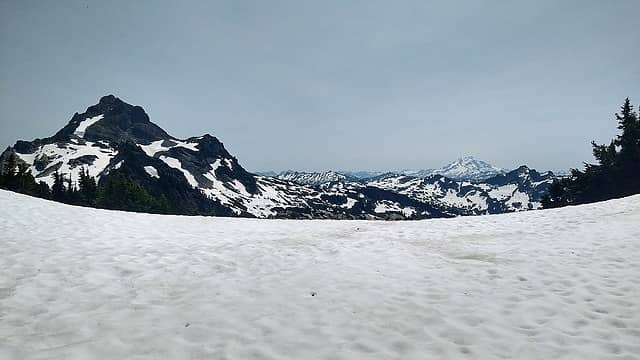 The col at last, chaval and gp 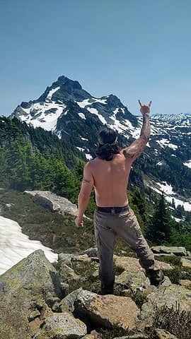 We comin' 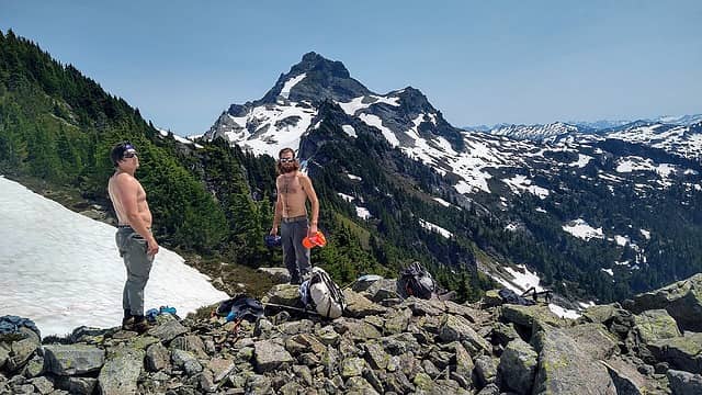 Wow...holy balls  Anyhow the ridge looked impossible to get off of, it funneled down to a little waterfall which was damn near impossible to downclimb. Then Hans spied a sidewalk/ledge on the the adjacent ridge! Anyhow the ridge looked impossible to get off of, it funneled down to a little waterfall which was damn near impossible to downclimb. Then Hans spied a sidewalk/ledge on the the adjacent ridge!  Wow the only weakness in the wall! It worked and we weaseled our way down carefully to the glacier! From here it would only be another 1200ft of gain to the summit. We made it up moderate snow slopes to the summit proper and the thing still looked daunting! It was all steep heather slopes but 700ft of it from here! We took some time to filter water here...I knew I would need it. I was starting to bonk pretty bad, it reminded me of my early days of peakbagging lol! So on we pushed to the promised land. The views were amazing and I wish I had the energy to enjoy the climb a little bit more but hey it was still great! We made it to about 30ft below and I bonked hard. The only thing that saved me was the noon tablets Hans had...it was like the nectar of the gods!! He gave me a tablet that I just let dissolve in my mouth while taking sips of water! Wow that was all I needed and we climbed the remainder, thanks Hans! When we got to the top the views were some of the best! Wow the only weakness in the wall! It worked and we weaseled our way down carefully to the glacier! From here it would only be another 1200ft of gain to the summit. We made it up moderate snow slopes to the summit proper and the thing still looked daunting! It was all steep heather slopes but 700ft of it from here! We took some time to filter water here...I knew I would need it. I was starting to bonk pretty bad, it reminded me of my early days of peakbagging lol! So on we pushed to the promised land. The views were amazing and I wish I had the energy to enjoy the climb a little bit more but hey it was still great! We made it to about 30ft below and I bonked hard. The only thing that saved me was the noon tablets Hans had...it was like the nectar of the gods!! He gave me a tablet that I just let dissolve in my mouth while taking sips of water! Wow that was all I needed and we climbed the remainder, thanks Hans! When we got to the top the views were some of the best!  Such a wild feeling to this place! Snowking, Buckindy, Glacier, and all the rest did not disappoint! Hans even had service! It makes sense as that we could see Darrington far below. We made it up top at 330pm, which made it 10hrs to get there. Holy sh## man it took 10hrs, 2hrs longer than we thought lol! It never surprises me at how fast some of these NWhikers are...truly some of the best to do it!! Usually we are use to long summit stays but today we had to make it just 45mins which I slept 15mins of those lol! We were able to find the summit reg which was sweet too. We sat there enjoying the views to be had all the while hooping and hollering so Bryan knew we had made it! Such a wild feeling to this place! Snowking, Buckindy, Glacier, and all the rest did not disappoint! Hans even had service! It makes sense as that we could see Darrington far below. We made it up top at 330pm, which made it 10hrs to get there. Holy sh## man it took 10hrs, 2hrs longer than we thought lol! It never surprises me at how fast some of these NWhikers are...truly some of the best to do it!! Usually we are use to long summit stays but today we had to make it just 45mins which I slept 15mins of those lol! We were able to find the summit reg which was sweet too. We sat there enjoying the views to be had all the while hooping and hollering so Bryan knew we had made it!
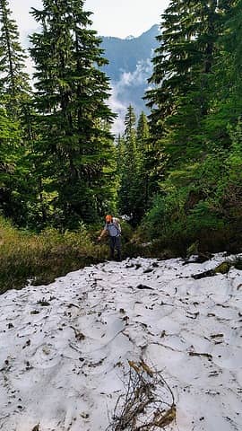
 Damn. Beasty. 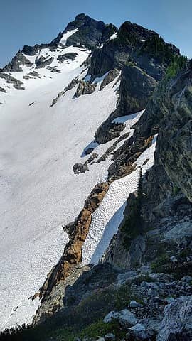 The ledge 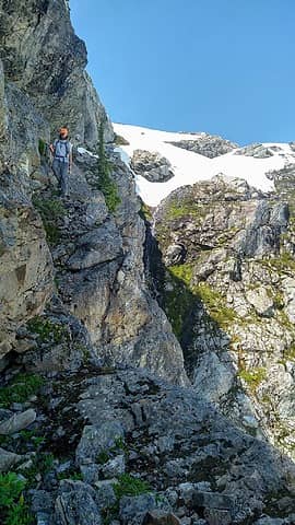 Hans on the sidewalk 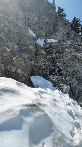 The exit to the glacier 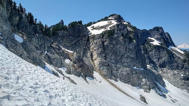 Hans below. The ledge and waterfall visible with pt 6356' towering above. 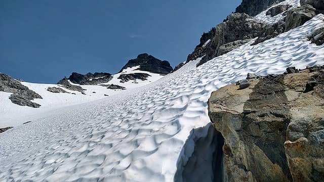 Easy peasy from here 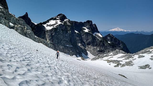 Slogging, petite chaval looks pointy from here 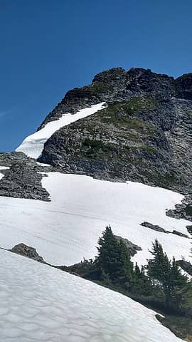 summit proper 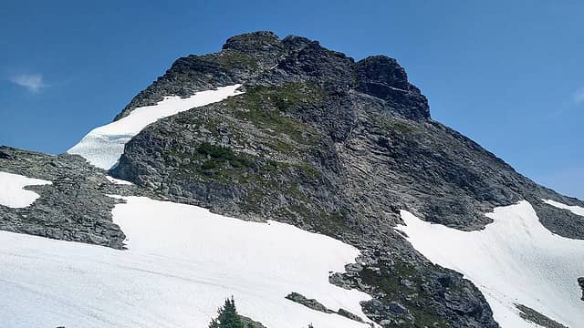 Evil! Still 700ft to go. 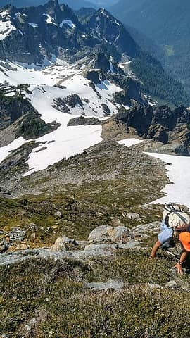 It was mostly this the whole way 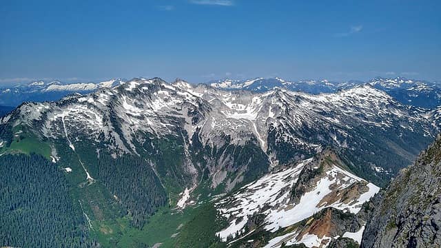 On top with Snowking to the North 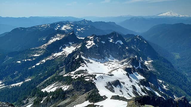 Our whole approach 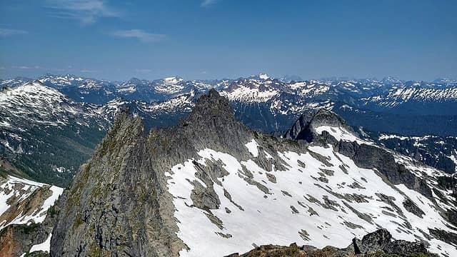 Middle and east chaval 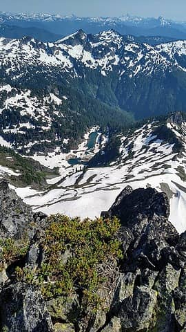 chaval Lk  We awoke at 5am and were moving by 530am. We were able to find a more direct line down the bush, one that came out almost at the hairpin turn. We dropped to the road rather quickly with only the last 100ft being a bushwhack! We made it back to the car at 730am! Dayummm...what a badass trip! It's definitely a reminder of how outta shape I'm in apparently! It was still badass to visit this remote piece of real estate! It was one of the better ridge runs I've done, it's hard to beat a good ole' ridge ramble! We awoke at 5am and were moving by 530am. We were able to find a more direct line down the bush, one that came out almost at the hairpin turn. We dropped to the road rather quickly with only the last 100ft being a bushwhack! We made it back to the car at 730am! Dayummm...what a badass trip! It's definitely a reminder of how outta shape I'm in apparently! It was still badass to visit this remote piece of real estate! It was one of the better ridge runs I've done, it's hard to beat a good ole' ridge ramble!  We might have underestimated it a touch but we still had a blast. I'm glad to have checked this beast off the list to say the least. Thanks again boys for joining! Cheers to all!!
12miles-ish, 6000ft-ish gain, and 26hrs lol! We might have underestimated it a touch but we still had a blast. I'm glad to have checked this beast off the list to say the least. Thanks again boys for joining! Cheers to all!!
12miles-ish, 6000ft-ish gain, and 26hrs lol!
 Goin down 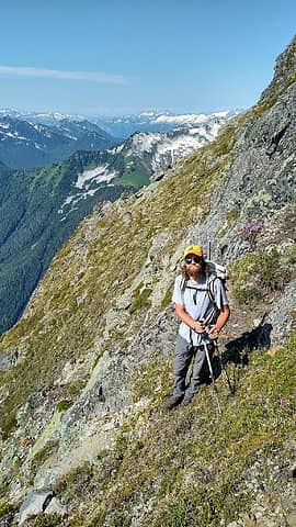 Beautiful steep open slopes 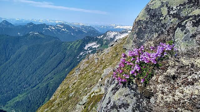 love it 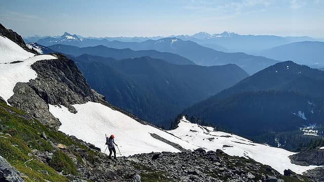 towards Whitehorse and Three fingers 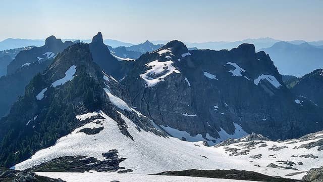 this is the way 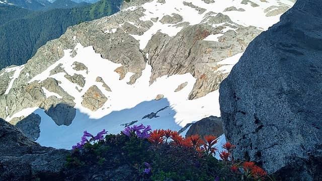 Smiley face 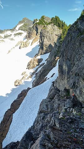 Hans and the sidewalk 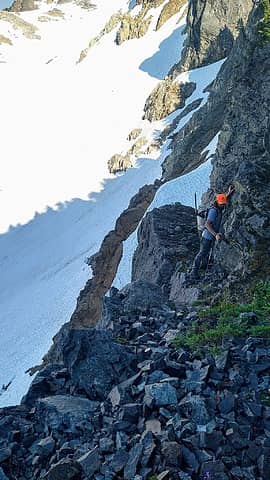 The airy one 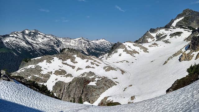 Snowking to chaval 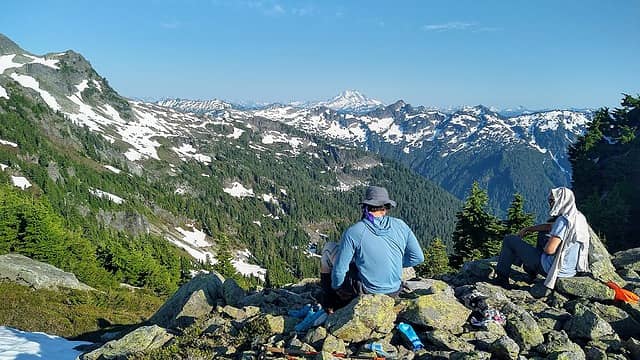 Reunited 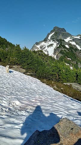 Da goat and chaval
I dont know whats gonna happen, but I wanna have my kicks before the whole shithouse goes up in flames-Mr Mojo Risin
 Nancyann, BensonM, RichP, GaliWalker, Alden Ryno, geyer, Schroder, Tom Nancyann, BensonM, RichP, GaliWalker, Alden Ryno, geyer, Schroder, Tom  KascadeFlat KascadeFlat
I dont know whats gonna happen, but I wanna have my kicks before the whole shithouse goes up in flames-Mr Mojo Risin
Nancyann, BensonM, RichP, GaliWalker, Alden Ryno, geyer, Schroder, Tom KascadeFlat
|
| Back to top |
  
|
|
Silas
Member

Joined: 14 Aug 2012
Posts: 77 | TRs | Pics
|
|
Silas
Member
|
Mon Jul 12, 2021 10:30 pm |
|
|
Great trip report and thanks for the beta. Been looking at this one for a good amount of time! Met a guy at a trailhead on 20 this weekend who said "The Ptarmigan is too crowded...head to the Buckindy!" Good on ya!
ozzy
ozzy |
| Back to top |
|
|
awilsondc
Member

Joined: 03 Apr 2016
Posts: 1324 | TRs | Pics
|
Wowzers! That is one slow going, involved route! I've had my eye on that one, but might reconsider taking Tom's route now. Was that your first unplanned bivy? Did you feel like you had enough gear with you to sufficiently endure the night? I mean obviously you all made it back which is good... Nice job. That's some rarely visited country.
ozzy
ozzy |
| Back to top |
|
|
Sculpin
Member

Joined: 23 Apr 2015
Posts: 1383 | TRs | Pics
|
|
Sculpin
Member
|
Tue Jul 13, 2021 8:21 am |
|
|
| awilsondc wrote: | | That is one slow going, involved route! |
The traverse to Chaval from Boulder Lake is a rarely visited, alpine-lakes-and-meadows Cascades treasure. That might be a factor in route choice for certain types of folks! 
Between every two pines is a doorway to the new world. - John Muir
Between every two pines is a doorway to the new world. - John Muir
|
| Back to top |
|
|
Kascadia
Member
Joined: 03 Feb 2014
Posts: 651 | TRs | Pics
|
|
Kascadia
Member
|
Tue Jul 13, 2021 11:31 am |
|
|
Way to suffer and get it done! Thanks for the register pics, there was a good and otherwise long lost memory in there.
Madding crowd, please stay on the Ptarmigan.
It is as though I had read a divine text, written into the world itself, not with letters but rather with essential objects, saying:
Man, stretch thy reason hither, so thou mayest comprehend these things. Johannes Kepler
ozzy
It is as though I had read a divine text, written into the world itself, not with letters but rather with essential objects, saying:
Man, stretch thy reason hither, so thou mayest comprehend these things. Johannes Kepler
ozzy
|
| Back to top |
|
|
iron
Member

Joined: 10 Aug 2008
Posts: 6392 | TRs | Pics
Location: southeast kootenays |
|
iron
Member
|
Tue Jul 13, 2021 12:11 pm |
|
|
fun trip. good perseverance.
tom's trip, i recall, was early season and a good snow year, so that makes a lot of difference. he was also in his top form those days as he and i would occasionally go out for double mailbox trips in <4.5 hours
if anyone is interested in the easiest route, suggest reading b00's TR here and then taking the modification that hotpantz and i used.
https://www.nwhikers.net/forums/viewtopic.php?t=8013010
later season, you will not need pons (no snow to cross) via our route. if you're on the glacier route, for sure bring them.
ozzy, belowfellow, awilsondc
ozzy, belowfellow, awilsondc |
| Back to top |
|
|
ozzy
The hard way
Joined: 30 Jul 2015
Posts: 476 | TRs | Pics
Location: University place, wa |
|
ozzy
The hard way
|
Tue Jul 13, 2021 3:47 pm |
|
|
Thanks everyone for the kind words!
Aaron- it probably wouldn't be too bad for you, the route that is, it is a longer day than most though. It was not my first unplanned bivy lol...I've had to take many naps in the bushes as well! Love my sleep I guess. We had some cold weather gear that helped endure the night which never got below 50f anyhow. Awesome country out that way man, cheers!
Iron- I always question myself a little if I'm following in y'alls footsteps lol! You guys are crazy! Thanks for the insight and cheers!
I dont know whats gonna happen, but I wanna have my kicks before the whole shithouse goes up in flames-Mr Mojo Risin
I dont know whats gonna happen, but I wanna have my kicks before the whole shithouse goes up in flames-Mr Mojo Risin
|
| Back to top |
|
|
Route Loser
Member
Joined: 24 Jul 2012
Posts: 199 | TRs | Pics
Location: Whidbey Island |
Really nice work up there, ozzy. Bryan's rest spot is a favorite of mine, with Baker and Glacier framed out each side of the col. Having done roughly your forest approach, I have to say the trail to Jug Lake is a whole lot faster. Iron's approach likely hits the nicer lakes and simplifies things; you know, for when you're ready for a second ascent.
ozzy, awilsondc
ozzy, awilsondc |
| Back to top |
|
|
Backpacker Joe
Blind Hiker

Joined: 16 Dec 2001
Posts: 23956 | TRs | Pics
Location: Cle Elum |
Krazie Klimbers! Nice work there. Even Chaval lake looks like it got Avy debris. Why is that a trend this year with so many lakes?
"If destruction be our lot we must ourselves be its author and finisher. As a nation of freemen we must live through all time or die by suicide."
Abraham Lincoln
ozzy
"If destruction be our lot we must ourselves be its author and finisher. As a nation of freemen we must live through all time or die by suicide."
Abraham Lincoln
ozzy
|
| Back to top |
|
|
Tom
Admin
Joined: 15 Dec 2001
Posts: 17854 | TRs | Pics
|
|
Tom
Admin
|
Sat Jul 17, 2021 1:41 pm |
|
|
ozzy |
| Back to top |
|
|
ozzy
The hard way
Joined: 30 Jul 2015
Posts: 476 | TRs | Pics
Location: University place, wa |
|
ozzy
The hard way
|
Sat Jul 17, 2021 9:11 pm |
|
|
| Route Loser wrote: | | Having done roughly your forest approach, I have to say the trail to Jug Lake is a whole lot faster. Iron's approach likely hits the nicer lakes and simplifies things; you know, for when you're ready for a second ascent. |
I was looking at the topo and figured the jug lake approach would be faster. Thanks for the Intel. So if Bryan is able to convince me to go back we'll probably go that route!
I dont know whats gonna happen, but I wanna have my kicks before the whole shithouse goes up in flames-Mr Mojo Risin
I dont know whats gonna happen, but I wanna have my kicks before the whole shithouse goes up in flames-Mr Mojo Risin
|
| Back to top |
|
|
|
|
You cannot post new topics in this forum
You cannot reply to topics in this forum
You cannot edit your posts in this forum
You cannot delete your posts in this forum
You cannot vote in polls in this forum
|
Disclosure: As an Amazon Associate NWHikers.net earns from qualifying purchases when you use our link(s). |


 Knees say no.

