| Previous :: Next Topic |
| Author |
Message |
ozzy
The hard way


Joined: 30 Jul 2015
Posts: 476 | TRs | Pics
Location: University place, wa |
|
ozzy
The hard way
|
 Sun Jul 25, 2021 4:45 pm |
|
|
Well it's kinda been a year of obscure peakbagging so Hans and myself decided to continue the trend lol!  The peak desired this go round would be Sefrit! I've always wanted to climb this lil monster since climbing Ruth Mtn back in my first year of doin this thing that we all enjoy! The peak desired this go round would be Sefrit! I've always wanted to climb this lil monster since climbing Ruth Mtn back in my first year of doin this thing that we all enjoy!  I remember walking under it on the hannegan pass trail and thinking it must be Shuksan with how dominating it was lol. Then recently this year when we climbed Goat Mtn it made a lasting impression for sure! We were able to find a good TR on peakbagger from a dood by the name of Andy Boos! As luck would have it he was kind enough to add a track as well, thanks Andy it probably saved us a lot of misery! I remember walking under it on the hannegan pass trail and thinking it must be Shuksan with how dominating it was lol. Then recently this year when we climbed Goat Mtn it made a lasting impression for sure! We were able to find a good TR on peakbagger from a dood by the name of Andy Boos! As luck would have it he was kind enough to add a track as well, thanks Andy it probably saved us a lot of misery!  Before this discovery I'd always planned on approaching up the north couloir of the mountain in early season as most do. I wasn't too keen on that route to be honest...gnarly! Before this discovery I'd always planned on approaching up the north couloir of the mountain in early season as most do. I wasn't too keen on that route to be honest...gnarly!  Andy's route went up the south slope accessed from the nooksack cirque trail. This immediately grabbed my attention. So as per freakin usual Hans and yours truly found ourselves at the trail at 5am and hiking by 530am. Andy's route went up the south slope accessed from the nooksack cirque trail. This immediately grabbed my attention. So as per freakin usual Hans and yours truly found ourselves at the trail at 5am and hiking by 530am.  The first obstacle is the Ford of Ruth creek. We searched briefly for a log crossing but found none. The water was shin deep so I just ran across and had moderately wet feet all day lol, my laziness is confounding sometimes!
  Hans walked across barefoot. After the crossing we walked the trail 2 miles and after the foot bridge we cut southeast up the dense slopes. The idea is to take the line of least resistance and kind of parallel the creek on up to 5800ft where you bust out into the alpine! Around 2800ft we were a little off route and encountered some horrible slide alder...man I was hoping this wasn't a sign of things to come lol. Hans walked across barefoot. After the crossing we walked the trail 2 miles and after the foot bridge we cut southeast up the dense slopes. The idea is to take the line of least resistance and kind of parallel the creek on up to 5800ft where you bust out into the alpine! Around 2800ft we were a little off route and encountered some horrible slide alder...man I was hoping this wasn't a sign of things to come lol.  Luckily we got back on track and the brush died out mostly. We climbed up forested slopes for 3200ft or so, most of it was pretty steep. A lot of it was littered with deadfall too which made travel a little slow at times. Luckily we got back on track and the brush died out mostly. We climbed up forested slopes for 3200ft or so, most of it was pretty steep. A lot of it was littered with deadfall too which made travel a little slow at times.  At 5200ft we took a break at the first stream we came across, time was 930am. After the break we continued up to 5800ft paralleling the creek on the topo. The trees began to give way and we broke on through to the alpine!! Wow...this lil basin at 5800ft is pretty badass! We had clear views of Sefrit proper, Shuksan, Baker, and so much more!!! Time was 945am. We definitely took another break here to study the surroundings and our route up this bastard! At 5200ft we took a break at the first stream we came across, time was 930am. After the break we continued up to 5800ft paralleling the creek on the topo. The trees began to give way and we broke on through to the alpine!! Wow...this lil basin at 5800ft is pretty badass! We had clear views of Sefrit proper, Shuksan, Baker, and so much more!!! Time was 945am. We definitely took another break here to study the surroundings and our route up this bastard! 
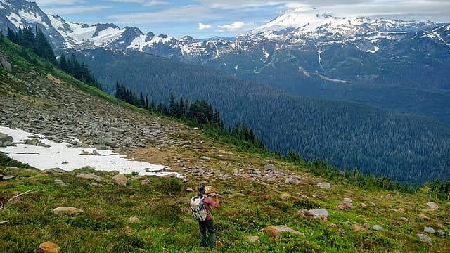
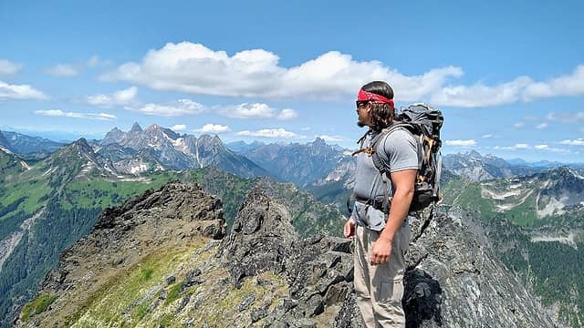
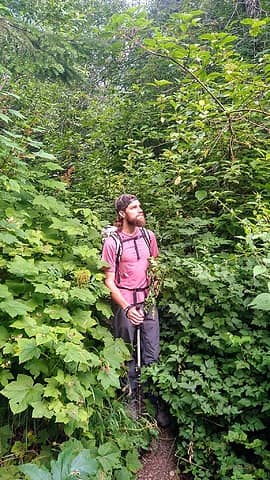 Nooksack cirque trail 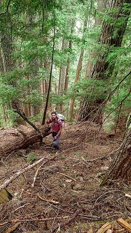 offtrail 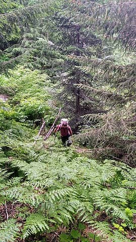 closer to the alpine 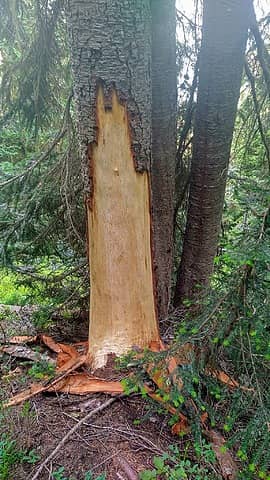 We saw hundreds of these trees. Stripped of the bark and only one did we see actual claw marks. What the hell would have done all that lol! 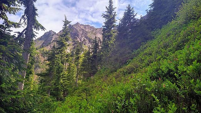 first views of the mountain 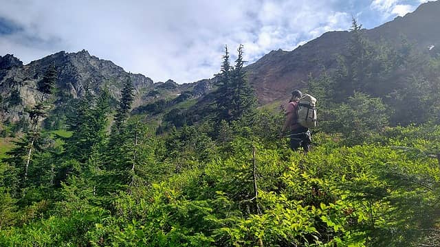 The basin 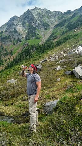 cheers with Sefrit behind  Man what a beautiful place in the cascades! From up here the scenery was breathtaking! From Baker to Shuksan, to the Chilliwacks and pickets! The Larrabee group and Tomyhoi! We made it up here around 1130am, so 6hrs from the car which was better than we expected lol! The summit is pretty comfortable so we loitered up there for about 2hrs. We even found the register which can use a new cannister if anyone remembers. What an airy perch indeed! Cheers! Man what a beautiful place in the cascades! From up here the scenery was breathtaking! From Baker to Shuksan, to the Chilliwacks and pickets! The Larrabee group and Tomyhoi! We made it up here around 1130am, so 6hrs from the car which was better than we expected lol! The summit is pretty comfortable so we loitered up there for about 2hrs. We even found the register which can use a new cannister if anyone remembers. What an airy perch indeed! Cheers! 
 ooh bakey 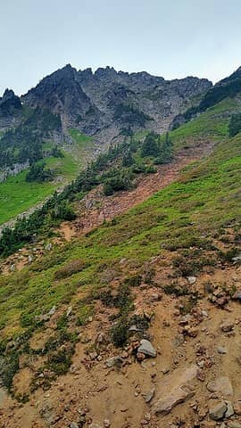 approaching the gully, just out of sight 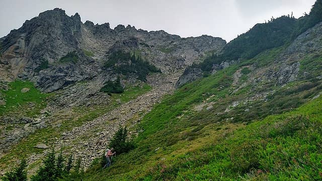 Hans and gully 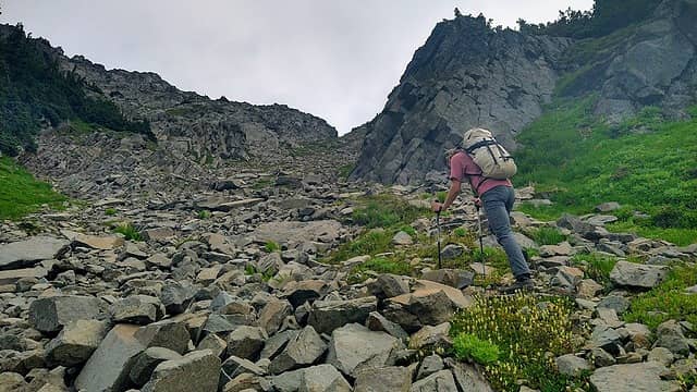 Gully proper 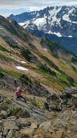 Topping out of the little gully that branches off from the main gully  upper heather slopes leading to the east ridge 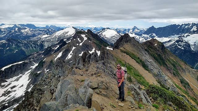 on the ridge looking east 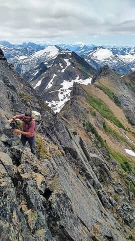 Some class 3 up on da ridge 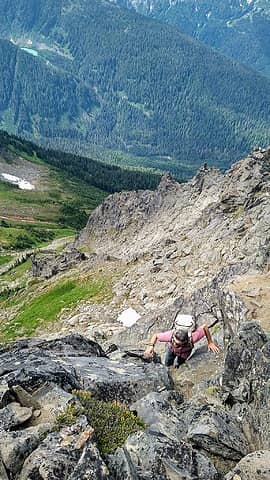 The chimney up towards the top 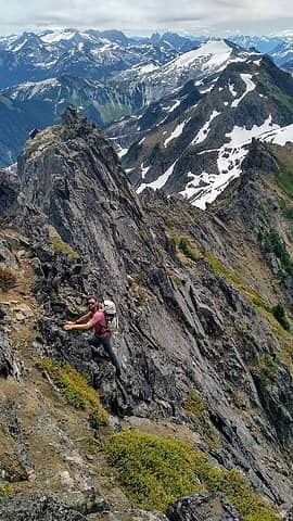 Hans loving the spice 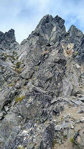 Block proper 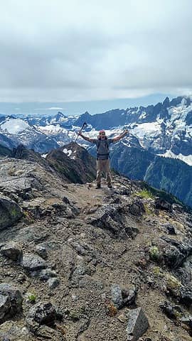 There it be 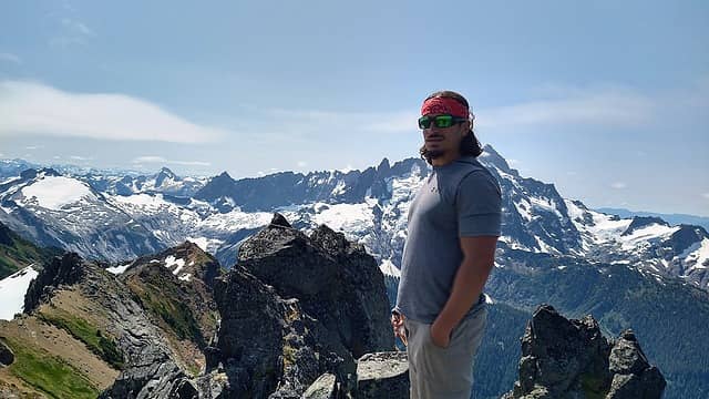 Dayummm 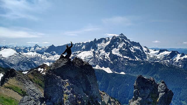 Hans being Hans lol 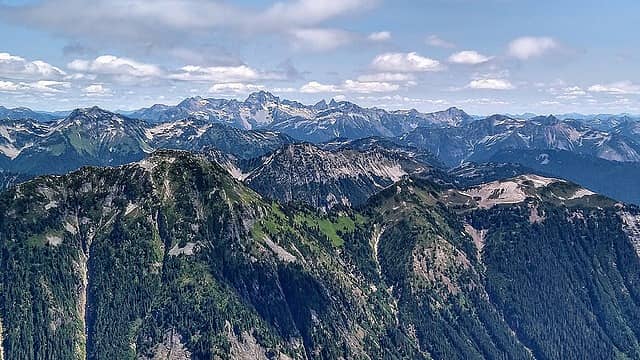 Chilliwacks 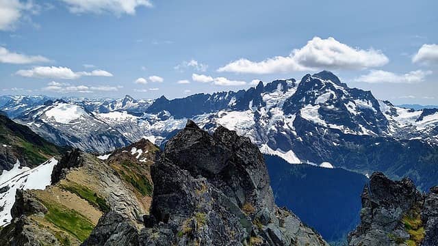 Oooowweeeee 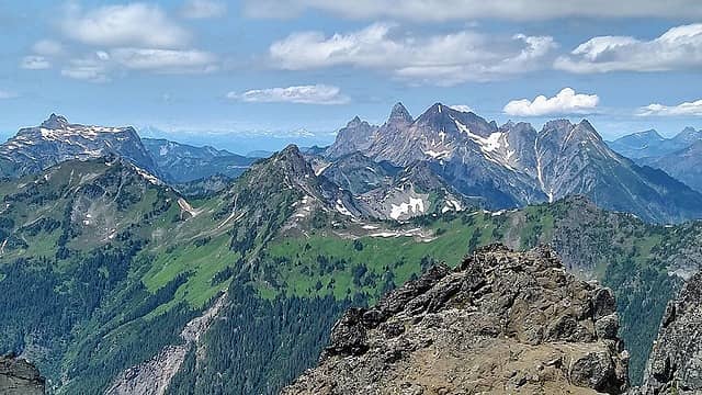 Larrabee and friends  We downclimbed all the hazards and arrived back at the basin in an hour. Another break here and water refill. I love looking back at the day's work (the peak) from below and takin it all in. We downclimbed all the hazards and arrived back at the basin in an hour. Another break here and water refill. I love looking back at the day's work (the peak) from below and takin it all in.  That's one of my favorite parts of these trips. So with the last views of the alpine we entered the woods and made the tedious descent into the woods towards the nooksack. We were kinda dreading the potential shwack down low but we able to stay on Andy's track more so this time! Thank God because the bush was very manageable at worst, and that was just the last 100ft or so, then the trail!! Stoked to be on the trail we made quick work back to the car and arrived just after 7pm, making for a 13.5hr day! I think the mileage was around 12miles. The gain about 4900ft. Another pretty sick peak in the bag we were again satisfied for another week anyhow, lol! Thanks Hans for joining again and cheers to all of y'all!! That's one of my favorite parts of these trips. So with the last views of the alpine we entered the woods and made the tedious descent into the woods towards the nooksack. We were kinda dreading the potential shwack down low but we able to stay on Andy's track more so this time! Thank God because the bush was very manageable at worst, and that was just the last 100ft or so, then the trail!! Stoked to be on the trail we made quick work back to the car and arrived just after 7pm, making for a 13.5hr day! I think the mileage was around 12miles. The gain about 4900ft. Another pretty sick peak in the bag we were again satisfied for another week anyhow, lol! Thanks Hans for joining again and cheers to all of y'all!!
 Parting ways 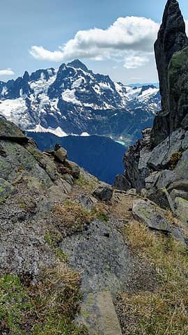 Framer 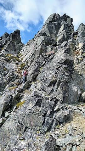 Hans below the summit 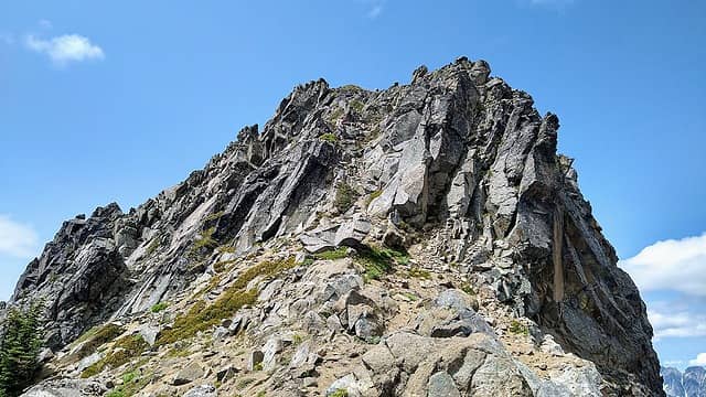 Hans on sub summit 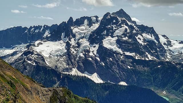 Mighty Shuksan 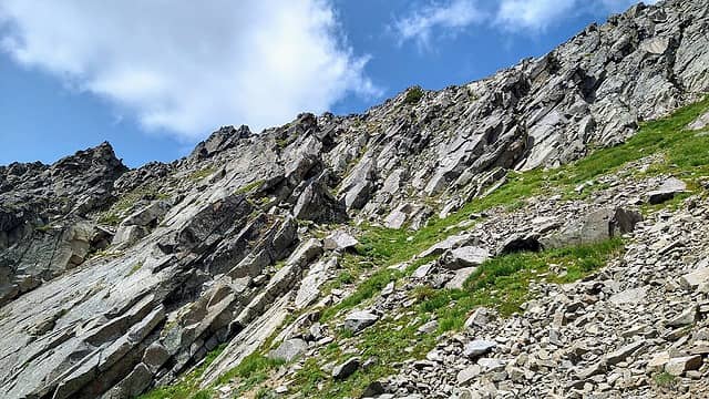 little gully at 6800ft 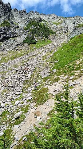 Yea buddy 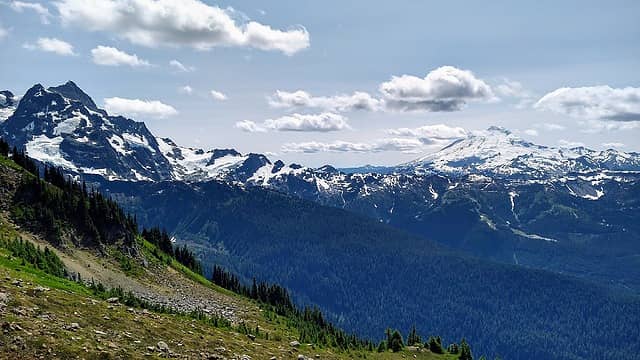 Shuk to Baker 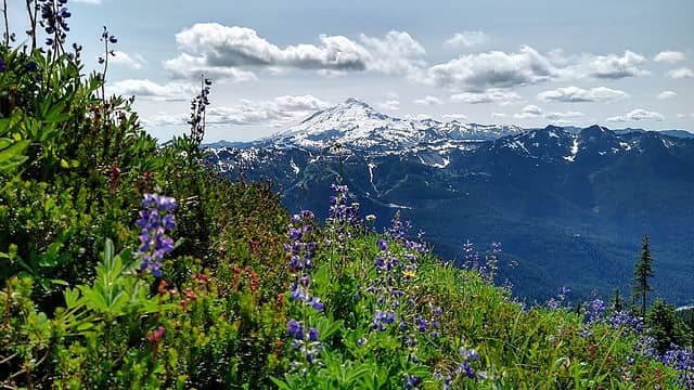 Love me some flowers 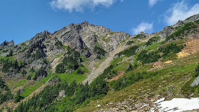 Sefrit in all it's glory, from this side at least lol 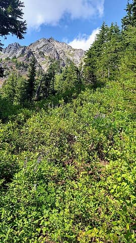 Last look 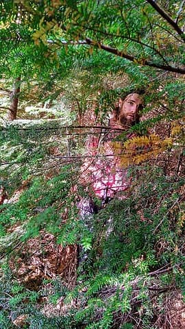 Last bush
I dont know whats gonna happen, but I wanna have my kicks before the whole shithouse goes up in flames-Mr Mojo Risin
 mosey, Silas, Frodo Barefoot, pjhorst, Nancyann, reststep, flatsqwerl, Route Loser, rubywrangler, KascadeFlat, ONELUV1, RichP, Tom mosey, Silas, Frodo Barefoot, pjhorst, Nancyann, reststep, flatsqwerl, Route Loser, rubywrangler, KascadeFlat, ONELUV1, RichP, Tom
I dont know whats gonna happen, but I wanna have my kicks before the whole shithouse goes up in flames-Mr Mojo Risin
mosey, Silas, Frodo Barefoot, pjhorst, Nancyann, reststep, flatsqwerl, Route Loser, rubywrangler, KascadeFlat, ONELUV1, RichP, Tom
|
| Back to top |
  
|
|
Gimpilator
infinity/21M

Joined: 12 Oct 2006
Posts: 1684 | TRs | Pics
Location: Edmonds, WA |
Very very cool. I was not aware that people do this peak without snow. Looks great. Badass
|
| Back to top |
|
|
Midnight Slogger
'Schwack Job

Joined: 04 Aug 2017
Posts: 96 | TRs | Pics
Location: Greater Cascadia |
Well done and entertainingly written, as always. Gotta love that Lovenox register.
ozzy
ozzy |
| Back to top |
|
|
Mike Collins
Member

Joined: 18 Dec 2001
Posts: 3097 | TRs | Pics
|
Congratulations on your successful endeavor. The peak has not seen many visitors since Creeden and I left the register sixteen years ago. The Lovenox paper was given out by a drug rep at the hospital. Our fording of Ruth Creek was the crux of the climb for us as we forded it in the afternoon when snowmelt greatly increased the flow.
ozzy
ozzy |
| Back to top |
|
|
raising3hikers
Member
Joined: 21 Sep 2007
Posts: 2344 | TRs | Pics
Location: Edmonds, Wa |
Might be the best view of shuksan from there. Wow!
Eric Eames
ozzy
Eric Eames
ozzy
|
| Back to top |
|
|
awilsondc
Member

Joined: 03 Apr 2016
Posts: 1324 | TRs | Pics
|
Nice trip gentlemen! I really like this here photo:
| ozzy wrote: | The basin |
That's the essence of peakbagging right there. I can practically feel the stoke!
ozzy
ozzy |
| Back to top |
|
|
Brushbuffalo
Member

Joined: 17 Sep 2015
Posts: 1887 | TRs | Pics
Location: there earlier, here now, somewhere later... Bellingham in between |
| ozzy wrote: | Hans being Hans lol |
As r3h remarked, this may be the best view of Shuksan. Check plate 8c opposite page 65 on Geology of the North Cascades by
Tabor and Haugerud for a ' hammock view' from this point.
By the way, when we climbed Sefrit in August 1967 we climbed from the north. We left the Hannegan Pass trail about 1 mile along, easily crossed the creek, and ascended granitic slabs then heather to the ridge east of the summit. If you scope out the line from below you will encounter almost no brush after getting up out of the valley. At that time we were the fourth registrants in the summit register.
Passing rocks and trees like they were standing still
ozzy
Passing rocks and trees like they were standing still
ozzy
|
| Back to top |
|
|
|
|
You cannot post new topics in this forum
You cannot reply to topics in this forum
You cannot edit your posts in this forum
You cannot delete your posts in this forum
You cannot vote in polls in this forum
|
Disclosure: As an Amazon Associate NWHikers.net earns from qualifying purchases when you use our link(s). |


