| Previous :: Next Topic |
| Author |
Message |
Midnight Slogger
'Schwack Job


Joined: 04 Aug 2017
Posts: 96 | TRs | Pics
Location: Greater Cascadia |
Many thanks to our good homie Kyle who made this trip possible by picking us up after we bailed on the original trip. Thanks bud! Also big thanks to Hannah who facilitated our car shuttle logistics before the asscrack of dawn. All of the photos are from Fletcher.
There are some great descriptions of this trip (a classic NWhikers trip report from 2007, a 2011 traverse from Randy, as well as some 2010 "notes" from DIYSteve, and a more recent debut report from some plucky Canadians in 2019). The funny thing was that we knew little of these reports when we decided do this traverse on the second day of our original trip, which was aimed at the Northern Pickets.
Day 1: Ambition
Brother Rob was in town from Wisconsin and in the mood for some good views and a little exercise. Naturally we all thought it a good idea to do the Mystery Ridge-Northern Pickets Traverse. Soon we were kissing goodbyes and hauling six-night packs down Bacon Creek Road (FS 1060) at 7am, about 2.5 miles from the road's end where several downed logs still block the way. After the road ends we followed the old "road" for a while before we were seduced into some vegetation and the first of many great 'schwacks. We didn't start descending to cross Bacon Creek until a little bit after Porkbelly Ridge began rising, which was probably a mistake.
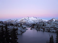
 Bacon Creek Road; FS says it'll be civilian clean-up only, so who knows how long before this is fully clear. 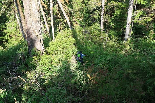 The first of many a great 'schwack getting down to the creek. 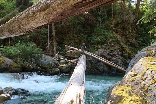 Our E. Fork Bacon Creek crossing. 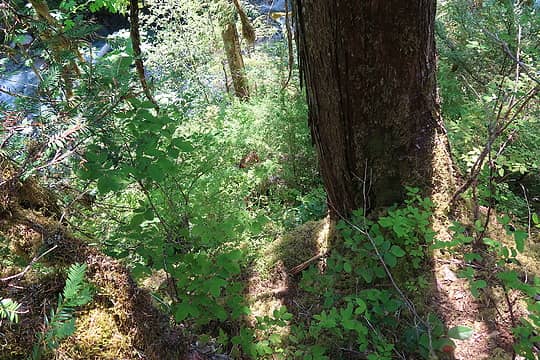 Typical veggies getting onto the "climber's path" of Porkbelly Ridge. 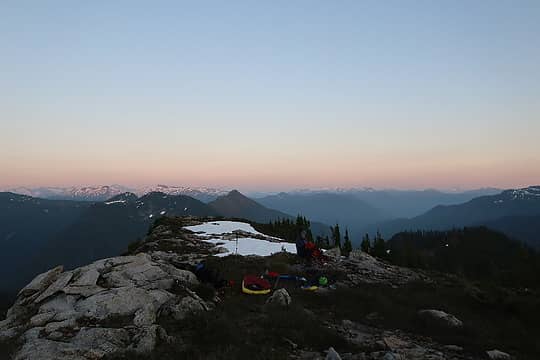 Night 1 ridge bivy below E ridge of Berdeen 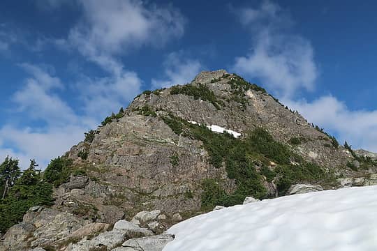 At the base of Berdeen's east ridge. 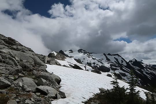 Going up towards Berdeen. 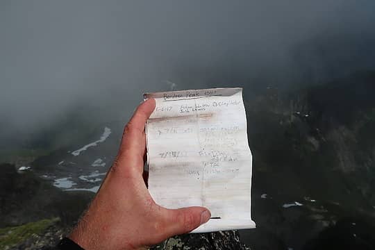 Seldom signed. 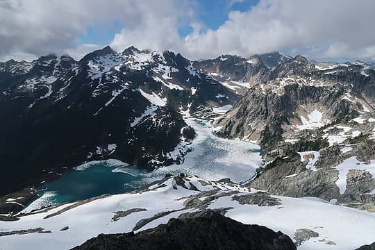 The crown jewel that is Berdeen Lake. 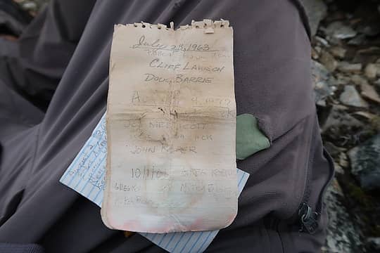 Our one Hagan pic not socked in. Note the placement date. 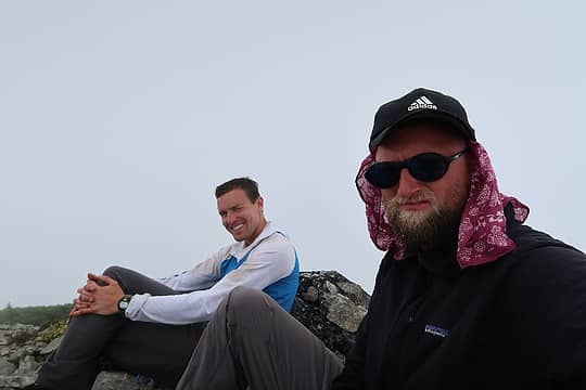 Socked, stoked. ![Intense patches of [i:d254edcb3d]Chlamydomonas nivalis[/i:d254edcb3d] on Hagan's southern aspects.](https://cloud.nwhikers.net/b87c247f223af64624c5aa9bd4d6a402_540x360.jpg) Intense patches of Chlamydomonas nivalis on Hagan's southern aspects. 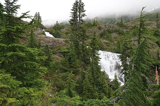 Large and splendiferous waterfalls draining from Berdeen to "Lower Berdeen". 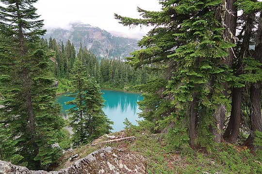 The seldom visited "Lower Berdeen". 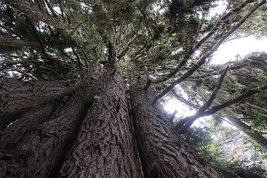 The Evergreen Quintet. We saw what seemed to be an unusually high amount of these tree clusters between Berdeen and Green lakes. 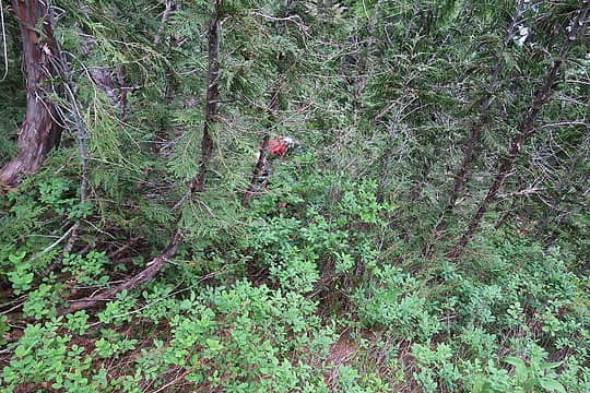 Typical veggie terrain between Berdeen and Green. 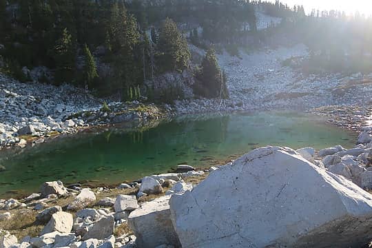 Upper Nert Lake. 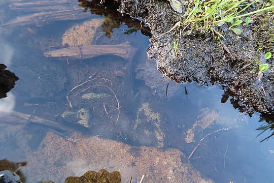 On the shore of Nert Lake proper; there's a previously at-risk animal in this pic, do you see it? 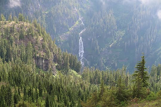 Looking back at the epics falls of Lower Berdeen. 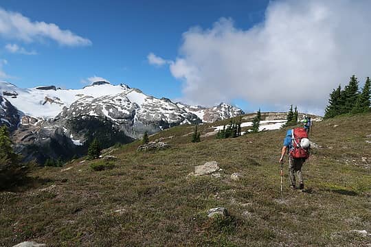 Approaching top of "Countdown Butte". 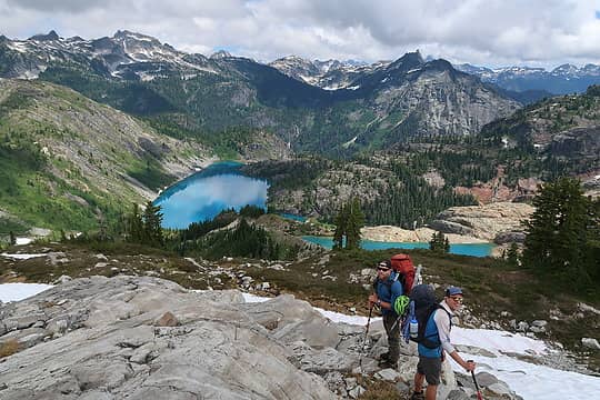 Bacon Laken and Green Lake. Berdeen, our second night's camp, and Hagan in the distance. 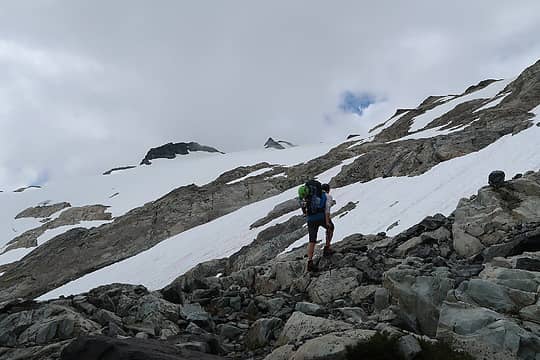 Ascending rocks and slabs, mostly avoiding snow, on Bacon's north side. 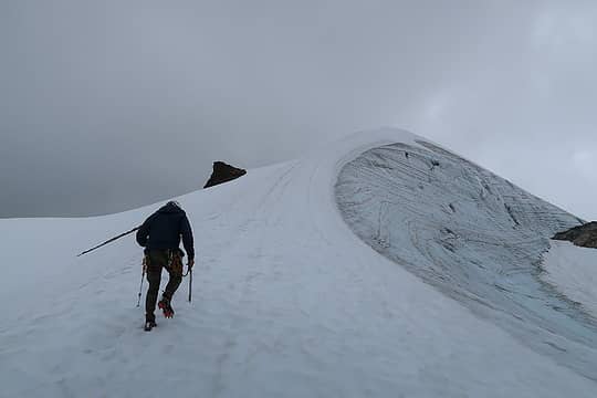 The quick snow arete leading to Bacon's summit. 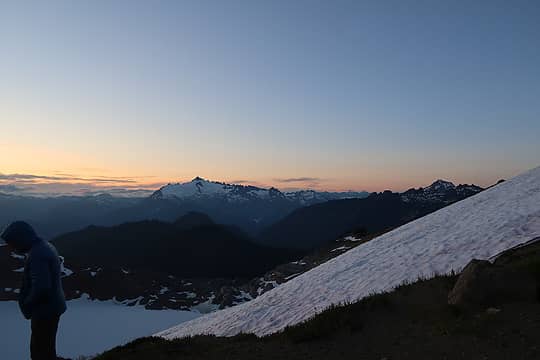 6400' bivy. 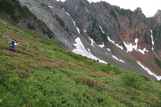 Dropping the upper Noisy Creek drainage... 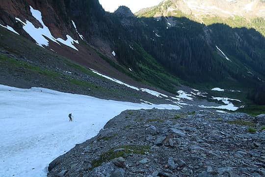 ...still dropping the drainage. 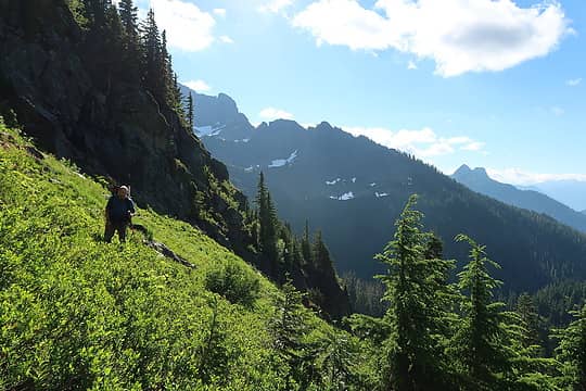 Typical terrain getting to the Upper Diobsud Lakes notch. ![Looking back at upper Noisy Creek drainage that we dropped (though we stayed far right of the creek/waterfall in this photo). We were all disgruntled to think that this is (was?) the standard route for Bacon--too much up/down I think compared to the Bacon Creek approach. See [url=http://www.nwhikers.net/forums/viewtopic.php?p=1193234]Fletcher's 2019 TR for more on this approach[/url].](https://cloud.nwhikers.net/00f03537aa510e15e05b5df4815e7601_320x480.jpg) Looking back at upper Noisy Creek drainage that we dropped (though we stayed far right of the creek/waterfall in this photo). We were all disgruntled to think that this is (was?) the standard route for Bacon--too much up/down I think compared to the Bacon Creek approach. See Fletcher's 2019 TR for more on this approach. 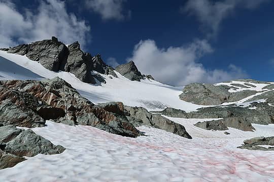 Looking up the north glacier/snowfield of the Watson massif, Kyle just a speck in the distance. 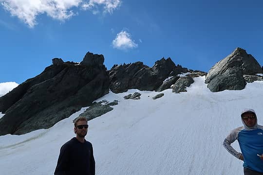 Watson summits, with true summit middle right and the easy access to the ridge just outside the left side of this photo. 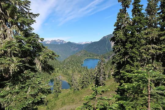 NOCA gold: Watson Lakes.
 freddyfredpants, reststep, ONELUV1, RichP, geyer, olderthanIusedtobe, dicey, Dave Weyrick, Silas, mosey, Gimpilator, Tom freddyfredpants, reststep, ONELUV1, RichP, geyer, olderthanIusedtobe, dicey, Dave Weyrick, Silas, mosey, Gimpilator, Tom  ozzy ozzy
freddyfredpants, reststep, ONELUV1, RichP, geyer, olderthanIusedtobe, dicey, Dave Weyrick, Silas, mosey, Gimpilator, Tom ozzy |
| Back to top |
  
|
|
raising3hikers
Member

Joined: 21 Sep 2007
Posts: 2344 | TRs | Pics
Location: Edmonds, Wa |
Nice job being able to come up with a great plan B after already starting the trip. You guys covered some nice area!
Also good to see a Kyle sighting in the mtns
Eric Eames
Matt
Eric Eames
Matt
|
| Back to top |
|
|
olderthanIusedtobe
Member
Joined: 05 Sep 2011
Posts: 7709 | TRs | Pics
Location: Shoreline |
| Midnight Slogger wrote: | On the shore of Nert Lake proper; there's a previously at-risk animal in this pic, do you see it? |
Hiding in plain sight. Took me a while to find it.
|
| Back to top |
|
|
Tom
Admin
Joined: 15 Dec 2001
Posts: 17854 | TRs | Pics
|
|
Tom
Admin
|
 Thu Jul 22, 2021 7:25 pm |
|
|
The first time we went up there Big Steve mentioned the fishing was good at Nert so we dropped pack and camped there. Dumbest decision of that trip and lamest camp ever. To escape the bugs I inflated the raft and floated around. Didn't catch anything as I don't think there are any fish in Nert but saw quite a few of those species cruising the bottom. I came home to find out that Big Steve thought that Lower Berdeen was called Nert. Not that I would camp at Lower Berdeen either. As you note there are many jewels along the way and no reason to opt for a camp that doesn't have a spectacular view.
|
| Back to top |
|
|
iron
Member

Joined: 10 Aug 2008
Posts: 6392 | TRs | Pics
Location: southeast kootenays |
|
iron
Member
|
Thu Jul 22, 2021 10:49 pm |
|
|
really jealous of this trip. this is the one area of the cascades i have yet to really explore and have always wanted to. i think this is WA's last unknown. an area devoid of IG and FB groups. good stuff!
|
| Back to top |
|
|
Matt
Tea, Earl Grey, Hot

Joined: 30 Jan 2007
Posts: 4307 | TRs | Pics
Location: Shoreline |
|
Matt
Tea, Earl Grey, Hot
|
Thu Jul 22, 2021 11:11 pm |
|
|
Seldom visited, but we missed intersecting you by only a few days, as you could see in the Berdeen register. We went through the area on a Mystery Ridge - Pioneer Ridge loop, camping at the Native-Lonesome col on July 11.
As beacons mountains burned at evening. J.R.R. Tolkien
As beacons mountains burned at evening. J.R.R. Tolkien
|
| Back to top |
|
|
carlb328
Member
Joined: 28 May 2007
Posts: 327 | TRs | Pics
Location: Yakima, WA |
|
carlb328
Member
|
Fri Jul 23, 2021 5:07 am |
|
|
That pool on Bacon creek looks like amazing fish habitat. How far was that from where the road was blocked?
|
| Back to top |
|
|
geyer
Member

Joined: 23 May 2017
Posts: 463 | TRs | Pics
Location: Seattle |
|
geyer
Member
|
Fri Jul 23, 2021 6:13 am |
|
|
Nice looking trip 
|
| Back to top |
|
|
RichP
Member

Joined: 13 Jul 2006
Posts: 5634 | TRs | Pics
Location: here |
|
RichP
Member
|
Fri Jul 23, 2021 6:21 am |
|
|
Sweet goodness! 
|
| Back to top |
|
|
Jaberwock
Member
Joined: 30 Jan 2013
Posts: 722 | TRs | Pics
Location: Bellingham |
I didn't know the gracile around here had been at-risk (except for pressure from introduced fish).
|
| Back to top |
|
|
Backpacker Joe
Blind Hiker

Joined: 16 Dec 2001
Posts: 23956 | TRs | Pics
Location: Cle Elum |
Great work guys. I dont know when it happened but I was told that all the forest service KILLED all the fish in all the lakes in the North Cascades.
"If destruction be our lot we must ourselves be its author and finisher. As a nation of freemen we must live through all time or die by suicide."
Abraham Lincoln
"If destruction be our lot we must ourselves be its author and finisher. As a nation of freemen we must live through all time or die by suicide."
Abraham Lincoln
|
| Back to top |
|
|
ChrisSJI
Member
Joined: 23 Jun 2008
Posts: 361 | TRs | Pics
Location: San Juan Island |
|
ChrisSJI
Member
|
Fri Jul 23, 2021 11:28 am |
|
|
| Backpacker Joe wrote: | | Great work guys. I dont know when it happened but I was told that all the forest service KILLED all the fish in all the lakes in the North Cascades. |
BPJ - The fish kill was proposed by the Park Service (not Forest Svc) for the lakes with reproducing fish within the National Recreation Area. I don't know if they followed through with it. Maybe someone else can answer that.
|
| Back to top |
|
|
Fletcher
Member

Joined: 29 Jul 2009
Posts: 1870 | TRs | Pics
Location: kirkland |
|
Fletcher
Member
|
Fri Jul 23, 2021 12:04 pm |
|
|
Thanks for the write up Reed! I am thankful for such awesome friends to share trips like this with. Good times!
|
| Back to top |
|
|
contour5
Member

Joined: 16 Jul 2003
Posts: 2963 | TRs | Pics
|
|
contour5
Member
|
Fri Jul 23, 2021 1:02 pm |
|
|
A+ Trip Report! Lots of great links makes for a really useful trip planning tool. Thanks for the time and effort.
|
| Back to top |
|
|
coldrain108
Thundering Herd

Joined: 05 Aug 2010
Posts: 1858 | TRs | Pics
Location: somewhere over the rainbow |
| olderthanIusedtobe wrote: | | Midnight Slogger wrote: | On the shore of Nert Lake proper; there's a previously at-risk animal in this pic, do you see it? |
Hiding in plain sight. Took me a while to find it. |
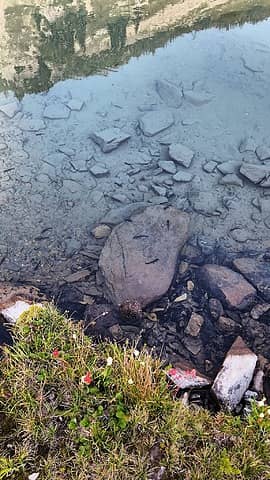 How many can you find?
Since I have no expectations of forgiveness, I don't do it in the first place. That loop hole needs to be closed to everyone.
Since I have no expectations of forgiveness, I don't do it in the first place. That loop hole needs to be closed to everyone.
|
| Back to top |
|
|
|
|
You cannot post new topics in this forum
You cannot reply to topics in this forum
You cannot edit your posts in this forum
You cannot delete your posts in this forum
You cannot vote in polls in this forum
|
Disclosure: As an Amazon Associate NWHikers.net earns from qualifying purchases when you use our link(s). |


![Intense patches of [i:d254edcb3d]Chlamydomonas nivalis[/i:d254edcb3d] on Hagan's southern aspects.](https://cloud.nwhikers.net/b87c247f223af64624c5aa9bd4d6a402_r.jpg#2048x1365+https://lh3.googleusercontent.com/RCZbsf6DeFFhdktNpUM5q7TigoNSHIdkvBJbKRswKe31NcHDpZMQUDzlGOiuiU06bqB80_TWz_yHFXQiuKGVSN8sP-ehKnPn2A3NI6deoatmWTcgsVEKHaXpzVzOf8blEjUAAmj_gE4=s0#5472x3648)


![Looking back at upper Noisy Creek drainage that we dropped (though we stayed far right of the creek/waterfall in this photo). We were all disgruntled to think that this is (was?) the standard route for Bacon--too much up/down I think compared to the Bacon Creek approach. See [url=http://www.nwhikers.net/forums/viewtopic.php?p=1193234]Fletcher's 2019 TR for more on this approach[/url].](https://cloud.nwhikers.net/00f03537aa510e15e05b5df4815e7601_r.jpg#1365x2048+https://lh3.googleusercontent.com/mnHH1-0O96XoKcuMlgUqwY7dVj1rEEG4L4VToJRjWLbWGhK87XvjfDSbDTnPgzuDQObTeeRPMj7xan0SYxIAR-ixUj4saIAGdOJ9_PWtED3bJHOhf4nuuajqKnpDv_i14Eo7CEM25X8=s0#3648x5472)


