| Previous :: Next Topic |
| Author |
Message |
awilsondc
Member


Joined: 03 Apr 2016
Posts: 1324 | TRs | Pics
|
Saturday marked the start of Smaugust, a day early. The forecast was for overcast skies (high clouds) and incoming smoke from wildfires. I wanted to go somewhere that had good nearby views, and distant views that I wouldn't mind missing out on. The Monte Cristo area seemed like it would fit the bill and Cadet Peak had been on my radar so I loaded up my bike and headed off for Barlow Pass. I left my big camera at home and just used my phone, which I regret. For beta on this trip I used this great trip report from MidLifeHiker as well as Gimpilator's and Ozzy's. I followed GPS tracks from Armit Panda and Bret Wiencke found on peakbagger which followed the route very well.
Around 6:15am I mounted my bike and started pedaling up the trail to Monte Cristo. I had been there only once before, about 9 years ago, so I was excited to see the area again. The road up is decent for biking, with several sections you need to get off your bike and push it along a hiking trail or carry it over a log crossing the Sauk River. It definitely is nice to have a bike for the portion leading to Monte Cristo, and even better on the way down! The main town site of Monte Cristo is just as I remember it. On my last trip I headed up to Poodle Dog Pass to climb Columbia, but this time Glacier Basin was the destination so I headed towards the bridge leading to Dumas Street. Heading up Dumas St was pretty wild. All kinds of dilapidated buildings, sign posts marking where historical buildings used to be... It looked like a normal hiking trail, but it used to be a street people lived on! Pretty cool... I enjoyed the history of the area a lot more than I thought I would but I had a peak to climb so I carried on towards Glacier Basin.
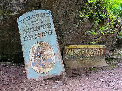 Monte Cristo signs 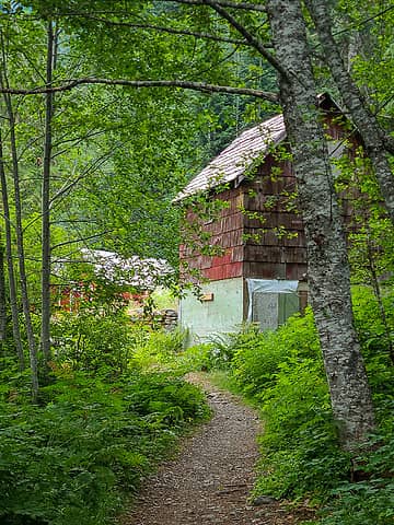 Entering the town site 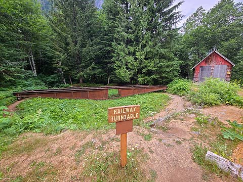 Railway Turntable 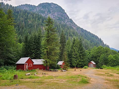 Main town site 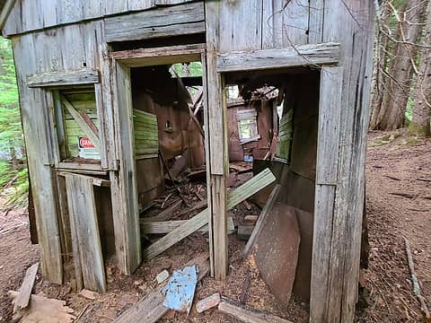 Dilapidated building 
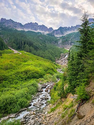 Cascading stream 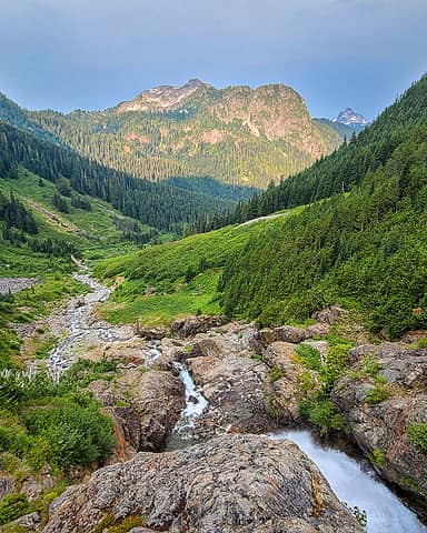 Golden hour light 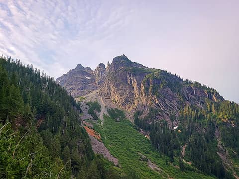 What a morning! 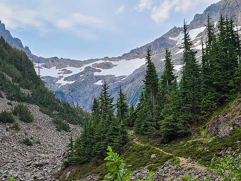 About to enter Glacier Basin 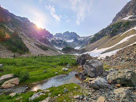 Sunrise over Glacier Basin 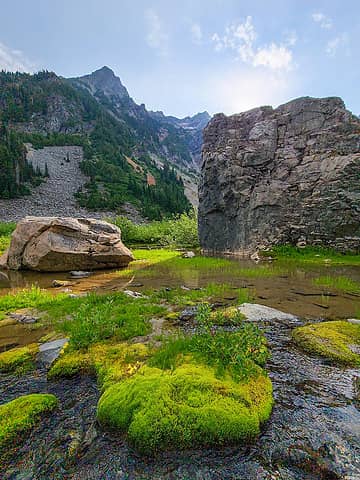 Environs 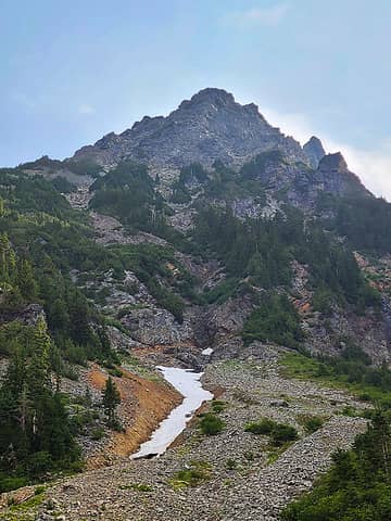 Washed out gully  Ramp leading to hidden gully  Getting up there!  Steep terrain  Wilmans Peak and Columbia 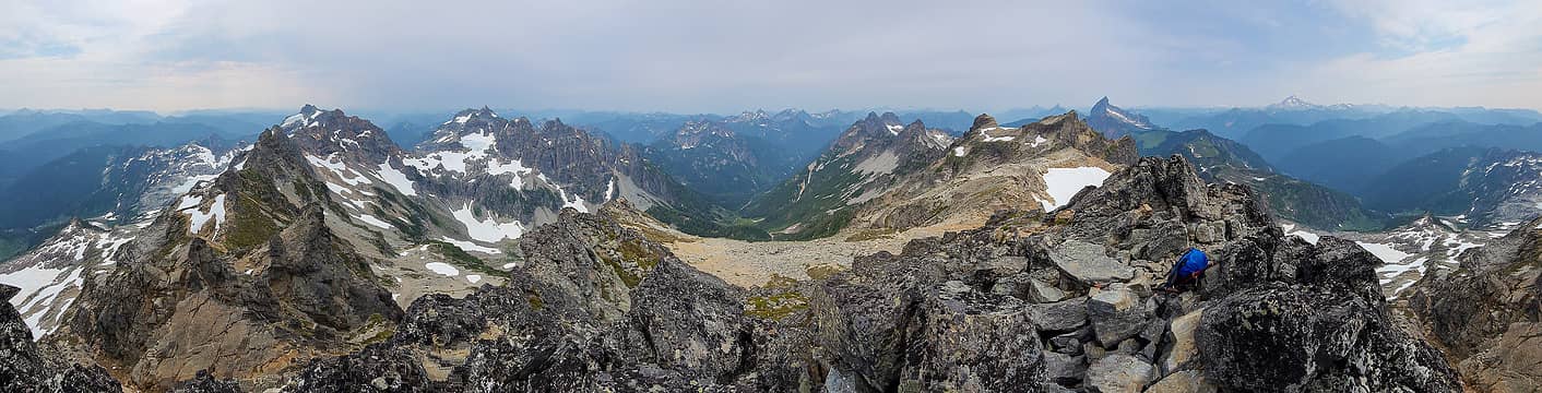 Cadet Summit Panorama 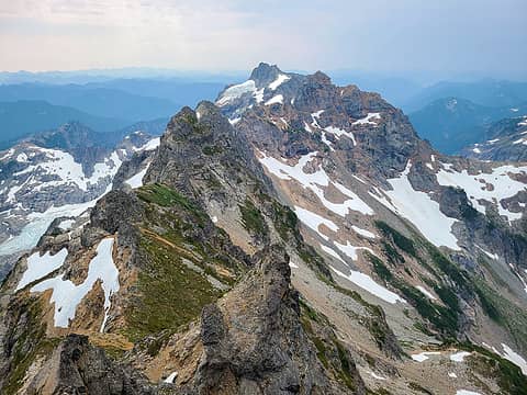 Monte Cristo and Kyes 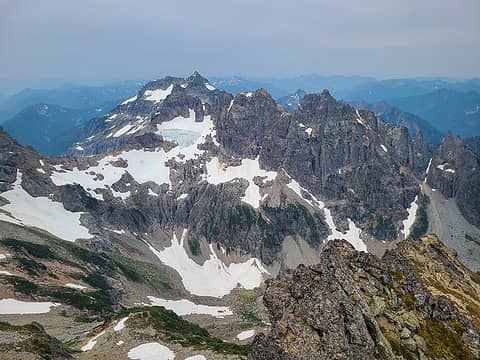 Wilmans and Columbia 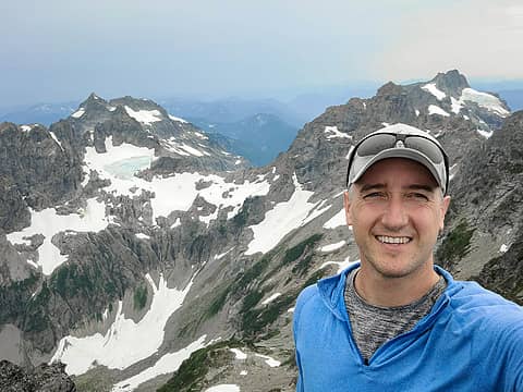 Summit selfie 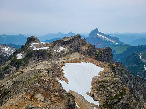 Rover and NW Cadet (and Sloan) 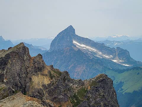 Sloan Peak 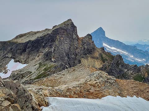 Rover and Sloan 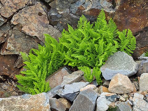 "Lets post up here, in this choss!" - Ferns 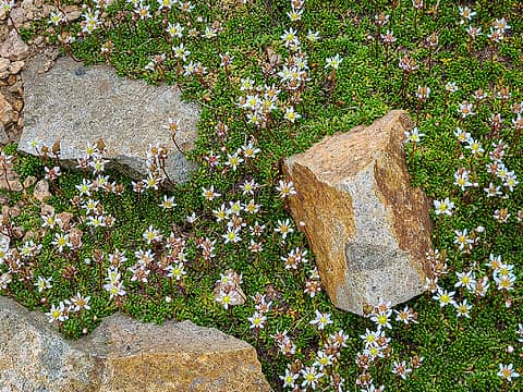 Rocks and flowers  Mud and flowers  Rocks and mud 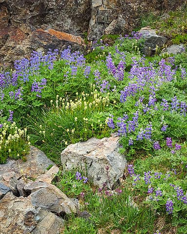 Flowers and rocks 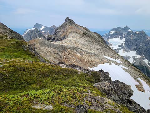 Cadet from near Rover's summit 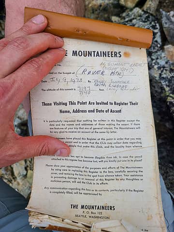 Rover register 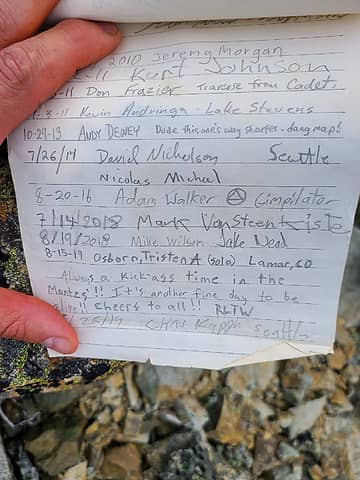 last page 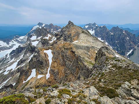 Cadet and co from Rover 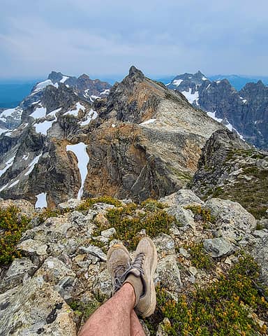 In my element 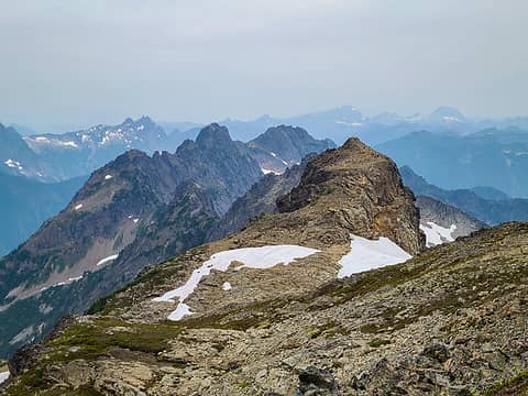 NW Rover and Foggy 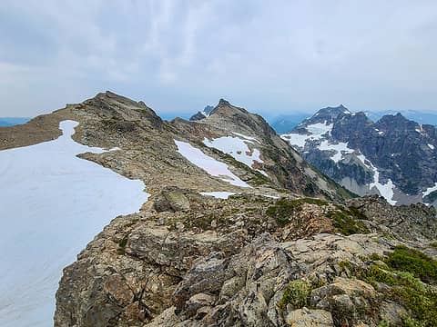 Rover, Cadet, Wilmans 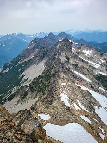 Foggy and Gemini Peaks 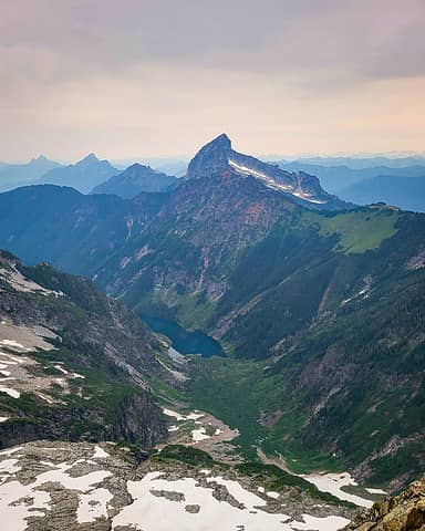 Sloan and Goat Lake 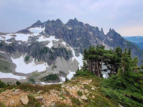 Wilmans on descent 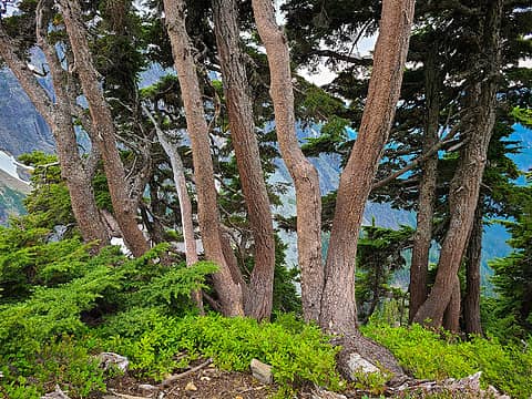 Trees 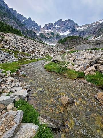 Glacier basin 1 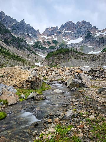 Glacier basin 2 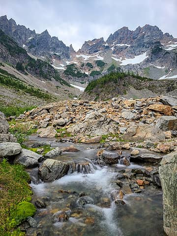 Glacier basin 3 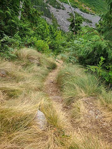 Grass and trail
 raising3hikers, ozzy, freddyfredpants, abkoch3, geyer, hot.choss, Tom, kw, Gimpilator, RichP raising3hikers, ozzy, freddyfredpants, abkoch3, geyer, hot.choss, Tom, kw, Gimpilator, RichP  Schroder Schroder
raising3hikers, ozzy, freddyfredpants, abkoch3, geyer, hot.choss, Tom, kw, Gimpilator, RichP Schroder |
| Back to top |
  
|
|
neek
Member

Joined: 12 Sep 2011
Posts: 2338 | TRs | Pics
Location: Seattle, WA |
|
neek
Member
|
 Tue Aug 03, 2021 8:49 pm |
|
|
Great shots despite the smoke and camera. Bike-hikes are the best!
|
| Back to top |
|
|
zephyr
aka friendly hiker

Joined: 21 Jun 2009
Posts: 3370 | TRs | Pics
Location: West Seattle |
|
zephyr
aka friendly hiker
|
Tue Aug 03, 2021 9:07 pm |
|
|
Spectacular trip. There are some really great scenes in there. Beautiful country. Lots of places you could just dawdle if you weren't on a mission. Like this one just as an example. ~z
| awilsondc wrote: | Environs |
|
| Back to top |
|
|
Schroder
Member

Joined: 26 Oct 2007
Posts: 6722 | TRs | Pics
Location: on the beach |
|
Schroder
Member
|
Tue Aug 03, 2021 9:27 pm |
|
|
Thanks for great photos of a place I'll never make it to again
|
| Back to top |
|
|
Gimpilator
infinity/21M

Joined: 12 Oct 2006
Posts: 1684 | TRs | Pics
Location: Edmonds, WA |
I remember those trees  Killer photography.
|
| Back to top |
|
|
ozzy
The hard way

Joined: 30 Jul 2015
Posts: 476 | TRs | Pics
Location: University place, wa |
|
ozzy
The hard way
|
Thu Aug 05, 2021 10:40 am |
|
|
Awesome dood! Looks like you made the right choice to avoid the smoke. I love Cadet, it has a lot of bang for the buck! Then Rover is right there...so sweet! I think I might find myself in that area again this year lol! Cheers man and it's awesome to see the register photos too! 
I dont know whats gonna happen, but I wanna have my kicks before the whole shithouse goes up in flames-Mr Mojo Risin
I dont know whats gonna happen, but I wanna have my kicks before the whole shithouse goes up in flames-Mr Mojo Risin
|
| Back to top |
|
|
Chief Joseph
Member

Joined: 10 Nov 2007
Posts: 7709 | TRs | Pics
Location: Verlot-Priest Lake |
| Schroder wrote: | | Thanks for great photos of a place I'll never make it to again |
+1...I have been there once maybe 8 years ago, but I really don't have an excuse for not going back, other than I'm lazy and there's no lake or fish.
Go placidly amid the noise and waste, and remember what comfort there may be in owning a piece thereof.
ozzy
Go placidly amid the noise and waste, and remember what comfort there may be in owning a piece thereof.
ozzy
|
| Back to top |
|
|
|
|
You cannot post new topics in this forum
You cannot reply to topics in this forum
You cannot edit your posts in this forum
You cannot delete your posts in this forum
You cannot vote in polls in this forum
|
Disclosure: As an Amazon Associate NWHikers.net earns from qualifying purchases when you use our link(s). |


