| Previous :: Next Topic |
| Author |
Message |
achildinthesehills
Member


Joined: 02 Jun 2021
Posts: 16 | TRs | Pics
Location: Tukwila, WA |
Holden Village has always been difficult to explain to the uninitiated. Not quite a church camp, more than a retreat center, only some elements of a commune, at times a pseudo-municipality. Someone wrote a master's thesis trying to define it. Fortunately for me, I was initiated in my childhoodmy grandparents made their first trip in the mid-1960s and its been a family-vacation destination ever since.
Briefly, Holdens physical plant largely comprises the remnants of a company mining town high above Lake Chelan in the Railroad Creek valley. The Holden Mine was one of the most prolific producers of copper in the country during the 20 years it operated, and was abandoned somewhat intact when it closed in 1957. Through some vision and persistence, the town (as well as all the mining claims and mineral rights) was gifted to the Lutherans and began operation as an independent nonprofit in the early '60s. In the last ten years, an enormous project has been undertaken to finally clean up the mine site, while the Wolverine Fire burned much of the lower valley and immediate surroundings of the village.
For hiking purposes, its tough to think of a better setup. By day you can explore some of the most wild and remote scenery on the continent (or some fascinating human history in the wilderness), then return to a hot meal, shower, ice cream, music, pool (in two senses), community, and a real mattress. This year is a little different with COVID protocols necessitating reduced services for hikers passing through, but as a volunteer or paying guest the day-to-day is similar to how it's been for a while. Having gone close to two years without taking a real vacation, I jumped at the chance to head up for two weeks with some family. Heres how that went. Get your maps and satellite imagery out and enjoy!
(This is a really long post, so heres a list of the sections. Looks like I cant do anchors on this site to make a linked table of contents, but you can copy and Ctrl+F from here.)
2021-07-23: Domke Lake and Domke Mountain
2021-07-24: Lucerne to Tenmile Pass
2021-07-25: Tenmile Point and Tenmile Peak
2021-07-26: Tenmile Pass to Holden
2021-07-28: Foreskin
2021-07-30: Honeymoon Heights and upper mine
2021-08-01: Various minor trails and explorations
2021-08-02: Monkey Bear Falls and Winston Camp
2021-08-03: Martin Ridge
2021-08-05: More minor trails
2021-08-07: Holden to Lyman Lake
2021-08-08: Lyman Lake to Image Lake
2021-08-09: Image Lake to the Green Mountain turnoff
(The final day is a reply. Looks like I found the post-length limit!)
2021-07-23: Domke Lake and Domke Mountain
Of course, I couldnt just be the normal paying guest so I devised a way to extend my trip while freeloading off my parents. Volunteers all go up on Friday this year but guests not until Monday, so I tagged along with my dad (who would be working on lodge porches) on the boat to Lucerne. Once there, I fended off the hiker-transport driver trying to take me up the valley and stashed my overnight gear in the Holden A-frame.
Domke Mountain thwarted me a couple years ago due to injury (long story) so I wasnt going to leave that peak unbagged this year. What I wanted to do was hike the trail to Domke Lake, traverse to Domke Falls, then head up the SE ridge, whose line looks awesome from the boat on the way in. Like someone took Little Si and inflated it. I set off at 2:20pm to do just that, making a brief excursion to a spot elevation along the way that Im calling Refrigerator Point. The trail to the lake has excellent tread but lots of undergrowth encroachment and due to fire damage very little shade. Past whats left of the resort things get a bit more choked, but still passable. I arrived at the Domke Lake Campground (day use only, like everything else at Domke) an hour after leaving Lucerne. Digital maps show the trail continuing to Stuart Campground from the there but I instead found an impenetrable thicket of fireweed and raspberries. Had I bothered to look at my Green Trails map I would have known something about this impasse (not doing so will be a theme, just wait). Realizing the time penalty of a long traverse in such conditions, I bailed on my plan (which will be another theme) and decided to just go for the summit.
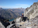
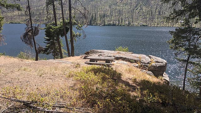 Domke Lake Campground. 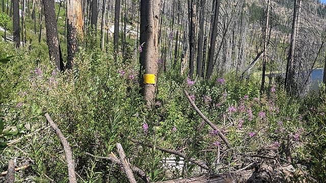 Emphatically the end of the trail. 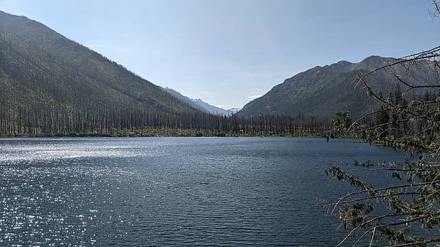 Lake from the campground. 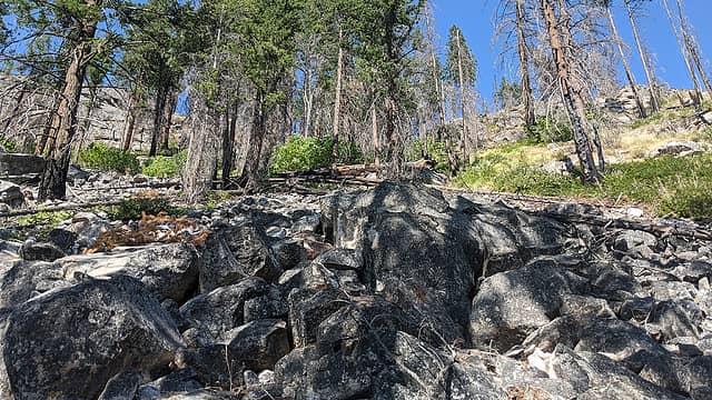 Looking up the gully from about the halfway point. 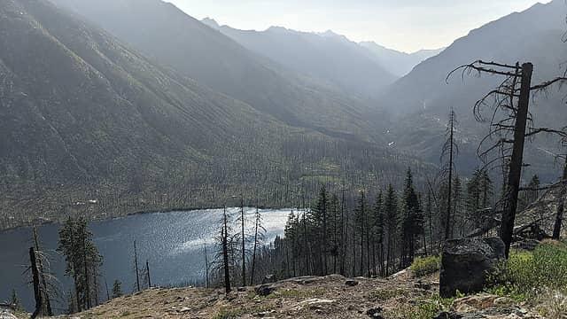 Looking up the Railroad Creek valley from the top of the gully. 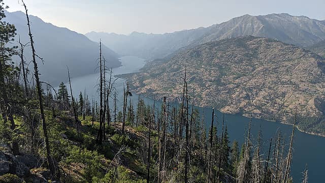 Lake Chelan from Point 4010. 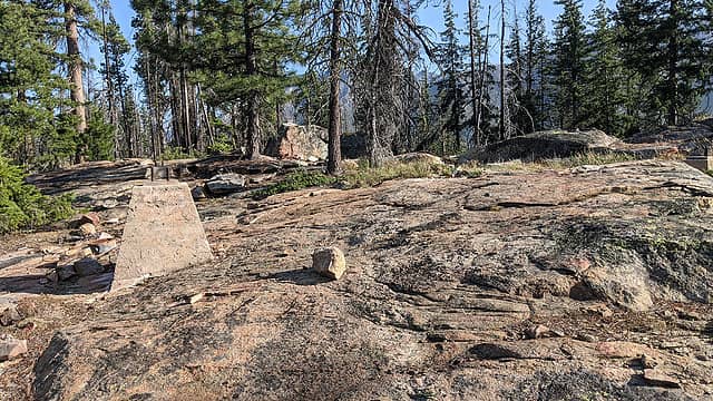 Lookout remnants. 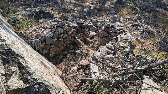 Possible lookout remnants. 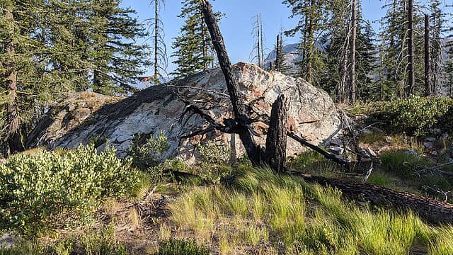 Domke Mountain summit block. 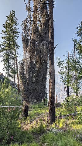 Funky burned tree thing. Anyone have a more scientific explanation? 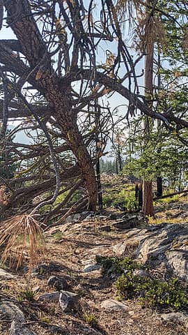 Tree tunnel over the trail. 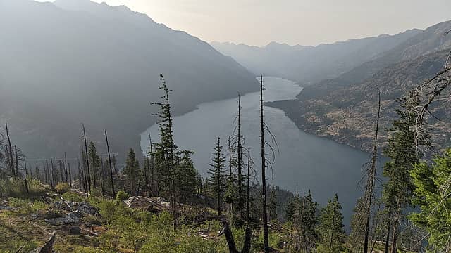 Lake Chelan. 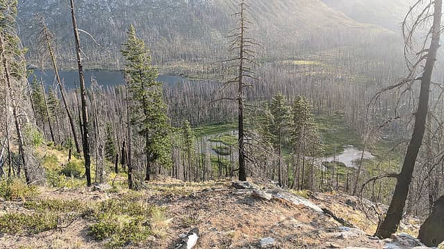 Domke swamp. 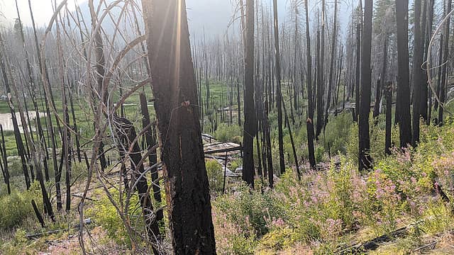 Finding this old telephone line where the map shows the trail did not help me realize I was looking in the wrong place. 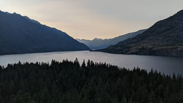 Evening on Lake Chelan. 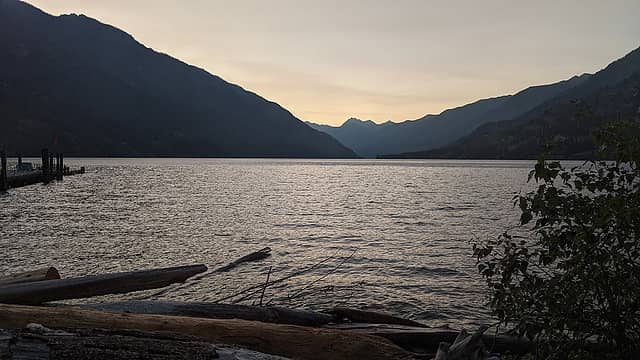 From the dock at Lucerne near sunset. 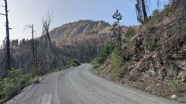 Approaching switchback 3 with Domke Mountain in view. ![I've always loved both of these signs at the top of the switchbacks, each for a different reason. The original "switchback sign" [url=https://www.charityauctionstoday.com/auctions/Jubilee-Auction-13471/items/retiredhvswitchbacksign-252478?category_id=0]recently fetched[/url] $1700 at auction.](https://cloud.nwhikers.net/msssa_640x360.jpg) I've always loved both of these signs at the top of the switchbacks, each for a different reason. The original "switchback sign" recently fetched $1700 at auction. 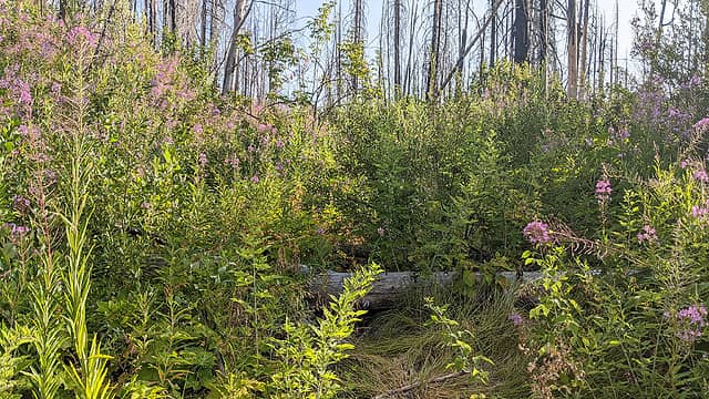 Possibly the clearest section of abandoned road. 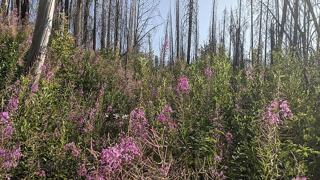 More typical conditions. For reference, the camera is about 6' off the ground here. 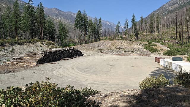 Dan's Camp overview. 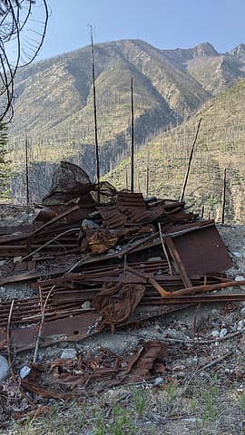 Dan's Memorial Scrap Heap. (For all my Holden-area history I actually don't know who Dan was. But I know that a lot of people think the place is called "Dance Camp".) 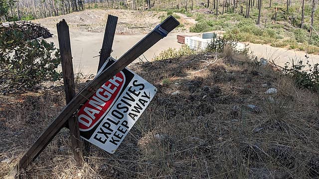 Helpful sign atop Point 2209. 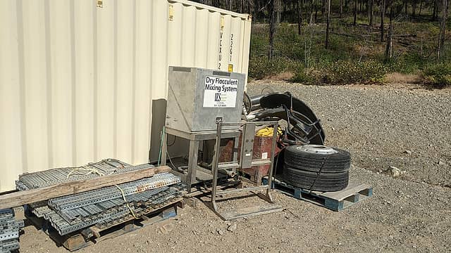 Anyone lose their dry flocculent mixing system? I hate it when that happens. 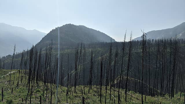 Domke Mountain above the Railroad Creek canyon. 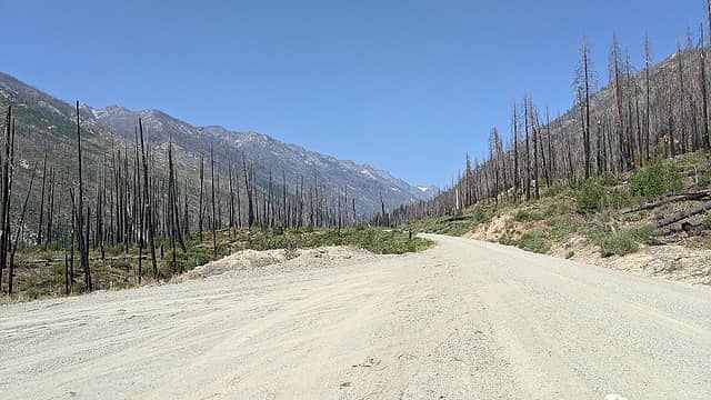 Desolation at a turnout. 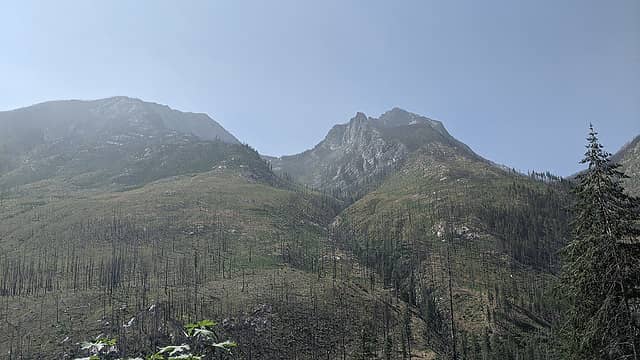 Mirror Mountain with Pinnacle peeking up behind. 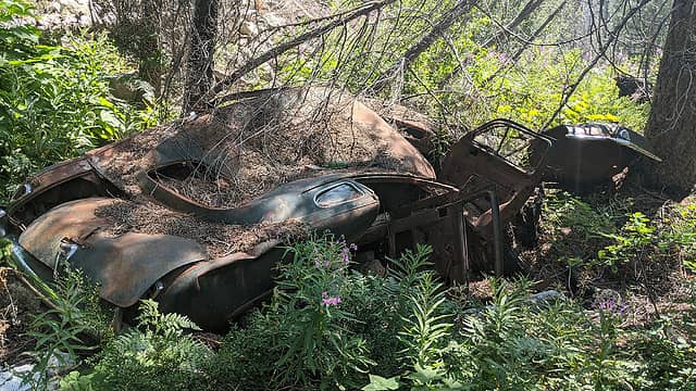 Abandoned car (48.1883,-120.6884). Couldn't get any read on the make and model, but if I have more pics if anyone wants to give it a shot. 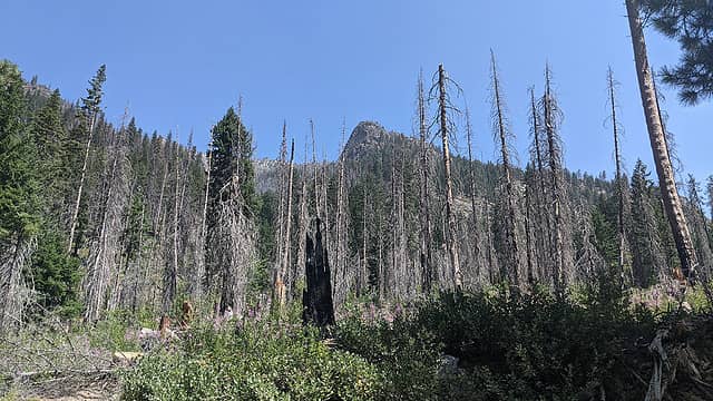 Lucerne Mountain. 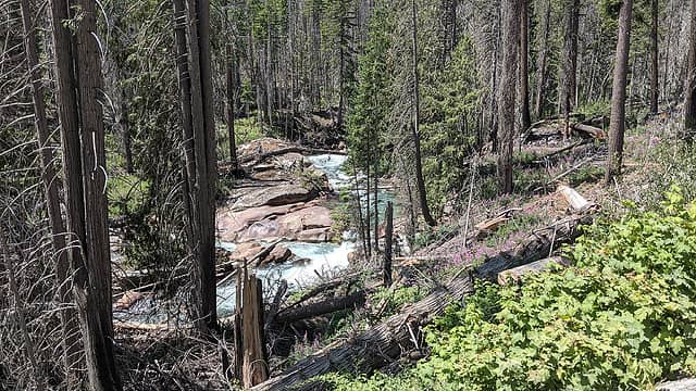 Neat spot where the creek has carved channels into the rock. The discoloration is due to contamination from the mine and tailings. 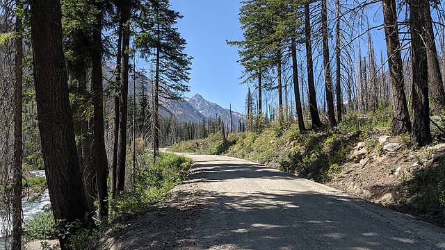 One of the few shady spots. Greenwood Mountain framed in the distance. 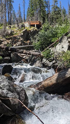 Break spot looking up at the Tenmile Falls viewing platform. 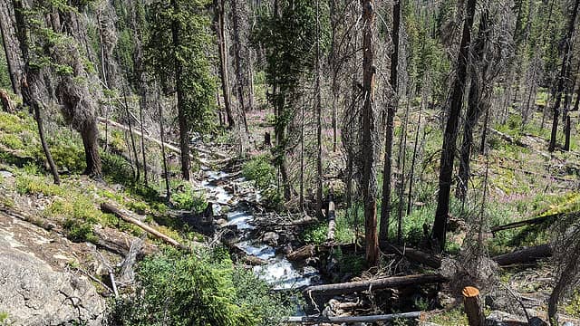 Reverse view. This used to be a lovely, shady grove. 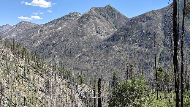 View back down the Railroad Creek valley from above the switchbacks. 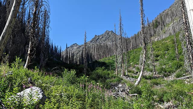 View up the Tenmile Creek valley. 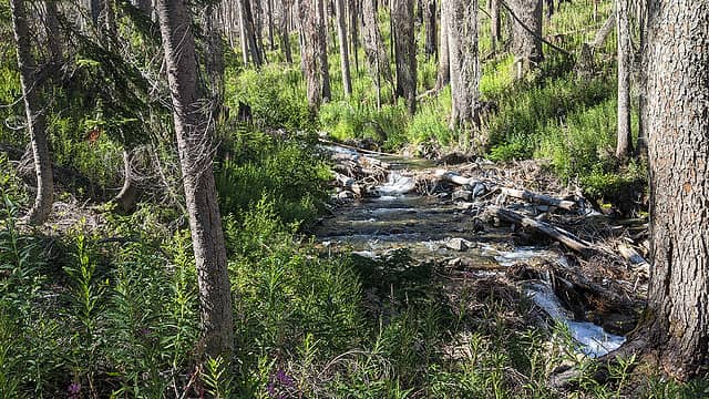 Tenmile Creek crossing. 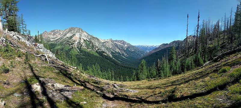 Tenmile Pass pano. 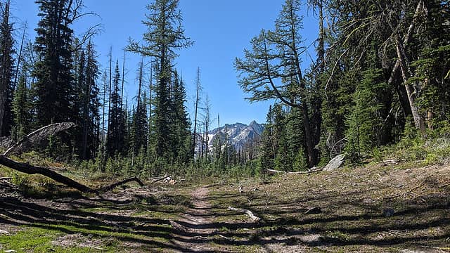 Looking back the other direction. Copper and Fernow in the distance. 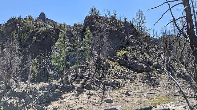 Headed up the ridge from the pass. One of the Riddle false summits at top left. 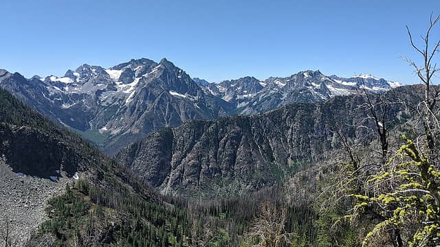 From Tenmile Point: Maude, Copper, Fernow, Genius, Dumbbell, Greenwood, Glacier Peak, probably more. Martin Ridge in the foreground. 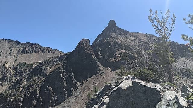 The remaining route on Riddle. 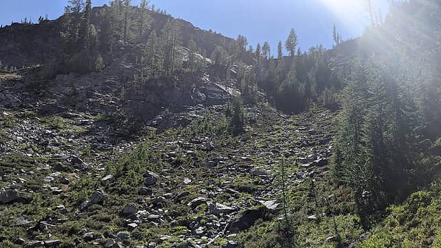 The headwall. 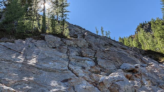 Fun scramble section. 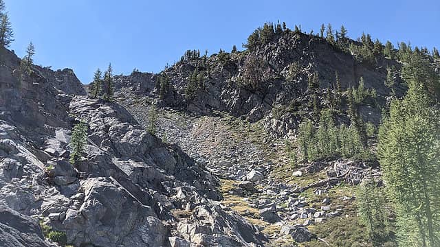 Loose but manageable gully. 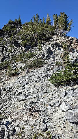 South ridge. 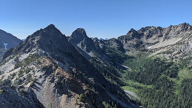 From the summit: Johnson's Jonah, Black Tower (what a striking peak!), Wy'East. 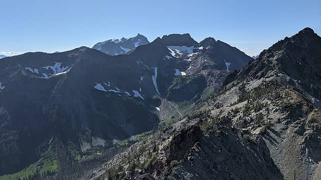 Martin and Bonanza. 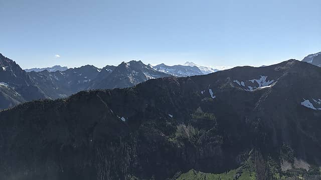 Martin Ridge and beyond. 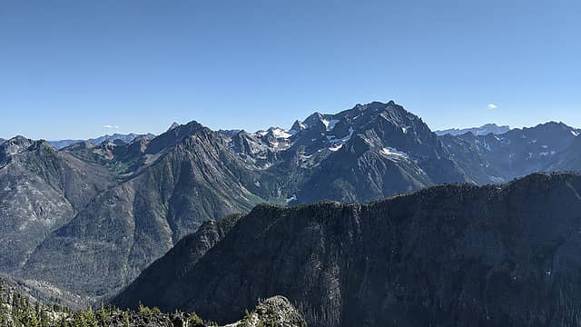 Tinpan, Buckskin, Copper, etc. 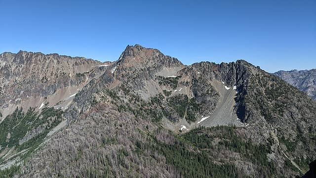 Riddles. 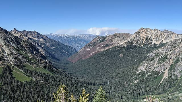 Devore Creek valley. Wildfire smoke in the distance. 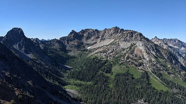 Fourth of July Basin. 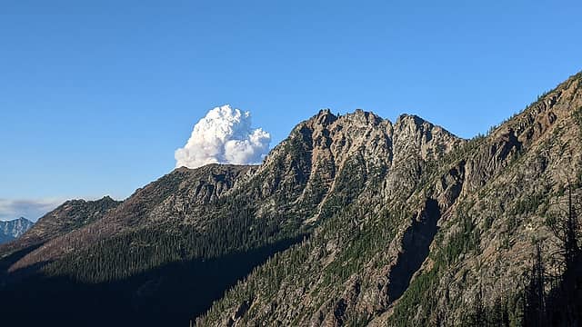 Puzzle, Enigma, smoke, cloud. 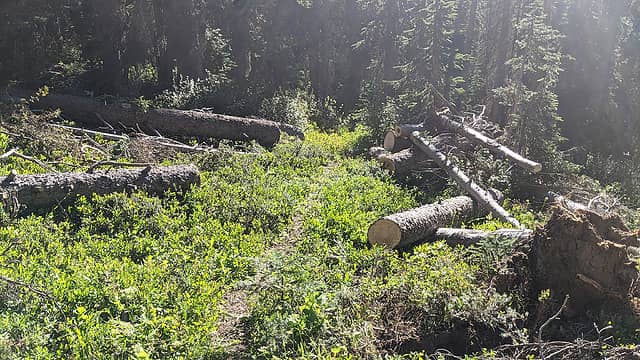 Freshly cleared logs, yay! 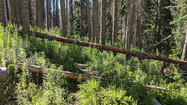 Still had to go over/under/around these, yay! 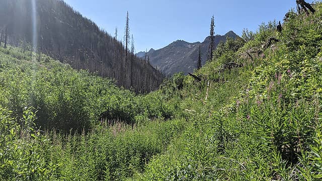 Heading down Tenmile Creek. 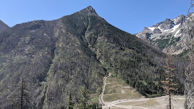 "Buckskin" from the switchbacks. That cut and diversion up the flank was not in the original remediation plans, and I still haven't gotten a good answer for why it was deemed necessary. 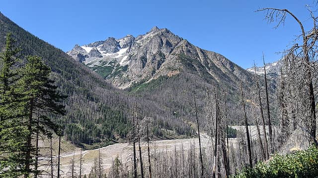 Copper and more remediation activities. 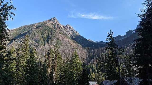 Foreskin and Second Skin from the village. 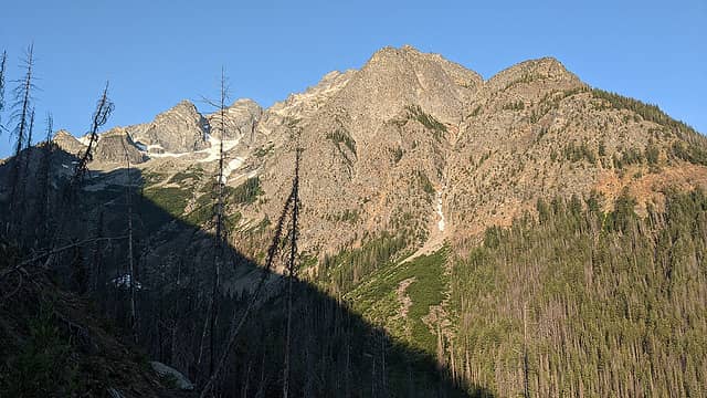 Morning light on Copper Peak. 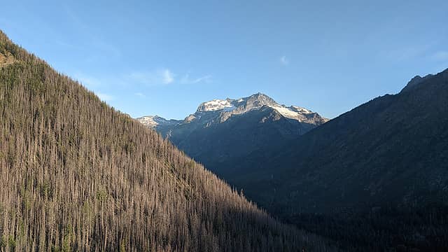 And on Bonanza. 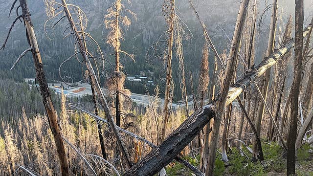 Village through the fire damage. The orange-colored spot in the gravel pit is what the water-treatment plant is pulling out of the runoff from the tailings. About one dump-truck load per day is delivered back up and deposited in this sealed area. 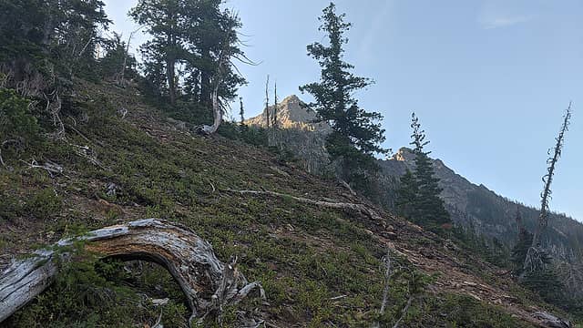 Objective in sight. 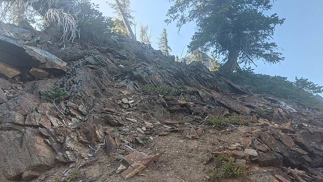 A slabby area. 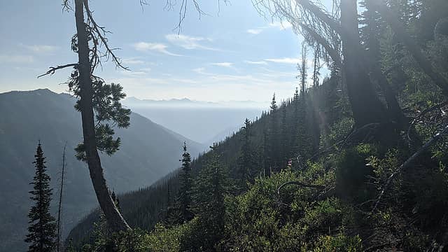 Looking down the Railroad Creek valley. 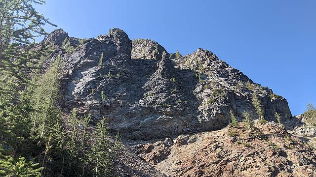 Cliffs of the summit area. 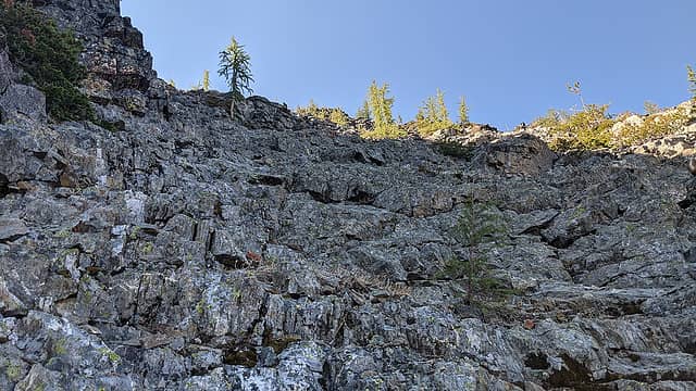 Fun, easy, and shaded scramble terrain. 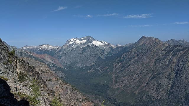 Cloudy, North Star, Bonanza, Martin from the summit area. 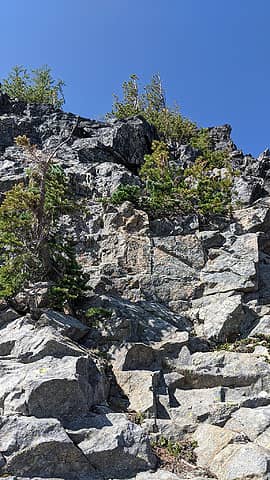 Final major obstacle. 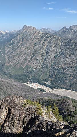 Village from the top. 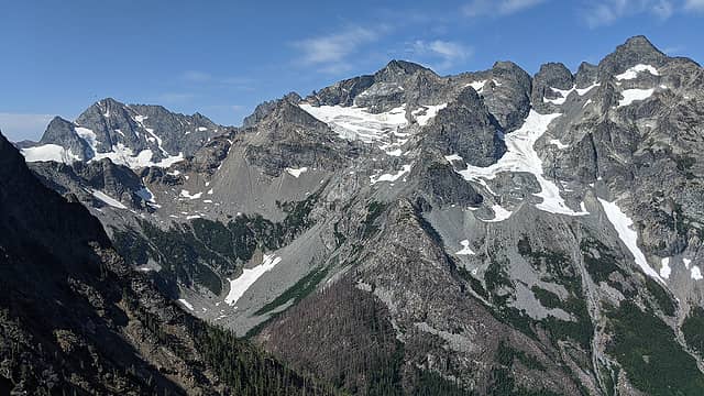 Maude, 7FJ, Fernow, Copper. 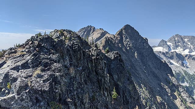 Foreskin true summit, Second Skin, Buckskin. 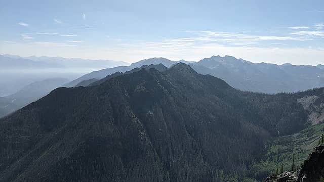 Tinpan. 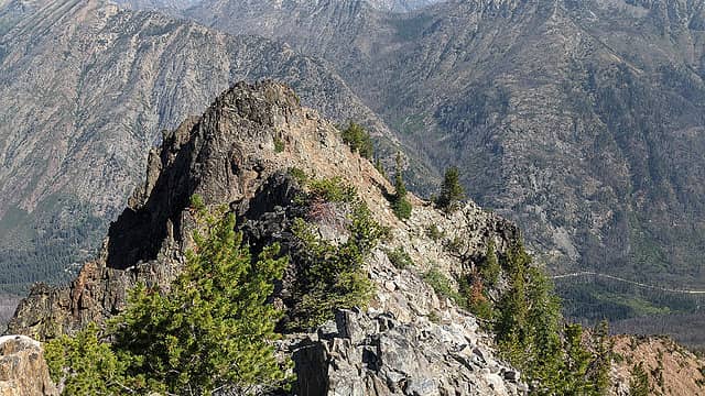 From the true summit to the point visible from the village. 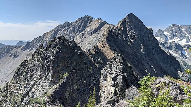 Ridge to Buckskin proper. 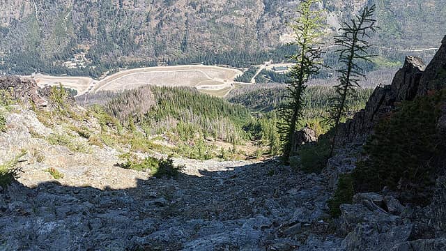 Looking down the scramble section. 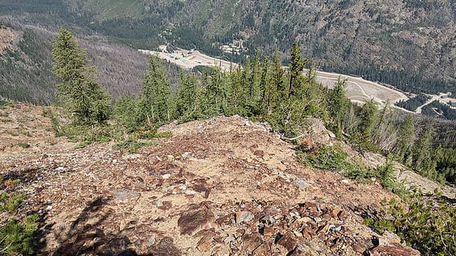 Crux area. Pretty significant lack of ground to either side. 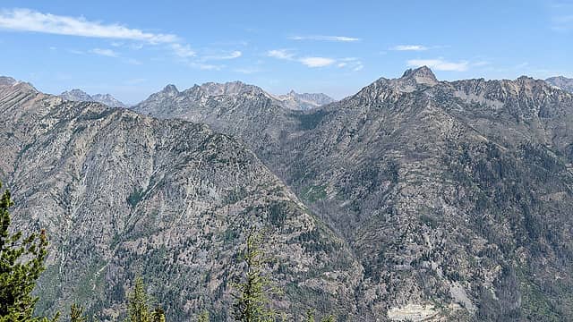 Tenmile Pass and surrounds. 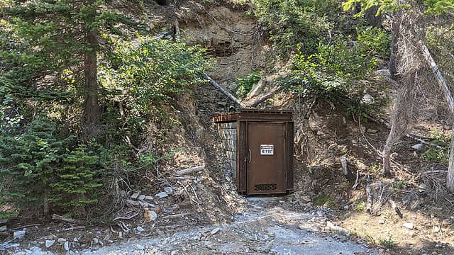 Lowest of the upper portals. Someone at Holden has the key to that padlock. 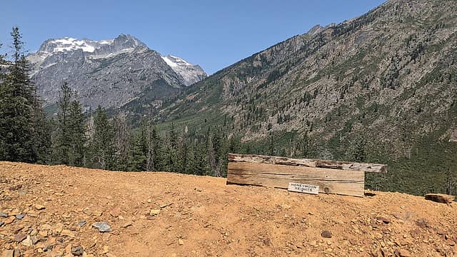 Someone moved the HONEYMOON HEIGHTS sign up here to near the portal, which is not really accurate. It should be on a wooden post (which is still there) a bit farther down. 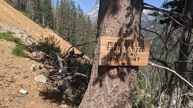 CLOZED 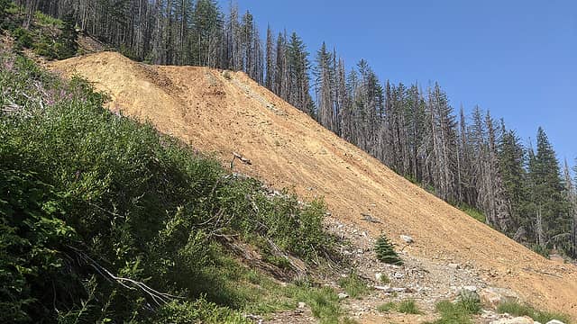 Second waste-rock pile. 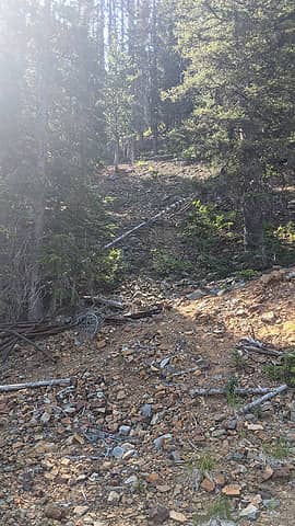 Access to the upper adits. 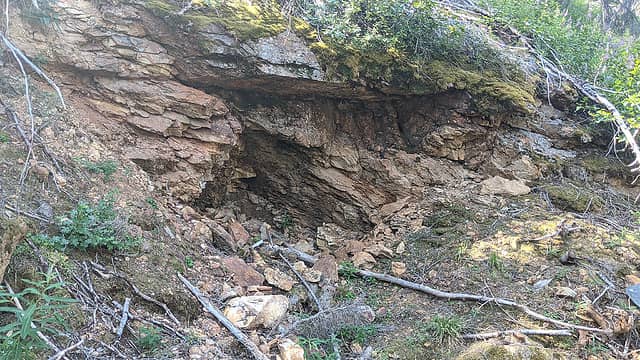 Early prospect, the highest one I've been able to find. 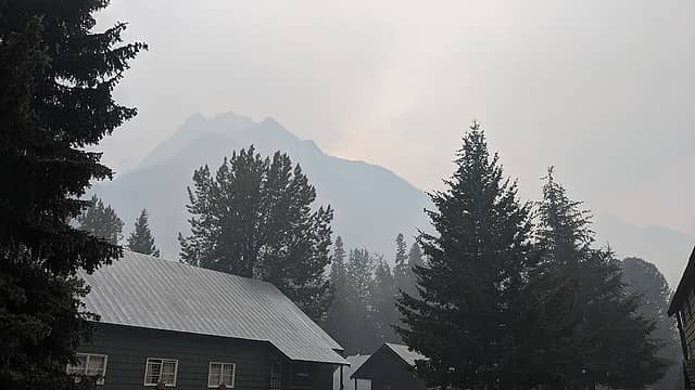 Smoke and mist on Copper Peak. 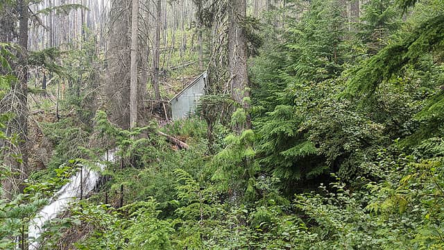 Old diversion structure. 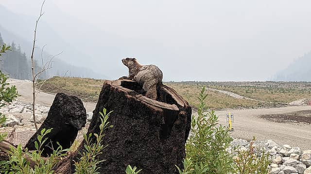 Marmot at the start of the Lower RR creek trail. 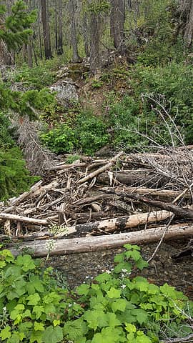 Wilson Creek crossing. 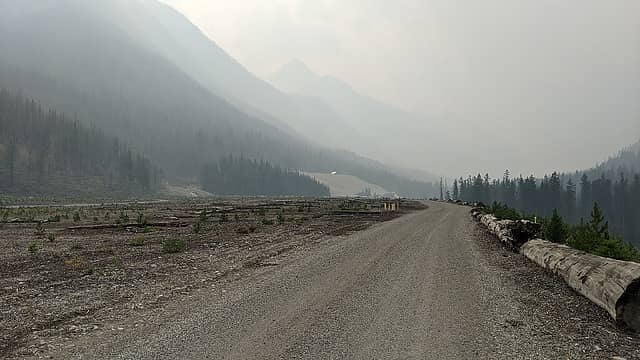 View from the capped and re-graded tailings. 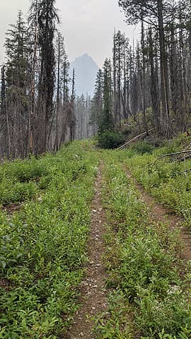 Diversion-dam road and Foreskin. 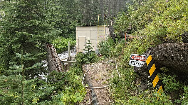 Diversion dam and penstock. 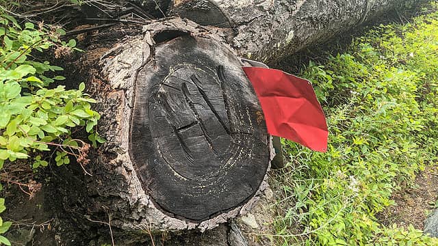 Art. 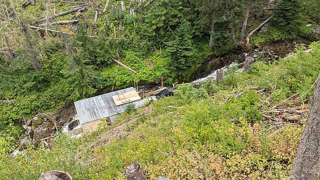 A short, abandoned spur road leads to an overlook view of the dam. Some people climb Copper Peak from here. 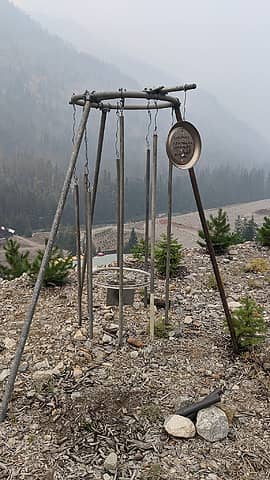 "Tonehenge" at its new home just across from the main portal. My dad built this windchime near this spot in 2011 out of the old scraps that used to cover the area, managed to disassemble and hide it in the village when everything was hauled away for remediation, and finally after 10 years secured permission to rebuild it. 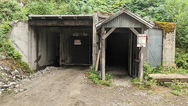 The ventilator portal. 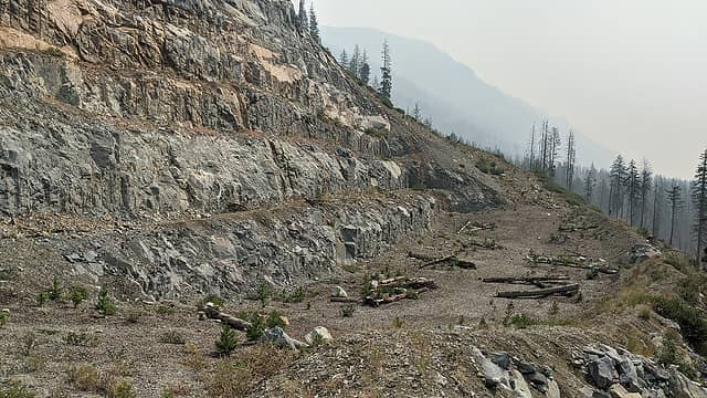 Quarry. 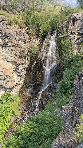 Monkey Bear Falls. 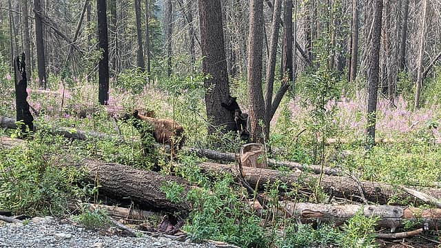 Monkey bears. 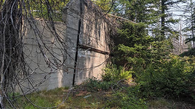 One of the larger remaining structures at Winston. 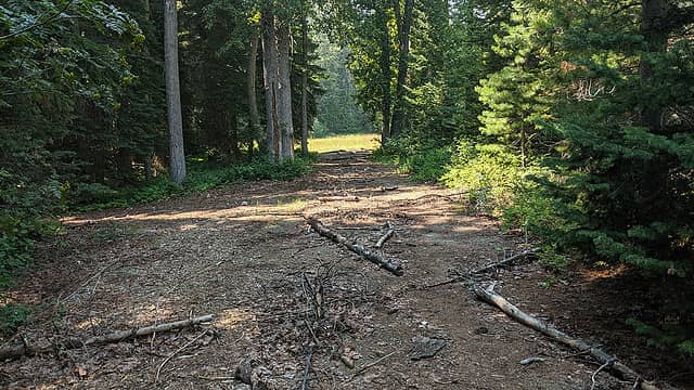 Abandoned segment of road leading to the ballpark. 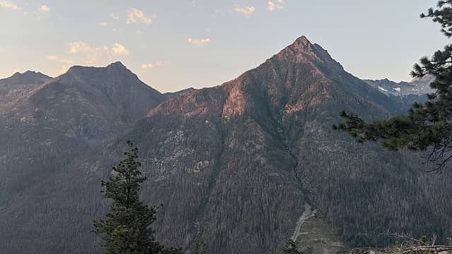 First light on Foreskin. It's completely acceptable to say that. 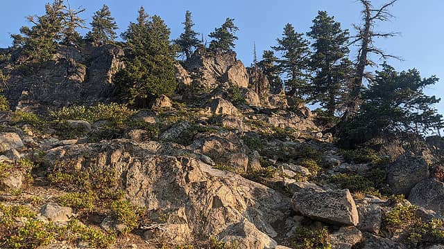 Representative terrain getting up the ridge. 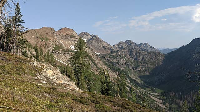 Hilgard Pass and surrounds. 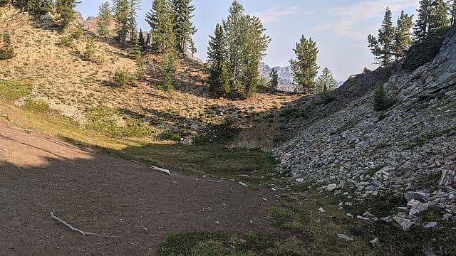 One of a couple "bomb craters" along the ridge. 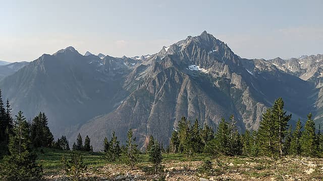 Buckskin and Copper. 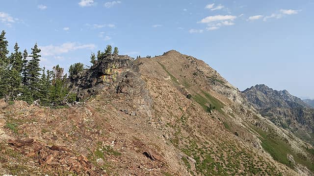 The only feature I went right to bypass. Would have been less sketchy to the left. 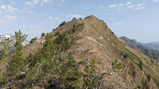 Final bit of ridge to the high point. 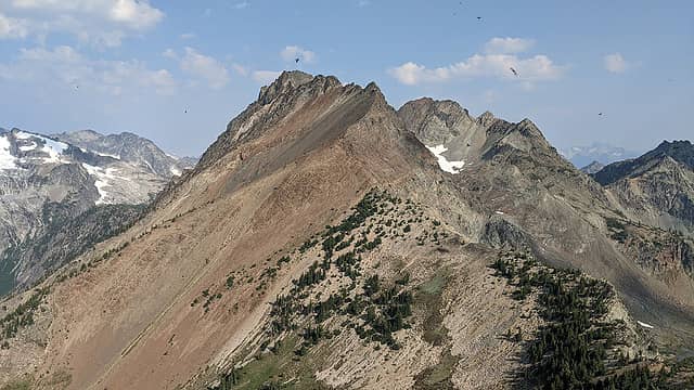 Looking towards Martin Peak (just out of sight) from the high point. Note the bugs. 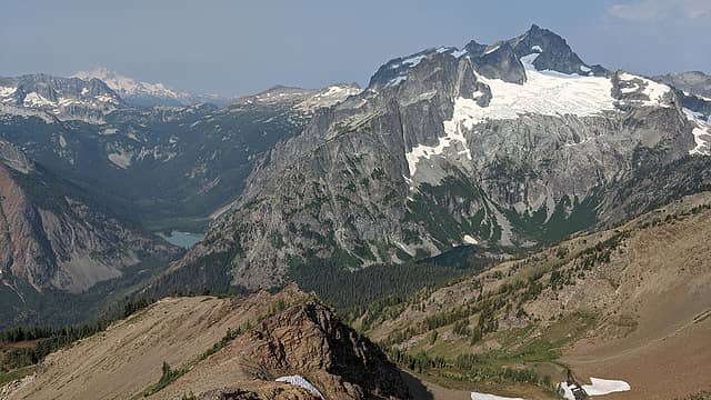 Hart Lake and Holden Lake in the same picture! 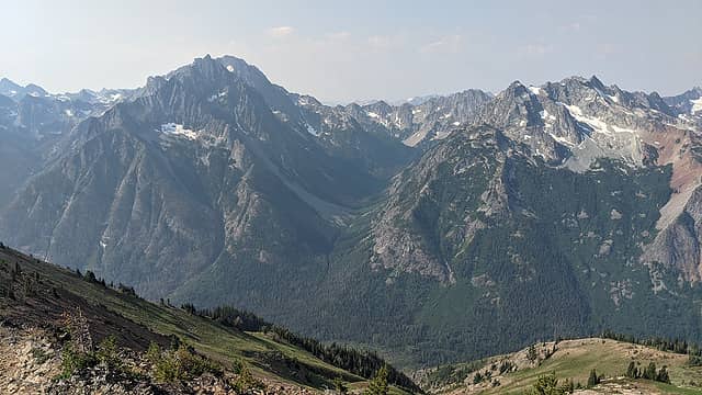 Big Creek valley. 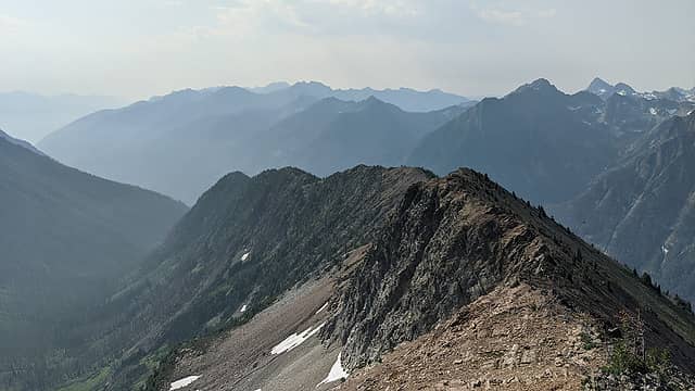 Looking back down the ridge. 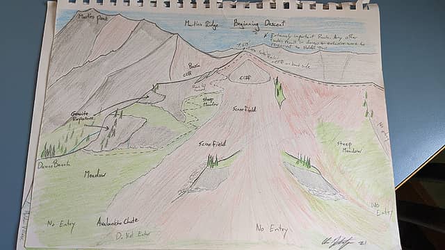 Chris Gustafson's incredible illustrated beta. 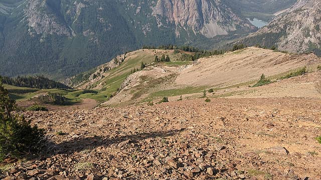 Looking towards the descent route. But if you head down straight from here you will find yourself in a precarious spot. 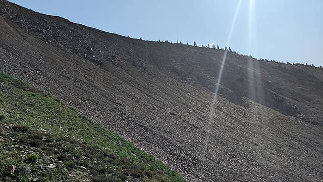 Said precarious spot. 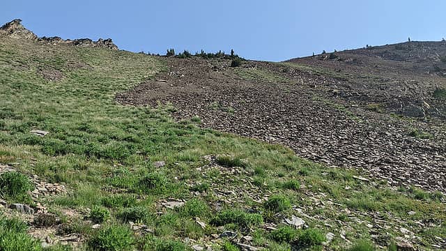 Looking back up the optimal descent route. 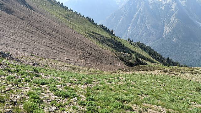 Cool animal trails in the scree. How do they decide which one to take? 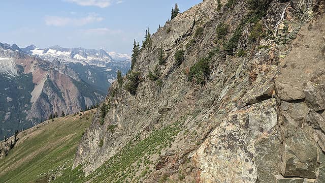 Working my way down around the cliff. 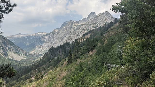 Bonanza and upper Railroad Creek from the Holden Lake trail. 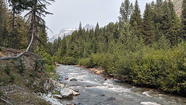 Railroad Creek and Bonanza. 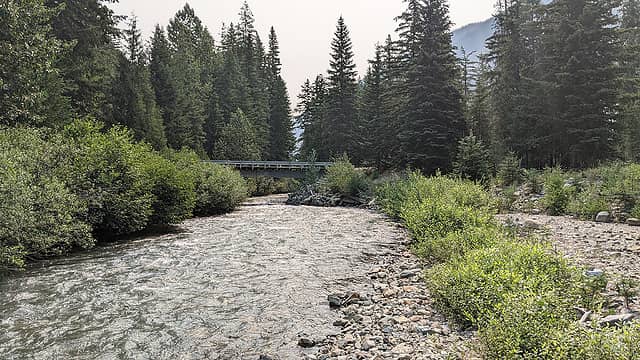 Holden vehicle bridge. 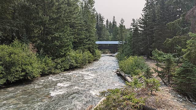 Holden footbridge. 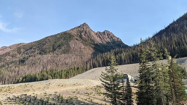 Evening light on Foreskin. Still not weird. 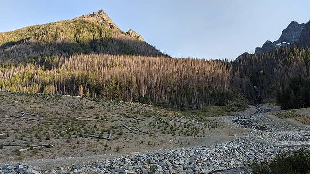 Copper Creek in its new bed, with Copper Falls visible. To me the remediation area looks like it could be a theme park but before any of the rides were installed. 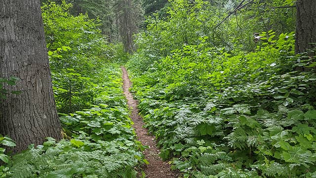 Nicer section of trail. 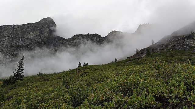 Mists on lower Bonanza. 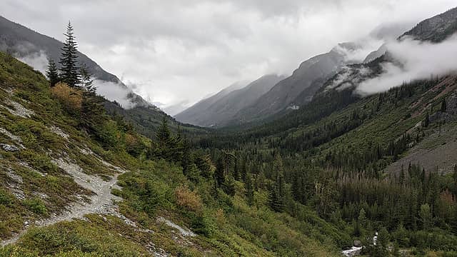 Saying goodbye to the valley. To me this view is a better payoff than the lake itself. 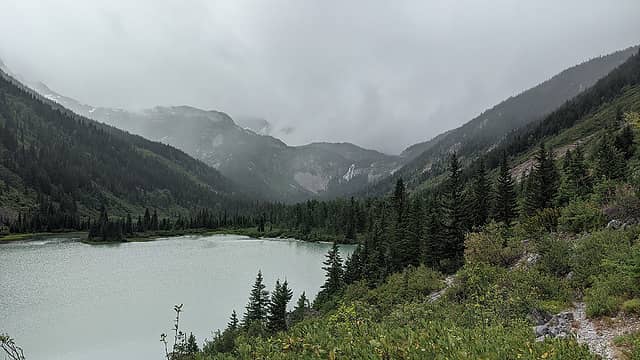 Crown Point Falls and Hart Lake. 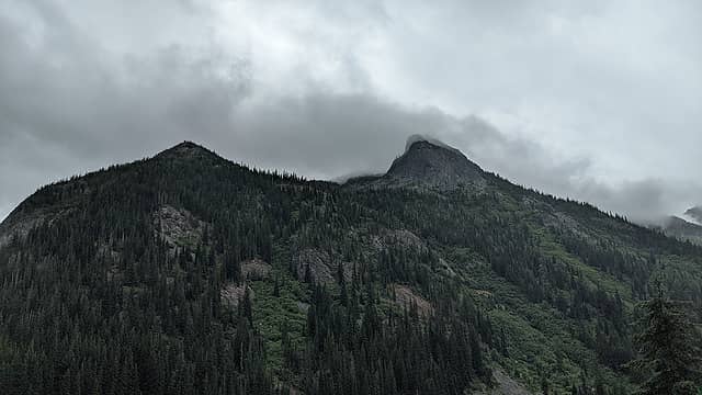 Not a weird exposure; it actually looked like that. Brush bash below. 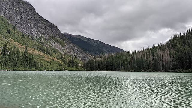 Martin Ridge over Hart Lake. 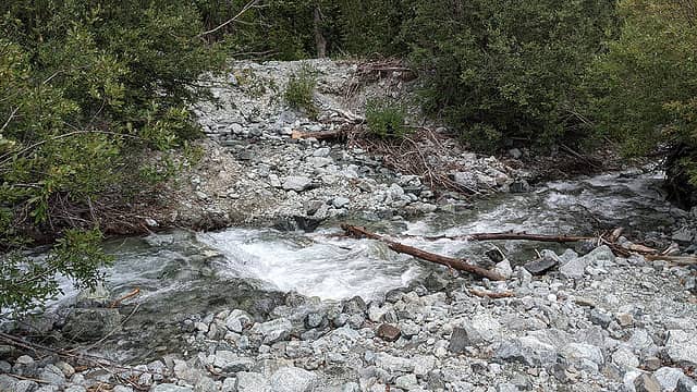 Creek crossing. 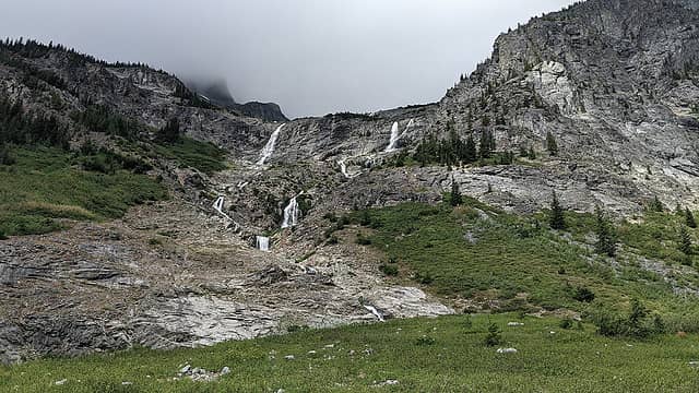 Isella waterfalls. 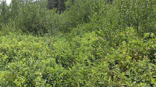 Typical brush on the trail. Described as a "car wash" by another hiker I met later. 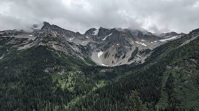 The Dumbbell/Greenwood massif. 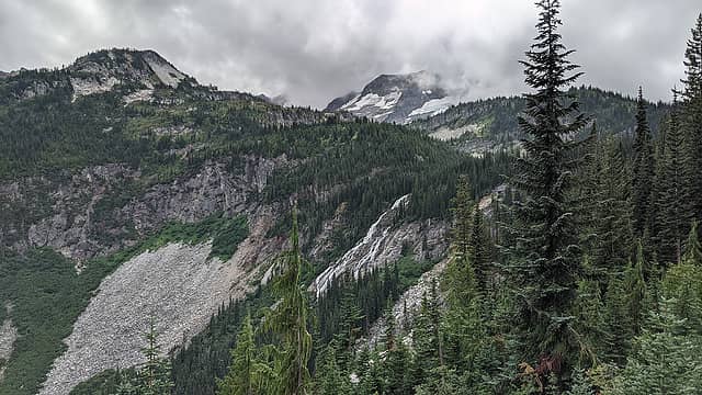 Crown Point and falls. I believe the cave and discolored area above the talus slope are the remains of the Aurelia Crown Mine, which produced a modest quantity of molybdenum well before the Holden Mine began operation. 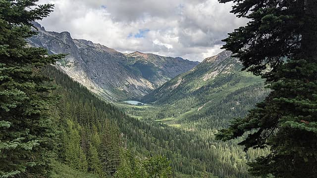 Looking back at Hart Lake. 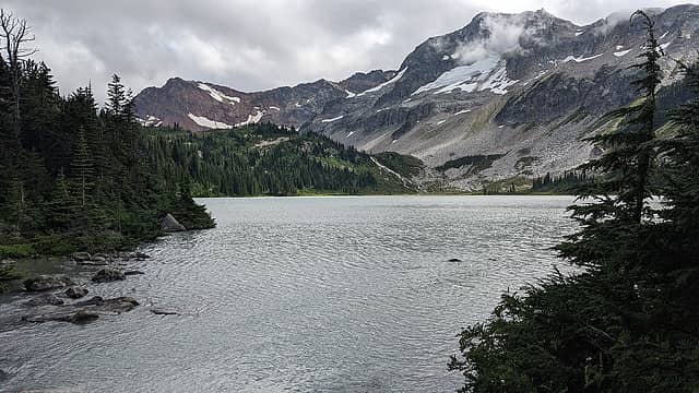 Lyman Lake. 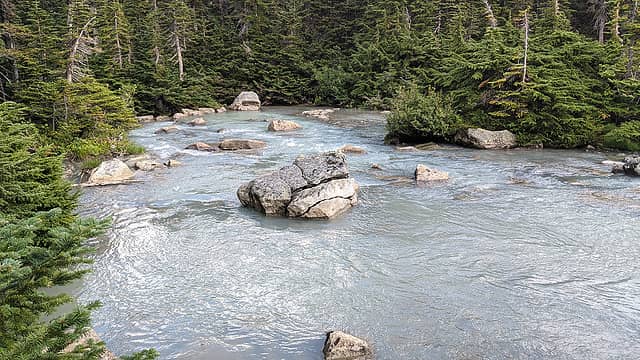 Railroad Creek headwaters. 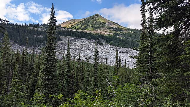 Really cool amphitheater slabs with the S ridge of Cloudy Peak above. 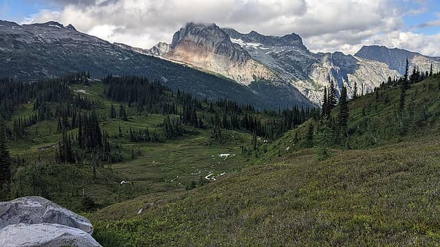 Meadows with Bonanza and Martin. 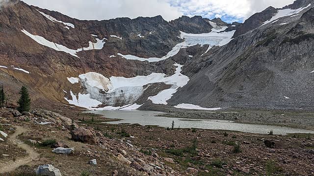 Upper Lyman Lake and "Glacier". 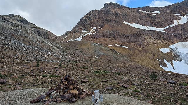 Spider Gap and cairn. 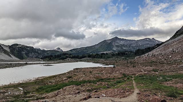 "If any man's hand / Ever made that land / Then I think it would have showed" 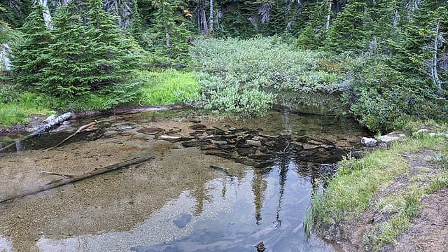 Causeway thing. 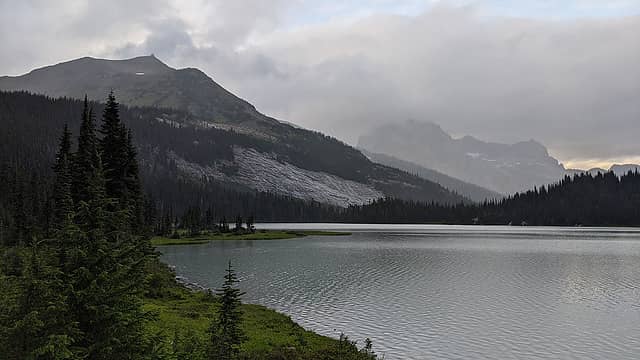 Cloudy Cloudy. 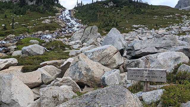 Informative and instructional! 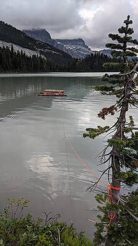 The USS WTF. 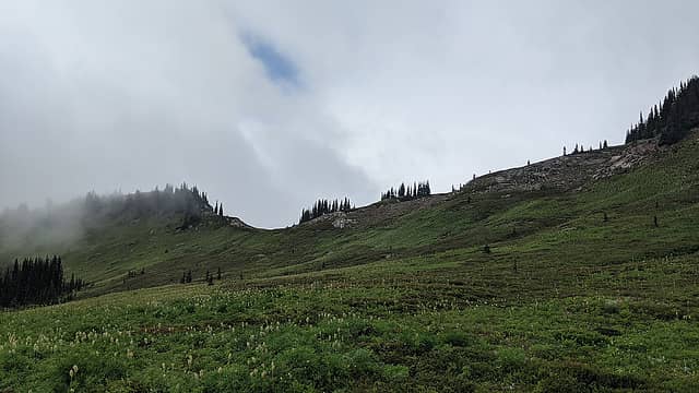 Approaching Cloudy Pass. 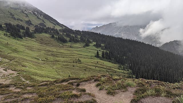 Looking back from Cloudy Pass. 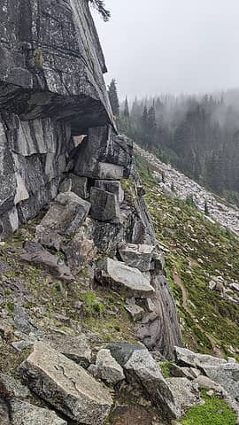 Terrain on the hiker shortcut. 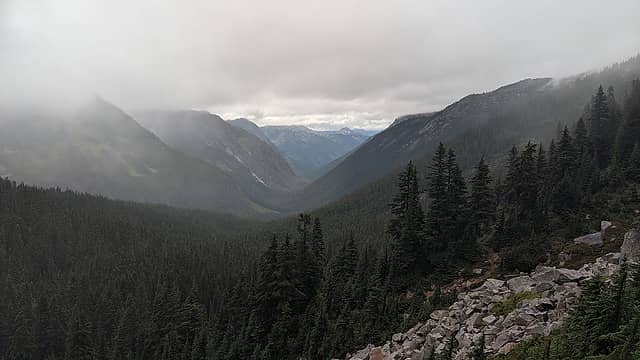 South Fork Agnes Creek valley. 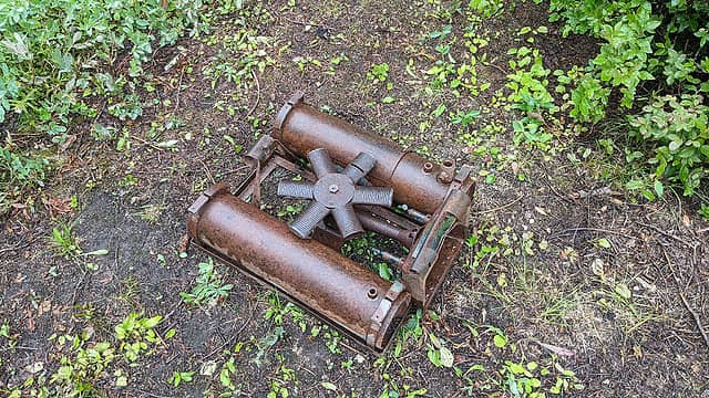 Anyone know what this is? I found a couple in some of the old mine camps. 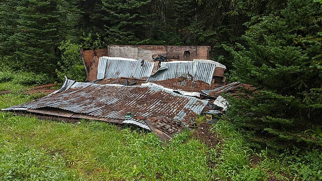 Collapsed cabin. Interestingly, this one was made of plywood. 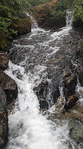 Neat creek crossing. 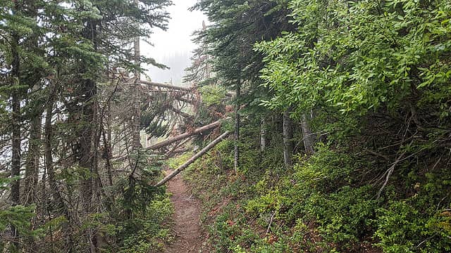 Logs. 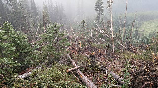 Reason for logs. 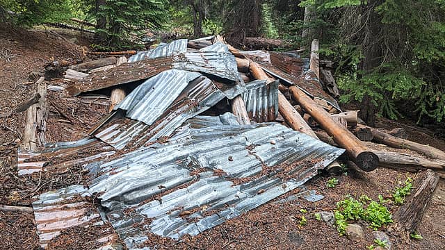 Stuff made of logs. 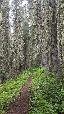 There are a couple sections of this cool mossy forest. 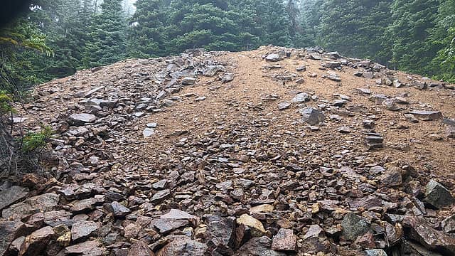 Waste-rock pile. 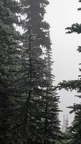 Moisture. 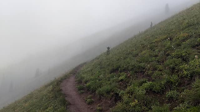 Ridge traverse in the clouds. 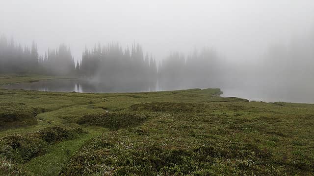 The legendary view I had come so far to see.
"But [you] can't slow down now / As the earth has presented / A new crest to reach / Without barely a rest / From the last one"
 mossbackmax, Dave Weyrick, RichP, reststep mossbackmax, Dave Weyrick, RichP, reststep
"But [you] can't slow down now / As the earth has presented / A new crest to reach / Without barely a rest / From the last one"
mossbackmax, Dave Weyrick, RichP, reststep
|
| Back to top |
  
|
|
achildinthesehills
Member
Joined: 02 Jun 2021
Posts: 16 | TRs | Pics
Location: Tukwila, WA |
2021-08-09: Image Lake to the Green Mountain turnoff
I awoke a little before 6am to find visibility even worse than the day before. But I could tell it was a thin layer this time, so I held out hope. I got my reserve dry socks for out day, which promptly got soaked the moment I put them in my shoes. Whatever. At 7am, like someone flipped a switch, suddenly all the mists cleared and I could see clear to Glacier Peak. What a glorious moment. Soon enough the sun came over the ridge and my optimism for the long day increased. I had instructed my ride to meet me at the Suiattle River Trailhead at 3pm, but I was sure I could easily make that mileage owing to the downhill.
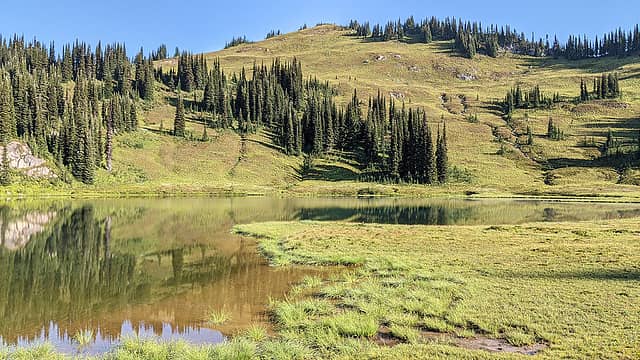 Image Lake meadows. 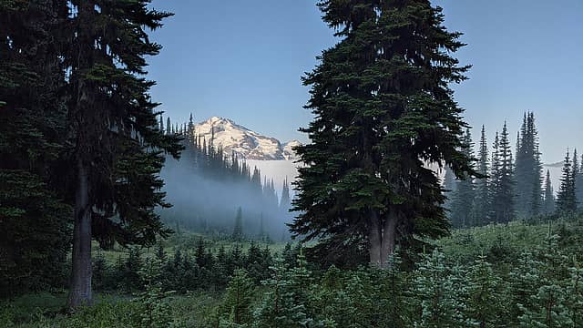 Glacier Peak from camp. 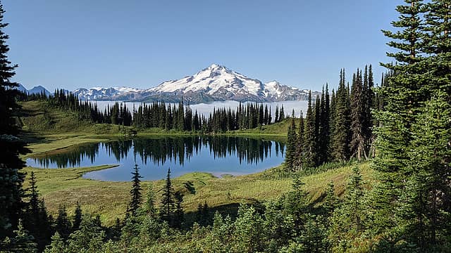 There we go. 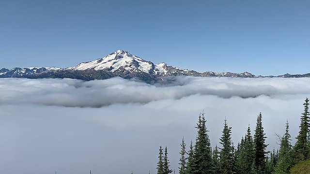 Oh yeah. 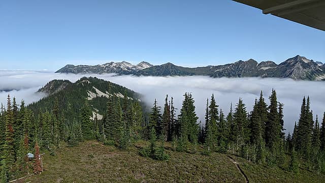 View to the west from the lookout (building). 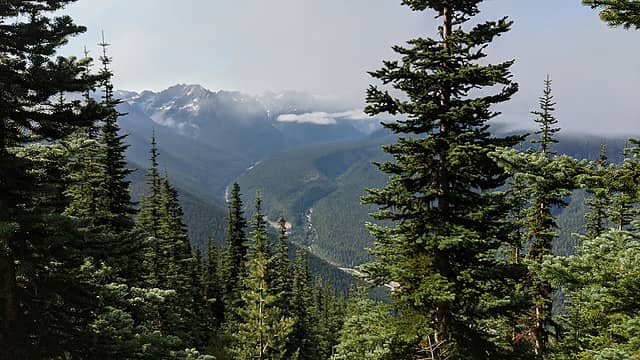 I've always loved the look of this valley on topo maps. Here's a horrible picture of it. 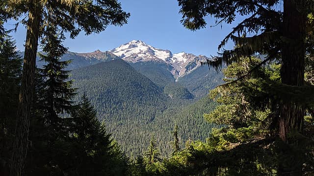 Fog completely cleared. 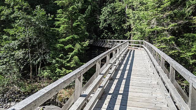 Bridge.
"But [you] can't slow down now / As the earth has presented / A new crest to reach / Without barely a rest / From the last one"
mossbackmax, Bramble_Scramble, geyer, Route Loser, Dave Weyrick, awilsondc, hikerbiker, RichP, reststep
"But [you] can't slow down now / As the earth has presented / A new crest to reach / Without barely a rest / From the last one"
mossbackmax, Bramble_Scramble, geyer, Route Loser, Dave Weyrick, awilsondc, hikerbiker, RichP, reststep
|
| Back to top |
|
|
fourteen410
Member

Joined: 23 May 2008
Posts: 2629 | TRs | Pics
|
Dreamy  Curious - was there any particular reason you didn't go to Holden Lake while you were out there?
|
| Back to top |
|
|
achildinthesehills
Member
Joined: 02 Jun 2021
Posts: 16 | TRs | Pics
Location: Tukwila, WA |
| fourteen410 wrote: | | Was there any particular reason you didn't go to Holden Lake while you were out there? |
No singular reason, although I've been there before. I would have visited on the way down from Martin Ridge but the call of lunch was stronger.
"But [you] can't slow down now / As the earth has presented / A new crest to reach / Without barely a rest / From the last one"
"But [you] can't slow down now / As the earth has presented / A new crest to reach / Without barely a rest / From the last one"
|
| Back to top |
|
|
Hiker Mama
Member

Joined: 25 Jun 2006
Posts: 3451 | TRs | Pics
Location: Lynnwood |
Very cool! My husband's family has been going to Holden since the 60's, and we've gone pretty much every other year since we've been married. Super neat place. I enjoyed seeing all the peaks around the village from a different perspective!
|
| Back to top |
|
|
Kat
Turtle Hiker
Joined: 05 Oct 2003
Posts: 2560 | TRs | Pics
|
|
Kat
Turtle Hiker
|
 Thu Aug 19, 2021 4:51 am |
|
|
Enjoyed the personal perspective of your TR. History tidbits were interesting, and documenting what has happened to the trails is helpful.
|
| Back to top |
|
|
Kim Brown
Member
Joined: 13 Jul 2009
Posts: 6899 | TRs | Pics
|
It took a while, but I read all of your terrific report. Thanks for sharing and to echo Kat, for the history.
I hope your mom is doing well now!
When I got to Holden, the first person I spotted happened to be my dad.
Hey, you made it!
Yeah, how were things in the village over the weekend?
Pretty good! Also your mom broke her leg yesterday.
"..living on the east side of the Sierra world be ideal - except for harsher winters and the chance of apocalyptic fires burning the whole area."
Bosterson, NWHiker's marketing expert
"..living on the east side of the Sierra world be ideal - except for harsher winters and the chance of apocalyptic fires burning the whole area."
Bosterson, NWHiker's marketing expert
|
| Back to top |
|
|
|
|
You cannot post new topics in this forum
You cannot reply to topics in this forum
You cannot edit your posts in this forum
You cannot delete your posts in this forum
You cannot vote in polls in this forum
|
Disclosure: As an Amazon Associate NWHikers.net earns from qualifying purchases when you use our link(s). |


![I've always loved both of these signs at the top of the switchbacks, each for a different reason. The original "switchback sign" [url=https://www.charityauctionstoday.com/auctions/Jubilee-Auction-13471/items/retiredhvswitchbacksign-252478?category_id=0]recently fetched[/url] $1700 at auction.](https://cloud.nwhikers.net/msssa.jpg#2048x1152)


