| Previous :: Next Topic |
| Author |
Message |
bubblehead
Member

Joined: 17 May 2021
Posts: 8 | TRs | Pics
|
Looks like it's finally my turn to write up a trip report! Selena, Trace and I got Overcoat and Little Big Chief this weekend. The original plan was to go for Chimney Rock north face, but we burned most of our tat getting down off of Overcoat. LBC was not a bad consolation prize, though.  We met up at the Mailbox parking area at 0530. We got a good chuckle about the five cars that were already in the lot. Bikes and packs were loaded into the bed of my truck, and soon we were headed down the middle fork road to the Dutch Miller Gap trailhead.
Two hours of biking up the old road led us to Hardscrabble horse camp, and the start of our hiking. Boy, was it hot and smokey.
We met up at the Mailbox parking area at 0530. We got a good chuckle about the five cars that were already in the lot. Bikes and packs were loaded into the bed of my truck, and soon we were headed down the middle fork road to the Dutch Miller Gap trailhead.
Two hours of biking up the old road led us to Hardscrabble horse camp, and the start of our hiking. Boy, was it hot and smokey.
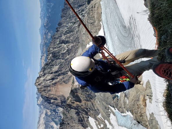
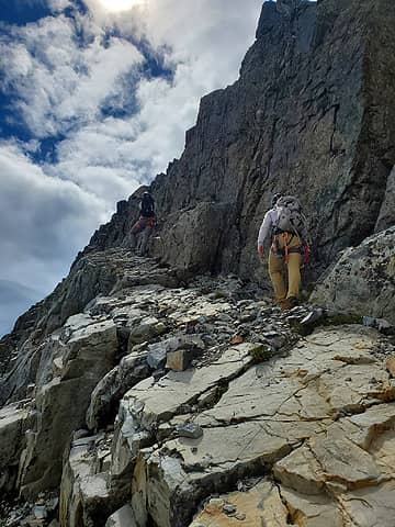
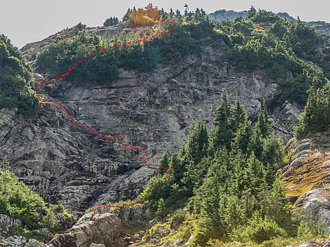
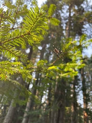 some local wildlife 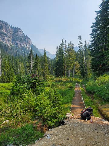 Camp Pedro 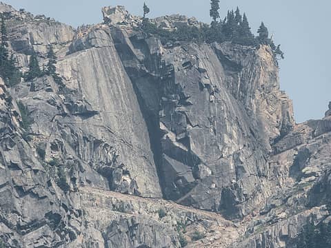 Wild rock formations on Iron Cap 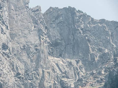 Giant's chair 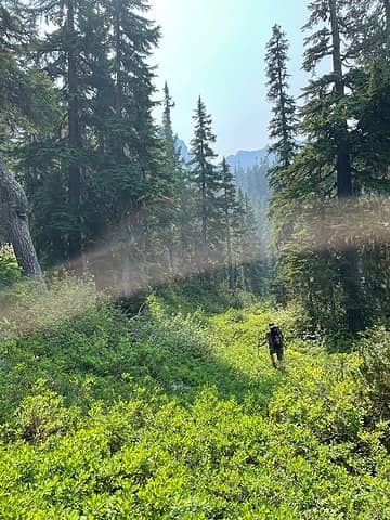 Pleasant bushwhacking 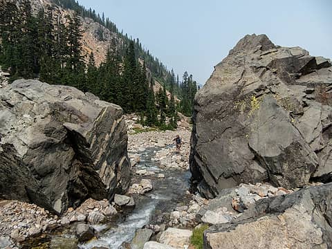 Large Boulders 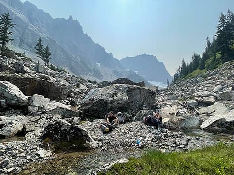 LBC and Summit Chief dominate this spectacular valley 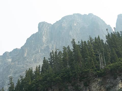 Little Big Chief 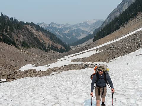 Me on some snow 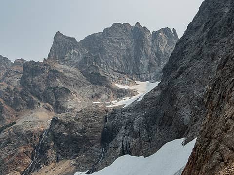 Middle Chief 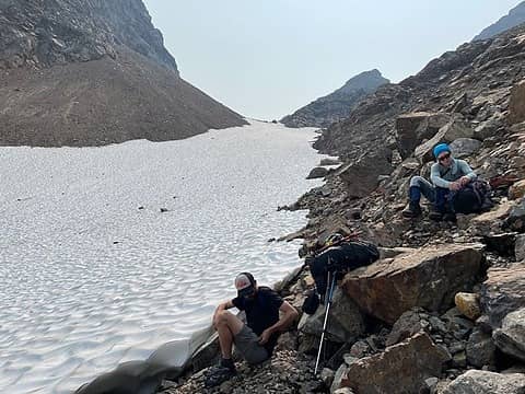 Water break/time to get the cramps on 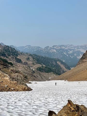 Selena working up the snow 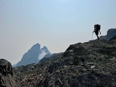 Trace at 6140 pass with Chimney Rock  We scrambled up about 15' on solid rock to the upper ledge, then down and across on some compact dirt and scree. We scrambled up about 15' on solid rock to the upper ledge, then down and across on some compact dirt and scree.
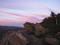
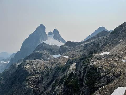 The traverse 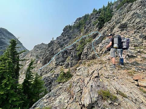 The upper ledge was exposed, but pretty easy. The lower ledge looked horrendous from both sides. 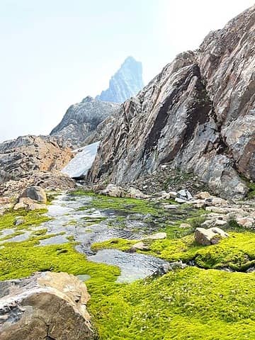 Lovely little water source before camp 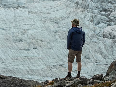 Looking over the Overcoat Glacier 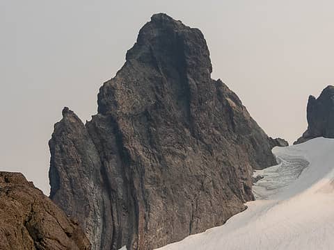 North Peak of Chimney Rock 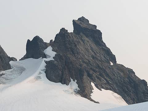 Finger of Fate on the left and Chimney Rock 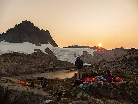 Sunset over high camp 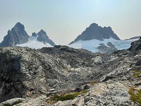 Chimney and Overcoat 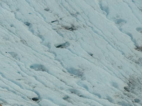 Moulins 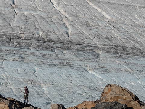 Selena and the Overcoat Glacier 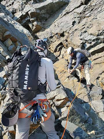 Setting up the first belay 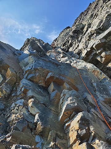 The climbing is runout, but easy enough. Me leading P1. 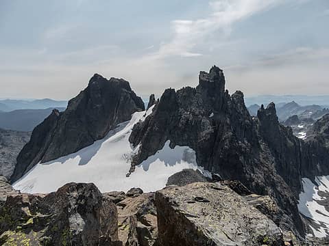 Chimney Rock 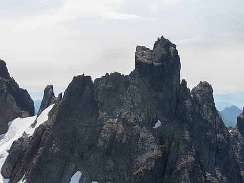 Very intimidating 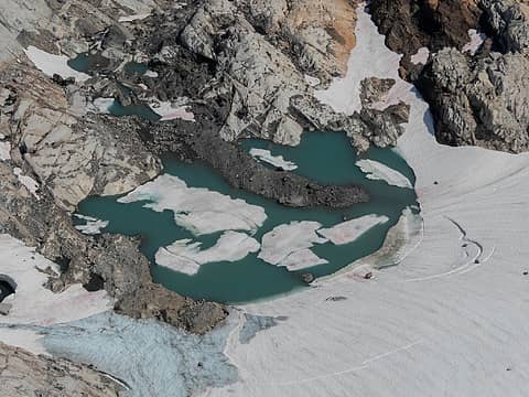 New lake forming 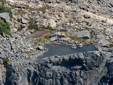 Tarn Camp from high above 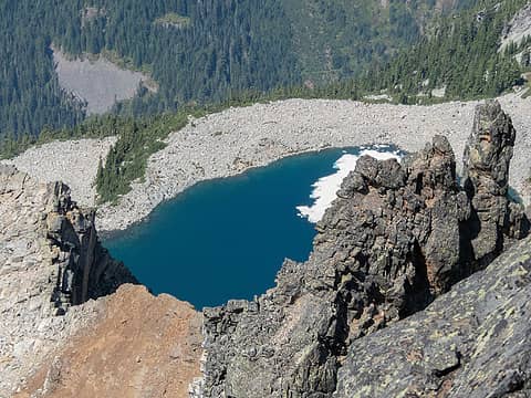 Overcoat Lake 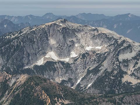 Big snow without the snow 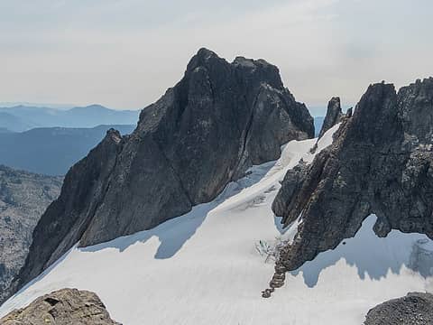 North Peak Chimney rock 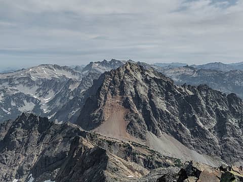 Summit Chief 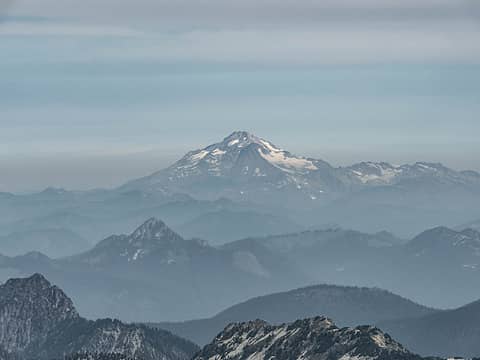 Glacier 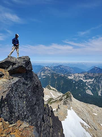 Seemed like a good spot to stand 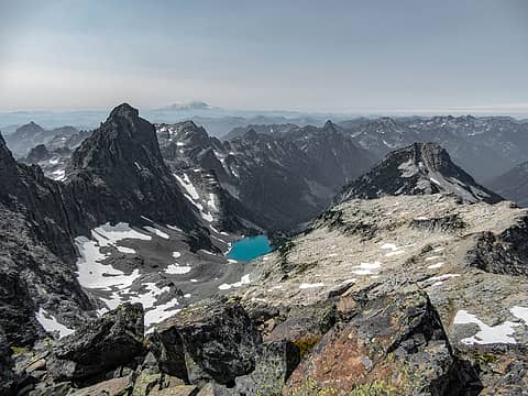 Hibox, Lemah, Chikamin, Huckleberry, Thomson, other snoqualmie peaks 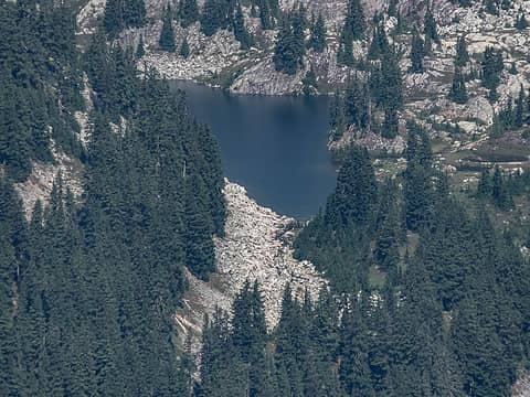 Crawford lake(I think) 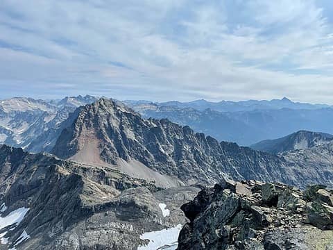 SC with Stuart to the east 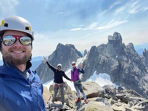 Summit smiles 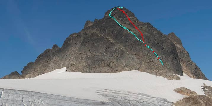 The route 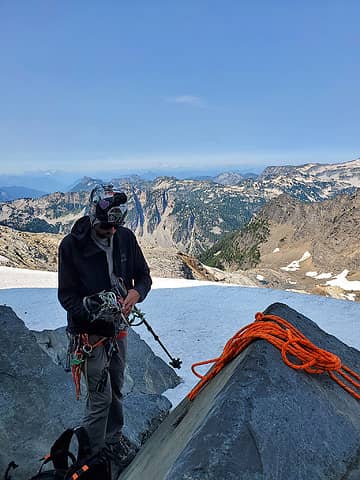 Back at our gear 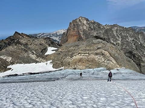 Descending the glacier 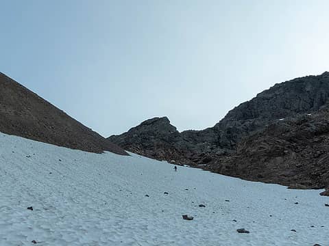 Back down into the Valley of the Chiefs 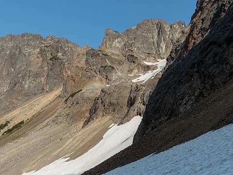 Glacial remnant below Middle Chief 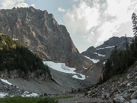 Summit Chief with less smoke 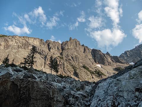 LBC 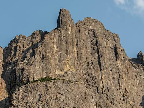 Close up. That face is pretty incredible. 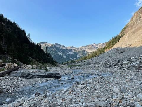 Clear skies 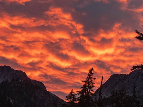 What a sight to wake up to 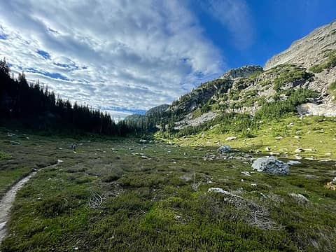 Almost at the gap 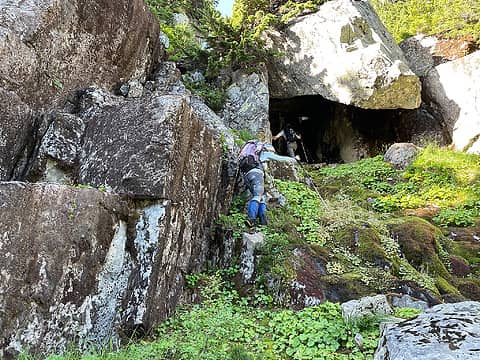 The cave with the key hole 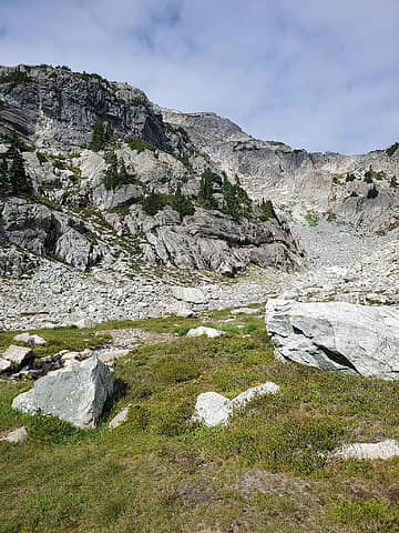 The basin 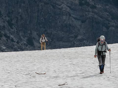 Selena and I ascending above the basin 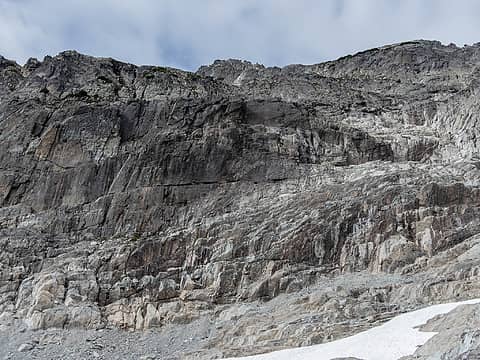 Beckey's 3rd class NE face route... sure. We did the north ridge variation. 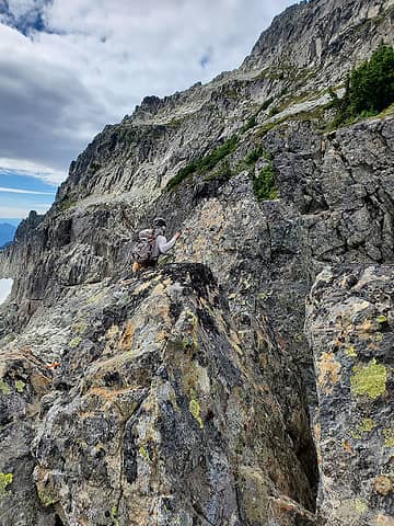 Heading over to the notch 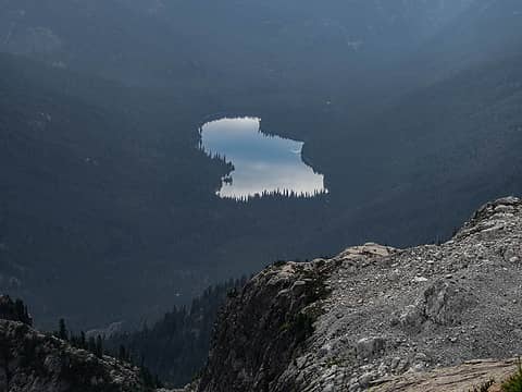 Waptus 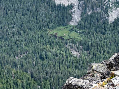 Camp Pedro 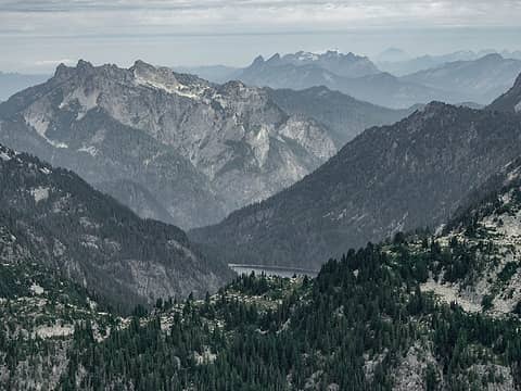 Malachite, Baring, Gunn and friends  Natural cairn. Sloan and friends beyond 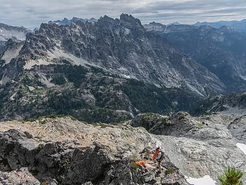 The notch is directly below me to the left. Bears Breast looking foreboding beyond 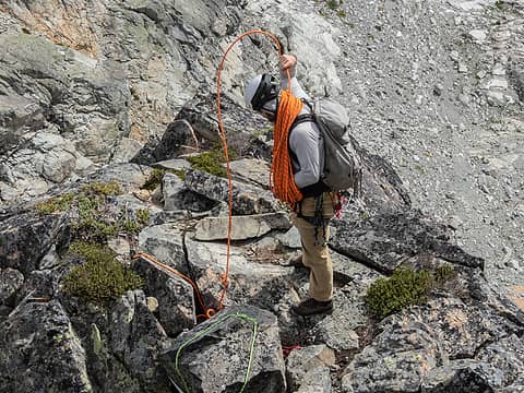 Action shot  To be fair, this may not have been the right route. This pitch was probably about 100' and we solo'd it. Above was some wet heather that lead to the 4th class summit block, which was trivial compared to what we had just come up. To be fair, this may not have been the right route. This pitch was probably about 100' and we solo'd it. Above was some wet heather that lead to the 4th class summit block, which was trivial compared to what we had just come up.
 Ramps heading up 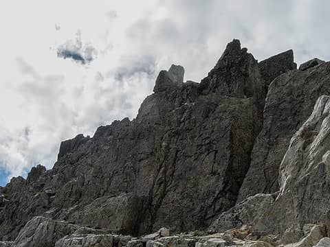 Summit ridge. Route up continued left. 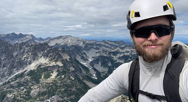 Quick summit selfie 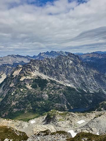 Bears Breast 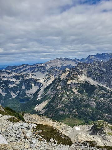 Williams Lake, Hinman, Daniel 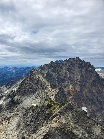 Middle and Summit Chief 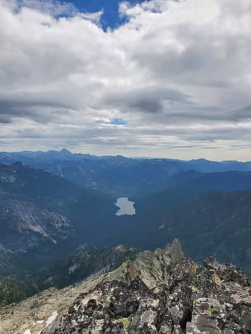 Stuart and Waptus  Initially, it was easy terrain for awhile before we ran into some trees above cliffs. I had this funny feeling that we would be alright if we just kept trying to work our way down, so that's what we did. I veggie belayed my way down to the lowest trees and popped out on a nice bench in the waterfall. I peeked over and it looked like I could get a bit further, as Trace was asking if we should find a tree to start rapping off of. I gave the downclimb a chance and it just kept looking like it would work. Down we scrambled, somehow picking our way down the most improbable terrain. We couldn't believe that we had just strung that whole descent together. Trace said we should call it "Rap Refusal." I guess all of that sketch on the upper mountain had it's benefits! Sketch tolerance +1 that day.
 Here's our improbable line down 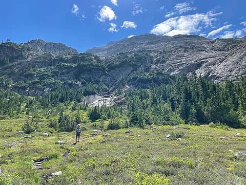 Selena below our descent route
 zimmertr, rstoddard24, Pef, mosey, Slim, RichP zimmertr, rstoddard24, Pef, mosey, Slim, RichP  awilsondc, Bluebird, Tom awilsondc, Bluebird, Tom
zimmertr, rstoddard24, Pef, mosey, Slim, RichP awilsondc, Bluebird, Tom |
| Back to top |
  
|
|
Tom
Admin
Joined: 15 Dec 2001
Posts: 17851 | TRs | Pics
|
|
Tom
Admin
|
 Wed Aug 18, 2021 12:59 pm |
|
|
Awesome report and welcome to the site (even if you've just been lurking). Brings back some great memories!
bubblehead
bubblehead |
| Back to top |
|
|
neek
Member

Joined: 12 Sep 2011
Posts: 2336 | TRs | Pics
Location: Seattle, WA |
|
neek
Member
|
Wed Aug 18, 2021 2:18 pm |
|
|
Very nice. Conditions look way more serious than when we did it early season.
bubblehead
bubblehead |
| Back to top |
|
|
Bluebird
suffering optional

Joined: 22 Jan 2014
Posts: 199 | TRs | Pics
Location: United States |
|
Bluebird
suffering optional
|
Wed Aug 18, 2021 4:12 pm |
|
|
Thanks for the trip report! I'll try to add a few of my favorite photos soon. It was such a good trip, burly and interesting... just how I like my mountains 
|
| Back to top |
|
|
awilsondc
Member

Joined: 03 Apr 2016
Posts: 1324 | TRs | Pics
|
bubblehead |
| Back to top |
|
|
rstoddard24
BBQWingz

Joined: 30 Dec 2016
Posts: 74 | TRs | Pics
|
thanks for the TR!
what would yall rate the tech difficulty of Overcoat E Face? (low 5th, 5.x ...?)
Also any idea what the N Ridge of Chimney rock goes at? That final step before the summit area looks difficult
|
| Back to top |
|
|
Backpacker Joe
Blind Hiker

Joined: 16 Dec 2001
Posts: 23956 | TRs | Pics
Location: Cle Elum |
Nice work guys. Great pics.
"If destruction be our lot we must ourselves be its author and finisher. As a nation of freemen we must live through all time or die by suicide."
Abraham Lincoln
"If destruction be our lot we must ourselves be its author and finisher. As a nation of freemen we must live through all time or die by suicide."
Abraham Lincoln
|
| Back to top |
|
|
hapemask
Member

Joined: 17 May 2021
Posts: 29 | TRs | Pics
|
|
hapemask
Member
|
Thu Aug 19, 2021 6:52 pm |
|
|
Awesome shots! I was on Hibox 8/15 admiring the view in your direction.
bubblehead
bubblehead |
| Back to top |
|
|
puzzlr
Mid Fork Rocks

Joined: 13 Feb 2007
Posts: 7220 | TRs | Pics
Location: Stuck in the middle |
|
puzzlr
Mid Fork Rocks
|
Thu Aug 19, 2021 7:49 pm |
|
|
It's great to see a report of a different and rare route on Overcoat. And the alternate route down Little Big Chief?  I hope "Underpants Ledge" sticks
|
| Back to top |
|
|
bubblehead
Member
Joined: 17 May 2021
Posts: 8 | TRs | Pics
|
| rstoddard24 wrote: | | what would yall rate the tech difficulty of Overcoat E Face? (low 5th, 5.x ...?)
Also any idea what the N Ridge of Chimney rock goes at? That final step before the summit area looks difficult |
Overcoat E Face was low 5th, mostly 3rd and 4th. Pretty run-out, 2-3 pieces of pro per pitch and belays were tricky to set up for the first 2 pitches. Lots of tiptoeing over looseness, as the route is a funnel for rockfall, but the underlying rock is solid and very enjoyable to climb on!
N Face of Chimey supposedly goes at 5.4. Check our GB's comment on Fletcher's Chimney Rock post. It's what inspired us to do this trip!
rstoddard24
rstoddard24 |
| Back to top |
|
|
|
|
You cannot post new topics in this forum
You cannot reply to topics in this forum
You cannot edit your posts in this forum
You cannot delete your posts in this forum
You cannot vote in polls in this forum
|
Disclosure: As an Amazon Associate NWHikers.net earns from qualifying purchases when you use our link(s). |


