| Previous :: Next Topic |
| Author |
Message |
Eric Gilbertson
Member


Joined: 04 Jul 2018
Posts: 188 | TRs | Pics
Location: Seattle |
Most Remote Point in Glacier Peak Wilderness
Oct 9, 2021, 12:30am 11:30pm
48 miles (45 hiking, 3 biking), 14,000ft gain
Eric Gilbertson
Im interested in visiting the most inaccessible and remote corners of Washington, and excellent candidates for these locations are the most remote points of wilderness areas. These are defined as the points farthest from the edge of the wilderness boundary, meaning farthest from where a road exists or where a road can be legally constructed.
Last fall I hiked and bushwhacked in to the most remote point in the Pasayten Wilderness, a point on the edge of alpine tarn 7045 near Ptarmigan Peak. That ended up being a 55-mile 36-hour continuous push in deep snow and difficult bushwhacking. I did indeed truly feel remote there.
Greg Slayden on peakbagger.com has compiled a list of the most remote points in wilderness areas in the lower 48 states using this definition, and Glacier Peak Wilderness is large enough that it is high on the list. The most remote point in Glacier Peak Wilderness is actually in a surprisingly interesting location. It could have easily been in the middle of the woods somewhere, but it is on a promontory overlooking Chocolate Creek Canyon near the base of the Chocolate Glacier coming down from Glacier Peak. I gleaned this information from satellite images of the location, since [unsurpringly] I couldnt find reports of anyone going to this point or even anywhere near it.
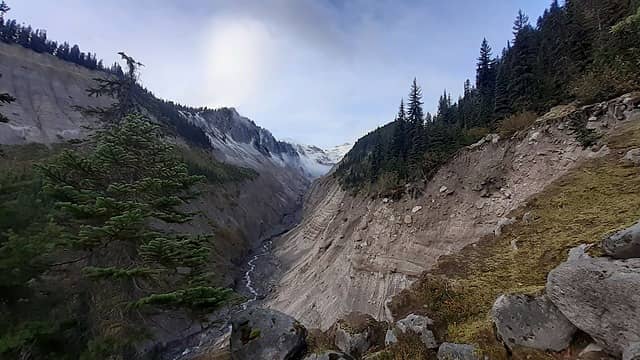 Looking up Chocolate Creek Canyon, with the remote point a promontory on the right 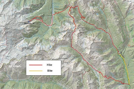 The route 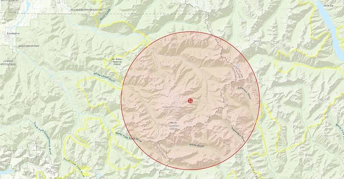 How the most remote point is determined 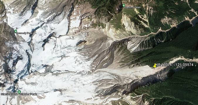 Location of the most remote point 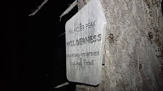 Entering the wilderness 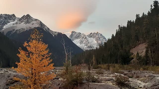 Sunrise looking up the Suiattle River at Hoof, Neyah Point, and Tenpeak (left to right) 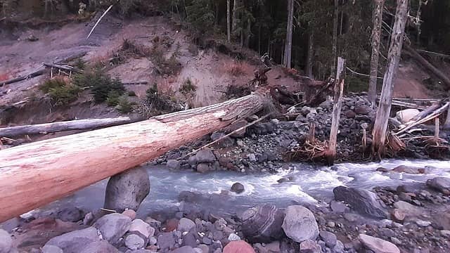 Crossing the suiattle on a good log 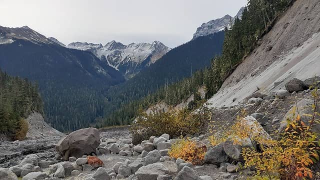 Looking down Chocolate Creek at Napeequa 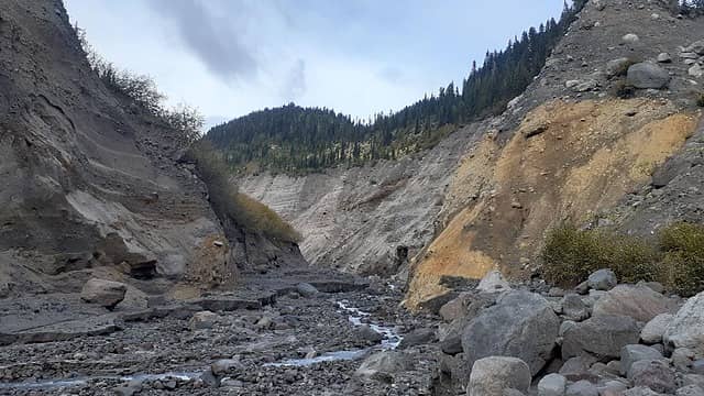 Chocolate Creek Canyon walls narrowing at the exit gully 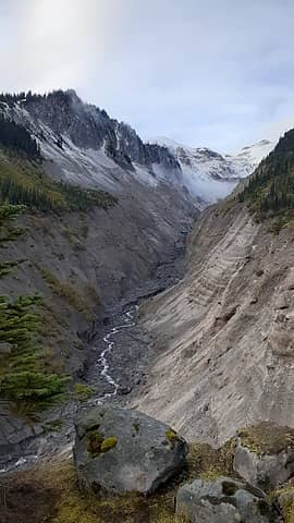 My first view of the most remote point 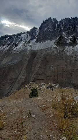 Looking down at the remote point 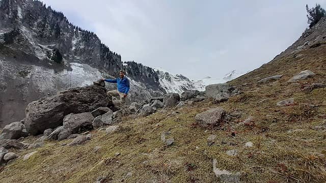 On the most remote point in glacier peak wilderness 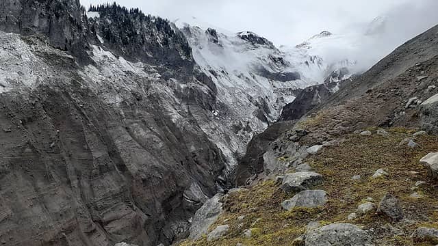 Looking up towards Glacier Peak 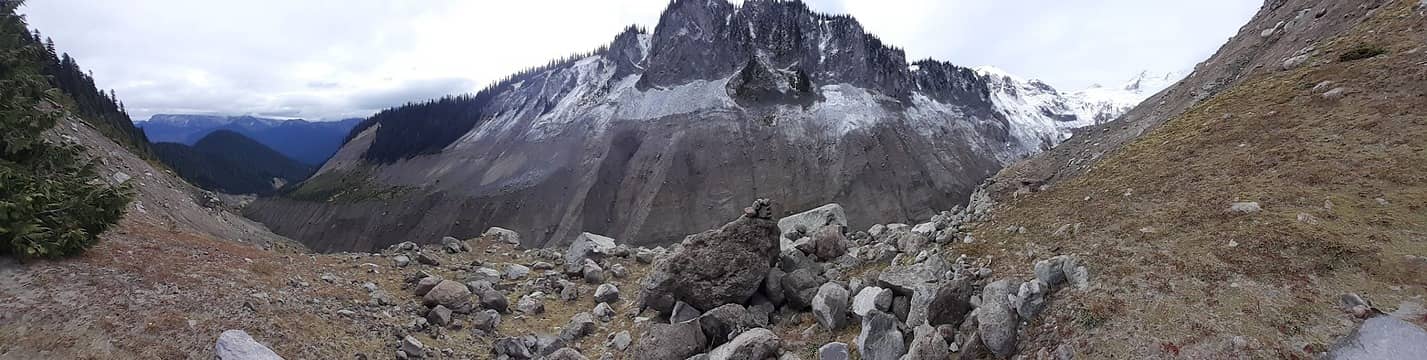 View of the remote point 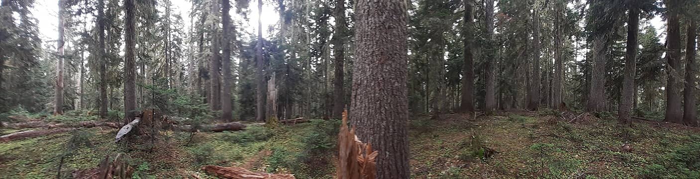 The summit of Chocolate Creek Peak 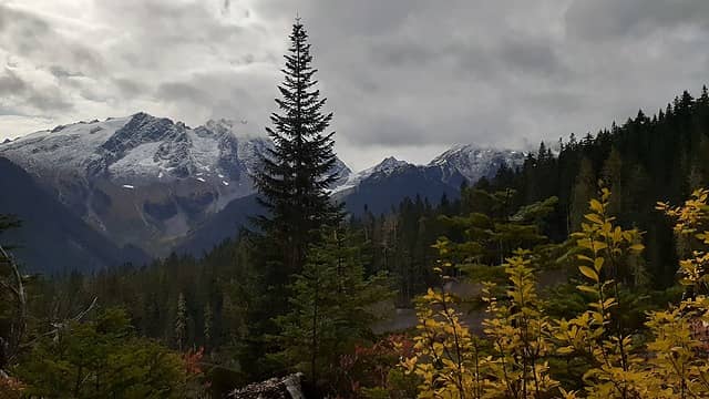 Clouds rolling in on Tenpeak and Kopeetah Divide 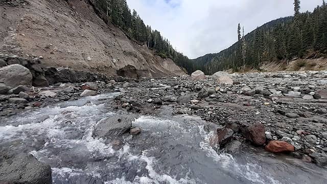 Chocolate Creek isn't actually very chocolate colored. Maybe it got its name a different way 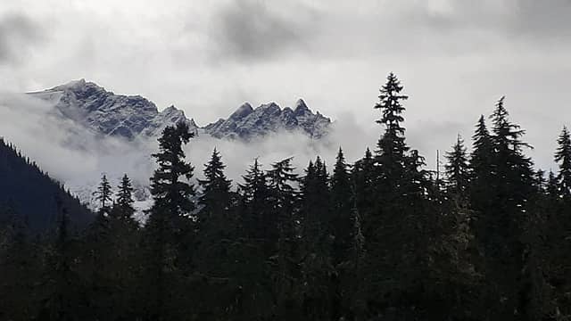 More clouds on Tenpeak  Last view up the Suiattle River valley 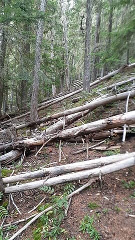 Typical Triad Creek trail conditions 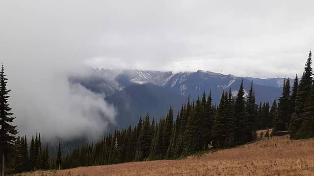 Clouds rolling in at Buck Creek Pass 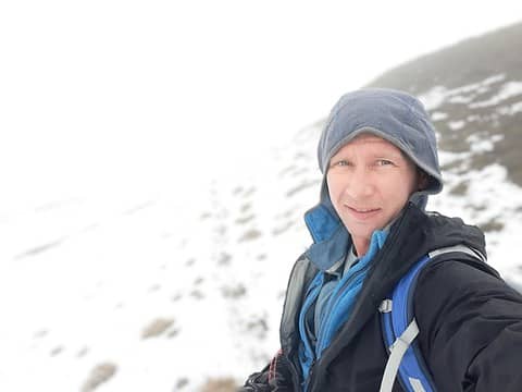 Trudging through snow at High Pass 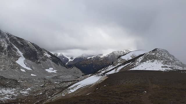 High Pass 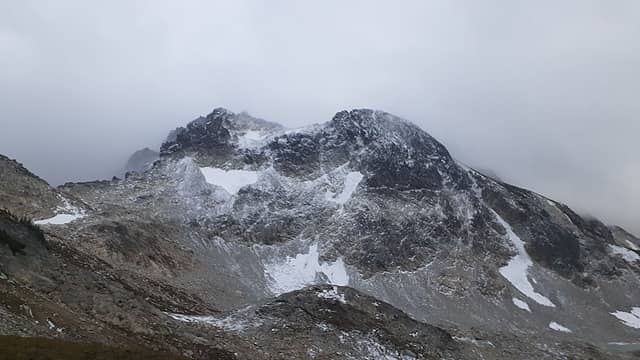 Berge and Berge SW 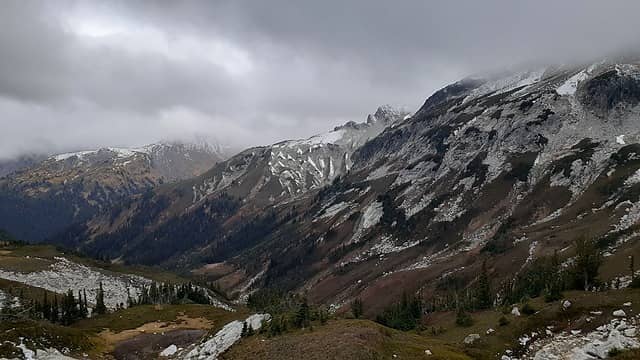 Looking down towards the Napeequa valley, with Napeequa peak in the clouds on the right 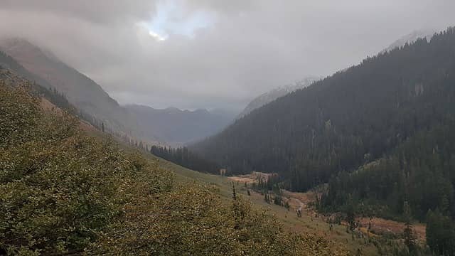 Looking down the Napeequa valley 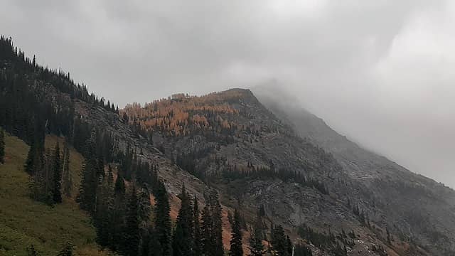 Larches on the side of Buck 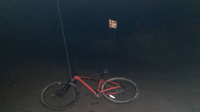 Biking back in the rain
 Obi Tony Kenobi, achildinthesehills, Bloated Chipmunk, Pef, Snuffy, kw, contour5, Brushbuffalo, Now I Fly, mosey, pushkarwallah, RichP, jaysway, Gimpilator, reststep, Kascadia, Dave Weyrick, drewcoll, IanB, raising3hikers, jstern, rubywrangler, Noheaperture, Matt, rstoddard24, hapemask, zimmertr, LukeHelgeson, Tom, Nancyann Obi Tony Kenobi, achildinthesehills, Bloated Chipmunk, Pef, Snuffy, kw, contour5, Brushbuffalo, Now I Fly, mosey, pushkarwallah, RichP, jaysway, Gimpilator, reststep, Kascadia, Dave Weyrick, drewcoll, IanB, raising3hikers, jstern, rubywrangler, Noheaperture, Matt, rstoddard24, hapemask, zimmertr, LukeHelgeson, Tom, Nancyann  awilsondc awilsondc  fourteen410, GaliWalker fourteen410, GaliWalker
Obi Tony Kenobi, achildinthesehills, Bloated Chipmunk, Pef, Snuffy, kw, contour5, Brushbuffalo, Now I Fly, mosey, pushkarwallah, RichP, jaysway, Gimpilator, reststep, Kascadia, Dave Weyrick, drewcoll, IanB, raising3hikers, jstern, rubywrangler, Noheaperture, Matt, rstoddard24, hapemask, zimmertr, LukeHelgeson, Tom, Nancyann awilsondc fourteen410, GaliWalker |
| Back to top |
  
|
|
Redwic
Unlisted Free Agent

Joined: 23 Feb 2009
Posts: 3292 | TRs | Pics
Location: Going to the Prom(inence) |
|
Redwic
Unlisted Free Agent
|
 Sun Oct 10, 2021 8:16 pm |
|
|
60 pounds lighter but not 60 points brighter.
|
| Back to top |
|
|
puzzlr
Mid Fork Rocks

Joined: 13 Feb 2007
Posts: 7220 | TRs | Pics
Location: Stuck in the middle |
|
puzzlr
Mid Fork Rocks
|
Mon Oct 11, 2021 7:29 am |
|
|
Another very impressive effort. Congratulations on figuring out how to do this, then crushing it.
|
| Back to top |
|
|
Foist
Sultan of Sweat

Joined: 08 May 2006
Posts: 3974 | TRs | Pics
Location: Back! |
|
Foist
Sultan of Sweat
|
Mon Oct 11, 2021 8:32 am |
|
|
Really cool. 
|
| Back to top |
|
|
reststep
Member
Joined: 17 Dec 2001
Posts: 4757 | TRs | Pics
|
|
reststep
Member
|
Mon Oct 11, 2021 9:49 am |
|
|
Great report and effort.
Wish there was some way to get them to reopen and maintain the Suiattle River Trail that went all the way to Chocolate Creek but will probably never happen.
"The mountains are calling and I must go." - John Muir
"The mountains are calling and I must go." - John Muir
|
| Back to top |
|
|
coldrain108
Thundering Herd

Joined: 05 Aug 2010
Posts: 1858 | TRs | Pics
Location: somewhere over the rainbow |
| Eric Gilbertson wrote: | Looking down at the remote point |
looks like a nice camp spot... 
Since I have no expectations of forgiveness, I don't do it in the first place. That loop hole needs to be closed to everyone.
Obi Tony Kenobi
Since I have no expectations of forgiveness, I don't do it in the first place. That loop hole needs to be closed to everyone.
Obi Tony Kenobi
|
| Back to top |
|
|
JVesquire
Member
Joined: 28 Jun 2006
Posts: 993 | TRs | Pics
Location: Pasco, WA |
Epic. Anything on that side of the Suiattle feels remote, and you pushed it to the limit.
|
| Back to top |
|
|
Pyrites
Member
Joined: 16 Sep 2014
Posts: 1884 | TRs | Pics
Location: South Sound |
|
Pyrites
Member
|
Mon Oct 11, 2021 12:09 pm |
|
|
Amazing.
I wonder if the local wilderness ranger follows this forum? I know theyd have twenty reasons not to post.
Keep Calm and Carry On?
Heck No.
Stay Excited and Get Outside!
Keep Calm and Carry On?
Heck No.
Stay Excited and Get Outside!
|
| Back to top |
|
|
geyer
Member

Joined: 23 May 2017
Posts: 463 | TRs | Pics
Location: Seattle |
|
geyer
Member
|
Mon Oct 11, 2021 12:58 pm |
|
|
That list is awesome Eric! Have you tried to figure out the remote points of the smaller Washington wildernesses like Wild Sky or Noisy-Diobsud?
I remember watching from Flower Dome a few years ago as the wind whipped all sorts of dust around the Chocolate
creek canyon. It would be a harsh place to be on a dry summer day.
| reststep wrote: | | Great report and effort.
Wish there was some way to get them to reopen and maintain the Suiattle River Trail that went all the way to Chocolate Creek but will probably never happen. |
The trail was very well maintained all the way to Gamma last year. Is it that bad past the turnoff? I can't imagine the brush being too thick over there for the extra ~4.5 miles to Chocolate creek.
|
| Back to top |
|
|
reststep
Member
Joined: 17 Dec 2001
Posts: 4757 | TRs | Pics
|
|
reststep
Member
|
Mon Oct 11, 2021 1:12 pm |
|
|
Good to know. Guess Id better go up there and check it out once they open the trail back up.
"The mountains are calling and I must go." - John Muir
"The mountains are calling and I must go." - John Muir
|
| Back to top |
|
|
coldrain108
Thundering Herd
Joined: 05 Aug 2010
Posts: 1858 | TRs | Pics
Location: somewhere over the rainbow |
| geyer wrote: | | The trail was very well maintained all the way to Gamma last year. Is it that bad past the turnoff? |
we got stopped by Dusty Creek. It was full on chocolate milk bubbling up to my thighs.
Since I have no expectations of forgiveness, I don't do it in the first place. That loop hole needs to be closed to everyone.
geyer
Since I have no expectations of forgiveness, I don't do it in the first place. That loop hole needs to be closed to everyone.
geyer
|
| Back to top |
|
|
Ski
><((((°>

Joined: 28 May 2005
Posts: 12831 | TRs | Pics
Location: tacoma |
|
Ski
><((((°>
|
Mon Oct 11, 2021 3:38 pm |
|
|
excellent.
"I shall wear white flannel trousers, and walk upon the beach.
I have heard the mermaids singing, each to each."
"I shall wear white flannel trousers, and walk upon the beach.
I have heard the mermaids singing, each to each."
|
| Back to top |
|
|
Kim Brown
Member
Joined: 13 Jul 2009
Posts: 6899 | TRs | Pics
|
| Pyrites wrote: | | Amazing.
I wonder if the local wilderness ranger follows this forum? I know theyd have twenty reasons not to post. |
Why would they object?
I guarantee a couple wilderness rangers have crawled all over this area. Perhaps not exactly as Eric has; but it's not new to 'em! We have some good ones in Western Washington!
"..living on the east side of the Sierra world be ideal - except for harsher winters and the chance of apocalyptic fires burning the whole area."
Bosterson, NWHiker's marketing expert
"..living on the east side of the Sierra world be ideal - except for harsher winters and the chance of apocalyptic fires burning the whole area."
Bosterson, NWHiker's marketing expert
|
| Back to top |
|
|
BirdDog
Member
Joined: 09 Jan 2007
Posts: 1067 | TRs | Pics
Location: Seattle |
|
BirdDog
Member
|
Mon Oct 11, 2021 7:41 pm |
|
|
Cool TR! Tom Sjolseth and I climbed Ten Peak a few years back. We were sting on the summit looking down into the headworks of the Suiattle and Chocolate Creek thinking, wow thats pretty remote down there. Congrats on getting in there!
"There can be no greater issue than that of conservation in this country."
Teddy Roosevelt August 6, 1912
"There can be no greater issue than that of conservation in this country."
Teddy Roosevelt August 6, 1912
|
| Back to top |
|
|
pasayten
Class of 65...

Joined: 18 Aug 2011
Posts: 536 | TRs | Pics
Location: Winthrop, WA |
|
pasayten
Class of 65...
|
Mon Oct 11, 2021 8:02 pm |
|
|
Cool trip! Back in the 70's, the Suiattle trail was open and I made a trip on my horses up Dusty Wedge on a climbers trail to areas above the glaciers. Quite spetacular. 
|
| Back to top |
|
|
|
|
You cannot post new topics in this forum
You cannot reply to topics in this forum
You cannot edit your posts in this forum
You cannot delete your posts in this forum
You cannot vote in polls in this forum
|
Disclosure: As an Amazon Associate NWHikers.net earns from qualifying purchases when you use our link(s). |


