Forum Index > Trip Reports > Copter Peak (Snoqualmie sub-summit) - 09/25/2021
 Reply to topic
Previous :: Next Topic
Author Message
puzzlr
Mid Fork Rocks


Joined: 13 Feb 2007
Posts: 7220 | TRs | Pics
Location: Stuck in the middle
puzzlr
Mid Fork Rocks
PostMon Sep 27, 2021 10:49 pm 
I've been eyeing this rocky spire on the north side of Snoqualmie for several years. From some directions it seems like it would be easy to climb and from others it looks impossible. I teamed up with two people who are actually rock climbers and my job was just to get us to the base of the climb. Why "Copter Peak"? Some years ago I connected with Clarke Stockwell (belayon here). He was part of a mining exploration crew working in the Middle Fork valley in the early 60s. They called the basin on the north side of Snoqualmie "Copter Cirque". According to him, they landed their small helicopter "in the small basin located part way up Mt Snoqualmie's north face. The geologists had discovered mineralization there and we established a monument by our survey. That is a pretty lonely spot! I’ll bet no one has been there since!!" His description and photos lead me to believe they landed on a small platform just below the rocky spire we climbed. We hiked up the Snoqualmie Peak trail to 5800' then traversed to the right below the summit ridge to reach a minor pass right of the rocky ridge. From there we followed a prominent ridge all the way down to the base of Copter Peak. Descending the ridge was all open at top but lower down there was some serious krumholz bushwhacking. We found better way up that avoided the worst of the ridge route. You could also get to the pass by Copter Peak by scrambling down the broad talus gully (Crooked Couloir), but that looked really loose and we heard rocks coming off Snoqualmie Peak just above it all day. Leland did all the leading which was two pitches then one big boulder problem at the top. His friend Jack did the belaying and I got to take photos and tie into the middle of the rope. We wondered if anyone had been on top before but we found what is almost certainly a cairn made of three big rocks. This climb is easy enough for a confident rock climber to scramble up and down, so it's not surprising someone had been up before.
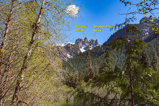
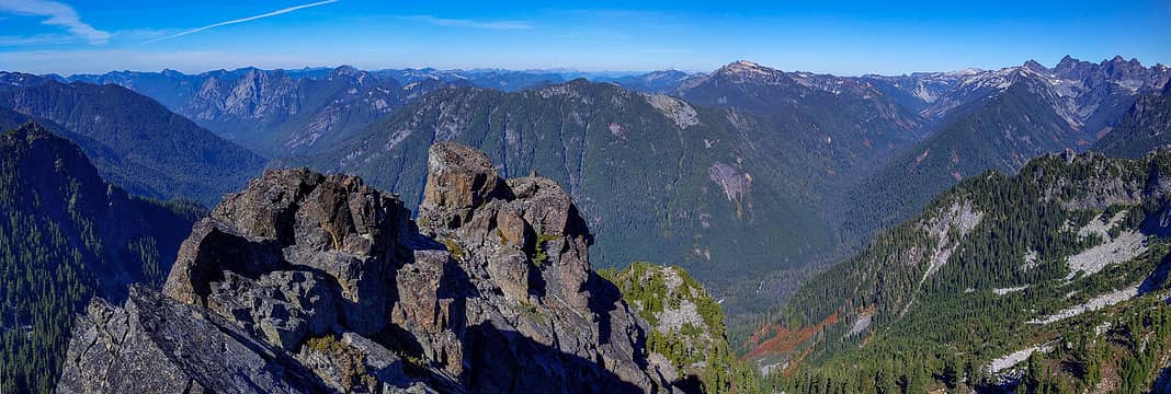
View of Copter and Snoqualmie Peaks from the Middle Fork valley
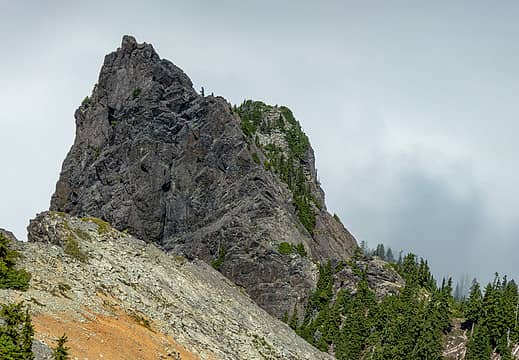
Copter Peak from near the summit of Snoqualmie Peak
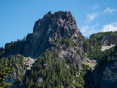
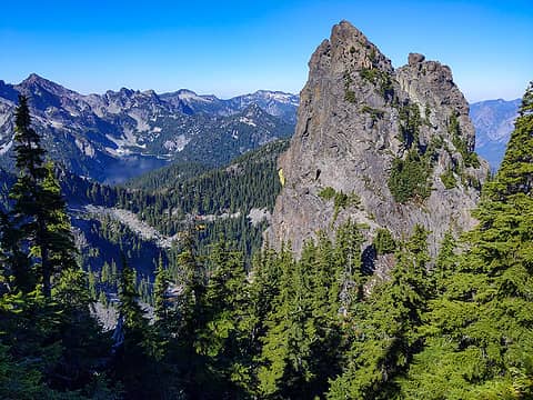
Copter Peak from near Avalanche Peak
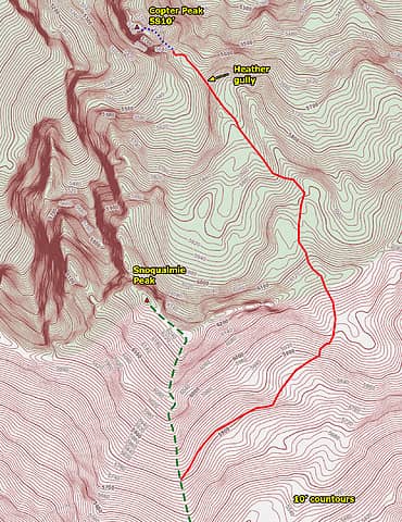
This is the route we used coming up and it's an easy trip
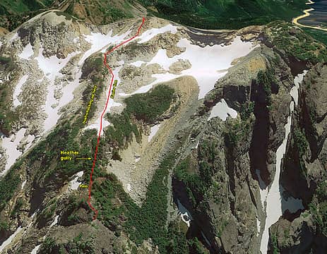
Google Earth view of the route down to the base of the climb
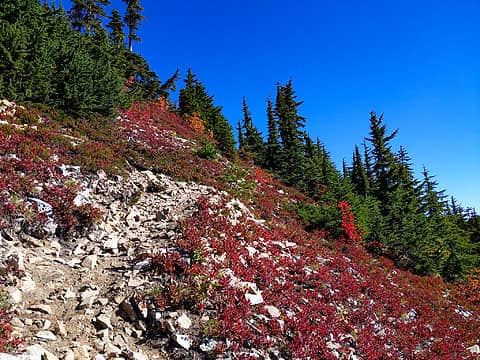
Bright colors of fall heather and blueberry
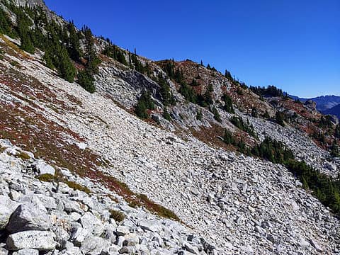
Traversing east below the summit ridge
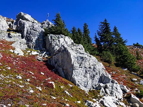
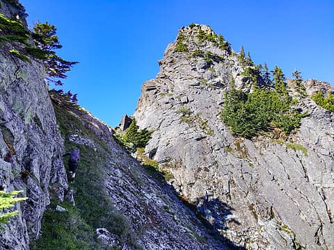
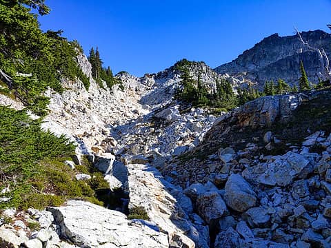
A silver tree snag is the same color as these rocks. We went up left of them.
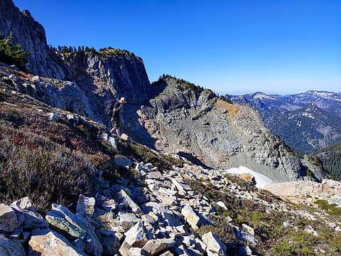
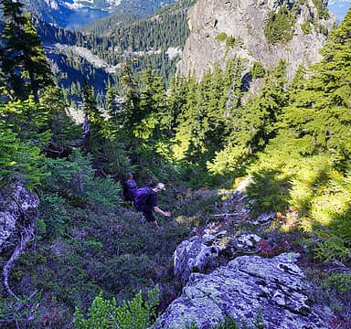
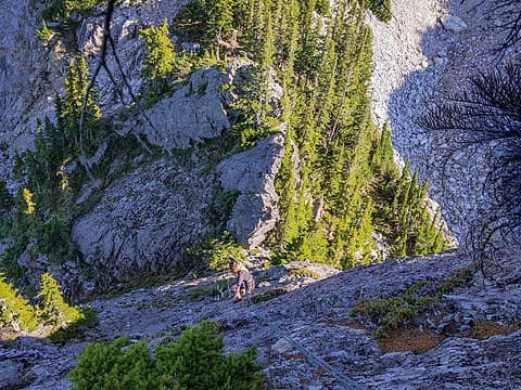
Jack descending the moderate slopes below the ridge
View back at Snoqualmie Peak summit area
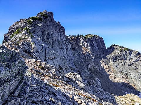
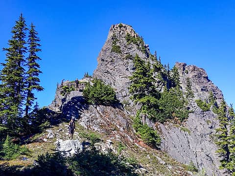
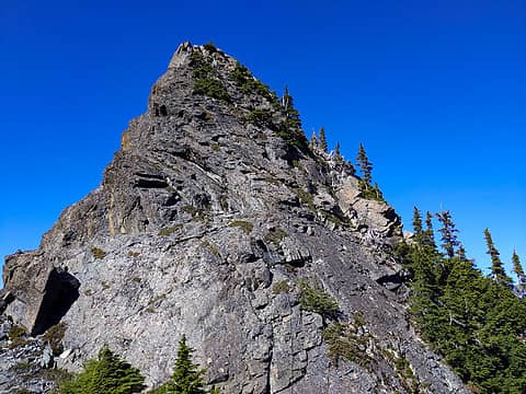
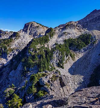
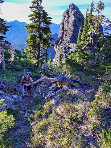
First full view of Copter Peak, about one third of the way down the ridge (on right)
Copter Peak closer up. The notch at the base is obscured by the trees on the ridge.
A couple of heather gullies allow dropping down the final steep section to the pass
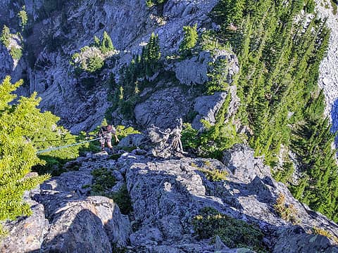
At Copter Peak pass. We still need to get on the other side of the big rock that Jack is standing on to be at the base of the rock climb.
Jack went over the top while Leland and I skirted around right on these heather slopes. I didn't like the big exposure to the right.
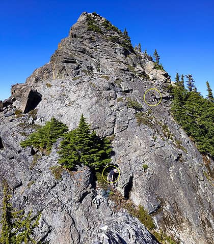
Leland traversing right and now about to head straight up to the grassy area above him.
Leland in the grassy corner. He belayed us from a spot beyond the dead white snag above him.
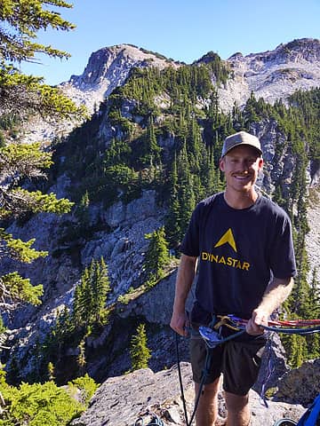
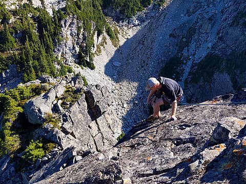
Jack belaying
Jack belaying
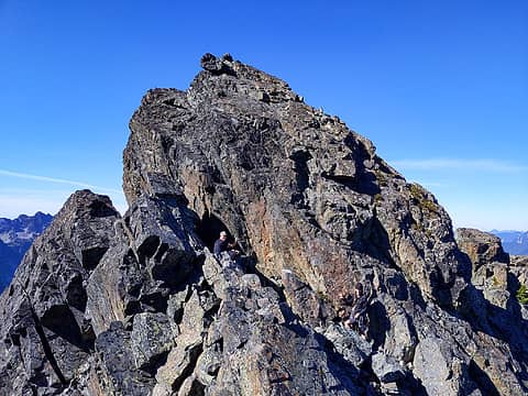
After the second pitch I unclipped and scrambled up to the shoulder and looked up at the final 20' of rock to the summit. It looked really hard from this angle and I wondered if we'd make it.
Jack and Leland saying "no problem" about getting up the final 20' to the top. They were right -- it's a lot easier than it looks.
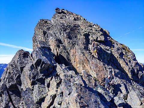
He discovers it's a ramp along the edge with good handholds too
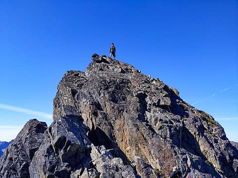
Leland on Copter Peak. He said there was already a cairn, which is not suprising.
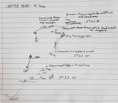
Climbing topo by Leland, made after the climb
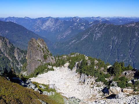
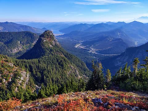
View from Copter Peak into the Middle Fork valley. Garfield at left, Price in the middle, Big Snow and others to the right.
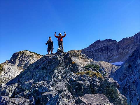
Leland and me on top
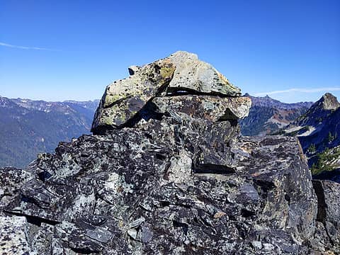
The cairn we found on top
From the summit we spotted a better route up. We went back up through the heather gullies, but then stayed on the talus to avoid the bushwhacking on the middle part of the ridge.
Jack being belayed down off the top
First rappel
First rappel
Second rappel, all the way to notch
Coming up out of the heather gully
After reclimbing the heather gully from the pass we veered right and went up this talus drainage to avoid the bushwhacking on the ridge. We got back onto the ridge where the taller trees stop.
Colorful heather, Guye Peak, and the Snoqualmie Pass area
It takes a long time to rock climb, especially on such a nice day when it's hard to stop looking around. The whole trip took 9 hours.

Mid Fork Rocksflickr

Fred Beavon, ozzy, raising3hikers, hapemask, geyer, Gimpilator, hot.choss, RichP, contour5, neek
Back to top Reply to topic Reply with quote Send private message
RichP
Member
Member


Joined: 13 Jul 2006
Posts: 5634 | TRs | Pics
Location: here
RichP
Member
PostTue Sep 28, 2021 8:43 am 
Very cool, Monty. So close but yet so far out there. Thanks for including Leland's notes.

Back to top Reply to topic Reply with quote Send private message
cascadeclimber
Member
Member


Joined: 04 Sep 2006
Posts: 1427 | TRs | Pics
cascadeclimber
Member
PostTue Sep 28, 2021 9:35 am 
Nicely done. I've eyeballed it quite a lot the last few years with the intent of wandering over to it. Had wondered how steep the slabby bits actually were.

If not now, when?
Back to top Reply to topic Reply with quote Send private message
Gimpilator
infinity/21M


Joined: 12 Oct 2006
Posts: 1684 | TRs | Pics
Location: Edmonds, WA
Gimpilator
infinity/21M
PostTue Sep 28, 2021 10:41 am 
Awesome report. Great to see you guys get this one.

Back to top Reply to topic Reply with quote Send private message
iron
Member
Member


Joined: 10 Aug 2008
Posts: 6392 | TRs | Pics
Location: southeast kootenays
iron
Member
PostTue Sep 28, 2021 9:11 pm 

Back to top Reply to topic Reply with quote Send private message
   All times are GMT - 8 Hours
 Reply to topic
Forum Index > Trip Reports > Copter Peak (Snoqualmie sub-summit) - 09/25/2021
  Happy Birthday treasureblue, CascadeSportsCarClub, PYB78, nut lady!
Jump to:   
Search this topic:

You cannot post new topics in this forum
You cannot reply to topics in this forum
You cannot edit your posts in this forum
You cannot delete your posts in this forum
You cannot vote in polls in this forum