| Previous :: Next Topic |
| Author |
Message |
cougmtsam
Member


Joined: 11 May 2015
Posts: 1 | TRs | Pics
Location: Seattle, WA |
Its been nearly 10 years since I last posted a TR to this site under an old username. Since then Ive continued to benefit from the wealth of information that this community offers -- thank you! Recently, a TR on this site played a big influence in a trip I went on. I figure it is now only fair to post a report...
Since finding ourselves living in separate states back in high school a few friends and I have kept a tradition of meeting up every summer for some outdoor activities, although only in recent years have we begun to venture towards backpacking. This summer, we had planned to do our most ambitious backpack trip yet in Olympic NP.
Our original itinerary was a 42-mile loop from Obstruction Point, heading east towards Deer Park, up the Grey Wolf River to Cedar lake, over Grey Wolf Pass into the Dosewallips river valley, over Cameron Pass, over Grand Pass, then back to Obstruction Point. Wanting to allow ourselves a leisurely pace we planned on completing the loop in 8 days.
Flights and camping permits were booked, gear purchased, and feelings stoked for our first big trip in a couple years. Unfortunately disaster struck when, two days before we were to hit the trail, we learned that there had been a close virus contact within the group. We began to isolate and look into our options for getting tested. Sadly, at this point one friend who had not yet arrived in Washington had to cancel his flight. For better or for worse he would miss out on the trip we later cobbled together.
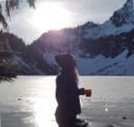
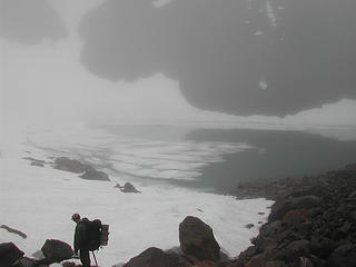
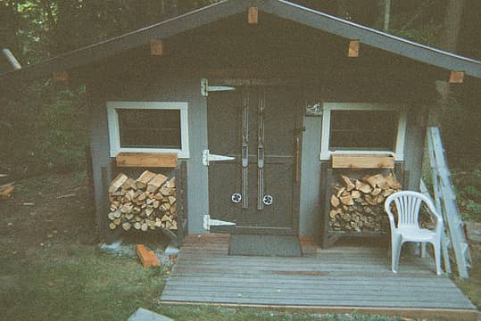 My friend isolated in this shed for three days, subsisting in part on our camping food. 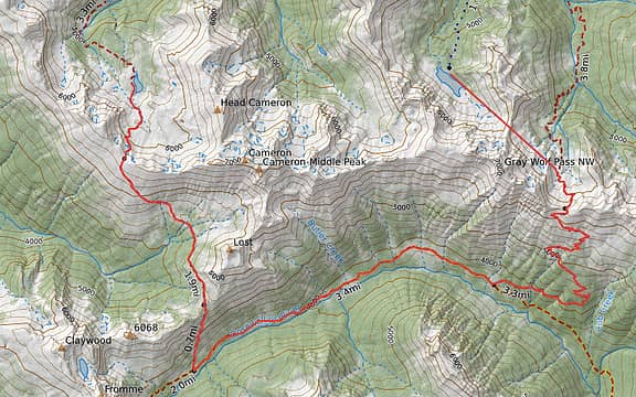 Instead of doing this 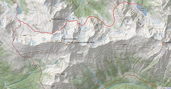 We would try something like this 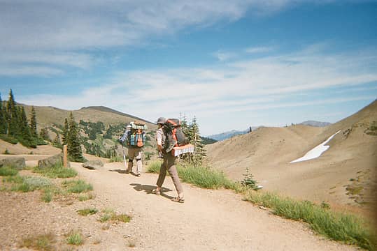 Starting out on the trail. 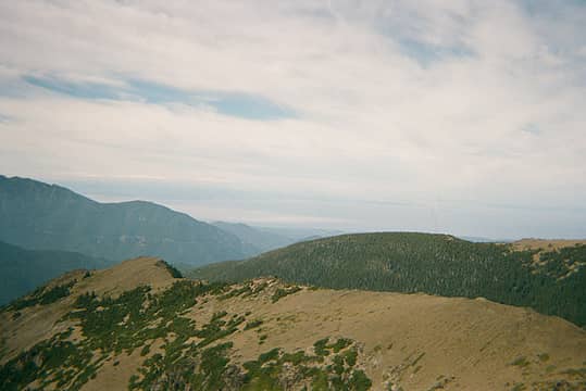 The Juan de Fuca views along the Obstruction-Deer Park trail did not disappoint. 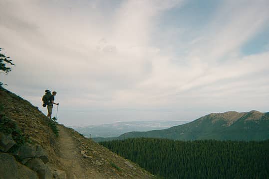 Taking in the views. 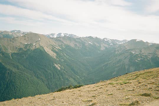 Grand Valley. Looking inland we were able to see much of our loop. 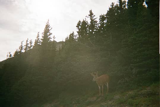 Deer encounter on our way to Deer Park. 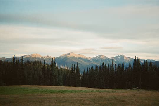 View from trail at Deer Park just before turning towards Three Forks. 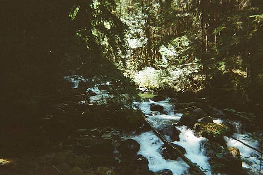 Grey Wolf River 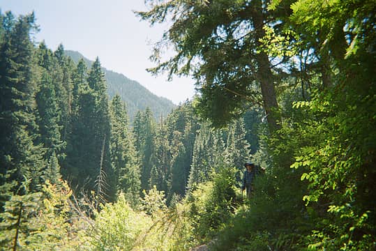 One of the only larger vistas along the Grey Wolf River Trail. 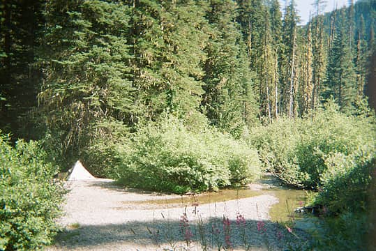 Campsite near Falls Camp. 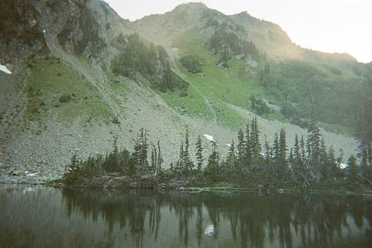 Evening view from our campsite, looking towards the start of the Cameron traverse. 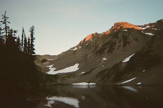 Sunset at Cedar Lake 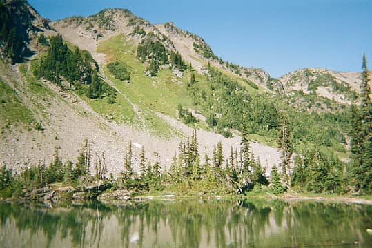 Morning view of Cedar Lake and the start of the traverse. 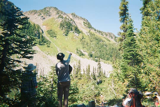 Plotting our attack of the traverse. 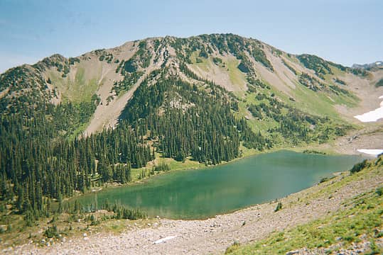 Cedar Lake 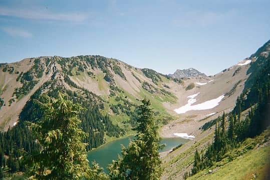 Moving up. I think we were a little off-route at this point. 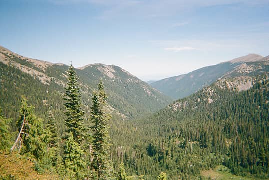 Looking down the Grey Wolf Valley. 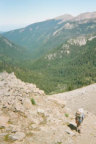 Just below the notch, above the steepest section of the climb to the notch. 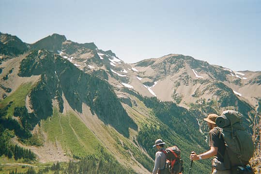 Mt. Cameron. The traverse cuts through a large chunk of this photo. 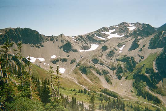 Top of the valley and snowfields on eastern flank of Mt. Cameron. We camped near where the creek meets the center of the photo. 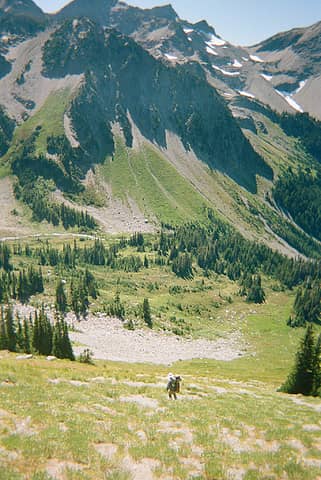 Bear can landed somewhere in the rocks at the bottom of the hill. The traverse crosses right below the dark cliff on the slopes in the upper right corner of this photo. 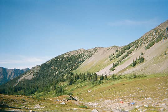 Our camp, with the slope we came from in the center-right of the photo. 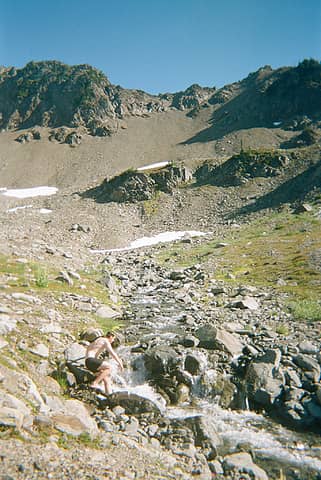 Bathing in the chilly waters. 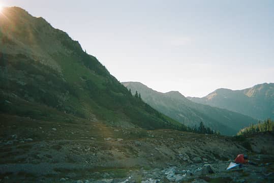 Bears were hanging out in the meadow in the upper left of this photo. 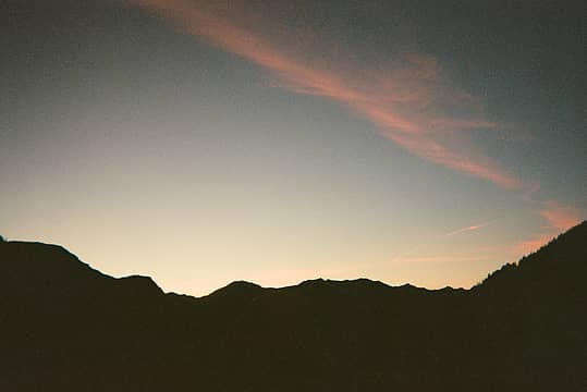 Evening view from my bivy sack. 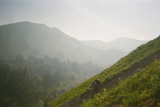 There were one or two gullies for us to cross. Soon after this point we traversed under a large cliff then were able to climb uphill towards the glaciers. 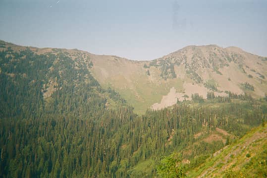 Looking back with amazement on the slope that we crossed the day before. Equally amazed that the bear can and its contents survived the fall undamaged. 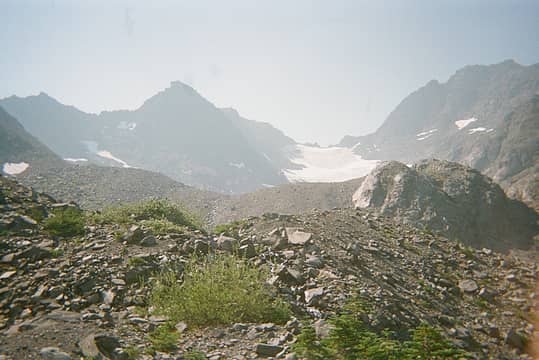 View uphill just below a small plateau/basin as we near the East Cameron Glacier. 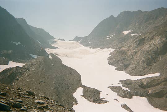 East Cameron Glacier, while supplies last. 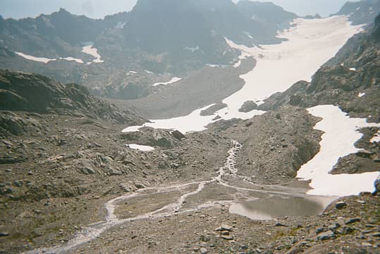 Looking back at the eastern glacier and tarn. We arrived from behind the rocky outcrop on the left. 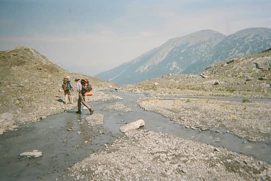 Crossing the creek delta below the tarn. 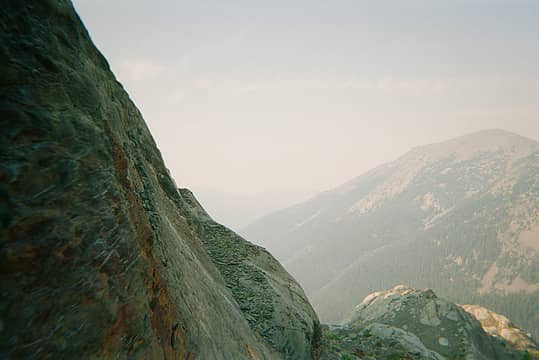 Artsy shot along the cliff traverse section. 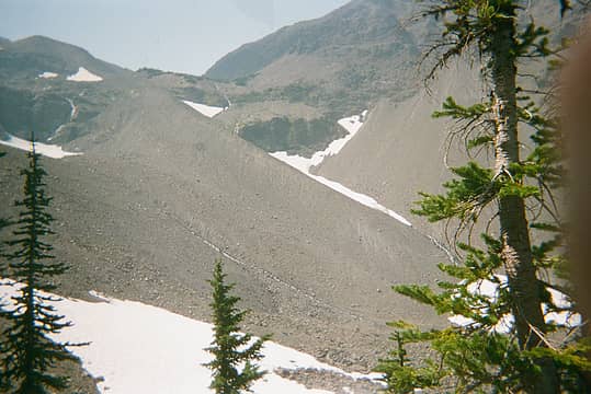 The dune that did us in. 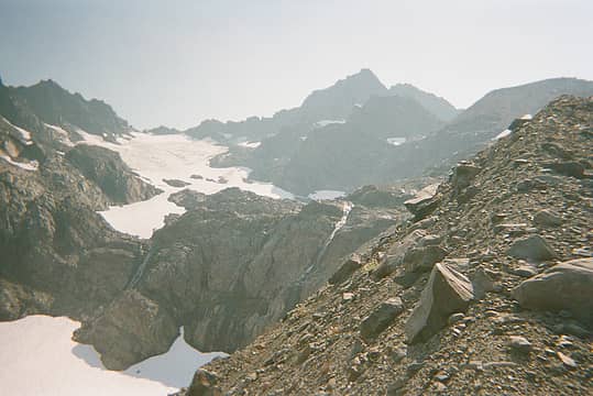 View towards Mt. Cameron peaks from base of the dune. 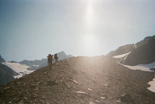 Getting started up the dune. It is steepest at the bottom. 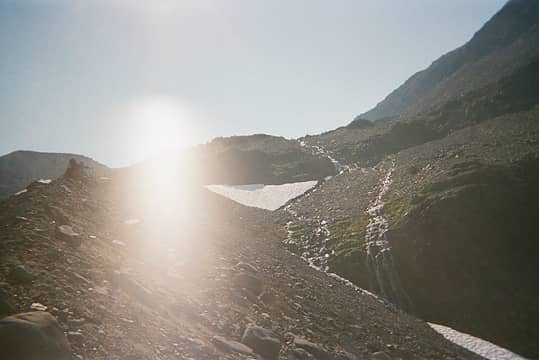 Resting along the dune. 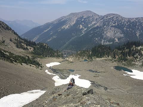 After this close call we dropped off the dune towards the snowfield on the left. 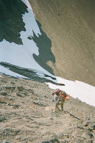 Dropping off the dune. 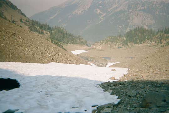 Looking down from the small creek that runs to the west of the dune. 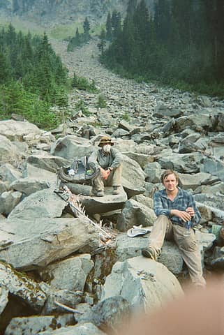 Celebrating our escape from the higher slopes. I think my friend may be justifiably trying to give me the finger. 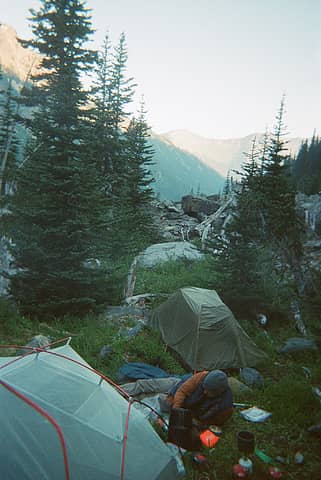 Our makeshift campsite. Grand pass in the background. 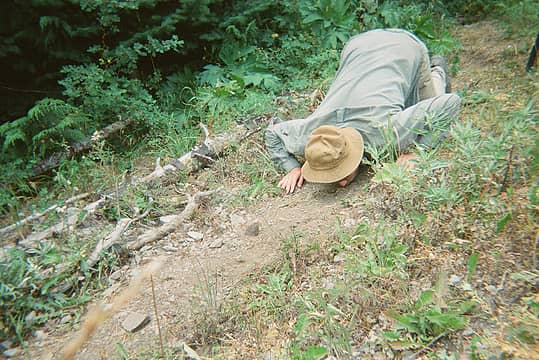 No caption needed. 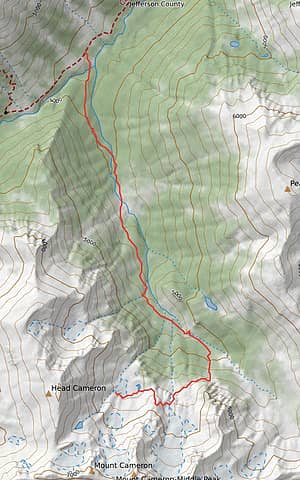 This is my best guess of what our bushwhack route looked like. We camped to the SW of the lake. 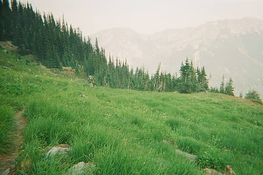 Entering the Marmot-filled meadows below Grand Pass. 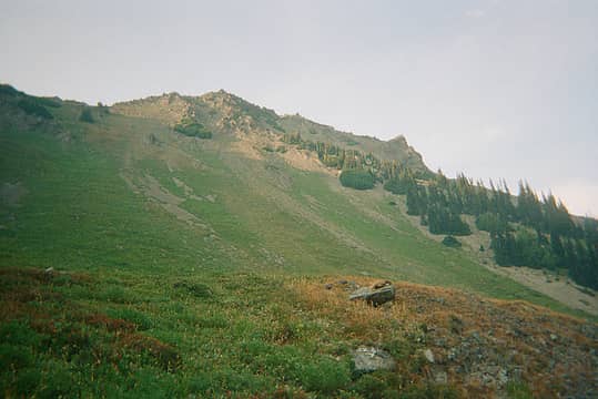 Looking up towards Grand Pass. 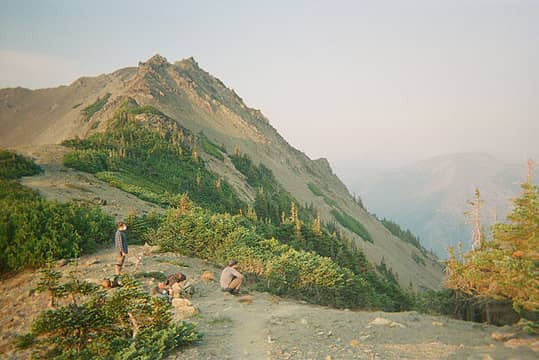 Grand Pass 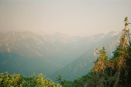 View from Grand Pass of the valley we had just hiked from. 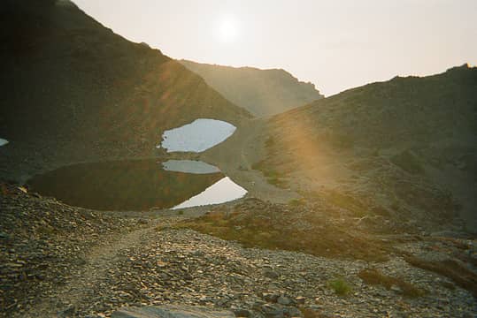 Tarn near Grand Pass 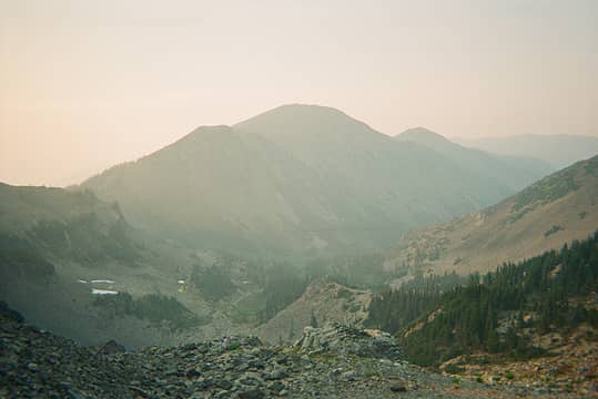 Looking down the Grand Valley. 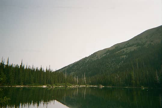 Morning at Grand Lake. 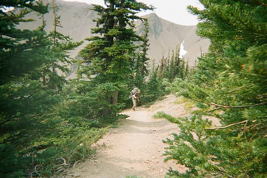 Climbing out of the Grand Valley. 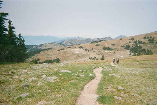 The end is in sight. 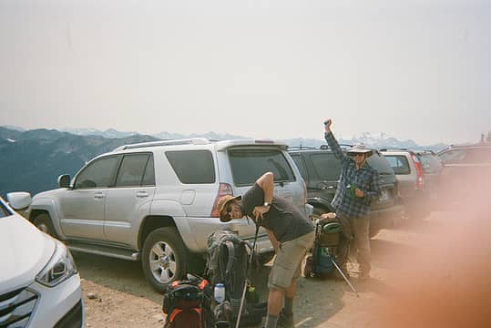 Headed home at last. 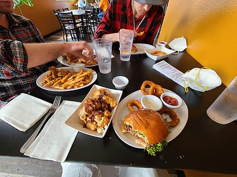 Post-hike feast.
 RodF, rubywrangler, jaysway, Nancyann, hapemask, MojaveGeek, reststep, Tom RodF, rubywrangler, jaysway, Nancyann, hapemask, MojaveGeek, reststep, Tom  kite kite
RodF, rubywrangler, jaysway, Nancyann, hapemask, MojaveGeek, reststep, Tom kite |
| Back to top |
  
|
|
IanB
Vegetable Belayer
Joined: 21 Jul 2010
Posts: 1062 | TRs | Pics
Location: gone whuljin' |
|
IanB
Vegetable Belayer
|
 Fri Oct 01, 2021 10:26 pm |
|
|
That was a great trip report!  Love the retro photography! You've captured the spirit of Ira Spring.
"Forget gaining a little knowledge about a lot and strive to learn a lot about a little." - Harvey Manning
MojaveGeek
"Forget gaining a little knowledge about a lot and strive to learn a lot about a little." - Harvey Manning
MojaveGeek
|
| Back to top |
|
|
zephyr
aka friendly hiker

Joined: 21 Jun 2009
Posts: 3370 | TRs | Pics
Location: West Seattle |
|
zephyr
aka friendly hiker
|
Fri Oct 01, 2021 10:37 pm |
|
|
Oh Good Grief! That looks intense. I feel your anxiety.
Man, you all did great work meeting all those challenges and coming back relatively unscathed. Wearing masks to boot. Congratulations on working through all those issues and keeping it together--finishing strong.
What a story. ~z
|
| Back to top |
|
|
KascadeFlat
Member
Joined: 06 Jul 2020
Posts: 320 | TRs | Pics
Location: Eating peanut M&Ms under my blue tarp |
You guys sure had an adventure! Thanks so much for sharing your trip with us. 
For a good time call: 1-800-SLD-ALDR.
For a good time call: 1-800-SLD-ALDR.
|
| Back to top |
|
|
zephyr
aka friendly hiker
Joined: 21 Jun 2009
Posts: 3370 | TRs | Pics
Location: West Seattle |
|
zephyr
aka friendly hiker
|
Sat Oct 02, 2021 9:52 am |
|
|
| IanB wrote: | | Love the retro photography! |
I know--right? I felt as though I was viewing scanned photos from the mid-1970's. Really added to the ambience and set the tone just right. ~z
|
| Back to top |
|
|
RAW-dad
Member

Joined: 07 Jul 2017
Posts: 119 | TRs | Pics
Location: Oregon |
|
RAW-dad
Member
|
Sun Oct 03, 2021 6:18 am |
|
|
MojaveGeek |
| Back to top |
|
|
MojaveGeek
Member
Joined: 16 Aug 2009
Posts: 49 | TRs | Pics
|
That was a bold plan B! Good save there on the re-route out and that the bushwhack was not too bad. I love that area but you really got into the wild there. Thanks for the TR!
|
| Back to top |
|
|
RodF
Member

Joined: 01 Sep 2007
Posts: 2593 | TRs | Pics
Location: Sequim WA |
|
RodF
Member
|
Sun Oct 03, 2021 9:59 pm |
|
|
Boomheist and I did this (based on ethorson's wonderful report) and hope our TR didn't mislead you into tackling more than you expected.
| cougmtsam wrote: | The dune that did us in. |
This "dune" is a lateral moraine. Hard packed clay and fine gravel do require short, carefully placed steps. Maybe microspikes might help, but I'm not sure as there is some rock-hopping, too. But you'd done the steepest and most difficult part at the bottom! If you'd persisted, in ~30 minutes you'd have been at the tarn above it, been overlooking Cameron Basin within an hour, and down on the trail in ~90 minutes.
| cougmtsam wrote: | This is my best guess of what our bushwhack route looked like. We camped to the SW of the lake. |
The lake is Lake Sarah, named for his wife by Amos Cameron, for whom Mount Cameron and Cameron Creek are named. He homesteaded on Deer Park Road in 1899, and explored this entire area extensively through the 1930s, making a living from the state bounty on cougar.
I've only spoken to two people who've visited Lake Sarah: one via Cedar Lake, and one up the south fork Cameron Creek (the route you chose) who reported "fairly easy going" via "elk trails above the east bank nearly all the way". Glad it worked out for you!
"of all the paths you take in life, make sure a few of them are dirt" - John Muir
"the wild is not the opposite of cultivated. It is the opposite of the captivated - Vandana Shiva
"of all the paths you take in life, make sure a few of them are dirt" - John Muir
"the wild is not the opposite of cultivated. It is the opposite of the captivated - Vandana Shiva
|
| Back to top |
|
|
Luc
Member

Joined: 05 Jul 2003
Posts: 1675 | TRs | Pics
Location: accepting wise-cracks like no other |
|
Luc
Member
|
Tue Oct 05, 2021 4:57 pm |
|
|
I second Rod and R-Dad's remarks.
I did this traverse a few years ago and from what I can tell, you made the right decisions at the right times, pushing your limits but listening to your gut. I also considered the valley as a bail point, and now I know it's not a full day of slide alder.
I agree with Rod that the bottom part is the steepest, but as you climb higher, then the fall distance becomes greater. You probably saw that on the left side (when ascending) also puts you above some steep rock faces below a cliff. That freaked me out.
At the top of the moraine, there is a tarn with snowfield (or did you make it that far?) Ascending beyond that, there's another section of moraine, albeit shorter. However from there if you were to fall to the right, you are now on a snowfield that could dump you into the (deep looking) tarn. Fall to the left and you might make headlines. I remember nearing the top, and basically going into tunnel vision and not looking down or thinking too much. I had already made the decision to put myself in a risky spot, and sometimes you think = you stink.
Anyway, thanks for the report! Brings back some tension for me!
BTW - your camp in the upper Cameron basin is the real prize. Great work and solid calls.
GNGSTR
silence, RAW-dad, RodF
GNGSTR
silence, RAW-dad, RodF
|
| Back to top |
|
|
Brockton
Member
Joined: 02 Aug 2012
Posts: 266 | TRs | Pics
Location: West Seattle |
|
Brockton
Member
|
Tue Oct 05, 2021 7:29 pm |
|
|
| IanB wrote: | | Love the retro photography! You've captured the spirit of Ira Spring. |
I was thinking the same thing! Like I'm flipping through my old paperback Manning and Spring guides decades ago and thinking, "Hmmm....that grainy B&W photo looks pretty good!"
|
| Back to top |
|
|
boomheist
Member
Joined: 25 Jul 2009
Posts: 55 | TRs | Pics
Location: tacoma |
When Rod and I climbed the moraine it was raining pretty hard and visibility was not the best, and perhaps this was why I didn't think too much about fall distance to fall from the prow of the ridge. At the top we fell into some big jagged rocks, bent to the right, and came out alongside a half frozen deep tarn, pretty big, actually - an acre? I somehow cut myself on the jagged rocks there but was able to pick my way over to the south end of the little lake. Be a nice camping spot once the snow melts. We didn't spare much time thinking about going up the snowfield behind the lake, a certain slide into icy water. We chose to work through the steep jagged rocks to the left of the snowfield, it was slow going, but then we came up to a little rise to what I call Cloudy Pass. It was easy coming down the other side into Cameron Basin, not half as steep as that face looks from Cameron Pass across the way.
 Rod starting off to work up the rocks beside the steep snowfield, which we had to avoid
|
| Back to top |
|
|
|
|
You cannot post new topics in this forum
You cannot reply to topics in this forum
You cannot edit your posts in this forum
You cannot delete your posts in this forum
You cannot vote in polls in this forum
|
Disclosure: As an Amazon Associate NWHikers.net earns from qualifying purchases when you use our link(s). |


