Matt Tea, Earl Grey, Hot
Joined: 30 Jan 2007 Posts: 4307 | TRs | Pics Location: Shoreline |
|
Matt
Tea, Earl Grey, Hot
|
Sat Oct 16, 2021 1:39 am
|
|
|
Dates: October 3-4, 2021
Destination: Sunrise & Sherman via Goat Creek and Panther Creek
Peaks: Sunrise 8144, Sherman 8204, Burgett 7367
Party: Matt, Carla, Don, Barry
Short Version
The goal was to visit a couple Top 200 peaks in larch season, but we weren't sure it would work out.
* In 2017, we attempted a late October visit to these peaks, but found unexpectedly deep snow. After hiking up Goat Creek to 6000 feet, we found ourselves in dense forest, wet snow, and cloudy skies, so we made a rare decision to turn around and go home.
* In 2018, this entire basin was burned by the McLeod fire, so we weren't sure what would be left.
* This year, we wanted to make a wider loop up Panther Creek to Sunrise, camp at a high meadow below Sunrise, traverse over to Sherman, and follow Sweetgrass Ridge back down.
For Day 1, each stage went almost wrong, but worked out well in the end. We lost trails in the burned forest, but found them again. Panther Creek ran dry, but we had just enough water to finish the day. Everything lower was burned, but the high larches were golden. Finding a camp with water was doubtful, but we ended up in a fine larchy meadow. The camp was in shadow, but later cloud glow tinted it rosy pink.
For Day 2, everything went right all along. Sunrise lit up our camp early, skies stayed clear, the route up Sherman was a fun scramble, we found more patches of larches, the ridge run south along Sweetgrass Ridge made an excellent return, and cow paths led us back to the trailhead.
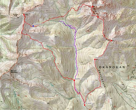
Sunrise-Sherman GPS Track 
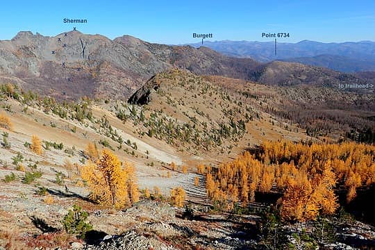
Looking from our approach route in Panther Basin across to our exit route on Sherman and Sweetgrass Ridge
Sunday
Goat Creek Trailhead to Sunrise Peak
They aren't on the maps, but there are trails up both Goat Creek and Panther Creek, starting from the end of Road 300 at the north end of Goat Creek Road 52, north of Mazama. We saw a few cows on the road in, and cow patties at the large trailhead showed that this is still a grazing area.
We weren't sure how much of this valley had burned, but it turned out to be almost everything. We followed the Goat Creek trail to 5000 feet, crossed the creek, and found the Panther Creek trail on the far side. The trail became harder to follow as it got closer to the creek, till finally above 6000 feet we just traveled on open slopes higher on the west side. Mostly we just picked whatever course would take us around fallen trees and avoid the thickest patches of fireweed. Around 6500 feet, we crossed back to the creek to fill up on water, and found that it was completely dry, so we would have to find water somewhere later for camping.
Higher up, however, the terrain was open meadows, the burn ended, and we hiked through glowing larches up to the ridge crest just south of Point 7740.
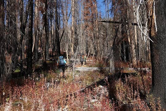
Hiking through burns and fireweed 
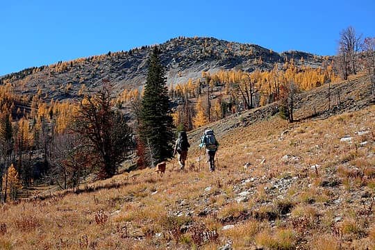
Hallelujah, there are open meadows and larches ahead
I wandered erratically uphill, zigzagging through as many larches as I could. Larchy, larch, larch, glowing larches make Matt happy.
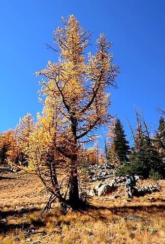
Don walking by a larger larch 
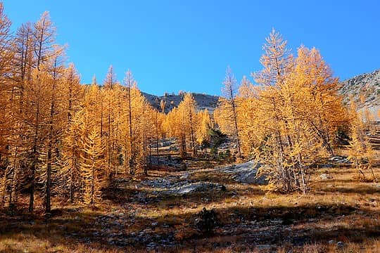
Gold beckons me upward 
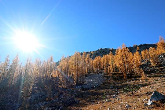
Sunshine lighting the trees 
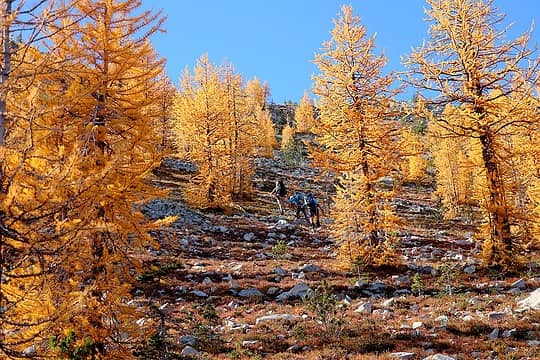
Hiking through the aisles of larches 
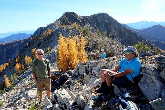
Resting on the crest with McLeod behind us.
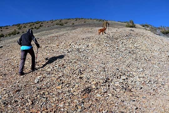
While resting at the col, we heard honking noises. After looking all around, we saw a large wing of snow geese flying above the valley. They fly surprisingly high. We were at 7700 feet, so it looked like their altitude was at least 9000 feet.
The rest of Sunrise was bare fragmented rock, but easy to walk up.
Hiking up Sunrise 
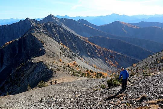
Hiking up with a sun and star in the background (Setting Sun Mtn in front of Silver Star) 
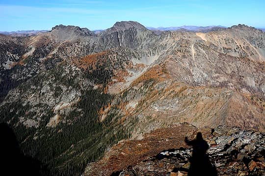
Looking northeast to the Craggies
Evening at Camp 6860
Now we needed a place to camp and find water. Down at 6860 was a basin of larches and meadows, which looked like the only pleasant place to camp, although it had already fallen into shadow. The question was whether it would have water, because everything below that looked like sloping ground and burned forest. The descent from the ridge went easily on mostly soft scree, and the meadows were indeed pleasant grassy ground amid vales of larches. I nobly emptied out my pack and volunteered to go as far downhill as needed to bring back water, but then we discovered there was a running stream just 60 feet below our camp.
We relaxed over dinner and watched the light change. Of course, as soon as I mixed my dinner, the clouds overhead turned pink, and their reflected light provided a fantasy colored glow to our surroundings. Fortunately I didn't have to run too far for photos, and was able to return to dinner before it got cold.
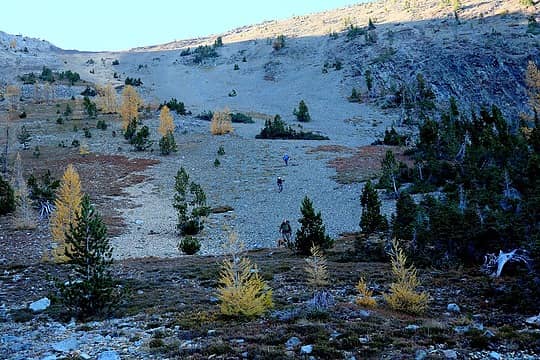
Dropping down scree east of Sunrise 
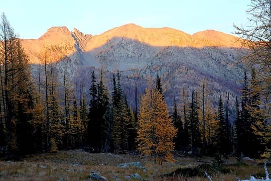
Alpenglow on Sherman 
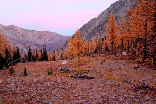
The pink hour, reflected light coloring our camp after sunset 
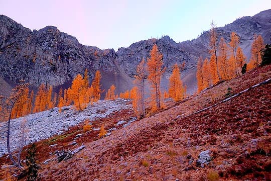
Larches glowing candied orange color in the pink light
Monday
Camp to Sherman
For Day 2, we divided our party. Don and I did the high route by traversing over to Sherman and then descending Sweetgrass Ridge. Carla and Barry descended the simpler but less entertaining route down Goat Creek. Just before we left camp, bright morning sun lit up our meadow, but then we were back in shadow until we were high op on Sherman.
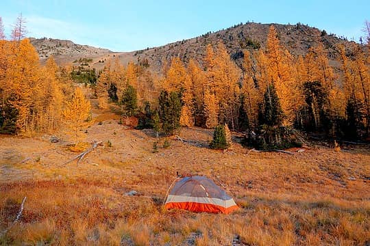
Morning golden light on our camp meadow 
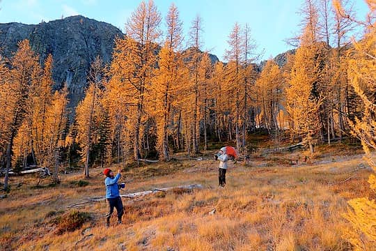
Taking photos in every direction 
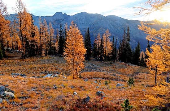
Heading toward the shady side of Sherman
To reach Sherman, we had to angle across the valley downward to about 6000 feet, then back uphill to the base of the major gully north of the summit. Our course was mostly determined by trying to avoid the thickest stand of fireweed, which was awkward to and filled the air with floating seed fluff. Our clothes looked like they were coated with sticky snow.
At the base of Sherman, we re-entered larches. They were scattered up the rock fields, looking like they were practically growing out of the rocks themselves. The route up Sherman lay back nicely. Even though the gully looked like endless loose rock, there were plenty of solid places to walk along the righthand edge, with only a few brief bits of steeper scrambling.
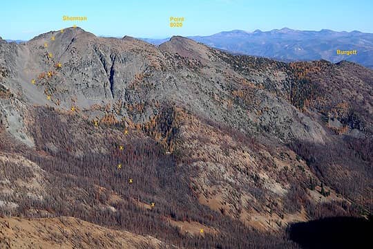
Sherman route, viewed yesterday from Sunrise 
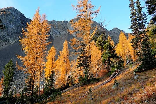
More variety of larches in morning sun 
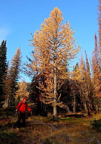
Hiking down past the last lighted tree into the shadows and burns 
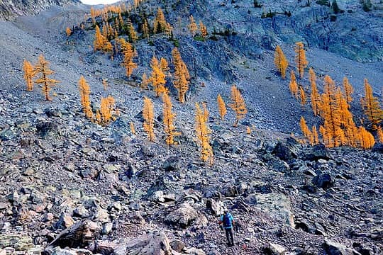
Larches growing among fields of rocks 
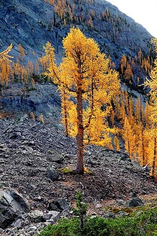
A big larch catching light in front of the shadowed ridge
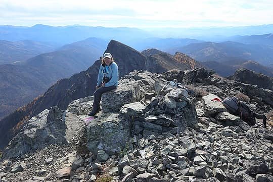
Sherman's summit register was surprisingly full, dating back to 2000. However, the first page held an interesting tale. It's a Mountaineers register, but the second entry relates that they found it on Point 8020 and moved it to the summit. Apparently the first party was on the wrong high point. There were also many ascents from Copper Glance Lake. Does anyone know the route for crossing the steep east side of Isabella Ridge from there?
Don on the summit 
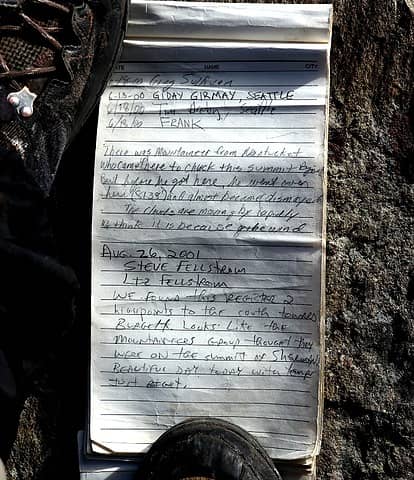
Sherman summit register 
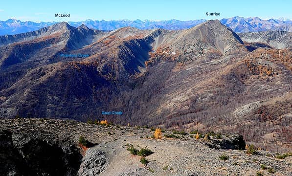
Looking back west at Sunrise and our approach 
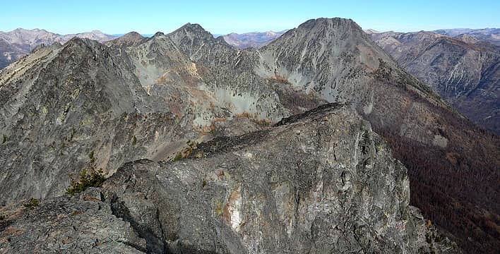
Looking north to the Craggies 
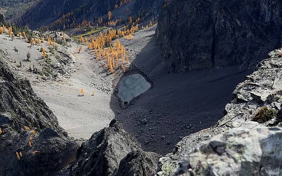
Looking east straight down 1600 feet, to a tarn full of clouds below us. Cloud reflections streamed across the tarns like a video display. 
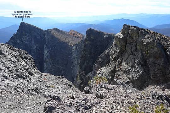
Looking south along our exit, with steep east faces of the ridge
Sherman to trailhead via Sweetgrass Ridge
We followed the ridge southward past several other high points, occasionally having to drop westward to get around cliffy edges. There was some annoying talus to traverse a5ound Point 8020, but after that we could just run down the crest on good bits of meadow or packed dirt. Point 7461 had more nice larches and a good food break. After Burgett, there was a beaten trail much of the time and a wider meadowy crest to follow.
To avoid the burn, we stayed on the crest till the last drainage before the trailhead. Lower in the descent, we encountered several groups of grazing cows, and we used their paths to avoid the denser stands of fireweed, arriving almost exactly at the trailhead. I've followed goat paths up a summit before, but this is the first time I've followed cow paths down a ridge.
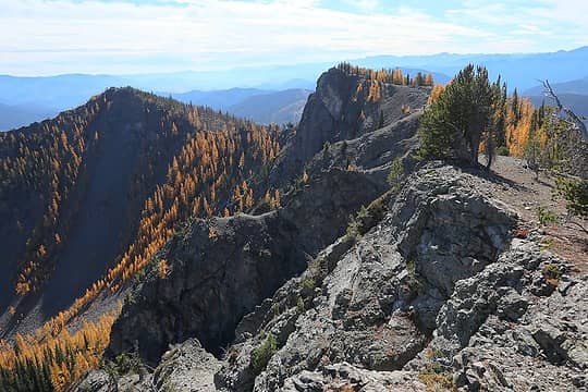
Following the crest south toward Point 7461 and Burgett. 
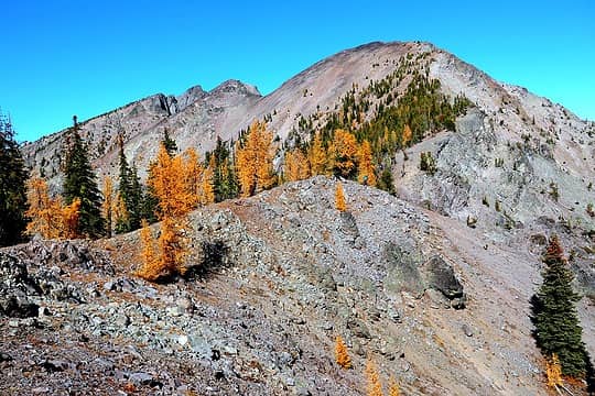
Bright blue dot of Don with Isabella Ridge behind. 
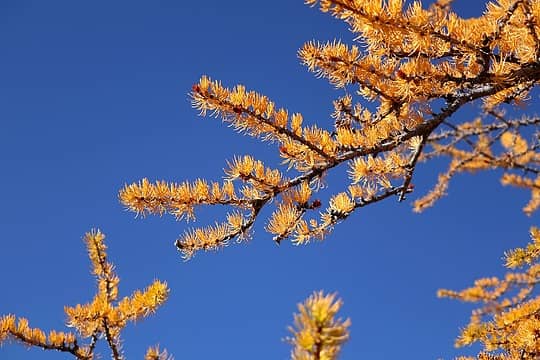
Golden needles in the sky
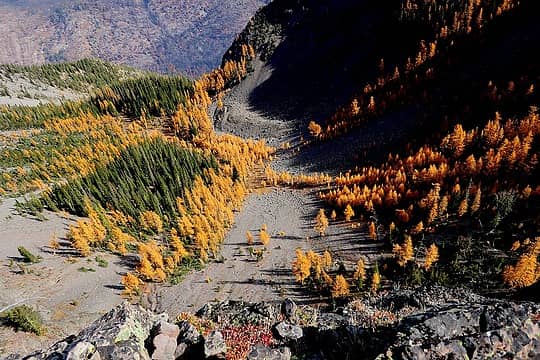
 Interesting view of a basin below – you can see how glaciers, avalanches, terrain, and orientation have shaped the lines and groves of trees. 
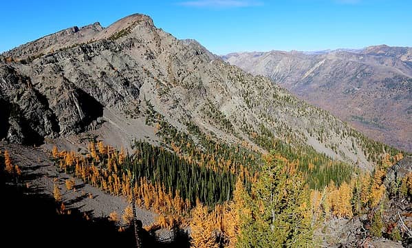
Looking back from Burgett 
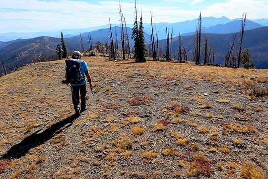
Hiking down the easy crest 
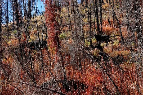
Cows amid the fireweed
A few other interesting map layers:
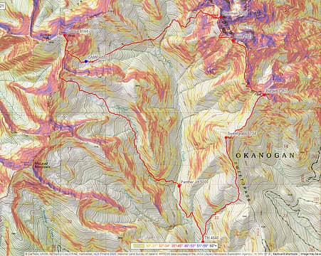
Slope angle shading, showing how the routes neatly thread through least steep terrain around the peaks 
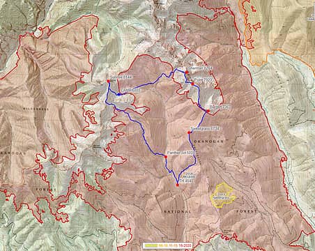
Fire history, McLeod fire bracketed whole area, but spared highest larch basins
“As beacons mountains burned at evening.” J.R.R. Tolkien
Prosit, Gimpilator, rubywrangler, reststep, neek, RichP awilsondc
“As beacons mountains burned at evening.” J.R.R. Tolkien
Prosit, Gimpilator, rubywrangler, reststep, neek, RichP awilsondc
|