| Previous :: Next Topic |
| Author |
Message |
cascadetraverser
Member


Joined: 16 Sep 2007
Posts: 1407 | TRs | Pics
|
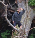
Carne Mountain-Phelps Ridge High route (9/7-9/11/2021)
After several fun but not terribly adventurous fall and winter trips (I guess if keeping an active fire going in pouring rain is an adventure, then I should speak otherwise) my hiking buddies Eugene and Bret (aka Route Loser) had planned a September traverse for quite a while. Unfortunately, I had suffered all summer from a sore knee and it had significantly hampered a traverse attempt earlier in July; in addition, Eugene was nursing a sore knee from a leg pivot on soft snow that didn`t go well and Bret had a very sore foot after an 20 mile reconnaissence trip the week before. We had planned big (hopefully that trip will happen in the next 1-2 years) but had to scale back. After some minimal hand ringing, we ultimately settled on a less strenuous Glacier Peak trip.
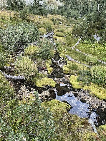
Day one: After a leisurely start we arrived at the Phelps creek trailhead to a relative minimal number of cars (hordes on return) and I was pleased at my sub 40 pound pack (for a 6 day trip) at the start (kudos to Bret and Eugene for all their advice to make this happen). After the turnoff, we made pretty quick work to the first basin. Lovely spot with a cool visibly emerging spring and creek running off from it. Nice clear skies and an early bedtime as we were all weary (me for sure) from all the stresses and long hours of civilized life.
 GPW trip 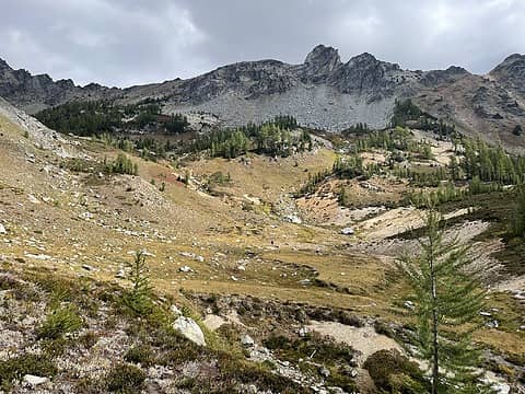 GPW trip 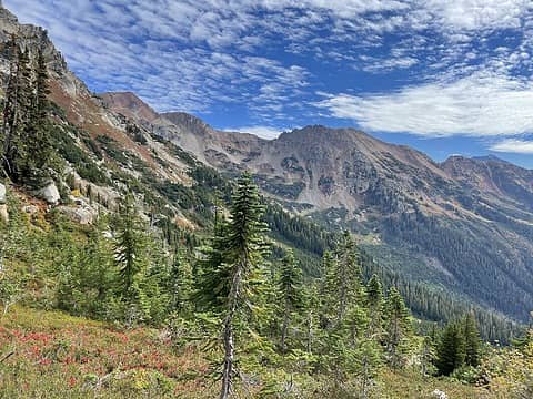 GPW trip  GPW trip 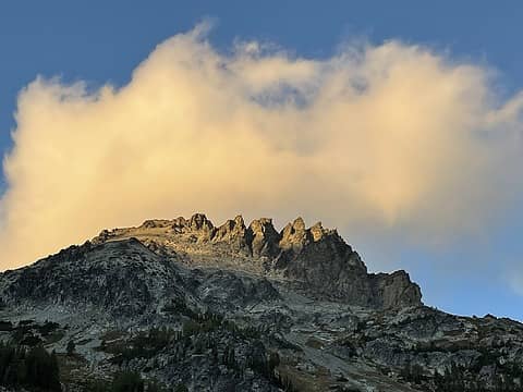 GPW trip 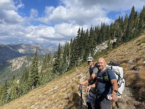 GPW trip 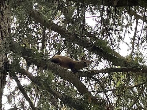 GPW trip 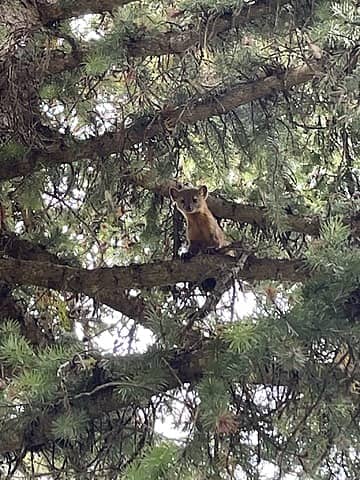 GPW trip
 jaysway, geyer, Brushbuffalo, fourteen410, Nancyann, contour5, HitTheTrail, rubywrangler, RichP, Pef jaysway, geyer, Brushbuffalo, fourteen410, Nancyann, contour5, HitTheTrail, rubywrangler, RichP, Pef
jaysway, geyer, Brushbuffalo, fourteen410, Nancyann, contour5, HitTheTrail, rubywrangler, RichP, Pef |
| Back to top |
  
|
|
Route Loser
Member
Joined: 24 Jul 2012
Posts: 199 | TRs | Pics
Location: Whidbey Island |
Marc, great report! You are not supposed to tell people that I prefer a cross-country route over a perfectly good trail. I will have no partners.
Great trip. Can't imagine two better guys to get stuck with under a tarp or in a tent, or on a magnificent alpine ramble.
geyer, RichP
geyer, RichP |
| Back to top |
|
|
HitTheTrail
Member

Joined: 30 Oct 2007
Posts: 5460 | TRs | Pics
Location: 509 |
This is a rather unique trip as high routes go, I have not heard of this particular traverse. Thanks for posting.  My hiking buddy Steve's main hobby in life is researching and hiking/exploring old sheep driveways. I have a short day hike planned with him tomorrow and I am sure this TR will be our main topic of discussion.
Also, since I like basins as much or more than peaks, I have been mentally planning a trip up the Chiwawa to the basin below Fortress/Chiwawa/Red for a long time. This may be the boost I need to get me off my butt and do it next summer. My hiking buddy Steve's main hobby in life is researching and hiking/exploring old sheep driveways. I have a short day hike planned with him tomorrow and I am sure this TR will be our main topic of discussion.
Also, since I like basins as much or more than peaks, I have been mentally planning a trip up the Chiwawa to the basin below Fortress/Chiwawa/Red for a long time. This may be the boost I need to get me off my butt and do it next summer.
|
| Back to top |
|
|
timberghost
Member

Joined: 06 Dec 2011
Posts: 1332 | TRs | Pics
|
|
| Back to top |
|
|
Nancyann
Member
Joined: 28 Jul 2013
Posts: 2319 | TRs | Pics
Location: Sultan Basin |
|
Nancyann
Member
|
 Tue Oct 26, 2021 8:17 pm |
|
|
Beautiful area to spend five days in!
Good choice to not go down from Massie with a swollen knee. 
|
| Back to top |
|
|
cascadetraverser
Member
Joined: 16 Sep 2007
Posts: 1407 | TRs | Pics
|
Thanks RouteLoser! Whatever your NWHIKERS name is, I am happy to follow you and your route finding skills into the deep wilderness anytime 😀
GOAG, you and Steve would love this trip. A fun, challenging but not over the top in difficulty. Dont hesitate to PM me or RL with any Beta questions but its pretty straightforward and I bet you wouldnt have any problems with it
.
Nancyann, gotta make it over to Massie Lake someday, but a tiptop knee for that decent will be a must.
Prosit, a horticulturist he is indeed. He is not too bad up in the high country either but I guess there are plants up there too!
|
| Back to top |
|
|
HitTheTrail
Member
Joined: 30 Oct 2007
Posts: 5460 | TRs | Pics
Location: 509 |
I met Steve for our hike today, he said he knew about that sheep drive route and had hiked parts of it but not the whole thing. He doesn't always follow NWhikers very close and had not read your TR because he didn't know it was about a sheep route, but he will read it now. And we both may be interested in some beta for future reference.
|
| Back to top |
|
|
raising3hikers
Member
Joined: 21 Sep 2007
Posts: 2344 | TRs | Pics
Location: Edmonds, Wa |
Looks like you guys had a good time in a very nice place.
|
| Back to top |
|
|
|
|
You cannot post new topics in this forum
You cannot reply to topics in this forum
You cannot edit your posts in this forum
You cannot delete your posts in this forum
You cannot vote in polls in this forum
|
Disclosure: As an Amazon Associate NWHikers.net earns from qualifying purchases when you use our link(s). |


