| Previous :: Next Topic |
| Author |
Message |
rubywrangler
Member


Joined: 04 Aug 2015
Posts: 511 | TRs | Pics
|
On Thanksgiving morning Julia and I met at the Grand Canyon for the second time this year. Back in early May we met on the north rim for 5 days on the Thunder River-Deer Creek loop. (Since John Morrow had just reported on this route, I didnt post it.) This time we met on the south rim for a 5-day loop on the Tanner trail, Escalante Route, and New Hance Trail, with a side trip to the confluence of the Colorado & Little Colorado Rivers. Luckily we were able to get permits just a couple weeks in advance, in spite of some faxing mishaps. The whole thing was completely spectacular. And Julia is a canyon fanatic, so she peppered me with interesting tidbits about routes and side canyons and geology and history along the way.
*Day 1 Lipan point to Palisades Beach camp*
After stashing a car near the New Hance trail, we dropped into the canyon on the Tanner trail from Lipan point. It was nearly freezing on the south rim and we were happy to get out of the wind. The wind died down some and temperatures went up as we descended on the Tanner trail. We passed just a handful of folks on the trail and at Tanner rapids camp. After a break, we continued upstream on the Beamer trail for another 3 miles to Palisades creek, passing a couple other creeks with campsites (all empty) along the way... I took a wrong turn onto a blocked off trail and led us up to an eroded goat trail along cliffs above the river (noticed the rocks blocking the trail on the way back). We had the whole Palisades area to ourselves and camped on the beach, which offered the only wind protection. I had dehydrated a whole thanksgiving dinner for this trip (turkey, stuffing, mashed potatoes, green bean casserole, gravy, cranberry sauce) which I rehydrated and then promptly flipped upside down on the beach. Mmmm, sand. At least the pumpkin pie was unscathed. The wine and sound of the rapids totally knocked us out - we were asleep by 8pm.
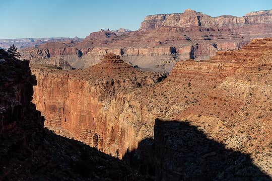 tanner trail views 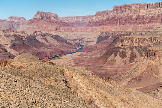 tanner trail views 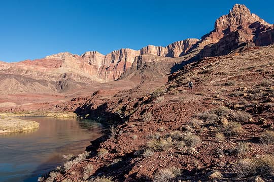 julia on the beamer 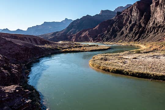 beamer trail views downstream 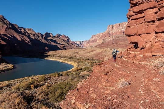 julia on the goat trail above the beamer trail - oops 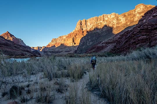 on the beamer trail, near espejo or comanche creek 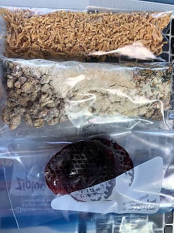 dehydrated thanksgiving 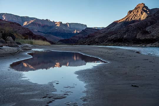 view downstream from palisades beach 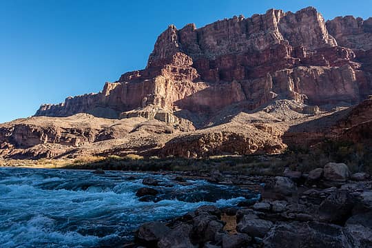 beamer trail continues up the fan on the left and around the cliff 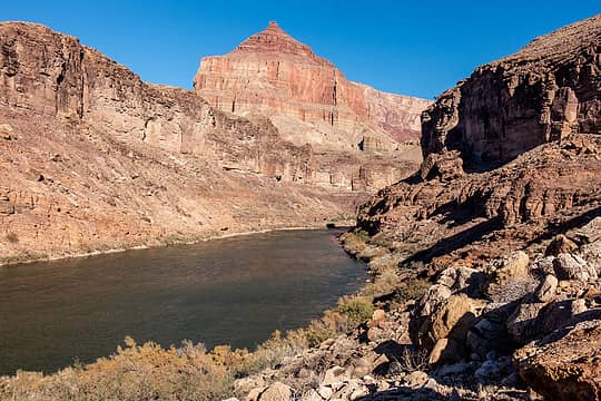 beamer trail views upstream 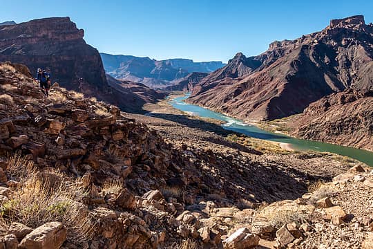 julia on the beamer trail, looking downstream 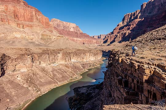 julia on the beamer 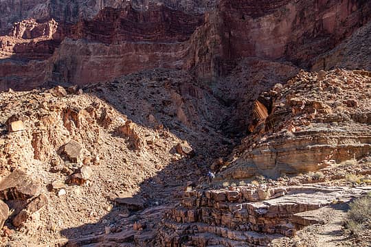 julia on the beamer 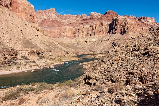 confluence ahead 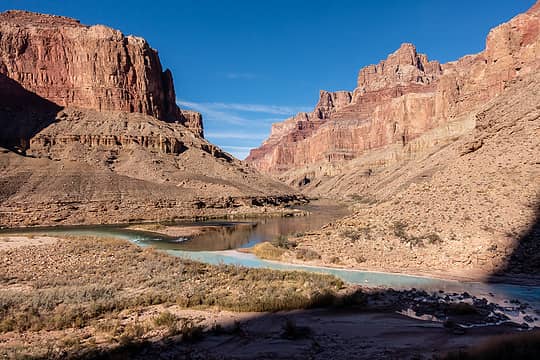 LCR confluence 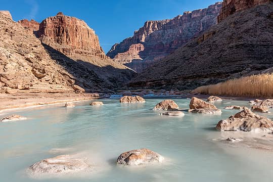 LCR upstream view 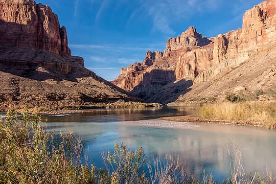 LCR confluence 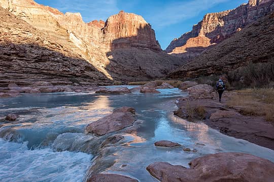 LCR upstream view + julia 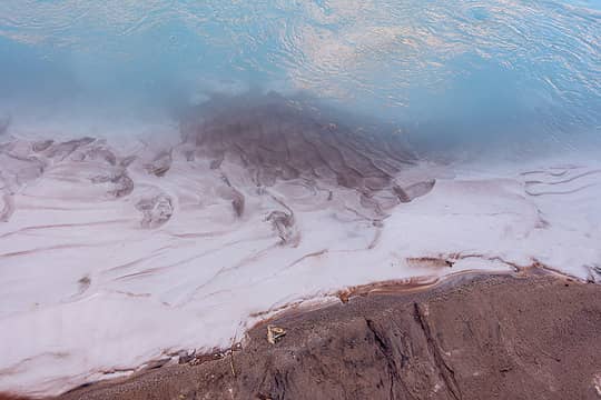 LCR 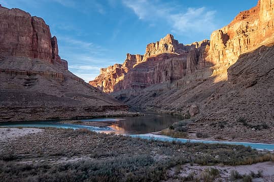 LCR confluence 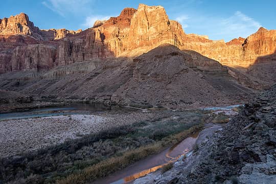 leaving the confluence 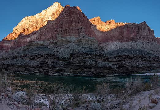 chuar butte 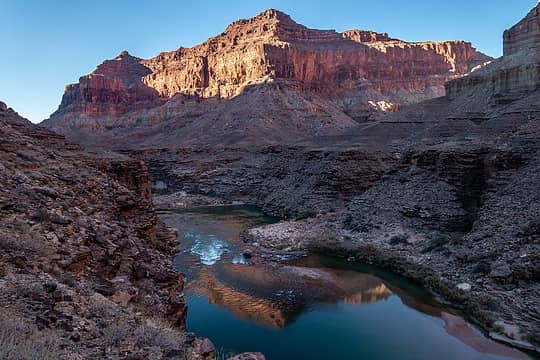 temple butte + rapids reflection 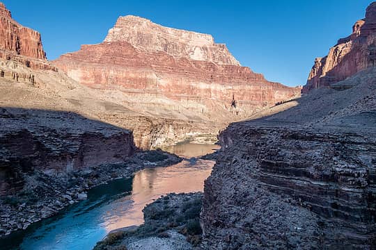 morning view upstream to chuar butte 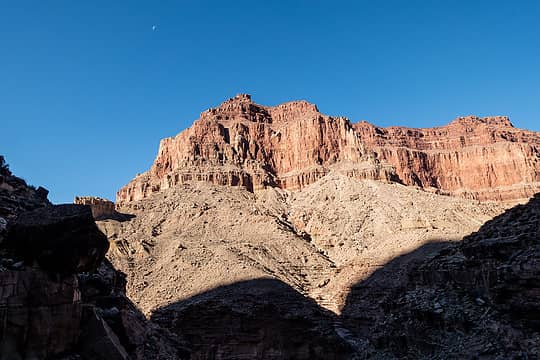 temple butte + moon 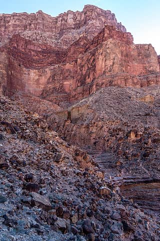 beamer trail side canyon 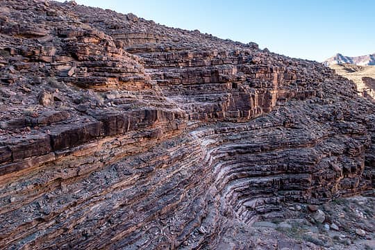 beamer trail 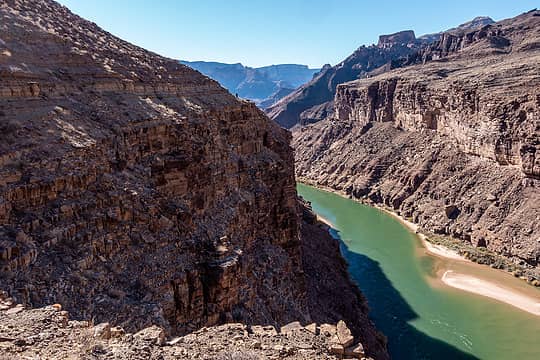 julia on a high section of the beamer 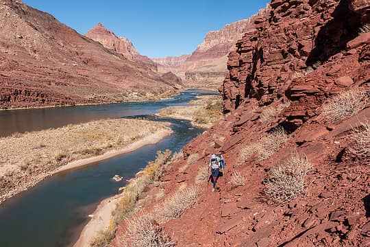 back on the goat trail 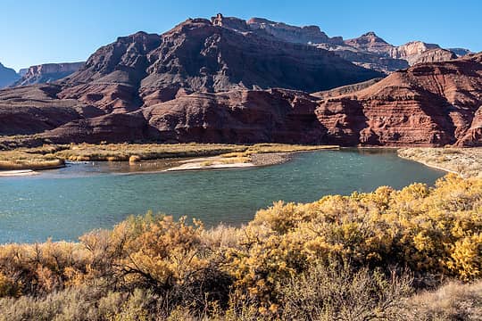 beamer trail view 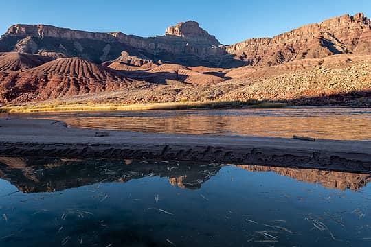 basalt cliffs and apollo temple from cardenas beach 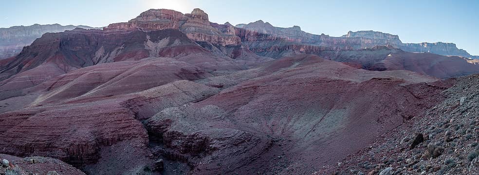 morning views on the escalante route 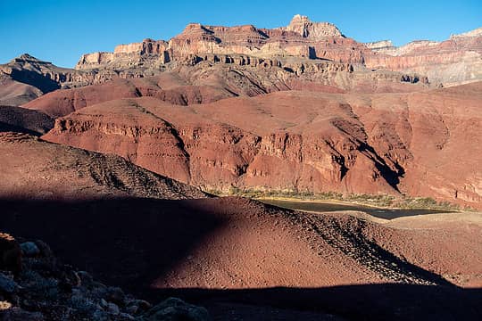 morning views on the escalante route 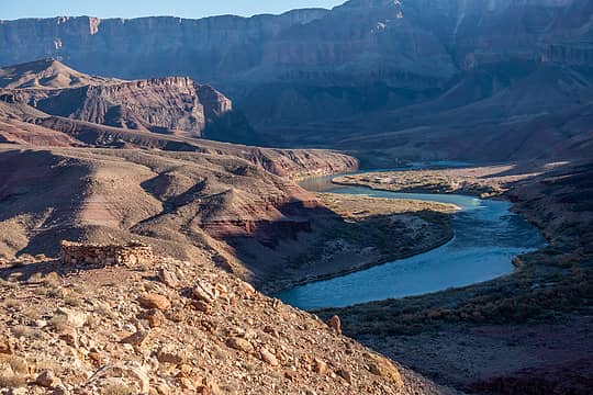 hilltop ruin + upstream view 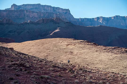 julia on the escalante route 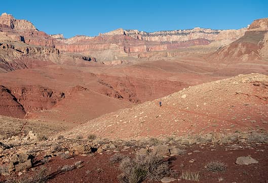 julia on the escalante route 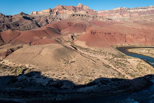 unkar delta + apollo temple 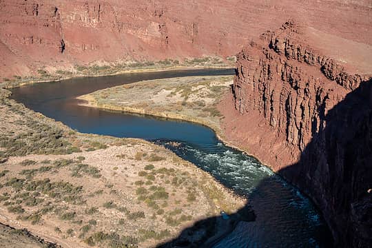 unkar rapid 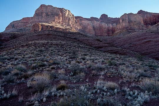 morning views on the escalante route 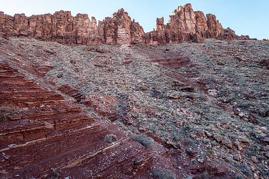 morning views on the escalante route 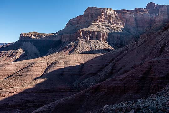 morning views on the escalante route 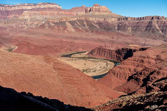 apollo temple + unkar delta 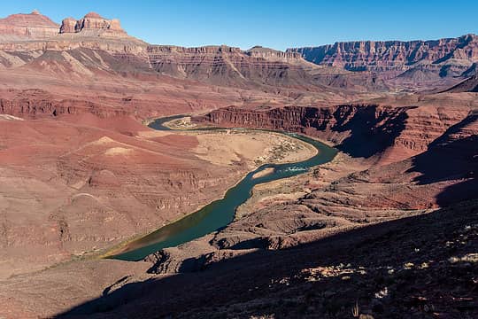 looking upstream at unkar delta from escalante route 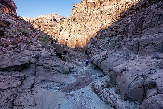 escalante canyon 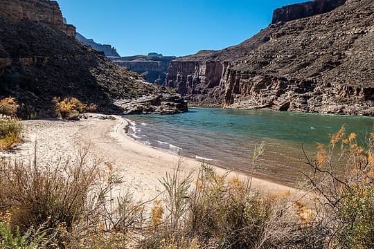 escalante beach 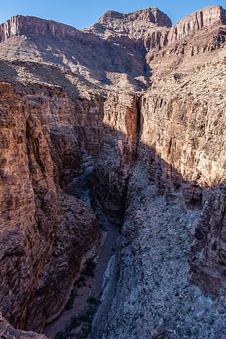 75 mile canyon 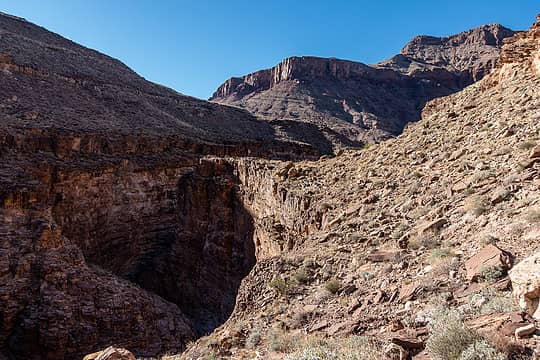 julia checking out 75 mile canyon 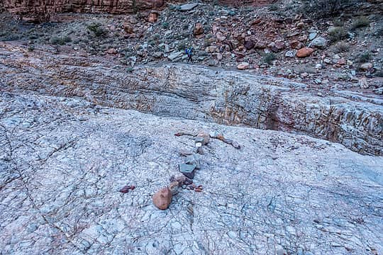 go down here 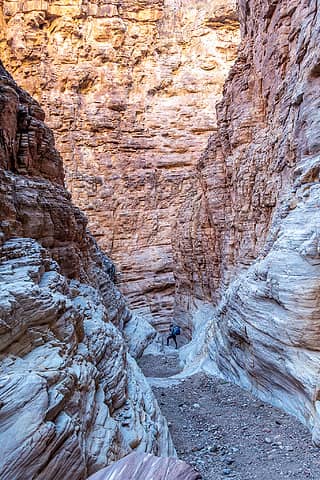 75 mile canyon 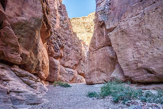 75 mile canyon 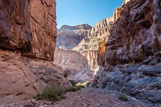 75 mile canyon 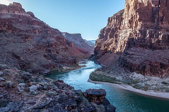 looking downstream on the escalante route 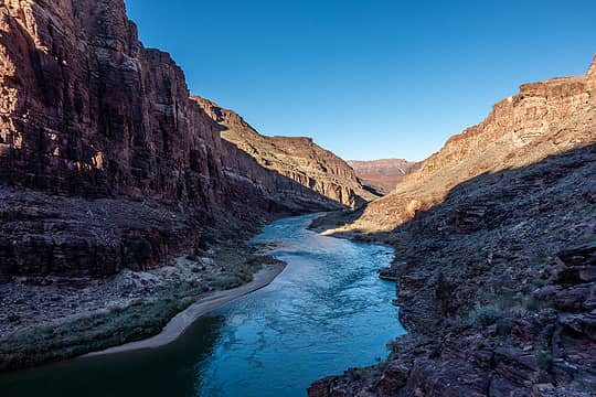 looking upstream on the escalante route 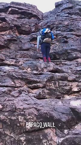 climbing the papago wall 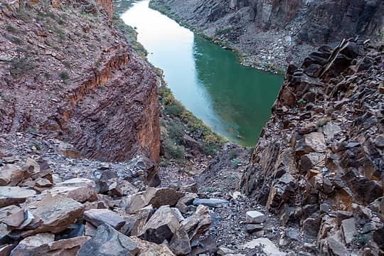 looking down the papago slide of death 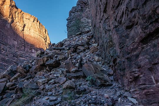 looking back up the papago slide of death 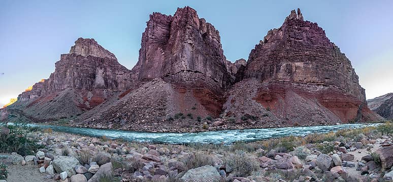 ?, sheba temple, solomon temple from hance rapids camp 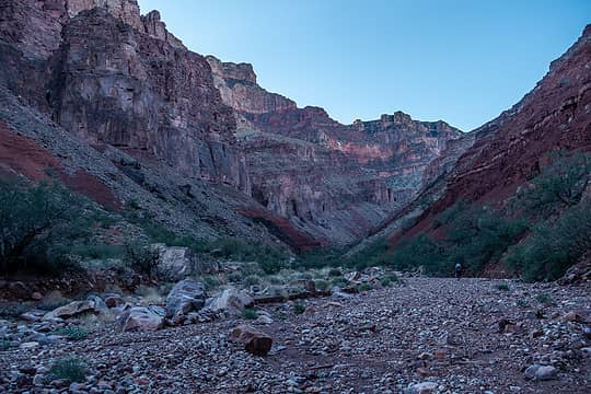 morning in red canyon 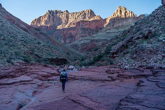 morning in red canyon 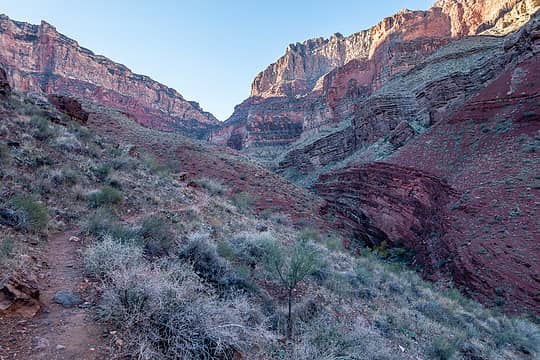 climbing on the new hance trail 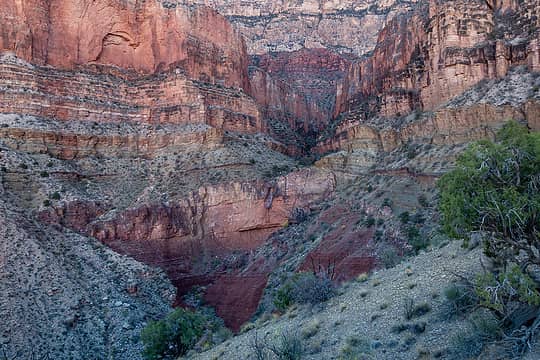 pretty side canyon 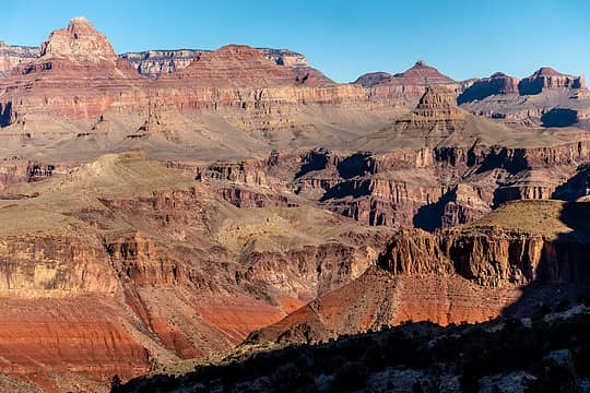 new hance trail view 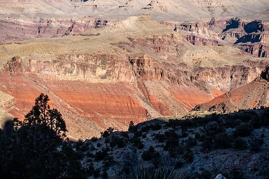 hakatai shale 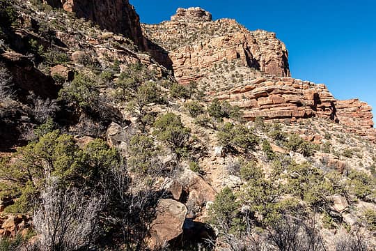 climbing on the new hance trail 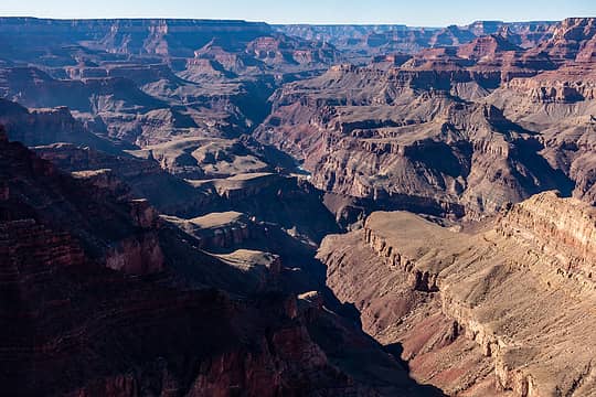 75 mile canyon from lipan point 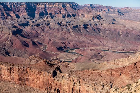 ridge above escalante ck (left) to cardenas area (right) from lipan point. unkar delta center 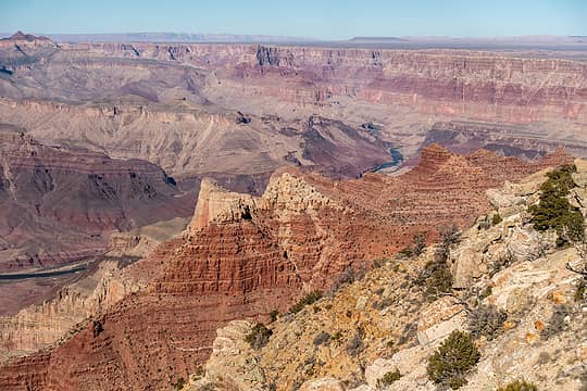 view looking upstream from tanner to palisades and beyond from lipan point, escalante butte & cardenas butte in the middle
 Prosit, RAW-dad, jaysway, raising3hikers, reststep, Gabep, Sculpin, RichP, puzzlr, half fast, Hesman Prosit, RAW-dad, jaysway, raising3hikers, reststep, Gabep, Sculpin, RichP, puzzlr, half fast, Hesman  Lindsay, kite Lindsay, kite  Walkin' Fool, awilsondc Walkin' Fool, awilsondc
Prosit, RAW-dad, jaysway, raising3hikers, reststep, Gabep, Sculpin, RichP, puzzlr, half fast, Hesman Lindsay, kite Walkin' Fool, awilsondc |
| Back to top |
  
|
|
zephyr
aka friendly hiker

Joined: 21 Jun 2009
Posts: 3370 | TRs | Pics
Location: West Seattle |
|
zephyr
aka friendly hiker
|
 Mon Dec 06, 2021 9:35 pm |
|
|
| rubywrangler wrote: | LCR upstream view |
Great trip and photos. So sorry about your Thanksgiving dinner mishap. You had gone to a lot of trouble to prepare and then transport it.
Re: the photo above. Normally I am not a fan of turbid water. But something about this particular batch is interesting and even inviting. Maybe it's the combo of the turquoise water and the white sand framed by the orangey sandstone and blue sky. It's beautiful. ~z
|
| Back to top |
|
|
Nancyann
Member

Joined: 28 Jul 2013
Posts: 2318 | TRs | Pics
Location: Sultan Basin |
|
Nancyann
Member
|
Mon Dec 06, 2021 11:57 pm |
|
|
What a wonderful trip! Thanks for the write-up and so many gorgeous and alluring photos. What a great idea to dehydrate your Thanksgiving dinner, despite the spill a unique and memorable way to celebrate the day. 
|
| Back to top |
|
|
geyer
Member

Joined: 23 May 2017
Posts: 463 | TRs | Pics
Location: Seattle |
|
geyer
Member
|
Tue Dec 07, 2021 9:12 am |
|
|
| rubywrangler wrote: | LCR upstream view + julia |
 Holy moly! I didn't realize rivers like that were a thing in Arizona
I bet your sandy dehydrated thanksgiving dinner still tasted better than canned chef boyardee mac n cheese which was unfortunately my meal of choice... Holy moly! I didn't realize rivers like that were a thing in Arizona
I bet your sandy dehydrated thanksgiving dinner still tasted better than canned chef boyardee mac n cheese which was unfortunately my meal of choice...
|
| Back to top |
|
|
Eric Hansen
Member
Joined: 23 Mar 2015
Posts: 866 | TRs | Pics
Location: Wisconsin |
Thanks Megan, great report and pictures.
"possibly the start of a new thanksgiving tradition!"
I hear ya. Back in the day friends and I would have an annual reunion trip there at Thanksgiving (hiking in to Cottonwood CG). It was a great tradition.
|
| Back to top |
|
|
Stefan
Member

Joined: 17 Dec 2001
Posts: 5092 | TRs | Pics
|
|
Stefan
Member
|
Tue Dec 07, 2021 10:18 am |
|
|
cool on the preparations for Thanksgiving!
Does anybody know if they are still planning on building a gondola down to the Havasu Canyon?
I guess they wanted it to the Little Colorado....
|
| Back to top |
|
|
Eric Hansen
Member
Joined: 23 Mar 2015
Posts: 866 | TRs | Pics
Location: Wisconsin |
|
| Back to top |
|
|
Stefan
Member
Joined: 17 Dec 2001
Posts: 5092 | TRs | Pics
|
|
Stefan
Member
|
Tue Dec 07, 2021 1:05 pm |
|
|
That is positive note to hear! Great pictures Rubywrangler!
|
| Back to top |
|
|
rubywrangler
Member
Joined: 04 Aug 2015
Posts: 511 | TRs | Pics
|
Thanks, everybody! I was able to salvage the thanksgiving dinner. It just had a little extra crunch 
|
| Back to top |
|
|
jaysway
Member

Joined: 16 Jul 2020
Posts: 347 | TRs | Pics
|
|
jaysway
Member
|
Wed Dec 08, 2021 1:15 pm |
|
|
What a great trip and beautiful photos! Added to the bucket list .
|
| Back to top |
|
|
nickmtn
Member
Joined: 04 Jun 2014
Posts: 105 | TRs | Pics
Location: Kirkland, wa |
|
nickmtn
Member
|
Wed Dec 08, 2021 3:34 pm |
|
|
Awesome! Thanks for the shout out wrangler - so glad you did this one.
That Papago death slide is still one of the sketchiest boulder fields I have ever been on. I remember being all hyped up for the wall (which ended up being trivial) but totally terrified of the slide - which the route description did not mention what so ever. I did the route in the opposite direction - doesn't sound like it makes too much difference.
How about all that crazy yellow and purple rock in 75 mile canyon??
|
| Back to top |
|
|
Gil
Member

Joined: 29 Sep 2004
Posts: 4062 | TRs | Pics
|
|
Gil
Member
|
Fri Dec 10, 2021 6:29 pm |
|
|
Cool trip! Our kids did a trip into the canyon a couple of years ago over Thanksgiving, eventually crossing the river four times, twice by packraft. Our daughter will be the park's artist in residence next fall.
Friends help the miles go easier.
Klahini
rubywrangler
Friends help the miles go easier.
Klahini
rubywrangler
|
| Back to top |
|
|
|
|
You cannot post new topics in this forum
You cannot reply to topics in this forum
You cannot edit your posts in this forum
You cannot delete your posts in this forum
You cannot vote in polls in this forum
|
Disclosure: As an Amazon Associate NWHikers.net earns from qualifying purchases when you use our link(s). |


