| Previous :: Next Topic |
| Author |
Message |
catsp
Member

Joined: 15 Jun 2017
Posts: 224 | TRs | Pics
|
|
catsp
Member
|
 Sun Mar 13, 2022 2:03 pm |
|
|
 Brucester, Fedor, Pef, fourteen410, runup, RichP Brucester, Fedor, Pef, fourteen410, runup, RichP
Brucester, Fedor, Pef, fourteen410, runup, RichP |
| Back to top |
  
|
|
whitebark
Member

Joined: 08 Jul 2005
Posts: 1864 | TRs | Pics
Location: Seattle |
Nice pictures from a quiet part of the I-90 corridor! There's a fun and direct alternative route to Greenway that follows the NE ridge (yellow line on the map below). Midway along the ridge you pass a big rock formation I call "Cheops".
Fedor, catsp
Fedor, catsp |
| Back to top |
|
|
Redwic
Unlisted Free Agent

Joined: 23 Feb 2009
Posts: 3292 | TRs | Pics
Location: Going to the Prom(inence) |
|
Redwic
Unlisted Free Agent
|
Tue Mar 15, 2022 6:19 am |
|
|
60 pounds lighter but not 60 points brighter.
|
| Back to top |
|
|
catsp
Member
Joined: 15 Jun 2017
Posts: 224 | TRs | Pics
|
|
catsp
Member
|
Tue Mar 15, 2022 8:07 am |
|
|
Parking is at Exit 38 Olallie State Park and the trail starts at a gate across the road. The only real unavoidable brush was a 1/4 mile section of the Hall Creek Trail, where the many fallen trees made the trail unnavigable for a bit.
Fedor
Fedor |
| Back to top |
|
|
neek
Member

Joined: 12 Sep 2011
Posts: 2337 | TRs | Pics
Location: Seattle, WA |
|
neek
Member
|
Tue Mar 15, 2022 9:12 am |
|
|
I didn't know you hiked! Looks like a nice winter option, although the map shows the area around 4370 within the cedar river watershed.
|
| Back to top |
|
|
catsp
Member
Joined: 15 Jun 2017
Posts: 224 | TRs | Pics
|
|
catsp
Member
|
Tue Mar 15, 2022 10:58 am |
|
|
| neek wrote: | | although the map shows the area around 4370 within the cedar river watershed. |
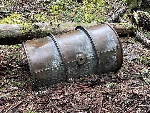
The map app I was using at the time doesn't show the CRW boundaries. So the first notice I had was the remains of an old plastic document holder stapled to a tree at the top of Point 4370, which I recognized as a boundary marker. I stayed to the good side of that.
|
| Back to top |
|
|
Fedor
Member
Joined: 06 May 2009
Posts: 126 | TRs | Pics
|
|
Fedor
Member
|
Fri Mar 18, 2022 9:18 pm |
|
|
| catsup wrote: | | the only real unavoidable brush was a 1/4 mile section of the Hall Creek Trail, where there were so many fallen trees the trail was unnavigable for a bit. |
I got lost two weeks ago descending that trail just after crossing the creek. I hiked the Change Creek Trail to Songbird Peak and then Greenway. It was my first time in that area other than Mt. Washington. I was really impressed with it. Looking forward to further explorations.
|
| Back to top |
|
|
Fedor
Member
Joined: 06 May 2009
Posts: 126 | TRs | Pics
|
|
Fedor
Member
|
Mon Apr 18, 2022 12:09 am |
|
|
Catsp, were you aware that Zig-Zag, Hall Creek, Change Creek and Machu Pichu Trails are un-official, un-endorsed, built by rogue trail builders and maintained by users?
|
| Back to top |
|
|
Fedor
Member
Joined: 06 May 2009
Posts: 126 | TRs | Pics
|
|
Fedor
Member
|
Mon Apr 18, 2022 6:11 pm |
|
|
I really enjoy whitebark's trip reports, and I think you're absolutely right, he clearly has much more knowledge of those trails and area in general. I saw your trip report and was curious if you were aware. You must have recognized my dog from WTA. I hope you truly don't mind me junking up your thread. I doubt that anyone else does.
|
| Back to top |
|
|
|
|


