| Previous :: Next Topic |
| Author |
Message |
Kim Brown
Member


Joined: 13 Jul 2009
Posts: 6899 | TRs | Pics
|
We knew it'd come to this, and so here we are:
Pg 17 of the Scoping letter proposes decommissioning these trails. Other recreation enhancements might be cool; more beginner bike trails on North Mtn. Not sure creating official camping at Texas Pond and Twin Bridges is sustainable. It will probably all be wrecked in short order. But I guess they have to try something, given the entire project is for the benefit of fish.
"..living on the east side of the Sierra world be ideal - except for harsher winters and the chance of apocalyptic fires burning the whole area."
Bosterson, NWHiker's marketing expert
"..living on the east side of the Sierra world be ideal - except for harsher winters and the chance of apocalyptic fires burning the whole area."
Bosterson, NWHiker's marketing expert
|
| Back to top |
  
|
|
neek
Member

Joined: 12 Sep 2011
Posts: 2336 | TRs | Pics
Location: Seattle, WA |
|
neek
Member
|
 Fri Apr 22, 2022 12:47 pm |
|
|
| Quote: | | Trails proposed for decommissioning include Mount Higgins Trail #640, Myrtle Lake Trail #640.1, and Round Mountain Trail #664. None of these trails have received maintenance in several years and there are substantial access issues for trails #640, and #640.1 (access issues include a 4-mile private property road walk and both the trailhead and first 2/3 mile of the trail is located on Washington State Department of Natural Resources managed lands). |
What am I missing...#640 looks like just a 1.2 mi road section to DNR land after turning off C-Post Road.
|
| Back to top |
|
|
neek
Member
Joined: 12 Sep 2011
Posts: 2336 | TRs | Pics
Location: Seattle, WA |
|
neek
Member
|
Fri Apr 22, 2022 1:03 pm |
|
|
Sorry, I meant getting to the trailhead doesn't look a 4 mile walk through private property: 0.5 miles on C-Post, 1.2 miles on unnamed road through private property, another 1.1 on the road through DNR land. I guess 4 miles makes sense if they are talking round trip and counting the DNR section.
I haven't been on the trail but it's one I've been meaning to check out.
|
| Back to top |
|
|
Kim Brown
Member
Joined: 13 Jul 2009
Posts: 6899 | TRs | Pics
|
Yeah, I realized that and then deleted my post.  I haven't calculated it; the road-turned-trail has been a trail for a very long time, but perhaps they do count it as road.
I suppose it will always be doable if the private landowner gives access to feet and bicycles as he has been doing. The trail wasn't maintained anyway, so unless the landowner says nope, or the road is closed at 530 permanently, nothing's changed and it will still be doable until ma Nature renders it impossible.
I would like to get up there one last time at least. It's sublime.
I haven't calculated it; the road-turned-trail has been a trail for a very long time, but perhaps they do count it as road.
I suppose it will always be doable if the private landowner gives access to feet and bicycles as he has been doing. The trail wasn't maintained anyway, so unless the landowner says nope, or the road is closed at 530 permanently, nothing's changed and it will still be doable until ma Nature renders it impossible.
I would like to get up there one last time at least. It's sublime.
"..living on the east side of the Sierra world be ideal - except for harsher winters and the chance of apocalyptic fires burning the whole area."
Bosterson, NWHiker's marketing expert
"..living on the east side of the Sierra world be ideal - except for harsher winters and the chance of apocalyptic fires burning the whole area."
Bosterson, NWHiker's marketing expert
|
| Back to top |
|
|
Foist
Sultan of Sweat

Joined: 08 May 2006
Posts: 3974 | TRs | Pics
Location: Back! |
|
Foist
Sultan of Sweat
|
Fri Apr 22, 2022 2:28 pm |
|
|
Oh the private landowner allows it now? The Higgins trail used to be in the 100 hikes in Washington book. But then (before I ever had a chance to hike it) I read somewhere that a private landowner had stopped letting people pass through, so it was no longer possible.
|
| Back to top |
|
|
Kim Brown
Member
Joined: 13 Jul 2009
Posts: 6899 | TRs | Pics
|
Yeah the access issue is relatively recent (a decade or so..?).
But so far as I know, the guy had been letting bicyclists and hikers through after he closed the gate. I assume it is private land and DNR and USFS has had an easement for many years, and the guy doesn't like that arrangement any longer (there have been a lot of creepy skeevy people up there, I don't blame him).
"..living on the east side of the Sierra world be ideal - except for harsher winters and the chance of apocalyptic fires burning the whole area."
Bosterson, NWHiker's marketing expert
"..living on the east side of the Sierra world be ideal - except for harsher winters and the chance of apocalyptic fires burning the whole area."
Bosterson, NWHiker's marketing expert
|
| Back to top |
|
|
Foist
Sultan of Sweat
Joined: 08 May 2006
Posts: 3974 | TRs | Pics
Location: Back! |
|
Foist
Sultan of Sweat
|
Fri Apr 22, 2022 3:21 pm |
|
|
Oh, so before you could drive through his property to the real trailhead, and now you need to walk the road? Eh, I hate road-walks...
|
| Back to top |
|
|
Bramble_Scramble
Member
Joined: 28 Dec 2012
Posts: 312 | TRs | Pics
|
I hope by decommissioning they just mean pulling any signs and not actually ripping up tread. Seems like a waste of money that could be spent elsewhere. We need more trails not less. Round is already basically decommissioned. The trail is rough and difficult to follow and doesn't go to the top. I don't think very many people use it. Higgins has the road issues and a bad landslide to limit use.
 MultiUser MultiUser
MultiUser |
| Back to top |
|
|
Kim Brown
Member
Joined: 13 Jul 2009
Posts: 6899 | TRs | Pics
|
Oh, yes! You sure could. Started out on a decommissioned part of a DNR road that was logged to the USFS border. It was actually a quite nice road-walk. Then it was extended and it was a little longer, but these were made into trails; culverts removed, treadwork done. It was cool because you were walking in logged land, then as soon as you hit the USFS border, BAM! Old growth forest hit you in the face. The temperature was immediately cooler, birds all over the place, moss, lush - and roller-coaster, tipped old slick puncheon.
It's a beautiful forest walk. And the meadows - good lord, you'll never see so much marsh marigold in your life. Sweet place. I'm sorry to see it let go. We can comment to fight to keep it open, but I don't know that it will succeed. DNR isn't interested in patrolling (not enough LEO's, no money), the mudslide issue, USFS funding for it is non-existent, the private landowner access issue, and it's an attraction for ne'er-do-wells because it's remote.
"..living on the east side of the Sierra world be ideal - except for harsher winters and the chance of apocalyptic fires burning the whole area."
Bosterson, NWHiker's marketing expert
ChinookPass
"..living on the east side of the Sierra world be ideal - except for harsher winters and the chance of apocalyptic fires burning the whole area."
Bosterson, NWHiker's marketing expert
ChinookPass
|
| Back to top |
|
|
Kim Brown
Member
Joined: 13 Jul 2009
Posts: 6899 | TRs | Pics
|
| Bramble_Scramble wrote: | | I hope by decommissioning they just mean pulling any signs and not actually ripping up tread. |
Actually, they might put up a sign, saying "trail abandoned," which would be also a waste because jackasses keep shooting the signs there to the point they're blown to bits. Pretty much, most likely it will just be taken off the map, off the inventory, and .... gone. They already don't maintain it.
Unfortunate; it's a beautiful trail, and a lot of work was done in the late 1990's early 2000's* to the closed road portion to make it nice to walk on, and it was. And it did get a new trail head sign (didn't last long; shitheads shot it up so badly, it looked more like a used Brillo pad than a sign).
*I'm talking like this was very recent; means I'm getting old. Sheesh.
"..living on the east side of the Sierra world be ideal - except for harsher winters and the chance of apocalyptic fires burning the whole area."
Bosterson, NWHiker's marketing expert
"..living on the east side of the Sierra world be ideal - except for harsher winters and the chance of apocalyptic fires burning the whole area."
Bosterson, NWHiker's marketing expert
|
| Back to top |
|
|
Bramble_Scramble
Member
Joined: 28 Dec 2012
Posts: 312 | TRs | Pics
|
If that's the case it doesn't change much from the way things are now. I just got a little worried when I saw this.
| Quote: | | Decommissioning of system trails that are no longer needed at the forest, watershed, or project level removes these trails from the transportation inventory and stabilizes and restores disturbed areas to a more natural state. There are a wide range of treatment techniques available to decommission trails. Decommissioning can be as simple as physically blocking an entrance or as extensive as removing infrastructure, installing drainage/check dams, scarifying compacted tread, rock placement, transplanting, and the import of fill/debris. |
|
| Back to top |
|
|
Kim Brown
Member
Joined: 13 Jul 2009
Posts: 6899 | TRs | Pics
|
Definitions, schmefinitions. They have to put that in.
If they do anything more than place a sign - and even that would be more than anyone has done up there in years - I would be shocked. Shocked, I tell you.
And you're right. No, as I mentioned above, I think probably nothing will change. But there was always the hope ( though slight) the USFS and DNR would collaborate on access and the trail head.
"..living on the east side of the Sierra world be ideal - except for harsher winters and the chance of apocalyptic fires burning the whole area."
Bosterson, NWHiker's marketing expert
"..living on the east side of the Sierra world be ideal - except for harsher winters and the chance of apocalyptic fires burning the whole area."
Bosterson, NWHiker's marketing expert
|
| Back to top |
|
|
Bramble_Scramble
Member
Joined: 28 Dec 2012
Posts: 312 | TRs | Pics
|
I've been meaning to go up and do Higgins for years now. It's really too bad the access has been such an issue. There aren't too many trails in that area of that skill level/quality of trail.
It's too bad the trail up Round was never finished. It would be a great, short trip to a spot with an awesome view. A good shoulder season hike. The trail gets really close but doesn't quite make it. The off trail section isn't bad at all. Odd seeing some constructed trail through the boulder field after the official end of the trail. I wonder if it was considered for a lookout site but they chose Higgins instead?
Edit: https://www.discoverdarrington.com/recreation/hiking/round-mountain/
Discover Darrington claims there was some sort of fire lookout or AWS lookout. Eric Willhite has a page for Round but doesn't mention anything about a lookout. I can't remember if we found any debris up there.
|
| Back to top |
|
|
neek
Member
Joined: 12 Sep 2011
Posts: 2336 | TRs | Pics
Location: Seattle, WA |
|
neek
Member
|
Sat Apr 23, 2022 5:27 am |
|
|
| Bramble_Scramble wrote: | | It's too bad the trail up Round was never finished. It would be a great, short trip to a spot with an awesome view. A good shoulder season hike. The trail gets really close but doesn't quite make it. The off trail section isn't bad at all. |
Round is great in winter from the south.
|
| Back to top |
|
|
Sallie4jo
Member
Joined: 24 Jun 2009
Posts: 220 | TRs | Pics
Location: Seattle |
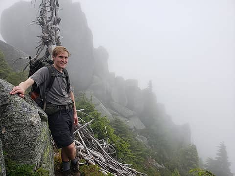
Always wanted to go back up to Higgins as the peak was one of great intrigues to me when I first really looked at it from the Boulder river trail. We had gone up when there was still snow in the meadow and the hike up to the top was quite icy I remember..as I remember how the wind sounded slapping against the rock. The rock platectonics from on top was just amazing to see up close. It was one of those trips one doesn't forget, I wanted to go back to the lake(s), but didn't get there b4 the road and private property stuff happened. I remember it being a great trail although the creek crossing could be quite challenging. AND..I am ok with decommissioning some roads/trails AS LONG AS LOGGING WILL NEVER BE PERMITTED. I really think we need to recognize that the fragmented forest lands have truly impacted the health of the forests, waterways and animals dependent upon wild spaces.
The good news..we can all continue to be wowed by mt Higgins beauty.
I choose to live in a landscape of hope.
Terry Tempest Williams
ChinookPass, Cyclopath
I choose to live in a landscape of hope.
Terry Tempest Williams
ChinookPass, Cyclopath
|
| Back to top |
|
|
|
|


