| Previous :: Next Topic |
| Author |
Message |
awilsondc
Member


Joined: 03 Apr 2016
Posts: 1324 | TRs | Pics
|
On Sunday, I got some much needed time in the mountains. I had tried Jolly Mountain in the Teanaway a few months ago, but turned around due to some bad blisters starting to form on my heels during the first mile or two. I stopped and put on heel pads, but it was no use, my mountaineering boots were killing my heels so I bailed. Interestingly enough, I wore those same boots almost the entire time on this trip with no problems at all. Go figure. But, I'm getting ahead of myself. On Saturday night I drove up to the trailhead and slept in my car. It was supposed to be mostly clear skies, but still most sunrise forecast sites predicted a terrible sunrise. I was feeling a little desperate for a good sunrise, it's been so long and conditions just haven't worked out for me this year, so I set my alarm for 1:30 anyway and went to sleep. Well 1:30 came pretty early and despite feeling awake enough to get a move on, decided to trust the forecast and get a couple hours extra sleep. This turned out to be the right call (sunrise was indeed terrible) and I was grateful for the extra sleep. I was up and hiking by 4:23am.
I started out in trail runners, hoping things would be melted out enough to hike a few hours before hitting consistent snow. Things were not melted out. The road was melted out in patches, but still mostly snowy and about 30-45 minutes in I stopped to put on my mountaineering boots and shortly later snowshoes. I left the road and snowshoed uphill through the forest for awhile aiming to meet up with a couple GPS tracks I was following. Soon I encountered an old snowmobile track heading in the direction I wanted to go. The compact snowmobile track provided a nice supportive crust and made the snowshoeing pretty easy. I followed it almost all the way to Peak 6086. The sun rose in the most boring manner possible, devoid of any color whatsoever and I was glad I didn't get up early. The sunrise gave way to a beautiful morning and the warmth of the sun was pure nourishment for what was ailing me. The views up high were better than expected. Lemah, Chimney Rock, and Bears Breast to the northwest, Stuart and co to the northeast, even Rainier was out and my spirits were lifted. I soon found myself on my first of six peaks for the day, 6086. The views were good, but I didn't linger and was soon off for Jolly. At this point the supportive crust of the snowmobile track was a thing of the past, and I would be breaking trail the rest of the way. It was a bit of extra work getting up to Jolly, but not that bad. I think it took me around 4 hours from the car to reach Jolly. Great views from up there! Again, I didn't linger too long and soon began my way to Humerus Hill.
 Dawn  Illumination 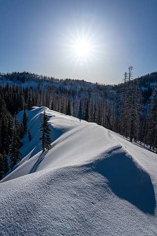 Sun up 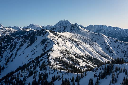 The Louve and Stuart 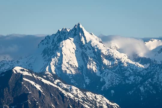 Bear's Breast 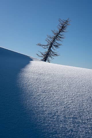 Shadow play 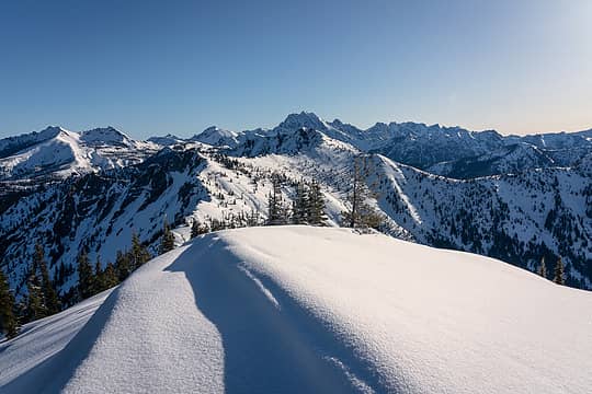 6086 summit view 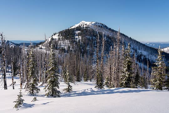 Jolly Mountain 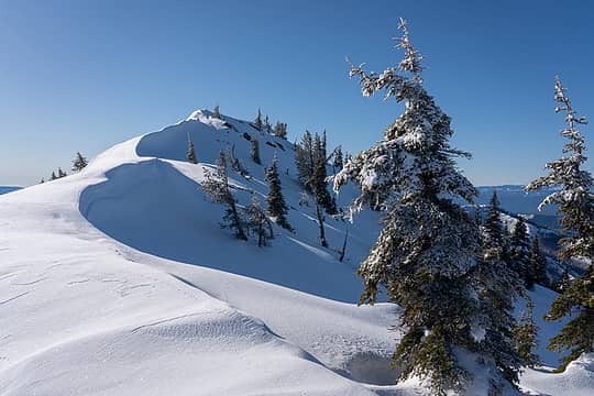 Jolly's summit block 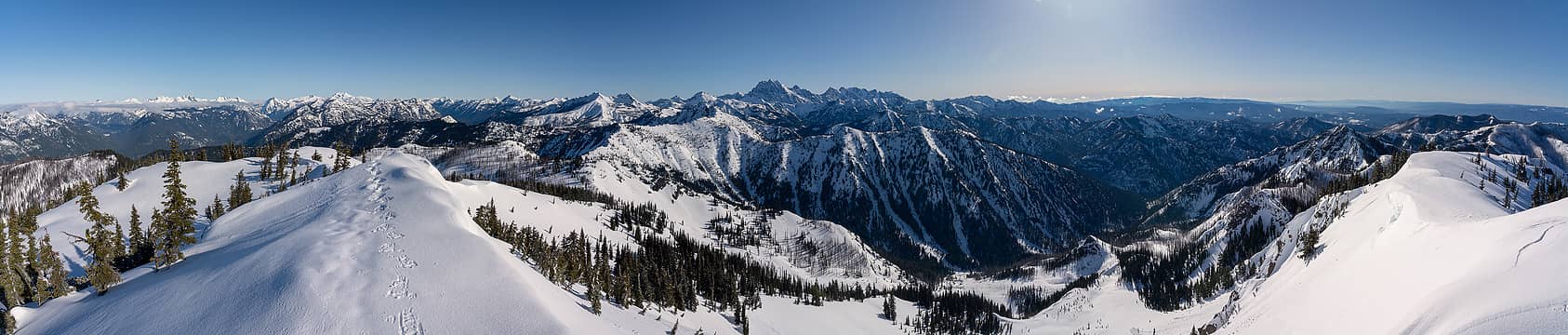 Jolly summit panorama 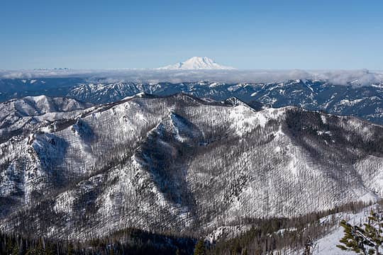 Sasse and Rainier 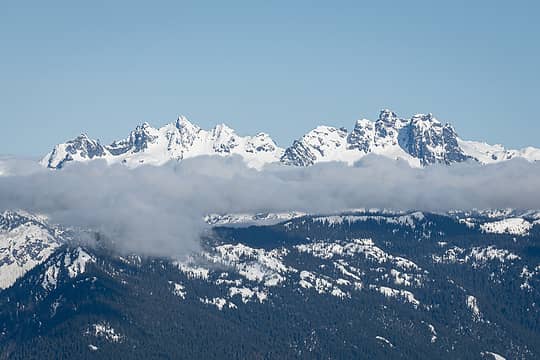 Lemah and Chimney Rock 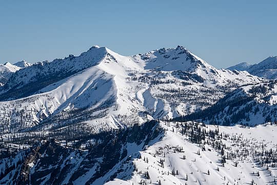 Hawkins Mountain 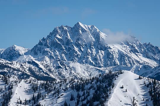 Mount Stuart 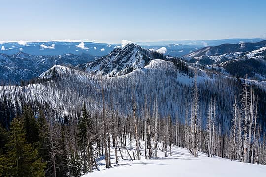 Descending from Jolly 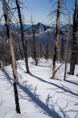 Humerus through the dead sticks 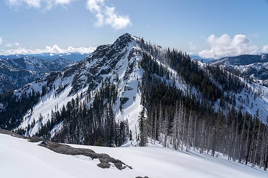 Humerus Hill 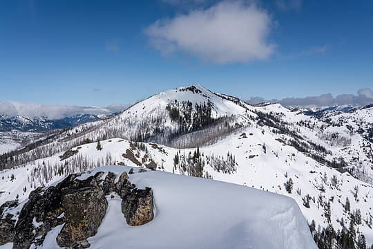 Jolly from Humerus 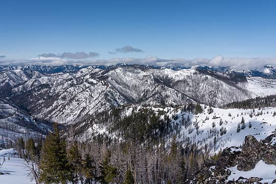 Sasse Mountain looking a long way away 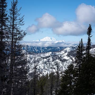 Rainier, framed 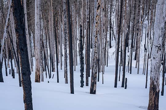 Down through burnt forest 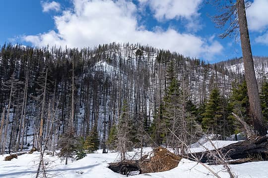 W F Teanaway River Valley 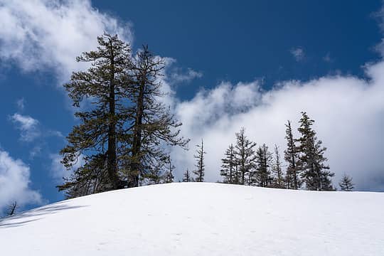 Slogging 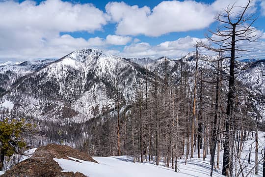 Looking back at Jolly 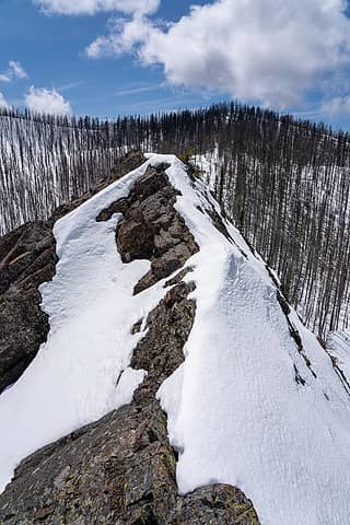 Interesting terrain in snowshoes 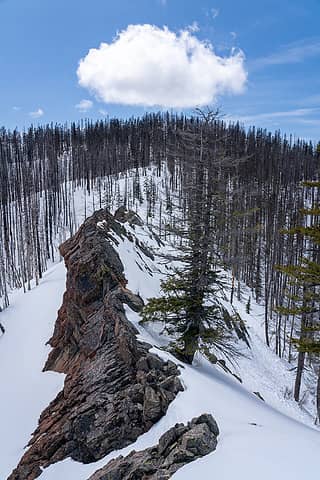 I bypassed this to the left 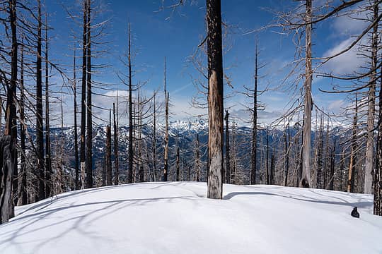 Sasse Mountain summit 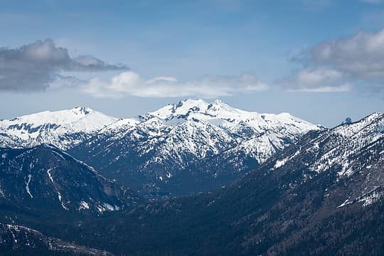 Mount Daniel 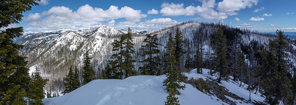 Not so Sasse summit panorama 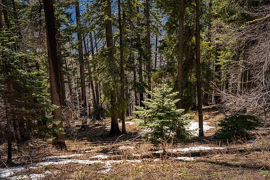 Forest on descent 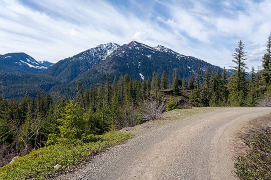 Back on the road 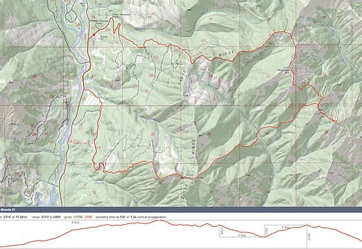 map
 Alden Ryno, abkoch3, Eric Willhite, geyer, Gimpilator, ejain, fairweather friend, neek, pwrobinson, raising3hikers, Randito, jaysway, rstoddard24, Now I Fly, ozzy, GaliWalker, reststep, wyattmullen, Eric Gilbertson, Kenji, Silas, LukeHelgeson Alden Ryno, abkoch3, Eric Willhite, geyer, Gimpilator, ejain, fairweather friend, neek, pwrobinson, raising3hikers, Randito, jaysway, rstoddard24, Now I Fly, ozzy, GaliWalker, reststep, wyattmullen, Eric Gilbertson, Kenji, Silas, LukeHelgeson
Alden Ryno, abkoch3, Eric Willhite, geyer, Gimpilator, ejain, fairweather friend, neek, pwrobinson, raising3hikers, Randito, jaysway, rstoddard24, Now I Fly, ozzy, GaliWalker, reststep, wyattmullen, Eric Gilbertson, Kenji, Silas, LukeHelgeson |
| Back to top |
  
|
|
Bootpathguy
Member

Joined: 18 Jun 2015
Posts: 1790 | TRs | Pics
Location: United States |
My neck of the woods. Love it!!!
Experience is what'cha get, when you get what'cha don't want
awilsondc
Experience is what'cha get, when you get what'cha don't want
awilsondc
|
| Back to top |
|
|
Stefan-K
Member

Joined: 10 Aug 2009
Posts: 522 | TRs | Pics
Location: seattle |
|
Stefan-K
Member
|
 Fri May 06, 2022 10:54 am |
|
|
Regal pic of Bear's Breast, love it! And the shadows of Ulrich's (Stuart); it all makes sense.
You covered some ground! Way to go. Always engaging traveling through all the zones of the day/sun/terrain and the report reflects that well.
awilsondc
awilsondc |
| Back to top |
|
|
jaysway
Member

Joined: 16 Jul 2020
Posts: 347 | TRs | Pics
|
|
jaysway
Member
|
Fri May 06, 2022 5:58 pm |
|
|
| awilsondc wrote: | Bear's Breast Mount Stuart |
Great TR and photos. I found these photos especially wonderful.
awilsondc
awilsondc |
| Back to top |
|
|
|
|
You cannot post new topics in this forum
You cannot reply to topics in this forum
You cannot edit your posts in this forum
You cannot delete your posts in this forum
You cannot vote in polls in this forum
|
Disclosure: As an Amazon Associate NWHikers.net earns from qualifying purchases when you use our link(s). |


